1747 resultados
1922Very Good Turkish, Ottoman (1500-1928) Original color map. 65,5x63 cm. In Ottoman script. This rare and decorative Gallipoli map including Hellespont, Gallipoli Peninsula, Suvla Bay, Seddülbahir, and Tenedos, the places of Gallipoli Aar in 1915 (Dardanelles Campaign) during World War 1, separated two map views. Seddulbahir and Suvla Bay at north and Straight, Peninsula, and its shores with Tenedos (now Bozcaada) at the southwest of the map. It's a very detailed and rare map printed with the series of "History of the Dardanelles Campaign" after the seven years of war. The Gallipoli campaign, also known as the Dardanelles campaign, the Battle of Gallipoli or the Battle of Çanakkale (Turkish: Çanakkale Savasi, or, Muharebâti), was a military campaign in the First World War that took place on the Gallipoli peninsula (Gelibolu in modern Turkey), from 17 February 1915 to 9 January 1916. The Entente powers, Britain (with Anzacs), France, and Russia, sought to weaken the Ottoman Empire, one of the Central Powers, by taking control of the Turkish straits.
1890Very Good Turkish, Ottoman (1500-1928) Original color map. Folded. Very good. Large oblong 8vo. (21 x 26 cm). In Ottoman script. [MAP of OTTOMANT SALONICA -THESSALONIKI-] Selânik Vilâyeti. Ottoman Greece. Scale: 1/1.500.000. It shows Thessaloniki and its around. Manastir Vilayat, At north Kosovo, Siroz Sandjak etc.
1890Very Good Turkish, Ottoman (1500-1928) Original color map. Folded. Very good. Obblong 4to. (21 x 38 cm). In Ottoman script. Scale:: 1/500.000. [MAP of OTTOMAN PROVINCE of TREBIZOND] Trabzon Vilâyeti, Trabzon Sancagi, Canik Sancagi, Sivas Vilâyeti. [Provinces of Trabzon and Sivas; Canik and Trebizond Sandjak]. Black Sea at north.
1890Very Good Turkish, Ottoman (1500-1928) Original color map. Folded. Very good. Large oblong 8vo. (26 x 26 cm). In Ottoman script. [MAP of OTTOMAN PROVINCE of SIVAS] Sivas Vilâyeti, Trabzon Vilâyeti, Tokat Sancagi. [Sivas and Trabzon Provinces, Tokat Sandjak]. Scale: 1/1.500.000.
1890Very Good Turkish, Ottoman (1500-1928) Original color map. Folded. Very good. Oblong 4to. (21 x 42 cm). In Ottoman script. [MAP of OTTOMAN PROVINCE of KONIA] Konya Vlâyeti and around; Burdur, Isparta, Teke sandjaks, Hüdavendigâr Province Tozlu Ova, Tuz Gölü etc. Scale: 1/500.000.
1890Very Good Turkish, Ottoman (1500-1928) Original color map. Folded. Very good. Large oblong 4to. (19 x 37 cm). In Ottoman script. [MAP of OTTOMAN PROVINCE of ERZURUM] Erzurum Vilâyeti. Province of Erzurum of east Anatolia and its around. Many sandjaks and provinces with their detailed place names. Scale: 1/1.500.000.
1890Very Good Turkish, Ottoman (1500-1928) Original color map. Folded. Very good. Large oblong 8vo. (21 x 26 cm). In Ottoman script. [MAP of OTTOMAN PROVINCE of EASTERN ROUMELI] Rumeli-yi Sarkî Vilâyeti, Bulgaristan Eyâleti, Edirne Vilâyeti, [Trakya], Selânik Vilâyeti. [East Roumeli, Salonica, Adrianople provinces; Old Zagra Sandjak, Bulgarian State]. Scale: 1/1.500.000. Ottoman Provinces in the Balkan Peninsula.
1890Very Good Turkish, Ottoman (1500-1928) Original color map. Folded. Very good. Large oblong 8vo. (21 x 26 cm). In Ottoman script. [MAP of OTTOMAN PROVINCE of DIYAR-I BEKR] Diyarbakir Vilâyeti. Province of Diyarbekir in Southeast Anatolia and its around. Many sandjaks and provinces with their detailed place names. Scale: 1/500.000.
1890Very Good Turkish, Ottoman (1500-1928) Original color map. Folded. Very good. Large oblong 8vo. (21 x 26 cm). In Ottoman script. [MAP of OTTOMAN PROVINCE of DIYAR-I BEKR] Diyarbakir Vilâyeti. Province of Diyarbekir in Southeast Anatolia and its around. Many sandjaks and provinces with their detailed place names. Scale: 1/1.500.000.
1900Very Good Turkish, Ottoman (1500-1928) Original color map on cloth. Oblong: 67x75 cm. In Ottoman script. Folded originally. A very detailed map. Scale: 1:210.000. Shows Shkodra Lake, its shores, Bog Mountains, Karadag (Montenegro), Iakoh, Has etc. [MAP of OTTOMAN PROVINCE of BALKANS-ALBANIA] 52 Ipek (Peja). 53 Yakoh. 59 Akola. 60 Iskodra (Shkodra).
1917Very Good Turkish, Ottoman (1500-1928) Original color map. Folded. Oblong atlas folio. (50 x 60 cm). In Ottoman script. Shows Southeastern parts of Asia Minor and Syria; Siverek, Sard (Iraq) and Ras Al-Ayn (Rasulayn - Resualyn) in Syria. Hegira: 1333 = Gregorian: 1917. Not description on map-maker. Scale: 1: 200.000. This is one the serie of the Bonn projection maps which are the first map series in modern techniques in Turkey and the Ottoman Empire. In order to produce these maps covering Turkish territory, Reconnaissance Branch was incorporated into The Mapping Commission. The maps were produced in the datum based on the latitude and longitude of Ayasofya Mosque in equal area Bonn Projection. The field works for the 123 sheets covering the country were conducted by 76 staff. The production was completed in 18 years starting from east west. Field works continued without stopping except in years 1914 and 1920. This map series called also reconnaissance maps contributed a lot to producing 1:25.000 scale maps. According to Türkezer & Çobanoglu: History of Mapping in Turkey-1:200.000 Scale Maps, last cartographer of Diyarbakir regio is M. Sait Malatyali. No his biographic material and info in 'Savaslarda Haritacilar'. Rare.
1910Very Good Greek, Modern (post 1453) Paperback. Demy 8vo. (21 x 14 cm). In Greek (Modern). 79 p. Not in OCLC. The Metropolis of Chalcedon is an ecclesiastical territory (diocese) of the Ecumenical Patriarchate of Constantinople. Christianity spread in Chalcedon during the 2nd century AD. The city was initially the see of a bishopric before being promoted to a metropolis at 451 AD, at the time of the Fourth Ecumenical Council. It is one of the four remaining active Greek Orthodox Church metropolises of the Ecumenical Patriarchate in Turkey today and the only one surviving in Asia Minor (Anatolia). During the 14th century, the metropolitan see remained vacant, due to the Ottoman conquest of the region. However, it was reorganized in the 15th century, possibly after the Fall of Constantinople and the subsequent incorporation of the Ecumenical Patriarchate into the millet system of the Ottoman society. The first recorded metropolitan of that time was Joseph, in 1477. In the following years, the jurisdiction of the metropolis was extended to the east. During the late 17th century the see of the diocese was transferred to Kuzguncuk (Ermoulianai, Chrysokeramos), where it remained until 1855. At that period a number of monasteries were established, like the one of Saint Panteleimon, which was declared Stauropegic. The metropolitan of Chalcedon was one of the five Elder metropolitans from the wider region of Constantinople, the other being those of nearby Herakleia, Cyzicus, Nicaea, and Nicomedia. Following an Ottoman decree of 1757, they had to be always present in the Holy Synod of the Ecumenical Patriarchate and had direct access to the Ottoman Sultan, to whom they announced the election of the new Ecumenical Patriarch. From the mid-19th century, the local metropolis prospered thanks to the significant population increase and economic development of the local Orthodox population. In 1855 the see of the metropolitan returned to Chalcedon during the primateship of Metropolitan Gerasimos. Moreover, the newly erected church of Saint Euphemia became the new cathedral. The metropolitan mansion was built near the cathedral in 1902. This is the first and only known printed regulation book of the Greek Community in Chalcedonia (Kadiköy). Extremely rare.
1876Very Good German Original color map on cloth. A little foxing on cloth. Very good. Folded. Oblong folio. (45 x 51 cm). In German. Shows N. Enyed, Zalathna, Mediasch, Hermannstadt, Hatszeg, Petroseni, Ôzt River, etc. Scale: 1/300,000. Sibiu (Sibiiu - Hermannstadt - Nagyszeben) is a city in Romanian Transylvania. The city straddles the Cibin River, a tributary of the river Olt. The first official record referring to the Sibiu area comes from 1191 when Pope Celestine III confirmed the existence of the free prepositure of the German settlers in Transylvania, the prepositure having its headquarters in Sibiu, named Cibinium at that time. In the 14th century, it was already an important trade center. As of the year 1376, the craftsmen were divided into 19 guilds. Sibiu became the most important ethnic German city among the seven cities that gave Transylvania its German name Siebenbürgen (literally "Seven Citadels"). It was home to the Universitas Saxorum (Community of the Saxons), a network of pedagogues, ministers, intellectuals, city officials, and councilmen of the German community forging an ordered legal corpus and political system in Transylvania since the 1400s. During the 18th and 19th centuries, the city became the second -and then the first most important center of Transylvanian Romanian ethnics. The first Romanian-owned bank had its headquarters here (The Albina Bank), as did the ASTRA (Transylvanian Association for Romanian Literature and Romanian's People Culture). After the Romanian Orthodox Church was granted status in the Habsburg Empire from the 1860s onwards, Sibiu became the Metropolitan seat, and the city is still regarded as the third-most important center of the Romanian Orthodox Church. Between the Hungarian Revolution of 1848 and 1867 (the year of the Ausgleich), Sibiu was the meeting-place of the Transylvanian Diet, which had taken its most representative form after the Empire agreed to extend voting rights in the region (Source: Wikipedia). A sheet of the collection of 'The general map of Central Europe'. appeared in the years between 1873-1876 with the work of Joseph Ritter von Scheda, (1815-1888) who was a general, geographer, and cartographer.
1916Very Good Turkish, Ottoman (1500-1928) Original color map. Folded. Oblong atlas folio. (50 x 60 cm). In Ottoman script. [MAP of EAST ANATOLIA] Malatya - Divrigi, Mancinik, Adiyaman, Harput. Shows Malatya, Adiyaman and Kharpout region; Firat River (Euphrates), Yazi Düzü, Erguvan etc. Scale: 1/200.000. This is one the serie of the Bonn projection maps which are the first map series in modern techniques in Turkey and the Ottoman Empire. In order to produce these maps covering Turkish territory, Reconnaissance Branch was incorporated into The Mapping Commission. The maps were produced in the datum based on the latitude and longitude of Ayasofya Mosque in equal area Bonn Projection. The field works for the 123 sheets covering the country were conducted by 76 staff. The production was completed in 18 years starting from east west. Field works continued without stopping except in years 1914 and 1920. This map series called also reconnaissance maps contributed a lot to producing 1:25.000 scale maps. Hegira: 1332 = Gregorian: 1916. Not description on map-maker. According to Türkezer & Çobanoglu: History of Mapping in Turkey-1:200.000 Scale Maps, cartographer of this map is Kambay, Cemal.
1979ref. H0296Moulins, Éditions des Cahiers Bourbonnais & du Centre, 1979 ; grand in-8, 192 pp., reliure d'éditeur plein Skivertex, vert émeraude, dos lisse. Important ouvrage sur le Bourbonnais et l'Auvergne. Nombreuses illustrations en noir et blanc (photographies de G. Guillemin, bois de F. Dubreuil). Très bon état.
1920Very Good French Original color map on cloth. Oblong folio. (42 x 53 cm). In Ottoman script. [MAP] Büyükada, Maltepe ve Adalar. [Feuille of Sedef Island and South of Prinkipo, Marmara Sea]. 6th sheet of set.
1914Very Good French Original color map on cloth. Oblong large folio. (49 x 58 cm). In Ottoman script. [MAP] Kocaeli-Izmit Körfezi. Gökbüze, Derince, Dilburnu, Hersek Gölü. [Izmit Bay, Dilburnu, Gökbüke, Derince, Marmara Sea]. Scale: 1/50.000.
1910Very Good Turkish, Ottoman (1500-1928) Original color map on cloth. Oblong eephant folio. (64 x 573 cm). Toponyms in Ottoman script. [MAP of BALKANS] Filibe [Plovdiv]. A very detailed map. Shows Plovdiv and mountains, rivers around it. Extremely rare.
1909Very Good Turkish, Ottoman (1500-1928) Original color map on cloth. A little foxing on cloth. Very good. Folded. Oblong atlas folio. (50 x 67 cm). In Ottoman script. Scale: 1/300.000. Map of Ottoman Kayseri printed in its period. No publisher and map-maker. Physical geography of Kayseri city and its around. It shows Kayseri, Sultan Sazligi, mountains and hills, Malatya borders, etc.
ref. 94375Paris, Baudouin, s.d. (1790) in-8, 12 pp., dérelié.
1761ref. 16534Lyon, J.M. Bruyset, 1761 ; in-8, veau fauve marbré, dos à nerfs décoré et doré, pièce de titre grenat, roulette sur les coupes (reliure d’époque) ; (4), XVI, 283 pp. grand plan dépliant (446 X 580 mm), dessiné et gravé par Jacquemin en 1747.
ref. 664120Paris, Patris, s.d. in-8, 3 pp.
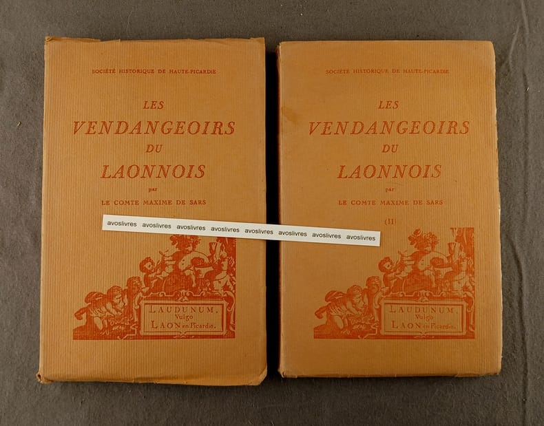
ref. 180Soissons, Imprimerie de l'Argus soissonnais, M.CM.XXX.IV - M.CM.XXX.V. Par le Comte Maxime de Sars, Lauréat de l'Institut. - 2 volumes - Format : 22,5 x 14,5 cm - (1) f. blanc-(3) ff.-XI pp.-378 pp.-(1) f. blanc + 18 planches HT sur papier glacé. - Brochés, couvertures saumon illustrées.
1936Very Good Turkish Original manuscript map of Alexandria Port and its immediate hinterland. Folio. (33 x 41 cm). In Turkish (Modern). Folded. No scale. The manuscript shows Alexandria Port and the Palace of the King Farouk of Egypt, customs shores, ports and harbors, locations of the British ships, radio station, location of SS Ramlah, strait, Great Pass (?), waterfront for the lumber ships, sea current zones and probably entrance and exit routes etc. A very detailed map, decorated with ships. Some repairs with tape, tears, foxing and stains. Overall a good copy.