1.090 resultados
1911Very Good Turkish, Ottoman (1500-1928) Original color map on cloth. Oblong atlas folio. (49 x 60 cm). Toponyms in Turkish with Arabic letters. In Ottoman script. Scale: 1/25.000. [MAP of ISTANBUL / CONSTANTINOPLE] Küçükköy, Petnahor, Makriköy, Kagidhane [Kagithane]. A rare Istanbul map including some old Byzantine toponyms.
1910Very Good Turkish, Ottoman (1500-1928) Original color litographed plate. 18x41 cm. In Ottoman script (Turkish with Arabic letters). Two-paged plate. A rare color lithographed plate from Mehmed Esref's 'Muhtasar Umûmî Atlas'. A very detailed plate showing Europe's and the US' demographic structure in 1922 with very attractive detailed statistical schemes. Besides the usual demographic scheme, there are 28 European states on the plate: Germany, France, Spain, Russia (Soviets), England, Italy, Poland, Romania, Holland, Norway, Estonia, Czechoslovakia, Austria, Switzerland, Lithuania, Yugoslavia, Portugal, The United States of America, Hungary, Sweden, Denmark, Latvia, Belgium, Greece, Finland, Avrupa-yi Türkî [i.e. Turkey in Europe], Albania. Mehmed Esref (1846-1912) was a Turkish / Ottoman military cartographer and educator in the Ottoman military school [Mekteb-i Harbiye] active in the first part of the 20th century, and he prepared and published many separate maps and atlases more besides this one.
1981ref. 2091502135307671Repair Committee 1981. Soft Cover. Fine. Volume: 1 Repair Committee paperback
1999ref. 2091502135419417Gunma Prefecture Tamamura Hachiman Shrine 1999. Soft Cover. Fine. Number of books: 1 (Gunma Prefecture) Tamamura Hachiman Shrine paperback
1995ref. 2091502135419421Ibaraki Prefecture Repair Committee 1995. Soft Cover. Fine. Number of books: 1 (Ibaraki Prefecture) Repair Committee paperback
1990ref. 2091502135421354Shizuoka Prefecture Conservation and Restoration Committee 1990. Soft Cover. Fine. Number of books: 1 (Shizuoka Prefecture) Conservation and Restoration Committee paperback
1987ref. 2091502135420377Yokohama City Sankeien Hoshokai 1987. Soft Cover. Fine. Number of books: 1 (Yokohama City) Sankeien Hoshokai paperback
2000ref. 2091502135420248Hyogo Prefecture 2000. Soft Cover. Fine. Number of books: 1 Hyogo Prefecture paperback
1979ref. 2091502135306742Company repair committee 1979. Soft Cover. Fine. Volume: 1 Company repair committee paperback
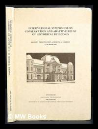
1995ref. 424672Tainan Taiwan : Dept. of Architecture National Cheng Kung University 1995. 1st edition. Hardcover. Near fine copy in the original colour-printed boards. Remains particularly well-preserved overall. Physical description; 208p. Notes; Sponsored by Chen Chung Ho Foundation organized by the Dept. of Architecture National Cheng Kung University and held at Kaohsiung and Tainan in March 1995. Tainan, Taiwan : Dept. of Architecture, National Cheng Kung University hardcover
1999ref. 2091502135305747Tamamura hachimangu 1999. Soft Cover. Fine. Volume: 1 Tamamura hachimangu paperback
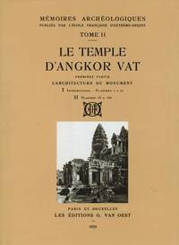
1995ref. 4911Bangkok Thailand: S D I Publications / Bruce Miller 1995 . Limited Facsimile edition. Hardcover. Fine/fine. Quartos cloth in fine publisher's slipcase. Note: the shipping weight is estimated at 20 lbs / 9 kg so it will require an additional fee at cost. Copy no. 826 of 999 copies. This 3-volume boxed set reprints Part 2 of the MEMOIRES ARCHEOLOGIQUES of the L'Ecole Francaise d'Extreme-Orient originally published at Paris 1929 ff. These volumes cover architecture sculpture and bas-reliefs. With hundreds of plates illustrations. Text in French. Printed on paper meant to withstand heavy library usage. A number of the sculptures were destroyed since the French did these surveys in the Twenties. S D I Publications / Bruce Miller hardcover
1927Very Good Turkish, Ottoman (1500-1928) Original color map. Chipped on folded places. Folded. Slightly toning on paper. Oblong atlas folio. (62 x 89 cm). In Ottoman script. Map of New Europe. Scale: 1/10.000.000. Gregorian: 1927. It's printed from 'Sudi Bey' Map Corpus. This was a map serie printed in the early Republican period in Turkish with Arabic letters. Very decorative map with its color flags of various countries longitudinal on right and left sides of map. Sudi printing house was an Ottoman / Turkish publisher who was one of the longest-running of Turkish publishers.
1927Very Good Turkish, Ottoman (1500-1928) Original color map. Chipped on folded places. Folded. Slightly toning on paper. Oblong atlas folio. (63 x 94 cm). In Ottoman script. Map of New Oceania. It shows Australia, Bahr-i Muhit-i Kebir, Pacific Ocean, New Zealand, Micronesia et alli. Scale: 1/20.000.000. Gregorian: 1927. It's printed from 'Sudi Bey' Map Corpus. This was a map serie printed in the early Republican period in Turkish with Arabic letters. Very decorative map with its color flags of various countries longitudinal on right and left sides of map. Sudi printing house was an Ottoman / Turkish publisher who was one of the longest-running of Turkish publishers.
1988ref. 2092902137704328Conservation and Repair Committee 1988. Soft Cover. Fine. The book is in fine condition. Conservation and Repair Committee paperback
1986ref. 2092902144201854Important Cultural Property Former Yakagewaki Honjin Takakusa House Repair Committee 1986. Soft Cover. Fine. The book is in fine condition. Important Cultural Property Former Yakagewaki Honjin Takakusa House Repair Committee paperback
1999ref. 2091202133209882Hachimangu 1999. Soft Cover. Fine. Volume: 1 Hachimangu paperback
1988ref. 2091502135419666Shizuoka Asama Shrine Repair Committee 1988. Soft Cover. Fine. Number of books: 1 Shizuoka Asama Shrine Repair Committee paperback
1989ref. 2091502135419419Ibaraki Prefecture Kashima Shrine 1989. Soft Cover. Fine. Number of books: 1 (Ibaraki Prefecture) Kashima Shrine paperback
1988ref. 2091502135421357Repair Committee 1988. Soft Cover. Fine. Number of books: 1 Repair Committee paperback
1984ref. 2091502135421351Chiba Prefecture Shinshoji Temple 1984. Soft Cover. Fine. Number of books: 1 (Chiba Prefecture) Shinshoji Temple paperback
1991ref. 2080302106807424Sofukuji 1991. Soft Cover. Fine. The book is in fine condition. Sofukuji paperback
1952290 pages. "This plan has two principal objects as follows: i) to act as a general and flexible guide to all concerned as to the manner in which planning control within the area of the plan will be discharged, and particularly as to the kind of development for which planning permission is likely to be granted by the Local Planning Authority. ii) to designate land as subject to compulsory acquisiton by any Minister, Local Authority or Statutory Undertaker." - from Foreword. Topics treated in this volume include: Regional Setting and Characteristics; Development of Settlement Pattern and Main Land Use Features; Communications and Transport; Employment, Industry and Population; Agriculture, Derelict and Marginal Land, and Forestry; Economic Geology and Mineral Resources; Housing; Public Utility, Educational, Library, Health, Recreational and Social Services; Landscape and Development in Rural Areas; Camping and Caravanning; Archaeology, Ancient Monuments and Buildings of Special Architectural or Historic Interest; Development by Government Departments; Programming; Summary of Analysis. Former reference library markings. Average wear. Binding intact. A sound copy. Book
1952301 pages. "This plan has two principal objects as follows: i) to act as a general and flexible guide to all concerned as to the manner in which planning control within the area of the plan will be discharged, and particularly as to the kind of development for which planning permission is likely to be granted by the Local Planning Authority. ii) to designate land as subject to compulsory acquisiton by any Minister, Local Authority or Statutory Undertaker." - from Foreword to Part I. This part considers the following towns: Bodmin, Bude-Stratton; Falmouth; Fowey; Launceston; Lostwitheil, Newquay, Padstow, Saltash, St. Austell, Torpoint, Truro. For each of these towns the text is divided into the following sections and includes diagrams relating to Population and the Location and Growth of each town: introduction and brief description; Historical Summary and Population Trends since 1801; Regional Communications; Mineral Resources; Population Structure in relation to Employment; Topography and Existing Land Use; Housing; Public Utilities; Social Services; Analysis of Urban Survey; Other Primary Land Uses; Programming. Former reference library markings. Average wear. Binding intact. A sound copy. Book
191848 pages. Black and white photos. Includes: separate group photos of staff and students of Claresholm School, Olds School, and Vermilion School, with name lists of staff; General Information; Admission Requirements; Regulations; Prizes; Details of Courses; Nice 5 panel fold-out photo of the "School of Agriculture and Demonstration Farm, Olds Alberta" (beneath which is a caption reading 'Buildings and Equipment are Identical at all Schools); Various photos of students at work and one shot of the Boys' Hockey Team. Blank 'Application for Admission to the Provincial School of Agriculture' remains affixed to perforated tab inside back cover. Prior owner's small ink stamp atop front cover else unmarked with moderate wear. Binding sound. A most wonderful item from Alberta's distant past! Book