2.043 resultados
ref. DADAX0367028042New unknown
ref. SONG3899552598Used: Good unknown
ref. DADAX0415522692New unknown
ref. 18941134Single sheet 6 x 9.25 inches 1.25 inch closed tear at upper edge edges chipped horizontal fold toning to lower quadrant. A blog entry by Nancy Noble archivist/cataloger at the Maine Historical Society identifies the poet A. W. Harmon 1812-1901 as a Scarborough carriage smith who published at least fifteen broadside poems on a variety of subjects.
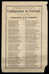
ref. 18941134Single sheet 6 x 9.25 inches 1.25 inch closed tear at upper edge edges chipped horizontal fold toning to lower quadrant. A blog entry by Nancy Noble archivist/cataloger at the Maine Historical Society identifies the poet A. W. Harmon 1812-1901 as a Scarborough carriage smith who published at least fifteen broadside poems on a variety of subjects. books
ref. 67806, L'architecture d'aujourd'hui 1946, 1946 couverture illustre de l'editeur original, 140 pages + 50 ads. bon etat.
ref. 67807, L'architecture d'aujourd'hui 1946, 1946 couverture illustre de l'editeur original, 140 pages + 50 ads. bon etat.
2012New New English Original bdg. Dust wrapper. In publisher's special slip-case. 4to. (34 x 24 cm). In English and Turkish. 751, [1] p. Color and b/w ills. The photograph album of Anatolian Seljuk monuments.= Anadolu Selçuklu eserleri fotograf albümü. A very heavy volume.
1914ref. AUB-8974Neuchâtel Attinger frères 1914. Bel exemplaire relié, reliure pleine toile ornée, 1 des 500 exemplaires numérotés, in-4 (28 x 22), 62 vignettes gravées sur papier cartonné avec serpentes reproduisant des légendes. Rousseurs.
ref. DADAX0367139057New unknown
ref. SONG1850749698Used: Good unknown
ref. SONG0300225040Used: Good unknown
ref. SONG0711239088Used: Good unknown
ref. DADAX0387788344New unknown
ref. DADAX0226472671New unknown
1890Very Good Turkish, Ottoman (1500-1928) Original color map. Folded. Very good. Large oblong 8vo. (21 x 26 cm). In Ottoman script. [MAP of OTTOMAN PROVINCE of EASTERN ROUMELI] Rumeli-yi Sarkî Vilâyeti, Bulgaristan Eyâleti, Edirne Vilâyeti, [Trakya], Selânik Vilâyeti. [East Roumeli, Salonica, Adrianople provinces; Old Zagra Sandjak, Bulgarian State]. Scale: 1/1.500.000. Ottoman Provinces in the Balkan Peninsula.
1890Very Good Turkish, Ottoman (1500-1928) Original color map. Folded. Very good. Large oblong 4to. (19 x 37 cm). In Ottoman script. [MAP of OTTOMAN PROVINCE of ERZURUM] Erzurum Vilâyeti. Province of Erzurum of east Anatolia and its around. Many sandjaks and provinces with their detailed place names. Scale: 1/1.500.000.
1890Very Good Turkish, Ottoman (1500-1928) Original color map. Folded. Very good. Large oblong 8vo. (26 x 26 cm). In Ottoman script. [MAP of OTTOMAN PROVINCE of SIVAS] Sivas Vilâyeti, Trabzon Vilâyeti, Tokat Sancagi. [Sivas and Trabzon Provinces, Tokat Sandjak]. Scale: 1/1.500.000.
1890Very Good Turkish, Ottoman (1500-1928) Original color map. Folded. Very good. Large oblong 8vo. (21 x 26 cm). In Ottoman script. [MAP of OTTOMANT SALONICA -THESSALONIKI-] Selânik Vilâyeti. Ottoman Greece. Scale: 1/1.500.000. It shows Thessaloniki and its around. Manastir Vilayat, At north Kosovo, Siroz Sandjak etc.
1782Very Good French Original b/w map. Oblong folio. (25 x 37 cm). In French. Jean-Denis Barbié, dit Barbié du Bocage , né le 28 avril 1760 à Paris et mort dans cette ville le 28 décembre 1825, est un géographe et cartographe français, doyen de la Faculté de lettres de Paris, membre de l'Institut. It shows Black Sea and its shores with their old toponyms very detailed.
2007As New As New English Original bdg. Dust wrapper. Folio. (34 x 24 cm). In English. 380 p., color and b/w ills. Architectureal achievements of King Abdul-Aziz in the honored area of Makkah, 1924-1953. "This book includes a general survey of the architectural accomplishments of King Abdul-Aziz in the Honored Area of Makkah. Those works include the Holy Kaba, the Al-Haram Mosque, the Zamzam Well, the Mosques, the Water Fountains, the Wells, the Water Dams, Road making, field opening and Airport construction projects, Road stops, Hospitals and others. This book records most of such works of restoration and building. It is also supported by pictures and drawings that shed some light on those projects".
1914Good Turkish, Ottoman (1500-1928) Original color map. Folded. Tears in margins. Slightly stained. Otherwise a good copy. Oblong atlas folio. (50 x 60 cm). In Ottoman script. [MAP of EAST BLACK SEA] Artvin, Rize, Oltu. Shows Artvin and Georgian borders, Rize (Rizeon - Rizunda - Rizini) and Oltu cities and regions. Scale: 1/200.000. Hegira: 1330 = Gregorian: 1914. This is one the serie of the Bonn projection maps which are the first map series in modern techniques in Turkey and the Ottoman Empire. In order to produce these maps covering Turkish territory, Reconnaissance Branch was incorporated into The Mapping Commission. The maps were produced in the datum based on the latitude and longitude of Ayasofya Mosque in equal area Bonn Projection. The field works for the 123 sheets covering the country were conducted by 76 staff. The production was completed in 18 years starting from east west. Field works continued without stopping except in years 1914 and 1920. This map series called also reconnaissance maps contributed a lot to producing 1:25.000 scale maps. Not description on map-maker. Extremely rare.
ref. DADAX0415581087New unknown
ref. DADAX0471793523New unknown
ref. DADAX0367579634New unknown