1.086 resultados
1989ref. 2091502135421349Niigata Prefecture Murakami City 1989. Soft Cover. Fine. Number of books: 1 (Niigata Prefecture) Murakami City paperback
1993ref. 2091502135420397Conservation and Repair Committee 1993. Soft Cover. Fine. Number of books: 1 Conservation and Repair Committee paperback
1989ref. 2091502135419420Tochigi Prefecture Repair Committee 1989. Soft Cover. Fine. Number of books: 1 (Tochigi Prefecture) Repair Committee paperback
1979ref. 2091502135419418Ibaraki Prefecture Hachimancho Repair Committee 1979. Soft Cover. Fine. Number of books: 1 (Ibaraki Prefecture Hachimancho) Repair Committee paperback
1987ref. 2091202133202449Sangusha 1987. Soft Cover. Fine. Volume: 1 Sangusha paperback
1982ref. 2092902137703931Repair Committee 1982. Soft Cover. Fine. The book is in fine condition. Repair Committee paperback
1975ref. 2092902144201726Kohiracho 1975. Soft Cover. Fine. The book is in fine condition. Kohiracho paperback
1972ref. 2092902144200681Important cultural property Nunnery school repair committee 1972. Soft Cover. Fine. The book is in fine condition. Important cultural property Nunnery school repair committee paperback
1978ref. 2092902144201950Important Cultural Property Sekigawa Family House Repair Committee 1978. Soft Cover. Fine. The book is in fine condition. Important Cultural Property Sekigawa Family House Repair Committee paperback
1997A clean, unmarked book with a tight binding. 8 3/4"w x 9 1/2"h. 544 pages. Black and white photos and illustrations, maps. "With projects that ranged from tombstones to skyscrapers, boiler rooms to entire industrial complexes, Holabird & Roche left an indelible stamp on the city of Chicago and, indeed, far beyond. In this volume, the first of two on Holabird & Roche and its successor, Holabird & Root, Robert Bruegmann traces the firm?s history from its founding in 1880 to the end of the First World War. Incorporating meticulous research based on the extensive architectural holdings of the Chicago Historical Society, Bruegmann documents the firm?s work from the boom years of the 1880s through the period of sustained growth and innovation after the turn of the century. In chapters devoted to topics as diverse as downtown commercial and retail development, business hotels, civic buildings, automobile showrooms, and suburban clubs and housing, Bruegmann creates a sustained historical narrative that considers the profound interdependence of architecture and modern urban life." [publisher]
1963A clean, unmarked book with a tight binding. 170 pages with very detailed mechanicals drawings, b&w photos, graphs, charts, tables, etc., Contents include: Preliminary Considerations, Architectural Considerations, Lateral Force Resistance, Roof Framing, Columns, Wall Panels, Pick Up Analysis, Concrete Floor Slabs, Footings & Foundations, Joinery, Sandwich Panels, Concrete Fundamentals, Design For Nuclear Weapons, Prestressed Single T Sections.
1920Very Good Turkish, Ottoman (1500-1928) Original color map of Erzurum city center and it environment. Folded. 69x42,5 cm. In Ottoman script. One sheet. Shows center of Erzurum city and topography environment. No scale info. Hegira: 1336 = Gregorian: 1920. Not description on map-maker. This is one the serie of the Bonn projection maps which are the first map series in modern techniques in Turkey and the Ottoman Empire. In order to produce these maps covering Turkish territory, Reconnaissance Branch was incorporated into The Mapping Commission. The maps were produced in the datum based on the latitude and longitude of Ayasofya Mosque in equal area Bonn Projection. The field works for the 123 sheets covering the country were conducted by 76 staff. The production was completed in 18 years starting from east west. Field works continued without stopping except in years 1914 and 1920. This map series called also reconnaissance maps contributed a lot to producing 1:25.000 scale maps. Extremely rare.
1996A clean, unmarked book with a tight binding. Full brown cloth boards. 8"w x 10 3/4"h. 162 pages. Black and white photos and illustrations. "Drawing upon a lifetime's knowledge, Patterns of Stylistic Change in Islamic Architecture presents Michael Meinecke's unique view of the evolution and development of Islamic architecture. Departing from conventional method which groups buildings and monuments according to dynasties and defines national characteristics based on the ethnic origins of Arabic, Persian, or Turkish patrons, Meinecke emphasizes the similarities which resulted from interrelations among neighboring or far-away areas. He argues that transformations in the development of Islamic architecture can be explained by the movements of skilled craftsmen who traveled extensively in their search for challenging work, allowing for their influence to be felt across a broad region. Meinecke's unique approach to Islamic architecture will no doubt inspire others to emulate his approach in studying other regions or areas. Few, however, will be able to attain the consummate mastery of the subject which enlivens these essays." [publisher]
1955Very Good Turkish Original manuscript map on cloth. Chipped margins, stains on cloth. Folded. Oblong folio. (32x35 cm) In modern Turkish. Sealed. It shows the exploration of an area of ??1487 hectares and some stone and brick mosques, fountains, buildings and geographic status of the region in the upper corner. Scale: 1:25.000. Extremely rare.
1996Book is in excellent condition in embossed black vinyl covers, no print at spine. Page block is made of heavy, glossy paper with a great many full page, full color photos throughout of exteriors, interiors, detail photos and some architectural drawings and paintings. Binding is solid and square, covers have sharp corners, exterior shows no blemishes, text/interior is clean and free of marking of any kind. Dust jacket shows edge wear with chipping and small tears. Contents include: The house in historical perspective, with subsections: Early Anatolia, The Pre-Anatolian Turks, The influence of Byzantine architecture, The Seljuks and Beyliks (Anatolian Lordiness / Principalities).; Factors in the development of the vernacular house, with subsections: The physical environment; climate and terrain, local building materials and structural; The cultural environment; Anatolia, Mesopotamia, and Persia, Caucasia. The house and its units; The room, sofa, service areas and storeys. Evolution of Anatolia house plans; Plans without a sofa, Exterior sofa plans, through sofa plans, central sofa plans.; Regional characters of Anatolian vernacular house, with subsections: Centers of development; Anatolia and Rumelia. Northern Anatolia; Marmara and Thrace; Western Anatolia; Central Anatolia; Eastern and Southeastern Anatolia, etc. 296 pages with a 16 page supplement.
1938ref. 16442Washington DC: Art in Federal Buildings Incorporated. Good copy paper catalog with plastic dustjacket 32 pp plus 12 pp of advertisements 1 pp list of works 1 pp introduction concerning the 28 American Artists 28 B/W illustrations with text for each . Good. Paper. 1938. Art in Federal Buildings, Incorporated unknown
1977ref. 2091502135306775Tata jinja 1977. Soft Cover. Fine. Volume: 1 Tata jinja paperback
1908Very Good German Original color map on cloth. A little foxing on cloth. Very good. Folded. Folio. (51 x 46 cm). In German with Greek place names in Latin script. [MAP of TURKISH BALKANS] Phthiotis, Canal Atalanti, I. Euboea (Evvia, Evripos, Negroponte, Golf v. Volo (Pagasetikos), Skiathos, Skopelos (Peparethos), Chiliodromia (Ikos), Magnesia, Cholkis. (Longitude given from Paris). Scarce.
1996Fine English Original bdg. HC. 4to. (28 x 22 cm). In English. 485 p., color and b/w ills. Istanbul an urban history. Byzantion, Constantinopolis, Istanbul. First Edition. This is not a book on archaeology, nor, although it lays particular stress on the architecture, an architectural history of Istanbul. It is an attempt to present the urban history of a world-city called Istanbul, Constantinople, Byzantion in different periods of its history. It delineates historical circumstances, or sudden ruptures, but above all, it attempts to present this unique world-city as experienced by its citizens and visitors, and as imagined by the world at large. While recent researches on the topography, history and monuments of the city are integrated in the text, my intention is to present the essence of the historical image of Istanbul contextually within physical, social and cultural framework. I have no intention of breaking new ground on the topography of the city, but I wish to convey the terms of a unique human experience in one of the longest surviving cities of the world, built in a most beautiful and enchanting landscape. The great Byzantine scholar R. Janin speaks of various "visages" of the city composed through the rhythms of life or caprices of the emperors. Most of this intricate relationships created in millennia between men, site, and artifact are gone and difficult to visualize. In writing this urban history, while I try to remain objective, I know that I create a literary model using as reference the least changed of the historical elements, the surviving monuments, the site with its basic shape and articulations, and contemporary accounts -not necessarily sources of hard facts, but as primary expressions, reactions and emotions. Thus tryingto keep myself away, as far as possible, from speculation and methods of criminal fiction, I have delineated the history of this grandiose, dramatic and often cruel city of Istanbul
1913Very Good Turkish, Ottoman (1500-1928) Original color map on cloth. Folded. Wrinkled on paper. Stains on cloth. 12 sheets on paper. Oblong atlas folio. (50 x 60 cm). In Ottoman script.[MAP of ALEXANDRETTA] Iskenderun - Tayakadin. It shows villages and settlements in Tayakadin of Iskenderiye. Scale: 1/25.000. Hegira: 1329 = Gregorian: 1913. This is one the serie of the Bonn projection maps which are the first map series in modern techniques in Turkey and the Ottoman Empire. In order to produce these maps covering Turkish territory, Reconnaissance Branch was incorporated into The Mapping Commission. The maps were produced in the datum based on the latitude and longitude of Ayasofya Mosque in equal area Bonn Projection. The field works for the 123 sheets covering the country were conducted by 76 staff. The production was completed in 18 years starting from east west. Field works continued without stopping except in years 1914 and 1920. This map series called also reconnaissance maps contributed a lot to producing 1:25.000 scale maps. Not description on map-maker. A very detailed map. Extremely rare.
1929ref. 1196640Wien, Filser, 1929. 4to. 4 Bl., 292 S. m. 339 Abb., 1 Falttaf., 1 farb. Karte. Hlwdbd (Kanten beschabt, Bibl.-Zettel a. Spiegel, Vors. u. 2 Bl. leicht fleckig, Stempel a. Titel). (Österreichische Kunsttopographie 22).
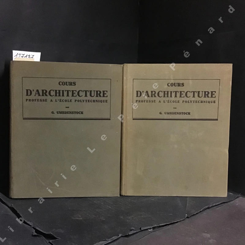
1930ref. 1271371930 Gauthier-Villars et Cie, Imprimeurs-Libraires, Paris - 1930 - 2 fort volumes in-4, reliure plein velours marron, couverture d'origines conservées - 1310 pages (Pagination continue) - Cours d'architecture professé à l'Ecole Polytechnique
1917ref. 1197090Jena, G. Fischer, 1917. 4to. 2 Bl., 16, 399, (1) S. m. 302 Abb., 76 Taf. in Lichtdruck, 2 doppelseit. Taf. (Gesamtreihe Heft 41). Hlwd (beschabt, Rücken m. Klebespur, Titelei etwas knickspurig, fingerfleckig u. mehrf. gest.). (Die Bau- u. Kunstdenkmäler Thüringens 2/3/2).
1953Sm. 8vo., First Edition thus, with plates, illustrations and double-page map in the text; original tan cloth, gilt back, a near fine copy in unclipped dustwrapper, the latter very lightly sunned at backstrip. COPIES OF THE ORIGINAL EDITION ARE EXTREMELY SCARCE IN THE FIRST-STYLE DUSTWRAPPER. CHERRY RECORDS NO DUSTWRAPPER IN HER BIBLIOGRAPHY. Buildings of England, BE9. Cherry 9; HB1 [no dw noted].
1989ref. Q-1558350217American Institute of Architects Press 1989-06-01. Paperback. New. In shrink wrap. Looks like an interesting title! American Institute of Architects Press paperback