1090 resultados
1986ref. 2092902144201854Important Cultural Property Former Yakagewaki Honjin Takakusa House Repair Committee 1986. Soft Cover. Fine. The book is in fine condition. Important Cultural Property Former Yakagewaki Honjin Takakusa House Repair Committee paperback
1927Very Good Turkish, Ottoman (1500-1928) Original color map. Chipped on folded places. Folded. Slightly toning on paper. Oblong atlas folio. (62 x 89 cm). In Ottoman script. Map of New Europe. Scale: 1/10.000.000. Gregorian: 1927. It's printed from 'Sudi Bey' Map Corpus. This was a map serie printed in the early Republican period in Turkish with Arabic letters. Very decorative map with its color flags of various countries longitudinal on right and left sides of map. Sudi printing house was an Ottoman / Turkish publisher who was one of the longest-running of Turkish publishers.
1927Very Good Turkish, Ottoman (1500-1928) Original color map. Chipped on folded places. Folded. Slightly toning on paper. Oblong atlas folio. (63 x 94 cm). In Ottoman script. Map of New Oceania. It shows Australia, Bahr-i Muhit-i Kebir, Pacific Ocean, New Zealand, Micronesia et alli. Scale: 1/20.000.000. Gregorian: 1927. It's printed from 'Sudi Bey' Map Corpus. This was a map serie printed in the early Republican period in Turkish with Arabic letters. Very decorative map with its color flags of various countries longitudinal on right and left sides of map. Sudi printing house was an Ottoman / Turkish publisher who was one of the longest-running of Turkish publishers.
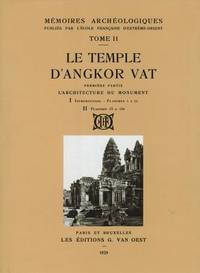
1995ref. 4911Bangkok Thailand: S D I Publications / Bruce Miller 1995 . Limited Facsimile edition. Hardcover. Fine/fine. Quartos cloth in fine publisher's slipcase. Note: the shipping weight is estimated at 20 lbs / 9 kg so it will require an additional fee at cost. Copy no. 826 of 999 copies. This 3-volume boxed set reprints Part 2 of the MEMOIRES ARCHEOLOGIQUES of the L'Ecole Francaise d'Extreme-Orient originally published at Paris 1929 ff. These volumes cover architecture sculpture and bas-reliefs. With hundreds of plates illustrations. Text in French. Printed on paper meant to withstand heavy library usage. A number of the sculptures were destroyed since the French did these surveys in the Twenties. S D I Publications / Bruce Miller hardcover
1999ref. 2091502135305747Tamamura hachimangu 1999. Soft Cover. Fine. Volume: 1 Tamamura hachimangu paperback
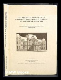
1995ref. 424672Tainan Taiwan : Dept. of Architecture National Cheng Kung University 1995. 1st edition. Hardcover. Near fine copy in the original colour-printed boards. Remains particularly well-preserved overall. Physical description; 208p. Notes; Sponsored by Chen Chung Ho Foundation organized by the Dept. of Architecture National Cheng Kung University and held at Kaohsiung and Tainan in March 1995. Tainan, Taiwan : Dept. of Architecture, National Cheng Kung University hardcover
1981ref. 2091502135307671Repair Committee 1981. Soft Cover. Fine. Volume: 1 Repair Committee paperback
1999ref. 2091502135419417Gunma Prefecture Tamamura Hachiman Shrine 1999. Soft Cover. Fine. Number of books: 1 (Gunma Prefecture) Tamamura Hachiman Shrine paperback
1995ref. 2091502135419421Ibaraki Prefecture Repair Committee 1995. Soft Cover. Fine. Number of books: 1 (Ibaraki Prefecture) Repair Committee paperback
1990ref. 2091502135421354Shizuoka Prefecture Conservation and Restoration Committee 1990. Soft Cover. Fine. Number of books: 1 (Shizuoka Prefecture) Conservation and Restoration Committee paperback
1987ref. 2091502135420377Yokohama City Sankeien Hoshokai 1987. Soft Cover. Fine. Number of books: 1 (Yokohama City) Sankeien Hoshokai paperback
2000ref. 2091502135420248Hyogo Prefecture 2000. Soft Cover. Fine. Number of books: 1 Hyogo Prefecture paperback
1979ref. 2091502135306742Company repair committee 1979. Soft Cover. Fine. Volume: 1 Company repair committee paperback
1990Book is in excellent condition. Binding is solid and square, covers have sharp corners, exterior shows no blemishes, text/interior is clean and free of marking of any kind. 143 pages, book concerns firm of Howe, Manning and Almy, designers of over 500 projects, producing sturdy, comfortable and adaptable buildings. designers of the first low-income public housing in Boston.
1911Very Good Turkish, Ottoman (1500-1928) Original color map on cloth. Oblong atlas folio. (49 x 60 cm). Toponyms in Turkish with Arabic letters. In Ottoman script. Scale: 1/25.000. [MAP of ISTANBUL / CONSTANTINOPLE] Küçükköy, Petnahor, Makriköy, Kagidhane [Kagithane]. A rare Istanbul map including some old Byzantine toponyms.
1910Very Good Turkish, Ottoman (1500-1928) Original color litographed plate. 18x41 cm. In Ottoman script (Turkish with Arabic letters). Two-paged plate. A rare color lithographed plate from Mehmed Esref's 'Muhtasar Umûmî Atlas'. A very detailed plate showing Europe's and the US' demographic structure in 1922 with very attractive detailed statistical schemes. Besides the usual demographic scheme, there are 28 European states on the plate: Germany, France, Spain, Russia (Soviets), England, Italy, Poland, Romania, Holland, Norway, Estonia, Czechoslovakia, Austria, Switzerland, Lithuania, Yugoslavia, Portugal, The United States of America, Hungary, Sweden, Denmark, Latvia, Belgium, Greece, Finland, Avrupa-yi Türkî [i.e. Turkey in Europe], Albania. Mehmed Esref (1846-1912) was a Turkish / Ottoman military cartographer and educator in the Ottoman military school [Mekteb-i Harbiye] active in the first part of the 20th century, and he prepared and published many separate maps and atlases more besides this one.
1999ref. 2091502135303955Yoshikawa hachimangu 1999. Soft Cover. Fine. Volume: 1 Yoshikawa hachimangu paperback
1997This book describes and explains joints made exclusively from wood, no glue/adhesives or metal connectors. There are many more examples than you think - well illustrated. With Bibliography, Index of Persons and Buildings, Index of Places and Subject Index. Black covers with silver title on spine
1909Very Good Turkish, Ottoman (1500-1928) Original color map on cloth. A little foxing on cloth. Very good. Folded. Oblong atlas folio. (66 x 72 cm). In Ottoman script. Scale: 1/210.000. Ottoman sanjaks in Albania, Macedonia and Greece. A rare Ottoman map of Balkans with Turkish place names for the period of pre-Balkan Wars, (1912-1913). Very important for onomastics and historical geography.
1909Very Good Turkish, Ottoman (1500-1928) Original color map on cloth. A little foxing on cloth. Very good. Folded. Oblong atlas folio. (66 x 72 cm). In Ottoman script. Scale: 1/210.000. Ottoman sanjaks in Balkans, Bulgaria. A very detailed map of Old Zagora. A rare Ottoman map of Balkans with Turkish place names for the period of pre-Balkan Wars, (1912-1913). Very important for onomastics and historical geography. Extremely rare.
1909Very Good Turkish, Ottoman (1500-1928) Original color map on cloth. A little foxing on cloth. Very good. Folded. Oblong atlas folio. (66 x 72 cm). In Ottoman script. Scale: 1/210.000. Ottoman sanjaks in Balkans, Bulgaria. A very detailed map of Plovdiv and Haskovo. A rare Ottoman map of Balkans with Turkish place names for the period of pre-Balkan Wars, (1912-1913). Very important for onomastics and historical geography. Extremely rare.
1909Very Good Turkish, Ottoman (1500-1928) Original color map on cloth. A little foxing on cloth. Very good. Folded. Oblong atlas folio. (66 x 72 cm). In Ottoman script. Scale: 1/210.000. Ottoman sanjaks in Balkans, Bulgaria. A very detailed map of Plovdiv. A rare Ottoman map of Balkans with Turkish place names for the period of pre-Balkan Wars, (1912-1913). Very important for onomastics and historical geography. Extremely rare.
1909Very Good Turkish, Ottoman (1500-1928) Original color map on cloth. A little foxing on cloth. Very good. Folded. Oblong atlas folio. (66 x 72 cm). In Ottoman script. Scale: 1/210.000. Ottoman sanjaks in Balkans, Macedonia. A very detailed map of Old Zagora. A rare Ottoman map of Balkans with Turkish place names for the period of pre-Balkan Wars, (1912-1913). Very important for onomastics and historical geography. Extremely rare.
1918Very Good French Original b/w map. Oblong: 57x66 cm. In French. Folded. It includes for pieces: Title, structure physique de la region, Thessalie and main part which shows the area from Ohrida Lake on the west to Golf of Thessaloniki on the east. [MAP] Mission antipaludique de l'Armee d'Orient: Carte des indices endemiques Macedoine, Thessalie, Serbie meridionale, confins albanais 1917 et 1918.
1999ref. 2091502135301712Honkoji 1999. Soft Cover. Fine. Volume: 1 Honkoji paperback