137 resultados
1852ref. 6650Paris, A. Marescq, 1852 ; 2 tomes in-8, brochés ; 16 pp. (catalogue de libraire), XVI pp., 456 pp. ; (8), 393 pp.
1848ref. 6655Paris, L. Mathias, 1848 ; in-8, broché ; X, (2), 299 pp., 2 tableaux dépliants hors-texte, 4 grandes planches hors-texte gravées par Dulos.
1867ref. 10883Paris, sans nom, 1867 ; grand in-4 ; demi-percaline vert-sapin, plats cartonnés et papier marbré vert (reliure de l'époque) ; 177 pp., nombreuses figures. Cours manuscrit lithographié.
1874ref. 11842Bourg, Francisque Martin-Bottier, Imprimerie Comte-Milliet, 1874 ; in-8 ; cartonnage bradel rigide de papier marbré, pièce de titre en long de maroquin vert-lierre (reliure de l’époque) ; VIII, 53 pp. (1 bl.), (1) f. blanc. Avant-propos de Jules Baux.
1896ref. 12361Lyon, A. Rey (“La Vie Française”), 1896 ; in-4, broché ; (20) pp., nombreuses reproductions photographiques in-texte, couverture cartonnée illustrée en couleurs.
1838ref. 12376Lyon, Imprimerie de Pélagaud, Lesne et Crozet, 1838 ; in-8, cartonnage rigide de papier marbré, pièce de titre bordeaux en long (reliure moderne) ; 24 pp.
1802ref. 15907Nismes, Veuve Belle, An X-1802 ; in-4 ; veau marbré, dos lisse à faux-nerfs, décoré dans le style de Bozérian, titre doré, roulette décorative dorée d'encadrement des plats, roulette sur les coupes (rel. de l'époque) ; XXIX, 588 pp., 1 tableau dépliant h.t. et 1 pl. gravée sur cuivre par Savin.
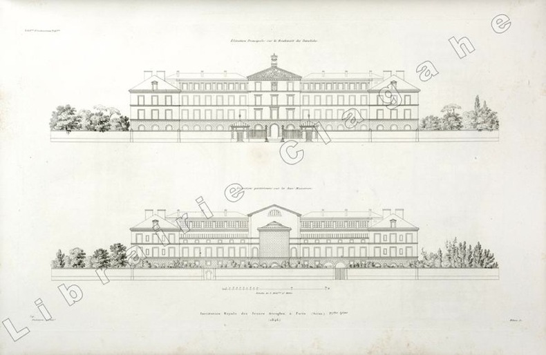
1846ref. 19809(Paris, 1846) ; in folio, toile vert foncé, double encadrement de filets dorés maigre et gras, tranches dorées, titre doré en long ; papier de garde multicolore peigné (reliure de l’époque); [4], 6 planches gravées de plans des bâtiments et des jardins situés au N°56 du boulevard des Invalides à Paris.
1889ref. ARCH120MEdité par Dujardin & Cie, Paris, 1889. Quatrième année. (28x35,5cm.) 2 volumes : 636pp + 104 planches. Plans en n&b. Couverture rigide. Epidermures sur les premières et dernières pages, couverture abîmée par le temps. L’intérieur reste en bon état.
1873ref. DZN-1476Paris Morel 1873, in-folio (34 x24 cm), 47 planches gravées sur double page en taille-douce sur acier et montées sur onglets. Demi vélin époque, pièce de titre en basane maroquinée rouge. Rousseurs éparses.
1820ref. 3657Couverture rigide Etablissement lithographique du Comte de Lasteyrie 1820 Paris 29,5x22,5 cm
1826ref. 3778Couverture rigide Bachelier 1826 Paris 21x13 cm
18318vo., First and Sole Edition, endpapers very lightly spotted; attractively bound in contemporary green half morocco, straight-grain cloth boards ruled in gilt, back gilt extra with five raised bands, second compartment lettered and ruled in gilt, all other compartments tooled and ruled in gilt, marbled endpapers, marbled edges, covers very lightly age-scuffed else a most attractive copy. Scarce, especially in this condition. Anderson, p.183.
1875Paris, Dunod éditeur 1875. In-16 relié pleine toile de l'éditeur, titre doré sur le plat, fermeture. Petite déchirure sans manque au dos. 66 pages + agenda. Planche dépliante. Annotations sur l'agenda.
1840Bordeaux Ramadié et Cie 1840, In-8 relié de chagrin vert à longs grains,dos lisse trés orné e filets et fleurons dorés, plats cartonnés, gardes de papier marbré. XXXI + 575 pages. Petits frottements à la reliure. Trés bon exemplaire .
1895Ex reference library book with usual (minimal) marks and stamps. Slight finger marking to a few pages, small piece missing from upper corner of half-title page and rubbing to spine ends. No creasing to covers or to spine. All edges gilt. Covers and spine embossed with gilt and green. Rubbing/scratching to rear board. 405-556pp.
1900Very Good Turkish, Ottoman (1500-1928) Original color map on cloth. Oblong: 67x75 cm. In Ottoman script. Folded originally. A very detailed map. Scale: 1:210.000. Shows Shkodra Lake, its shores, Bog Mountains, Karadag (Montenegro), Iakoh, Has etc. [MAP of OTTOMAN PROVINCE of BALKANS-ALBANIA] 52 Ipek (Peja). 53 Yakoh. 59 Akola. 60 Iskodra (Shkodra).
1894Very Good Turkish, Ottoman (1500-1928) Original color map. Folded. Oblong folio. (35 x 52 cm). In Ottoman script. Color lithograph. It shows Sudan and West Africa, Atlas Ocean shores, Sahra Desert, and other parts of Africa. Scale: 1:15.000.000. A very detailed and attractive map. Slightly fading. Otherwise a very good copy. Dated Hegira: 1310 = [Gregorian 1894]. [EARLY OTTOMAN MAP of SUDAN] Sudan. Sâye-i Türkiye Hazret Gazi Sultan Abdülhamid Hân-i Sâni'de Maarif Umûmiye Nezâret-i Celîlesi ruhsatiyle meshur Haset tarafindan Fransa Cemiyet-i Cografya âzâlarindan mütesekkil komisyona mahsûs tanzîm edilmis oldugu son defaki atlasinin tercümesi olarak bu def'a Erkân-i Umûmiyye Dairesi Besinci Fen Subesi'ne me'mûr piyade mirlivâlarindan saâdetlü Ali Seref Pasa ve rifatlubinbasi fütûvvetlü Muhyiddin Efendi maarifetleriyle tertib ettirilmistir. Ali Seref Pasa or Hafix Ali Esref. He was a soldier, who was schooled in Paris as a cartographer around 1862. Already in Paris he published his first atlas with 22 maps, called 'Yeni atlas'. Upon his return to Istanbul he became a chief cartographer at the Maatbaa-i amire Printing Press in Beyazit, which was the successor of the Muteferrika press from 1727. Among others he translated the large Kiepert map of Anatolia to Ottoman. He died in 1907, leaving his large project of a gigantic map of Anatolia in 100 sheets unfinished. Ali's name is often misunderstood or even listed as two different people: Ali Seref Pasa and Hafiz Ali Esref. Until the surname law adopted on June 21, 1934, Turks did not have surnames. They were born with one first name and were until the adulthood described only as sons or daughters of their parent's names. Later they were given titles such as Effendi (Sir), Bey (Chief) or Hanim (Madam) for higher classes, or they were given names according to their work or class. The names were not inherited by children until 1934, when the surname law was enforced. The map maker Ali received names Seref, the honourable, and Pasa, the dignitary. He was also known as Hafiz, the memorizer of Qur'an and Esref, Proud. So Ali Seref Pasa would have a meaning 'Honourable Dignitary Ali, and Hafiz Ali Esref, Memorizer of Qur'an, Proud Ali. Daruttibaa - Matbaa-I Amire Printing Press: The first press in the Muslim world, called Daruttibaa, was founded in Istanbul by Ibrahim Muteferrika in 1727, with a permission of Sultan Ahmeet III. It was located in Muteferrika's house. The first book was published in 1729 and until 1742 sixteen other works followed. After Muteferrika's death, the press was supressed for printing, as printed books were considered dangerous. In 1796 the press was purchased by the government and moved to Uskudar in Istanbul, and in 1831 finally to Beyazit, where it was renamed to Matbaa-i Amire in 1866. The press was closed in 1901 and was reopened in 1908 under the name 'Âmire' In 1927 the name changed to State Printing House. The press still exists and is known for publishing school and educational books. Extremely rare. Not in OCLC.; Not in TBMM Map Collection.
1831Very Good Turkish, Ottoman (1500-1928) Original manuscript autograph handwritten document sealed 'Hüsrev Mehmed' sent to (and responded by) Serkâtib Mustafa. Written in special paper with 'ahar'. 39x21 cm. In Ottoman script. Slightly tear on folded place and slightly stains. Otherwise a very good manuscript paper. The document was written in accordance with the Ottoman state correspondence tradition prior to modernization. However, it is an indication of modernization that it is written to the serkâtib of Humâyûn (head clerk of the Ottoman / Turkish court) and not to the Sultan directly. The importance of this document is that it has many hints of modernization movements of the last period of Empire, depiction of the division of the first modern Ottoman army (Asakir-i Mansure-i Muhammediye) that's before one year of Egyptian Campaign by Koca Husrev Pasha and before eight years of proclamation of Reform (Tanzimat) and after only 22 years of Turkish Magna Carta (Sened-i Ittifak). Husrev Pasha was 'serasker' (commandant and head) of Assakir-i Mansure-i Muhammediye Army in that year. Husrev's text starts as 'Devletlü, inayetlü, atufetlü, oglum.." in 'Elqab'. In the Ottoman diplomacy, first person who used 'oglum' [i.e. my son] in elqab of the documents was Koca Hüsrev Pasha. (Source: Osmanli Arsiv Belgeleri, Orhan Sakin). Koca Hüsrev Pasha (Khosrew Pasha) was an Ottoman Kapudan Pasha ("Grand Admiral") of the Ottoman Navy and statesman who reached the position of Grand Vizier rather late in his career, between 2 July 1839 and 8 June 1840 in the reign of Abdülmecid I. However, during the 1820s, he occupied key administrative roles in the fight against regional warlords, the reformation of the army, and the reformation of Turkish attire. In 1801, Hüsrev Pasha commanded the 6,000 Ottoman troops who assisted the British in removing the French from Rashid (Rosetta). For this, he was made governor of Egypt Eyalet (province), in which position he was charged with assisting Hüseyin Pasha in the killing or imprisoning the surviving leaders of the Mamluks. Many of these were freed by or fled with the British, while others held Minia between Upper and Lower Egypt. [.] He was later made governor again by Muhammad Ali for 2 days [.] After Diyarbekir and Salonica, in 1806 he was governor of Bosnia Eyalet, before being reappointed as governor of Salonica in 1808. Hüsrev Pasha held the rank of Kapudan Pasha of the Ottoman Navy from 1811 to 1818. He was then appointed governor of the Eyalet of Trabzon twice, during which time he conducted for the Black Sea region of Turkey the struggle the central Ottoman state was waging against local feudal rulers (Derebeys). During the Greek War of Independence, he was appointed Kapudan Pasha again in the end of 1822. In 1826, Husrev Pasha played vital roles both in the Auspicious Incident (the annihilation of the Janissary Corps in 1826) and in the formation of the new "Mansure Army" modeled after those of European Powers. Appointed as seraskier (commander the army) of the Mansure in May 1827, Husrev reformed and disciplined the corps. Himself ignorant of modern military methods, he assembled a staff of foreign experts and other personnel to assist him, the "Seraskeriye", which constituted the first staff in Ottoman history. Due to his early championing of military reform and virtual control over the new Ottoman army, Husrev was able to install many of his protégés in senior military positions. Husrev Pasha was also instrumental for the near-abandonment of the turban and the adoption of the fez as a universal headgear for Muslim men of the Ottoman Empire (excluding the religious classes) under Sultan Mahmud II. (Wikipedia). Möltke talks about him in famous book includes his personal letters as 'he is more powerful than sultan'. Following the suppression of the Janissaries in 1826, Sultan Mahmud II transferred the functions of the old Agha of the Janissaries to the seraskier.
1876Very Good German Original color map on cloth. Chipped on folded places. Oblong atlas folio. (46 x 52 cm). Toponyms in German. [MAP of WEST WALLACHIA - CRAIOVA] N.10. Kraiova. A sheet of the collection of 'The general map of Central Europe'. appeared in the years between 1873-1876 with the work of Joseph Ritter von Scheda, (1815-1888) who was a general, geographer and cartographer.
1876Very Good German Original color map on cloth. Chipped on folded places. Oblong atlas folio. (46 x 52 cm). Toponyms in German. A sheet of the collection of 'The general map of Central Europe'. appeared in the years between 1873-1876 with the work of Joseph Ritter von Scheda, (1815-1888) who was a general, geographer and cartographer.
1876Very Good German Original color map on cloth. Chipped on folded places. It needs repair. Oblong atlas folio. (46 x 52 cm). Toponyms in German. Shows Kastoria area in Greece. A sheet of the collection of 'The general map of Central Europe'. appeared in the years between 1873-1876 with the work of Joseph Ritter von Scheda, (1815-1888) who was a general, geographer and cartographer.
1876Very Good German Original color map on cloth. Chipped on folded places. It needs repair. Oblong atlas folio. (46 x 52 cm). Toponyms in German. Shows Durach (Durazzo) and its around, Musakija at south, western shores of Albania, Elbasan, and three bays (Drin Golf etc). A sheet of the collection of 'The general map of Central Europe'. appeared in the years between 1873-1876 with the work of Joseph Ritter von Scheda, (1815-1888) who was a general, geographer and cartographer.
1876Very Good German Original color map on cloth. Chipped on folded places. Otherwise a clean copy. Oblong atlas folio. (46 x 52 cm). Toponyms in German. Shows Krusevac and its around in Serbia. A sheet of the collection of 'The general map of Central Europe'. appeared in the years between 1873-1876 with the work of Joseph Ritter von Scheda, (1815-1888) who was a general, geographer and cartographer.
1876Very Good German Original color map on cloth. Chipped on folded places. Otherwise a clean copy. Oblong atlas folio. (46 x 52 cm). Toponyms in German. Shows Brood area and its around, Djakovo, Tuzla etc. A sheet of the collection of 'The general map of Central Europe'. appeared in the years between 1873-1876 with the work of Joseph Ritter von Scheda, (1815-1888) who was a general, geographer and cartographer.