TREGOLD, ThomasLivre Rare Book
Société centrale des Architectes.Livre Rare Book
Manuel des Lois du Batiment
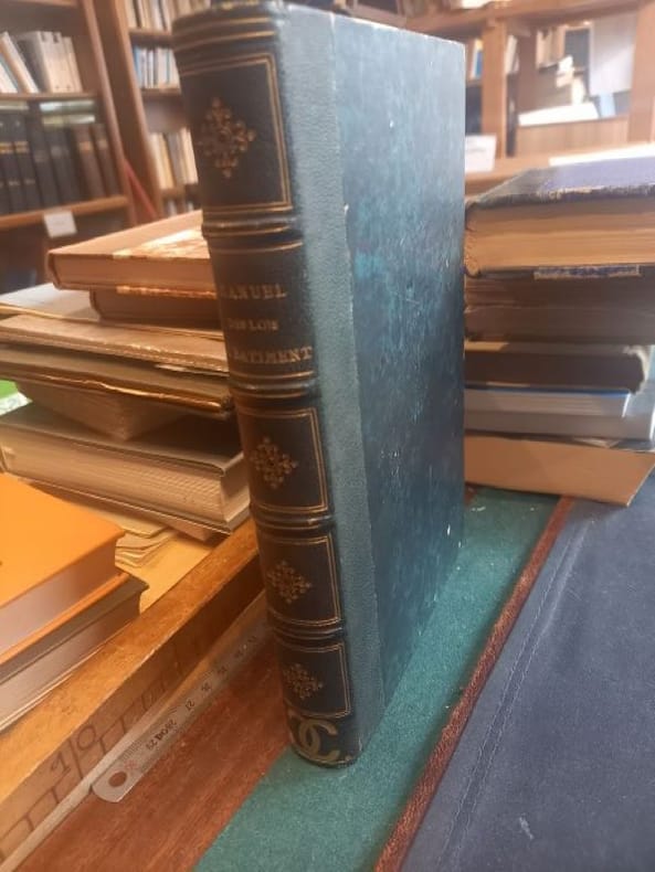
1863ref. LCI-5714Paris A. Morel et Cie 1863 1 in -8 demi chagrin vert dos orné
Le Chef d'Oeuvre Inconnu · Lille, Francia90,00 €
144 resultados
1826ref. 3778Couverture rigide Bachelier 1826 Paris 21x13 cm
1875ref. 2161Hamburg, Lucas Gräfe, 1875. 26 S. Brosch. d. Zt.
1863ref. LCI-5714Paris A. Morel et Cie 1863 1 in -8 demi chagrin vert dos orné
1873ref. DZN-1476Paris Morel 1873, in-folio (34 x24 cm), 47 planches gravées sur double page en taille-douce sur acier et montées sur onglets. Demi vélin époque, pièce de titre en basane maroquinée rouge. Rousseurs éparses.
1856ref. NATW0722Wien, Braumüller, 1856. gr.-8°, XVII, 410 S., mit 65 Textholzschnitten, OBrosch. m. kl. Umschlagzeichnung, angestaubt, Knickspuren, berieb., winzige Fliegenspuren, Umschlag aufgebogen, etw. eselsohrig, Schnitt ungleich geschnitten, staubdunkel, etw. stockfleck. Inhalt: Bewegung und Ausfluß des Wassers. Bewegung und Ausfluß der Gase. Motoren. Wasserräder. Windräder. Dampfmaschinen. Nutzeffekt bestehender Dampfmaschinen. Anordnung von Dampfmaschinen. Schwungräder. Riemen und Seile ohne Ende. Festigkeit der Materialien. Beobachtungs-Resultate.
1888ref. 0005137Chicago: People's Publishing Co. 1888 circa. New edition. Pictorial Cloth. Good. Steel Engravings and woodcuts. 4to 649 pages recased original covers with new endpapers blue ink stain on bottom edge all edges gilt extremities worn. Uncommon. "Picturesque Ireland' is designed to embrace and present all the best and most striking features of preceding works on the subject .with hundreds of other views from recent photographs and drawings especially engraved for this work. . In this work every county in Ireland will be noticed and the remarkable features of each illustrated." Each county map is in colour. Steel Engravings and woodcuts. People's Publishing Co. hardcover
1879ref. 1007212Halle, Hendel, 1879. 4to. 8, 76 S. m. 50 Textabb., 1 gef. Taf. Neuer Hlwdbd (Titel mehrf. gestemp.).
1825Very Good French Original engraved b/w map. Folded. A little foxing. Otherwise very good and clean copy. Folio. (40 x 27 cm). In French. From 'Voyage Egypte et en Syrie.; pendant les années 1783, 1784 et 1785, suivi de considérations sur la guerre des russes et des turks, publiées en 1788 et 1789, Vol. 1 (Egypt chapter). At north, Mer Mediterranee, Syrie,, Alexandrie, Delta, et alli. Also shows Desert d'Arabie, Desert d'Afrique; with El Tih ou Desert de l'Egarement, Bahr ou Mer de Qolzoumm, Mer Rouge, Ancien Thebes, et alli.
1866ref. 230513New York: John Wiley & Son 1866. New Edition. Hardcover. Very Good. 12mos terra-cotta cloth bevelled edges tips of spines worn With illustrations drawn by the author. A classic work a classic study of Venice and its architecture. Illustrations on wood. John Wiley & Son hardcover
1863ref. 1304423Paris, Imprimerie Impériale, 1863. 4to. 2 Bl., 234 Sp. bei zweispaltigem Druck, 1 Bl. Neuer Lwdbd (Stempel a. d. Titel).
1868Very Good Turkish, Ottoman (1500-1928) Contemporary quarter leather bdg. Rebacked boards. Foolscap 8vo. (18 x 12 cm). In Ottoman script (Old Turkish with Arabic letters). 220 p. Very rare early book of the concise biographies of 137 people who served as admirals in the Ottoman Empire between 1352 and 1853, written by Mehmed Izzet Pasha (d. 1853), son of Turkish admiral Abdullah Râmiz Pasha (d. 1813). Ceridehâne Printing House was founded for publishing Ceride-i Havâdîs [i.e. The Journal of News], which was the first semi-official newspaper in the Ottoman Empire. This journal was published from 1840 to 1877 and was founded by William Nosworthy Churchill (1796-1846), a British-born journalist who moved to Turkey aged 19. He was the cause of a diplomatic incident that resulted in the temporary severance of diplomatic relations between Britain and the Ottoman Empire. Babinger p. 323/2.; Özege 6951.; Library of Congress. Karl Süssheim Collection, no. 1336., OCLC: 11810438, 880485954.
1880Very Good French Original color map on cloth. Folded. Oblong atlas folio. (48 x 63 cm). Toponyms in German. It shows Sinop and Samsun city with their shores to 'Schwarzes Meer' and their hinterlands. [MAP] A IV. Sinob. Black Sea shores, Pontus Euxinus.
1889ref. ARCH120MEdité par Dujardin & Cie, Paris, 1889. Quatrième année. (28x35,5cm.) 2 volumes : 636pp + 104 planches. Plans en n&b. Couverture rigide. Epidermures sur les premières et dernières pages, couverture abîmée par le temps. L’intérieur reste en bon état.
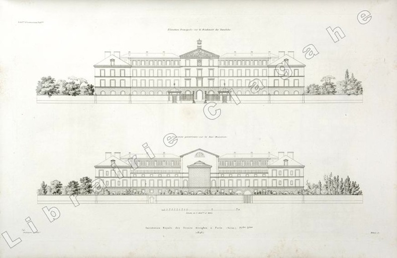
1846ref. 19809(Paris, 1846) ; in folio, toile vert foncé, double encadrement de filets dorés maigre et gras, tranches dorées, titre doré en long ; papier de garde multicolore peigné (reliure de l’époque); [4], 6 planches gravées de plans des bâtiments et des jardins situés au N°56 du boulevard des Invalides à Paris.
1840Bordeaux Ramadié et Cie 1840, In-8 relié de chagrin vert à longs grains,dos lisse trés orné e filets et fleurons dorés, plats cartonnés, gardes de papier marbré. XXXI + 575 pages. Petits frottements à la reliure. Trés bon exemplaire .
1840ref. 126852Bordeaux Ramadié et Cie Bordeaux Ramadié et Cie 1840, In-8 relié de chagrin vert à longs grains,dos lisse trés orné e filets et fleurons dorés, plats cartonnés, gardes de papier marbré. XXXI + 575 pages. Petits frottements à la reliure. Trés bon exemplaire .
181056 p. LACKS Frontis Map. Foxed and browned. Early manuscript ownership of Phebe Coddington (1767-1826). 12mo. 180 mm. Original leather spine over marbled boards, worn. Spine very worn with loss. Front board detached. Hardbound. Fair. Title continues: 'In The City And Suburbs Of Philadelphia, With References for finding their Situations On An Alphabetical Plan'. S&S/AI 21000. PALIB 4 / PAIMP 25
1897ref. 1196705Stuttgart, Neff, 1897. 4°. M. 14 (12 in Lichtdruck) Taf. u. zahlr. Abb. VIII, 551 S. OLwd. m. goldgepr. Rtit. u. Rverg.
1866ref. 1951866 A.LEVY - PARIS - 1866 - 1 Année - Nouvelle Série - In-folio, sous portefeuille - 192 pages + Table + 72 Gravures HT PP - Nouvelle série, Année 1866 complète :192 pages, 72 planches, dont certaines couleurs.- Propre
1862ref. 118394Paris, L. Hachette 1862 2 volumes. In-8 22 x 13,5 cm. Reliures demi-basane vert-olive, dos lisses ornés de filets à froid encadrés de filets dorés, 498-349 pp, tables des matières, 6 planches repliées in fine. Mors légèrement frottés, intérieur frais. Exemplaires en bon état.
1895Very Good Turkish, Ottoman (1500-1928) Original color map. Folded. Oblong folio. (35 x 52 cm). In Ottoman script. Color lithograph. A very detailed and attractive Ottoman map of America. Scale: 1:12.000.000. Otherwise a very good copy. Slightly chipped extremities. Dated Hegira: 1311 = [Gregorian 1895]. Ali Seref Pasa or Hafiz Ali Esref. He was a soldier, who was schooled in Paris as a cartographer around 1862. Already in Paris he published his first atlas with 22 maps, called 'Yeni atlas'. Upon his return to Istanbul he became a chief cartographer at the Maatbaa-i amire Printing Press in Beyazit, which was the successor of the Muteferrika press from 1727. Among others he translated the large Kiepert map of Anatolia to Ottoman. He died in 1907, leaving his large project of a gigantic map of Anatolia in 100 sheets unfinished. Ali's name is often misunderstood or even listed as two different people: Ali Seref Pasa and Hafiz Ali Esref. Until the surname law adopted on June 21, 1934, Turks did not have surnames. They were born with one first name and were until the adulthood described only as sons or daughters of their parent's names. Later they were given titles such as Effendi (Sir), Bey (Chief) or Hanim (Madam) for higher classes, or they were given names according to their work or class. The names were not inherited by children until 1934, when the surname law was enforced. The map maker Ali received names Seref, the honourable, and Pasa, the dignitary. He was also known as Hafiz, the memorizer of Qur'an and Esref, Proud. So Ali Seref Pasa would have a meaning 'Honourable Dignitary Ali, and Hafiz Ali Esref, Memorizer of Qur'an, Proud Ali. Daruttibaa - Matbaa-I Amire Printing Press: The first press in the Muslim world, called Daruttibaa, was founded in Istanbul by Ibrahim Muteferrika in 1727, with a permission of Sultan Ahmeet III. It was located in Muteferrika's house. The first book was published in 1729 and until 1742 sixteen other works followed. After Muteferrika's death, the press was supressed for printing, as printed books were considered dangerous. In 1796 the press was purchased by the government and moved to Uskudar in Istanbul, and in 1831 finally to Beyazit, where it was renamed to Matbaa-i Amire in 1866. The press was closed in 1901 and was reopened in 1908 under the name 'Âmire' In 1927 the name changed to State Printing House. The press still exists and is known for publishing school and educational books. Extremely rare. Not in OCLC.; Not in TBMM Map Collection.
1894Very Good Turkish, Ottoman (1500-1928) Original color chromo-lithograph map. Folded. Oblong folio. (40 x 50 cm). In Ottoman script. Color lithograph. An attractive map which shows Austria-Hungary land with Venice Bay and North Italy. Scale: 1:3.500.000. Dated Hegira: 1310 = [Gregorian 1894]. This uncommon map of Austria-Hungary in Ottoman script was published in an atlas, 'Yeni cografya atlasi', which was issued in Istanbul in the late 19th century. Ali Seref Pasa or Hafiz Ali Esref. He was a soldier, who was schooled in Paris as a cartographer around 1862. Already in Paris, he published his first atlas with 22 maps, called 'Yeni atlas'. Upon his return to Istanbul, he became a chief cartographer at the Matbaa-i Amire Printing Press in Beyazit, which was the successor of the Muteferrika press from 1727. Among others, he translated the large Kiepert map of Anatolia to Ottoman. He died in 1907, leaving his large project of a gigantic map of Anatolia in 100 sheets unfinished. Ali's name is often misunderstood or even listed as two different people: Ali Seref Pasa and Hafiz Ali Esref. Until the surname law adopted on June 21, 1934, Turks did not have surnames. They were born with one first name and were until adulthood described only as sons or daughters of their parent's names. Later they were given titles such as Effendi (Sir), Bey (Chief), or Hanim (Madam) for higher classes, or they were given names according to their work or class. The names were not inherited by children until 1934 when the surname law was enforced. The mapmaker Ali received names Seref, the honorable, and Pasa, the dignitary. He was also known as Hafiz, the memorizer of the Qur'an and Esref, Proud. So Ali Seref Pasa would have a meaning 'Honourable Dignitary Ali, and Hafiz Ali Esref, Memorizer of Qur'an, Proud Ali. Daruttibaa - Matbaa-I Amire Printing Press: The first press in the Muslim world, called Daruttibaa, was founded in Istanbul by Ibrahim Muteferrika in 1727, with permission of Sultan Ahmet III. It was located in Muteferrika's house. The first book was published in 1729 and until 1742 sixteen other works followed. After Muteferrika's death, the press was suppressed for printing, as printed books were considered dangerous. In 1796 the press was purchased by the government and moved to Uskudar in Istanbul, and in 1831 finally to Beyazit, where it was renamed to Matbaa-i Amire in 1866. The press was closed in 1901 and was reopened in 1908 under the name 'Âmire' In 1927 the name changed to State Printing House. The press still exists and is known for publishing school and educational books. Extremely rare. Not in OCLC.; Not in TBMM Map Collection.
1894Very Good Turkish, Ottoman (1500-1928) Original color chromo-lithograph map. Folded. Oblong folio. (40 x 50 cm). In Ottoman script. Color lithograph. It Portugal and Spain with Gibraltar and North African shores. Scale: 1:3.500.000. Dated Hegira: 1310 = [Gregorian 1894]. OTTOMAN MAP of SPAIN & PORTUGAL] Ispanya & Portekiz: Sâye-i Türkiye Hazret Gazi Sultan Abdülhamid Hân-i Sâni'de Maarif Umûmiye Nezâret-i Celîlesi ruhsatiyle Haset tarafindan Fransa Cemiyet-i Cografya âzâlarindan mütesekkil komisyona mahsûs tanzîm edilmis oldugu son atlasinin tercümesi olarak bu def'a Erkân-i Umûmiyye Dairesi Besinci Fen Subesi'ne me'mûr piyade mirlivâlarindan saâdetlü Ali Seref Pasa maarifetleriyle tersîm ettirilmistir. This uncommon map of Spain and Portugal in Ottoman script was published in an atlas, 'Yeni cografya atlasi', which was issued in Istanbul in the late 19th century. Ali Seref Pasa or Hafix Ali Esref. He was a soldier, who was schooled in Paris as a cartographer around 1862. Already in Paris he published his first atlas with 22 maps, called 'Yeni atlas'. Upon his return to Istanbul he became a chief cartographer at the Maatbaa-i amire Printing Press in Beyazit, which was the successor of the Muteferrika press from 1727. Among others he translated the large Kiepert map of Anatolia to Ottoman. He died in 1907, leaving his large project of a gigantic map of Anatolia in 100 sheets unfinished. Ali's name is often misunderstood or even listed as two different people: Ali Seref Pasa and Hafiz Ali Esref. Until the surname law adopted on June 21, 1934, Turks did not have surnames. They were born with one first name and were until the adulthood described only as sons or daughters of their parent's names. Later they were given titles such as Effendi (Sir), Bey (Chief) or Hanim (Madam) for higher classes, or they were given names according to their work or class. The names were not inherited by children until 1934, when the surname law was enforced. The map maker Ali received names Seref, the honourable, and Pasa, the dignitary. He was also known as Hafiz, the memorizer of Qur'an and Esref, Proud. So Ali Seref Pasa would have a meaning 'Honourable Dignitary Ali, and Hafiz Ali Esref, Memorizer of Qur'an, Proud Ali. Daruttibaa - Matbaa-I Amire Printing Press: The first press in the Muslim world, called Daruttibaa, was founded in Istanbul by Ibrahim Muteferrika in 1727, with a permission of Sultan Ahmeet III. It was located in Muteferrika's house. The first book was published in 1729 and until 1742 sixteen other works followed. After Muteferrika's death, the press was supressed for printing, as printed books were considered dangerous. In 1796 the press was purchased by the government and moved to Uskudar in Istanbul, and in 1831 finally to Beyazit, where it was renamed to Matbaa-i Amire in 1866. The press was closed in 1901 and was reopened in 1908 under the name 'Âmire' In 1927 the name changed to State Printing House. The press still exists and is known for publishing school and educational books. Extremely rare. Not in OCLC.; Not in TBMM Map Collection.
1899ref. 2104260233xbvkParis, Imprimerie Nationale - Octave Doin Éditeur, 1er Janvier 1899. XLVI, 1.176 pages; with many thousand names of all and everyone related to the French Navy and extensvie Index. - Gently gilt decorated and -titled heavy dark-green grained half-morocco binding of the period over 4 raised bands, with blind-tooled panels, all edges gilt and marbled endpapers; small-4to.(ca. 26 x 18 x 6 cm; ca. 2 kg.).
1874ref. 11842Bourg, Francisque Martin-Bottier, Imprimerie Comte-Milliet, 1874 ; in-8 ; cartonnage bradel rigide de papier marbré, pièce de titre en long de maroquin vert-lierre (reliure de l’époque) ; VIII, 53 pp. (1 bl.), (1) f. blanc. Avant-propos de Jules Baux.