Kubach, Hans ErichBiblio.com
1751 resultados
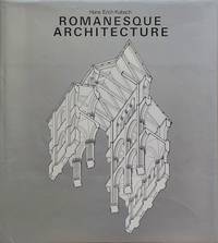
1975ref. 220197New York: Harry N. Abrams Inc. Publishers 1975. Cloth 431 pages illustrations; 29 cm. History of World Architecture Series. Translation of Architettura romanica. Near fine. Firm binding clean inside copy. Age toning. Dust jacket protected in a mylar cover. OVERSIZE! Additional shipping charges may be requested for international & priority orders. A massive coffee-table book. Profusely illustrated. CONTENTS: Pre-Romanesque architecture; Early Romanesque architecture; High Romanesque architecture; Late Romanesque architecture; Domestic and military architecture; The Church building and its environment. . 1st. Hardcover. Near Fine/Fine. 4to. Collectible. Harry N. Abrams, Inc., Publishers hardcover
1904ref. TECH0189Lpz., Weber 1904. kl.-8°, 2 Vlgsanz., XII, 414 S., 15(1) S. Vlgsanz., mit 260 in den Text gedr. Abb., ill. OLn., leicht berieben, Et. auf Buchrü. u. vord. Innendeckel, Inst.-Stemp. auf Innentit., "Ausgereiht"-Stemp. am vord. Innendeckel, Rotschn., altersbed. schwach gebr.
1831Very Good Turkish, Ottoman (1500-1928) Original manuscript autograph handwritten document sealed 'Hüsrev Mehmed' sent to (and responded by) Serkâtib Mustafa. Written in special paper with 'ahar'. 39x21 cm. In Ottoman script. Slightly tear on folded place and slightly stains. Otherwise a very good manuscript paper. The document was written in accordance with the Ottoman state correspondence tradition prior to modernization. However, it is an indication of modernization that it is written to the serkâtib of Humâyûn (head clerk of the Ottoman / Turkish court) and not to the Sultan directly. The importance of this document is that it has many hints of modernization movements of the last period of Empire, depiction of the division of the first modern Ottoman army (Asakir-i Mansure-i Muhammediye) that's before one year of Egyptian Campaign by Koca Husrev Pasha and before eight years of proclamation of Reform (Tanzimat) and after only 22 years of Turkish Magna Carta (Sened-i Ittifak). Husrev Pasha was 'serasker' (commandant and head) of Assakir-i Mansure-i Muhammediye Army in that year. Husrev's text starts as 'Devletlü, inayetlü, atufetlü, oglum.." in 'Elqab'. In the Ottoman diplomacy, first person who used 'oglum' [i.e. my son] in elqab of the documents was Koca Hüsrev Pasha. (Source: Osmanli Arsiv Belgeleri, Orhan Sakin). Koca Hüsrev Pasha (Khosrew Pasha) was an Ottoman Kapudan Pasha ("Grand Admiral") of the Ottoman Navy and statesman who reached the position of Grand Vizier rather late in his career, between 2 July 1839 and 8 June 1840 in the reign of Abdülmecid I. However, during the 1820s, he occupied key administrative roles in the fight against regional warlords, the reformation of the army, and the reformation of Turkish attire. In 1801, Hüsrev Pasha commanded the 6,000 Ottoman troops who assisted the British in removing the French from Rashid (Rosetta). For this, he was made governor of Egypt Eyalet (province), in which position he was charged with assisting Hüseyin Pasha in the killing or imprisoning the surviving leaders of the Mamluks. Many of these were freed by or fled with the British, while others held Minia between Upper and Lower Egypt. [.] He was later made governor again by Muhammad Ali for 2 days [.] After Diyarbekir and Salonica, in 1806 he was governor of Bosnia Eyalet, before being reappointed as governor of Salonica in 1808. Hüsrev Pasha held the rank of Kapudan Pasha of the Ottoman Navy from 1811 to 1818. He was then appointed governor of the Eyalet of Trabzon twice, during which time he conducted for the Black Sea region of Turkey the struggle the central Ottoman state was waging against local feudal rulers (Derebeys). During the Greek War of Independence, he was appointed Kapudan Pasha again in the end of 1822. In 1826, Husrev Pasha played vital roles both in the Auspicious Incident (the annihilation of the Janissary Corps in 1826) and in the formation of the new "Mansure Army" modeled after those of European Powers. Appointed as seraskier (commander the army) of the Mansure in May 1827, Husrev reformed and disciplined the corps. Himself ignorant of modern military methods, he assembled a staff of foreign experts and other personnel to assist him, the "Seraskeriye", which constituted the first staff in Ottoman history. Due to his early championing of military reform and virtual control over the new Ottoman army, Husrev was able to install many of his protégés in senior military positions. Husrev Pasha was also instrumental for the near-abandonment of the turban and the adoption of the fez as a universal headgear for Muslim men of the Ottoman Empire (excluding the religious classes) under Sultan Mahmud II. (Wikipedia). Möltke talks about him in famous book includes his personal letters as 'he is more powerful than sultan'. Following the suppression of the Janissaries in 1826, Sultan Mahmud II transferred the functions of the old Agha of the Janissaries to the seraskier.
2001180 pages. Bibliography. References. Index. "Focuses on the topography, environment, historical development, buildings, and townscape of old Lhasa. Introduces future plans and issues concerning the safeguarding of Lhasa's historical townscape in the face of urban development. Includes 25 new maps never before published, satellite photos, historical maps and photos, watercolours, information on old buildings, and many new colour photos." - dust jacket. Dust jacket attractive in glossy new archival-grade Brodart. Average wear and usual library markings to book bound in scarlet cloth with hinges taped. A worthy reference copy. Book
1937Ex Boots library book with minimal marks, to boards and rear end paper only. Foxing to page edges and a few pages. No other marks or inscriptions. No creasing to covers or to faded spine. A clean very tight copy with red cloth boards, enclosed tear to final index page and no bumping to corners. 288pp. History of the building of The Mansion House in London plus other London related history.
199395 pages. Kluckner has "drawn inspiration from his travels around the province, in most cases not from 'the days when I was drawn like a moth to the candle of a doomed building, or a doomed piece of landscape'... Records the mansions, cabins, churches, front porches and gardens, roadside shacks and grand panoramas that are the essence of the province." - from front flap. Somewhat above-average wear. Usual library markings. A sound copy. Book
1990208 pages. Index. Bibliography. "An extraordinary collection of watercolours painted in the late 1980s, many of downtown buildings and houses that have since been demolished, and others that are doomed by the changing nature and growth of the city... Accompanying the watercolours is a text of historical anecdote and architectural information, supplemented by photographs of similar designs from old architectural pattern books, and of the city itself in a less frantic age... A rare combination of architectural history, social history, contemporary politics, art, and nostalgia for the universal values of home, stability and neighbourhood." - from dust jacket. Clean and unmarked with light wear. A quality copy of this magnificent and handsome reference. Book
1980ref. 1196089Düsseldorf, Schwann, (1980). 4to. 12, 393, (1) S. m. 182 Textabb., 14 Taf. (davon 6 gefalt.). OLwd.
1970ref. 1167215Hamburg, Christians Verlag, 1970. Gr.-8vo. 312 S. m. 93 Textabb., 290 Abb. auf Taf., 1 mehrfach gefaltete Taf. (Die Bau- u. Kunstdenkmale der Freien und Hansestadt Hamburg 2). OLwdbd m. OUmschl.
1927Very Good Turkish, Ottoman (1500-1928) Original color map. Chipped on folded places. Folded. Slightly toning on paper. Oblong atlas folio. (62 x 89 cm). In Ottoman script. Map of New Europe. Scale: 1/10.000.000. Gregorian: 1927. It's printed from 'Sudi Bey' Map Corpus. This was a map serie printed in the early Republican period in Turkish with Arabic letters. Very decorative map with its color flags of various countries longitudinal on right and left sides of map. Sudi printing house was an Ottoman / Turkish publisher who was one of the longest-running of Turkish publishers.
1927Very Good Turkish, Ottoman (1500-1928) Original color map. Chipped on folded places. Folded. Slightly toning on paper. Oblong atlas folio. (63 x 94 cm). In Ottoman script. Map of New Oceania. It shows Australia, Bahr-i Muhit-i Kebir, Pacific Ocean, New Zealand, Micronesia et alli. Scale: 1/20.000.000. Gregorian: 1927. It's printed from 'Sudi Bey' Map Corpus. This was a map serie printed in the early Republican period in Turkish with Arabic letters. Very decorative map with its color flags of various countries longitudinal on right and left sides of map. Sudi printing house was an Ottoman / Turkish publisher who was one of the longest-running of Turkish publishers.
Published around 1968, 32 pages, illustrated, map, list of owners. eng
1971Kingston is known for its historic properties, as reflected in the city's motto of "where history and innovation thrive". Including World Heritage Sites, National Historic Sites, Provincially Significant sites, municipally designated heritage properties, and listed or non-designated heritage properties, the city has 1211 properties listed in the heritage register it maintains pursuant to the Ontario Heritage Act.[61]the 1970 City of Kingston Act gave it authority to protect this architectural heritage. This volume published in1971 by the City Architectural Review Committee is the first part of the formal inventory of such buildings. A typescript of 104 leaves with illustrations. maps and appendices bound in paper covers. ame of previous owner , else fine Book
1986A clean, unmarked book with a tight binding. Full beige cloth boards. 328 pages. 8 5/8"w x11 1/4"h. Inscribed by William Dendy.
199010 pages. eng
1997Book is in excellent condition, as new in 1/4 blue cloth covers. Binding is solid and square, covers have sharp corners, exterior shows no blemishes, text/interior is clean and free of marking of any kind. Dust jacket shows the slightest signs of shelf wear only, no tears. 354 pages with b&w illustrations throughout, floor plans, elevations, architectural detail.
199232 pages, illustrated, maps. eng
1854ref. 48328Zürich Meyer und Zeller 1854- 1879. 4to. Contemporary halfcalf. Gilt spine gilt letterinf. Fronthinge weakening. 1. Bericht title without year: pp. 66- 100 - 2.: pp. 110- 155 - 3.: X73- 116 - 4.: 342 pp. - 5.: 4131- 188 pp. - 6.: VIII245- 320 pp. - 7.: 24692XII2 pp. - 8.: VIII58 pp. and 85 lithographed plates each with numerous illustr. 2 views complete. Siebenter berich has 2 titlepages the first: "Résultat des Recherches exécutées dans les Lacs de la Suisse Occidentale depuis l'année 1866 decrit par V. Gross F.-A. Forel et Edm. de Fellenberg". The second: "Pfahlbauten. Siebenter Bericht. Von Ferdinand Keller". A few minor brownspots internally clean.The work was published in "Mittheilungen der antiquarischen Gesellschaft in Zürich" Bde IXXIIXIIIXIV.XVXIX a. XX. The work has successively belong to three well-known Danish archaeologist: Georg Sarauw Axel Steensberg and J. Troels-Smith with their names on front free endpaper.Troels-Smith is internatonally known as one of the pioneers in Pollen Analysis especially with his work "Pollenanalytische Untersuchungen zu einigen Schweizerischen Pfahlbauproblemen" founded on his excavations on the "Pfahlbauten". First edition of this pioneer work in Swiss archaeology exposing in a long series of reports his finds in the Swiss lakes the Swiss lake Dwellings - describing the Swiss "Urbevölkerung" with their Stake Buildings and the rich finds around these in the Swiss lakes. unknown
1903Very Good German Original color map. Folded. A stamp of S. H. Weiss, Constantinople. Elephant folio. (82 x 65 cm). In German. Scale: 1/864.000. [MAP] Karte von Bulgarien mit Ostrumelien und Tu?rk. Thrakien.; Mit kartographischen und statistischen Beilagen zum Versta?ndnis der orientalischen Krise. Showing Bulgaria, Balkans, and Eastern Roumeli, and Turkish / Ottoman Thrace. A rare map. OCLC: 43528174.
1978299 pages. Glossary. Bibliography. Architect Index. General Index. Profusely illustrated with maps and black and white photos. The Official Guidebook of the Greater Vancouver Chapter of the Architectural Institute of British Columbia. "With its six walking and four driving tours, this work is of interest to the resident, the visitor and the architectural historian alike." - from back cover. Average wear. Short opening to base of backstrip. Binding intact. Book
1985No marks or inscriptions. No creasing to covers or to spine. A very clean very tight copy with bright unmarked white cloth boards and no bumping to corners. Dust jacket not price clipped or marked or torn or creased. 192pp. Architectural and cultural pictorial guide to Prague. Interestingly the Mayor states (in 1985) that the city was saved in 1945 by the illustrious (!) Soviet Army from destruction.. A number of poems in Czech throughout the book. The page-referenced index at the end names each illustration in five languages including English.
1978ref. 6069University of British Columbia Press In-8 oblong Softcover Vancouver/B.C. 1978
1876Very Good German Original color map on cloth. Folded. A good copy. Oblong folio. (45 x 51 cm). In German. [MAP] O.14. Brussa. [Southern Brussa - Gönen - Manias Göl -Lake-, Anatolien, Abulonia Göl -Lake-]. Shows Abhuitis See, Artynia See, Kirmisli Kasaba, etc. A sheet of the collection of 'The general map of Central Europe'. appeared in the years between 1873-1876 with the work of Joseph Ritter von Scheda, (1815-1888) who was a general, geographer and cartographer.
1876Very Good German Original color map on cloth. Oblong atlas folio. (46 x 52 cm). Toponyms in German. [MAP of BALKANS] J.10. Glina and around. North Bosnia and Herzegovina sheet. A sheet of the collection of 'The general map of Central Europe'. appeared in the years between 1873-1876 with the work of Joseph Ritter von Scheda, (1815-1888) who was a general, geographer and cartographer.
1876Very Good German Original color map on cloth. Chipped on folded places. Otherwise a clean copy. Oblong atlas folio. (46 x 52 cm). Scale: 1/300.000. Toponyms in German. Shows Saraybosna (Sarajevo), and its around, Travnik, Kladanj, G. Yakuf, Konjiva, Gorazda, Mostar et alli. A sheet of the collection of 'The general map of Central Europe'. appeared in the years between 1873-1876 with the work of Joseph Ritter von Scheda, (1815-1888) who was a general, geographer and cartographer.


