1090 resultados
1942Very Good German n modern aesthetic full leather bdg. Folio. (32 x 24 cm). Bilingual in German and Turkish. 103, [1] p., b/w plates. Includes exhibition booklet (15 pp., b/w ills.), and text of the speech of German ambassador (Franz von Papen) for this exhibition (4 pp.). "The New German Architectural Exhibition opened in Ankara Exhibition House between 31st January and 15th February 1943 was one of the exhibitions opened during World War II. This exhibition occupied a distinctive place on the public agenda due to its size and effect in media on that date. A great number of Turkish authorities, foreign diplomatic representatives, and journalists attended the exhibition, which was opened with great efforts, and the leading role of the German Ambassador in Ankara, Franz von Papen, and such a situation caused the exhibition to attract attention. Even though the civil architectural and engineering works stopped completely in Germany during the War and some of the projects were draft and incomplete, they tried to be exhibited to give the impression of Nazi Germany's "great power" with the aim of propaganda. In Turkey's press, great praises were presented in writings towards the magnificence and architects of German architecture. Not only axis powers but also allied powers tried to attract the attention of the Turkish Government and the public agenda in Turkey using propaganda methods. As a result of such attempts, the UK opened exhibitions in 1944 on English architecture in Ankara first and then in Istanbul. Similar praises spent for German architecture were also presented to that of the UK. At this point, it may be stated that as for the War, Turkey followed a policy of active neutrality, Turkish media also followed the same policy." (Source: Küçük, Evren: An Example of Nazi Germany's Propaganda in Turkey: German Architectural Exhibitions in Ankara and Istanbul).
1921Very Good Turkish, Ottoman (1500-1928) An extremely rare litho propaganda map published as an extra supplement to the Tercümân-i Hakîkat [i.e. The Translator of Truth] newspaper just before the proclamation of Republic in Turkey in 1923 by Mustafa Kemal Atatürk (1881-1938), showing the front in West Anatolia during the War of Independence (or National Struggle) between 1919-1922 against Greek forces. The upside of the map between the note as title 'Gift to the readers of 'Tercümân-i Hakîkat', Mustafa Kemal Atatürk's portrait among decorated heroic lithographed drawings. In the lower right corner, can be seen legends of the map, scale, and mapmaker's signature. Tercümân-i Hakîkat was a daily newspaper published in Istanbul between 1878-1921 during the Ottoman Empire. Tercüman-i Hakîkat, the most important newspaper published during the reign of Sultan Abdülhamid II, was founded by novelist Ahmed Midhat Efendi, (1844-1912). In the beginning, most of the articles were written by Ahmed Midhat Efendi. It was an encyclopedic newspaper with the aim of inculcating and educating reading habits among the Turks and it played an important role in the training of many famous Ottoman journalists. Its first issue was published on June 26, 1878. After Ahmed Midhat's death in 1913, the newspaper changed owners, and the last issue was published on February 11, 1921. Ibrahim Alaettin Gövsa, (1889-1949), was an Ottoman / Turkish journalist, educator, and intellectual who supported the War of Independence the most. This propaganda map published in Tercümân-i Hakîkat, during the war in 1920 or 1921, is a propaganda tool that calls on the literate people belonging to a certain class, especially those living in Istanbul, to support the war, and aims to spread the word that Turkey is winning the war. Original lithograph map. 50x35,5 cm. In Ottoman script (Turkish with Arabic letters). Scale: 1: 250.000. Occasionally foxing and slight stains on paper, folded traces. Otherwise a very good copy.
1930Very Good Turkish, Ottoman (1500-1928) Original pictorial wrappers. Chromo-lithographed photo-montage collage cover with seven b/w photos of African buildings and natives, and a red map of Africa. Complete in wrappers and folded huge Africa map (size: 57 x 82 cm). Cover size: 28.5 x 20.5 cm. In Turkish. Scale: 1/20,000,000. A very rare chromo-lithographed Africa map, prepared for the geography lessons about foreign countries in Turkey in 1930. The map shows the territories of the African continent, which was still politically under European colonialism as of the 1930s. It includes Rio de Oro (Spanish territory), Fas [i.e. Morocco], Algeria, Sahara, Cameroon (French territories), Trabulus [i.e. Libya] as Italian territory; and Liberia, Egypt, East Sudan, Eritre [i.e. Eritrea], Habesistan [i.e. Ethiopia], Somali, Kenya, Belgian Kongo, Angola, Mozambique and South African land including Rhodesia (equivalent in the territory to modern Zimbabwe), Transvaal, The Orange Free State [Oranje-Vrystaat], Natal and Kap [Cape] with Madagascar. An extra panel for the same scale map showing the Suez Canal, Nile Delta, and North Egypt in the lower-left corner. Duran studied in Istanbul and Paris. He worked as a geography teacher in various high schools and afterward he undertook the positions of lecturer and administrator in Ankara Gazi Education Institute for a time. He was known for his writings on various topics and particularly for his works on geography. Born in the imperial period, Duran conducted the first cartographic studies of the Republic of Turkey after the transition to the Republican administration. Sealed. Slight foxing. Otherwise a fine copy. Not in OCLC.
1958Very Good English Revised Third Edition of this rare map of Cyprus, made by Salmon, who was the director of Cypriot land registration and surveys. "Shows grid, district boundaries, heights in feet, railways, roads (2 categories), antiquities, ancient sites.". / "Shows district boundaries, towns and cities, roads (2 categories), railroads, ancient sites and antiquities, and dry streams. Relief is shown by contours, gradient tints, and spot heights. Earlier Edition: 1952.". (OCLC). "In December 1926, in a memorandum to the Colonial Office on vacant surveying positions in the colonies, Palestine and Cyprus were mentioned at the end of a group of Mediterranean colonies; that is there was a group of Mediterranean colonies, and also Cyprus and Palestine [.] Only in 1929 was an Imperial project involving Palestine and Transjordan, brought up at the committee (Colonial Survey Committee). This was the experimental aerial survey for determining the route of the Haifa - Damascus railway, which was presented as a model for mapping from aerial photographs [.] Among the important things reported to the Colonial Survey Committee was the reconnaissance conducted by Colonial Winterbotham, the Chief of the GSGS, in the survey departments of the colonies in 1929, a trip that had been encouraged in the first Conference of Empire Survey Officers in 1928 [.] ... how much Salmon [F. J.] expected from Winterbotham's visit to Ceylon a short time before he was to take over the directorship of the small survey department of Cyprus.". (Source: The Survey of Palestine Under the British Mandate, 1920-1948). Original color map. Folded in original wrappers. Fine. Elephant folio. (58 x 89 cm). In English. Survey of Cyprus administration map. Scale of 4 miles to one inch = 1/253440. Compiled and drawn under the direction of F. J. SALMON, (Director of Land Registration and Surveys, Cyprus, 1932). Revised Third Edition. Second in 1950.
1927Very Good Turkish, Ottoman (1500-1928) Original bdg. Large roy. 8vo. (24 x 20 cm). In Ottoman script. (Old Turkish with Arabic letters). 16 p., 15 chromo-lithographed maps. Some markings on the two maps. Otherwise a very good copy. First edition of this scarce atlas for Turkish primary schools drawn and published by Turkish geographical educators and cartographers in the early Republican period of Turkey. This fine atlas was printed in London, in a period after the proclamation of the Republic, before the Letter Revolution in 1928. Duran studied in Istanbul and Paris. He worked as a geography teacher in various high schools then he became a lecturer and a manager at Ankara Gazi Education Institute for a while. He was known for his writings on various topics and especially for his works on geography. Born in the imperial period, Duran signed the first cartographic studies of the Republic of Turkey with the transition to the Republican administration. Özege 8764.
1948Very Good Turkish Original color map. 52x65 cm. In Turkish. Scale: 1: 800,000. Showing shores from Latakia to Haifa; Lebanon , Beyrouth, North Palestine, Syria, Saudi Arabia and borders, Orontes river, deserts. [TURKISH MAP of BEYROUTH, DAMASCUS, JORDAN] Sam, Beyrouth, Lebanon, Jordan.
198212 pages, illustrated, sources of information, list of incumbants. eng
198310 pages, front cover photo of the church. eng
194720 pages, illustrated, plan, rusty staples. eng
1994No marks or inscriptions. No creasing to covers or to spine. A lovely clean very tight copy with bright unmarked boards and no bumping to corners. 335pp. Reprint of the classic work with over 400 drawings depicting all aspects of architecture, from the brickwork in the walls of ancient Rome to the vaulted roof of Westminster Abbey.
1980Appears unread. No marks or inscriptions. No creasing to covers or to spine. A lovely clean very tight copy with bright unmarked boards and no bumping to corners. 400pp. A detailed study of American architecture from pre-historic times to the late 20th century. An excellent introduction to American architecture. Enhanced with around 300 illustrations. Second corrected edition.
19775 pages, some light creasing. eng
19834 pages, illustrated, some creasing. eng
19928 pages, sources. eng
196920 pages, illustrated, plan, glossary. eng
1979Book's covers show light shelf wear only. Large format , 352 pages with architectural drawings, elevations, photos, floorplans throughout. Heavily illustrated. Binding is solid and square, text/interior is clean and free of marking of any kind. Chapters include the architectural investigation of Theatres, Libraries, Museums, Hospitals, Prisons, Hotels, Exchanges and banks, Warhouses adn office buildings, Railway stations, Market halls, exhibition buildings, Shops stores and department stores, Factories et al.
1973ref. 52943London, Hugh Evelyn, 1973. origi.Leinenband, kl.4°,143 Seiten.
1906168 pages, 55 plates, numerous illustrations. Previous owners name in pencil on front free endpaper and at base of title page. 25mm tear to top of spine down edge with back cover and wear to remaining spine edges. Occasional foxing. Some occasional pencilled notes in the margins.
1955No marks or inscriptions. No creasing to covers or to spine. A very clean very tight copy with bright unmarked boards and no bumping to corners. 19pp. Undated, possibly 1950s.
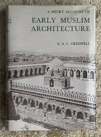
1968ref. 004173Beirut: Librairie du Liban 1968. New Impression. Hardcover. Very Good /near fine. 8vo. xiv 2 330 pp. Bound in dark maroon cloth title in gilt on spine in illustrated dust jacket. 72 black and white plates and black and white in-text illustrations. Very Good minor age-toning to pages minor scuffing to binding otherwise bright clean copy in Near Fine dust jacket with minor wear to extremities. Librairie du Liban hardcover
1965No marks or inscriptions and very minor creasing to covers adjacent to spine. A very clean very tight booklet with unmarked very slightly foxed boards, unrusted staples and no bumping to corners. 17pp. History and description of St Germans Church, Cornwall. Illustrated.
194824 pages, with photographs by John S Gough, folded plan. eng
195136 pages, illustrated, map, plan. eng
197216 pages, list of curates, bibliographical references, appendix, foreword by Francis Hill. eng