[JAPANESE MAP OF NORTHERN CHINA].Biblio.com
14.474 resultados
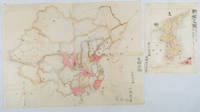
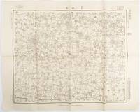
1938ref. 172168Japan.: 陸地測量部参謀本部. Rikuchi Sokuryōbu Sanbō Honbu. Showa 13 1938. Black and white folded map 45.5 x 57.5 cm scale 1:50000 Two small red pencil marks and one in blue some careless folding of map but overall very good. This 1938 map of northern China was published in 1938 by the General Staff Headquarters of the Japanese Army and was marked as military secret. By this time Japanese military was fighting in China in various regions. This military map shows parts of 單縣 Shan County in Shandong Province 虞城縣 Yucheng County in Hennan Province and 碭山縣 Dangshan County in Jiangsu Province. . 陸地測量部参謀本部. [Rikuchi Sokuryōbu Sanbō Honbu]. unknown
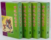
1975ref. 223379Hong Kong.: 新雅七彩畫片公司. Xinya qicai huapian gongsi. 1975. Forty volume graphic novel set of Journey to the West complete illustrated in black and white with captions in traditional Chinese characters below. Presented in 4 boxes of 10 volumes each approximately 44 - 60pp per volume 20.2 x 12.5cm. Coloured paper wrappers each with its own title and list of all titles on lower wrapper. Wrappers slightly foxed a little soiling on boxes but overall the set is in exceptionally good condition. A very appealing graphic lianhuanhua set of Wu Cheng'en's famous novel Journey to the West sometimes translated as "Monkey". . 新雅七彩畫片公司. [Xinya qicai huapian gongsi]. unknown
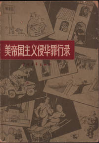
1966ref. 220355Beijing.: 中国青年出版社 Zhongguo qingnian chubanshe. 1966. Black and white photographic and black line drawn illustrations 149pp text in simplified Chinese characters 18.5 x 13cm paper wrapper. Evenly browned throughout worn and soiled wrappers chipped at corners and head and tail of spine. . 中国青年出版社 [Zhongguo qingnian chubanshe]. unknown
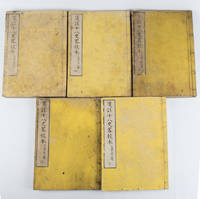
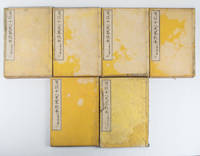
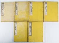
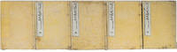
1880ref. 165397大阪.Osaka.: 中川勘助.Nakagawa Kansuke. 明治131880. 5 volumes of 7. Missing volumes two and three bound in Japanese 5 hole stab binding double leaves oriental style. Paper title labels laid down upper covers rubbed with loss soiling and creasing on covers edges little soiled occasional worming still text clean and sound. Text in Chinese with Japanese reading marks. 26 x 18.5cm. A Japanese edition of Jūhasshiryaku 十八史略 Shi ba shi lue in pinyin with extra notes. The text was checked against the authorative text by Japanese scholar 近藤元粹 Kondō Gensui. The Summary of the Eighteen Histories is an introductory Chinese history for children compiled by Zeng Xianzhi 曾先之 in the Yuan period. The full set is complete in 7 volumes. . 中川勘助.[Nakagawa Kansuke]. unknown
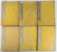
1880ref. 165396大阪.Osaka.: 中川勘助.Nakagawa Kansuke. 明治131880. 6 volumes of 7. Lacks volume 1 bound in Japanese 5 hole stab binding double leaves oriental style. Paper title labels laid down upper covers soiling and creasing on covers edges little soiled occasional worming and chops insect damage upper edge volume one still text clean and sound. Text in Chinese with Japanese reading marks. 26 x 18.5cm. A Japanese edition of Jūhasshiryaku 十八史略 Shi ba shi lue in pinyin with extra notes. The text was checked against the authorative text by Japanese scholar 近藤元粹 Kondō Gensui. The Summary of the Eighteen Histories is an introductory Chinese history for children compiled by Zeng Xianzhi 曾先之 in the Yuan period. The full set is complete in 7 volumes. . 中川勘助.[Nakagawa Kansuke]. unknown
1880ref. 165395大阪.Osaka.: 中川勘助.Nakagawa Kansuke. 明治131880. 6 volumes of 7. Lacks volume one bound in Japanese 5 hole stab binding double leaves oriental style. Paper title labels laid down upper covers soiling and creasing on covers edges little soiled ink annotation upper edge some volumes string split volume seven with some browning still text clean and sound. Text in Chinese with Japanese reading marks. 26 x 18.5cm. A Japanese edition of Jūhasshiryaku 十八史略 Shi ba shi lue in pinyin with extra notes. The text was checked against the authorative text by the Japanese scholar 近藤元粹 Kondō Gensui. The Summary of the Eighteen Histories is an introductory Chinese history for children compiled by Zeng Xianzhi 曾先之 in the Yuan period. The full set is complete in 7 volumes. . 中川勘助.[Nakagawa Kansuke]. unknown
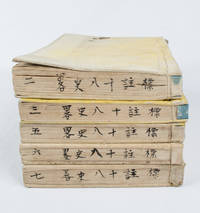
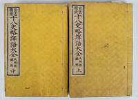
1878ref. 165197Tokyo.: 山中市兵衛.Yamanaka Ichibee. 1878. Volumes 2 3 5-7 of 7 volumes a Japanese edition of 18 Chinese histories classics spanning from pre-Qing to Song Dynasty. Originally edited by a Chinese scholar 曽先之 Zeng Xianzhi in Yuan Dynasty it was later annotated by another Chinese scholar 陳殷 Chen Yin in Ming Dynasty. This is Japanese edition compiled by 大賀富二 Ōga Tomoji has Japanese reading marks. Four-hole stab binding double leaves oriental style paper title label missing on volume 2 some marking covers particularly volumes 2 and 3 occasional worming string volume 3 split but still holding in good condition. 18.4 x 12.7cm. . [山中市兵衛?].[Yamanaka Ichibee?]. unknown
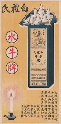
1519ref. 219406Shanghai.: No publication details. Circa 1915 -1930s. Coloured handbill advertising Price's Water Buffalo Brand candles. Text in traditional Chinese characters 26.2 x 13.2cm. Very good. Price's candles started developing internationally in 1910 and in 1915 had a factory in Shanghai. In this advertisement the name of this old family brand founded in 1830 Price's Candles has been rendered into Chinese with characters that sound like Price's i.e. 'Bai li shi' 'bai li' being a name which would appeal in China being a homonym for 'a hundred benefits'. It is also a homonym for 'white pears' which the advertisement has included as a clever visual pun - white pears in fact not pears but the top portion of six candles in a box. According to the text these 'foreign' candles have won international prizes are made of top quality ingredients and have a number of special qualities; they are produced by the Chinese in Shanghai under expert supervision last for a long time do not have an unpleasant smell and will not go soft and bend. The picture includes an image of strength - an old man holding burning candles riding a water buffalo drawn in an appealing Chinese line-drawing style with the characters for happiness good fortune and long life next to him guaranteed to appeal to Chinese customers. . No publication details. unknown
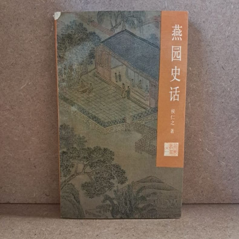
1988ref. 6061988 - broché - Peking University Press - 1988 - In-12 (18 x 11 cm) broché, couverture à rabats - 241 pages - Illustrations et photographies en noir et blanc - Quelques cartes dépliantes - ISBN : 7-301-00453-2 - Traduction de Wang Mingzhu & Meg Gallagher - Textes en anglais et en chinois - ENGLISH: Peking University Press - 1988 - In-12 (18 × 11 cm) softcover with flaps - 241 pages - Black-and-white illustrations and photographs - Includes some fold-out maps - ISBN: 7-301-00453-2 - Translated by Wang Mingzhu & Meg Gallagher - Texts in English and Chinese - 中文:北京大学出版社 — 1988年 — 12开(18 × 11厘米)平装折口封面 — 241页 — 黑白插图及照片 — 附若干折叠地图 — ISBN 7-301-00453-2 — 译者:王明珠、Meg Gallagher — 中英文对照
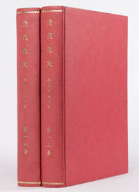
1934ref. 159936No publication details. circa1934. Complete Part Three of the "General History of Qing Dynasty" 清代通史 in 2 volumes by the modern Chinese historian Xiao Yishan 1902-1978. This work is made up of 10 chapters which focuses on the Boxer Rebellion and Chinese Qing government's politics and foreign affairs. Volume I: 38 124 228 280pp. Volume II: 497 130pp. Rebound in modern cloth boards titled in gilt on the spine. Upper wrapper with title and list of contents of both volumes laid down with some loss not affecting the text 8 pages of volume 2 p.123-130are also laid down. Title of volume one gives the incorrect information of the volume number whereas on the spine the correct volume number is shown. Browned throughout with occasional tears and minor loss. A stamp in the set which says "Complete set two volumes cost four Dayang " silver coins which were in use as Chinese currency suggests the books were published and sold during Chinese Minguo period 1911-1949. Text in traditional Chinese. "General History of the Qing Dynasty" was written and published over almost a decade from 1923 to 1930. The first part was first published in 1923 while Xiao Yishan 1902-1978 was still a student at Peking University. This two volume set is the third part of the series and is Xiao's lecture notes from the period he was lecturing at Peking Political College of Culture and History 北平文史政治學院 between 1928 and 1930. He was the founder and principal of the college. Volume one lists very detailed information on the Qing imperial officials both local and central governments and also presents famous Qing scholars' origin and major works. Volume two focuses on the rising and falling of Taiping Rebellion movement in China and also covers the political history under the reign of Tongzhi Emperor 1861-1875 . No publication details. hardcover
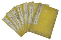
1818ref. 165209京都.Kyoto.: 五車楼.Gosharō. 明治18 1885. 6 volumes of 7 volume-set missing volume one bound in Japanese 5 hole stab binding woodblock printed on double leaves oriental style. Paper title labels laid down on yellow embossed upper covers some rubbing and light soiling in good condition. Text in Chinese with Japanese reading marks. 26 x 18.5cm. A Japanese Meiji edition of Jūhasshiryaku 十八史略 Shibashilue in pinyin with extra notes added by a Kyoto resident 奧野精一 Okuno Seiichi. The Summary of the Eighteen Histories is an introductory Chinese history for children compiled by Zeng Xianzhi 曾先之 in the Yuan period. Complete in 7 volumes. . 五車楼.[Gosharō]. unknown
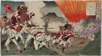
1894ref. 218366Yokoyama.: Ryohachi . 1894. Conjoined triptych of ink and watercolour woodblock prints trimmed to the margins together 35 x 63.3 cm backed onto Japanese scrap paper with some writing title and descriptive cartouches top right red censor's stamp lower left and artist's signature lower right some paper abrasions wear at the joins slight bleeding of ink and offsetting on the verso but overall in good condition. Vivid depiction of the Battle of Seonghwan also known as the battle of Asan in Korea July 29 1894 the first major land battle on of the Sino-Japanese War 1894-1895. Chinese troops are seen fleeing the charging Japanese marines and the silhouettes of airborn casualties are depicted in the bright orange explosion. Yōsai Nobukazu 1872-1944 was active towards the very end of the ukiyo-e period when the popular days of this style were over. Printmakers like Yōsai struggled and he survived as an artist by depicting the Sino-Japanese and Russo-Japanese wars. Yōshū Chikanobu was his teacher active 1838-1912 and Yōsai Nobukazu was considered his best student. The majority of his prints were triptychs of battles of the Sino-Japanese war. See a digitisation of this woodblock from the Lavenberg Collection of Japanese prints online at the University of Oregon The caption on top right praises the Japanese troops' bravery against 500 strong Chinese troops. From the collection of the late John Caiger lecturer in Asian studies ANU. . Ryohachi (?). unknown
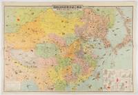
1419ref. 214497東京. Tokyo.: 東京日日新聞社. Tōkyō Nichinichi Shinbunsha. Showa 14 1939. Colour folding illustrated map charts black and white photographic illustrations with interpretive text on reverse. Few very small tears at margins some light creasing but overall still a good attractive map. 55 x 79cm. The map of China and surrounding areas are richly illustrated with little images showing the resources and products of the countries of East Asia together with their road railway sea and air routes which are marked in detail. Inset charts show Chinese trade figures in detail. The reverse side of the map provides summary information on China each region Manchukuo and Outer Mongolia with black and white photographic illustrations. Chinese trade and resource graphs are printed on the corner of the map and include steel petroleum rice pigments and dyes wood products etc; comprehensive information on population Chinese governments and Western investments are included in the reverse side. The map was a supplement of Volume 3 Number 1 issue of the Tonichi Jikyoku Joho Tokyo Nichinichi Shinbun Current Affair and Information in January 1939 which later became Mainichi Jikyoku Joho. The map and detailed information demonstrate the deep interest Japan had in China and its resources at this time reflecting its territorial desires. . 東京日日新聞社. [Tōkyō Nichinichi Shinbunsha]. unknown
1902ref. 220266Japan. No date. Circa1902. Two very attractive colour folded manuscript maps one showing China and the other Korea. Map of China: Watercolour map 48 x 63.5cm. Closed tear now professionally repaired. Map of Korea: Finely detailed watercolour map a few tiny holes very neatly repaired on the verso with archival washi. 33 x 24.5cm Two delicate hand-painted maps one of China and one of Korea produced by a Japanese student cartographer named Koike Tokushige 小池徳重. The undated map of China appears to have been produced in the first five years of the twentieth century: a time when Japan had recently colonized Taiwan and when Japanese economic and political interest in the region was rapidly expanding. The inscription on the map suggests that it was a third year college project. But the high level of detail suggests that the artist had considerable experience of map making. The map of China shows the main provinces rivers major transport routes the Great Wall and the location of key cities although the names of the cities are not included. It also shows outlines of the Korean Peninsula Taiwan and the Japanese island of Kyushu but not the rest of Japan. The map of Korea is more detailed. It provides an accurate outline of the Korean Peninsula with careful hatching indicating changes in elevation. Rivers and major road routes are shown on the map and the locations of major towns are marked though only Busan and Incheon are named. Dotted lines show coastal sea routes and routes between Kyushu and Busan and between Incheon and China. The map shows the Gyeongin railway line between Seoul and Incheon which was completed in 1899 and route of the Gyeongbu railway line between Busan and Seoul whose construction started from both ends in 1901. But the map depicts only small sections of this line close to Seoul and Busan as being completed with the rest more lightly outlined to show the projected route implying that the map was drawn around 1901-1902 and certainly before the Gyongbu line was opened in 1904. Inserted text gives the land area and population of Korea. Rather strangely though the figure given for the Korean population is vastly underestimated. Ikeda gives this as 5.7 million when in fact at that time is was around 18 million. . unknown
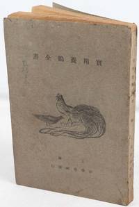
1719ref. 218140Shanghai.: 新學會社. Xin xue hui she. Minguo 171928. Black line illustrations 274pp various charts text in traditional Chinese characters 22 x 14.8cm. Heavily browned throughout closed tear neatly repaired title written in ink on lower edge. Wrappers worn small chips paper spine a sound copy. This volume offers practical information about everything concerning the farming of chickens from their shapes characters and species including from different countries to their physiology feed reproduction breeding and housing. Egg structure and incubation are also discussed among many other aspects of chicken farming. . 新學會社. [Xin xue hui she]. unknown
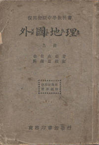
1933ref. 164732上海.Shanghai.: 商務印書館 Shang wu ying shu guan. 1st Edition. 民国22 1933. Volume 1 only of 2 maps black and white illustrations 140pp geography textbook for high school students. Original wrappers marked and worn with minor loss in places including along spine occasional ink marking and pencilling sound copy. Text in traditional Chinese. 18.7 x 12.8cm. This geography text was written under the curriculum guidance of the Education Department in 1933. The Volume One includes geography and climate information on Asia and Europe. . 商務印書館 Shang wu ying shu guan unknown
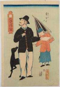
1862ref. 220053Japan.: 山田屋庄次郎. Yamada Shōjirō. Bunkyu 1 1862. Colour woodblock print 37.2 x 25.3 cm the sheet a little age-toned a spot of browning at the foot and a pinhole in the upper margin but the image unaffected very good condition. This colour woodblock print by Utagawa Yoshitora is an excellent example of Yokohama-e Yokohama Prints which were very popular in Japan after the country was opened in the mid-19th century. Yokohama was one of the trading ports with the outside world and many foreigners were residing in the area. The Yokohama-e was very similar to the Nagasaki-e Nagasaki Prints and depicted people and cultures which were foreign to the Japanese. Utagawa Yoshitora was active between the end of Edo Period to the mid-Meiji Period and produced numerous Nishiki-e prints including Yokohama-e in his career. He was regarded as one of the top Nishiki-e artists around that time. In this print a Western man is strolling outside with his dog and a Mongolian boy who carries an umbrella for him. The man is observing something in the distance and about to jot down something in his notebook with a pen which he holds in his right hand. Behind him his young attendant plays with the dog unobserved by his pre-occupied master. . 山田屋庄次郎. [Yamada Shōjirō]. unknown
1886ref. 165206Osaka.: 岡島眞七. Okajima Shinshichi. Meiji 19. 1886. 5 volumes only of 7 lacks volumes 1 and 2 bound in Japanese 5 hole stab binding double leaves oriental style. Paper title labels laid down upper covers of all but volume 3 covers marked and stained in places. Generally good. Text in Chinese with Japanese reading marks. 25.9 x 18.1cm. A Japanese edition of Jūhasshiryaku 十八史略 Shi ba shi lue in pinyin with extra notes added by Confucian scholar Fujisawa Nangaku 藤澤南岳 1842-1920. The Summary of the Eighteen Histories is an introductory Chinese history for children compiled by Zeng Xianzhi 曾先之 in the Yuan period. The complete set runs to 7 volumes. . 岡島眞七. [Okajima Shinshichi]. unknown
1886ref. 153806Osaka.: 岡島眞七 Okajima Shinshichi. Meiji 19. 1886. Complete 7 volume set 12 coloured copper engraved double page maps of China. Bound in Japanese 5 hole stab binding. Covers damp damaged with some showing mould staining string on first volume broken in one place but binding still sound very occasional light spotting contents. Lower edge of all volumes and upper edge of 3 volumes are titled in ink. Although the condition of the bindings are poor the maps and woodblock printed text are very good. A Japanese edition of Jūhasshiryaku 十八史略 Shi ba shi lue in pinyin with extra notes added by Confucian scholar Fujisawa Nangaku 藤澤南岳 1842-1920. The Summary of the Eighteen Histories is an introductory Chinese history for children compiled by Zeng Xianzhi 曾先之 in the Yuan period. Complete in 7 volumes. . 岡島眞七 [Okajima Shinshichi]. unknown
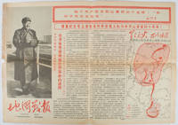
1967ref. 169746Beijing.: 地图戰報.Di tu zhan bao. September1967. Maps printed in red and black single sheet printed on both sides folded scale not given photographic image of Mao Zedong. Some light browning at edges with tears and losses on left edge still good. Text in Chinese. Sheet measures 26.5 x 38.4cm. Includes a map of Autumn Harvest Uprising and also shows the routes of the military advancing towards Jinggangshan between September and October 1927. On reverse left section a map shows the route along which Chairman Mao led the Fourth Army of the Chinese Red Army marching towards south of Anhui and Jiangxi Provinces in 1929. On reverse right section a map titled "The Long March of The Chinese Workers' and Peasants' Red Army October 1934-October 1935". Quotations of Chairman Mao about the Long March insert on corners of the map. Issue no. 6 of a series of maps with text issued by the Red Guards organisations in the form of Cultural Revolution tabloid-sized newspaper. This issue is designed to celebrate the 40th anniversary of the Autumn Harvest Uprising which was one of the earliest armed uprisings organised by the Chinese Communist Party. . 地图戰報.[Di tu zhan bao]. unknown
1518ref. 165201大阪.Osaka.: 明善堂. Meizendō. 明治15 1882. Volumes 1 and 2 only lacks volume 3. Map in text showing Chinese ancient battlefield of Fei River in 383 A.D. black and white illustrations original yellow embossed card covers four hole Japanese stab binding double leaves in oriental style paper title labels laid down upper covers. Covers a little marked and lightly worn at edges otherwise very good. Vol 1: 75 leaves; Vol 2: 76 leaves. Text in Chinese with Japanese translation. 17.8 x 12.1cm. Accompanying the Chinese text these volumes provide Japanese translations and some illustrations for words and terms which appeared in the 18 histories. . 明善堂. [Meizendō]. unknown
1979ref. 218555存粹學社 Cuncui Xueshe. 1979. Five volume set Volume 1: 396pp; Volume 2: 352pp; Volume 3: 299pp; Volume 4: 449pp; Volume 5: 212pp. Text in traditional Chinese characters 26.8 x 18.7cm. Paperback edges slightly browned else in very good condition. A collection of research papers on land issues rural economic issues changes in handicrafts as well as market employment and guild system issues during the last 300 years. . 存粹學社 [Cuncui Xueshe]. paperback
1963ref. 137007北京. Beijing.: 地图出版社.Di tu chu ban she. 1963. Large folding tourist map of Chinese transportation in colour four inset maps scale 1: 8000000 printed both sides with travel information on reverse. Stamp of a prior dealer in Guangzhou on reverse. Creases on corners occasional small holes along folds very lignt browning lower margin generally good. Text in Chinese. Sheet measures 53.8x 76.4cm. It was first published in 1957 and this map is the 2nd Edition 20th print published in 1963. The four inset maps feature regions of Hainan and surrounding islands Beijing and Tianjin region Shanghai Ningbo and Hangzhou Region and the national commercial airline route. Transportation mileage tables including roads railways and inland waterways alongside general knowledge for travel via railways coaches commercial aeroplanes and cruisers. . 地图出版社.[Di tu chu ban she]. unknown
1964ref. 169809No place of publication.: No details of publisher. 1964 -2007. Three Chinese Red Cross membership certificates issued in 1964 1989 2007 respectively page numbers vary from 2 to 6 one in plain paper covers one in red vinyl plastic covers one in green card covers in different sizes. Two certificates in Chinese and one is bilingual Chinese and Mongolian. One certificate is accompanied by a Red Cross metal pin. All in very good condition. . No details of publisher. unknown
1957ref. 164737上海.Shanghai.: 地图出版社. Ti du chu ban she. 1st edition 3rd Printing. 1957. 37 maps in colour signs of wear at extremities on covers a stamp and a prior owner's signature rear free endpaper hinge starting good copy in hardback. Text in Chinese. 17.6 x 12.5cm. This Chinese language atlas includes two world maps along with five continental maps. The remaining thirty maps are countries and regions including China Mongolia North Korea Japan Soviet Unions Poland Germany UK France Spain Australia US Arabian Peninsula South and North Poles and more. . 地图出版社. [Ti du chu ban she]. hardcover