Pye, ThomasBiblio.com

10 989 résultats
1866réf. biblio546Montréal: John Lovell 1866. Very Good. Tinted lithograph after photograph 255x330 mm brownished margins not affected image Small spot in the sky John Lovell unknown
1866réf. biblio542Montréal: John Lovell 1866. Very Good. Tinted lithograph after photograph 255x330 mm margins brownished image clean John Lovell unknown
1866réf. biblio545Montréal: John Lovell 1866. Very Good. Tinted lithograph after photograph 255x330 mm brownished margins not affected image John Lovell unknown
1866réf. biblio541Montréal: John Lovell 1866. Very Good. Tinted lithograph from photograph 255x330mm margins brownished image clean John Lovell unknown
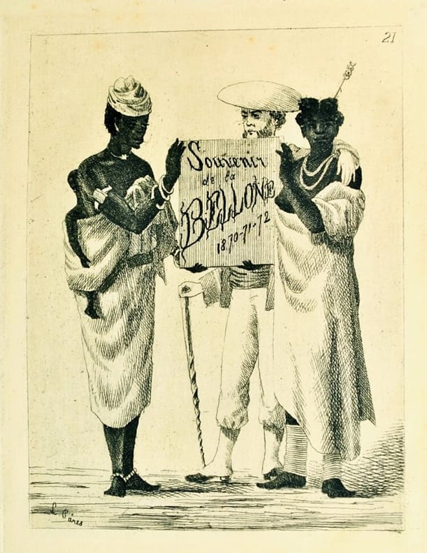
1875réf. 11333, , 1875 ca. Ensemble 36 planches non classées (10 x 14 cm et 22 x 13,5 cm), montées sur onglet et reliées en 1 vol. in-4 oblong (32 x 24 cm) demi-chagrin brun à coins, dos orné à nerfs (Gaëtan Ronner).
Large folio (ca. 64 x 49 cm). Title-page with etched, coloured and pasted vignette plan of the Church of the Holy Sepulchre, 4 pp., and 14 lithographs by Albert Adam, Charles Claude Bachelier, Hubert Clerget, Charles Fichot, and Jules Gaildrau after F.-E. Pâris (12 printed in colour). Stored loosely, as issued, in original paper wrapper with title and modern brown half cloth portfolio with white cloth ties and giltstamped title lable pasted to upper cover. Elaborate album of lithographs based on drawings by Vice Admiral François-Edmond Pâris from a visit to the holy city in 1861. The album follows his itinerary as described by Pâris in the introductory text. Leading his squadron from Jaffa to Jerusalem, Pâris drew a charming scene of pilgrims gathering at the fountain of Abu-Nabbut. Before entering the city, he captured an impressive view of Jerusalem from the Mount of Olives. 52 important sights are marked in the uncoloured lithograph and described in the text. The view of the city is followed by impressions of Christian places of worship such as the Holy Grave, the Prison of Christ, and the Chapel of Saint Helena in the Church of the Holy Sepulchre, the Tomb of the Virgin Mary, the Grotto of the Nativity in nearby Bethlehem, and an unusual, uncoloured view of the interior of the Golden Gate (Gate of Mercy). The final three lithographs present two beautiful interiors of the Mosque of Omar and one of the Al-Aqsa Mosque. All sights depicted are described in the text. - François-Edmond Pâris (1806-93) commanded the 2nd Division of the French fleet in the Mediterranean when he visited Jerusalem. Leading primarily scientific missions, Pâris was a talented draughtsman who took an interest in naval architecture, steam engineering, and geography. Today Pâris is considered the father of modern maritime ethnography; he played an important role in the modernisation of the National Maritime Museum in Paris. - Original paper wrapper rather wrinkled with some repaired tears and restored loss to corners. Title-page a little stained; several tears to margins professionally repaired. Lower right corner of the first text-sheet repaired without text loss. Lithographs generally well preserved, but some lightly affected by stains in the margins; occasional tears to the sheets and corners restored, not affecting the illustrations. Blackmer 1255. Röhricht 2762. Tobler 231.
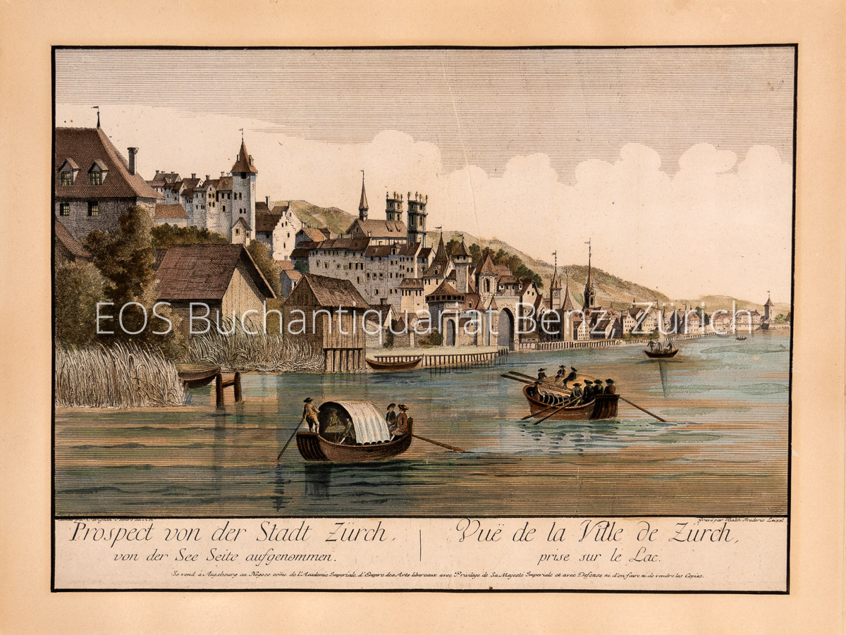
1770réf. 946CGum 1770. Kol. Kupferstich von Frederic Leizel nach Pérignon. Blattgrösse: 29 x 39 cm. + Wichtig: Für unsere Kunden in der EU erfolgt der Versand alle 14 Tage verzollt ab Deutschland / Postbank-Konto in Deutschland vorhanden +, A
1770réf. 946CGum 1770. Kol. Kupferstich von Frederic Leizel nach Pérignon. Blattgrösse: 29 x 39 cm.
réf. 28560Paris Librairie de Charles Delagrave et Cie, Editeurs 1870 1 carte géographique gravée ancienne de l'AFRIQUE, imprimée sur papier fort et coloriée à l'époque, de format : 32,5 x 47 cm, trace de pliure centrale. Carte originale gravée sur acier, figurant la géographie de l'Afrique. Les fonds de chacune des contrées de l'AFRIQUE sont aquarellés chacun d'une couleur différente (original hand coloring). Carte dressée par Ch. Périgot. Bel exemplaire ( Photographies sur demande / We can send pictures of this print on simple request ) Envoi dans un emballage de protection (tube carton)
réf. 28559Paris Librairie de Charles Delagrave et Cie, Editeurs 1870 1 carte géographique gravée ancienne de l'AMÉRIQUE MÉRIDIONALE, imprimée sur papier fort et coloriée à l'époque, de format : 47 x 32,5 cm, trace de pliure centrale. Carte originale gravée sur acier, figurant la géographie de l'Amérique méridionale. Les fonds de chacune des contrées de l'AMÉRIQUE MÉRIDIONALE sont aquarellés chacun d'une couleur différente (original hand coloring). Carte dressée par Ch. Périgot. Bel exemplaire ( Photographies sur demande / We can send pictures of this print on simple request ) Envoi dans un emballage de protection (tube carton)
réf. 28556Paris Librairie de Charles Delagrave et Cie, Editeurs 1870 1 carte géographique gravée ancienne de l'AMÉRIQUE SEPTENTRIONALE, imprimée sur papier fort et coloriée à l'époque, de format : 32,5 x 47 cm, trace de pliure centrale. Carte originale gravée sur acier, figurant la géographie de l'Amérique septentrionale. Les fonds de chacune des contrées de l'AMÉRIQUE SEPTENTRIONALE sont aquarellés chacun d'une couleur différente (original hand coloring). Carte dressée par Ch. Périgot. Bel exemplaire ( Photographies sur demande / We can send pictures of this print on simple request ) Envoi dans un emballage de protection (tube carton)
réf. 28561Paris Librairie de Charles Delagrave et Cie, Editeurs 1870 1 carte géographique gravée ancienne de l'OCÉANIE CENTRALE, ou Malaisie, imprimée sur papier fort et coloriée à l'époque, de format : 32,5 x 47 cm, trace de pliure centrale, trois petites tâches claires d'encre noire sur le tiers inférieur droit de la carte. Carte originale gravée sur acier, figurant la géographie de l'ASIE et OCÉANIE CENTRALE, ou Malaisie, les fonds de chacune des contrées sont aquarellés chacun d'une couleur différente (original hand coloring). Carte dressée par Ch. Périgot. Bel exemplaire ( Photographies sur demande / We can send pictures of this print on simple request ) Envoi dans un emballage de protection (tube carton)
réf. 28558Paris Librairie de Charles Delagrave et Cie, Editeurs 1870 1 carte géographique gravée ancienne de l'OCÉANIE CENTRALE, Australie et Nouvelle-Zélande, imprimée sur papier fort et coloriée à l'époque, de format : 32,5 x 47 cm, trace de pliure centrale. Carte originale gravée sur acier, figurant la géographie de l'OCÉANIE CENTRALE, Australie et Nouvelle-Zélande, les fonds de chacune des contrées sont aquarellés chacun d'une couleur différente (original hand coloring). Carte dressée par Ch. Périgot. Bel exemplaire ( Photographies sur demande / We can send pictures of this print on simple request ) Envoi dans un emballage de protection (tube carton)
réf. 28563Paris Librairie de Charles Delagrave et Cie, Editeurs 1870 1 carte géographique gravée ancienne de la: GÉOGRAPHIE MATHÉMATIQUE OU COSMOGRAPHIQUE, imprimée sur papier fort et coloriée à l'époque, de format : 32,5 x 47 cm, trace de pliure centrale. Carte originale gravée sur acier, figurant la géographie de la: GÉOGRAPHIE MATHÉMATIQUE OU COSMOGRAPHIQUE. Carte dressée par Ch. Périgot. Bel exemplaire ( Photographies sur demande / We can send pictures of this print on simple request ) Envoi dans un emballage de protection (tube carton)
réf. 28562Paris Librairie de Charles Delagrave et Cie, Editeurs 1870 1 carte géographique gravée ancienne: MAPPEMONDE, physique et commerciale, imprimée sur papier fort et coloriée à l'époque, de format : 32,5 x 47 cm, trace de pliure centrale. Carte originale gravée sur acier, figurant la géographie de l'Afrique. Les fonds de chacune des contrées de la: MAPPEMONDE, physique et commerciale sont aquarellés chacun d'une couleur différente (original hand coloring). Carte dressée par Ch. Périgot. Bel exemplaire ( Photographies sur demande / We can send pictures of this print on simple request ) Envoi dans un emballage de protection (tube carton)
réf. 28564Paris Librairie de Charles Delagrave et Cie, Editeurs 1870 1 carte géographique gravée ancienne de l'ALLEMAGNE, ou ROYAUME DE PRUSSE, et de l'EMPIRE D'AUTRICHE, imprimée sur papier fort et coloriée à l'époque, de format : 32,5 x 47 cm, trace de pliure centrale, trois petites tâches claires d'encre noire. Carte originale gravée sur acier, figurant la géographie de l'ALLEMAGNE, ou ROYAUME DE PRUSSE, et de l'EMPIRE D'AUTRICHE, les fonds de chacune des contrées sont aquarellés chacun d'une couleur différente (original hand coloring). Carte dressée par Ch. Périgot. Bel exemplaire ( Photographies sur demande / We can send pictures of this print on simple request ) Envoi dans un emballage de protection (tube carton)
réf. 28557Paris Librairie de Charles Delagrave et Cie, Editeurs 1870 1 carte géographique gravée ancienne: Carte physique et politique des ÉTATS-UNIS, imprimée sur papier fort et coloriée à l'époque, de format : 32,5 x 47 cm, trace de pliure centrale. Carte originale gravée sur acier, figurant la géographie de l'Amérique septentrionale. Les fonds de chacune des contrées de la carte physique et politique des ÉTATS-UNIS sont aquarellés chacun d'une couleur différente (original hand coloring). Carte dressée par Ch. Périgot. Bel exemplaire ( Photographies sur demande / We can send pictures of this print on simple request ) Envoi dans un emballage de protection (tube carton)
1792réf. 635328Göttingen, Vandenhoeck und Ruprecht, 1792-94. S. 243-386; 3 Bl., S. 387-508; S. 257-384; 4 Bl., S. 385-528 Modernes Halbleinen, Originalumschläge teilw. beigebunden.
2003réf. P�RETBEN002140Kickshaws Paris. 2003. First edition. Original title: ''Imp�ratif''. Small square octavo. Loose folded sheets printed in various typefaces against decorative backgrounds in a characteristically playful Kickshaws manner. Wrappers. One of 120 numbered copies.Fine. Kickshaws, Paris. unknown
1977No marks or inscriptions. No creasing to covers. A very clean very tight copy with bright unmarked boards, tiny bump to upper front edge and no bumping to corners. 69pp. Periodical magazine with feature articles on the Trans-Siberian caravan route, An Adriatic Hastings 1081, Saragarhi - Sikhs and Pathans, Ohio Frontier Valley, Lord Odo Russell and Bismarck, Doukhobors in Russia and Canada, Jean Baptiste Oudry, Catchpenny prints in Holland plus book reviews and letters.
1945réf. 1596DBBern, Kümmerly & Frey, 1945. 4°. 56 S. Mit mehreren Textabb. Orig.-Broschur + Wichtig: Für unsere Kunden in der EU erfolgt der Versand alle 14 Tage verzollt ab Deutschland / Postbank-Konto in Deutschland vorhanden + (mit getilgtem Besitzerstempel). = "Beiträge zur Geologie der Schweiz", Geotechnische Serie, 23. Lieferung.
réf. 57184 superbes planches imprimées par Aubert pour Pannier. Paris Milieu XIXè 31,5 x 23,5
réf. 500298749Sans date.
1934réf. 24882ABBern, A. Francke AG, 1934. 4°. XIII (1), 103 (1) S. Mit 2 Tafeln und 14 Abb. Orig.-Broschur + Wichtig: Für unsere Kunden in der EU erfolgt der Versand alle 14 Tage verzollt ab Deutschland / Postbank-Konto in Deutschland vorhanden + (berieben und bestossen). = "Beiträge zur Geologischen Karte der Schweiz", Neue Folge, 68. Lieferung. Des ganzen Werkes 98. Lieferung.
1934réf. 24882ABBern, A. Francke AG, 1934. 4°. XIII (1), 103 (1) S. Mit 2 Tafeln und 14 Abb. Orig.-Broschur (berieben und bestossen). = "Beiträge zur Geologischen Karte der Schweiz", Neue Folge, 68. Lieferung. Des ganzen Werkes 98. Lieferung.