Ballanti GraziellaLivre Rare Book
10.210 Ergebnisse
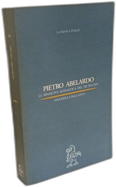
1999Best.-Nr. 100137617La Nuova Italia 1999 518 pages 13x2 8x21cm. 1999. Broché. 518 pages.
Best.-Nr. 66078, Brepols, 2019 Paperback, 487 pages, Size:216 x 280 mm, Illustrations:502 b/w, 6 col., 2 tables b/w., 5 maps b/w, Languages: French, English. ISBN 9782503583440.
1818Carta geografica tratta dal raro "Atlante Geografico" dell'abate Bartolomeo Borghi (1750-1821), cartografo, incisore ed editore che tra l'altro pubblicò l'atlante del Pazzini Carli in Siena. Incisione in rame, coloritura coeva dei contorni, in ottimo stato di conservazione. A rare map from "Atlante Geografico" of priest Bartolomeo Borghi. Copperplate with original outline colour, in very good condition. Bartolomeo Borghi(1750-1821) was an italian cartographer, engraver and publisher (editor of Atlante Geografico by Pazzini Carli, Siena 1788/1800).
1925Best.-Nr. 724031925 Les Belles Editions Françaises - 1925 - In-4, broché couverture illustrée - 1er album de Buffalo Bill, contenant 10 fascicules de 16 pages chacun avec couvertures illustrées en couleurs (reliés ensemble)
1971Best.-Nr. 1272131971 Editions Dargaud - 1971 - In-4, cartonnage illustré en couleurs - 47 planches illustrées en couleurs - Édition originale française (DL 4e trimestre 1971)
1963Portions of jacket tipped into endpapers, Very Good Condition ; 8vo; 175 pages; Woodrow Wilson named Cohen "The First Citizen of Texas, " Stephen S Wise called him "Prime Minister of American Jewry. " Cohen was Rabbi of Congregation B'nai Israel of Galveston from 1888 until 1950 and was a leader in the Galveston Movement of 1907-1914 which assisted over ten thousand Jewish immigrants to settle in the Midwest & Southwest. (amr-20-25-dw)
1963Original Publisher's Cloth. 8vo. xv, 175 pages. Cover Subtitle: "A Tribute to the Memory of its Beloved Rabbi on the One Hundredth Anniversary of his Birth by Congregation B'nai Israel of Galveston." Woodrow Wilson named Cohen "The First Citizen of Texas, " Stephen S Wise called him "Prime Minister of American Jewry. " Cohen was Rabbi of Congregation B'nai Israel of Galveston from 1888 until 1950 and was a leader in the Galveston Movement of 1907-1914 which assisted over ten thousand Jewish immigrants to settle in the Midwest & Southwest. Very good condition in good jacket. (SPEC23-15a)
1983Hardcover. 8vo. IX 357 pages. 24 cm. First edition. A work comprising various studies on the immigration, communities, cultural and political experiences of Jewish migrants to Argentina, Australia, and South Africa. Subjects: Jews - Argentina - Politics and government. Jews - Australia - Politics and government. Jews - South Africa - Politics and government. OCLC lists 314 copies worldwide. Slight indent on bottom of back cover, publishers plastic wrap unopened, with slight holes in the plastic, showing dust that has settled on the top edges. Very good+condition. (LATAM1-35)
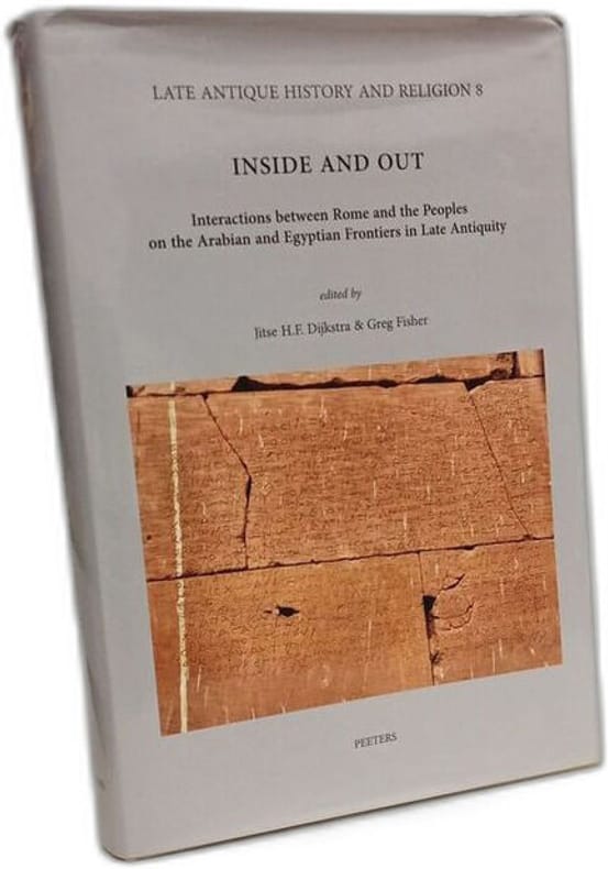
2014Best.-Nr. 100143999Peeters Publishers 2014 481 pages 16 6x3 2x24 6cm. 2014. Cartonné jaquette. 481 pages.
19218vo. Xv, 304 pages. Illustrated, including maps and portraits. In Czech. SUBJECT (S) : United States Constitution; United States history. OCLC lists 13 copies worldwide. Bumped corners, good condition. (Czech-4-12)
1991Soft Cover. 219 pages. 26 cm. First Edition. In Spanish. A documentary study of Jewish settlers and major protagonists of agricultural colonization in Argentina in the late 19th and early 20th century. With dozens of photographs and sketches throughout, several interviews, and a history of the JCA (Jewish Colonization Association) . Slightly warped spine, otherwise in excellent condition. (LATAM1-13)
19391st edition, original cloth with dust jacket, 8vo, xi+361 pages. Signed by the author. Francis Haines grew up in the Montana range country. Considered one of the country's leading authorities on the diffusion of the horse among the Indian tribes of North America, on the Appaloosa horse, and on the Nez Perce, he was the author of The Buffalo and Red Eagles of the Northwest (google books 2018) The history and background of the Nez Perce war, and a great leader, Chief Joseph, whose story so stirred the country fifty years ago. But this book is of much more than a bitter and hopeless struggle for independence; it is a study of the ever-shifting line of conflict between two civilizations- on one hand the sturdy and closely-knit culture of the Nez Perces, on the other hand the many-sided, constantly advancing front of white civilization. This intensely absorbing book will take a prominent place in our library on the American Indian. (from back of dust jacket) Inscription from author Francis Haines on title page. Has dust jacket, very scarce to have. Dust jacket is color with illustrations and a short review on the back. Dust jacket has chipping on front and back and a tear on front, spine of dust jacket is mising. Previous owners sticker on front end page, else Very Good Condition. (AC-20-17)
Best.-Nr. hp400Le Lombard Album cartonné "Sept volumes in-4 (24 x 32 cm), albums cartonnés, ensemble complet de la série ""Duke"" de Hermann et H. Yves, en édition originale (à l'exception du tome 2) ; TOME 1 : La boue et le sang // TOME 2 : Celui qui tue // TOME 3 : Je suis une ombre // TOME 4 : La dernière fois que j'ai parlé // TOME 5 : Un pistolero, tu seras // TOME 6 : Au-delà de la piste // Tome 7 : Ce monde n'est pas le mien ; très bon état général. Livraison a domicile (La Poste) ou en Mondial Relay sur simple demande."
1972Paper Wrappers. 12mo. 36, 35 Pages. First edition. In Hebrew, Yiddish and Spanish. Guide to Kashrut in Argentina, Aroysgegebn durkhn Religyezn oyfkler departament bay der ha-Rabanut ha-rashit li-yehude Argentinah un Ihud bate ha-keneset be-Argentina; Department of religious clarification of the higher Rabbinate of the Republic of Argentina and the Federation of Orthodox Synagogues of Argentina. Includes laid-in errata slip from the publishers. Subjects: Jews - Dietary laws - Directories - Argentina. OCLC lists 1 copy worldwide. Pages wavy, no dampstains. Covers slightly soiled, with a few ink marks. Text crisp. Good + Condition. (LATAM1-20)
1961(FT) Hard bound.166 Pages. 24 cm. First edition. In Yiddish; preface in Spanish and Yiddish. Title in Spanish reads Colonizacio´n y cooperacio´n agraria judi´a en la Argentina (Jewish colonization and agrarian cooperation in Argentina) . A history of the Jewish colonies, and of the J. C. A. , Jewish Colonization Association, in Argentina. Subjects: Jewish Colonization Association; Agricultural colonies; Jews. OCLC lists 15 copies worldwide. Some small stains, on cover and title pages, with some pen inscriptions on title page. Very Good Condition. (LATAM1-6)
1616Carta geografica tratta dal Tabularum Geographicarum contractarum libri septem di Petrus Bertius, edizione latina del 1616. L'opera contiene 219 carte che illustrano questa nuova versione della geografia del Bertius, per la prima volta pubblicata nel 1612 con le carte di Barent Langenes. Le carte derivano dal grande atlante di Mercator/Hondius, delle quali molte rappresentano una semplice riduzione. "After the death of Cornelis Claesz in 1609, Jodocus Hondius II became the new publisher of the work, composed by 7 parts in 1, with engraved title-page and 220 full-page engraved maps in text. All the maps were newly engraved and slightly larger in size, because Hondius was not able to acquire the original plates. With the new plates the work was definitely improved and enjoyed a growing demand of the public, which at that time had the choice between the Atlas Minor by Mercator and Bertius' Tabularum Geographicarum. The 219 plates, with the oval world map appearing twice, were produced to illustrate a new version of the geography of Bertius, published in 1616. According to King, their correct attribution is by Hondius, after Mercator and Hondius, taken from Bertius, who was only responsible for revising his text again" [cfr. G. King, Miniature Antique Maps]. Incisione in rame, perfette condizioni. A superior rival to the pocket Ortelius atlas appeared about 1598, under the imprint of Barent Langenes and Cornelis Claesz. Claesz also published the Tabularum Geographicarum contractarum libri septem, edition with texy by Petrus Bertius, in 1600. After the death of Cornelis Claesz in 1609, Jodocus Hondius II became the new publisher of the work, composed by 7 parts in 1, with engraved title-page and 220 full-page engraved maps in text. All the maps were newly engraved and slightly larger in size, because Hondius was not able to acquire the original plates. With the new plates the work was definitely improved and enjoyed a growing demand of the public, which at that time had the choice between the Atlas Minor by Mercator and Bertius' Tabularum Geographicarum. The 219 plates, with the oval world map appearing twice, were produced to illustrate a new version of the geography of Bertius, published in 1616. According to King, their correct attribution is by Hondius, after Mercator and Hondius, taken from Bertius, who was only responsible for revising his text again. "After the death of Cornelis Claesz in 1609, Jodocus Hondius II became the new publisher of the work, composed by 7 parts in 1, with engraved title-page and 220 full-page engraved maps in text. All the maps were newly engraved and slightly larger in size, because Hondius was not able to acquire the original plates. With the new plates the work was definitely improved and enjoyed a growing demand of the public, which at that time had the choice between the Atlas Minor by Mercator and Bertius' Tabularum Geographicarum. The 219 plates, with the oval world map appearing twice, were produced to illustrate a new version of the geography of Bertius, published in 1616. According to King, their correct attribution is by Hondius, after Mercator and Hondius, taken from Bertius, who was only responsible for revising his text again" [cf. G. King, Miniature Antique Maps]. Copperplate, in very good conditions. Koeman p. 42; King p. 96/99.
1963Original paper. 76 pages. 20 cm. First edition. In Spanish. In praise of poetry is a collection of poems by Jose Isaacson, Argentinian Jewish existentialist writer and literary theorist of the pre-dictatorship era. Slightly rubbed and warped spine, semi-legible ink marks facing title page, internal pages in perfect condition. Otherwise Very Good Condition. (LATAM1-5)
Best.-Nr. 65957, Brepols, 2019 Hardback, viii + 351 pages, Size:156 x 234 mm, Languages: German, English, Italian. ISBN 9782503585079.
Best.-Nr. 64397, Brepols, 2024 Paperback, xii + 220 pages, Size:216 x 280 mm, Illustrations:73 b/w, 23 col., 4 tables b/w., 3 maps b/w, 8 maps color, Language: English. ISBN 9782503609539.
1973(FT) Hardcover. 345 Pages. 33 cm. First edition. In Yiddish and some Spanish. Celebrating one hundred years of Jewish life in Argentina, profusely illustrated with black and white photographs. Subjects: Jews - Argentina Biography. OCLC lists 16 copies worldwide. Red cloth over boards, with silver debossed title, marbled endboards. Edge of back cover barely bumped, in near flawless condition. Very Good +. (LATAM1-9)
1965Soft Bound Periodical. 120 [24] pages. 26 cm. Serial Publication In Spanish, with some Hebrew. Title translates as Organ of the Jewish Congregation of Buenos Aires with a picture of the synagogue of Buenos Aires on the cover. Contains studies on the Talmud written by various professors; analyses of the Jewish community in Buenos Aires, and a Hebrew calendar for the year 1965. Contains a laid in typewritten note inserted in the cover, n. D. , on the history of the congregation. Subjects: Judaism Periodicals Argentina. OCLC lists 7 holdings of various issues worldwide. Paper covers, slight tears at edges, minor pen marks in the margins on a few pages, yellowed edges, text crisp. In good condition. (LATAM1-11)
Best.-Nr. 65332, Brepols, 2021 Paperback, xvi + 360 pages, Size:216 x 280 mm, Illustrations:130 b/w, 18 col., 8 tables b/w., 17 maps b/w, 3 maps color, Language: English. ISBN 9782503589497.
1946(FT) Hard Bound. Octavo. Book Size. 245 Pages. 24 cm. First edition. Yiddish, with Spanish title on back cover: Siluetas de Sud America (Silhouettes of South America) . Subjects: Jews - Argentina - Social life and customs - South America - Biography. OCLC lists 17 copies worldwide. Slightly yellowed pages. Ink dedication in Yiddish on title page. Very Good Condition. (LATAM1-7)
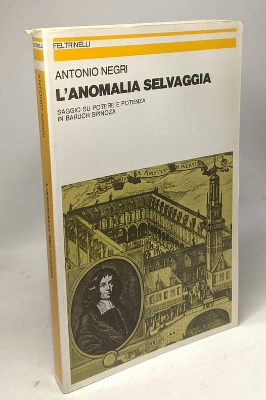
1981Best.-Nr. 100124711Feltrinelli 1981 304 pages in8. 1981. Broché. 304 pages.
1788Carta tratta dalla rara raccolta di carte geografiche denominata Atlante Geografico, prima stesura delle opera dell’abate Bartolomeo Borghi, pubblicata in Siena dal Pazzini Carli. Molte delle carte, datate tra il 1788 ed il 1800, sono incise da Agostino Costa e poi successivamente inserite nell’opera Atlante generale dell'ab. Bartolommeo Borghi, pubblicato a Firenze nel 1819.Bartolomeo Borghi, che Vermiglioli (Biografia degli scrittori perugini, 1829) definisce "uno dei migliori geografi dell'Europa", nacque nel 1750 a Monte del Lago, piccola frazione del comune di Magione, in provincia di Perugia, sulle rive del Trasimeno. Ordinato sacerdote nel 1774, trascorse i primi anni del suo mandato nel paese natale, poi a Magione e quindi a Sorbello (Cortona).Appassionato studioso di geografia, applicò dapprima le sue conoscenze all'analisi delle terre a lui più familiari: nel 1770 scrisse Descrizione geografica, fisica e naturale del Lago Trasimeno (che sarà tuttavia data alle stampe per la prima volta solo nel 1821), e nel 1791 pubblicò negli atti dell'Accademia etrusca di Cortona una Dissertazione sopra l'antica geografia dell'Etruria, Umbria e Piceno, arricchendo entrambe le opere di una carta delle regioni descritte. Intanto la sua fama di cartografo, oltre che di geografo, cresceva, tanto da fargli ottenere le nomine a membro delle Accademie Cortonese e Reale di Firenze, e procurargli l'incarico, da parte di Pietro Leopoldo, di delineare la carta del catasto pubblico di Cortona e del contado di Castiglione.Nello stesso tempo gli orizzonti geografici della sua attività si allargavano sensibilmente, e se nell'Atlante Novissimo, illustrato ed accresciuto sulle osservazioni, e scoperte fatte dai più celebri e più recenti cartografi di Antonio Zatta (Venezia 1779-1785) il suo contributo fu ancora legato all'area toscana, nell'Atlante geografico che si pubblicò a Siena da Pazzini Carli tra il 1798 ed il 1800 il Borghi tracciò la maggior parte delle carte e spaziò dalle province del Sud-Est dell'Inghilterra, al Regno di Danimarca, alla Romania.Una sorta di prova generale, quest'ultima, della sua opera più importante, quell'Atlante generale dell'ab. Bartolommeo Borghi, pubblicato a Firenze nel 1819. L'Atlante, corredato da brevi descrizioni storiche, politiche, civili e naturali che introducono le carte relative ai territori afferenti a ciascun Impero o Regno illustrato, rispecchia il nuovo assetto geo-politico attuato dal Congresso di Vienna. Map taken form the very rare Atlante Geografico, the first draft of the abbot Bartolomeo Borghi, published in Siena by Pazzini Carli. Many of the mapss, dated between 1788 and 1800, are engraved by Agostino Costa and then later incorporated in the work of AB Atlante Generale di Bartolomeo Borghi, published in Florence in 1819.Bartolomeo Borghi, who Vermiglioli (Biography of writers Perugini, 1829) calls "one of the best geographers of Europe", was born in 1750 in Monte del Lago, a small fraction of the town of Mansfield, in the province of Perugia, on the shores of Lake Trasimeno. Ordained in 1774, spent the first years of his term in his hometown, then to Mansfield and then Sorbello (Cortona).A passionate student of geography, first applied his knowledge to the analysis of land more familiar to him: he wrote in 1770 Description geographical, physical and natural Lake Trasimeno (which will however be given to the press for the first time only in 1821), and 1791 published in the Proceedings of Etruscan Cortona a dissertation on the geography of ancient Etruria, Umbria and Piceno, enriching both the works of a map of the regions described. Meanwhile, his fame as a cartographer, as well as a geographer, was growing, so that he get the nomination as a member of the Royal Academies of Florence and Cortona, and give him the job, by Pietro Leopoldo, to outline the paper's public land Cortona and the county of Castiglione.At the same time the geographical horizons of its activities widened considerably, and if in the Atlas Novissimo, illustrated and amplified the observations and discoveries made by the most recent and most famous cartographer Antonio Zatta (Venice 1779-1785) his contribution was still related area of Tuscany, in the Atlas geographic monthly published in Siena by Pazzini Carli between 1798 and 1800 the villages drew most of the cards and spaced from the provinces of South-East of England, the Kingdom of Denmark, Romania.A sort of dress rehearsal, the latter, his most important work, quell'Atlante General of AB. Bartolomeo Borghi, published in Florence in 1819. The Atlas, accompanied by brief descriptions of historical, political, civil and natural to introduce the papers relating to the territories belonging to each United Empire or illustrated, reflects the new geo-political structure implemented by the Congress of Vienna.