8 906 résultats
1978réf. ZB393453Western Agricultural Economics Association 1978. volumes 3-5 7-8 10-11 13 15-21 1978-1996 complete volumes partly bound ex library overall good-very good PRICE IS FOR THE LOT. - If you are reading this this item is actually physically in our stock and ready for shipment once ordered. We are not bookjackers. Buyer is responsible for any additional duties taxes or fees required by recipient's country. Photos available upon request. Western Agricultural Economics Association unknown
1905réf. 3538Copper River Valley Ak 1905. Very good. Forty-five printing-out paper photographs between 3.25 x 3.25 and 4 x 6 inches plus three real photo postcards. Minor wear a few creases occasional light soiling. A unique collection of almost fifty images capturing scenes in and around Copper Center in the Copper River Valley of Alaska in the years after gold was first found there in 1898. The images document pioneers panning for gold running dog sled teams posed in front of early wooden buildings in a bleak snow-covered landscape and more as well as capturing shots of a riverside mill a wooden bridge scenery on the Copper River and the majesty of the surrounding forests. A handful of the images capture pioneer women and children posed for the camera in winter clothing worn to combat the bitter Alaskan winters. One image pictures three men and two dogs standing outside the Hotel Holman an early Copper Center roadhouse that began in a tent but was opened in a wooden structure in 1899; the present image captures the post-1899 wooden structure. The Holman Hotel was established in July 1898 by Copper Center's first resident Andrew Holman in order to provide shelter for prospectors on their way to the Klondike gold fields. Copper Center is located northeast of Anchorage and served as a brief but important way station for gold prospectors in southeastern Alaska; one image here apparently pictures the early riverside settlement or is perhaps an early view of Anchorage. A rare view of Alaskan life in an uncommonly-seen settlement during the first decade of the 20th century. unknown
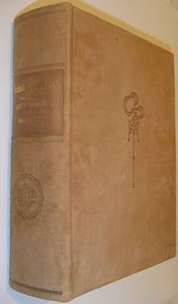
1913réf. 559a9589British Columbia: British Columbia Historical Association 1913. Book. Fine. Hardcover. Signed by Authors. First Edition. Folio - over 12" - 15" tall. Unread. As new. Number 216 of limited edition of 350 copies. Signed by co-author R.E. Gosnell. "Few publications if any of similar size and excellence have been produced in Canada." - From Editor's Foreword. Part I includes 210 pages and eighteen chapters which constitute "a survey of events from the earliest times down to the Union of the Crown Colony of British Columbia with the Dominion of Canada." Part II is "a history mainly political and economic of the Province since Confederation up to the present time." Part I is preceded and followed by dozens of tissue-protected black and white portraits of individuals influential in the early history of the province complete with their brief biographies upon the tissue. Part II comprises eighteen chapters over 226 pages plus 5 pages of addenda followed by dozens of tissue protected portraits of "some of the men conspicuous as present day factors in development." Top edge gilt. Gilt lettering upon backstrip. Marbled endpapers. Exceptionally clean bright and unmarked with zero wear. Brown suede exterior appears as fresh as the day it was applied over 100 years ago. This majestic fourteen pound tome measures 13" x 10.5" x 4". A magnificent acquisition for any serious collector of British Columbia history. A better copy will not be found. Lowther 1607 Hale 2523 Edwards & Lort 3177 Strathern 495. British Columbia Historical Association Hardcover
réf. 44211Japan and Western Medicine. Oranda jin Geka ryoji no zu Dutch Surgery in Nagasaki. Original pen ink and watercolor drawing on light brown-toned silk with 4 vertical lines of Japanese characters in the upper left corner. Japan: late 18th or early 19th century. 483 x 363 mm. mounted as a scroll at a modern date on light grey silk backed with paper with a half-round hanging rail with braided ribbon attached at the top and a suspension bar at the foot measuring 914 x 443 mm. overall; preserved in a custom-made wooden box. A few tiny pinholes in upper corners of image but fine with the coloring fresh and bright. This striking image showing an amputation carried out by a Dutch surgeon in Japan was most likely painted in the late eighteenth or early nineteenth century during Japan's self-imposed period of national isolation. The hand-painted image is related but by no means identical to a Nagasaki woodblock print titled "Surgery by a Dutch Physician" one of many popular souvenir prints depicting scenes unique to Nagasaki which at the time was the sole point of contact between Japan and the outside world. See our reproduction of the print. It may be that our scroll is the original of the image; however it is also possible that both hand-painted and woodcut versions of the image were produced simultaneously. Western surgery came to Japan in the sixteenth and seventeenth centuries via the Portuguese who in 1543 became the first Europeans to make direct contact with Japan and the Dutch who became the only European nation allowed to trade with Japan after Japan's expulsion of the Portuguese in 1639. Surgeons attached to the Dutch East India Company established practices at the island of Dejima in Nagasaki Bay which led to the formation of several Japanese schools of surgery based on European methods. "This aspect of Western medicine known as K m -ry geka or ‘Surgery of the Red-Haired' has had a profound effect on the development of surgical practice in Japan" Van Gulik p. 37. Van Gulik "Dutch surgery in Japan" in Red-Hair Medicine: Dutch-Japanese Medical Relations ed. Beukers et al. pp. 37-50. . unknown books
réf. 44211Japan and Western Medicine. Oranda jin Geka ryoji no zu Dutch Surgery in Nagasaki. Original pen ink and watercolor drawing on light brown-toned silk with 4 vertical lines of Japanese characters in the upper left corner. Japan: late 18th or early 19th century. 483 x 363 mm. mounted as a scroll at a modern date on light grey silk backed with paper with a half-round hanging rail with braided ribbon attached at the top and a suspension bar at the foot measuring 914 x 443 mm. overall; preserved in a custom-made wooden box. A few tiny pinholes in upper corners of image but fine with the coloring fresh and bright. This striking image showing an amputation carried out by a Dutch surgeon in Japan was most likely painted in the late eighteenth or early nineteenth century during Japan's self-imposed period of national isolation. The hand-painted image is related but by no means identical to a Nagasaki woodblock print titled "Surgery by a Dutch Physician" one of many popular souvenir prints depicting scenes unique to Nagasaki which at the time was the sole point of contact between Japan and the outside world. See our reproduction of the print. It may be that our scroll is the original of the image; however it is also possible that both hand-painted and woodcut versions of the image were produced simultaneously. Western surgery came to Japan in the sixteenth and seventeenth centuries via the Portuguese who in 1543 became the first Europeans to make direct contact with Japan and the Dutch who became the only European nation allowed to trade with Japan after Japan's expulsion of the Portuguese in 1639. Surgeons attached to the Dutch East India Company established practices at the island of Dejima in Nagasaki Bay which led to the formation of several Japanese schools of surgery based on European methods. "This aspect of Western medicine known as K m -ry geka or 'Surgery of the Red-Haired' has had a profound effect on the development of surgical practice in Japan" Van Gulik p. 37. Van Gulik "Dutch surgery in Japan" in Red-Hair Medicine: Dutch-Japanese Medical Relations ed. Beukers et al. pp. 37-50. . unknown
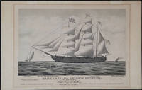
1876réf. 23907Boston: Forbes Lith. Mfg. Co. 1876. First edition. This scarce tinted lithograph was issued to commemorate the escape of Irish political prisoners from Fremantle W.A. on April 17th 1876. The Fenians are shown rowing towards the bark which is under full sail. The Catalpa is flying a flag with the initials "J T R" - for John T Richardson the ship's agent. A pennant with the letter C the Fenian flag and the American flag are also flying. The police boat is in hot pursuit and the British steamship "Georgette" is steaming in from a distance. Among the Fenians freed in this effort was John Boyle O'Reilly who became a leading citizen in Boston and was later to edit the 'Boston Pilot'. Captain George Anthony an American whaling captain out of New Bedford Massachusetts recruited a crew for this mission and set sail for Western Australia where two Fenian agents John Breslin and Tom Desmond had already established themselves with aliases. With several delays the day for the escape was set for the 17th of April when most of the convict garrison was distracted by watching the Perth Yacht Club regatta. Captain Anthony who refused to surrender the escaped prisoners to the British later sold his story to Zephaniah W. Pease who published the account in 'The Catalpa Expedition'. See also Laubenstein 'The Emerald Whaler'. On its arrival in New York in August of 1876 the Catalpa was met with great crowds; jubilant celebrations were held in the US and Ireland. 17 x 13" on paper 22 x 14 1/4". For information on the artist E. N. Russell see Blasdale Artists of New Bedford pp 160-161; Kendall Prints 28; Ingalls 318. OCLC: 191908718 1 copy at the Boston Athenaeum. Trove 45254 at the Australian National Maritime Museum; and 57714676 at the State Library of Western Australia. Professionally deacidified. In very good condition. A rare print important for its depiction of an important Western Australian colonial event. Forbes Lith. Mfg. Co. unknown
réf. 80817A substantial archive of 779 original photographs documenting a young woman homesteader's life in North Dakota and Eastern Oregon beginning around 1910 through the 1940s. Photos are generally about 3" x 5" or the reverse a few smaller including some wallet-size images and several larger up to approximately 9" x 6". 102 are loose photos; the remainder are laid into four well-composed albums of varying dimensions as ennumerated below. About one third of album images are captioned though none are dated. Overall condition is Very Good with occasional rippling to images that have been pasted onto album leaves; occasional mild fading to the earliest photographs; five album images missing though very possibly present among loose photos. Idella Cook née McElrath was born in 1894 to a farming family in Dakota County Minnesota about twenty miles south of Minneapolis. The U.S. Census of 1910 shows the McElraths still residing in Orchard Lake Minnesota; but around that time the family appears to have emigrated to Plaza North Dakota in the sparsely-populated northwest corner of the state near the present-day Fort Berthold Indian Reservation. Idella remained in North Dakota until 1917 when she relocated to Klamath Falls Oregon possibly in the company of her future husband a druggist professional photographer and traveling salesman named Roy H. "Doc" Cook. The couple married in 1922. In Klamath Falls Idella learned photography and darkroom work presumably under the tutelage of Mr. Cook then in 1929 the couple opened a general store "Idella's" that operated continuously until 1947 and then until 1978 under new owners selling groceries curios photographs of local scenery and folk remedies. All of these phases of Idella Cook's life are captured in the current archive as is a one-year sojourn 1925-6 in Hawaii. However the bulk of material contained in two thick albums is devoted to the relatively brief interval - no more than six years - between the family's arrival in North Dakota and Idella's departure to Oregon in 1917. Idella's precise status in North Dakota is difficult to pinpoint. Her 1972 obituary in the Klamath Falls Herald and News states: ".as a young girl she staked out a claim on a homestead in North Dakota.17 miles from the nearest town" implying that she had emigrated to North Dakota on her own. However the photographs present here clearly show Idella in the presence of her family members including her younger sister Izetta born in 1904 and looking eight or nine years old in the earliest photos; another photo shows a stout man leading two draft horses captioned "Papa". A January 1913 notice in a Minot ND newspaper The Ward County Independent lists an "N.G. McElrath" almost certainly a transcription error for "U.G. McElrath" Idella's father as one of a group of about 200 settlers activating to carve a new county out of the the northeastern portion of the Bertholdt Reservation which had been opened to non-Indian settlement in 1910. So while it is clear that Idella's family settled in Plaza at some point between April 1910 and January 1913 it is not clear that Idella had yet ventured out as a homesteader. Assuming then that these photos date from the period 1911 to 1912 Idella would have been seventeen or eighteen years old - not precisely a "young girl;" also not old enough to claim a parcel under the Homestead Act but certainly old enough to strike out on her own. Not until 1917 when she is 21 do we find land office records in Idella's name - as the purchaser of four parcels totalling sixty acres near the now-defunct town of Sanish which was later inundated in the construction of Lake Sakakawea in 1953. Shortly after the purchase of those parcels Idella appears to have moved to Oregon. Idella's dependent status notwithstanding these are extraordinary photographs. The earliest images present a vivid picture of the windswept and desolate existence of the area's early settlers. The brand-new town of Plaza founded in 1908 is well represented looking rather like a 1950s cowboy movie set with horse-drawn carriages far outnumbering motorcars on the towns main street. Also represented in a number of photographs is the now-disappeared hamlet of Sanish a town which was inundated in the creation of Lake Sakakawea in 1953. Also lost in that event were many square miles of land sacred to the Mandan Hidatsa Arikara Nation whose members are also a constant presence in Cook's photographs; one important series of photographs captures a large Indian pow-wow likely held on the newly-established Fort Berthold Reservation around 1910. Though the albums are extensively captioned providing a wealth of information on the early settlement and demography of the region they are occasionally wanting for specifics of date and/or locale leaving much deductive work to be done to pinpoint locations and events. Of almost equivalent interest are the many photographs taken and developed by Idella after her move to Klamath Falls around 1917. These were still early days in eastern Oregon with many towns only coming into being in the 1890's and provide a wealth of grass roots historical detail that cannot be found outside primary source materials like this. unknown
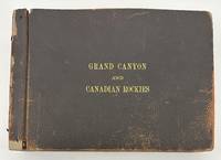
1910réf. 3375Numerous locations including New Mexico Arizona California but mostly British Columbia 1910. About very good. Forty-six leaves illustrated with 232 photographs between 3.25 x 5.5 inches including forty small panoramic images measuring around 3.5 x 12 inches some manuscript annotations some images captioned in the negative. Oblong folio. Contemporary pebbled leather stamped in gilt "Grand Canyon and Canadian Rockies" on the front cover formerly string tied but binding and leaves now loose. One image roughly removed from the album minor chipping to some leaves but otherwise minor wear. An unusual and wholly engrossing collection of western American vernacular photography titled in manuscript on the first page "Views taken by M.H. Fussell of trip taken by Sarah E. Fussell and himself to Los Angeles to attend Amer. Med. Asso. On return trip via Canadian Rockies camping at Emerald Lake near Field Canada as seen by pictures." The author of this inscription was Dr. Milton Howard Fussell 1855-1921 longtime Philadelphia physician and instructor of clinical medicine at the University of Pennsylvania who was the head of the Medical Ward at Episcopal Hospital until shortly before his death. Dr. Fussell must have also had a passion for photography as the present photographs were apparently taken by him along the course of his trip to the west coast with many of the pictures displaying Dr. Fussell's captions in the negative. A few of the captions are written backwards adding to the amateur character of Dr. Fussell's otherwise well-composed pictures. While on the way to California Dr. Fussell's photographs begin in Chicago with a couple of small panoramas of Lincoln Park but the scene swiftly shifts to the American West with images of Native Americans among them shots of "Indian children" and an "Indian Village" a "Pueblo at Laguna" numerous shots of New Mexico Las Vegas Raton and Albuquerque several small panoramic scenes of the majestic Grand Canyon and more. During their visit to the Grand Canyon Dr. and Mrs. Fussell took the chance to snap portraits of each other under which the annotation reads "The climbers. It took 12 hours to make the trip up & down. Hot!!!" On the way to California Dr. Fussell also took a couple of images of Kansas and Nevada before proceeding to snap about a half dozen pictures of the Sacramento Valley. The photographs from this point forward constituting the majority of the pictures in the album concentrate on the latter half of Dr. and Mrs. Fussell's expedition to British Columbia and the Canadian Rockies. After visiting Victoria and Vancouver the Fussells stayed at Camp Crusoe on Emerald Lake. This portion of their trip includes a few more images of the travelers themselves including a shot of Sarah with a large dead black bear. In addition to several small panoramas of Emerald Lake Dr. Fussell captures scenes of the natural wonders of British Columbia such as Mt. Burgess Mt. Wapta Bow Valley Yoho River Emerald Glacier Valley of Ten Peaks Kicking Horse Canyon Bow River Lake Louise Moraine Lake Mirror Lake Fraser River and more. The last few leaves feature other scenes in British Columbia and elsewhere with a street scene in Banff a view of the "Prairie Town of Suscatchewan B.C." a handful of pictures featuring the Sierra Nevadas and several photos captioned "Over the Coast Range" taken from a train. A unique photographic record of a West Coast excursion taken by a notable Philadelphian and his wife in the early 20th century. unknown
1846réf. 25916Paris: French Admiralty chart 1846. Very rare early map of the south west coast of Western Australia just 17 years after the founding of the colony. The map covers much of the Western Australian coast from the Dampier Archipelago in the north Broome Exmouth Gulf Shark Bay Perth Geographe Bay Cape Leeuwin Albany all the way to Port Lincoln in South Australia. To our knowledge the only copy held in an Australian institution is at the State Library of Western Australia. It is not recorded in the collection of National Library of Australia collection nor other Australian institutions. It is very interesting for the early inland detail. The areas around Perth and Fremantle are shown extending inland to Beverley York Bejoording Toodjoy and Northam on the Swan River with the Swan Avon & Moore Rivers. There are 4 insets: Plan de la entree de la Riviere Cygnes Swan River et de l'Ile Rottnest J. L. Stokes; Plan de Port Grey nomme aussi Baie Champion Captain Wickham Plan du Havre Peel dans la Baie Warnbro Lieut. J. S. Roe Plan de la Baie Warnbro J.S. Roe. Coastal features include Baie de l'Esperence; Houtmann's Abrolhos; Albany north east of Albany a mountain described as "Montagne escarpee visible a 10 lieues"; Golfe Exmouth with a prominent Cape Nord Ouest. Depth soundings are taken all around the coast. Daussy maps are rare. The State Library of Western Australia holds two. Their copy of this map bears the "Prix deux francs" lower right; with an applied printed chart sellers label from P. Sauvat Bordeaux below the rule on the lower right. They also hold the following: "Carte des mers Australes partie comprise entre les méridiens du Cap de Bonne Espérance et du Port du Roi Georges" cartographic material / dressée par M. Daussy Ingénieur Hydrographe en Chef ; gravé par Jacobs ; écrit par J.M. Hacq. MAPR0000018. This map is recorded as Tooley 1470 and Libraries Australia ID 23501679 which calls it "Rare". Centered below the margin - Ecrit de J. M. Hacq Grave par Jacobs lower left Noo. 1111 in upper right margin. Printed area 34.5 x 23.25" with very large margins 40 1/4 x 27 1/2". Backed with tissue on the center fold and margin edges supporting some small closed tears. In magnificent condition overall. An extremely rare map especially in this condition. French Admiralty chart unknown
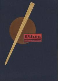
1930réf. 50786New York Chicago San Francisco: Wilson-Western Sporting Goods Company 1930. First edition. 2 volumes. 8vo. The wrappers are illustrated with Rogers Hornsby in batting stance on the front cover. There are some marginal tears and general wear and soiling especially to the Made -To -Measure catalogue; else in very good condition. Housed in a custom-made clamshell box of cloth with inlays of wood and leather. These two companion catalogues illustrate off-the-rack and tailor-made uniforms in a variety of price ranges. They contain original wool flannel samples a drawing of the complete uniform full description and price. The READY-TO-WEAR catalogue is sixteen pages plus covers fully illustrated and contains thirty-two uniform samples in a variety of colors and pinstripes. The MADE-TO-MEASURE catalogue is thirteen pages plus covers contains illustrations and sixty uniform samples in a variety of colors and pinstripes. Additionally there are endorsements for mitts with photo portraits by Bill Terry and Ray Schalk. We have been unable to locate any other copies of these or other Wilson swatch book catalogues in OCLC or any other database. The library of The Baseball Hall of Fame in Cooperstown New York had heard that such catalogues were produced but had never seen one. Rare. Wilson-Western Sporting Goods Company hardcover books
1872réf. WRCAM29311Various places 1872. Twelve cards each 17 x 13 inches a.e.g. with manuscript captions in lower margins. Images are 9 x 6 1/2 inches except the two oval images of San Francisco. Some minor soiling on cards some images slightly faded. Very good. Archivally matted protected with a mylar sheet. An excellent collection of views quite early for Hawaii and New Zealand. The four views of Honolulu include one wide view of the town a view of a side street with a church steeple in the background the Pali mountain pass and the harbor with several large vessels at anchor. In New Zealand the Supreme Court building in Christchurch and the city of Littleton are displayed. The San Francisco images include the Palace Hotel and the famous Cliff House. Of particular interest are the three views of the Central Pacific Railway. The sections of the track include Capestown the Palisade and Summit Station each with fresh evidence of the line's recent completion. Also in the collection is one image of a railroad along the banks of Salt Lake and three wide views of Salt Lake City one with the Mormon tabernacle completed in 1871 prominently featured. An attractive collection of views each quite displayable. unknown books
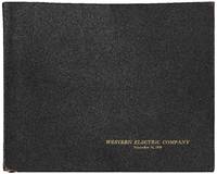
1928réf. 545041Cicero Illionis 1928. Hardcover. Very Good. Oblong folio 12 ½" x 10. A handsome presentation album consisting of three letterpress leaves followed by 27 gelatin silver prints neatly mounted on the rectos of thick card leaves each with a letterpress caption printed underneath. All but the first print measure 8" x 10". Screw-bound in flexible leather covers lettered in gold on the front cover. Head and tail of spine are torn the cardboard leaves are slightly bowed very good or better. The album was prepared "upon the occasion of a visit of city officials and business men of Baltimore to the Hawthorne Works of the Western Electric Company." It contains crisp professional views mostly of the Hawthorne factory complex at Cicero Illinois as well as a few views of other parts of the Company's operations such as the plant in Kearny New Jersey and the distribution houses in New York and Kansas City. Among the many visually striking views are "A three and one-half acre" interior the "Reel Yard operating by Floodlight" throngs of employees at a "Hawthorne-Club Open-Air Dance" and a final view of employees leaving the complex under a dramatic sunset "After the day's work." At the peak of its operations from 1905 through 1983 the Hawthorne Works employed upwards of 45000 people in the production of radio systems radar and telephone equipment and related consumer goods. Located in a suburb of Chicago the complex also gained notoriety for the term "Hawthorne effect" which "refers to the type of reactivity in which individuals modify an aspect of their behavior in response to their awareness of being observed." An early scarce promotional album dating from the heyday of Western Electric during the roaring twenties. hardcover
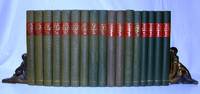
1937réf. 617G1246Victoria British Columbia: The Archives of British Columbia/British Columbia Historical Association. Good. 1937. First Edition. Hardcover. Seventeen volumes individually and uniformly bound in green cloth with with red labels and gilt lettering upon backstrips. Index in each volume. Fold-out maps. Black and white plates. Includes all issues from 1937 through 1945 and 1947 through 1954. Bindings tight. Unmarked. Moderate wear. A magnificent repository of early British Columbia history. Very heavy. Special shipping considerations may apply.; 8vo - over 7¾" - 9¾" tall; British Columbia Quarterly History . The Archives of British Columbia/British Columbia Historical Association hardcover
1872réf. 29311Various places. ca. 1872. Views in Hawaii New Zealand and on the Central Pacific Railroad An excellent collection of views quite early for Hawaii and New Zealand. The four views of Honolulu include one wide view of the town a view of a side street with a church steeple in the background the Pali mountain pass and the harbor with several large vessels at anchor. In New Zealand the Supreme Court building in Christchurch and the city of Littleton are displayed. The San Francisco images include the Palace Hotel and the famous Cliff House. Of particular interest are the three views of the Central Pacific Railway. The sections of the track include Capestown the Palisade and Summit Station each with fresh evidence of the line's recent completion. Also in the collection is one image of a railroad along the banks of Salt Lake and three wide views of Salt Lake City one with the Mormon tabernacle completed in 1871 prominently featured. An attractive collection of views each quite displayable. Twelve cards each 17 x 13 inches a.e.g. with manuscript captions in lower margins. Images are 9 x 6½ inches except the two oval images of San Francisco. Some minor soiling on cards some images slightly faded. Very good. Archivally matted protected with a mylar sheet. unknown
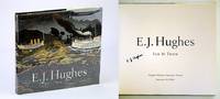
2002réf. 547H0222Canada: Douglas & McIntyre / Vancouver Art Gallery. Fine in Fine dust jacket. 2002. First Printing. Hardcover. 1550548999 . Signed by E.J. Hughes upon title page. 226 pages. Index of works. Chronology. Selected bibliography. Oblong 11" x 12". "Lavishly illustrated with 100 full colour and 25 black-and-white reproductions of prints drawings and paintings this is the first full-scale volume to honour the artistic life and work of E.J. Hughes from the start of his long career in the 1930s to the present. His unique talent for depicting the landscape in a way that both he and viewers believe it should be rather than the way it actually is enables us to experience and understand place and nature in new and deeper ways." - from dust jacket. Clean bright and unmarked with very light wear. Dust jacket now preserved in glossy new archival-grade Brodart. A marvelous gift for any devotee of E.J. Hughes and his magnificent art.; 4to - over 9¾" - 12" tall; E.J. Hughes British Columbia Canadian Artists Painters Landscape Painting Vancouver Island Signed; Signed by Authors . Douglas & McIntyre / Vancouver Art Gallery hardcover
réf. 42856London : s.n. 1835. Quarto 250 x 200 mm 3 pp; printed on letterpress; fourth side docketed 'Mission to Western Australia' and with Webster Collection stamp with number 2621 in ms.; original vertical and horizontal folds some toning else very well preserved. The foundation document for the Western Australian Missionary Society recording the resolution for its establishment made on 30 September 1835. The document also gives details of Honorary Secretary Captain F. C. Irwin's proposal for an Appeal to raise funds for the sending of missionaries to the Swan River colony and for their maintenance there which includes the observation that 'the Natives of the country who are still in the lowest state of barbarism continue in the grossest heathen darkness without a single Christian teacher of any denomination among them.' Ferguson 2070 Very rare. Trove locates only three copies in Australian collections NLA; SNSW; SLWA which represent two different printings: the SLWA and Mitchell Library copies have the variant '10s.' for 'Ten Shillings' in the last line on the first page. Note: The NLA copy is fully digitised and may be viewed at the following link: https://catalogue.nla.gov.au/catalog/2914171 Provenance: Private collection Australia; ex Maggs Bros. London c.1978; ex Webster Collection. Kenneth Athol Webster 1906-1967 was a New Zealand-born dealer and collector in manuscripts books paintings and ethnographic artefacts relating to the Pacific. In the two decades after World War Two he built one of the largest and most important collections of this type of material ever assembled. unknown
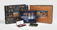
1940réf. 1690571940-43. Fine photographs of North Africa and the Middle East A British airman's substantial archive comprising photographs autographs ephemera and medals. A skilled photographer Jack Leslie Lees 1912-1980 was a leading aircraftman at the RAF's Air Ministry Experimental Station AMES Number 235 a British radar unit employed in Wadi El Natrun Egypt and Tobruk Libya where they suffered German attack in 1942. His personal archives hold extensive records of his military service and activities on leave between 1940 and 1943. The photographs portray Lees and other soldiers during their free moments and in battle as well as everyday scenes at the base and outside. He photographed Aboukir Alexandria including the zoo Cairo and Mersa Matrouh the site of several battles. In 1941 he was in Tobruk where he photographed as always everyday scenes and interesting buildings and documented the siege; he was also in Derna and Benghazi. Lees was especially fond of Jerusalem where he visited and photographed the holy sites. The first album opens with a Certificate of Pilgrimage with a chip of rock from the Grotto from Lees's visit to the Holy Sepulchre in Jerusalem issued signed and stamped in Greek by Archimandrite Kyriakos; Lees also kept a memento with the leaf of a tree from the Garden of Gethsemane. The albums include fine views of Beirut's cityscape and other areas of Lebanon where he visited ruins and the Jezzine waterfalls as well as of Syria with several Roman sites and a coastal town perhaps Latakia or Tartus. The autographs and sketches in his pocket book were jotted down by British soldiers; one in Russian calls Lees "a comrade met in Tel-Aviv". Together 5 items: landscape folio brown camel leather album 325 x 345 mm with tooled and hand-coloured pictorial scene long-stitched with thick leather strip green silk pastedowns one with pasted broadsheet 15 stiff black card leaves tissue guards 224 photographs c. 61 x 87 mm mostly gelatine silver prints with ink caption at head of some leaves; landscape folio black leather 250 x 320 mm with tooled both covers and hand-coloured front cover only pictorial scene and Egyptian hieroglyphs long-stitched with a lace 30 stiff black card leaves 411 photographs c.61 x 87 mm of which 3 inserted loosely and 5 hand-coloured mostly gelatine silver prints occasional captions in white pen; an oblong octavo leatherette autograph book 90 x 110 mm upper cover gilt-lettered label of Oriental Philatelic House B. Hagopian Cairo on front pastedown 96 pages with autographs dedications and sketches in ink to 34 pages the remainder blank; a wooden display case 200 x 250 mm with velvet lining glazed containing four medals Atlantic Star Africa Star with North Africa 1942-43 bar Defence Medal and War Medal; and a leather flip case 125 x 55 mm with velvet lining containing one Imperial Service Medal. Extremities occasionally a trifle rubbed: very good examples. hardcover
1958réf. ZB393066Western Speech Communication Association 1958. Volumes 21-46 1958-1992 partly bound library markings textually clean & tight price is for the lot. - If you are reading this this item is actually physically in our stock and ready for shipment once ordered. We are not bookjackers. Buyer is responsible for any additional duties taxes or fees required by recipient's country. Photos available upon request. Western Speech Communication Association unknown
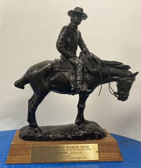
réf. 50746Oklahoma City: National Cowboy & Western Heritage Museum 1985. 1985. BRONZE WRANGLER AWARD. Wrangler bronze 13" x 9 1/2" x 4 3/4" overall on a 1 3/4" wood base complete with a 1 3/4" x 5 1/2" brass plague. The bronze is signed by "R. Muno" and weighs almost ten pounds. The brass plague is inscribed: "Western Heritage Wrangler Award / National Cowboy Hall Of Fame and Western Heritage Center / Ben Johnson Narrator / 'THE DREAM' / Outstanding Special Short Feature Award 1985." The Bronze Wrangler is an award presented annually by the National Cowboy & Western Heritage Museum at the Western Heritage Awards to honor the top works in Western music film television and literature. Provenance: Ben Johnson estate. Francis Benjamin Johnson Jr. June 13 1918 - April 8 1996 was an American film and television actor stuntman and world-champion rodeo cowboy. Tall and laconic Johnson brought authenticity to many roles in Westerns with his droll manner and expert horsemanship. The son of a rancher Johnson arrived in Hollywood to deliver a consignment of horses for a film. He did stunt-double work for several years before breaking into acting with the help of John Ford. An elegiac portrayal of a former cowboy theater owner in the 1950s coming-of-age drama The Last Picture Show won Johnson the 1971 Academy Award BAFTA Award and Golden Globe Award for Best Supporting Actor. Johnson also operated a horse-breeding ranch throughout his career. Although he said he had succeeded by sticking to what he knew shrewd real estate investments made Johnson worth an estimated $100 million by his later years. He was an actor from 1939 until 1996 and is the only true cowboy to have won an Academy Award. The film The Dream was directed by Joe Pytka born November 4 1938 an American film television commercial and music video director born in Pittsburgh Pennsylvania. He holds the record for the most nominations for the Directors Guild of America Award for Outstanding Directing - Commercials. Pytka gets a call from a new agency in Minneapolis to do a short film for U.S. West a telephone company and the idea was a 'teaser' film of cowboys saddling their horses at predawn. The art director was Pat Burnham and the writer was Bill Miller. Pytka asks whether or not they have the account. Told no simply the current assignment Pytka says "Let's do something big!" Pytka had been filming Busch Beer commercials for a number of years and was familiar with locations and cowboys. He also knew that the number of convincing cowboy actors in Hollywood was extremely limited. He needed to get away from Los Angeles where he knew a great cowboy that had a great hat. "Cowboys are defined by their hats and boots . The thing should be realistic. Real cowboys. Real horses . There are horses and there are horses. For example a cowboy wouldn't be caught dead on a paint horse." The short film was shot mostly in Monument Valley with a select few real cowboys as that is their home. Most amazing to Pytka was how the cowboys and their horses are completely as one. The film was shot and almost everything done in a single day. By some stroke of good fortune the agency has gotten the great cowboy actor Ben Johnson to record the narration. In the session Johnson remarked that we'd gotten some real cowboys there a huge compliment since he was a real wrangler before he discovered that he could make more money in Hollywood than in Oklahoma. National Cowboy & Western Heritage Museum, 1985. unknown
1670réf. 2080502106917709Not Available 1670. Soft Cover. Fine. The book is in fine condition. Not Available paperback
1906réf. 62652St. Louis MO: Holt St. Louis Streets Dept. 1906. Forty-four of 46 original linen-backed panoramic silver gelatin photographs comprised of 116 approx. 8 x 10 in. images divided into 2-4 panel panoramic photographs w/ captions neatly written w/in negatives at lower fore-edge annotations in red & black ink occasional pencil notes sectional numbers on versos edgewear & rubbing some lifting to fore-edges of some of the images creasing soot soiling to versos minor over-exposure to some images still a VG archive. This historic archive of panoramic photographs meticulously document the now largely disappeared and built-over River des Peres in a Ruscha-like manner and if pasted end-to-end would span nearly 100 feet. Capturing the River des Peres Valley which still meandered at the beginning of the 20th-Century along the Western boundaries of St. Louis MO and reveal a fast-growing Western city industrializing and appropriating the marshy lowlands farms and rural areas into factories breweries and railroad routes. Eleven of the images wind through Forest Park where much of the river had been channeled in 1904 through wooden sewers and culverts in order to cut down on the stench and prepare the park for the 1904 St. Louis World’s Fair. Holt 1866-1925 was renowned for his excessive photographic documentation leading groups of city engineers armed with large format cameras shooting on glass plate negatives recording the sprawling activities of the burgeoning St. Louis community in the Progressive Era. As evidenced by this meticulously shot archive of panoramic images Holt and his team document from the Mouth of River des Peres looking North with railroad bridge in right foreground and steamers in the river alongside the banks. The images continue along the River des Peres capturing the brewery next to the Railroad and between Broadway & Alabama Ave.; the sprawling unidentified factory on Webster; and also demarcating where the City Limits Stones were set and what numbers. A four-panel panoramic photo denotes the Saints Peter & Paul Cemetery on Gravois Avenue followed by others indicating different distances from Gravois Road bridges and houses along the road a road grading and roadbuilding team West of Gravois and then recording the rural lowland areas Southwest of Gravois and then towards Echelberger Street. About halfway through the series the images begin capturing more industrial and suburban development including the St. Louis & San Francisco Railroad Line Frisco RR telephone poles along Fyler Ave. Frisco RR stone station on Fyler with nearby culvert; the Hirsch Rolling Mill Co. complex with railcars labeled and carrying steel and railroad bridge in the distance. The photos show the River des Peres winding around revealing the Clifton Heights in the background; between Knox and Sulpher Ave. with Fire Engine House in the right foreground and many different railroad company cars including those for the Cotton Belt Line the Chicago Peoria & St. Louis RR the Missouri Kansas & Texas RR; and many for the Frisco RR. Several photos shot by Holt and his team May 10 1906 capture the sprawling Laclede Fire Brick Manufacturing Co. complex the Frisco RR Arch Bridge and even a Birds-Eye view. Other photos approaching Forest Park also depict the Police Headquarters Stables the Forest Park Highlands and once in the Park a group of boys playing baseball in the lower foreground. The final three-panel panoramic photo was taken looking West with Delmar Blvd. on the right and the Frisco RR trestle in the middle foreground Delmar Garden in the background and center field filled with the trestle stretching over the River des Peres. Unsurprisingly this cataloguer could find no similar partial or extant collection of images and the original negatives appear to have probably been dumped by St. Louis City Hall housecleaning around 1950 when they offloaded the thousands of photos shot by the Holt for the Street Department. The historically invaluable images were all sold at an auction comprising three 13 foot high stacks of negatives nearly all of them on glass. Purchased originally by Swekosky the collection was lent to Dick Lemen of Moline IL who cleaned printed and enlarged the photos purchased them and later donated the remnants of what he preserved to the St. Louis Mercantile Library. These photographs capture a Western waterway almost entirely displaced with nearly all of its original route completely rebuilt as it was engineered to operate as the backbone of the St. Louis sewer system and almost completely underground with just a few sections near the mouth with a channel and paved bans. In 1904 the Forest Park section was covered in a “large wooden box” to prevent visitors to the World’s Fair from breathing the unhealthy stench and after a 1915 flood backed up sewers killed 11 people in flooding and destroyed over 1000 homes chief engineer Horner was ordered to prepare a plan to completely control and build over the River des Peres. It still carries storm water and sewage in separate pipes and now that the channel has almost no direct source from the Mississippi River and all of the lowland meadows wetlands and areas that existed at the beginning of the 20th Century have been entirely paved over there largely remains no water to supply the river itself. Some of the River at the site of the former Carondelet Coke Plant has been largely remediated and a short piece connected to the Mississippi Greenway near River City Casino. See: Kelly Moffitt Salvaged Photographs from the St. Louis Street Department circa 1900-1930 Catalogued in New Book St. Louis on the Air St. Louis Public Radio Aug. 2 2017; Enter Dick Lemen Dr. William G. Swekosky The collection Grows Unwieldy Lafayette Square Archives 2020; Michael Allen The Harnessed Channel: How the River Des Peres Became a Sewer Preservation Research Office Nov. 27 2010; Chris Naffziger Reconnecting with the Roots of River des Peres in St. Louis Terrain Magazine 2022. Holt, [St. Louis Streets Dept.], unknown
1963réf. ZB3938051963-1994. volumes 1-32; lacks volume 4. 1963-1994. partly bound library markings textually clean & tight price is for the set. - If you are reading this this item is actually physically in our stock and ready for shipment once ordered. We are not bookjackers. Buyer is responsible for any additional duties taxes or fees required by recipient's country. Photos available upon request. unknown
2017réf. 2081502111904155Tianjin ancient books 2017. Soft Cover. Fine. The book is in fine condition. Tianjin ancient books paperback
1654Folio (320 x 215mm). (16) ll, including frontispiece, 618 pp, (14) ll. Engraved frontispiece, title in red and black with large engraved vignette, numerous engraved illustrations including large-format ones, and numerous woodcut illustrations, headpieces and initials, with final blank. Contemporary vellum, manuscript title on spine. Somewhat browned and with a small defect in the engraved title-page, but still in good condition, binding slightly bowed.
1897réf. WRCAM56506Various locations in Oregon California and Colorado 1897. Seventy-nine printing out paper photographic prints each image 6 x 8 inches on 9 1/2 x 11 1/4 inch medium weight sheets all but two captioned in the negative. Minor surface wear to a handful of prints several with minor emulsion chipping to edges some curling to prints. Overall very good or better condition. An extraordinary collection of large handsomely-produced photographic prints documenting the exploits of a group of travelers who set out by train through Oregon California and Colorado in 1897. The photographs which are skillfully composed and indicative of an experienced photographer picture a wide variety of both urban and rural settings along the Pacific Coast and in Colorado showing a mixture of horse-drawn and cable and street cars but nary an automobile and constitute a unique and evocative time capsule for numerous locations in the American West in the final few years of the 19th century. The first image features a large group of women and children posed outside a railroad car with the image captioned "The R&W 97 Transcontinental Party." In fact two of the images reference the party as "R&W" which likely refers to the company or family who participated in the railway excursion. The travelers were apparently well-to-do by their dress and by the variety of notable high-end hotels they visited. The selection of photographs here was likely hand-picked by one of the members of the excursion after the journey was completed. The preponderance of the images document locations in California. These include two different views of Mount Shasta scenes in Yosemite Park sites in Santa Cruz and several images each in and around San Francisco Santa Cruz and Los Angeles. The Yosemite Park pictures show members of the group taking a horse-drawn carriage through a redwood tree and other Yosemite landmarks are captioned "Yosemite from Inspiration Point" "Bridal Veil Falls" "Two Brothers of the Yosemite" "Trail to Glacier Pt." "A fallen Monarch of the Yosemite" the famous downed redwood tree and "Wawona Point." The San Francisco images include Stanford University two images a view of Stanford's Tomb in Menlo Park the driveway to the Crocker residence a striking image of downtown focused on the Spreckels Building the San Francisco City Hall building the "Courtyard of the Palace Hotel" Golden Gate Park a spectacular view across the ocean from Golden Gate Park the entrance to Sutro Park and the esplanade in Sutro Park. Images in Santa Cruz depict the residence of Major Frank McLaughlin known as the Golden Gate Villa an elevated view of the beach at Santa Cruz a scene of several travelers in a horse-drawn carriage captioned "Our four in hand on the cliff drive Santa Cruz Cal." and three striking views of the cliffs including two featuring the "Natural Bridge" Cliff at Santa Cruz. The Los Angeles area is well represented in the photographs which picture the downtown courthouse a downtown street scene showing the Van Nuys Hotel the year it opened a view down Spring Street West Lake Park East Side Park four images including the entrance an orange grove in Riverside picturing one of the travelers Magnolia Avenue in Riverside an "Orange grower's home" in Riverside a pair of horses pulling a streetcar labeled "Riverside & Arlington Ry." before the line was electrified in 1899 and an interesting street scene in downtown Riverside. Other sites in California comprise the Hotel Coronado four pictures including an unusual view of the "Drive to the Entrance" of the hotel Coronado Beach two views the "Ruins of Capistrano" the remnants of the mission church the train depot at Fresno a residence in San Jose the "View from Mt. Hamilton" near San Jose and the road to the hedge maze at the Hotel Del Monte in Monterey. The Colorado pictures include a breathtaking elevated view of a snowy Denver taken from the top of the capitol building. Other Colorado scenes include a view of New Castle from the train Glenwood Springs an image of horse-drawn carriages crossing a bridge over the river in Glenwood Springs and two images capturing the incline tram up the Royal Gorge near Canon City. The collection also includes a handful of images in Portland Oregon. These feature the Portland wharf three separate shots of the Portland Hotel the "Residence of Dr. McKenzie" and a horse- drawn carriage ride on City Park Drive. Eight of the more intriguing images in the collection were taken while aboard the traveling party's moving railroad car and picture the vast landscape of the American West in California Colorado and Nevada. The captions for these read "From Top of Mountain near Scisco" "We pass through Eagle Cañon" "Leaving Leadvill sic behind us" "Some Colorado Scenery" "On the Rio Grande Western" and "Princeton Harvard & Yale" a distant view of the three mountains named for those Ivy League schools in the "Collegiate Peaks" region of the Rocky Mountains. One image likely in Colorado but with location unidentified is captioned "Mountains rising thousands of feet all around." There are even a couple of images taken from the train while passing briefly through Nevada including one of the "Humboldt Desert." In addition to the aforementioned image picturing the women and children of the "R&W 97 Transcontinental Party" there are a handful of images focused on other various members. One is captioned "The R&W 97 Philharmonic Symposium" and features six men standing on a railroad handcar with musical instruments. The words and music to "Sweet Rosy O'Grady" have been written into the photographic negative at center along with a humorous musical quatrain at right referencing one of the traveling party. This latter bit reads "The Director General Russ Couldn't play with us with us He was not allowed to toot So he kept time with His Boot." Additional pictures of the group feature them dining inside an unnamed restaurant posed in front of a giant redwood near Santa Cruz and sitting on chairs in a semi-circle in Sutro Park. The latter photograph is captioned "The Russo Hershian Family will now perform." The collection is rounded out with a striking photograph of a woman in a white dress posing for the camera against a white wall which is captioned "Miss Lethbridge." Though the subjects of the traveling party in these pictures are ultimately unknown to us their journey is emblematic of an entire generation's fascination with the railroad and the American West. In addition these large and impressive prints which capture both the urban development of California Oregon and Colorado along with the majesty of the rural settings in these states document their travels in an unusually rich and deluxe format. A unique and rich collection of western photographs produced in the last few years of the 19th century. unknown books