9.739 Ergebnisse
1846Best.-Nr. 25916Paris: French Admiralty chart 1846. Very rare early map of the south west coast of Western Australia just 17 years after the founding of the colony. The map covers much of the Western Australian coast from the Dampier Archipelago in the north Broome Exmouth Gulf Shark Bay Perth Geographe Bay Cape Leeuwin Albany all the way to Port Lincoln in South Australia. To our knowledge the only copy held in an Australian institution is at the State Library of Western Australia. It is not recorded in the collection of National Library of Australia collection nor other Australian institutions. It is very interesting for the early inland detail. The areas around Perth and Fremantle are shown extending inland to Beverley York Bejoording Toodjoy and Northam on the Swan River with the Swan Avon & Moore Rivers. There are 4 insets: Plan de la entree de la Riviere Cygnes Swan River et de l'Ile Rottnest J. L. Stokes; Plan de Port Grey nomme aussi Baie Champion Captain Wickham Plan du Havre Peel dans la Baie Warnbro Lieut. J. S. Roe Plan de la Baie Warnbro J.S. Roe. Coastal features include Baie de l'Esperence; Houtmann's Abrolhos; Albany north east of Albany a mountain described as "Montagne escarpee visible a 10 lieues"; Golfe Exmouth with a prominent Cape Nord Ouest. Depth soundings are taken all around the coast. Daussy maps are rare. The State Library of Western Australia holds two. Their copy of this map bears the "Prix deux francs" lower right; with an applied printed chart sellers label from P. Sauvat Bordeaux below the rule on the lower right. They also hold the following: "Carte des mers Australes partie comprise entre les méridiens du Cap de Bonne Espérance et du Port du Roi Georges" cartographic material / dressée par M. Daussy Ingénieur Hydrographe en Chef ; gravé par Jacobs ; écrit par J.M. Hacq. MAPR0000018. This map is recorded as Tooley 1470 and Libraries Australia ID 23501679 which calls it "Rare". Centered below the margin - Ecrit de J. M. Hacq Grave par Jacobs lower left Noo. 1111 in upper right margin. Printed area 34.5 x 23.25" with very large margins 40 1/4 x 27 1/2". Backed with tissue on the center fold and margin edges supporting some small closed tears. In magnificent condition overall. An extremely rare map especially in this condition. French Admiralty chart unknown
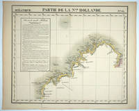
1827Best.-Nr. 25576Brussels: P. Vandermaelen 1827. An early map of the Exmouth Western Australia area from the North West Cape to Roebuck Bay. Lithograph with original outline color 15 3/4 x 21". Scale ca. 1:1 650 000. Plate no. 44 Partie de La Nlle. Hollande in vol. 6 Oceanique of Atlas Universal de Geographie Physique Politique Statistique et Mineralogique" by P. Vandermaelen 1827. Tooley 1286; Phillips 749; Bib ID 1553060. P. Vandermaelen unknown
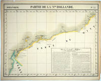
1827Best.-Nr. 25575Brussels: P. Vandermaelen 1827. Maps. Very good condition. An early map of the Broome & the Kimberly Western Australia area from P. Cantheaume to Cambridge Gulf including the Lacepede Islands. Broome is at the bottom of the Dampier Peninsula called "C. Boileau." Lithograph with original outline color 25 x 21.5". Plate no. 35 Partie de La Nlle. Hollande in vol. 6 Oceanique of Atlas Universal de Geographie Physique Politique Statistique et Mineralogique" by P. Vandermaelen 1827. Tooley 1282; Phillips 749; Bib ID 30855. P. Vandermaelen unknown
1947Best.-Nr. 25851Perth: Department of Lands and Surveys 1947. Cadastral map showing land use and zoning with notes on soil and vegetation. Includes locality plan. Originally dated 22.9.37 this is "Reprint 26.3.47". Manuscript additions in pencil in the top margin. The SLWA holds the 1937 version- "Townsite of Manjimup Nelson District cartographic material Western Australia. Department of Lands and Surveys. Map Dept. of Lands & Surveys W.A. 1937. Available at 3rd Floor Map Stack Call number: 35/11/MANJ 1937 plus 1 more. 1 map ; 54 x 69 cm. encapsulated in plastic. Notes "22/9/37" Cadastral map showing land use and zoning with notes on soil and vegetation. Includes locality plan. Part of collection: Townsite maps Western Australia. Department of Lands and Surveys unknown
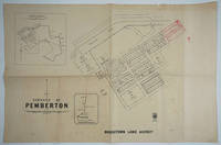
1933Best.-Nr. 25852Perth: Department of Lands and Surveys 1933. Cadastral map showing land use. Includes plan showing townsite boundary. Version dated "6.2.33". Addition of lots 185-200 on upper right to town plan printed in red. The earliest held by SLWA seems to be ca. 1950. Call Number 9024.P3G46 1 map ; 58 x 76 cm. encapsulated in plastic. Western Australia. Department of Lands and Surveys. Map Dept. of Lands & Surveys W.A. 1937. Available at 3rd Floor Map Stack Call number: 35/11/MANJ 1937 plus 1 more. Call Number 9024.M25G46 Related titles Townsite maps Western Australia. Description 1 map ; 54 x 69 cm. encapsulated in plastic. Part of collection: Townsite maps Western Australia. Department of Lands and Surveys unknown
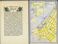
1932Best.-Nr. 249231932. Wraps. Very good condition. Folded hand sheet with brief history of Western Australia and description of the highlights of Perth and Fremantle. With two printed color maps of Perth and Fremantle showing the Orient Line Offices and Orient Line Berths as well as tram lines & taxi service loosely inserted. Hand sheet 10 1/4 x 8"; maps 5 x 7 3/4" paperback
1920Best.-Nr. 243371920. Very good condition. 11 b&w real photographs printed titles on the back including a great view of South Beach with a view over the wharves and a crowd in their holiday best crossing the railway line looking towards the Indian Ocean and a view of Convict Bridge with automobiles crossing over. The other images are: the War Memorial panorama of the wharves the Town Hall and High Street High Street showing the store front of Samuel's "The Big Tailors the Swan River another view of High Street the Post Office shipping on the Harbour and Round House Arthur's Point. These were perhaps the majority of a set of photographs issued for tourists. Photographs measure 3 1/2 x 2 1/2" unknown
1900Best.-Nr. 22027Perth: Sands & McDougall 1900. Very good condition. Two lithographed beer labels one on red paper and printed in red and black the second on cream paper and printed in black and both with the brewery's logo. Bottled by H. Sherwood & Co. Esplanade Perth. 3 1/2 x 2 3/4" Sands & McDougall unknown
1900Best.-Nr. 210191900. Very good condition. Gelatin photograph with exceptional clarity a view of Albany from lower down Mt. Clarence with boulders framing the roof tops and the long jetty into the bay at center. Mounted on stiff board as found in photo albums of the time with title hand written below "Albany". Image 8 x 6". not found on Trove. unknown
1842Best.-Nr. 18891Edinburgh 1842. Very good condition. January 8th article on George Grey's expedition to the Northwest of Western Australia. Sir George Grey 1812 - 1898 explorer governor of South Australia and governor and Premier of New Zealand lead two expeditions to northwest Australia in 1837-9. Both expeditions were extremely grueling with Grey being wounded but led to the discovery of the rivers Glenelg and Gascoyne. Grey describes threatening to shoot his aborigine tracker "Kaiber" who Grey claimed pretended to not be able to find the members of the party they had left temporarily while in search of water. Folio 6pp complete issue. The article three full columns over two pages. String bound a bit ruffled at right margin otherwise very good condition. unknown
Best.-Nr. B9781167277146New. unknown
1979Best.-Nr. 352g0446Victoria B.C.: British Columbia Provincial Museum. Fair. 1979. First Edition. Paperback. 077188110x . 249 pages. References. "Brooks was a remarkable Canadian known to few Canadians. Naturalist artist soldier sniper hunter scientist his goals were to excel his achievements therefore were among the best. English to the core he was Canadian more than he knew and home through most of his life was his beloved British Columbia." - from Foreword. Illustrated primarily in black and white with several colour plates. Above-average wear. Binding intact. Usual library markings. A worthy reading copy.; 8vo - over 7¾" - 9¾" tall; Allan Brooks Artist-Naturalist - British Columbia Provincial Museum Special Publication No. 3 Birds in Art Painters British Columbia Biography Hunters . British Columbia Provincial Museum paperback
1992Best.-Nr. 115a9080Canada: Sunfire Publications Ltd. Very Good. 1992. First Edition. Single Issue Magazine. Abundantly illustrated with colour and black and white archival photos. Features: Canyon City and Closeleigh - klondike locations; The Forgotten Mines of Silver Peak Mountain - just south of Hope B.C.; Portaging in the Fur Trade; The Amazing Mr. O'B - Eugene Francis O'Beirne was the western traveller's worst hazard; Mapping Klondike Gold. Clean bright and unmarked with very light wear. Excellent copy.; 4to - over 9¾" - 12" tall; Canadian West Magazine - The Pioneer Years: October/November/December 1992 Vol. 8 No. 3 Collector's #30 Canyon City and Closeleigh - klondike locations; The Forgotten Mines of Silver Peak Mountain - just south of Hope B.C.; Portaging in the Fur Trad . Sunfire Publications Ltd. unknown
1983Best.-Nr. 715a4976Nanaimo BC Canada: Nanaimo & District Museum Society. Good. 1983. First Edition. Paperback. 68 pages. A collection of uncommon historical pictures and their descriptions. Chapters include: First Peoples; Mining; Other Industries; Transportation; People; Buildings and Services; Recreation; Local Government; Military; Development. Moderate wear. Unmarked. Illustrated brown card covers. An excellent overview of the history of this dynamic city.; 4to - over 9¾" - 12" tall; Nanaimo - The Story of a City History British Columbia 68 pages. A collection of uncommon historical pictures and their descriptions. Chapters include: First Peoples; Mining; Other Industries; Transportation; People; Buildings and Services; Recreation; . Nanaimo & District Museum Society paperback
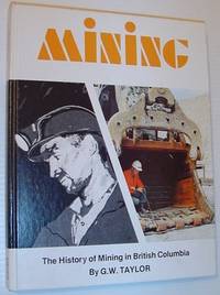
1978Best.-Nr. 744a0064Canada: Hancock House Pub Ltd. Very Good. 1978. First Edition. Hardcover. 0919654878 . 200 pages. Index. Glossary. Dozens of black and white archival illustrations. Chapters include: Golden Future Cariboo Fever Gold - North South East West; Progress in Coal 1835-1900; Change and Turmoil on Vancouver Island; Province-wide Black diamonds; Mining in the Kootenays 1880-1900; Where Copper is King; and more. Clean and unmarked with light wear. Binding sound. Pages have partially yellowed with age. Quality copy.; 4to - over 9¾" - 12" tall; Mining: The History of Mining in British Columbia Mineral Industries . Hancock House Pub Ltd hardcover
1989Best.-Nr. 75-175CSmithsonian/ Amon Carter Museum of Western Art; 1989. 1989. 366p. Period Photos & art. Many full page color reproductions of the prints. Very Oversize. Fine/Fine copy. Hardcover. Fine/Fine. Book. Smithsonian/ Amon Carter Museum of Western Art;, 1989. Hardcover
1993Best.-Nr. 318c6939British Columbia: LCHAC. Fair. 1993. First Edition. Paperback. 0888783388 . 142 pages. Footnotes. Black and white illustrations. "A fascinating account of the growth of logging in Lake Cowichan - the companies their founders the woodworkers and their struggles to organize unions the ever-changing technology of lumbering and the public policies that have been instrumental in determining the fate of logging in B.C. Above all this is a story of the people of Cowichan Lake and how their lives have been influenced by logging and the forest." - from back cover. Most of this copy has been exposed to moisture with resulting soiling and undulations. Binding intact. Unmarked. Average wear. A worthy reading copy.; 8vo - over 7¾" - 9¾" tall; BRITISH COLUMBIA_HISTORY The Legacy and the Challenge: A Century of the Forest Industry at Cowichan Lake Logging Fallers . LCHAC paperback
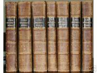
1798Best.-Nr. 930273The Works: London: Printed for G.G. and J. Robinson Paternoster-Row and J. Edwards Pall-Mall. MDCCXCVIII 1798 WITH Memoires of the Last Ten Years of the Reign of George the Second: London John Murray Albemarle-Street. MDCCCXXII 1822. Over 4000 pages and 177 full-page engravings. Seven volumes uniformly bound in Contemporary Calf over marbled boards. Gold Gilt on black leather title labels. Additional spine gilt stamping with decorative blindstamp. Some rubbing to bindings wear heavier towards extremities see image. Hand Marbled endpapers hinges unobtrusively reinforced with moire brown cloth. Internally clean Unmarked. Off-setting from plates with sporadic foxing particularly to plates and adjoining leaves as per usual. Full Collation of the papers used contents and plates on request. A Very Good Antiquarian Set Indeed. First Edition. Half-Leather Marbled Boards. Very Good. Illus. by 177 Full-page Engravings Fold-outs etc. 4to - over 11½" tall. Extremely Heavy Oversized Safely Securely Packed. Printed for G.G. and J. Robinson and J. Edwards hardcover
1980Best.-Nr. 328c7977British Columbia: Self-Published. Very Good. 1980. First Edition. Paperback. 66 pages. Undated - circa 1980. Black and white illustrations. Presents the history of Port Alice British Columbia from 1917-1965. Clean bright and unmarked with light wear. Tight and square. A quality copy.; 4to - over 9¾" - 12" tall; Port Alice Vancouver Island British Columbia History Native Peoples Pulp Mill Sawmill Chinese Immigrants . Self-Published paperback
2011Best.-Nr. 297909Red deer: Robert Lampard 2011. First edition. paperback. very good/no dustjacket. 8vo. Signed by Author. pp.239 signed by the author on title page Robert Lampard paperback
1971Best.-Nr. 747G4570Kelowna BC Canada: School District No. 23 S.D. 23. Good. 1971. First Edition. Plastic Comb. 162 pages. A lovely compilation of Kelowna recipes combined with history of the area. Average wear and soiling. Some markings to contents. A worthy vintage copy.; 8vo - over 7¾" - 9¾" tall; Centennial Cook Book Cookbook - School District No. 23 SD 23 Kelowna B.C. British Columbia Recpies Cookery . School District No. 23 (S.D. 23) unknown
1912Best.-Nr. 328a4724Ottawa: Canada Department of Mines Geological Survey Branch. Fair. 1912. First Edition. Hardcover. 208 pages. Black and white photographic plates. Colour Geological Reconnaissance Map of Southern Vancouver Island stored in pocket inside back board. This map has been bolstered in many places with adhesive tape which has yellowed over the years. Above-average wear. Binding intact. It appears that a reference library may have added stiff boards to what was initially a softcover copy. A worthy copy of this very informative work.; 8vo - over 7¾" - 9¾" tall; Southern Vancouver Island - Memoir No. 13 Colour Geological Reconnaissance Map Coal Minerals . Canada Department of Mines, Geological Survey Branch hardcover
1929Best.-Nr. 170383Edmonton: The Western Veteran 1929. First Edition. Paperback. Very Good/No Dj. 8vo. pp. 4 27 The Western Veteran paperback
1954Best.-Nr. 558H3361Nanaimo B.C.: Nanaimo Senior High School. Fair. 1954. First Edition. Paperback. 80 pages loaded with black and white photos of students and staff plus nostalgic ads for local businesses some with photos. Who knew Nanaimo used to have an Egg Pool Many dozens of autographs of both staff and students including Valedectorian Doreen Dobinson. Somewhat above-average wear. Binding intact. A sound and pleasing vintage copy of this memento of the school which has since been renamed Nanaimo District Secondary School / NDSS.; 8vo - over 7¾" - 9¾" tall; Nanaimo District Secondary School Bastion 1953-1954: Student Yearbook of N.S.H.S. Nanaimo Senior High School Now N.D.S.S. Nanaimo B.C. Staff . Nanaimo Senior High School paperback
1971Best.-Nr. 417H3141Canada: Canada West Magazines. Good. 1971. First Edition. Single Issue Magazine. 40 pages. Illustrated in black and white. Features: Gold Along Little Hixon Creek; The K and S Railway; Our Vanishing Heritage - Salishan Indian Basketry; Old Fort Rupert Vancouver Island; W.G. Cox - Gold Commissioner - Part III; Collector's Page; The Battle Bend Country; W.S. Hatton's Paintings; Historic Three Forks in the silver country of the West Kootenay. Unmarked with average wear. A sound vintage copy.; 4to - over 9¾" - 12" tall; Canada West Magazine Fall 1971 Volume 3 Number 3 - Gold on Little Hixon / The K & S Railway Kaslo and Slocan Gold Along Little Hixon Creek; The K and S Railway; Our Vanishing Heritage - Salishan Indian Basketry; Old Fort Rupert Vancouver Island; W.G . Canada West Magazines unknown