27 567 résultats
réf. 57235aafBern, (Julius Adam in München für) Dalp, o.J. (186-), gr. in-Folio, 1 Bl. (Vorwort) + lith. Titel mit Vignette + 15 getönten lith. Tafeln mit je 1 Bl. Begleittext, vereinzelt leicht stockfleckig. Textbl. aufgezogen und vereinzelt restauriert, Tafeln u. Text etwas beschnitten, lose Tafeln in H-Ln. Mappe, Orig.-Umschlag aufgezogen.
réf. 130561aafCoblenz, Karl Baedeker, Printed by Breitkopf and Härtel, Leipzig, 1863, lg. in-8vo, Mit getöntem illustriertem Holzschnitt-Titel, 11 (1 doppelblattgroßen) chromolithographischen Tafeln, 2 getönten Holzstich-Tafeln, 2 Textholzstichen und 1 gefalteten chromolithographischen Karte. 3 Bl. + 82 S. first flyleaf with rests of tipped-in paper + 1 leaf of the German description of Interlibrum (W. Alicke’s cat. 1983), Blaue Leinwand mit goldgeprägtem Deckeltitel. / Privat blue cloth binding, title gilt on first cover, fine copy.
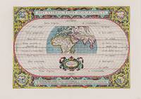
1590réf. 200018AG1590. Antwerp Ortelius 1590. Original hand-coloured engraving. Plate Size: 44 cm x 31 cm. Sheet Size: 53.7 cm x 38.5 cm. Original map. Very good actually stunning condition. Really clean and crisp. Generous margins. Reverse recto carries Latin text. Shirley 176; Broecke 186.1; Koeman III 0800H:31. Beautifully unusual and richly decorated map of the Ancient World based upon the work of Claudius Ptolemy from Ortelius' Parergon 'Supplement'. The depicted land masses of Europe Africa and western Asia are largely in their modern configurations although the place names on the map are based upon Ptolemy. The southern portion of Africa is missing and China is not included on the map. A small number of cities including Hispalis Seville Lutetia Paris Rome Byzantium Istanbul Hierusalem Jerusalem Alexandria and Memphis are identified. Relief shown pictorially. The mythical Luna Montes Mountains of the Moon - the fabled source of the Nile - can be seen in the southern half of Africa. Madagascar is also included. The climate zones are shown as 'Zona frigida et inhabitablis' 'Zona temperata et habitabilis' and 'Zona torrida et ob Solis nimium fervorem a veteribus inhabitabilis credita.' The tropics and Arctic and Antarctic circles are also shown. The 'Zona frigida' lying above the Arctic Circle and the region lying at the Equator are described as being inhospitable. The border of the globe carries longitudinal and latitudinal information. The outer areas of the map are decoratively patterned and there is one inset roundel map in each corner showing the different continents depicting in clockwise order Europe Asia Africa and the Americas. Ortelius' characteristic strapwork design ornaments the title cartouche above the globe as it does the cartouche seen beneath it. It bears the inscription: "En Spectator Pilae Totius Terrae Ichnographiam at Veteribus Usque ad Annum Salutis Nonagesimum Secundum Supra Milles Quadrigent. Cognitae Tantum Geographiam." Immediately underneath the illustrated landmass is a further cartouche similarly ornamented decorated with two lion heads and bearing an oval inset statement of responsibility in Latin script. The Parergon was conceived initially as a supplement to Ortelius' Theatrum Orbis Terrarum Theatre of the World. The work a vast and finely researched index of the Classical world was accompanied by a number of ancient world maps. Unlike the maps of the Theatrum the majority of which were reductions of earlier maps the maps of the Parergon were researched and drawn by Ortelius himself. The work was a great commercial success and the maps themselves set the standard for ancient world maps for the duration of the 17th Century. Abraham Ortelius was a Flemish cartographer and geographer conventionally recognized as the creator of the first modern atlas the Theatrum Orbis Terrarum Theatre of the World. He was one of the most notable figures of the Dutch school of cartography during its golden age approximately 1570s-1670s. unknown
1635réf. 1413892c.1635. Image measures 13 in. x 10.25 in. Matted in frame measuring 23.2 in. x 19.25 in. Shelved at Rockville second floor. From a series of seven engravings titled "Les Metiers" 1413892. Special Collections - Upstairs. unknown
1635réf. 1413892c.1635. Image measures 13 in. x 10.25 in. Matted in frame measuring 23.2 in. x 19.25 in. Shelved at Rockville second floor. From a series of seven engravings titled "Les Metiers" 1413892. Special Collections - Upstairs. unknown books
réf. 175London i.e. Brussels: John Macock for Henry Herringman et. al. 1681. Hardcover. Good. Duodecimo. Two parts in three volumes. Part I: 62 82 6 103 1 215 1 29 1 194pp.; Part II: 6 7-143 7 149-223 1pp. Part I: A12-HH12; Part II: a12-i12 k6. Nineteenth-century green morocco by P. Low with his ticket. All edges gilt. Frontispiece portrait in facsimile. From the library of Robert Hoe with his bookplate in each volume and the bookplate of Moses H. Grossman designed by Henri Bérengier 1881-1943. Part I: ESTC R30277; Part II: ESTC R224230. 0 London [i.e. Brussels?]: J[ohn] M[acock] for Henry Herringman, et. al., 1681. hardcover
1864réf. 438380Rangoon: American Mission Press C. Bennett 1864. Softcover. Very Good. First edition. Quarto. 91 1pp. Tables. Stitched printed yellow wrappers. Faint contemporary penciled name on front wrap "Rev. C. H. Carpenter" modest vertical crease small nicks tears and dogears; spine partially perished but tight overall very good. A comprehensive accounting of cargo exported from and imported to Rangoon with summaries of tonnage specific lists of cargo for each ship etc. "Published by the permission of the Collector of Customs." OCLC locates two copies only both at the British Library. American Mission Press, C. Bennett unknown
1864réf. 438380Rangoon: American Mission Press C. Bennett 1864. Softcover. Very Good. First edition. Quarto. 91 1pp. Tables. Stitched printed yellow wrappers. Faint contemporary penciled name on front wrap "Rev. C. H. Carpenter" modest vertical crease small nicks tears and dogears; spine partially perished but tight overall very good. A comprehensive accounting of cargo exported from and imported to Rangoon with summaries of tonnage specific lists of cargo for each ship etc. "Published by the permission of the Collector of Customs." OCLC locates two copies only both at the British Library. American Mission Press, C. Bennett unknown books
1909réf. 256570New York: Privately Printed by the De Vinne Press 1909. First edition one of 300 copies. Frontispiece portrait and 7 other photographs and a colored Jock Scott fly at the end. xii 266 pp. 1 vols. 8vo. Original green cloth t.e.g. Light shelfwear title page foxed else near fine. First edition one of 300 copies. Frontispiece portrait and 7 other photographs and a colored Jock Scott fly at the end. xii 266 pp. 1 vols. 8vo. Scarce privately printed work with considerable sporting content. Pp. 123 to 266 comprise the Logbook of Camp Albany on the Ristigouche River with entries from 1883 to 1898 on angling hunting and social topics. A prefatory note quotes from Dean Sage's classic book and an afterword by Charles H. Raymond offers an appreciation of Abraham Lansing 1835-1899 of Albany New York: "To watch his tall graceful form while casting on the river was to see the exemplar of the accomplished fisherman; the man the rod the line were together but the extension and the completion of artistic and practical perfection". Wetzel p. 174; Bruns L39; Bibliotheca Salmo Salar 107 Privately Printed [by the De Vinne Press] unknown
1909réf. 256570New York: Privately Printed by the De Vinne Press 1909. First edition one of 300 copies. Frontispiece portrait and 7 other photographs and a colored Jock Scott fly at the end. xii 266 pp. 1 vols. 8vo. Original green cloth t.e.g. Light shelfwear title page foxed else near fine. First edition one of 300 copies. Frontispiece portrait and 7 other photographs and a colored Jock Scott fly at the end. xii 266 pp. 1 vols. 8vo. Scarce privately printed work with considerable sporting content. Pp. 123 to 266 comprise the Logbook of Camp Albany on the Ristigouche River with entries from 1883 to 1898 on angling hunting and social topics. A prefatory note quotes from Dean Sage's classic book and an afterword by Charles H. Raymond offers an appreciation of Abraham Lansing 1835-1899 of Albany New York: "To watch his tall graceful form while casting on the river was to see the exemplar of the accomplished fisherman; the man the rod the line were together but the extension and the completion of artistic and practical perfection". Wetzel p. 174; Bruns L39; Bibliotheca Salmo Salar 107 Privately Printed [by the De Vinne Press] unknown books
réf. 1329347A color example of the map of the Azores by Abraham Ortelius 1527-1598. This map was first published as part of a 1583 addendum to his Theatrum Orbis Terrarum the first modern world atlas. Condition: Very Good. Some age toning particularly in the upper right corner. Text from the verso of the page is visible in the margins particularly on the left side. Matted not framed. w 29 5/8 in. x h 23 5/8 in. Shelved at DuPont. 1329347. Arts & Antiques. unknown
1603réf. W2303Antwerp Belgium: Jan Baptiste Vrients 1603. 14 3/4 inches by 19 3/8 inches on a 16 5/8" by 21 3/4" sheet of laid paper. Latin text on the verso. van den Broecke 193. Abraham Ortelius was a Flemish scholar who moved to Antwerp to become a bookseller and cartographer. This map of ancient Spain is from his PARERGON published as an appendix to the THEATRUM ORBIS TERRARUM the world's first true atlas as well as the most authoritative and commercially successful atlas of the late 16th and early 17th centuries. Although it is dated 1586 in one cartouche this map actually is a second state printed between 1601 and 1612 as indicated by the stipple engraving in the ocean & seas and by the line through the word "Cinniana" in line 8 of the descriptive text within the cartouche in the lower right corner. The map is in very good condition: generally clean and bright with barely a hint of toning and minor soiling limited to the blank margins. Madrid bookseller's stamp and brief handwritten comment and signature in the margin on the verso. Original. Single Sheet. Very Good. Folio - over 12" - 15" tall. Map. Jan Baptiste Vrients
1598réf. 16886Antwerp: Christopher Platin 1598. Other. A very good example in excellent condition. 360 by 475mm 14 by 18 inches. Original copper engraving published 1598 in a French edition of the Theatrum Orbis Terrarum. Finely hand-colored in wash and outline. Decorative doublepage map showing six islands in the Mediterranean Islands Sicily Sardinia Corfu Malta Djerba Elba. Sicily is prominently displayed in the center of the map above the title cartrouche. Ortelius was born on 14 April 1527 in the city of Antwerp which was then in the Habsburg Netherlands modern-day Belgium. The Orthellius family were originally from Augsburg a Free imperial city of the Holy Roman Empire. In 1535 the family had fallen under suspicion of Protestantism. Following the death of Ortelius's father his uncle Jacobus van Meteren returned from religious exile in England to take care of Ortelius. Abraham remained close to his cousin Emanuel van Meteren who would later moved to London. In 1575 he was appointed geographer to the king of Spain Philip II on the recommendation of Arias Montanus who vouched for his orthodoxy. He travelled extensively in Europe and is specifically known to have traveled throughout the Seventeen Provinces; in southern western northern and eastern Germany e.g. 1560 15751576; France 15591560; England and Ireland 1576; and Italy 1578 and perhaps twice or thrice between 1550 and 1558. Beginning as a map-engraver in 1547 he entered the Antwerp Guild of Saint Luke as an illuminator of maps. He supplemented his income trading in books prints and maps and his journeys included yearly visits to the Frankfurt book and print fair where he met Gerardus Mercator in 1554. In 1560 however when travelling with Mercator to Trier Lorraine and Poitiers he seems to have been attracted largely by Mercator's influence towards the career of a scientific geographer. Wikipedia Broe. 141 Christopher Platin unknown
réf. 1329347A color example of the map of the Azores by Abraham Ortelius 1527-1598. This map was first published as part of a 1583 addendum to his Theatrum Orbis Terrarum the first modern world atlas. Condition: Very Good. Some age toning particularly in the upper right corner. Text from the verso of the page is visible in the margins particularly on the left side. Matted not framed. w 29 5/8 in. x h 23 5/8 in. Shelved at DuPont. 1329347. Arts & Antiques. unknown books
1836réf. elala1043Halifax: Printed By Gossip and Coade Times Office 1836. 1836. 8vo. pp. xl 272 1. tipped-in slip Explanation of the Maps. 2 lithographed plates incl. folding frontis.: Parrsboro From The Water 1836 and Cape Split 1836. folding partly hand-coloured engraved map. modern bds. some foxing & pencil scoring outer margins of title clipped & repaired. First Edition of Gesner's first published book modelled on a paper by C.T.Thompson and F.Alger of Boston but written in a more popular manner and improving on the subdivisions of geological regions. It quickly established his reputation in the field and led to his appointment as government geologist in New Brunswick 1838-43 - the first such appointment in a British colony - and his engagement in the preparation of geological surveys of that province Prince Edward Island and Nova Scotia. Gesner laid the foundations of geological knowledge in the area and his Remarks later served as a guide-book for Sir Charles Lyell in his geological survey of Nova Scotia 1841. TPL 1957. Sabin 27225. Gagnon I 1501. Lande 269 no mention of plates. Morgan p. 140. Story p. 313. DCB IX pp. 308-12. 1st Edition. Halifax: Printed By Gossip and Coade, Times Office, 1836. unknown
réf. 7984511"Short description: In Russian. Pasternak, Boris Leonidovich. Stories. Moscow; Leningrad: Krug, 1925. You are welcome to reach out to us for a detailed description of the copies currently available. Delivery of this book may take longer than usual including extended processing and pre-shipping time, no expedited shipping is available. Please advise us if you have a set date or a deadline to receive your order.SKU7984511"
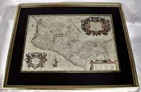
1606réf. 2008060188Antwerp : Theatrum Orbis Terrarum 1606. Maps. Very Good. Ortelius' map of late 16th Mexico A handsome map in very good condition. Map under glass mounted in gilt frame. Map dimensions is 50 x 34 cm 19.5 x 13 inches in frame 66 x 51.5 cm. Double-page engraved map of southwestern Mexico. The map shows Spanish strongholds including Mexico City Lake de Bhapala Chapilacum Mare Guadelajara Tuxpan and Indian towns. Early hand-color. Large cartouche on upper right corner. Text in Latin. "The first printed real Map of New Spain" Wagner 119; Van den Broecke 13. Theatrum Orbis Terrarum unknown
1667réf. 131Paris Par A. Bosse 1667 In-8 - 12x18,5cm. Reliure d'époque en plein veau moucheté, dentelle dorée sur sur les coupes. 5ff, 72pp, 10ff.
1634réf. 83993Paris Chez la Veuve-Martin & Jean Boudot, rue Saint Jaques , au Soleil d'or, 1634, in-4 (19x25cm), pleine basane du temps, dos à 5 nerfs, roulette sur les coupes, toutes tranches jaspées gras, caissons ornés de fleurons,, 64p., 326p.,18p. Edition originale de la traduction française. Page de titre ornée d'une vignette, bandeau de Pierre le Pautre et lettrine pour la dédicace au Roi. Ne figure pas le portrait en frontispice de Louis XIV. Restauration par un professionnel en coiffes et coins.
1738réf. G95014Amsterdam, by Jakobus Loveringh en Jan Roman den Jongen 1738-1740 Complete in 4 volumes: [40],503 + 557,[3] + [8],466,108 + 506,[68] pp., with engraved frontispiece in vol.I (portrait of Joan Churchill) and complete with its 30 folding plans and maps out of text + 2 folding genealogical tables (few tears in plates repaired), title in red and black, engraved vignette on title pages, 16cm., contemporary uniform full leather bindings with some traces of use and some loss of leather at corners and at the ends of joints, gilt title and decorations on spines, most text is clean and bright except for some pages with marginal foxing and some vague spots of humidity (text always well readable), overall good copy of this rare Dutch biography and history of John Churchill (1650-1722), G95014
1594réf. 0044301594 [Anvers], Ortelius, 1594. Carte (557 X 405 mm, marges comprises) sous cadre en bois noirci moderne.
réf. 1751Europe: Antverpiæ"/Antwerp. "ex Officiana Plantiana" . Plantijn Christoffel. 1595. Copper engraved map of Greece after Jacob Gastaldi from Ortelius' "Theatrum Orbis Terrarum" 1595 edition; black & white. Latin text to verso. Good dark impression. Abraham Ortelius 1527-1598 Flemish Cartographer . produced the first modern Atlas "Theatrum Orbis Terrarum" in 1570. printed by Aegidus Coppen Diest. There were numerous editions thereafter with texts in various languages; the printing of such was taken over by Chrstoffel Plantijn in 1579 . Ortelius himself drew all the maps in manuscript before passing them to the printers. there is conjecture that he may have engraved some of the plates as well The 1595 Latin text edition is the most complete produced during his lifetime containing all the maps of the 1593 edition plus those of the the"Additamentum" and the"Pareragon" or Ancient geography. The " Additamenta" were supplements to the original Atlas; at the same time Ortelius replaced some maps with new ones showing the same place; some plates were also reworked . Ortelius was Geographer Royal To Phillip II of Spain from 1575. He also worked closely with Braun & Hogenburg on the "Civitas Orbis Terarum". After his death the plates were purchased by Jan Baptiste Vrients in 1601 who published further editions until 1612. Van de Krogt :3; .Koeman: Ort29 91 40 Zacherakis: 2485/1610; van den Broecke:146. Europe Greece Gastaldi Antverpiæ"/Antwerp.. "ex Officiana Plantiana" . Plantijn Christoffel.. 1595 unknown
1646réf. 73281646 Leyde, Elzevier, 1646. Petit in-12, reliure d'époque velin ivoire dos lisse avec titre et auteur inscrit La première des quatre éditions imprimées par Bonaventure et Abraham Elzevier. Elle est ornée d'un frontispice gravé symbolique, suivi de son explication, et d'un feuillet avec les armoiries gravées du prince Maximilien de Bourgogne à qui les Elzevier dédient l'ouvrage. Exemplaire parfait , tres bel objet dans cette reliure d'époque ...
réf. 220686S.l. [Stockholm], [Kjellberg & Åströms], s.d. (vers 1870) in-8, 17 photographies, en petits tirages de format 90 x 59 mm, rehaussés de couleurs, montés sur papier fort, légendés en suédois, sous serpentes roses, percaline bleue à rabats et à lacets, dos lisse muet, encadrement de simple filet doré avec volutes d'angle sur les plats, titre poussé en lettres dorées au centre du plat supérieur (reliure de l'éditeur).
1603réf. 213571Antwerp: Ortelius Abraham 1603. unbound. very good. Map. Engraving with original hand coloring. Image measures 13" x 18.25". Fine antique map of Perugia and Lake Trasimeno in central Italy in the Umbria region. Today the region is known it's foraged truffles and red wine. From 1603 edition "Theatrum Orbis Terrarum". Minor chipping to edges. Light stain near top centerfold. Full original margins. Abraham Ortelius 1527--1598 a Flemish cartographer and geographer is widely regarded as one of the important and influential cartographers in history. He is known for his "Theatrum Orbis Terrarum" which was the first modern atlas. Ortelius, Abraham unknown