Delfos, AbrahamBiblio.com
27 536 résultats
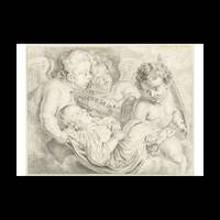
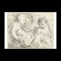
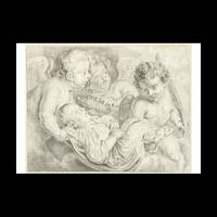
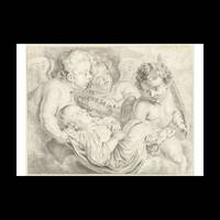
réf. 3529847Contentum Ltd. Loose sheet. New. High-quality art print based on an original work from the Rijksmuseum. Created in the 18th century 1741. Professionally printed on premium fine-art paper Museum Etching museum quality in size A2. The artwork is printed with a white border museum-style presentation. Contentum Ltd. unknown
réf. 3529845Contentum Ltd. Loose sheet. New. High-quality art print based on an original work from the Rijksmuseum. Created in the 18th century 1741. Professionally printed on premium fine-art paper Photo Rag Bright White in size A2. The artwork is printed with a white border museum-style presentation. Contentum Ltd. unknown
réf. 3529844Contentum Ltd. Loose sheet. New. High-quality art print based on an original work from the Rijksmuseum. Created in the 18th century 1741. Professionally printed on premium fine-art paper Museum Etching museum quality in size A3. The artwork is printed with a white border museum-style presentation. Contentum Ltd. unknown
réf. 3529846Contentum Ltd. Loose sheet. New. High-quality art print based on an original work from the Rijksmuseum. Created in the 18th century 1741. Professionally printed on premium fine-art paper Photo Rag 308 premium quality in size A2. The artwork is printed with a white border museum-style presentation. Contentum Ltd. unknown
2018réf. 2-1980509905Independently published 2018. Paperback. New. 94 pages. German language. 9.00x6.00x0.24 inches. Independently published paperback
réf. SLIVCN-9782487771314PIKTOS POCHE
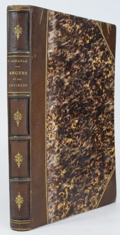
1876réf. 174921876 un volume, reliure d'époque demi-chagrin rouge in-folio Editeur à coins (binding half shagreen in-folio with corners Editor)(27,5 x 37,5cm), RELIURE D'EPOQUE, dos 5 nerfs (spine with raised bands), cernés de filets à froid (blind stamping décoration), décoré or (gilt decoration) et à froid (blind-stamping decoration), titres et auteurs frappés or (gilt title), pièce de titre et pièce Auteur sur fond noir (label of title and label of Author) avec filet or (label of title with gilt line and label of volume numbering), filets à froid en tête et en pied (stamping line on top and at the foot of spine), mors et coins décorés or d'un filet et une roulette "chainette" or (joints and corners with gilt decoration), papier percale rouge aux plats (cover with red paper "percale"), toutes tranches non rognée (all edges no smooth), TIRAGE LIMITE à 350 EXEMPLAIRES.......ALBUM orné au titre d'une eau-forte des Ponts-de-Cé + 36 eaux-fortes d'Abraham protégées par des serpentes légendées, sans pagination, [112 pages] + [2 pages de Tables] , 1876 Château-Gontier, J.-B. Bezier.Editeur,
1876réf. 7020Château-Gontier, Librairie de J.-B. Bezier, 1876. In- 4 (364 x 265 mm), (4) ff. (faux-titre, titre, dédicace et introduction)- 1 vignette gravée sur la page de titre (Les ponts de Cé) et 36 planches gravées à l'eau-forte accompagnées de feuillets de texte, (1) f. de table. Reliure demi-chagrin à coins, dos à faux-nerfs orné de fleurons dorés, traces de griffures aux plats, épidermures et manques au cuir, coupes et coins frottés, bel état intérieur. Tirage à 330 exemplaires numérotés (ici N° 8). Bon exemplaire.
1982réf. BN621409DVA 1982. 1982. Softcover. Angesichts der Wälder. Erzählungen - signiert Angesichts der Wälder. Erzählungen - signiert Jehoschua Abraham B. DVA paperback
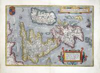
1603réf. M10773Antwerp Belgium c.1603. Very Good margins extended. Notes: Important map of United Kingdom by Ortelius based on an earlier map by Christopher Saxton in 1579. Size : 384x483 mm 15.12x19.02 Inches Coloring: Hand Colored Category: Maps Europe United Kingdom England; Maps Europe Ireland; Maps Europe United Kingdom Wales; unknown
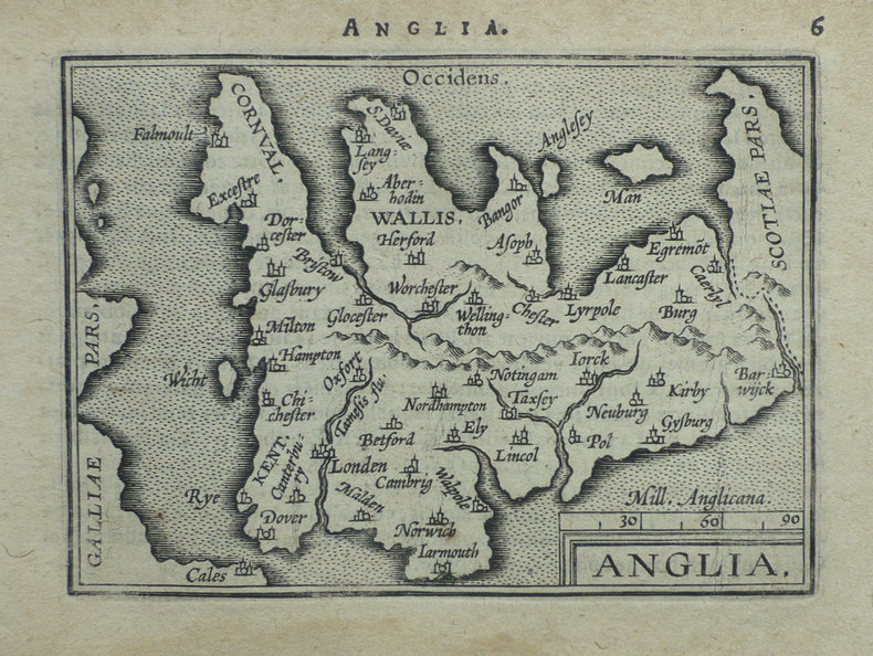
1598réf. LBW-1375Anvers 1598 80 x 104 mm.
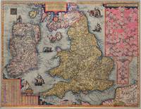
réf. 7752Antwerp: 1605-09. No binding. Very Good. 435 x 570 mm. in full early wash colour trimmed close to the side margins as is often the case with no apparent loss otherwise in very good condition. The second state with Latin text of Jan Baptiste Vrients' classic map of England Wales and Ireland issued to celebrate the recent accession of James I to the throne. It first appeared in the English text edition of Abraham Ortelius' 'Theatre of the World' published in 1606. On the death of Queen Elizabeth I in March 1603 James VI of Scotland inherited the throne. Along with uniting the Scottish and English thrones he claimed historical rights to the throne of France. The dedication of the English edition of the atlas is to ""James by the grace of God King of Great Britaine France and Ireland"" and was clearly made to cultivate sales. A similar claim appears on this map upper right on the first state. In 1608 Vrients published an Italian edition dedicated to the Pope. The Catholic Church did not recognise James I a Protestant as King of France then ruled by Henry IV. This was also the case for Ireland. Therefore Vrients issued variants of the map in which a pasted label re-written would be placed over the offending part of the map; this did however still leave one further reference to the claim still visible in almost all known examples. These are known as variants of the first state. For the Latin edition of 1609 offered here Vrients was clearly prepared having had time to alter the plates themselves. All references to James I being King of France and Ireland are removed creating the second state. Below these references in the upper right is an attractive family tree of the English royal family from William the Conqueror. The map itself is derived from the Anonymous map printed in London 1594 which itself is derived from that of Jodocus Hondius of 1592. The engravers are believed to the Arsenius brothers who have produced a magnificent map one of the finest ever produced for the atlas. Its desirability along with the fact that it only appears in a handful of editions makes this one of the rarest. Shirley 1991 no. 275 see also 164 & 177; Kelly 2007; Van den Broecke 1996 no. 17. 1605-[09] unknown
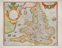
réf. 115608Antwerp Christopher Plantin for the author 1598. . Double-page copper engraved map with later hand-colouring centre fold as issued cartouches for titles and publishing privilege French text on verso; sheet size: 41.8 x 53 cm mounted size: 52 cm by 65.5 cm. Some light marginal soiling left margin and part of the map has text showing through. Well-preserved example of Ortelius' map of England & Wales. Taken from the fifth final and most complete French edition of Theatre de l'Univers. Enriched with decorative cartouches ships and sea monsters. A flock of sheep are included in an unmapped Ireland. Abraham Ortelius 1527-1598 was a cartographer and publisher he was born and died in Antwerp. Koeman III Ort 32. Antwerp, Christopher Plantin for the author, 1598. unknown
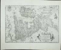
1595réf. 8359Antwerp Plantin-Moretus 1595. Copper engraving 37 x 50 cms black and white small hole at centrefold Latin text to verso. Shirley notes that the map is a general improvement on the previous Mercator-Ortelius outline and draws attention to a detail which vividly suggests the personal involvement of the map-maker Welsh antiquary Humphrey Lluyd: the Caernarvon peninsula near Lluyds home town of Denbigh is badly distorted but it has been suggested very reasonably that this may have been due to Lluyds attempt to sketch this in by eye from the nearby mountains. Ortelius's Theatrum Orbis Terrarum is generally considered the first modern atlas of the world originally published in 1570. Ortelius gathered and selected the best available cartographic knowledge and presented it in a single volume duly credited and finely engraved in a consistent style with explanatory text. The Theatrum was very decorative and hugely popular amongst the wealthy and educated running into over forty editions in Latin and the major European languages. Shirley British Isles 185. Van den Broecke 19.3 Map unknown
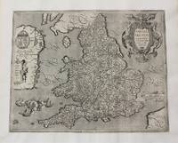
réf. 6982Antwerp: 1570-87. No binding. Good. 345 x 500 mm. in fine modern wash colour a small wormhole by the cartouche lower right repaired otherwise in good condition. This is one of the most recognisable of all the early maps of the British Isles. It was published by Abraham Ortelius in his 'Theatrum Orbis Terrarum' first published in 1570 the first modern atlas. This example was issued in the French text edition of 1587 with the pagination 9 to the verso. The map is derived from Gerard Mercator's eight sheet wall map of 1564. It is a beautifully designed plate with a nice balance between accurate cartographic information and ornate decoration. The map is orientated with north to the right and the Royal Coat of Arms are depicted upper left. Shirley speculates that the engraver was Frans Hogenberg. Van Den Broecke 1996 16; Shirley 1991 British Isles no. 86. 1570-[87] unknown
réf. 11746Antwerp: 1570-79. No binding. Very Good. 345 x 500 mm. in good condition. This is one of the most recognisable of all the early maps of the British Isles. It was published by Abraham Ortelius in his 'Theatrum Orbis Terrarum' first published in 1570 the first modern atlas. This example was issued with Latin text and is in its second state which involved only slight strengthening of the engraving. The map is derived from Gerard Mercator's eight-sheet wall map of 1564. It is a beautifully designed plate with a nice balance between accurate cartographic information and ornate decoration. The map is orientated with north to the right and the Royal Coat of Arms are depicted upper left. Shirley speculates that the engraver was Frans Hogenberg. Abraham Ortelius 1527-98 developed an interest in cartography geography and history at an early age. He began as a 'kaarten afzetter' or illuminator of maps and would purchase single maps from booksellers and colour them for re-sale mounted on linen suitable for wall-hanging. At twenty he was entered in the Guild of St Luke at Antwerp. Ortelius travelled extensively in Europe and maintained regular correspondence with mapmakers historians and scientists acquiring information which was to form his greatest opus the 'Theatrum Orbis Terrarum'. What made the atlas stand out as the first modern atlas was its uniformity. They were produced in a similar style and none of the ancient Ptolemaic maps were included. The atlas was accompanied a catalogue of the authors whose source Ortelius had drawn upon in compiling the work. Without this list many cartographers of the day would remain unknown to us today. From its first appearance in 1570 the 'Theatrum' was far more comprehensive in scope than any contemporary work. In all over forty different editions were published with text in Latin Dutch German French Spanish English or Italian with the maps being frequently revised or replaced. By 1612 when the final edition was published the atlas contained no less than 128 maps. Provenance: Clive A. Burden Ltd. Van Den Broecke 16; Kelly 2007 'Maps of the British Isles England and Wales and Ireland' in 'Mappae Antiquae Liber Amicorum Günter Schilder' pp .221-38; Shirley British Isles no. 86. 1570-[79] unknown
1584réf. 9733Antwerp 1584. Copper engraving 34.5 x 49.5 cm modern hand-colour centrefold reinforced on verso several neat marginal restorations Latin text on verso. The British Isles aligned with west at the top of the map and north on the right which makes better use of the available space on the page; it was chiefly derived from Mercators map of 1564. Abraham Ortelius's Theatrum Orbis Terrarum is widely considered the first modern world atlas originally published in 1570. Ortelius gathered and selected the maps which he believed represented the best available cartographic knowledge of his day which he then presented it in a single volume duly credited and finely engraved in a consistent style with explanatory text. The Theatrum was highly decorative and hugely popular amongst the wealthy and educated running into over forty editions in Latin and other major European languages. Shirley British Isles 139 but cf. 86.Van den Broecke 16. Map unknown
1575réf. 21270Amsterdam: Ortelius 1575. Very good overall. A classic map of the British Isles published in the 'Theatrum Orbis Terrarum' regarded as the first modern atlas. The map was oriented with north to the right so that the map fitted the sheet of paper as it predates the convention of north to the top of the map. Ort 16 Koeman/Meurer: 6 Karrow: 1/11 van der Krogt AN: 5000:31A. Listed on Van Den Broecke as 1575L6 100 copies printed small page number 7 mm; last line centred like 3 lines above it: sem;Ponticum Virunium;Ioannem Prisæum;&Bedam. Shirley: British Isles 1477-1650 86. Latin text on verso. 19 1/2 x 13 1/2". Centerfold and right margin strengthened. Original color heightened. Ortelius unknown
1584réf. 53076Antwerp. c. 1584-95. A beautiful map of the British Isles north to the right. The map is based on Mercator's earlier map of the British Isles of 1564. Title in strapwork cartouche at top right text in Latin in its own cartouche at lower right scale and royal arms; ships at sea. It is difficult to put an exact date on the map because of the complex publishing history of Ortelius' atlas. Published in the Theatrum Orbis Terrarum. Size: 345 x 505 mm. Copper engraving. Coloured. Framed size: 780 x 640 mm. Fine condition good margins. Moreland & Bannister p. 200-203; Van den Broecke 16. unknown
1590réf. 37978np 1590. Image area 19 1/2 x 13 1/2 inches in 28 x 23 inch mat. Single crease down center with one 1/2 inch spot worn through otherwise a nice handsome map. Image area 19 1/2 x 13 1/2 inches in 28 x 23 inch mat. Abraham Ortelius 1527-1598 was a Flemish geographer of German origin. His major work Theatrum Orbis Terrarum 1570 with later revisions and addenda was the first modern atlas. It was based on contemporary charts and maps and contained a collection of plates engraved by Franz Hagenberg in a uniform size and format. The Theatrum preceded the first Atlas of Ortelius' good friend Gerardus Mercator. In fact popular and sentimental legend has it that Mercator delayed publication of his own work so that his younger friend's would appear first. although this simply is not true Mercator wasn't ready the legendary cartographer did compliment Ortelius for the "care and elegance" he put into his "Theatrum. unknown
1590réf. 37978np 1590. Image area 19 1/2 x 13 1/2 inches in 28 x 23 inch mat. Single crease down center with one 1/2 inch spot worn through otherwise a nice handsome map. Image area 19 1/2 x 13 1/2 inches in 28 x 23 inch mat. Abraham Ortelius 1527-1598 was a Flemish geographer of German origin. His major work Theatrum Orbis Terrarum 1570 with later revisions and addenda was the first modern atlas. It was based on contemporary charts and maps and contained a collection of plates engraved by Franz Hagenberg in a uniform size and format. The Theatrum preceded the first Atlas of Ortelius' good friend Gerardus Mercator. In fact popular and sentimental legend has it that Mercator delayed publication of his own work so that his younger friend's would appear first. although this simply is not true Mercator wasn't ready the legendary cartographer did compliment Ortelius for the "care and elegance" he put into his "Theatrum. unknown books
réf. 0267251580.Ghardcover. Good. Access codes and supplements are not guaranteed with used items. May be an ex-library book. hardcover
réf. 1331658055.Gpaperback. Good. Access codes and supplements are not guaranteed with used items. May be an ex-library book. paperback
2010réf. DADAX1164047515Kessinger Publishing 2010-09-10. paperback. New. 6.00x0.99x9.00. Buy with confidence. Excellent Customer Service & Return policy. Kessinger Publishing paperback
réf. 0548729581.Gpaperback. Good. Access codes and supplements are not guaranteed with used items. May be an ex-library book. paperback