ORTELIUS, AbrahamBiblio.com
27 963 résultats
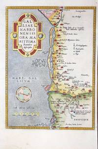
réf. 9346Antwerp: 1570-1580. No binding. Very Good. 300 x 220 mm. in recent wash colour in good condition. A nice example of Ortelius' map of southern France with north to the right. It extends from Oranges in the north to Narbonne in the west and Marseille in the east. This map was introduced to the Ortelius atlas in the first edition of 1570. This example is from the 1580 German text issue. According to Van den Broecke Charles de l'Ecluse 1510-63 was asked by Ortelius to produce a map of the region which turned out to be not particularly accurate. in 1595 'Adam la Planche wrote Ortelius Hessels letter 279 that he had obtained from Pierre Pithou a manuscript map of Ile de France attributed to Francois de la Guillotiere'. Meurer p. 128; Van den Broecke M. 48a. 1570-[1580} unknown
réf. 1806Europe: Antverpiæ"/Antwerp. "ex Officiana Plantiana" . Plantijn Christoffel. 1595. Copper engraved map of Ancient France from "The Parergon "of Ortelius' "Theatrum Orbis Terrarum" 1595 edition; black & white. Latin text to verso. Ortelius paid particular reference to the description of Strabo. Good dark impression. Abraham Ortelius 1527-1598 Flemish Cartographer . produced the first modern Atlas "Theatrum Orbis Terrarum" in 1570. printed by Aegidus Coppen Diest. There were numerous editions thereafter with texts in various languages; the printing of such was taken over by Chrstoffel Plantijn in 1579 . Ortelius himself drew all the maps in manuscript before passing them to the printers. there is conjecture that he may have engraved some of the plates as well The 1595 Latin text edition is the most complete produced during his lifetime containing all the maps of the 1593 edition plus those of the the"Additamentum" and the"Pareragon" or Ancient geography. The " Additamenta" were supplements to the original Atlas; at the same time Ortelius replaced some maps with new ones showing the same place; some plates were also reworked . Ortelius was Geographer Royal To Phillip II of Spain from 1575. He also worked closely with Braun & Hogenburg on the "Civitas Orbis Terarum". After his death the plates were purchased by Jan Baptiste Vrients in 1601 who published further editions until 1612. Van de Krogt :3; .Koeman: Ort29: F 27p; van.de. Broecke: 196 Europe France Ancient France Gallia Veteris Antverpiæ"/Antwerp. "ex Officiana Plantiana" . Plantijn Christoffel. 1595 unknown
1600réf. 1103040004Conatibus Geographicis Abrah Ortelii 1600. Map. Very Good. 17-1/4 x 22-1/2 inches. France. Black and white copperplate engraving. Decorative title cartouche in bottom left corner. Seal in top left corner contains an inscription reading "Imperator C. Iulius Caesar." The author Abraham Ortelius was a Flemish cartographer and geographer generally recognised as the creator of the first modern atlas the Theatrum Orbis Terrarum Theatre of the World. He is also believed to be the first person to imagine that the continents were joined together before drifting to their present positions. The following map is an excellent example of his attention to detail and cartographic accuracy. 2 large tears on bottom middle of print. Crease across center. Minor wear to corners. Slight age-related discoloration. Lines remain crisp and clear and lettering is easily legible. Overall a superior print in very good condition age considered. Conatibus Geographicis Abrah Ortelii unknown
1624réf. 7933Antwerp: Plantin-Moretus 1624. Copper engraving 36.5 x 46.5 cms modern hand colour a couple of unobtrusive printers creases Latin text on verso. Ancient Gaul engraved on the basis of Caesars commentaries on the Gallic Wars his first hand account of the campaign. The text on the verso explores ancient source material relating the the druids. Our example was published by Balthasar Moretus at the Plantin Press in the final edition of the Parergon. Ortelius's Theatrum Orbis Terrarum is generally considered the first modern atlas of the world originally published in 1570. Ortelius gathered and selected the best available cartographic knowledge and presented it in a single volume duly credited and finely engraved in a consistent style with explanatory text. The Theatrum was very decorative and hugely popular amongst the wealthy and educated running into over forty editions in Latin and the major European languages. For Ortelius himself however his accompanying atlas of ancient geography the Parergon was a "personal work" Koeman. He seems to have regarded himself first and foremost as an antiquary and rather than copying other people's maps he drew the originals himself; they were subsequently engraved for him by the master engraver Jan Wierix. The results have to be evaluated as the most outstanding engravings depicting the wide-spread interest in classical geography in the 16th century Koeman. Koeman Atlantes Neerlandici Ort 46. Van den Broecke 194.3 Map Plantin-Moretus unknown
réf. 1511Europe: Antwerp Joannem Bapt. Vrientium/ Vrients. 1601. Copper engraved minature map by Phillip Galle of France from" Epitome theatri Orteliani praecipuarum orbis regionum delinaetiones. . Editio ultima" Latin text to verso describing the succeeding map. . Dark impression overall toning light foxing to blank margins. The first edition of the"Epitome" in 1577 a reduced format atlas with minature maps of Abraham Ortelius's "Theatrum" is believed to have been the initiative of the engraver Phillip Galle who asked Peter Heyns to write the text. Ortelius had fled to England in 1576 having taken refuge there from Spanish oppression and may have been unaware of the plan of his two friends. The pocket atlas was a a commmercial success and was reprinted several times with Galle adding many new maps and replacing some. Jan. Baptist Vrients bought the rights and plates of the Epitome from Phillip Galle in 1601 . he published 4 editions using the Galle plates of which this is the first with Latin text. Koeman Ort58; Phillips 413; Europe France Antwerp Joannem Bapt. Vrientium/ Vrients. 1601 unknown
réf. 1808Europe: Antverpiæ"/Antwerp. "ex Officiana Plantiana" . Plantijn Christoffel. 1595. Copper engraved map of France after Ioanne Ioliveto from Ortelius' "Theatrum Orbis Terrarum" 1595 edition; black & white. Latin text to verso. Good dark impression. Abraham Ortelius 1527-1598 Flemish Cartographer . produced the first modern Atlas "Theatrum Orbis Terrarum" in 1570. printed by Aegidus Coppen Diest. There were numerous editions thereafter with texts in various languages; the printing of such was taken over by Chrstoffel Plantijn in 1579 . Ortelius himself drew all the maps in manuscript before passing them to the printers. there is conjecture that he may have engraved some of the plates as well The 1595 Latin text edition is the most complete produced during his lifetime containing all the maps of the 1593 edition plus those of the the"Additamentum" and the"Pareragon" or Ancient geography. The " Additamenta" were supplements to the original Atlas; at the same time Ortelius replaced some maps with new ones showing the same place; some plates were also reworked . Ortelius was Geographer Royal To Phillip II of Spain from 1575. He also worked closely with Braun & Hogenburg on the "Civitas Orbis Terarum". After his death the plates were purchased by Jan Baptiste Vrients in 1601 who published further editions until 1612. Van de Krogt :3; .Koeman: Ort29: 21 9; van.de. Broecke:34. Europe France Gallia Regni Antverpiæ"/Antwerp. "ex Officiana Plantiana" . Plantijn Christoffel. 1595 unknown
réf. 1815Europe: Antverpiæ"/Antwerp. "ex Officiana Plantiana" . Plantijn Christoffel. 1595. 3 copper engraved maps on 1 plate of :the southern coast of France from Narbonne to Marseille; the Savoy and Venaisssin the area of Avignon from Ortelius' "Theatrum Orbis Terrarum" 1595 edition; black & white. Latin text to verso. Good dark impression; some dampstaining to lower blank margin. Abraham Ortelius 1527-1598 Flemish Cartographer . produced the first modern Atlas "Theatrum Orbis Terrarum" in 1570. printed by Aegidus Coppen Diest. There were numerous editions thereafter with texts in various languages; the printing of such was taken over by Chrstoffel Plantijn in 1579 . Ortelius himself drew all the maps in manuscript before passing them to the printers. there is conjecture that he may have engraved some of the plates as well The 1595 Latin text edition is the most complete produced during his lifetime containing all the maps of the 1593 edition plus those of the the"Additamentum" and the"Pareragon" or Ancient geography. The " Additamenta" were supplements to the original Atlas; at the same time Ortelius replaced some maps with new ones showing the same place; some plates were also reworked . Ortelius was Geographer Royal To Phillip II of Spain from 1575. He also worked closely with Braun & Hogenburg on the "Civitas Orbis Terarum". After his death the plates were purchased by Jan Baptiste Vrients in 1601 who published further editions until 1612. Van de Krogt :3; .Koeman: Ort29: 29 108; van.de. Broecke:49abc. Europe France Narbonne Savoy Sabaudia Avignon Venaissin Venuxiensis Antverpiæ"/Antwerp. "ex Officiana Plantiana" . Plantijn Christoffel. 1595 unknown
1624réf. 8029Antwerp: Plantin-Moretus 1624. Copper engraving 39.5 x 49.5 cms modern hand colour Latin text on verso. Van den Broecke stresses the sigificance of this map of Gaul: in contrast to plate Ort 194 Gallia vetus based on Caesars commentaries this map is based on ancient geographical rather than on ancient military sources and is much more detailed. It contains the largest amount of text to be found on any map by Ortelius . testifying the importance he attached to it. It contains all elements of Ortelius as a true Renaissance scholar. Our example was published by Balthasar Moretus at the Plantin Press in the final edition of the Parergon. Ortelius's Theatrum Orbis Terrarum is generally considered the first modern atlas of the world originally published in 1570. Ortelius gathered and selected the best available cartographic knowledge and presented it in a single volume duly credited and finely engraved in a consistent style with explanatory text. The Theatrum was very decorative and hugely popular amongst the wealthy and educated running into over forty editions in Latin and the major European languages. For Ortelius himself however his accompanying atlas of ancient geography the Parergon was a "personal work" Koeman. He seems to have regarded himself first and foremost as an antiquary and rather than copying other people's maps he drew the originals himself; they were subsequently engraved for him by the master engraver Jan Wierix. The results have to be evaluated as the most outstanding engravings depicting the wide-spread interest in classical geography in the 16th century Koeman. Koeman Atlantes Neerlandici Ort 46; Van den Broecke 196.2. Map Plantin-Moretus unknown
2013réf. gameofthrones_grap2_may221st edition thus hardback with full number-line published by HarperVoyager in 2013. Bringing together issues 7-12 of the comic books into a single hardback edition. Complete with additional content. Near fine bright clean cover - some minor shelf wear to the top edges. Now in a removable protective covering. Book itself is in near fine condition with a nice tight binding HarperVoyager hardcover
2012réf. BN348878Panini Verlags GmbH 2012. 2012. Game of Thrones - Das Lied von Eis und Feuer Bd. 1 Collectors Edition Game of Thrones - Das Lied von Eis und Feuer Bd. 1 Collectors Edition Martin George R.R. Daniel Abraham und Tommy Patterson Panini Verlags GmbH unknown
1970réf. Q-0671202030Simon & Schuster 1970-02-15. Hardcover. New. In shrink wrap. Looks like an interesting title! Simon & Schuster hardcover
réf. 0718209044.Ghardcover. Good. Access codes and supplements are not guaranteed with used items. May be an ex-library book. hardcover
1619réf. 4286AG1619. Kupferstich von Boetius-Adams Bolswest nach Abraham Bloemert, 8,8 x 13,4 (ohne Titel), Bll. 16,8 x 22,8; auf Rückseite lat. Text über S. Basilius Magnus; beiliegend: Kopie des zugehörigen Textes. Auf Wunsch Digitalaufnahme in jpg-Format erhältlich- photo in jpg-format available. Je nach Versandart können die Portokosten bis zu 2 ? weniger als angegeben betragen.+
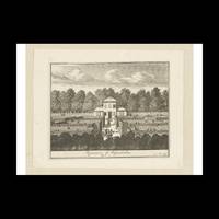
réf. 2258134Contentum Ltd. Loose sheet. New. High-quality art print based on an original work from the Rijksmuseum. Created in the 17th century 1684. Professionally printed on premium fine-art paper Museum Etching museum quality in size A3. The artwork is printed with a white border museum-style presentation. Contentum Ltd. unknown
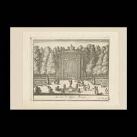
réf. 2260283Contentum Ltd. Loose sheet. New. High-quality art print based on an original work from the Rijksmuseum. Created in the 17th century 1684. Professionally printed on premium fine-art paper Museum Etching museum quality in size A3. The artwork is printed with a white border museum-style presentation. Contentum Ltd. unknown
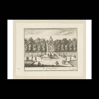
réf. 2260543Contentum Ltd. Loose sheet. New. High-quality art print based on an original work from the Rijksmuseum. Created in the 17th century 1684. Professionally printed on premium fine-art paper Museum Etching museum quality in size A3. The artwork is printed with a white border museum-style presentation. Contentum Ltd. unknown
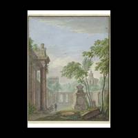
réf. 2384893Contentum Ltd. Loose sheet. New. High-quality art print based on an original work from the Rijksmuseum. Created in the 18th century 1741. Professionally printed on premium fine-art paper Photo Matt Fibre in size A2. The artwork is printed with a white border museum-style presentation. Contentum Ltd. unknown
réf. 2384918Contentum Ltd. Loose sheet. New. High-quality art print based on an original work from the Rijksmuseum. Created in the 18th century 1741. Professionally printed on premium fine-art paper Museum Etching museum quality in size A3. The artwork is printed with a white border museum-style presentation. Contentum Ltd. unknown
réf. 2384919Contentum Ltd. Loose sheet. New. High-quality art print based on an original work from the Rijksmuseum. Created in the 18th century 1741. Professionally printed on premium fine-art paper Photo Matt Fibre in size A2. The artwork is printed with a white border museum-style presentation. Contentum Ltd. unknown
réf. 2384921Contentum Ltd. Loose sheet. New. High-quality art print based on an original work from the Rijksmuseum. Created in the 18th century 1741. Professionally printed on premium fine-art paper Museum Etching museum quality in size A2. The artwork is printed with a white border museum-style presentation. Contentum Ltd. unknown
réf. 2384895Contentum Ltd. Loose sheet. New. High-quality art print based on an original work from the Rijksmuseum. Created in the 18th century 1741. Professionally printed on premium fine-art paper Museum Etching museum quality in size A2. The artwork is printed with a white border museum-style presentation. Contentum Ltd. unknown
réf. 2384892Contentum Ltd. Loose sheet. New. High-quality art print based on an original work from the Rijksmuseum. Created in the 18th century 1741. Professionally printed on premium fine-art paper Museum Etching museum quality in size A3. The artwork is printed with a white border museum-style presentation. Contentum Ltd. unknown
réf. 2384920Contentum Ltd. Loose sheet. New. High-quality art print based on an original work from the Rijksmuseum. Created in the 18th century 1741. Professionally printed on premium fine-art paper Photo Rag Bright White premium quality in size A2. The artwork is printed with a white border museum-style presentation. Contentum Ltd. unknown
réf. 2384894Contentum Ltd. Loose sheet. New. High-quality art print based on an original work from the Rijksmuseum. Created in the 18th century 1741. Professionally printed on premium fine-art paper Photo Rag Bright White premium quality in size A2. The artwork is printed with a white border museum-style presentation. Contentum Ltd. unknown
réf. 3546272Contentum Ltd. Loose sheet. New. High-quality art print based on an original work from the Rijksmuseum. Created in the 18th century 1716. Professionally printed on premium fine-art paper Museum Etching museum quality in size A2. The artwork is printed with a white border museum-style presentation. Contentum Ltd. unknown