781 résultats
1974réf. 194605London and Abu Dhabi: George Philip & Son and Centre for Documentation and Research Ministry of Cabinet Affairs 1974. Early cartography of the UAE The smaller-format English version of the most detailed map of the UAE at the time of publication originally prepared and published in 1973 only two years after the establishment of the federation. In addition to pearling grounds the map also details oil fields oil production in 1968-1972 and the oil companies operating in the area. It delineates tarmac roads roads under construction and important traditional trails as well as ports and airports. The three islands contested by Iran - Greater and Lesser Tunb and Abu Musa - are shown as being part of the UAE. The official stamp states that the changes to the borders with Oman and Saudi Arabia subsequent to the Treaty of Jeddah 1974 "are not present on this map which was prepared in 1973". An Arabic version was also published in the same year. The Egyptian-born Ezzeddin Ibrahim was cultural adviser to Sheikh Zayed. The former director of the Centre for Documentation and Research Abu Dhabi Muhammad Mursi Abd' Allah was the author of some of the earliest historical studies of the UAE. Colour folding map 583 x 735 mm; 194 x 123 mm when folded. With 2 insets. Pale blue cover printed in black with arms of the UAE. Official ink stamp in English on front wrapper. Contents clean: a fine copy. unknown
1974réf. 194607London and Abu Dhabi: George Philip & Son and Markaz al-watha'iq wa-l-dirasat bi-wazirat shu'un al-ra'asah 1974. Early cartography of the UAE The smaller-format Arabic version of the most detailed map of the UAE at the time of publication originally prepared and published in 1973 only two years after the establishment of the federation. In addition to pearling grounds the map also details oil fields oil production in 1968-1972 and the oil companies operating in the area. It delineates tarmac roads roads under constructions and important traditional trails as well as ports and airports. The three island contested by Iran - Greater and Lesser Tunb and Abu Musa - are shown as being part of the UAE. The official stamp states that the changes to the borders with Oman and Saudi Arabia subsequent to the Treaty of Jeddah 1974 "are not present on this map which was prepared in 1973". An English version was also published in the same year. The Egyptian-born Ezzeddin Ibrahim was cultural adviser to Sheikh Zayed. The former director of the Centre for Documentation and Research Abu Dhabi Muhammad Mursi Abd' Allah was the author of some of the earliest historical studies of the UAE. Colour folding map 583 x 735 mm; 194 x 123 mm when folded. With 2 insets. Pale blue cover printed in black with arms of the UAE. Official ink stamp in Arabic on front wrapper. Wrappers minimally soiled minor clean tear on upper blank margin couple of tiny holes at fold junctures contents clean: a very good copy. unknown
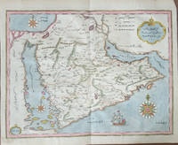
1732réf. 000239Arabian Peninsula. Şekil-i Cezîre-i Arab Map of the Arabian Peninsula. Istanbul: İbrahim Müteferrika in Kâtib Çelebi's Kitâb-i Cihannuma 1732. Measures; 36.5x30.5 cm. Copper-engraved map with contemporary hand color and gold out rules printed on laid paper. The map depicts the Arabian Peninsula with the Red Sea Arabian Gulf and Indian Ocean including numerous Ottoman Turkish place names mountain ranges shown pictorially compass roses an engraved ship vignette and an ornate title cartouche. Original central fold as issued in the atlas. An early and important Ottoman printed map from the first Turkish-language Muslim printing press. Engraved by Ahmed el kirimi أحمد القريمي who does not appear in İbrahim Müteferrika's estate inventory tereke register which provides detailed information about the personnel of his printing house. He was most likely not part of the permanent staff of the press ; rather he sseems to have produced printing plates on a commission basis whenever needed. İbrahim Muteferrika
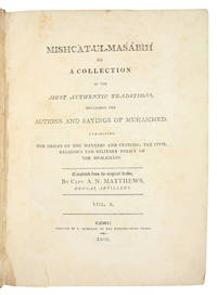
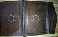
1809réf. ABC_45217Calcutta: T. Hubbard at the Hindoostanee Press 1809. Contemporary sheepskin flat spines with red morocco labels. Small folio 23.5 x 31 cm. 2 volumes. The Mishcàt-ul-Masábìh niche for lamps by al-Khatib al-Tabrizi also known as Wali al-Din d. 741 AH or 1340/41 CE a revised and expanded version of the Masábìh al-Sunnah by al-Baghawi adding approximately 1500 hadith short non-Quranic texts by or approved by Muhammad. This important Sunni text was first translated into English by Capt. Matthews of the Bengal Artillery. Although some of the original hadith are not included and others incorrectly translated this attempt to publish a translation from the Arabic was a noted accomplishment for its time. The list of subscribers accounts for 122 copies with an additional 100 copies noted as being published on order of the Governor General in Council for the Honourable Company. A statement in a 1848 issue of the Journal of Sacred Literature suggests that most copies of the work were destroyed at sea yet it was still advertised for sale in 1817 in the Literary panorama at the price of £4.4s.Some browning throughout more pronounced in endpapers a short tear in the foot of vol. 1 not affecting the text but still in good condition. A rare Calcutta imprint bound in India.l WorldCat 15466515. T. Hubbard at the Hindoostanee Press, unknown
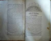
1450réf. 000103Arabic manuscript in Naskh script 80 pages copied by Muḥammad b. Abī Bakr b. ʿAlī b. Muḥammad b. ʿAlī al-Ḥarīrī in 848 AH 1450 AD. The manuscript contains a samÄÊ¿ سماع note written by the scribe himself and further annotated by ShihÄb al-Dīn b. Aḥmad al-QÄdirī al-Mawṣilī al-IqnÄʿī in 849 AH. It is preserved in a Mamluk-style binding possibly contemporary with the manuscript. The work is by Abū al-Faá¸l Ibn ʿAá¹Äʾ AllÄh al-Iskandarī d. 709 AH / 1309 AD one of the great Sufi imams also renowned as a muḥaddith preacher and MÄlikī jurist. He was a student of Abū al-ʿAbbÄs al-Mursī d. 686 AH / 1288 AD and the second successor of ImÄm Abū al-Ḥasan al-ShÄdhilī. Ibn ʿAá¹Äʾ AllÄh was the first to systematically transmit the teachings of the ShÄdhiliyya order in written form. Born in the mid-7th century AH 13th century AD he grew up in Alexandria during the Mamluk period. Although detailed information about his early life is limited he studied with leading scholars in all branches of the traditional Islamic sciences and became a distinguished authority in MÄlikī jurisprudence. His lifetime coincided with the flourishing of several major Sufi orders including the ShÄdhiliyya Mawlawiyya Chishtiyya and Aḥmadiyya. His father had been a disciple of ImÄm al-ShÄdhilī though it is unlikely that Ibn ʿAá¹Äʾ AllÄh himself met the founder of the order. Initially inclined toward jurisprudence rather than Sufism he later became a devoted disciple of Shaykh Abū al-ʿAbbÄs al-Mursī. As evidenced by his most important and enduring work al-Ḥikam Ibn ʿAá¹Äʾ AllÄh emerged as a Sufi master in his own right and was already recognized as a shaykh by the time of al-Mursī's death. He became the third major figure of the ShÄdhiliyya order which originated in Morocco and spread throughout North Africa and beyond. While enjoying a prominent scholarly career in Cairo under the Mamluks he died at approximately sixty years of age in 709 AH 1309 AD and was buried in the QarÄfa cemetery. hardcover
1732réf. 000109The first page of the preface and the final page of the index are in facsimile; otherwise complete. The volume includes 40 original maps and diagrams preserved in mint condition with wide and complete margins. It comprises 698 pages of Ottoman Turkish text printed by İbrahim Müteferrika in 1145 AH 1732 AD. Bound in later hard covers. FIRST AND ONLY EDITION OF THE JIHANNUMA. Planned as a great cosmosgraphy the work was never completed although Katib Celebi wrote two versions. The text contained here is the second version rewritten after the author had acquired a Mercator-Hondius Atlas minor Koemans mistakenly considered the Jihannuma a translation into Turkish of that Atlas. It covers the world from Japan to the Ottoman borders and is well-illustrated with engraved maps including: the World in twin hemispheres the World in oval projection Europe Africa Asia America the North and South Poles Arabia Japan and various other parts of Asia and Asia Minor. Several of the maps and diagrams had appeared in earlier books printed by Mteferrika. The author born Mustafa ibn Abd Allah at Constantinople in 1609 was a prolific scholar historian geographer and bibliophile. Another of his works Tuhfet l-Kibar fi esfar il bihar was published only 4 years earlier at the same press and was the first geographical work to be printed in Turkey. Mteferrika added to the Jihannuma a section concerning the ideas of Copernicus and Tycho Brahe. Koemans II 549 cites 37 plates; Toderini p.114ff. cites 39; and copies are known with 41. Christies note. Ibrahim Muteferrika hardcover