England (Parish) BrutonBiblio.com

26 748 résultats
réf. B9781013464287Hardback. New. hardcover
réf. B9781013888984Hardback. New. hardcover
réf. B9781013758959Hardback. New. hardcover
réf. B9781013920486Hardback. New. hardcover
réf. B9781013396021Hardback. New. hardcover
réf. B9781013479458Hardback. New. hardcover
réf. B9781013569937Hardback. New. hardcover
réf. B9781013537325Hardback. New. hardcover
réf. B9783741186738Paperback. New. paperback
réf. B9781013685583Hardback. New. hardcover
réf. B9781017204179Hardback. New. hardcover
réf. 43889272like new. unknown
réf. B9781013330605Hardback. New. hardcover
réf. 43940619like new. unknown
réf. B9781013345494Hardback. New. hardcover
1996réf. AME_9780723424758Mosby 1996. 2nd. Paperback. New/New. _ Mosby paperback
1901réf. mon0000103686Small Maynard & Co. 1919-01-01. Hardcover. Acceptable. in x in x in. Spine torn. Cover worn. Otherwise text is clean. Small , Maynard & Co. hardcover
1919réf. 121504-JBoston MA.: Small Maynard & Co. 1919. Book. Illus. by Author. Very Good. Hardcover. 1st.ed. 1919 Hardcover with light brown paper boards with green illustration and letters 140 page book. Illustrated with black and white drawings by the author . A scarce title by this author. Condition : Very Good with edge rubs and light ware at the corners. see the book at oue shop at : GibbsBooks. Size: 12mo - over 6¾" - 7¾" tall. Small , Maynard & Co. Hardcover
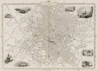
1851réf. 200141AG1851. London & New York The London Printing and Publishing Company 1851. Original steel engraving / Vintage map. Drawn and engraved by John Rapkin. Illustrated and Engraved by D. Pound. Plate Size: 49 cm x 36.5 cm. Sheet Size: 51.5 cm x 37.2 cm. Vintage 19th century map / city-plan in very good condition. Published in the Illustrated Atlas And Modern History Of The World Geographical Political Commercial & Statistical Edited By R. Montgomery Martin. Handsome town-plan of Manchester in the North West of England. The River Irwell can be seen running through the city. Canals railways street and district areas of the city are also included. Decorative scrolling and title cartouche around the edges of the map. One of the few double page plans published by Tallis. The project of 'The Illustrated Atlas' was designed to be finished just in time for the anxiously awaited "Great Exhibition of the Works of Industry of All Nations" or The Great Exhibition sometimes referred to as the Crystal Palace Exhibition in reference to the temporary structure in which it was held was an international exhibition that took place in Hyde Park London from 1 May to 11 October 1851. It was the first in a series of World's Fairs exhibitions of culture and industry that became popular in the 19th century and it was a much-anticipated event. The Great Exhibition was organized by Henry Cole and Prince Albert husband of the reigning monarch Queen Victoria. It was attended by numerous notable figures of the time including Charles Darwin Samuel Colt members of the Orléanist Royal Family and the writers Charlotte Brontë Charles Dickens Lewis Carroll George Eliot and Alfred Tennyson. Music for the opening was under the direction of Sir George Thomas Smart and the continuous music from the exhibited organs for the Queen's procession was "under the superintendence of William Sterndale Bennett". Wikipedia unknown
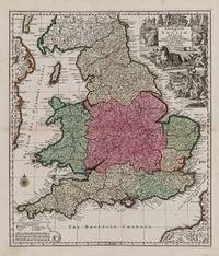
1740réf. 200029AG1740. Augsburg Seutter c.1740. Original hand-coloured engraving. Plate Size: 48.6 cm x 56.7 cm. Sheet Size: 54 cm x 62.1 cm. Original map. In very good condition. Some minor browning evident with the slightest traces of staining to outer margins. Tape repairs to reinforced reverse. Moreland and Bannister 1983: Tooley 1979. A very detailed and interesting map of England and Wales. To the north lies Scotland while offshore parts of Ireland and France are seen. Rivers headlands towns and cities are identified and relief shown pictorially. Divides England into pre-Norman Conquest: The Kingdome of West Saxons The Kingd. Of South Saxons The Kingd. Of Kent The Kingd. of East Saxons The Kingdom of East Angles The Kingdom of Mercie The Princedome of Wales and the Kingdome of Northumberland. Shows major cities and regions such as Surrey Cornwall Dorsetshire Wiltshire Somersetshire Essex Suffolk Warwikshire London Hartfordshire Denbighshire Shorpshire Yorkshire Cumberland Cambridge and Darbyshire. Includes the British Channel to the south and the Irish Sea or St. George's Channel to the west. In the top right of the map a large allegorical title cartouche represents the wealth of Britain - illustrating the sciences trade and industry agriculture and maritime activity throughout the realm. In the opposite corner a smaller cartouche shows map symbols and three scale bars. A compass rose guards the mouth of the Bristol channel. Matthäus Seutter 1678-1757 was one of the most important and prolific German map publishers of the 18th century. Matthaus Seutter the elder first published his "Atlas Geographicus" in 1720 and added to the contents in subsequent editions under the title "Atlas Novus". He was succeeded in his business by his son Georg Matthaus Seutter and after his death his son Albrecht Carl inherited but died early in 1762. Matthaus' widow then sold the business to her sons-in-law Tobias Conrad Lotter and Johann Michael Probst who eventually left it to M.A. Lotter Matthaus' grandson. Wikipedia unknown
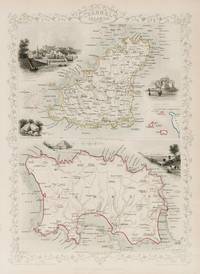
1851réf. 200116AG1851. London & New York John Tallis & Company 1851. Original steel engraving / Vintage map. Drawn and engraved by John Rapkin. Partly hand-coloured. Illustrations by H. Winkles and engravings by E. Radclyffe. Plate Size: 24.5 cm x 35 cm. Sheet Size: 27.3 cm x 37.3 cm. Vintage 19th century map in very good condition. Published in the Illustrated Atlas And Modern History Of The World Geographical Political Commercial & Statistical Edited By R. Montgomery Martin. Two beautiful maps of the Channel Islands from the Victorian Era. In the upper-most map is Guernsey with its major towns such as Braye du Valle and St Peter's Port shown. The potentially hazardous coastline is depicted. A small inset box contains an overall miniature map of the Channel Islands including Alderney and The Caskets and showing the coast of France. In the lower map is Jersey with its major towns such as St Helier shown. Again the potentially dangerous shallow shoreline is depicted pictorially. Relief is depicted through hachuring and the rivers are also included. John Tallis 7 November 1817 3 June 1876 was an English cartographic publisher. His company John Tallis and Company published views maps and atlases in London from roughly 1838 to 1851. Tallis set up as a publisher with Frederick Tallis in Cripplegate in 1842; the business moved to Smithfield in 1846 and was dissolved in 1849. From 1851 to 1854 Tallis operated as John Tallis and Company. He started The illustrated news of the world and national portrait gallery of eminent personages in 1858 selling it for £1370 in 1861; it folded in 1863. Wikipedia The most important project John Tallis undertook was the 'Illustrated Atlas' from 1851. The original map we offer here was part of this exceptional Atlas and all the maps it contained are still today considered as the last reminder of an era of lavish map production. Tallis worked the project together with John Rapkin 1815-1876 and it was Rapkin's style and talent that we have to thank for when we marvel at these maps today. What makes these maps so special is the detail of engraved vignettes that surround the map and often show indigenous scenes people in their environment and even more so historical buildings or historical views of towns and cities architecture and landscape. The project of 'The Illustrated Atlas' was designed to be finished just in time for the anxiously awaited "Great Exhibition of the Works of Industry of All Nations" or The Great Exhibition sometimes referred to as the Crystal Palace Exhibition in reference to the temporary structure in which it was held was an international exhibition that took place in Hyde Park London from 1 May to 11 October 1851. It was the first in a series of World's Fairs exhibitions of culture and industry that became popular in the 19th century and it was a much-anticipated event. The Great Exhibition was organized by Henry Cole and Prince Albert husband of the reigning monarch Queen Victoria. It was attended by numerous notable figures of the time including Charles Darwin Samuel Colt members of the Orléanist Royal Family and the writers Charlotte Brontë Charles Dickens Lewis Carroll George Eliot and Alfred Tennyson. Music for the opening was under the direction of Sir George Thomas Smart and the continuous music from the exhibited organs for the Queen's procession was "under the superintendence of William Sterndale Bennett". Wikipedia unknown
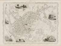
1851réf. 200130AG1851. London & New York John Tallis & Company 1851. Original steel engraving / Vintage map. Drawn and engraved by John Rapkin. Illustrated and Engraved by H. Winkles. Plate Size: 33.5 cm x 26 cm. Sheet Size: 37.5 cm x 27 cm. Vintage 19th century map in very good condition. Published in the Illustrated Atlas And Modern History Of The World Geographical Political Commercial & Statistical Edited By R. Montgomery Martin. Handsome town-plan of Exeter in Devon England on the banks of the River Exe. Railway street and district areas of the city are also included. Decorative scrolling and title cartouche around the edges of the image. The project of 'The Illustrated Atlas' was designed to be finished just in time for the anxiously awaited "Great Exhibition of the Works of Industry of All Nations" or The Great Exhibition sometimes referred to as the Crystal Palace Exhibition in reference to the temporary structure in which it was held was an international exhibition that took place in Hyde Park London from 1 May to 11 October 1851. It was the first in a series of World's Fairs exhibitions of culture and industry that became popular in the 19th century and it was a much-anticipated event. The Great Exhibition was organized by Henry Cole and Prince Albert husband of the reigning monarch Queen Victoria. It was attended by numerous notable figures of the time including Charles Darwin Samuel Colt members of the Orléanist Royal Family and the writers Charlotte Brontë Charles Dickens Lewis Carroll George Eliot and Alfred Tennyson. Music for the opening was under the direction of Sir George Thomas Smart and the continuous music from the exhibited organs for the Queen's procession was "under the superintendence of William Sterndale Bennett". Wikipedia unknown
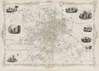
1851réf. 200142AG1851. London & New York John Tallis & Company 1851. Original steel engraving / Vintage map. Drawn and engraved by John Rapkin. Illustrated and Engraved by D. Pound. Plate Size: 50 cm x 35.5 cm. Sheet Size: 52 cm x 37 cm. Vintage 19th century map / city-plan in very good condition. Published in the Illustrated Atlas And Modern History Of The World Geographical Political Commercial & Statistical Edited By R. Montgomery Martin. Handsome town-plan of Leeds West Yorkshire in Northern England. The River Aire can be seen running through the city. Canals railways street and district areas of the city are also included. Decorative scrolling and title cartouche around the edges of the map. One of the few double page plans published by Tallis. The project of 'The Illustrated Atlas' was designed to be finished just in time for the anxiously awaited "Great Exhibition of the Works of Industry of All Nations" or The Great Exhibition sometimes referred to as the Crystal Palace Exhibition in reference to the temporary structure in which it was held was an international exhibition that took place in Hyde Park London from 1 May to 11 October 1851. It was the first in a series of World's Fairs exhibitions of culture and industry that became popular in the 19th century and it was a much-anticipated event. The Great Exhibition was organized by Henry Cole and Prince Albert husband of the reigning monarch Queen Victoria. It was attended by numerous notable figures of the time including Charles Darwin Samuel Colt members of the Orléanist Royal Family and the writers Charlotte Brontë Charles Dickens Lewis Carroll George Eliot and Alfred Tennyson. Music for the opening was under the direction of Sir George Thomas Smart and the continuous music from the exhibited organs for the Queen's procession was "under the superintendence of William Sterndale Bennett". Wikipedia unknown
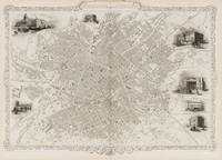
1851réf. 200137AG1851. London & New York The London Printing Company 1851. Original steel engraving / Vintage map. Drawn and engraved by John Rapkin. Illustrated and Engraved by H. Watkins. Plate Size: 49 cm x 36 cm. Sheet Size: 51 cm x 37.2 cm. Vintage 19th century map / city-plan in very good condition. Published in the Illustrated Atlas And Modern History Of The World Geographical Political Commercial & Statistical Edited By R. Montgomery Martin. Handsome town-plan of Manchester in the North West of England. The River Irwell can be seen running through the city. Canals railways street and district areas of the city are also included. Decorative scrolling and title cartouche around the edges of the map. One of the few double page plans published by Tallis. The project of 'The Illustrated Atlas' was designed to be finished just in time for the anxiously awaited "Great Exhibition of the Works of Industry of All Nations" or The Great Exhibition sometimes referred to as the Crystal Palace Exhibition in reference to the temporary structure in which it was held was an international exhibition that took place in Hyde Park London from 1 May to 11 October 1851. It was the first in a series of World's Fairs exhibitions of culture and industry that became popular in the 19th century and it was a much-anticipated event. The Great Exhibition was organized by Henry Cole and Prince Albert husband of the reigning monarch Queen Victoria. It was attended by numerous notable figures of the time including Charles Darwin Samuel Colt members of the Orléanist Royal Family and the writers Charlotte Brontë Charles Dickens Lewis Carroll George Eliot and Alfred Tennyson. Music for the opening was under the direction of Sir George Thomas Smart and the continuous music from the exhibited organs for the Queen's procession was "under the superintendence of William Sterndale Bennett". Wikipedia unknown
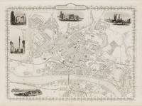
1851réf. 200127AG1851. London & New York The London Printing and Publishing Company 1851. Original steel engraving / Vintage map. Drawn and engraved by John Rapkin. Illustrated and Engraved by H. Winkles. Plate Size: 33.5 cm x 25.5 cm. Sheet Size: 37.5 cm x 27 cm. Vintage 19th century map in very good condition. Published in the Illustrated Atlas And Modern History Of The World Geographical Political Commercial & Statistical Edited By R. Montgomery Martin. Handsome town-plan of Newcastle in England's Northeast bordered to the south by the Tyne with Gateshead across the river. Railway street and district areas of the city are also included. Decorative scrolling and title cartouche around the edges of the image. The project of 'The Illustrated Atlas' was designed to be finished just in time for the anxiously awaited "Great Exhibition of the Works of Industry of All Nations" or The Great Exhibition sometimes referred to as the Crystal Palace Exhibition in reference to the temporary structure in which it was held was an international exhibition that took place in Hyde Park London from 1 May to 11 October 1851. It was the first in a series of World's Fairs exhibitions of culture and industry that became popular in the 19th century and it was a much-anticipated event. The Great Exhibition was organized by Henry Cole and Prince Albert husband of the reigning monarch Queen Victoria. It was attended by numerous notable figures of the time including Charles Darwin Samuel Colt members of the Orléanist Royal Family and the writers Charlotte Brontë Charles Dickens Lewis Carroll George Eliot and Alfred Tennyson. Music for the opening was under the direction of Sir George Thomas Smart and the continuous music from the exhibited organs for the Queen's procession was "under the superintendence of William Sterndale Bennett". Wikipedia unknown