Canada Dept of Public WorksBiblio.com
22 713 résultats
réf. A9781345663341Hardback. New. hardcover
réf. A9781344007269Hardback. New. hardcover
réf. A9781346117485Hardback. New. hardcover
réf. B9783337209384Paperback / softback. New. paperback
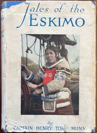
1925réf. 59669London: W. & R. Chambers Ltd. 38 Soho Square 1925. 8vo. 196 pp. Photo frontisp. 17 photo plates. Blue cloth blue lettering minor shelfwear rubbing light wear to corners w/o ffep. w/ d.j. colour cover art photo price of 3/6 on rear flap minor chipping & tear head of spine upper fore-edge some dustsoiling minor creasing still G/G- copy. First edition of this semi-autobiographical memoir and partly fictional account of the Eskimo families on Southampton Island and others on Baffin Island. Munn 1864-1952 an inveterate adventurer prospected for gold through the Yukon Gold Rush into Newfoundland established a trading post at Button Point north of Baffin Island and clashed often with the Hudson’s Bay Company as it increased it’s posts into the Canadian Arctic. Scarce in original jacket. See: Kenn Harper Looking Back: An Inconvenient Munn the Well-Connected Quarrelsome Englishman Who Fought With Just About Everyone in the Arctic Up Here Life in Canada’s Far North June 1 2014. W. & R. Chambers, Ltd., 38 Soho Square, hardcover
1934réf. 59558Boston: Meador Publishing Co. 1934. 8vo. 271 1 pp. Red-ribbed publisher’s cloth black lettering front cover & spine w/ d.j. wraparound cover art of bucking bronco slight shelfwear toning still NF/NF copy. First American edition of this thrilling Western set in Saskatchewan against the backdrop of prairie fires stampedes wolves cattle-rustlers and gun-play. With parts in Western dialect the author recounts the homesteading days of Northwest Canada. See: Peel’s Bibliography of the Canadian Prairies to 1953 5800. Meador Publishing Co., hardcover
2015réf. AME_9781849739399Royal Society of Chemistry 2015. 1 ST. Hardcover. New/New. Royal Society of Chemistry hardcover
1925réf. 59066Vancouver B.C.: Board of Park Commissioners Park Board Offices 1925. 8vo. 70 pp. Colour frontisp. numerous photo plates 1 large folding colour map. Tan colour-illustrated softcovers Arts & Crafts cover art of swans swimming in park lake yapp fore-edge minor creasing & edgewear creasing to a few corners minor fold creases at fore-edge of folding map still a VG copy. First edition of this work illustrating and outlining many of the improvements and changes brought to Stanley Park during the first decade of Rawlings 1882-1937 as Park Superintendent. These changes included the construction of the Lost Lagoon Lake saltwater pipes were shut off turning it into a freshwater lake with many other changes. This work also details several other newly acquired parks during the Progressive Era as well as improvements initiated for beach access bathing facilities and upgrades for automobile tours. See: Christina Cameron Jim Barlow & Susan Mundick Stanley Park National Historic Site of Canada Commemorative Integrity Statement 2004. Board of Park Commissioners, Park Board Offices, paperback
réf. B9783639008432Paperback. New. paperback
réf. B9783742862518Paperback. New. paperback
1920réf. 59237Washington D.C.: Government Printing Office Hydrographic Office U.S. Navy 1920-1940. Five vols. 8vo. vi 638; v 1 287 1; 8 390 pp.; 1; 2 17 1 leaves. With 5 large folding colour maps numerous plates showing elevations. Three volumes uniformly bound in blue publisher’s buckram gilt lettering front cover & spine darkening to spines fore-edges minor shelfwear dustsoiling slightly shaken Supplements in self-printed softcovers edgewear toning to fore-edges minor chipping still VG- set. Third editions revised & updated of vols. I & II second edition of vol. II and 1st editions of both scarce Supplements of these coast pilot guides to British Columbia including lower Alaska and upper Washington in the years between the World Wars. Prior to modern GPS systems and satellite navigation these regularly updated and revised navigation handbooks provided key sailing instructions often drawing not only from Brazilian Argentine and British coast pilots as well as sailing reports from U.S. Navy vessels and those from merchant ships. The first large map delineates the requisite coast pilots for sailing in B.C. waters and charts to be ordered from the Hydrographic Office while the second maps depict the sailing routes to Asia the Soviet Union and the Arctic across the Pacific. Both editions of Vol. II are offered here with the expanded 3rd edition featuring nearly double the material and extra map of the 2nd. Government Printing Office, Hydrographic Office, U.S. Navy, paperback
réf. SONG3319946307Used: Good unknown
réf. SONG3319208004Used: Good unknown
réf. SONG1552388042Used: Good unknown
réf. SONG3030301257Used: Good unknown
réf. 57533-k-C5Lausanne/Oss: Musée de l'Élysée/Museum Jan Cunen 2002-2004. Photo-illustrated cardboard box 355 x 255 x 1 cms. containing 12 folded posters each 70 x 50 cms. with texts and illustrations partly in color CLOSED with seal. EXTREMELY RARE. This publication was issued on the occasion of the educative approach of the exhibition Color is Power a presentation of the works of photographer Robert Walker. The exhibition is the result of an international substantive co-operation between two museums. Photography Musée de l'Élysée/Museum Jan Cunen, 2002-2004 unknown
1927réf. 58785Fort Erie ONT & Buffalo NY: Buffalo Heights Development Co. 1927. 4to. 4 pp unpaginated. printed in sepia & red. With 2 maps 1 large double-page in red & sepia photo illustrations text illustrations. Self-printed softcovers NF. First edition of this uncommon land promotion for the Buffalo Heights land development off of Dominion Road in Fort Erie Ontario which was to have been a model community featuring 66-foor parkways electric street lighting and traffic circles. Launched after the opening of the Peace Bridge between Canada and the U.S. in 1927 the project was touted as an excellent opportunity with 453 lots sold within months. Unfortunately the stock market crash of October 1929 and subsequent Great Depression left most of it uncompleted and eventually only a small number of modest homes were ever built. Worldcat locates 1 copy Yale. Buffalo Heights Development Co., paperback
réf. B9781465256706Paperback / softback. New. paperback
réf. B9781524933203Paperback / softback. New. paperback
1885réf. 58338Port Hawkesbury Inverness Nova Scotia: n.p. ca. 1885. Four mounted albumen photos including three cabinet card sized photos w/ images sized 3.75 x 6.2 in. mounted on 4.25 x 6.5 in. brown boards gilt lettering stamped at lower fore-edges 1 small 3.25 x 3.25 in. photo on 5 x 5 in. gray studio mount card stock all w/ annotations on versos indicating locations and w/ manuscript greetings some soiling dustsoiling and minor spotting to the Cabinet photos the smaller image a tad over-exposed still all three with fairly good contrast and well-defined images. These scarce images depict the town and harbour of Port Hawkesbury situated along the Strait of Canso and the only really viable port along the strait which faced Point Tupper. Originally named Ship Harbour the town supplied men materials and repairs to the Gulf of St. Lawrence fishing fleet and two of these images show vessels either anchored or under sail. These cabinet photos appear to have been sent to “Angus” as “Pictures of ‘home dear home’” with manuscript notes indicating “Port Hawkesbury looking towards Pt. Tupper. . . from Pt. Tupper. . . across the harbour.” The final photo shows the small Langley family home built by John Langley 1849-1926 who had married Maria Ballieul Langley 1848-1925 in 1872. He was initially a barrel cooper and later ship’s carpenter boat builder and later a railway foreman. n.p., hardcover
1998réf. G0660174936I5N00Government of Canada 1998. Paperback. Acceptable. Readable copy. Pages may have considerable notes/highlighting. ~ ThriftBooks: Read More Spend Less.Dust jacket quality is not guaranteed. Government of Canada paperback
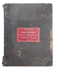
réf. 53940Toronto John Lovell 1857. Printed by John Lovell Toronto 1857. 62 x 47 cm. Hard-cover with leather at spine and corners. Gilt title on red label displayed on front cover. All 22 large lithographed maps describing the development of mining regions in Canada and explorations on the north shore of Lake Huron and eastward to Ottawa are complete and in good condition. Spine is damaged cover is mottled slight water damage to the outside of the pages some pages folded and even browning throughout. Toronto John Lovell 1857 hardcover
1929réf. 57253Seattle WA: Puget Sound Navigation Co. Black Ball Ferry Lines 1929. 8vo. 4 x 9 in. 12 pp unpaginated. triptych printed in red & black which opens out into 9 x 12 in. pictorial map showing auto ferry routes in Washington & British Columbia w/ inset maps & photo illustrations on verso minor dustsoiling minor closed tears at the folds edgewear still G copy. First edition of this scarce and well-executed automobile brochure for the 1920’s traveler in the Puget Sound and Strait of Juan de Fuca w/ illustrations in red showing the routes out of Seattle Brmemerton Whidby Island Port Townsend and Port Angeles into Victoria B.C. Friday Harbor and Bellingham. Worldcat locates 2 copies UC Berkeley Newberry Library. Puget Sound Navigation Co., Black Ball Ferry Lines, unknown
1950réf. 56953Victoria B.C.: Victoria and Vicinity Motor Courts Assoc. ca. 1950. 4to. 7 x 7.5 in. printed in red & blue in double-columns which opens into folio-sized double-sided 14 x 20 in. poster w/ illustrated ads inset pictorial maps photo illustrations. First edition of this scarce automobile travel map and brochure guiding visitors in Post-World War II Canada to the auto courts and motor courts. Demarcated carefully on a pictorial inset map showing the scenic Island Highway Butchart’s Garden the Dominion Observatory Victoria and Thetis Lake all of the auto courts are carefully marked with some featuring extra amenities such as golf swimming laundry bungalows others with meal service and more. No copies located in Worldcat. Victoria and Vicinity Motor Courts Assoc., unknown
1909réf. 74475Montreal: Chemin de fer Grand-Tronc-Pacifique 1909. First edition thus Octavo. 24 pp. of text plus a 44 x 18 inch folding color map of the route. Publisher's printed brown wrappers. This copy issued by the J. M. Currie Company of Paris with their imprint on the front cover. A very good copy. (Chemin de fer Grand-Tronc-Pacifique) unknown