[Florida]Biblio.com

2 557 résultats
1922réf. 40720Washington D.C.: Published by the United States Coast and Geodetic Survey 1922. Large folding nautical chart printed on heavy paper stock. Colored. A rare original coastal survey of Key West Harbor. Established by President Thomas Jefferson in 1807 as the Survey of the Coast the U.S. Coast and Geodetic Survey was the United States' first civilian scientific agency. This agency has followed its mission to survey the U.S. coastline create nautical charts of the coast and help increase maritime safety since its founding and has often played fascinating roles in significant chapters of U.S. history. It served in all theaters of the Civil War in the service of the Union Army and Navy pioneered acoustic exploration in the wake of the sinking of the Titanic and during WWI it worked to detect enemy submarines. In addition this agency worked to survey and produce detailed maps and renderings of the U.S. coast. These nautical survey maps commonly referred to as "T-sheets" provide fascinating insights into the history of the United States coastline which has and will continue to shift. These maps are the most important data source for understanding the physical and ecological characteristics of the U.S. shoreline. The present map of the Florida coastline is notable in displaying the Overseas Railroad as the only main land transportation link between the Keys. At the time this map was published the overseas highway had yet to be built and tourism and travel in the region was limited to boat or train. This map is a highly detailed and accurate sea chart of Key West and an important historical view of a developing Florida. Published by the United States Coast and Geodetic Survey unknown
1922réf. 40720Washington D.C.: Published by the United States Coast and Geodetic Survey 1922. Large folding nautical chart printed on heavy paper stock. Colored. A rare original coastal survey of Key West Harbor. Established by President Thomas Jefferson in 1807 as the Survey of the Coast the U.S. Coast and Geodetic Survey was the United States' first civilian scientific agency. This agency has followed its mission to survey the U.S. coastline create nautical charts of the coast and help increase maritime safety since its founding and has often played fascinating roles in significant chapters of U.S. history. It served in all theaters of the Civil War in the service of the Union Army and Navy pioneered acoustic exploration in the wake of the sinking of the Titanic and during WWI it worked to detect enemy submarines. In addition this agency worked to survey and produce detailed maps and renderings of the U.S. coast. These nautical survey maps commonly referred to as "T-sheets" provide fascinating insights into the history of the United States coastline which has and will continue to shift. These maps are the most important data source for understanding the physical and ecological characteristics of the U.S. shoreline. The present map of the Florida coastline is notable in displaying the Overseas Railroad as the only main land transportation link between the Keys. At the time this map was published the overseas highway had yet to be built and tourism and travel in the region was limited to boat or train. This map is a highly detailed and accurate sea chart of Key West and an important historical view of a developing Florida. Published by the United States Coast and Geodetic Survey unknown books
1864réf. 63452Richmond VA 1864. 4to one-page on blue paper the text in full: "In compliance with your request I have the honor to transmit herewith copy of my letter to the Hon. W. Porcher Miles on the subject of the torpedo boats"; with a "Rebel Archives" stamp on verso. Chambliss 1809-1875; Sussex County Virginia plantation owner and member of the Confederate House of Representatives 1862-1865 was a member of the house Naval Affairs committee and William Porcher Miles 1822-1899; Mayor of Charleston South Carolina 1855-1857 U.S. House of Representatives 1857-1860 Confederate House of Representatives 1862-1865 was chairman of the house Military Affairs committee. This letter was written several months after the Confederacy's first torpedo boat the David made its initial attack against the Union ship New Ironsides in Charleston Harbor 5 October 1863 and two months before its second against the USS Memphis 6 March 1864. After two failed attempts at a sortie in 1863 losing 13 crew members in the process the Hunley became the first torpedo boat to actually sink a war vessel successfully completing its mission against the USS Housatonic in Charleston Harbor on February 17 1864. Very good Mallory's signature strong and black. Folded. 10187. unknown
1864réf. 63452Richmond VA 1864. 4to one-page on blue paper the text in full: "In compliance with your request I have the honor to transmit herewith copy of my letter to the Hon. W. Porcher Miles on the subject of the torpedo boats"; with a "Rebel Archives" stamp on verso. Chambliss 1809-1875; Sussex County Virginia plantation owner and member of the Confederate House of Representatives 1862-1865 was a member of the house Naval Affairs committee and William Porcher Miles 1822-1899; Mayor of Charleston South Carolina 1855-1857 U.S. House of Representatives 1857-1860 Confederate House of Representatives 1862-1865 was chairman of the house Military Affairs committee. This letter was written several months after the Confederacy's first torpedo boat the David made its initial attack against the Union ship New Ironsides in Charleston Harbor 5 October 1863 and two months before its second against the USS Memphis 6 March 1864. After two failed attempts at a sortie in 1863 losing 13 crew members in the process the Hunley became the first torpedo boat to actually sink a war vessel successfully completing its mission against the USS Housatonic in Charleston Harbor on February 17 1864. Very good Mallory's signature strong and black. Folded. 10187. unknown books
1990réf. 26721Tallahassee FL: Gallery & Museum School of Visual Arts & Dance Florida State University. New. Paperback. FREE UPGRADE to Courier/Priority Shipping Upon Request - IN STOCK AND IMMEDIATELY AVAILABLE FOR SHIPMENT - FLAWLESS COPY BRAND NEW PRISTINE NEVER OPENED -- with a bonus offer--; T-FLORFIBE; Florida State University Gallery & Museum Arte Textil Fibers USA - Colombia - Florida State University Gallery & Museum Tallahassee - 9/28/90 - 10/22/90 . 1990. Gallery & Museum School of Visual Arts & Dance, Florida State University paperback
1990réf. 26722Tallahassee FL: Florida State University Gallery & Museum. New. Paperback. FREE UPGRADE to Courier/Priority Shipping Upon Request - IN STOCK AND IMMEDIATELY AVAILABLE FOR SHIPMENT - -- with a bonus offer--; T-FLORDESH; Florida State University Gallery & Museum; Hobbs Robert Arthur Deshaies: Casting Doubt - Florida State University Gallery & Museum - 1/12/90 - 2/4/90 . 1990. Florida State University Gallery & Museum paperback
1988réf. 26723Tallahassee FL: Florida State University Institute for Contemporary Art. New. Paperback. FREE UPGRADE to Courier/Priority Shipping Upon Request - IN STOCK AND IMMEDIATELY AVAILABLE FOR SHIPMENT - -- with a bonus offer--; T-FLORATHAN; Florida State University Gallery & Museum Athanor VII - Florida State University - Journal of the Institute for Contemporary Art . 1988. Florida State University Institute for Contemporary Art paperback
1991réf. 26727Tallahassee FL: Florida State University Gallery & Museum. As New. Paperback. FREE UPGRADE to Courier/Priority Shipping Upon Request - IN STOCK AND IMMEDIATELY AVAILABLE FOR SHIPMENT - AS NEW THE TEXT BLOCK IS PRISTINE CLEAN UNMARKED AND IN EXCELLENT CONDITION - -- -- with a bonus offer--; T-FLORHANSON; Hobbs Robert; Florida State University Gallery & Museum Duane Hanson - The New Objectivity - Florida State University Gallery & Museum - Tallahassee FL - 2/8/91 - 3/10/91 . 1991. Florida State University Gallery & Museum paperback
1996réf. 26724Tallahassee FL: Dance. As New. Paperback. FREE UPGRADE to Courier/Priority Shipping Upon Request - IN STOCK AND IMMEDIATELY AVAILABLE FOR SHIPMENT - -- with a bonus offer--; T-FLORMAGIC; Museum of Fine Arts / Florida State University School of Visual Arts & Dance My Magic Pours Secret Libations - Museum of Fine Arts / Florida State University School of Visual Arts & Dance - Tallahassee FL - 2/16/96 - 4/6/96 . 1996. Dance paperback
1969réf. 59289St. Petersburg Florida: Museum of Fine Arts. As New. Paperback. FREE UPGRADE to Courier/Priority Shipping Upon Request – – IN STOCK AND IMMEDIATELY AVAILABLE FOR SHIPMENT - AS NEW THE TEXT BLOCK IS PRISTINE CLEAN UNMARKED AND IN EXCELLENT CONDITION - - 48 pp. With 27 ills. 2 col. . 23 x 27 cm. -- with a bonus offer-- . 1969. Museum of Fine Arts paperback
1978réf. 58098University Gallery University of Florida. As New. Paperback. FREE UPGRADE to Courier/Priority Shipping Upon Request – – IN STOCK AND IMMEDIATELY AVAILABLE FOR SHIPMENT - AS NEW THE TEXT BLOCK IS PRISTINE CLEAN UNMARKED AND IN EXCELLENT CONDITION - - 52 pp. With one text ill. And 28 ills. On 20 pls. One map. 23 x 19 cm. -- with a bonus offer-- . 1978. University Gallery, University of Florida paperback
1970réf. 59605Gainesville Florida U. S. A. : University Gallery University of Florida. As New. Paperback. FREE UPGRADE to Courier/Priority Shipping Upon Request – – IN STOCK AND IMMEDIATELY AVAILABLE FOR SHIPMENT - AS NEW THE TEXT BLOCK IS PRISTINE CLEAN UNMARKED AND IN EXCELLENT CONDITION - - 22 pp. With 16 ills. 23 x 19 cm. -- with a bonus offer-- . 1970. University Gallery, University of Florida paperback
1981réf. 26725Tallahassee FL: University. As New. Paperback. FREE UPGRADE to Courier/Priority Shipping Upon Request - IN STOCK AND IMMEDIATELY AVAILABLE FOR SHIPMENT - -- with a bonus offer--; T-FLORWILE; University Fine Arts Galleries School of Visual Arts - Florida State University William T. Wiley - University Fine Arts Galleries School of Visual Arts - Florida State University - Tallahassee FL - May 2 - 31 1981 . 1981. University paperback
1918réf. 40712Washington D.C.: Published by the United States Coast and Geodetic Survey 1918. Large folding nautical chart printed on heavy paper stock. Colored. A rare original coastal survey of Florida from Jupiter to Tampa including West Palm Beach Miami Boca Raton Fort Lauderdale Miami the Keys and Fort Meyers as well as the Bahamas and a partial mapping of the northern Cuban coastline including Havana. Established by President Thomas Jefferson in 1807 as the Survey of the Coast the U.S. Coast and Geodetic Survey was the United States' first civilian scientific agency. This agency has followed its mission to survey the U.S. coastline create nautical charts of the coast and help increase maritime safety since its founding and has often played fascinating roles in significant chapters of U.S. history. It served in all theaters of the Civil War in the service of the Union Army and Navy pioneered acoustic exploration in the wake of the sinking of the Titanic and during WWI it worked to detect enemy submarines. In addition this agency worked to survey and produce detailed maps and renderings of the U.S. coast. These nautical survey maps commonly referred to as "T-sheets" provide fascinating insights into the history of the United States coastline which has and will continue to shift. These maps are the most important data source for understanding the physical and ecological characteristics of the U.S. shoreline. The present map is a highly detailed and accurate sea chart of Southern Florida and the Northern Caribbean region and an important historical view of a developing Florida. Published by the United States Coast and Geodetic Survey unknown
1918réf. 40712Washington D.C.: Published by the United States Coast and Geodetic Survey 1918. Large folding nautical chart printed on heavy paper stock. Colored. A rare original coastal survey of Florida from Jupiter to Tampa including West Palm Beach Miami Boca Raton Fort Lauderdale Miami the Keys and Fort Meyers as well as the Bahamas and a partial mapping of the northern Cuban coastline including Havana. Established by President Thomas Jefferson in 1807 as the Survey of the Coast the U.S. Coast and Geodetic Survey was the United States' first civilian scientific agency. This agency has followed its mission to survey the U.S. coastline create nautical charts of the coast and help increase maritime safety since its founding and has often played fascinating roles in significant chapters of U.S. history. It served in all theaters of the Civil War in the service of the Union Army and Navy pioneered acoustic exploration in the wake of the sinking of the Titanic and during WWI it worked to detect enemy submarines. In addition this agency worked to survey and produce detailed maps and renderings of the U.S. coast. These nautical survey maps commonly referred to as "T-sheets" provide fascinating insights into the history of the United States coastline which has and will continue to shift. These maps are the most important data source for understanding the physical and ecological characteristics of the U.S. shoreline. The present map is a highly detailed and accurate sea chart of Southern Florida and the Northern Caribbean region and an important historical view of a developing Florida. Published by the United States Coast and Geodetic Survey unknown books
1917réf. 40734Washington D.C.: Published by the United States Coast and Geodetic Survey 1917. Large folding nautical chart printed on heavy paper stock. Colored. A rare original coastal survey of Florida from Vero Beach to Jupiter including Fort Pierce Port St. Lucie Stuart and the Hobe Sound with an inset map of the Narrows in the upper left corner. Established by President Thomas Jefferson in 1807 as the Survey of the Coast the U.S. Coast and Geodetic Survey was the United States' first civilian scientific agency. This agency has followed its mission to survey the U.S. coastline create nautical charts of the coast and help increase maritime safety since its founding and has often played fascinating roles in significant chapters of U.S. history. It served in all theaters of the Civil War in the service of the Union Army and Navy pioneered acoustic exploration in the wake of the sinking of the Titanic and during WWI it worked to detect enemy submarines. In addition this agency worked to survey and produce detailed maps and renderings of the U.S. coast. These nautical survey maps commonly referred to as "T-sheets" provide fascinating insights into the history of the United States coastline which has and will continue to shift. These maps are the most important data source for understanding the physical and ecological characteristics of the U.S. shoreline. The present map of the Florida coastline was issued before the incorporation of Jupiter Township in 1925 and predates the development of Route 1. A railroad is marked as following the approximate route of the highway. This map is a highly detailed and accurate sea chart of the Jupiter region and an important historical view of a developing Florida. Published by the United States Coast and Geodetic Survey unknown
1917réf. 40734Washington D.C.: Published by the United States Coast and Geodetic Survey 1917. Large folding nautical chart printed on heavy paper stock. Colored. A rare original coastal survey of Florida from Vero Beach to Jupiter including Fort Pierce Port St. Lucie Stuart and the Hobe Sound with an inset map of the Narrows in the upper left corner. Established by President Thomas Jefferson in 1807 as the Survey of the Coast the U.S. Coast and Geodetic Survey was the United States' first civilian scientific agency. This agency has followed its mission to survey the U.S. coastline create nautical charts of the coast and help increase maritime safety since its founding and has often played fascinating roles in significant chapters of U.S. history. It served in all theaters of the Civil War in the service of the Union Army and Navy pioneered acoustic exploration in the wake of the sinking of the Titanic and during WWI it worked to detect enemy submarines. In addition this agency worked to survey and produce detailed maps and renderings of the U.S. coast. These nautical survey maps commonly referred to as "T-sheets" provide fascinating insights into the history of the United States coastline which has and will continue to shift. These maps are the most important data source for understanding the physical and ecological characteristics of the U.S. shoreline. The present map of the Florida coastline was issued before the incorporation of Jupiter Township in 1925 and predates the development of Route 1. A railroad is marked as following the approximate route of the highway. This map is a highly detailed and accurate sea chart of the Jupiter region and an important historical view of a developing Florida. Published by the United States Coast and Geodetic Survey unknown books
1917réf. 40733Washington D.C.: Published by the United States Coast and Geodetic Survey 1917. Large folding nautical chart printed on heavy paper stock. Colored. A rare original coastal survey of the south eastern Florida coastline from Boca Raton to Jupiter encompassing Lake Worth West Palm Beach and Delray Beach. Established by President Thomas Jefferson in 1807 as the Survey of the Coast the U.S. Coast and Geodetic Survey was the United States' first civilian scientific agency. This agency has followed its mission to survey the U.S. coastline create nautical charts of the coast and help increase maritime safety since its founding and has often played fascinating roles in significant chapters of U.S. history. It served in all theaters of the Civil War in the service of the Union Army and Navy pioneered acoustic exploration in the wake of the sinking of the Titanic and during WWI it worked to detect enemy submarines. In addition this agency worked to survey and produce detailed maps and renderings of the U.S. coast. These nautical survey maps commonly referred to as "T-sheets" provide fascinating insights into the history of the United States coastline which has and will continue to shift. These maps are the most important data source for understanding the physical and ecological characteristics of the U.S. shoreline. The present map is a highly detailed and accurate sea chart of the coast of southeast Florida and an important historical view of the developing state. Published by the United States Coast and Geodetic Survey unknown
1917réf. 40733Washington D.C.: Published by the United States Coast and Geodetic Survey 1917. Large folding nautical chart printed on heavy paper stock. Colored. A rare original coastal survey of the south eastern Florida coastline from Boca Raton to Jupiter encompassing Lake Worth West Palm Beach and Delray Beach. Established by President Thomas Jefferson in 1807 as the Survey of the Coast the U.S. Coast and Geodetic Survey was the United States' first civilian scientific agency. This agency has followed its mission to survey the U.S. coastline create nautical charts of the coast and help increase maritime safety since its founding and has often played fascinating roles in significant chapters of U.S. history. It served in all theaters of the Civil War in the service of the Union Army and Navy pioneered acoustic exploration in the wake of the sinking of the Titanic and during WWI it worked to detect enemy submarines. In addition this agency worked to survey and produce detailed maps and renderings of the U.S. coast. These nautical survey maps commonly referred to as "T-sheets" provide fascinating insights into the history of the United States coastline which has and will continue to shift. These maps are the most important data source for understanding the physical and ecological characteristics of the U.S. shoreline. The present map is a highly detailed and accurate sea chart of the coast of southeast Florida and an important historical view of the developing state. Published by the United States Coast and Geodetic Survey unknown books
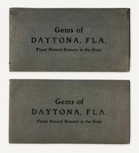
1900réf. ALB.24.0011900. Photo albums 2; Silver prints 15 and photogravures 23. A handsome pair of early-20th century albums with mini-panoramic views of Daytona Florida. There albums contain both silver prints and photogravures. Daytona locations represented in the albums include Daytona Beach; Ormond Drive; the Tomoka River; Ridgewood Avenue; the Claredon Hotel; Seminole Island; the Palmetto Club; Spanish Canal; and more. Most 3 1/4 x 10 inches a few smaller ; With printed captions in negative. unknown
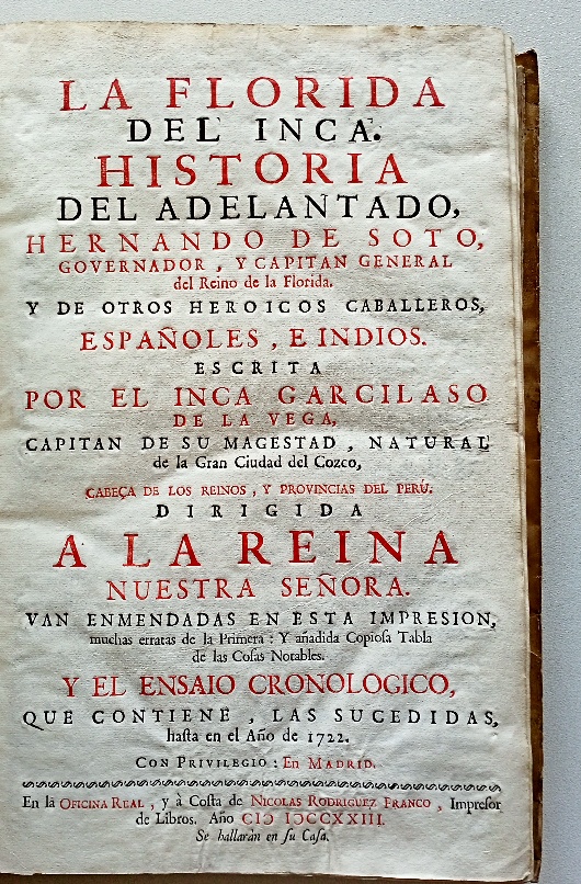
1723réf. 7416AMadrid, Oficina Real für N. R. Franco, 1723. 4°. 16 Bll., 268 S., 6 Bll. Flexibler Pergamentband der Zeit mit 2 Schließschlaufen. Vord. Innengelenk aufgeplatzt. 1 Bl. mit Einriß. [2 Warenabbildungen] 2. Auflage.
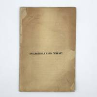
1837réf. 370450New York 1837. First edition. 16pp. 8vo. Original printed yellow wrappers repairs to small chips and separation at fold. Provenance: Thomas W. Streeter booklabel on inner rear wrapper pencil notes on front wrapper and first page of text. First edition. 16pp. 8vo. Comprising 1.4 million acres of land on the Gulf of Mexico between the Apalachicola and Wakulla Rivers in West Florida the Forbes land grant was ceded by the Seminoles and Lower Creeks to John Forbes & Company in payment for debts. With trade with Native Americans unprofitable during the War of 1812 Forbes sold the claim. The treaty transferring Florida to the United States did not go into effect until 1821 and private title under Spanish land grants with the territory was questionable. Decades of lawsuits ensued going as high as the Supreme Court. After the resolution of claims the title was reorganized as the Apalachiocola Land Company in 1835. The present report by the President of the Board of Directors of the New York-based company describes the geography of the region and outlines the plan for its division into lots for dwellings and businesses. The report summarizes the surveys of the region and describes the land and its resources and flora. Sabin calls for a map in this report although Servies does not note one. However the text references a map on page 7 which was likely not issued with all copies. The development of the land was not successful and the company eventually folded. "As an object of speculation the Forbes Purchase not only originated in a chaotic era but was hampered for many years by uncertain title to the land. Its development was also hindered by a lack of good agricultural land as well as by competition from the United States itself which was selling new lands in the American West at the same time the Apalachicola Land Company was getting started" Upchurch. This Streeter copy is the only example appearing in auction records and the only one we can trace in the market. Streeter purchased it from Rosenbach in 1936 for $50 and it was acquired at the Streeter sale for $65 by dealer and former Rosenbach employee John Fleming. It was eventually acquired by the collector Jay Kislak. Servies 2010; Streeter sale 1240 this copy; Sabin 5878; American Imprints 43274. See John C. Upchurch "Aspects of the Development and Exploration of the Forbes Purchase" Florida Historical Quarterly Vol. XLVIII No. 2 October 1969 unknown
1837réf. 370450New York 1837. First edition. 16pp. 8vo. Original printed yellow wrappers repairs to small chips and separation at fold. Provenance: Thomas W. Streeter booklabel on inner rear wrapper pencil notes on front wrapper and first page of text. First edition. 16pp. 8vo. Comprising 1.4 million acres of land on the Gulf of Mexico between the Apalachicola and Wakulla Rivers in West Florida the Forbes land grant was ceded by the Seminoles and Lower Creeks to John Forbes & Company in payment for debts. With trade with Native Americans unprofitable during the War of 1812 Forbes sold the claim. The treaty transferring Florida to the United States did not go into effect until 1821 and private title under Spanish land grants with the territory was questionable. Decades of lawsuits ensued going as high as the Supreme Court. After the resolution of claims the title was reorganized as the Apalachiocola Land Company in 1835. The present report by the President of the Board of Directors of the New York-based company describes the geography of the region and outlines the plan for its division into lots for dwellings and businesses. The report summarizes the surveys of the region and describes the land and its resources and flora. Sabin calls for a map in this report although Servies does not note one. However the text references a map on page 7 which was likely not issued with all copies. The development of the land was not successful and the company eventually folded. "As an object of speculation the Forbes Purchase not only originated in a chaotic era but was hampered for many years by uncertain title to the land. Its development was also hindered by a lack of good agricultural land as well as by competition from the United States itself which was selling new lands in the American West at the same time the Apalachicola Land Company was getting started" Upchurch. This Streeter copy is the only example appearing in auction records and the only one we can trace in the market. Streeter purchased it from Rosenbach in 1936 for $50 and it was acquired at the Streeter sale for $65 by dealer and former Rosenbach employee John Fleming. It was eventually acquired by the collector Jay Kislak. Servies 2010; Streeter sale 1240 this copy; Sabin 5878; American Imprints 43274. See John C. Upchurch "Aspects of the Development and Exploration of the Forbes Purchase" Florida Historical Quarterly Vol. XLVIII No. 2 October 1969 unknown books
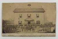
1880réf. 4993N.p. but likely Live Oak FL 1880. Very good. Albumen photograph 4.5 x 7.75 inches mounted on card. Card trimmed with pinholes at corners remnants of printed caption in bottom margin slight surface soiling and spotting. Penciled annotation on verso. A stunning original photograph featuring Rev. Joseph Leroy Atwell Fish 1828-1890 and his wife and children posed amongst their African-American students at an unnamed "colored school" which was very likely the Florida Baptist Institute. The images captures Fish his wife and probably his daughters in the middle of the frame standing in front of a large two-story schoolhouse surrounded by about eighty young Black men and women in suits and dresses. Revered Fish was a graduate of Amherst College and the Newton Theological Seminary who was ordained a Baptist minister in 1856. Fish was also a teacher who helped found Florida Memorial University Florida Baptist Institute in Live Oak in 1880 where he served as first president of the institution until his death there on March 26 1890. Florida Memorial University is the only HBCU in the southern part of the state. The penciled annotation on the present photograph provides some information on the photograph but is probably ultimately misleading in one regard: "Rev. J.L.A. Fish & wife In Virginia teaching a colored school -- He married my Father & Mother Mr. & Mrs. Milan Hills Lucy M. Williams Dec. 21 1875." The latter part of this inscription is indeed true. Reverend Fish married Milan Hills and Lucy Williams on December 21 1875 in Hebron New York where he was serving as a church pastor. But the historical record does not indicate that Reverend Fish ever taught at an African-American school in Virginia if he did it was so brief that it is now lost to history. Fish's first known foray into teaching African American students was a brief six-month stint in Natchez Mississippi in 1879. Immediately thereafter Fish was appointed to the Florida Baptist Institute where he served the last decade of his life. As such it is far more likely that the inscriber here meant to say that Reverend Fish and his wife were "In FLORIDA teaching a colored school." Reverend Fish's work at the Florida Institute is covered in the Obituary Record of Graduates of Amherst College for the Academical Year ending June 27 1883: "His chief work was with the Freedmen as he brought Florida Institute out of all its troubles financial and social changed the feeling of the whites from hatred to sympathy with his work and put the school on a permanent foundation. His aim was to educate leaders for the race and the principal effort of his school was to train teachers and preachers to go out through the state and by their example to lift up and educate both intellectually and morally the colored people. His influence was felt throughout the state both through his training of teachers and preachers and through his counsels given at conventions associations and other gatherings of the colored men and in private. He is mourned by both white and black. By the whites because they knew his teachings would help the colored people without causing trouble to them. By the latter because they miss their leader teacher and friend. unknown
1880réf. 4993N.p. but likely Live Oak FL 1880. Very good. Albumen photograph 4.5 x 7.75 inches mounted on card. Card trimmed with pinholes at corners remnants of printed caption in bottom margin slight surface soiling and spotting. Penciled annotation on verso. A stunning original photograph featuring Rev. Joseph Leroy Atwell Fish 1828-1890 and his wife and children posed amongst their African-American students at an unnamed "colored school" which was very likely the Florida Baptist Institute. The images captures Fish his wife and probably his daughters in the middle of the frame standing in front of a large two-story schoolhouse surrounded by about eighty young Black men and women in suits and dresses. Revered Fish was a graduate of Amherst College and the Newton Theological Seminary who was ordained a Baptist minister in 1856. Fish was also a teacher who helped found Florida Memorial University Florida Baptist Institute in Live Oak in 1880 where he served as first president of the institution until his death there on March 26 1890. Florida Memorial University is the only HBCU in the southern part of the state. The penciled annotation on the present photograph provides some information on the photograph but is probably ultimately misleading in one regard: "Rev. J.L.A. Fish & wife In Virginia teaching a colored school -- He married my Father & Mother Mr. & Mrs. Milan Hills Lucy M. Williams Dec. 21 1875." The latter part of this inscription is indeed true. Reverend Fish married Milan Hills and Lucy Williams on December 21 1875 in Hebron New York where he was serving as a church pastor. But the historical record does not indicate that Reverend Fish ever taught at an African-American school in Virginia if he did it was so brief that it is now lost to history. Fish's first known foray into teaching African American students was a brief six-month stint in Natchez Mississippi in 1879. Immediately thereafter Fish was appointed to the Florida Baptist Institute where he served the last decade of his life. As such it is far more likely that the inscriber here meant to say that Reverend Fish and his wife were "In FLORIDA teaching a colored school." Reverend Fish's work at the Florida Institute is covered in the Obituary Record of Graduates of Amherst College for the Academical Year ending June 27 1883: "His chief work was with the Freedmen as he brought Florida Institute out of all its troubles financial and social changed the feeling of the whites from hatred to sympathy with his work and put the school on a permanent foundation. His aim was to educate leaders for the race and the principal effort of his school was to train teachers and preachers to go out through the state and by their example to lift up and educate both intellectually and morally the colored people. His influence was felt throughout the state both through his training of teachers and preachers and through his counsels given at conventions associations and other gatherings of the colored men and in private. He is mourned by both white and black. By the whites because they knew his teachings would help the colored people without causing trouble to them. By the latter because they miss their leader teacher and friend. unknown books