[Florida]:ABAA
2 555 résultats
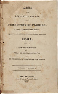
1831réf. 31652Tallahassee: Gibson & Smith 1831. Early Florida Laws Prints a list of the officers of the Territory of Florida acts and resolutions of the legislative council laws of the United States relative to the Territory and the text of the Treaty of Washington. Includes important early laws relating to Indian affairs transportation commercial development etc. Servies locates only one copy in Florida. Original half calf and boards printed label. Spine heavily chipped front board detached boards spotted and edgeworn. Front free endpaper excised pencil notation on p.3 contemporary ink signature illegible on p.5. Light scattered foxing. A good copy. SERVIES 1541. AII FLORIDA 132. GILCREASE p.335. hardcover books
2006réf. SONG0757527221Brand: Kendall Hunt Publishing 2006-05-15. 2. CD-ROM. Used: Good. 5.25x0.50x7.25. Buy with confidence. Excellent Customer Service & Return policy. Brand: Kendall Hunt Publishing unknown
2010réf. SONG0757565875Brand: Kendall Hunt Publishing 2010-01-13. 1. spiral_bound. Used: Good. 0.00x0.00x0.00. Buy with confidence. Excellent Customer Service & Return policy. Brand: Kendall Hunt Publishing unknown
1919réf. 40735Washington D.C.: Published by the United States Coast and Geodetic Survey 1919. Large folding nautical chart printed on heavy paper stock. Colored. A rare original coastal survey of Florida and Georgia from Sapelo Island to Amelia Island including St. Simons Island Sea Island Brunswick Jekyll Island Cumberland Island and Fernandina Beach. Established by President Thomas Jefferson in 1807 as the Survey of the Coast the U.S. Coast and Geodetic Survey was the United States' first civilian scientific agency. This agency has followed its mission to survey the U.S. coastline create nautical charts of the coast and help increase maritime safety since its founding and has often played fascinating roles in significant chapters of U.S. history. It served in all theaters of the Civil War in the service of the Union Army and Navy pioneered acoustic exploration in the wake of the sinking of the Titanic and during WWI it worked to detect enemy submarines. In addition this agency worked to survey and produce detailed maps and renderings of the U.S. coast. These nautical survey maps commonly referred to as "T-sheets" provide fascinating insights into the history of the United States coastline which has and will continue to shift. These maps are the most important data source for understanding the physical and ecological characteristics of the U.S. shoreline. The present map is a highly detailed and accurate sea chart of the coastal border between Georgia and Florida and an important historical view of the developing states. Published by the United States Coast and Geodetic Survey unknown
1919réf. 40735Washington D.C.: Published by the United States Coast and Geodetic Survey 1919. Large folding nautical chart printed on heavy paper stock. Colored. A rare original coastal survey of Florida and Georgia from Sapelo Island to Amelia Island including St. Simons Island Sea Island Brunswick Jekyll Island Cumberland Island and Fernandina Beach. Established by President Thomas Jefferson in 1807 as the Survey of the Coast the U.S. Coast and Geodetic Survey was the United States' first civilian scientific agency. This agency has followed its mission to survey the U.S. coastline create nautical charts of the coast and help increase maritime safety since its founding and has often played fascinating roles in significant chapters of U.S. history. It served in all theaters of the Civil War in the service of the Union Army and Navy pioneered acoustic exploration in the wake of the sinking of the Titanic and during WWI it worked to detect enemy submarines. In addition this agency worked to survey and produce detailed maps and renderings of the U.S. coast. These nautical survey maps commonly referred to as "T-sheets" provide fascinating insights into the history of the United States coastline which has and will continue to shift. These maps are the most important data source for understanding the physical and ecological characteristics of the U.S. shoreline. The present map is a highly detailed and accurate sea chart of the coastal border between Georgia and Florida and an important historical view of the developing states. Published by the United States Coast and Geodetic Survey unknown books
1919réf. 40687Washington D.C.: Published by the United States Coast and Geodetic Survey 1919. Nautical chart printed on heavy paper stock. Colored. A rare coastal survey of the Florida Georgia and South Carolina including Daytona Palm Coast St. Augustine Ponte Vedra Amelia Island Jacksonville Fernandina Jekyll Island St. Simons Sea Island Tybee Savannah Hilton Head Kiawah and Folly Beach. Established by President Thomas Jefferson in 1807 as the Survey of the Coast the U.S. Coast and Geodetic Survey was the United States' first civilian scientific agency. This agency has followed its mission to survey the U.S. coastline create nautical charts of the coast and help increase maritime safety since its founding and has often played fascinating roles in significant chapters of U.S. history. It served in all theaters of the Civil War in the service of the Union Army and Navy pioneered acoustic exploration in the wake of the sinking of the Titanic and during WWI it worked to detect enemy submarines. In addition this agency worked to survey and produce detailed maps and renderings of the U.S. coast. These nautical survey maps commonly referred to as "T-sheets" provide fascinating insights into the history of the United States coastline which has and will continue to shift. These maps are the most important data source for understanding the physical and ecological characteristics of the U.S. shoreline. The present map is a highly detailed and accurate sea chart of the coasts of Florida Georgia and Alabama and an important historical view of the developing states. Published by the United States Coast and Geodetic Survey unknown
1919réf. 40687Washington D.C.: Published by the United States Coast and Geodetic Survey 1919. Nautical chart printed on heavy paper stock. Colored. A rare coastal survey of the Florida Georgia and South Carolina including Daytona Palm Coast St. Augustine Ponte Vedra Amelia Island Jacksonville Fernandina Jekyll Island St. Simons Sea Island Tybee Savannah Hilton Head Kiawah and Folly Beach. Established by President Thomas Jefferson in 1807 as the Survey of the Coast the U.S. Coast and Geodetic Survey was the United States' first civilian scientific agency. This agency has followed its mission to survey the U.S. coastline create nautical charts of the coast and help increase maritime safety since its founding and has often played fascinating roles in significant chapters of U.S. history. It served in all theaters of the Civil War in the service of the Union Army and Navy pioneered acoustic exploration in the wake of the sinking of the Titanic and during WWI it worked to detect enemy submarines. In addition this agency worked to survey and produce detailed maps and renderings of the U.S. coast. These nautical survey maps commonly referred to as "T-sheets" provide fascinating insights into the history of the United States coastline which has and will continue to shift. These maps are the most important data source for understanding the physical and ecological characteristics of the U.S. shoreline. The present map is a highly detailed and accurate sea chart of the coasts of Florida Georgia and Alabama and an important historical view of the developing states. Published by the United States Coast and Geodetic Survey unknown books
1921réf. 40692Washington D.C.: Published by the United States Coast and Geodetic Survey 1921. Nautical chart printed on heavy paper stock. Colored. A rare coastal survey of the Florida Keys including Key Largo Islamorada Long Key Marathon Key and Everglades National Park. Established by President Thomas Jefferson in 1807 as the Survey of the Coast the U.S. Coast and Geodetic Survey was the United States' first civilian scientific agency. This agency has followed its mission to survey the U.S. coastline create nautical charts of the coast and help increase maritime safety since its founding and has often played fascinating roles in significant chapters of U.S. history. It served in all theaters of the Civil War in the service of the Union Army and Navy pioneered acoustic exploration in the wake of the sinking of the Titanic and during WWI it worked to detect enemy submarines. In addition this agency worked to survey and produce detailed maps and renderings of the U.S. coast. These nautical survey maps commonly referred to as "T-sheets" provide fascinating insights into the history of the United States coastline which has and will continue to shift. These maps are the most important data source for understanding the physical and ecological characteristics of the U.S. shoreline. The present map is a highly detailed and accurate sea chart of BLANK and an important historical view of a developing Florida. Published by the United States Coast and Geodetic Survey unknown
1921réf. 40692Washington D.C.: Published by the United States Coast and Geodetic Survey 1921. Nautical chart printed on heavy paper stock. Colored. A rare coastal survey of the Florida Keys including Key Largo Islamorada Long Key Marathon Key and Everglades National Park. Established by President Thomas Jefferson in 1807 as the Survey of the Coast the U.S. Coast and Geodetic Survey was the United States' first civilian scientific agency. This agency has followed its mission to survey the U.S. coastline create nautical charts of the coast and help increase maritime safety since its founding and has often played fascinating roles in significant chapters of U.S. history. It served in all theaters of the Civil War in the service of the Union Army and Navy pioneered acoustic exploration in the wake of the sinking of the Titanic and during WWI it worked to detect enemy submarines. In addition this agency worked to survey and produce detailed maps and renderings of the U.S. coast. These nautical survey maps commonly referred to as "T-sheets" provide fascinating insights into the history of the United States coastline which has and will continue to shift. These maps are the most important data source for understanding the physical and ecological characteristics of the U.S. shoreline. The present map is a highly detailed and accurate sea chart of BLANK and an important historical view of a developing Florida. Published by the United States Coast and Geodetic Survey unknown books
1917réf. 40708Washington D.C.: Published by the United States Coast and Geodetic Survey 1917. Large folding nautical chart printed on heavy paper stock. Colored with minor wear. A rare coastal survey of Florida from Port Canaveral to Vero Beach including Satellite Beach Melbourne and Palm Bay. Established by President Thomas Jefferson in 1807 as the Survey of the Coast the U.S. Coast and Geodetic Survey was the United States' first civilian scientific agency. This agency has followed its mission to survey the U.S. coastline create nautical charts of the coast and help increase maritime safety since its founding and has often played fascinating roles in significant chapters of U.S. history. It served in all theaters of the Civil War in the service of the Union Army and Navy pioneered acoustic exploration in the wake of the sinking of the Titanic and during WWI it worked to detect enemy submarines. In addition this agency worked to survey and produce detailed maps and renderings of the U.S. coast. These nautical survey maps commonly referred to as "T-sheets" provide fascinating insights into the history of the United States coastline which has and will continue to shift. These maps are the most important data source for understanding the physical and ecological characteristics of the U.S. shoreline. The present map is a highly detailed and accurate sea chart of the Florida coast and an important historical view of the developing state. Published by the United States Coast and Geodetic Survey unknown
1917réf. 40708Washington D.C.: Published by the United States Coast and Geodetic Survey 1917. Large folding nautical chart printed on heavy paper stock. Colored with minor wear. A rare coastal survey of Florida from Port Canaveral to Vero Beach including Satellite Beach Melbourne and Palm Bay. Established by President Thomas Jefferson in 1807 as the Survey of the Coast the U.S. Coast and Geodetic Survey was the United States' first civilian scientific agency. This agency has followed its mission to survey the U.S. coastline create nautical charts of the coast and help increase maritime safety since its founding and has often played fascinating roles in significant chapters of U.S. history. It served in all theaters of the Civil War in the service of the Union Army and Navy pioneered acoustic exploration in the wake of the sinking of the Titanic and during WWI it worked to detect enemy submarines. In addition this agency worked to survey and produce detailed maps and renderings of the U.S. coast. These nautical survey maps commonly referred to as "T-sheets" provide fascinating insights into the history of the United States coastline which has and will continue to shift. These maps are the most important data source for understanding the physical and ecological characteristics of the U.S. shoreline. The present map is a highly detailed and accurate sea chart of the Florida coast and an important historical view of the developing state. Published by the United States Coast and Geodetic Survey unknown books
1919réf. 40701Washington D.C.: Published by the United States Coast and Geodetic Survey 1919. Large folding nautical chart printed on heavy paper stock. Colored. A rare coastal survey around Jacksonville including Fernandina Beach Amelia Island Jacksonville Atlantic Beach Neptune Beach Jacksonville Beach Ponte Vedra and Sawgrass. Established by President Thomas Jefferson in 1807 as the Survey of the Coast the U.S. Coast and Geodetic Survey was the United States' first civilian scientific agency. This agency has followed its mission to survey the U.S. coastline create nautical charts of the coast and help increase maritime safety since its founding and has often played fascinating roles in significant chapters of U.S. history. It served in all theaters of the Civil War in the service of the Union Army and Navy pioneered acoustic exploration in the wake of the sinking of the Titanic and during WWI it worked to detect enemy submarines. In addition this agency worked to survey and produce detailed maps and renderings of the U.S. coast. These nautical survey maps commonly referred to as "T-sheets" provide fascinating insights into the history of the United States coastline which has and will continue to shift. These maps are the most important data source for understanding the physical and ecological characteristics of the U.S. shoreline. The present map is a highly detailed and accurate sea chart of the coast around Jacksonville and an important historical view of a developing Florida. Published by the United States Coast and Geodetic Survey unknown
1919réf. 40701Washington D.C.: Published by the United States Coast and Geodetic Survey 1919. Large folding nautical chart printed on heavy paper stock. Colored. A rare coastal survey around Jacksonville including Fernandina Beach Amelia Island Jacksonville Atlantic Beach Neptune Beach Jacksonville Beach Ponte Vedra and Sawgrass. Established by President Thomas Jefferson in 1807 as the Survey of the Coast the U.S. Coast and Geodetic Survey was the United States' first civilian scientific agency. This agency has followed its mission to survey the U.S. coastline create nautical charts of the coast and help increase maritime safety since its founding and has often played fascinating roles in significant chapters of U.S. history. It served in all theaters of the Civil War in the service of the Union Army and Navy pioneered acoustic exploration in the wake of the sinking of the Titanic and during WWI it worked to detect enemy submarines. In addition this agency worked to survey and produce detailed maps and renderings of the U.S. coast. These nautical survey maps commonly referred to as "T-sheets" provide fascinating insights into the history of the United States coastline which has and will continue to shift. These maps are the most important data source for understanding the physical and ecological characteristics of the U.S. shoreline. The present map is a highly detailed and accurate sea chart of the coast around Jacksonville and an important historical view of a developing Florida. Published by the United States Coast and Geodetic Survey unknown books
1919réf. 40690Washington D.C.: Published by the United States Coast and Geodetic Survey 1919. Nautical chart printed on heavy paper stock. Colored with minor wear. A rare coastal survey of Fort Lauderdale Hollywood Miami and Key Biscayne. Established by President Thomas Jefferson in 1807 as the Survey of the Coast the U.S. Coast and Geodetic Survey was the United States' first civilian scientific agency. This agency has followed its mission to survey the U.S. coastline create nautical charts of the coast and help increase maritime safety since its founding and has often played fascinating roles in significant chapters of U.S. history. It served in all theaters of the Civil War in the service of the Union Army and Navy pioneered acoustic exploration in the wake of the sinking of the Titanic and during WWI it worked to detect enemy submarines. In addition this agency worked to survey and produce detailed maps and renderings of the U.S. coast. These nautical survey maps commonly referred to as "T-sheets" provide fascinating insights into the history of the United States coastline which has and will continue to shift. These maps are the most important data source for understanding the physical and ecological characteristics of the U.S. shoreline. The present map is a highly detailed and accurate sea chart of the Miami area and an important historical view of a developing Florida. Published by the United States Coast and Geodetic Survey unknown
1919réf. 40690Washington D.C.: Published by the United States Coast and Geodetic Survey 1919. Nautical chart printed on heavy paper stock. Colored with minor wear. A rare coastal survey of Fort Lauderdale Hollywood Miami and Key Biscayne. Established by President Thomas Jefferson in 1807 as the Survey of the Coast the U.S. Coast and Geodetic Survey was the United States' first civilian scientific agency. This agency has followed its mission to survey the U.S. coastline create nautical charts of the coast and help increase maritime safety since its founding and has often played fascinating roles in significant chapters of U.S. history. It served in all theaters of the Civil War in the service of the Union Army and Navy pioneered acoustic exploration in the wake of the sinking of the Titanic and during WWI it worked to detect enemy submarines. In addition this agency worked to survey and produce detailed maps and renderings of the U.S. coast. These nautical survey maps commonly referred to as "T-sheets" provide fascinating insights into the history of the United States coastline which has and will continue to shift. These maps are the most important data source for understanding the physical and ecological characteristics of the U.S. shoreline. The present map is a highly detailed and accurate sea chart of the Miami area and an important historical view of a developing Florida. Published by the United States Coast and Geodetic Survey unknown books
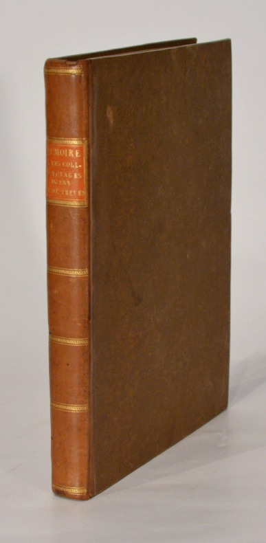
1802réf. 0041271802 Paris, Baudouin, 1802. In-quarto (208 X 261) demi-veau fauve, dos lisse, frise et deux filets dorés en place des nerfs, pièce de titre maroquin rouge, tranches jaspées (reliure de l'époque); (2) ff. blancs, (2) ff. de faux-titre et titre, III pages de table, 401 pages, (2) pages d'errata, (3) ff. blancs.
1919réf. 40705Washington D.C.: Published by the United States Coast and Geodetic Survey 1919. Large folding nautical chart printed on heavy paper stock. Colored. A rare coastal survey of the Florida Keys including Newfound Harbor Key Ramrod Key Summerland Key Cudjoe Key Sugarloaf Key Saddlebunch Keys and Big Coppitt Key. Established by President Thomas Jefferson in 1807 as the Survey of the Coast the U.S. Coast and Geodetic Survey was the United States' first civilian scientific agency. This agency has followed its mission to survey the U.S. coastline create nautical charts of the coast and help increase maritime safety since its founding and has often played fascinating roles in significant chapters of U.S. history. It served in all theaters of the Civil War in the service of the Union Army and Navy pioneered acoustic exploration in the wake of the sinking of the Titanic and during WWI it worked to detect enemy submarines. In addition this agency worked to survey and produce detailed maps and renderings of the U.S. coast. These nautical survey maps commonly referred to as "T-sheets" provide fascinating insights into the history of the United States coastline which has and will continue to shift. These maps are the most important data source for understanding the physical and ecological characteristics of the U.S. shoreline. The present map is a highly detailed and accurate sea chart of Florida Keys and an important historical view of a developing Florida. Published by the United States Coast and Geodetic Survey unknown
1919réf. 40705Washington D.C.: Published by the United States Coast and Geodetic Survey 1919. Large folding nautical chart printed on heavy paper stock. Colored. A rare coastal survey of the Florida Keys including Newfound Harbor Key Ramrod Key Summerland Key Cudjoe Key Sugarloaf Key Saddlebunch Keys and Big Coppitt Key. Established by President Thomas Jefferson in 1807 as the Survey of the Coast the U.S. Coast and Geodetic Survey was the United States' first civilian scientific agency. This agency has followed its mission to survey the U.S. coastline create nautical charts of the coast and help increase maritime safety since its founding and has often played fascinating roles in significant chapters of U.S. history. It served in all theaters of the Civil War in the service of the Union Army and Navy pioneered acoustic exploration in the wake of the sinking of the Titanic and during WWI it worked to detect enemy submarines. In addition this agency worked to survey and produce detailed maps and renderings of the U.S. coast. These nautical survey maps commonly referred to as "T-sheets" provide fascinating insights into the history of the United States coastline which has and will continue to shift. These maps are the most important data source for understanding the physical and ecological characteristics of the U.S. shoreline. The present map is a highly detailed and accurate sea chart of Florida Keys and an important historical view of a developing Florida. Published by the United States Coast and Geodetic Survey unknown books
1915réf. 40709Washington D.C.: Published by the United States Coast and Geodetic Survey 1915. Large folding nautical chart printed on heavy paper stock. Colored. Coastal survey map encompassing Tampa Bay up to Cape San Blas including St. Petersburg Tampa Clearwater St. George Island and Cedar Keys. Established by President Thomas Jefferson in 1807 as the Survey of the Coast the U.S. Coast and Geodetic Survey was the United States' first civilian scientific agency. This agency has followed its mission to survey the U.S. coastline create nautical charts of the coast and help increase maritime safety since its founding and has often played fascinating roles in significant chapters of U.S. history. It served in all theaters of the Civil War in the service of the Union Army and Navy pioneered acoustic exploration in the wake of the sinking of the Titanic and during WWI it worked to detect enemy submarines. In addition this agency worked to survey and produce detailed maps and renderings of the U.S. coast. These nautical survey maps commonly referred to as "T-sheets" provide fascinating insights into the history of the United States coastline which has and will continue to shift. These maps are the most important data source for understanding the physical and ecological characteristics of the U.S. shoreline. The present map is a highly detailed and accurate sea chart of the coast of Florida from Tampa Bay to Cape San Blas and is an important historical view of the developing state. Published by the United States Coast and Geodetic Survey unknown
1915réf. 40709Washington D.C.: Published by the United States Coast and Geodetic Survey 1915. Large folding nautical chart printed on heavy paper stock. Colored. Coastal survey map encompassing Tampa Bay up to Cape San Blas including St. Petersburg Tampa Clearwater St. George Island and Cedar Keys. Established by President Thomas Jefferson in 1807 as the Survey of the Coast the U.S. Coast and Geodetic Survey was the United States' first civilian scientific agency. This agency has followed its mission to survey the U.S. coastline create nautical charts of the coast and help increase maritime safety since its founding and has often played fascinating roles in significant chapters of U.S. history. It served in all theaters of the Civil War in the service of the Union Army and Navy pioneered acoustic exploration in the wake of the sinking of the Titanic and during WWI it worked to detect enemy submarines. In addition this agency worked to survey and produce detailed maps and renderings of the U.S. coast. These nautical survey maps commonly referred to as "T-sheets" provide fascinating insights into the history of the United States coastline which has and will continue to shift. These maps are the most important data source for understanding the physical and ecological characteristics of the U.S. shoreline. The present map is a highly detailed and accurate sea chart of the coast of Florida from Tampa Bay to Cape San Blas and is an important historical view of the developing state. Published by the United States Coast and Geodetic Survey unknown books
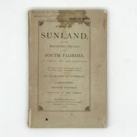
1882réf. 345842Braidentown Florida: Published by the author 1882. Second edition. Presentation copy inscribed by the author on the upper part of the front coverr. Frontispiece and illustrations. 83pp. 12mo. Original printed wrappers staining minor wear. Provenance: Thomas W. Streeter booklabel. Second edition. Presentation copy inscribed by the author on the upper part of the front coverr. Frontispiece and illustrations. 83pp. 12mo. "This is an early piece on the beginnings of settlement on the west coast of Florida below Tampa. The tract says that the railroad from Palatka on the St. John's River should be completed "within two years" and that "a narrow-gauge railroad from Tampa to the Manatee and thence to Sarasota Bay will soon follow" Streeter. The portrait is of "Madam Julia Atzeroth The Lady who raised the first coffee grown in the United States." Clark New South I:231; Streeter 1264 this copy Published by the author unknown
1882réf. 345842Braidentown Florida: Published by the author 1882. Second edition. Presentation copy inscribed by the author on the upper part of the front coverr. Frontispiece and illustrations. 83pp. 12mo. Original printed wrappers staining minor wear. Provenance: Thomas W. Streeter booklabel. Second edition. Presentation copy inscribed by the author on the upper part of the front coverr. Frontispiece and illustrations. 83pp. 12mo. "This is an early piece on the beginnings of settlement on the west coast of Florida below Tampa. The tract says that the railroad from Palatka on the St. John's River should be completed "within two years" and that "a narrow-gauge railroad from Tampa to the Manatee and thence to Sarasota Bay will soon follow" Streeter. The portrait is of "Madam Julia Atzeroth The Lady who raised the first coffee grown in the United States." Clark New South I:231; Streeter 1264 this copy Published by the author unknown books
1917réf. 40688Washington D.C.: Published by the United States Coast and Geodetic Survey 1917. Nautical chart printed on heavy paper stock. Colored. A rare coastal survey of the coast from Tampa to Venice including Sarasota Bradenton Longboat Key and Siesta Key. Established by President Thomas Jefferson in 1807 as the Survey of the Coast the U.S. Coast and Geodetic Survey was the United States' first civilian scientific agency. This agency has followed its mission to survey the U.S. coastline create nautical charts of the coast and help increase maritime safety since its founding and has often played fascinating roles in significant chapters of U.S. history. It served in all theaters of the Civil War in the service of the Union Army and Navy pioneered acoustic exploration in the wake of the sinking of the Titanic and during WWI it worked to detect enemy submarines. In addition this agency worked to survey and produce detailed maps and renderings of the U.S. coast. These nautical survey maps commonly referred to as "T-sheets" provide fascinating insights into the history of the United States coastline which has and will continue to shift. These maps are the most important data source for understanding the physical and ecological characteristics of the U.S. shoreline. The present map is a highly detailed and accurate sea chart of the coast south of Tampa and an important historical view of a developing Florida. Published by the United States Coast and Geodetic Survey unknown
1917réf. 40688Washington D.C.: Published by the United States Coast and Geodetic Survey 1917. Nautical chart printed on heavy paper stock. Colored. A rare coastal survey of the coast from Tampa to Venice including Sarasota Bradenton Longboat Key and Siesta Key. Established by President Thomas Jefferson in 1807 as the Survey of the Coast the U.S. Coast and Geodetic Survey was the United States' first civilian scientific agency. This agency has followed its mission to survey the U.S. coastline create nautical charts of the coast and help increase maritime safety since its founding and has often played fascinating roles in significant chapters of U.S. history. It served in all theaters of the Civil War in the service of the Union Army and Navy pioneered acoustic exploration in the wake of the sinking of the Titanic and during WWI it worked to detect enemy submarines. In addition this agency worked to survey and produce detailed maps and renderings of the U.S. coast. These nautical survey maps commonly referred to as "T-sheets" provide fascinating insights into the history of the United States coastline which has and will continue to shift. These maps are the most important data source for understanding the physical and ecological characteristics of the U.S. shoreline. The present map is a highly detailed and accurate sea chart of the coast south of Tampa and an important historical view of a developing Florida. Published by the United States Coast and Geodetic Survey unknown books
1916réf. 40722Washington D.C.: Published by the United States Coast and Geodetic Survey 1916. Large folding nautical chart printed on heavy paper stock. Uncolored. A rare original coastal survey of the central Florida coast around Cedar Keys. Established by President Thomas Jefferson in 1807 as the Survey of the Coast the U.S. Coast and Geodetic Survey was the United States' first civilian scientific agency. This agency has followed its mission to survey the U.S. coastline create nautical charts of the coast and help increase maritime safety since its founding and has often played fascinating roles in significant chapters of U.S. history. It served in all theaters of the Civil War in the service of the Union Army and Navy pioneered acoustic exploration in the wake of the sinking of the Titanic and during WWI it worked to detect enemy submarines. In addition this agency worked to survey and produce detailed maps and renderings of the U.S. coast. These nautical survey maps commonly referred to as "T-sheets" provide fascinating insights into the history of the United States coastline which has and will continue to shift. These maps are the most important data source for understanding the physical and ecological characteristics of the U.S. shoreline. The present map of the Florida coastline precedes the inclusion of Yankeetown; chartered in 1923 and the site of one of only two completed sections of the proposed Cross Florida Barge Canal. This map is a highly detailed and accurate sea chart of the central Florida coastal region and an important historical view of a developing Florida. Published by the United States Coast and Geodetic Survey unknown