[Florida]Biblio.com

2 599 résultats
1921réf. 40730Washington D.C.: Published by the United States Coast and Geodetic Survey 1921. Large folding nautical chart printed on heavy paper stock. Colored with minor wear. A rare original coastal survey of the south east Florida coastline from Biscayne Bay south of Miami to the northern tip of Islamorada including Key Largo Tavernier and Everglades National Park. Established by President Thomas Jefferson in 1807 as the Survey of the Coast the U.S. Coast and Geodetic Survey was the United States' first civilian scientific agency. This agency has followed its mission to survey the U.S. coastline create nautical charts of the coast and help increase maritime safety since its founding and has often played fascinating roles in significant chapters of U.S. history. It served in all theaters of the Civil War in the service of the Union Army and Navy pioneered acoustic exploration in the wake of the sinking of the Titanic and during WWI it worked to detect enemy submarines. In addition this agency worked to survey and produce detailed maps and renderings of the U.S. coast. These nautical survey maps commonly referred to as "T-sheets" provide fascinating insights into the history of the United States coastline which has and will continue to shift. These maps are the most important data source for understanding the physical and ecological characteristics of the U.S. shoreline. The present map of the Florida coastline shows part of the Overseas Railroad prior to its partial destruction and abandonment after a Hurricane in 1935. This map is a highly detailed and accurate sea chart of the Keys region and an important historical view of a developing Florida. Published by the United States Coast and Geodetic Survey unknown
1921réf. 40730Washington D.C.: Published by the United States Coast and Geodetic Survey 1921. Large folding nautical chart printed on heavy paper stock. Colored with minor wear. A rare original coastal survey of the south east Florida coastline from Biscayne Bay south of Miami to the northern tip of Islamorada including Key Largo Tavernier and Everglades National Park. Established by President Thomas Jefferson in 1807 as the Survey of the Coast the U.S. Coast and Geodetic Survey was the United States' first civilian scientific agency. This agency has followed its mission to survey the U.S. coastline create nautical charts of the coast and help increase maritime safety since its founding and has often played fascinating roles in significant chapters of U.S. history. It served in all theaters of the Civil War in the service of the Union Army and Navy pioneered acoustic exploration in the wake of the sinking of the Titanic and during WWI it worked to detect enemy submarines. In addition this agency worked to survey and produce detailed maps and renderings of the U.S. coast. These nautical survey maps commonly referred to as "T-sheets" provide fascinating insights into the history of the United States coastline which has and will continue to shift. These maps are the most important data source for understanding the physical and ecological characteristics of the U.S. shoreline. The present map of the Florida coastline shows part of the Overseas Railroad prior to its partial destruction and abandonment after a Hurricane in 1935. This map is a highly detailed and accurate sea chart of the Keys region and an important historical view of a developing Florida. Published by the United States Coast and Geodetic Survey unknown books
1916réf. 40724Washington D.C.: Published by the United States Coast and Geodetic Survey 1916. Large folding nautical chart printed on heavy paper stock. Colored. A rare original coastal survey of Florida from Tampa Bay to the Keys including Tampa St. Petersburg Sarasota Fort Myers Naples and of Northern Cuba including Havana. Established by President Thomas Jefferson in 1807 as the Survey of the Coast the U.S. Coast and Geodetic Survey was the United States' first civilian scientific agency. This agency has followed its mission to survey the U.S. coastline create nautical charts of the coast and help increase maritime safety since its founding and has often played fascinating roles in significant chapters of U.S. history. It served in all theaters of the Civil War in the service of the Union Army and Navy pioneered acoustic exploration in the wake of the sinking of the Titanic and during WWI it worked to detect enemy submarines. In addition this agency worked to survey and produce detailed maps and renderings of the U.S. coast. These nautical survey maps commonly referred to as "T-sheets" provide fascinating insights into the history of the United States coastline which has and will continue to shift. These maps are the most important data source for understanding the physical and ecological characteristics of the U.S. shoreline. The present map is a highly detailed and accurate sea chart of the Greater Florida Gulf region and an important historical view of a developing Florida. Published by the United States Coast and Geodetic Survey unknown
1916réf. 40724Washington D.C.: Published by the United States Coast and Geodetic Survey 1916. Large folding nautical chart printed on heavy paper stock. Colored. A rare original coastal survey of Florida from Tampa Bay to the Keys including Tampa St. Petersburg Sarasota Fort Myers Naples and of Northern Cuba including Havana. Established by President Thomas Jefferson in 1807 as the Survey of the Coast the U.S. Coast and Geodetic Survey was the United States' first civilian scientific agency. This agency has followed its mission to survey the U.S. coastline create nautical charts of the coast and help increase maritime safety since its founding and has often played fascinating roles in significant chapters of U.S. history. It served in all theaters of the Civil War in the service of the Union Army and Navy pioneered acoustic exploration in the wake of the sinking of the Titanic and during WWI it worked to detect enemy submarines. In addition this agency worked to survey and produce detailed maps and renderings of the U.S. coast. These nautical survey maps commonly referred to as "T-sheets" provide fascinating insights into the history of the United States coastline which has and will continue to shift. These maps are the most important data source for understanding the physical and ecological characteristics of the U.S. shoreline. The present map is a highly detailed and accurate sea chart of the Greater Florida Gulf region and an important historical view of a developing Florida. Published by the United States Coast and Geodetic Survey unknown books
réf. 709291 The Seven Symbols of the Klan cover title. Lake Wales FL: United Klans of America 1966. Unrecorded variant OCLC locates a 1966 edition published in Tuscaloosa: Northwestern Duke Wisconsin Historical Society; OCLC also locates three copies of the first edition published in the 1920s. 6-panel brochure folded to narrow 8vo. Multi-paragraph descriptions of The Bible Cross Flag Sword Water Robe and Hood. Illustrated from a photograph of Robert Shelton the Imperial Wizard. Original decorated self-wrapper. 2 Application for membership in the United Klans of America small partly printed document this copy unused. Lake Wales FL: John Paul Rogers ca. 1965. Small slip 3 5/8 x 4 7/8 inches with a marginal stamp "Sons of the Confederacy /West Palm Beach FL." 3 Chapter letterhead illustrated with a subdued gray portrait of Rober Shelton in Klan regalia. West Palm Beach FL: United Klans of America Unit No. 180 nd ca. 1965. 4to. Head and illustration enclosed within a fiery red border. Unused. 4 Special occasion card offering God's blessing for comfort and cheer. West Palm Beach FL: United Klans of Americam Unit #180 nd ca. 1965. 24mo bifolium cover illustrated in red and blue with a pair of candles The Bible and a red cross. 5 Klan visitation card color illustrated with robed Klan members before a fiery cross. Calling card 2 ¼ x 3 ½ inches. Lake Wales FL: United Klans of America nd ca. 1965. "You have been visited by a proud Klansman." 6 Elect / John Paul Rogers / Seat 49 / Florida House of / Representative / Democrat political card text recto. Polk County FL: Paulette Rogers nd ca. 1960s. Recto illustrated from a photo of the candidate printed both sides in red and blue; verso prints the candidate's stands on various issues. Rogers served as grand dragon of the Florida United Klans mid-1960s to 1982; he won a race for a seat on the Polk County Commission in 2008 but was defeated in a race for mayor of Lake Wales in 2013. Creased. 7 Certificate of service as a delegate to the 1976 National Klonvokation. Tuscaloosa AL: United Klans of America 1976. 4to one-page clerically signed by Robert Shelton as Imperial Wizard and Lewis Perkins as Imperial Kligrapp. Tear through Klan seal at bottom. 8 Certificate of service as a delegate to the 1977 National Klonvokation. Tuscaloosa AL: United Klans of America 1977. 4to one-page clerically signed by Robert Shelton as Imperial Wizard. Tear through Klan seal at bottom. 9 Oath of Allegiance caption title. Tuscaloosa AL: United Klans Knight of the Ku Klux Klan nd ca. 1965. 4to. 3-page copy of the typescript oath in four sections. Some manuscript corrections for a possible new edition. Later stapling. 10 Official Business / Quarterly Unit Report caption title. Tuscaloosa AL: United Klans of America nd ca. 1975. Folio. One-page unused questionnaire seeking information about an individual unit's activities 21 questions some multi-part with a section for personal comments. 11 Application for citizenship in the Klan Youth Corp. Tuscaloosa AL: United Klans of America nd ca. 1975. Half-sheet 4to a partly-printed unused document seeking information on the applicant's's church school and grade employment social activities etc. 12 Bumper Sticker Eternal Vigulance sic / Is the Price Liberty / United Klans of America / Knight of the Ku Klux Klan complete text. NP: np nd ca. 1965. Never used but quite rubbed. 13 Visitation peel-off card 1 3/8 x 3 inches. NP: np nd ca. 1975. "You have been visited by the / United Klans of America / Knights of the Ku Klux Klan / Now would you like a Real Visit" complete text. 14 Peel off label four copies still attached to their section of computer label paper. NP: np ca. 1965. "K K K / The only Reason you are / White to day / Is Because Your Ancestors / Believed & Practiced / SEGREGATION / Be a Man Goin six the Klan" complete text. 15 Visitation peel-off card 2 x 3 ½ inches. NP: np nd ca. 1965. "The / Ku Klux Klan / Is Watching / You!" complete text. 16 Visitation card 3 x 3 ½ inches. NP: np nd ca. 1965. "Since Eighteen Hundred Sixty-Six / THE KU KLUX KLAN / Has been riding and will / continue to do so as long as / the WHITE MAN lives" complete text. 17-18 Two peel-off cards both 1960s and printed in red one 2 x 3 ½ inches reading "White Only" the other a bumper sticker 3 x 15 inches reading "Bus the Judges." 19-21 Three ephemeral items dealing with the American flag one a 1960s peel-off bumper sticker 5 x 6 inches picturing the Confederate battle flag and reading "Vote America / Throw the rascals out" the second "Flags of the Confederacy" 1960s 4to one-page picturing four Confederate flags the "Stars and Bars" the "Battle Flag" The "Second Confederate Flag" and the "Last Confederate Flag" with two or three paragraphs of descriptive text for each and the third "Flags of the Confederacy"Montgomery AL & Verona NJ: Tumbling Waters Museum c1978; 24mo 6-panel folding brochure illustrated with five flags describing each with several paragraphs of text. 22-23 Two outrageously racist creations both 4to one-page no creative responsibility noted for either the first offering a shaded outline figure of a Black man to shoot at the second presenting a page full of stereotypically racist questions and insinuations masquerading as an employment application. OCLC locates one copy of the first Michigan State. 24 "Brevard; Next Little Rock" caption headline of a front page editorial in the Brevard Frontier Cocoa Beach FL Friday April 6 1962 Vol.I No. 11 this number only. Folio. 8 pp. The editorial covers the top half of the front page 10 paragraphs in three columns reminding Brevard County readers of the Federal intervention in Little Rock in 1957 "Demands from the NAACP and allied groups should be ignored; unthinking edicts from the federal government tending to force their racial solutions on us should at least be questioned" and solutions should come from "our political representatives on the local and state levels." This periodical apparently unrecorded on OCLC. For the lot of 24 items most at least uncommon unknown
réf. 709291 The Seven Symbols of the Klan cover title. Lake Wales FL: United Klans of America 1966. Unrecorded variant OCLC locates a 1966 edition published in Tuscaloosa: Northwestern Duke Wisconsin Historical Society; OCLC also locates three copies of the first edition published in the 1920s. 6-panel brochure folded to narrow 8vo. Multi-paragraph descriptions of The Bible Cross Flag Sword Water Robe and Hood. Illustrated from a photograph of Robert Shelton the Imperial Wizard. Original decorated self-wrapper. 2 Application for membership in the United Klans of America small partly printed document this copy unused. Lake Wales FL: John Paul Rogers ca. 1965. Small slip 3 5/8 x 4 7/8 inches with a marginal stamp "Sons of the Confederacy /West Palm Beach FL." 3 Chapter letterhead illustrated with a subdued gray portrait of Rober Shelton in Klan regalia. West Palm Beach FL: United Klans of America Unit No. 180 nd ca. 1965. 4to. Head and illustration enclosed within a fiery red border. Unused. 4 Special occasion card offering God's blessing for comfort and cheer. West Palm Beach FL: United Klans of Americam Unit #180 nd ca. 1965. 24mo bifolium cover illustrated in red and blue with a pair of candles The Bible and a red cross. 5 Klan visitation card color illustrated with robed Klan members before a fiery cross. Calling card 2 ¼ x 3 ½ inches. Lake Wales FL: United Klans of America nd ca. 1965. "You have been visited by a proud Klansman." 6 Elect / John Paul Rogers / Seat 49 / Florida House of / Representative / Democrat political card text recto. Polk County FL: Paulette Rogers nd ca. 1960s. Recto illustrated from a photo of the candidate printed both sides in red and blue; verso prints the candidate's stands on various issues. Rogers served as grand dragon of the Florida United Klans mid-1960s to 1982; he won a race for a seat on the Polk County Commission in 2008 but was defeated in a race for mayor of Lake Wales in 2013. Creased. 7 Certificate of service as a delegate to the 1976 National Klonvokation. Tuscaloosa AL: United Klans of America 1976. 4to one-page clerically signed by Robert Shelton as Imperial Wizard and Lewis Perkins as Imperial Kligrapp. Tear through Klan seal at bottom. 8 Certificate of service as a delegate to the 1977 National Klonvokation. Tuscaloosa AL: United Klans of America 1977. 4to one-page clerically signed by Robert Shelton as Imperial Wizard. Tear through Klan seal at bottom. 9 Oath of Allegiance caption title. Tuscaloosa AL: United Klans Knight of the Ku Klux Klan nd ca. 1965. 4to. 3-page copy of the typescript oath in four sections. Some manuscript corrections for a possible new edition. Later stapling. 10 Official Business / Quarterly Unit Report caption title. Tuscaloosa AL: United Klans of America nd ca. 1975. Folio. One-page unused questionnaire seeking information about an individual unit's activities 21 questions some multi-part with a section for personal comments. 11 Application for citizenship in the Klan Youth Corp. Tuscaloosa AL: United Klans of America nd ca. 1975. Half-sheet 4to a partly-printed unused document seeking information on the applicant's's church school and grade employment social activities etc. 12 Bumper Sticker Eternal Vigulance sic / Is the Price Liberty / United Klans of America / Knight of the Ku Klux Klan complete text. NP: np nd ca. 1965. Never used but quite rubbed. 13 Visitation peel-off card 1 3/8 x 3 inches. NP: np nd ca. 1975. "You have been visited by the / United Klans of America / Knights of the Ku Klux Klan / Now would you like a Real Visit" complete text. 14 Peel off label four copies still attached to their section of computer label paper. NP: np ca. 1965. "K K K / The only Reason you are / White to day / Is Because Your Ancestors / Believed & Practiced / SEGREGATION / Be a Man Goin six the Klan" complete text. 15 Visitation peel-off card 2 x 3 ½ inches. NP: np nd ca. 1965. "The / Ku Klux Klan / Is Watching / You!" complete text. 16 Visitation card 3 x 3 ½ inches. NP: np nd ca. 1965. "Since Eighteen Hundred Sixty-Six / THE KU KLUX KLAN / Has been riding and will / continue to do so as long as / the WHITE MAN lives" complete text. 17-18 Two peel-off cards both 1960s and printed in red one 2 x 3 ½ inches reading "White Only" the other a bumper sticker 3 x 15 inches reading "Bus the Judges." 19-21 Three ephemeral items dealing with the American flag one a 1960s peel-off bumper sticker 5 x 6 inches picturing the Confederate battle flag and reading "Vote America / Throw the rascals out" the second "Flags of the Confederacy" 1960s 4to one-page picturing four Confederate flags the "Stars and Bars" the "Battle Flag" The "Second Confederate Flag" and the "Last Confederate Flag" with two or three paragraphs of descriptive text for each and the third "Flags of the Confederacy"Montgomery AL & Verona NJ: Tumbling Waters Museum c1978; 24mo 6-panel folding brochure illustrated with five flags describing each with several paragraphs of text. 22-23 Two outrageously racist creations both 4to one-page no creative responsibility noted for either the first offering a shaded outline figure of a Black man to shoot at the second presenting a page full of stereotypically racist questions and insinuations masquerading as an employment application. OCLC locates one copy of the first Michigan State. 24 "Brevard; Next Little Rock" caption headline of a front page editorial in the Brevard Frontier Cocoa Beach FL Friday April 6 1962 Vol.I No. 11 this number only. Folio. 8 pp. The editorial covers the top half of the front page 10 paragraphs in three columns reminding Brevard County readers of the Federal intervention in Little Rock in 1957 "Demands from the NAACP and allied groups should be ignored; unthinking edicts from the federal government tending to force their racial solutions on us should at least be questioned" and solutions should come from "our political representatives on the local and state levels." This periodical apparently unrecorded on OCLC. For the lot of 24 items most at least uncommon unknown books
1996réf. __311013215XDe Gruyter 1996. Hardcover. New. 3954 pages. 10.25x7.25x9.00 inches. De Gruyter hardcover
1921réf. 40685Washington D.C.: Published by the United States Coast and Geodetic Survey 1921. Nautical chart printed on heavy paper stock. Colored. A rare coastal survey of Florida from Fernandina to Jacksonville including Amelia Island Atlantic Beach Neptune Beach and the St. Johns River. Established by President Thomas Jefferson in 1807 as the Survey of the Coast the U.S. Coast and Geodetic Survey was the United States' first civilian scientific agency. This agency has followed its mission to survey the U.S. coastline create nautical charts of the coast and help increase maritime safety since its founding and has often played fascinating roles in significant chapters of U.S. history. It served in all theaters of the Civil War in the service of the Union Army and Navy pioneered acoustic exploration in the wake of the sinking of the Titanic and during WWI it worked to detect enemy submarines. In addition this agency worked to survey and produce detailed maps and renderings of the U.S. coast. These nautical survey maps commonly referred to as "T-sheets" provide fascinating insights into the history of the United States coastline which has and will continue to shift. These maps are the most important data source for understanding the physical and ecological characteristics of the U.S. shoreline. The present map is a highly detailed and accurate sea chart of the Florida coast from Fernandina to Jacksonville and is an important historical view of the state. Published by the United States Coast and Geodetic Survey unknown
1921réf. 40696Washington D.C.: Published by the United States Coast and Geodetic Survey 1921. Large folding nautical chart printed on heavy paper stock. Colored. A rare coastal survey of Florida from Fernandina to Jacksonville including Amelia Island Atlantic Beach Neptune Beach and the St. Johns River. Established by President Thomas Jefferson in 1807 as the Survey of the Coast the U.S. Coast and Geodetic Survey was the United States' first civilian scientific agency. This agency has followed its mission to survey the U.S. coastline create nautical charts of the coast and help increase maritime safety since its founding and has often played fascinating roles in significant chapters of U.S. history. It served in all theaters of the Civil War in the service of the Union Army and Navy pioneered acoustic exploration in the wake of the sinking of the Titanic and during WWI it worked to detect enemy submarines. In addition this agency worked to survey and produce detailed maps and renderings of the U.S. coast. These nautical survey maps commonly referred to as "T-sheets" provide fascinating insights into the history of the United States coastline which has and will continue to shift. These maps are the most important data source for understanding the physical and ecological characteristics of the U.S. shoreline. The present map is a highly detailed and accurate sea chart of Florida from Fernandina to Jacksonville and an important historical view of the developing state. Published by the United States Coast and Geodetic Survey unknown
1921réf. 40685Washington D.C.: Published by the United States Coast and Geodetic Survey 1921. Nautical chart printed on heavy paper stock. Colored. A rare coastal survey of Florida from Fernandina to Jacksonville including Amelia Island Atlantic Beach Neptune Beach and the St. Johns River. Established by President Thomas Jefferson in 1807 as the Survey of the Coast the U.S. Coast and Geodetic Survey was the United States' first civilian scientific agency. This agency has followed its mission to survey the U.S. coastline create nautical charts of the coast and help increase maritime safety since its founding and has often played fascinating roles in significant chapters of U.S. history. It served in all theaters of the Civil War in the service of the Union Army and Navy pioneered acoustic exploration in the wake of the sinking of the Titanic and during WWI it worked to detect enemy submarines. In addition this agency worked to survey and produce detailed maps and renderings of the U.S. coast. These nautical survey maps commonly referred to as "T-sheets" provide fascinating insights into the history of the United States coastline which has and will continue to shift. These maps are the most important data source for understanding the physical and ecological characteristics of the U.S. shoreline. The present map is a highly detailed and accurate sea chart of the Florida coast from Fernandina to Jacksonville and is an important historical view of the state. Published by the United States Coast and Geodetic Survey unknown books
1921réf. 40696Washington D.C.: Published by the United States Coast and Geodetic Survey 1921. Large folding nautical chart printed on heavy paper stock. Colored. A rare coastal survey of Florida from Fernandina to Jacksonville including Amelia Island Atlantic Beach Neptune Beach and the St. Johns River. Established by President Thomas Jefferson in 1807 as the Survey of the Coast the U.S. Coast and Geodetic Survey was the United States' first civilian scientific agency. This agency has followed its mission to survey the U.S. coastline create nautical charts of the coast and help increase maritime safety since its founding and has often played fascinating roles in significant chapters of U.S. history. It served in all theaters of the Civil War in the service of the Union Army and Navy pioneered acoustic exploration in the wake of the sinking of the Titanic and during WWI it worked to detect enemy submarines. In addition this agency worked to survey and produce detailed maps and renderings of the U.S. coast. These nautical survey maps commonly referred to as "T-sheets" provide fascinating insights into the history of the United States coastline which has and will continue to shift. These maps are the most important data source for understanding the physical and ecological characteristics of the U.S. shoreline. The present map is a highly detailed and accurate sea chart of Florida from Fernandina to Jacksonville and an important historical view of the developing state. Published by the United States Coast and Geodetic Survey unknown books
1921réf. 40700Washington D.C.: Published by the United States Coast and Geodetic Survey 1921. Large folding nautical chart printed on heavy paper stock. Colored. A rare coastal survey of Pensacola Bay including Perdido Key Pensacola and Pensacola Beach. Established by President Thomas Jefferson in 1807 as the Survey of the Coast the U.S. Coast and Geodetic Survey was the United States' first civilian scientific agency. This agency has followed its mission to survey the U.S. coastline create nautical charts of the coast and help increase maritime safety since its founding and has often played fascinating roles in significant chapters of U.S. history. It served in all theaters of the Civil War in the service of the Union Army and Navy pioneered acoustic exploration in the wake of the sinking of the Titanic and during WWI it worked to detect enemy submarines. In addition this agency worked to survey and produce detailed maps and renderings of the U.S. coast. These nautical survey maps commonly referred to as "T-sheets" provide fascinating insights into the history of the United States coastline which has and will continue to shift. These maps are the most important data source for understanding the physical and ecological characteristics of the U.S. shoreline. The present map is a highly detailed and accurate sea chart of Pensacola Bay and an important historical view of a developing Florida. Published by the United States Coast and Geodetic Survey unknown
1922réf. 40699Washington D.C.: Published by the United States Coast and Geodetic Survey 1922. Large folding nautical chart printed on heavy paper stock. Colored. A rare coastal survey of Florida and Alabama around Pensacola Bay including Orange Beach Perdido Key Pensacola Pensacola Beach and Santa Rosa Island. Established by President Thomas Jefferson in 1807 as the Survey of the Coast the U.S. Coast and Geodetic Survey was the United States' first civilian scientific agency. This agency has followed its mission to survey the U.S. coastline create nautical charts of the coast and help increase maritime safety since its founding and has often played fascinating roles in significant chapters of U.S. history. It served in all theaters of the Civil War in the service of the Union Army and Navy pioneered acoustic exploration in the wake of the sinking of the Titanic and during WWI it worked to detect enemy submarines. In addition this agency worked to survey and produce detailed maps and renderings of the U.S. coast. These nautical survey maps commonly referred to as "T-sheets" provide fascinating insights into the history of the United States coastline which has and will continue to shift. These maps are the most important data source for understanding the physical and ecological characteristics of the U.S. shoreline. The present map is a highly detailed and accurate sea chart of the Pensacola area and an important historical view of a developing Florida. Published by the United States Coast and Geodetic Survey unknown
1921réf. 40700Washington D.C.: Published by the United States Coast and Geodetic Survey 1921. Large folding nautical chart printed on heavy paper stock. Colored. A rare coastal survey of Pensacola Bay including Perdido Key Pensacola and Pensacola Beach. Established by President Thomas Jefferson in 1807 as the Survey of the Coast the U.S. Coast and Geodetic Survey was the United States' first civilian scientific agency. This agency has followed its mission to survey the U.S. coastline create nautical charts of the coast and help increase maritime safety since its founding and has often played fascinating roles in significant chapters of U.S. history. It served in all theaters of the Civil War in the service of the Union Army and Navy pioneered acoustic exploration in the wake of the sinking of the Titanic and during WWI it worked to detect enemy submarines. In addition this agency worked to survey and produce detailed maps and renderings of the U.S. coast. These nautical survey maps commonly referred to as "T-sheets" provide fascinating insights into the history of the United States coastline which has and will continue to shift. These maps are the most important data source for understanding the physical and ecological characteristics of the U.S. shoreline. The present map is a highly detailed and accurate sea chart of Pensacola Bay and an important historical view of a developing Florida. Published by the United States Coast and Geodetic Survey unknown books
1922réf. 40699Washington D.C.: Published by the United States Coast and Geodetic Survey 1922. Large folding nautical chart printed on heavy paper stock. Colored. A rare coastal survey of Florida and Alabama around Pensacola Bay including Orange Beach Perdido Key Pensacola Pensacola Beach and Santa Rosa Island. Established by President Thomas Jefferson in 1807 as the Survey of the Coast the U.S. Coast and Geodetic Survey was the United States' first civilian scientific agency. This agency has followed its mission to survey the U.S. coastline create nautical charts of the coast and help increase maritime safety since its founding and has often played fascinating roles in significant chapters of U.S. history. It served in all theaters of the Civil War in the service of the Union Army and Navy pioneered acoustic exploration in the wake of the sinking of the Titanic and during WWI it worked to detect enemy submarines. In addition this agency worked to survey and produce detailed maps and renderings of the U.S. coast. These nautical survey maps commonly referred to as "T-sheets" provide fascinating insights into the history of the United States coastline which has and will continue to shift. These maps are the most important data source for understanding the physical and ecological characteristics of the U.S. shoreline. The present map is a highly detailed and accurate sea chart of the Pensacola area and an important historical view of a developing Florida. Published by the United States Coast and Geodetic Survey unknown books
1916réf. 40695Washington D.C.: Published by the United States Coast and Geodetic Survey 1916. Large folding nautical chart printed on heavy paper stock. Uncolored. A rare coastal survey of the Fort Myers area including the San Carlos Bay Caloosahatchee River Cape Coral Sanibel Island and Fort Myers Beach. Established by President Thomas Jefferson in 1807 as the Survey of the Coast the U.S. Coast and Geodetic Survey was the United States' first civilian scientific agency. This agency has followed its mission to survey the U.S. coastline create nautical charts of the coast and help increase maritime safety since its founding and has often played fascinating roles in significant chapters of U.S. history. It served in all theaters of the Civil War in the service of the Union Army and Navy pioneered acoustic exploration in the wake of the sinking of the Titanic and during WWI it worked to detect enemy submarines. In addition this agency worked to survey and produce detailed maps and renderings of the U.S. coast. These nautical survey maps commonly referred to as "T-sheets" provide fascinating insights into the history of the United States coastline which has and will continue to shift. These maps are the most important data source for understanding the physical and ecological characteristics of the U.S. shoreline. The present map is a highly detailed and accurate sea chart of Fort Myers area and an important historical view of a developing Florida. Published by the United States Coast and Geodetic Survey unknown
1916réf. 40695Washington D.C.: Published by the United States Coast and Geodetic Survey 1916. Large folding nautical chart printed on heavy paper stock. Uncolored. A rare coastal survey of the Fort Myers area including the San Carlos Bay Caloosahatchee River Cape Coral Sanibel Island and Fort Myers Beach. Established by President Thomas Jefferson in 1807 as the Survey of the Coast the U.S. Coast and Geodetic Survey was the United States' first civilian scientific agency. This agency has followed its mission to survey the U.S. coastline create nautical charts of the coast and help increase maritime safety since its founding and has often played fascinating roles in significant chapters of U.S. history. It served in all theaters of the Civil War in the service of the Union Army and Navy pioneered acoustic exploration in the wake of the sinking of the Titanic and during WWI it worked to detect enemy submarines. In addition this agency worked to survey and produce detailed maps and renderings of the U.S. coast. These nautical survey maps commonly referred to as "T-sheets" provide fascinating insights into the history of the United States coastline which has and will continue to shift. These maps are the most important data source for understanding the physical and ecological characteristics of the U.S. shoreline. The present map is a highly detailed and accurate sea chart of Fort Myers area and an important historical view of a developing Florida. Published by the United States Coast and Geodetic Survey unknown books
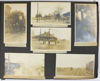
1909réf. 5288Various locations mostly in Cuba and Florida: March 5 to April 1 1909. About very good. 21 leaves illustrated with 235 photographs all with typed captions. Oblong folio. Contemporary full dark brown cloth brad bound. Moderate staining and coiling to covers some edge wear. Bottom corners of all leaves chipped not costing content. Occasional minor wear to photos or captions. A well-organized and meticulously-captioned vernacular photograph album with significant content on Florida and Cuba in the first decade of the 20th century. The album is organized chronologically and features a family from Ohio traveling from home by train to Florida and thence to Cuba then returning home in the spring of 1909. The first seven and the last twenty-five photographs emanate from Ohio where the journey started Tennessee and Georgia but otherwise the album features Florida and Cuba in over 200 pictures. The scenes in Florida range from Jacksonville to Key West and other points in-between featuring the state in almost 120 photos both before and after the traveling party went to Cuba. The images capture portraits of the travelers numerous homes hotels businesses and other buildings including an ostrich farm in Jacksonville numerous scenes in Ocala including one image featuring "Mary and her old colored Mammy" various churches and other scenes in Tampa residences in Key West beach scenes at Long Key various hotels and agricultural fields in Miami and various buildings in Palm Beach Ormand and St. Augustine concluding with a front view of the "Old Slave Market" in the latter city. Most notably the album includes eighty-six photographs of Cuba the nexus point for the present trip where the party arrived on March 20. The Cuba scenes mostly feature Havana with several views of "Beautiful Residences" and other buildings plus some street views and other scenes in the city. Other interesting Havana scenes picture the railroad station "The Bone Yard -- Old destroyed Catacombs" scenes in the Malecon and more. Some of the street scenes in Havana picture local residents one of "Children on the street corner" and another showing "Children scrambling for pennies" in the middle of the street. The album also contains views of the wreck of the Maine Morro Castle the interior of Fort Cabanas and more. The travelers managed to wander outside Havana for a day when they ventured to the countryside and the town of Guines on March 23. While there the compiler took photographs of countryside outside Guines a railroad car full of sugar cane thatched houses a group photograph of the students at a "Spanish School in Guines" a "Child crying in the street" a group of locals outside a cafe captioned "Strangers in a strange land.Where we tried to get something to eat" other street scenes in the town and the local jail. The last photograph of Cuba here features a "Large Sugar Mill in Providencia." The group then returned through Florida Georgia and Tennessee where they spent a day at Lookout Mountain and Orchard Knob before their final stop in Dayton Ohio. A wonderful early-20th century travel album with significant views in Florida and Cuba. March 5 to April 1 unknown
1909réf. 5288Various locations mostly in Cuba and Florida: March 5 to April 1 1909. About very good. 21 leaves illustrated with 235 photographs all with typed captions. Oblong folio. Contemporary full dark brown cloth brad bound. Moderate staining and coiling to covers some edge wear. Bottom corners of all leaves chipped not costing content. Occasional minor wear to photos or captions. A well-organized and meticulously-captioned vernacular photograph album with significant content on Florida and Cuba in the first decade of the 20th century. The album is organized chronologically and features a family from Ohio traveling from home by train to Florida and thence to Cuba then returning home in the spring of 1909. The first seven and the last twenty-five photographs emanate from Ohio where the journey started Tennessee and Georgia but otherwise the album features Florida and Cuba in over 200 pictures. The scenes in Florida range from Jacksonville to Key West and other points in-between featuring the state in almost 120 photos both before and after the traveling party went to Cuba. The images capture portraits of the travelers numerous homes hotels businesses and other buildings including an ostrich farm in Jacksonville numerous scenes in Ocala including one image featuring "Mary and her old colored Mammy" various churches and other scenes in Tampa residences in Key West beach scenes at Long Key various hotels and agricultural fields in Miami and various buildings in Palm Beach Ormand and St. Augustine concluding with a front view of the "Old Slave Market" in the latter city. Most notably the album includes eighty-six photographs of Cuba the nexus point for the present trip where the party arrived on March 20. The Cuba scenes mostly feature Havana with several views of "Beautiful Residences" and other buildings plus some street views and other scenes in the city. Other interesting Havana scenes picture the railroad station "The Bone Yard -- Old destroyed Catacombs" scenes in the Malecon and more. Some of the street scenes in Havana picture local residents one of "Children on the street corner" and another showing "Children scrambling for pennies" in the middle of the street. The album also contains views of the wreck of the Maine Morro Castle the interior of Fort Cabanas and more. The travelers managed to wander outside Havana for a day when they ventured to the countryside and the town of Guines on March 23. While there the compiler took photographs of countryside outside Guines a railroad car full of sugar cane thatched houses a group photograph of the students at a "Spanish School in Guines" a "Child crying in the street" a group of locals outside a cafe captioned "Strangers in a strange land.Where we tried to get something to eat" other street scenes in the town and the local jail. The last photograph of Cuba here features a "Large Sugar Mill in Providencia." The group then returned through Florida Georgia and Tennessee where they spent a day at Lookout Mountain and Orchard Knob before their final stop in Dayton Ohio. A wonderful early-20th century travel album with significant views in Florida and Cuba. March 5 to April 1 unknown books
1921réf. 40729Washington D.C.: Published by the United States Coast and Geodetic Survey 1921. Large folding nautical chart printed on heavy paper stock. Colored. A rare original coastal survey of the Northern Gulf coast from Florida to Louisiana encompassing Panama City Rosemary Beach Seaside Grayton Destin Pensacola Gulf Shores Mobile Gulfport and the Mississippi Delta. Established by President Thomas Jefferson in 1807 as the Survey of the Coast the U.S. Coast and Geodetic Survey was the United States' first civilian scientific agency. This agency has followed its mission to survey the U.S. coastline create nautical charts of the coast and help increase maritime safety since its founding and has often played fascinating roles in significant chapters of U.S. history. It served in all theaters of the Civil War in the service of the Union Army and Navy pioneered acoustic exploration in the wake of the sinking of the Titanic and during WWI it worked to detect enemy submarines. In addition this agency worked to survey and produce detailed maps and renderings of the U.S. coast. These nautical survey maps commonly referred to as "T-sheets" provide fascinating insights into the history of the United States coastline which has and will continue to shift. These maps are the most important data source for understanding the physical and ecological characteristics of the U.S. shoreline. The present map is a highly detailed and accurate sea chart of the Gulf coasts of Florida Alabama Mississippi and Louisiana and an important historical view of the developing states. Published by the United States Coast and Geodetic Survey unknown
1921réf. 40729Washington D.C.: Published by the United States Coast and Geodetic Survey 1921. Large folding nautical chart printed on heavy paper stock. Colored. A rare original coastal survey of the Northern Gulf coast from Florida to Louisiana encompassing Panama City Rosemary Beach Seaside Grayton Destin Pensacola Gulf Shores Mobile Gulfport and the Mississippi Delta. Established by President Thomas Jefferson in 1807 as the Survey of the Coast the U.S. Coast and Geodetic Survey was the United States' first civilian scientific agency. This agency has followed its mission to survey the U.S. coastline create nautical charts of the coast and help increase maritime safety since its founding and has often played fascinating roles in significant chapters of U.S. history. It served in all theaters of the Civil War in the service of the Union Army and Navy pioneered acoustic exploration in the wake of the sinking of the Titanic and during WWI it worked to detect enemy submarines. In addition this agency worked to survey and produce detailed maps and renderings of the U.S. coast. These nautical survey maps commonly referred to as "T-sheets" provide fascinating insights into the history of the United States coastline which has and will continue to shift. These maps are the most important data source for understanding the physical and ecological characteristics of the U.S. shoreline. The present map is a highly detailed and accurate sea chart of the Gulf coasts of Florida Alabama Mississippi and Louisiana and an important historical view of the developing states. Published by the United States Coast and Geodetic Survey unknown books
1922réf. 40698Washington D.C.: Published by the United States Coast and Geodetic Survey 1922. Large folding nautical chart printed on heavy paper stock. Colored with minor wear. A rare coastal survey of the Florida coast from Fort Walton Beach to Panama City Beach including Destin Grayton Beach Seaside Alys Beach Rosemary Beach and Laguna Beach. Established by President Thomas Jefferson in 1807 as the Survey of the Coast the U.S. Coast and Geodetic Survey was the United States' first civilian scientific agency. This agency has followed its mission to survey the U.S. coastline create nautical charts of the coast and help increase maritime safety since its founding and has often played fascinating roles in significant chapters of U.S. history. It served in all theaters of the Civil War in the service of the Union Army and Navy pioneered acoustic exploration in the wake of the sinking of the Titanic and during WWI it worked to detect enemy submarines. In addition this agency worked to survey and produce detailed maps and renderings of the U.S. coast. These nautical survey maps commonly referred to as "T-sheets" provide fascinating insights into the history of the United States coastline which has and will continue to shift. These maps are the most important data source for understanding the physical and ecological characteristics of the U.S. shoreline. The present map is a highly detailed and accurate sea chart of 30A area in Florida and an important historical view of the developing state. Published by the United States Coast and Geodetic Survey unknown
1922réf. 40698Washington D.C.: Published by the United States Coast and Geodetic Survey 1922. Large folding nautical chart printed on heavy paper stock. Colored with minor wear. A rare coastal survey of the Florida coast from Fort Walton Beach to Panama City Beach including Destin Grayton Beach Seaside Alys Beach Rosemary Beach and Laguna Beach. Established by President Thomas Jefferson in 1807 as the Survey of the Coast the U.S. Coast and Geodetic Survey was the United States' first civilian scientific agency. This agency has followed its mission to survey the U.S. coastline create nautical charts of the coast and help increase maritime safety since its founding and has often played fascinating roles in significant chapters of U.S. history. It served in all theaters of the Civil War in the service of the Union Army and Navy pioneered acoustic exploration in the wake of the sinking of the Titanic and during WWI it worked to detect enemy submarines. In addition this agency worked to survey and produce detailed maps and renderings of the U.S. coast. These nautical survey maps commonly referred to as "T-sheets" provide fascinating insights into the history of the United States coastline which has and will continue to shift. These maps are the most important data source for understanding the physical and ecological characteristics of the U.S. shoreline. The present map is a highly detailed and accurate sea chart of 30A area in Florida and an important historical view of the developing state. Published by the United States Coast and Geodetic Survey unknown books
1916réf. 40706Washington D.C.: Published by the United States Coast and Geodetic Survey 1916. Large folding nautical chart printed on heavy paper stock. Colored. A rare coastal survey of Tampa Bay including Tampa St. Petersburg Clearwater Anna Maria Island and Bradenton. Established by President Thomas Jefferson in 1807 as the Survey of the Coast the U.S. Coast and Geodetic Survey was the United States' first civilian scientific agency. This agency has followed its mission to survey the U.S. coastline create nautical charts of the coast and help increase maritime safety since its founding and has often played fascinating roles in significant chapters of U.S. history. It served in all theaters of the Civil War in the service of the Union Army and Navy pioneered acoustic exploration in the wake of the sinking of the Titanic and during WWI it worked to detect enemy submarines. In addition this agency worked to survey and produce detailed maps and renderings of the U.S. coast. These nautical survey maps commonly referred to as "T-sheets" provide fascinating insights into the history of the United States coastline which has and will continue to shift. These maps are the most important data source for understanding the physical and ecological characteristics of the U.S. shoreline. The present map is a highly detailed and accurate sea chart of Tampa Bay and an important historical view of a developing Florida. Published by the United States Coast and Geodetic Survey unknown
1916réf. 40706Washington D.C.: Published by the United States Coast and Geodetic Survey 1916. Large folding nautical chart printed on heavy paper stock. Colored. A rare coastal survey of Tampa Bay including Tampa St. Petersburg Clearwater Anna Maria Island and Bradenton. Established by President Thomas Jefferson in 1807 as the Survey of the Coast the U.S. Coast and Geodetic Survey was the United States' first civilian scientific agency. This agency has followed its mission to survey the U.S. coastline create nautical charts of the coast and help increase maritime safety since its founding and has often played fascinating roles in significant chapters of U.S. history. It served in all theaters of the Civil War in the service of the Union Army and Navy pioneered acoustic exploration in the wake of the sinking of the Titanic and during WWI it worked to detect enemy submarines. In addition this agency worked to survey and produce detailed maps and renderings of the U.S. coast. These nautical survey maps commonly referred to as "T-sheets" provide fascinating insights into the history of the United States coastline which has and will continue to shift. These maps are the most important data source for understanding the physical and ecological characteristics of the U.S. shoreline. The present map is a highly detailed and accurate sea chart of Tampa Bay and an important historical view of a developing Florida. Published by the United States Coast and Geodetic Survey unknown books