7 684 résultats
1860réf. WRCAM41089BWashington 1860. Twelve volumes bound in thirteen. Profusely illustrated with maps lithographic plates colored lithographic plates profiles etc. Large thick quarto. Original blindstamped cloth spines gilt. Minor edge wear. Each volume rebacked retaining original backstrip but with new endpapers. All but one volume from the Senate issue Vol. XII Part 1 is the House issue with a Senate backstrip. Lacking the general map of the routes surveyed from Vol. XI. Several maps with holes and separations along fold lines many with large tears including Warren's map of the western United States. Occasional tideline affecting text or an illustration scattered foxing and toning. Overall quite clean internally. Good plus. This large quarto set is the most important and massive compilation of exploration reports and data ever published about the trans-Mississippi West. Under the direction of Secretary of War Jefferson Davis the Pacific Railroad survey in two years increased the contemporary knowledge of the geography topography geology and natural history of the West by a quantum leap. Included herein are the reports of Humphreys Stevens Beckwith Whipple Warren Williamson Lander et al supplemented with reports on scientific observations and numerous significant achievements in cartography including Warren's "Map of the Territory of the United States from the Mississippi to the Pacific Ocean." here present in the eleventh volume which has been hailed as "the best cartographical work on the West up to its time." Howes. The illustrative material engraved and lithographed views specimens of birds fishes and other animals is of the highest quality often in colored state and encompasses thousands of illustrations either in the text or as separate plates. Wheat devotes twenty-four pages of detailed discussion to the maps in this series of reports singling out the Warren map as "among the great maps of the United States that preceded the Civil War." All things considered this edition of the Pacific Railroad Surveys stands as a testament to one of the greatest government sponsored projects in our history and is a foundation work for any collection devoted to Western Americana or cartography. HOWES P3 etc. WHEAT TRANSMISSISSIPPI 822 through 824 843 through 846 852 853 864 through 867 874 875 877 through 882 898 936 23 in all. TWENEY 89 59. WAGNER-CAMP 262 through 267. RITTENHOUSE 442. REESE STAMPED WITH A NATIONAL CHARACTER 75. ZAMORANO SELECT 108. REESE BEST OF THE WEST 138. hardcover books
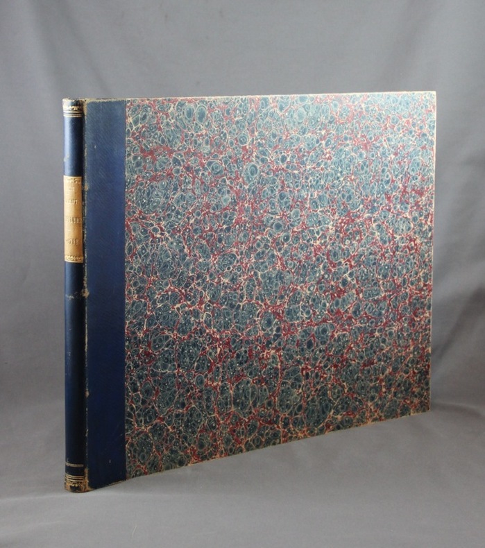
1689réf. 6577Zürich, Gesellschaft der Constaffleren im Zeughaus zu Zürich, 1689-1798. Bel ensemble de 110 planches publié par Gesellschaft der Constabler und Feuerwerker de Zurich, relié en demi-basane bleue, pièce de titre beige, léger frottement au dos. La première pl. est volante, doublée sur papier gris, rognée au bord de l'image, celle de 1727 a été doublée (quelques déchirures en marge inférieure), 1777 et 1778 sont marquées d'une auréole d'humidité, et 1789 est rognée avec un manque dans l'image). Les 105 autres planches sont très belles. De la collection Henry Galopin, dont la collection d'armes anciennes fut incorporée au Musée d'Art et d'Histoire de Genève.
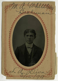
1890réf. COL26-181890. Tintypes 57. A remarkable typological assemblage of portraits showing employees of the Los Angeles division of the Southern Pacific and two of the company's Yuma division. The majority of the men are identified on the photographs' accompanying paper mats with many also noting their occupation division and date the photo was taken. A few also note the subject's date of birth. Occupations represented in the collection include fireman brakeman switchman night car sealer and more. Affixed to one of the paper mats is a some sort of health survey which has been filled out by the subject. There are a number of unusual and fascinating aspects of the collection. First the exact purpose of their creation. Given the relative uniformity of the information present on the mats these were clearly done for internal record-keeping and not created as the kind of "souvenir" one often associates with the tintype. Relatedly the second intriguing aspect of the collection is its chosen format. By the 1890s paper photography was readily available and we have encountered similar "in-house" photographic employee records from around time. These are usually albumen or silver prints tipped into an album similar to mugshot books. Why exactly the tintype was used is not entirely clear. It is possible due to the transient nature of railroad work that it was easier or more efficient to take their portrait in the field. Perhaps these were done in a tintype studio at a railway depot one usually catering to travelers or tourists. We have been unable to locate another collection of this kind. It is a compelling example of the use of the tintype and a fascinating compendium of Los Angeles railroad history. Each 5 x 3 inches overall ; Most with subject ID and occupation to paper mat. unknown
1906réf. 9347London 1906. Edwardian station map approx 40 x 60 inches this example 101 x 150.5 cm printed in colours some restoration with small areas of loss along the folds made good blank verso. Un-titled undated and without a printer this exceptionally scarce early poster was created for display in stations but establishing which ones presents a challenge. We can date it with reasonable confidence to 1906 or perhaps a fraction earlier. Our map predates the western extension of the Central London Railway to Wood Lane which opened for the Franco-British Exhibition in 1908. Angel is still shown as the terminus of the City & South London Railway but the western extension to Euston which opened in May 1907 is under construction. The use of a green border appears to be a nod to the successful series of green-bordered UERL Underground Group maps but as those were introduced in 1907 it might be the other way around. Another unusual design feature is the two tone shading in line colours of the names of interchange stations such as The Bank. The Bakerloo Line which opened in March 1906 appears to be shown as a thin dotted black line but as it was owned by the rival UERL its use for dating purposes cannot be guaranteed: this is most emphatically not a UERL map. Just three underground lines are highlighted none of which was under the UERL umbrella in 1906: The Central London Railway the City & South London Railway and the Great Northern & City Railway the first two purchased by the UERL and the latter by the Metropolitan Railway all in 1913. Two mainline companies are featured: the Great Northern Railway with its terminus at Finsbury Park and the Great Western Railway which served Paddington. Of these two the GWR is far more prominent with an inset showing the route to Reading. The map promotes travel across London using the highlighted routes at the expense of all others including the UERL: all are razor thin black and unobtrusive with no further differentiation between underground mainline and suburban services and seemingly haphazard naming of stations. It seems likely that our map was a joint response by three of the independent underground railway companies to the growing power of the UERL possibly in co-operation with the GWR and was created for display in any of their stations. We have been unable to locate another example. Map unknown
1839réf. 965Z28DLondon: The Railway Times Office 1839-63. First edition. Leather. Very Good Indeed. 11" by 9". None stated. An impressive run of early issues of the 'Railway Times' periodical an important railway periodical which documented developments and current news in the railway industry during the 1800s. A beautifully bound set of a very scarce periodical. An extensive twenty-nine volume set featuring a collection of the 'Railway Times' periodical from 1839-1863. All being the first edition. The periodical provides an impressive historical account of the current news and developments in the railway industry during the early to mid nineteenth century. The articles range from finances stock information new patents and inventions accidents and updates on railways from across the globe. Notable articles include; an article on Mr Robert Stephenson's new 1842 locomotive which proposed to use less fuel and a Testimonial to Isambard Kingdom Brunel the legendary engineer. This set includes; '1839' Vol II No. 71-72 85-94 and '1840' Vol III No. 27-41 and Vol II No. 52 of the 'Railways Magazine & Commercial Journal' bound into one volume. The rest of the years are bound over two volumes and feature complete runs of the magazine for that year with these being; '1841' Vol I- No.157 Vol III No. 1 - No.182 Vol Iv-No. 26. Vol II- No.183 Vol IV No.27 - No. 208 Vol IV No.52. '1842' Vol I- No. 209 Vol IV No.1 - No.234 Vol V-No.26. Vol II- No.235 Vol V No.27 - No.261 Vol V No.53. '1846' Vol I- No.418 Vol IX No.1 - No.443 Vol IX No.26. Vol II- nO.44 Vol IX No.27 - No.469 Vol IX No. 52. '1847' Vol I- No.470 Vol X No.1 - No.495 Vol X No.26. Vol II- No.496. Vol X No.27 - No.521 Vol X No.52. '1854' Vol I - No.836 Vol XVII No.1 - No.860 Vol XVII No.25.Vol II - No.861 Vol XXII No.26 - No.887 Vol XVII No. 52. '1855' Vol I - No.888 Vol xviii No.1 - No.913 Vol xviii No.26. Vol II - No. 914 Vol XVII No.27-No.939 Vol XVIII No. 52. '1856' Vol I - No. 940 Vol XIX No.1 - No.965 Vol XIX No.26.Vol II - No. 966 Vol XIX No.27 - No.991 Vol XIX No.52. '1857' Vol I- No.992 Vol XX No.1 - No.1017 Vol XX No.26. Vol II - No.1018 Vol XX No.27 - No.1043 Vol XX No.52. No. 18-22 have been misnumbered with No.18 numbered twice and missing No.21 however the work is complete with the pagination continuous as is expected. '1858' Vol I-No.1044 Vol XXI No.1 - No.1069 Vol XXI No.26. Two of the issues are numbered '23' but nothing is lacking. Vol II- No.1070 Vol XXI No.27-No.1094 Vol XXI No.52. '1859' Vol I- No.1095 Vol XXII No.1 - No.1120 Vol XXII No.26. Vol II - No.1121 Vol XXII No.27 - No.1147 Vol XXII No.53. '1860' Vol I- No.1148 Vol XXIII No.1 - No.1173 XXIII No.26. Vol II- No.1174 XXIII No.27 - No.1199 Vol XXIII No.52. '1861' Vol I- No.1200 Vol XXIV No.1 - No.1225 Vol XXIV No.26.Vol II - No.1251 Vol XXIV No.27 - No.1251 XXIV No.52.'1862' Vol I - No.1252 Vol XXV No.1 - No.1277 Vol XXV No.26. Vol II - No.1278 Vol XXV No.27 - No.1303 Vol XXV No.52. '1863' Vol I - No.1305 Vol XXVI No.1 - No.1329 Vol XXVI No.26.Vol II - No.1330 Vol XXVI No.27 - No.1355 Vol XXVI No.52. Illustrated heavily with numerous monochrome vignettes and the occasional full page illustration. Volume '1854' contains a folding map to pp. 356. A very scarce and important periodical with this being some of the earliest examples of the magazine currently on the market. A beautifully bound and uniform set. Bound in modern crushed quarter morocco with cloth to the boards. Endpapers renewed.All pages and issues present after the 1839-40 volumes. The occasional article clipped. Bound in modern crushed quarter morocco with cloth to the boards. Endpapers renewed. Externally lovely with only very minimal edge wear and slight leans to the odd volume. Internally generally firmly bound with the title page to pp.22 to '1854' tender and minimal strain in places otherwise firmly bound. Pages generally bright with only light age toning to the odd volume. Pages generally clean with only the odd spot slightly heavier to '1855' the occasional ink mark to '1841' and a more significant tidemark to '1856' pp. 569. Very minimal handling marks and occasional 'Railway Times' stamps to all the volumes. The odd page closely cropped to '1839-40' and the odd small closed tear and chip to the extremities. Several articles have been clipped from the pages heavier to the earlier volumes. Minor ink notations to '1847'. Hand written notes written on separate papers inserted into the odd volume. All in all a beautifully bound set with generally clean and bright pages with only the odd clipped article and mark. Very Good Indeed The Railway Times Office hardcover
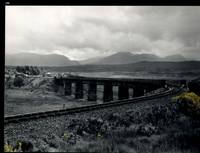
réf. 32483AB1974. Scotland 1974-2002. Oblong-Folio 44 cm wide x 36 cm high. Hardcover / Original Full-Leather Folders with stong black cardboards and original tissue-guards. Excellent condition with only minor signs of wear. With hundreds of manuscript annotations on the photography the photography-technique film used and with extensive elaborations on each photograph in these albums. More images on request ! Album 1: Covers the years 1974 1977 and 1978. The West Highland Line is walked from Arrochar a 1977 driving and camping holiday and a 1978 seventeen day touring holiday with many nights sleeping in a car fill the leaves with c. 200 b/w original photographs. Album 2: Covers the years 1991 and 1992. It is noted that 1990 is the fourth year that returning locomotives from the Mallaig line will work south over the West Highland main line. Images of Corrour Summit Glasgow to Fort William trains and many many more bridges viaducts tunnels stations and signalling equipment fill the leaves. c.182 b/w original photographs. Album 3: Covers 1993. More colour photographs now fill the leaves and annotations cease to second half of album. c 270 b/w colour and tinted original photographs. Album 4: Covers 1999 and 2002. Many images from The Highlands Rail Festival in Sept 1999. c.250 b/w and colour original photographs. An extraordinary photographic record and passion project presented in 4 huge well-bound albums containing over 900 fine photographs taken curated and annotated by an unidentified railway enthusiast and talented photographer. The albums span 4 decades recording trips to some of the most scenic and famous rail locations in the UK. The West Highland Line is returned to again and again over the decades and our photographer captures Scotlands most dramatic landscapes and railways as the route passes on its way from Glasgow to Mallaig through sections including Corrour and Rannoch Moor. Albums and contents in fine condition. A tissue guard between every leaf protects the photographs within. A single photograph of a middle aged man among every other photograph which records a detail of the railway is the only clue to the albums previous ownership and perhaps authorship. Partial description by our colleague Dr.Christian White from Christian White Rare Books in Ilkley UK. __________________________________________________________________________________________________________ The West Highland Line Scottish Gaelic: Rathad Iarainn nan Eilean "Iron Road to the Isles" is a railway line linking the ports of Mallaig and Oban in the Scottish Highlands to Glasgow in Central Scotland. The line was voted the top rail journey in the world by readers of independent travel magazine Wanderlust in 2009 ahead of the notable Trans-Siberian line in Russia and the Cuzco to Machu Picchu line in Peru. The ScotRail website has since reported that the line has been voted the most scenic railway line in the world for the second year running. The West Highland Line is one of two railway lines that access the remote and mountainous west coast of Scotland the other being the Kyle of Lochalsh Line which connects Inverness with Kyle of Lochalsh. The line is the westernmost railway line in Great Britain. At least in part the West Highland Line is the same railway line as that referred to as the West Highland Railway. History: The route was built in several sections: Glasgow Queen Street to Cowlairs Junction - Edinburgh and Glasgow Railway Cowlairs Junction to Bowling - Glasgow Dumbarton and Helensburgh Railway later absorbed into the Edinburgh and Glasgow Railway Bowling to Dumbarton Central - Lanarkshire and Dumbartonshire Railway operated by the Caledonian Railway Dumbarton Central to Dalreoch - Caledonian and Dumbartonshire Junction Railway Dalreoch to Craigendoran - Glasgow Dumbarton and Helensburgh Railway Craigendoran to Fort William opened 11 August 1894 - West Highland Railway sponsored by the North British Railway Crianlarich to Oban - Callander and Oban Railway operated by the Caledonian Railway. There is an additional section from Fort William or a junction near Fort William to Mallaig built as the Mallaig Extension Railway. The West Highland Railway approved the construction of the line at their annual meeting in January 1895. The line faced potential closure as part of the Beeching cuts in 1963 and again in 1995 due to reduced revenues. Route description: Shortly after leaving Glasgow Queen Street station and beyond Queen Street Tunnel the line diverges from the main trunk route to Edinburgh Waverley and Perth at Cowlairs and follows a northwesterly course through the suburbs of Maryhill and Kelvindale. Between Westerton and Dumbarton the route is shared with the North Clyde Line to Helensburgh Central before branching northward at Craigendoran Junction towards Garelochhead the section where the West Highland Line itself is generally accepted to begin. It gives high-level views of the Gare Loch and Loch Long before emerging alongside the northwesterly shores of Loch Lomond then climbs Glen Falloch to Crianlarich. The branch to Oban diverges at Crianlarich an important Highland junction of both road and rail and runs through Glen Lochy to Dalmally and through the Pass of Brander to reach salt water at Taynuilt and Connel Ferry before a final climb over a hill to Oban. About three miles five kilometres from Crianlarich the Mallaig and Oban routes both pass through the village of Tyndrum but they are served by separate stations making it an unusually small settlement to be served by more than one railway station. After Bridge of Orchy the line to Mallaig climbs onto Rannoch Moor past the former crossing point at Gorton Crossing to Rannoch station. In winter the moor is often covered with snow and deer may be seen running from the approaching train. The station at Corrour on the moor is one of the most remote stations in Britain and is not accessible by any public road. This is the summit of the line at 1347 ft 410 m above sea level. Carrying on northwards the line descends above the shores of Loch Treig and through the narrow Monessie Gorge. The final stop before Fort William is Spean Bridge. The section between Fort William and Mallaig passes over the Glenfinnan Viaduct through Arisaig with its views of the Small Isles of Rùm Eigg Muck and Canna and the white sands of Morar before coming to Mallaig itself. With the exception of the route between Glasgow Queen Street and Helensburgh Upper and the short section between Fort William Junction and Fort William station the railway is signalled using the Radio Electronic Token Block controlled from the signal box at Banavie station. Notable railway-related features Glenfinnan Viaduct The Horse Shoe Curve between Upper Tyndrum and Bridge of Orchy The Cruach Rock snowshed between Rannoch and Corrour Glenfinnan Viaduct between Locheilside and Glenfinnan The Pass of Brander stone signals between Dalmally and Taynuilt Arisaig is the most westerly railway station in Great Britain West Highland Line in film: Train crossing bridge at Banavie The summit of the line just north of Corrour Glenfinnan Viaduct on the line between Fort William and Mallaig is a filming location for the Hogwarts Express in the Harry Potter series of films. Eddie McConnell's poetic documentary A Line for All Seasons 1970 showcases the line and its history set against the scenery of the western highlands as it changes through the seasons. Corrour features in Trainspotting 1996 directed by Danny Boyle. Source: Wikipedia hardcover
1861réf. 55725Washington DC: Beverley Tucker; A. O. P. Nicholson; George W. Bowman; Thomas H. Ford 1861. Mixed Senate and House editions. Leather bound. Very Good. Twelve volumes in thirteen books Volume twelve in two parts plus one thick volume with the following title in gilt on the spine: "Explorations and Surveys for a Railroad Route from the Mississippi River to the Pacific Ocean. General Report." Large quartos 30 cm Bound in modern black leather with the title stamped in gilt on the spines and blind-tooled embellishments on the spines and boards. "Senate" and "House" stamped in gilt at the head of the spines. "War Department" stamped at the foot. New endpapers. Spines of a couple volumes a bit faded. Sporadic foxing and toning throughout though a large majority of the color lithographs remain in excellent condition. Stitching periodically visible in the inside margins. Occasional moisture stains other light stains and darkening to the pages. Tide mark staining more frequent in volume VI and the General Report. Volumes VIII and XII Book 1 are ex-library with discreet markings. Volume XI with maps and plates is heavily foxed at the beginning mostly affecting the text. This volume contains Warren's great map. Many of the large maps and profiles are fragile and have many splits normally encountered in these kinds of sets. "General Map of Explanations and Surveys in California" in Volume XI completely detached from binding but present. With 665 illustrated plates 64 maps/sections/profiles and 15 diagrams. Collation Notes: Volume II: 12 scenic plates one nearly detached; 20 botanical plates; 4 geological plates; 1 large folding map; 1 large folding geological section. Volume III: 12 scenic plates; 7 diagrams; 8 Native American plates missing illustration titled "Pictographs at Yampais Spring"; 3 geological plates; 2 folding sections and 1 folding map at the rear. Not present in this volume: "General Map from Fort Smith to Rio Del Norte" "General Map from Rio del Norte to the Pacific Ocean" and "Profile of a route for the Pacific Railroad from Fort Smith to Martinez." Volume IV: 1 large folding botanical plate with explanation of signs; 24 plates related to Cacti; 25 other botany plates; 10 plates devoted to Mosses and Liverworts. Volume V: 12 views; 4 maps; 14 sections; 13 views missing plate XII- "Mirage on the Colorado Desert"; 11 fossil and shell plates missing plate X; 28 botany plates. Volume VI: 13 General Report plates; 5 geology plates; 14 botany plates missing Plate I- "Quercus Hindsii"; missing plate X- "Juniperus occidentalis"; 11 fish plates; 3 mammal plates; 2 bird plates. Volume VII: 8 scenic plates; 10 paleontological plates; 14 geological plates; 2 fold-out maps; 8 botanical plates; 11 meteorological plates. Volume VIII: 20 mammal plates plates XVII-LX. Volume X: 33 reptile plates missing plate VI- "Dipsosaurus dorsalis Hallow & Sceloporus biseriatus Hallow"; reptile plate II mislabeled as III; 51 fish plates; 9 mammal plates plate XI- "Sciurus fremonti Towns" mislabeled as plate VI; plate VIII- "Lepus audubonii Baird" mislabeled XIII; 28 bird plates. Volume XI: 4 map plates; 13 sketches of Route of Forty-First Parallel- Beckwith's Report Vol. II; Warren Map plus 31 maps and profiles. Volume XII Book I: 70 lithographs. Volume XII Book II: 6 botany plates; 2 insect plates; 5 mammal plates missing plate VIII- "Texas Mouse etc."; 8 bird plates; 10 reptile plates; 21 fish plates. Some fish plates that are listed in Volume XII Book II as being present in Volume X appear to be absent LXXVI XXVb XXV XXVI LXX LXXV. General Report: 8 diagrams; 3 large folding maps/profiles at rear one with tape repairs- "Milk R. to the Crossing of the Columbia R."; 120 illustrated plates lacking "View of Fort Smith" and "Pictographs at Yampais Spring". No general title page. A mixed Senate and House set in attractive modern leather bindings. The quarto edition of the Pacific Railroad Reports first appeared in 1855 and concluded in 1861 with volume XII. The Surveys aimed at determining the best route for a transcontinental railroad. It embodied the most comprehensive information source on the American West in the mid-19th century. Numerous illustrators engravers lithographers cartographers and printing firms contributed to the publication. This monumental work is rarely found in such nice condition. ".it was the best cartographical work on the West up to its time." - Wright Howes. ".these volumes contain a monumental collection of scientific information geographical zoological botanical geological of the still mysterious American West." - Henry Wagner. Howes P3. Moffat 3536 & 49. Wagner/Camp 262-267 pp. 468-507. Beverley Tucker; A. O. P. Nicholson; George W. Bowman; Thomas H. Ford unknown
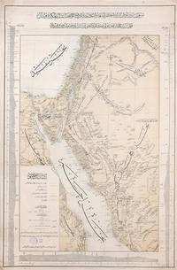
1903réf. 163825Constantinople: Matba'a-i Bahriye "The Press of the Navy" 1319 Rumi 1903. Mapping the great Hejaz Railway the embodiment of Hamidian Pan-Islamism A rare and important official map depicting the route of the Hejaz Railway based on a manuscript drafted under the supervision of the "brilliant Turkish engineer" Hadji Mukhtar Bey Maunsell p. 585 who served as the chief of operations. It was issued in 1903 while the main line from Damascus to Medina was still under construction but after the final route had been established. This detailed large-format map covers most of Syria all of Palestine the Sinai Peninsula the Suez Canal and all the north-western Arabian Peninsula. It delineates those parts of the railway that are in place and those under construction with each station labelled. Additionally it depicts the two alternative routes proposed for extending the line to Mecca as well as the proposed but unrealized route of a rail line from Mecca to the port of Jeddah. The map also labels important roads and caravan routes. In September 1907 four years after publication of this map the railway reached AlUla. Although AlUla is not marked here Mada'in Salih modern al-Hijr/Hegra is present which was a significant station responsible for the maintenance of locomotives. Mada'in Salih was UNESCO's first World Heritage Site in Saudi Arabia and comprises "a major site of the Nabataean civilization in the south zone of its influence" UNESCO. Construction of the Hejaz Railway began in 1901 and by 1908 had reached Medina 400 km short of Mecca where for various political reasons it had to be terminated. Until the outbreak of the First World War it allowed hundreds of thousands of pilgrims to make the hajj in safety and with relative ease. For the first time branch lines provided a rapid link from Syria to Palestine. The moving figure behind this map was the veteran military engineer Hadji Mukhtar Bey who had conducted "military-scientific expeditions in east Africa Harrar and the Somali coast in the 1870s and early 1880s producing the first 'correct' cartographic maps of the region" El Shakry p. 42. It was he along with fellow officer Ali Rida al-Rikabi later first prime minister of modern Syria who originally assessed the route when they joined the 1900 hajj. Initial field surveys for the present map were conducted by two Ottoman cavalry officers Captain Umar Zaki and Lieutenant Hasan Mu'ayyin. In an interesting article in Jerusalem Quarterly Zeynep Celik and Zeinab Azarbadegan pay particular attention to this map and note that the Ottoman Navy "produced different versions of the map in Arabic and Ottoman Turkish pointing to the multiple purposes and audiences targeted within and beyond the empire. The mass production of maps demonstrates the Ottoman state's attempt to disseminate cartographic knowledge about the empire to the public. This speaks to the third and final aspect of analysis of the Hejaz Railway: its use as a tool of Ottoman state propaganda during the Hamidian era". There are at least two states of this map with slightly different titles. Colour lithographic map 800 x 520 mm coastal profiles of the Red Sea in left and right margins script in Ottoman Turkish. Light vertical creasing throughout minor foxing publisher's stamp in the cartouche marginal small tears repaired with old paper. A very good example. Zeynep Celik & Zeinab Azarbadegan "Late Ottoman Visions of Palestine: Railroads Maps and Aerial Photography" Jerusalem Quarterly 82 Summer 2020; Lieut.-Col. F. R. Maunsell "The Hejaz Railway" The Geographical Journal Vol. 32 No. 6 Dec. 1908; Omnia El Shakry The Great Social Laboratory: Subjects of Knowledge in Colonial and Postcolonial Egypt 2007. unknown
réf. 2658Lausanne, Impr. Centrale,1943 ; 8°, broché.