Company, South Manchuria Railway,Biblio.com

224 resultados
ref. 45325446-nnew. unknown
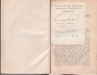
1872ref. 224630London.: Royal Geographical Society. 1872. 143-274pp notes. 21 x 13cm. Bound by a prior owner in green cloth-covered boards and quarter calf. One gathering bound in upside-down spine and boards shelf worn hinges tender but holding overall still in good condition. Alongside Palladius' Journey through Manchuria this issue also includes such articles as: the Livingstone Search and Relief Expedition; Journey Round the Island of Yezo Japan; and a Letter to Dr Kirk on an Ascent of Mount Kilima Njaro by Rev. Charles New. . Royal Geographical Society. hardcover
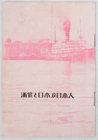
1933ref. 171122Circa1933. Map in text with outline colour graphs black and white mainly photographic illustrations 16pp original pictorial wrappers. Very good copy. 18.9 x 12.8cm. This booklet argues the importance of Manchuria and Inner Mongolia for Japan and its people as a new frontier for migration and development. It points out that the development of railway networks and in agricultural production should be of benefit for not only for Japan and its migrants but also for Manchuria through its growth prosperity and stable governance. It seems likely this booket was published a few years after the Manchurian Incident when Japan was keen to expand its influence and rights throughout the area. . unknown
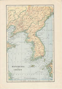
1900ref. 174813London. Circa1900. Map printed in colour showing submarine and overland telegraphs Manchuria Chosen Liao-Ting Kirin and Chili 21.5 x 13.3 cm 25.7 x 17.1 cm sheet size margins a little scuffed in very good condition. . unknown
ref. 90019306Dairen 1932 S.M.R. Red cloth tall folio 235p. index profusely illustrated with b.w. photos charts statistics many fold out maps &c. THIRD REPORT 1907-1932. FIRST & ONLY EDITION An exceptionally comprehensive reference source covering a diagram of trade of Manchuria geography administrtion hilstoricl background Manchuria in the past Russian penet- ration Japanese in Manchuria recent events communication leased territory and railway zone South Manchurian Railway trade agriculture mining forestry fisheries manufactur- ing industry currency and banking education sanitation. Copious appendices charts tables & extensive statistics. unknown
ref. 22071901Harbin 1928 M.R.S. Stiff green wrs. very good 19 x 26.5 cm. 36p. English 36p. Chinese text 3 color maps charts statistics 16 b.w. photos March 1928 issue. OBSCURE WORK The journal is a record of the activities for the Society members in North Manchuria. With reports on the structure of the M.R.S. reports of committee work organization & manag- ement statistics charts museum work publishing library scientific activity: natural history Sungaree river biolog- ical station botanical plot geology & physical geography medical veterinary and sanitary work historical science cultural development photographic work publishing &c. unknown
ref. 91065401New York 1922 S.M.R. Half cloth over boards very good 91 113p. 102 b.w. photos fold out color map 41 tables 10 charts statistics. An excellent source which addresses the geogrpahy history & government natural resources argiculture development in manufacturing commerce & finance. The South Manchuria Rail way and its work: the railway harbors ships coal mines & steel works gas electricity hotels scientific instituti- ons civic administration. The open road to Manchuria. Very good primary source loaded with statistics and facts. Scans can be sent by email. unknown
ref. 91115401Seoul 1920. Blue cloth very good 266p.index 2 appendices 46 b.w. photos statistics fold out chart valuable refer- ence source loaded with charts & statistics fold out map top gilt crisp clean copy. Covering the ten years since the establishment of the Bank of Chosen. Addressing the economic reconstruction of Chosen currency reform central bank system monetary organs. Econ- omic development of Chosen fishery forestry mining manu- facturing industry. Development of commerce & trade finan- cial banking growth of the Bank of Chosen & the part played by it in Manchuria & Chosen's economic development. SCARCE. unknown
ref. 240476011933 South Manchuria Railways. Folded pamphlet 10 x 23 cm very good 3 folds opens to a large 30 x 46 cm. sheetlarge map 12 b. w. photos 3 statistical charts English text. A lovely period ephemera and guide. Designed for the "The exhibit of the South Manchuria Railway Company.was at the Centur of Progress International Exposition at Chicago. It is an industrial and commerical exhibit of Manchuria. This folding 12p pamphlet shows good b. w. photos of Hsinking and other places: Dairen Port Arthur Harbin development of Manchoukuo Anshan ironworks statistical charts of popu- lation staple products exports &c. unknown
1925ref. 95101Ryuzan Chosen: Chosen Railways 1925. Very Good. single sheet folded several times to produce a 12 panel brochure on one side and a map of Heijo with a smaller map of Shingishu-Antung and various small 18 black and white photos around the edge on the other side. 19 x 9 cm. when folded and 38 x 44 cm. when fully unfolded. Text in English. Back cover of folded brochure heavily scuffed and lacking some of the text which briefly described hotels under the management of S.M.R. -- this damage probably occurred when this scarce item was "rescued" from an album or scrapbook. One of the photos surrounding the map shows the Railway bridge built by the Japanese 1909-1911 over the Yalu River between what is now Dandong on the Chinese side and Sinuiju in North Korea. Heij then a modest-sized city is known today as Pyongyang and is the capital of North Korea with a population of more than three million. Chosen Railways was under control of South Manchuria Railway between 1917 and 1925. Chosen Railways unknown
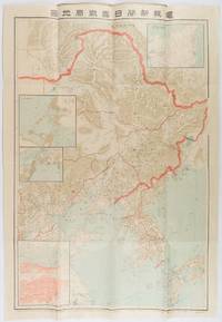
1904ref. 216818東京. Tokyo.: 電報新聞社. Denpō Tsūshinsha. Fifth Edition. Meiji 37 1904. Colour folding map with four inset maps 78.2 x 54.5cm folds into light card covers measuring 21 x 14cm. Very good copy. This the fifth edition of this map was published on 7th June 1904 reflecting the high level of public interest in receiving up-to-date information on the war particularly while the siege of Port Arthur continued without a decisive Japanese victory. The map includes four inset maps among them detailed views of Port Arthur and Vladivostok. It also records distances between key ports in Japan Korea and China. . 電報新聞社. [Denpō Tsūshinsha]. unknown
1980ref. KOS01400379Yoshifumi 1980. Soft Cover. Fine. KOS01400379 Yoshifumi paperback
1980ref. KOS01400344Yoshifumi 1980. Soft Cover. Fine. KOS01400344 Yoshifumi paperback
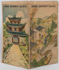
1921ref. 177452Chinese Government Railways. 1921. Doublesided broadside sheet 36 x 39cm folding to 7 x 4 inches colour lithographic covers black and white map and photographic illustrations. Wear along some folds with three small spots of paper loss along one fold which has been neatly repaired with archival material age toning to sheet still good or better condition. The opened sheet shows a map of Northern China Manchuria and Japan with the Chinese Government Railways in red and other connecting lines; the map is surrounded by photographic illustrations of various tourist spots. On the verso is further information about the different railways and day excursions. An uncommon publication. . Chinese Government Railways. unknown
1910ref. 151371910. Very good. B&w photo taken by the photographer Digby Bassett who traveled widely in Siberia and was the author of 'Mammoth and Mammoth Hunting'. Bassett studied and photographed mammoths as they thawed from glaciers. The photograph shows the governor general out of doors with a brick edifice in the background receiving visitors; on the verso is a handwritten explanatory note & signature of the photographer. 5 3/4 x 3 3/4" unknown
ref. 15156Gotha: Justus Perthes Geographical Institute. Adolf Stieler 1775-1836 was a German cartographer at the Justus Perthes Geographical Institute in Gotha. Color map includes Mongolia in the south and Japan to the east. Mounted on linen with damp stains to the linen which do not penetrate the map o/w very good. 19 x 15 1/2" Justus Perthes Geographical Institute unknown
ref. 2111902154800499Kawade Shobo Shinsha N.A. Soft Cover. Fine. The book is in fine condition. Kawade Shobo Shinsha paperback
1973ref. 2111902154606690full iron society 1973. Soft Cover. Fine. The book is in fine condition. full iron society paperback
1978ref. 2110502150905045Kaimei shoin 1978. Soft Cover. Fine. Number of books: 12 Kaimei shoin paperback
1939ref. 2110502150410819South Manzhou Railway 1939. Soft Cover. Fine. Volume: 1 South Manzhou Railway paperback
1992ref. 2092902141207495Futoshi Jilin 1992. Soft Cover. Fine. Volume: 1 Futoshi Jilin paperback
1994ref. 2092902141207616Futoshi Jilin 1994. Soft Cover. Fine. Number of books: 2 Futoshi Jilin paperback
1925ref. 2092902137602032South Manshu Railway General Affairs Department Research Division 1925. Soft Cover. Fine. Number of pages: 220p 26 maps Map size: B5 26cm Number of books: 1 South Manshu Railway General Affairs Department Research Division paperback
1927ref. 2091502135418712South Manzhou Railway 1927. Soft Cover. Fine. Number of books: 1 South Manzhou Railway paperback
1930ref. 2091502135419796South Manchuria Railway KK 1930. Soft Cover. Fine. Number of books: 1 South Manchuria Railway KK paperback