230 resultados
ref. DADAX0520219341New unknown
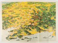
1932ref. 220844東京. Tokyo.: 大日本雄弁会講談社. Dainihon Yūbenkai Kōdansha. Showa 7 1932. Attractive colour folding bird's-eye view map with black and white photographic illustrations on the reverse. 39 x 53.5cm. Very good condition. This colourful bird’s-eye view map of Manchuria by Ito Kikuzo 1901–1985 a popular graphic artist in the early Showa period covers the entire region showing railway lines cities local produce and natural resources. Although a few small human figures appear the map largely presents Manchuria as a treasure trove of agricultural produce and natural resources. The reverse features agricultural produce and natural resources including soya beans sheep and coal with accompanying explanations. A list of products at the lower left reinforces this emphasis on Manchuria’s abundant resources while making no mention of its inhabitants. . 大日本雄弁会講談社. [Dainihon Yūbenkai Kōdansha]. unknown
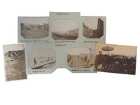
1903ref. 236401903. Chinese Eastern Railway and rural Manchuria photo archive depicting railway travel across Manchuria in 1903 documenting the rapid transformation of northeastern China into one of the most contested transportation corridors of the early twentieth century. Created only months before the outbreak of the Russo-Japanese War the photographs record a landscape where imperial railway construction traditional village life and foreign travel briefly occupied the same space. The French captions identify the photographer as part of the growing community of European travelers who crossed northern China by rail during the final years of the Qing dynasty when newly completed railway lines made regions previously reached only by caravan or river increasingly accessible. Photo archive of 7 silver gelatin photographs ranging from approximately 3 x 4 to 4 x 6.25 inches Manchuria and northern China 1903. Most prints bear contemporary handwritten French captions identifying locations and events including "Montée des monts Kingan" "Passage du Liao-Ho" "Attendant le train de secours" and "Scène champêtre au village de Che-San-Ling." The photographs show passenger trains winding through the forested slopes of the Khingan Mountains travelers gathered beside railway tracks awaiting a rescue train pedestrians crossing the Liao River by ferry expansive mountain vistas viewed from the railway a rural farming scene with villagers pack animal and harvested fields near Che-San-Ling and a ceremonial procession led by musicians carrying traditional instruments and parasols while foreign uniformed soldiers in white tropical helmets march behind. The photographs were made as Manchuria became the focal point of international competition following construction of the Chinese Eastern Railway between 1897 and 1903 a Russian-financed line that connected the Trans-Siberian Railway with Port Arthur and opened the interior of Manchuria to unprecedented commercial and military movement. By 1903 Russia's expanding railway presence and continued military occupation had become an international diplomatic crisis with negotiations over withdrawal collapsing only months before war erupted with Japan in February 1904. These photographs preserve the region immediately before that transformation showing railway travel functioning alongside agricultural villages river crossings and ceremonial life that had defined Manchuria long before foreign concessions arrived. The French captions also reflect the wave of French-speaking diplomats missionaries engineers businessmen and independent travelers who moved through China after the Boxer Rebellion using the expanding railway network to record landscapes and communities that had only recently become accessible to European visitors. Light surface wear minor edge wear and expected age toning; several photographs mounted with original manuscript captions. Overall in very good condition. A visual record of railway expansion cross-cultural travel and everyday life in Manchuria at the moment the region stood on the threshold of the Russo-Japanese War. unknown
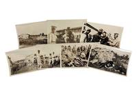
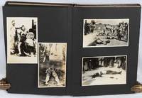
1940ref. 234221940. Chinese prisoner execution photo archive from Japanese-occupied Manchuria circa 1940s recording the custody restraint killing and aftermath of Chinese prisoners under Japanese military control. Japan's occupation of Manchuria followed the Mukden Incident of September 18 1931 when Japanese forces used an explosion along the South Manchurian Railway as the pretext for military conquest; in 1932 Japan established Manchukuo a puppet state that drew international condemnation through the League of Nations' Lytton Commission. By the 1940s Manchuria remained a central zone of Japanese military power in northeast China where occupation authority puppet-state policing and anti-guerrilla campaigns produced summary punishments prisoner shootings and public terror against local Chinese populations. Photo archive of 7 silver gelatin photographs each 4" x 6.5" Manchuria circa 1940s. Japanese soldiers in field uniforms and peaked caps surround blindfolded Chinese captives seated in open ground near an earthen bank; in one scene soldiers level rifles toward bound or blindfolded prisoners at close range. Several men lie face down or on their sides at the base of the embankment with soldiers and civilian onlookers standing above them; plain wooden boxes or planks sit nearby suggesting prepared burial or removal. Another scene records a prisoner being physically restrained in a courtyard or village setting with tiled rooflines uniformed soldiers and civilian men crowded around him. The sequence moves between armed custody execution ground bodies on the earth and prisoner handling under guard giving the group a direct evidentiary relationship to Japanese military violence in occupied Manchuria. Manchuria was not a peripheral theater in Japan's war in China; it was the region where the Kwantung Army transformed a railway-security pretext into territorial occupation state building under Manchukuo and a long-running military presence that helped bring international crisis in the 1930s and full-scale war in Asia. The scenes preserved here are not battlefront combat views but close-range records of prisoners controlled by armed soldiers making the archive especially significant for the study of occupation violence Japanese military practice wartime China and the fate of Chinese civilians or irregular fighters labeled enemies under Japanese authority. Light edge wear and minor fading to some areas; images remain primarily clean; overall very good condition. The archive preserves a compact but stark record of military force in Japanese-occupied Manchuria grounded in the physical proximity between guards prisoners rifles and bodies. unknown
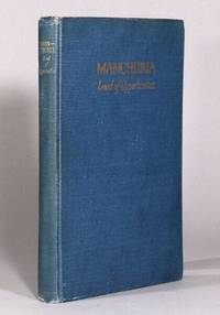
1924ref. 71397New York: South Manchuria Railway Company 1924. Revised edition 8vo pp. ix 1 98 2; color folding map 60 pages of plates; publisher's blue cloth gilt title on upper cover and spine; hinges cracked a touch of foxing very good. The South Manchuria Railway Company was founded and managed by the Japanese government and served as sort of imperial representative of the colonial project in China. They published many books aimed at a western audience touting the success of this project. From the preface: "The record of this achievement in colonial enterprise is here set forth in facts and figures with a careful avoidance of debatable questions of international politics. South Manchuria Railway Company unknown
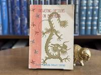
1936ref. 0107528Tokyo: The Herald Press 1936. Paperback. pp. x 84. 8vo. Black and white photos and map. Fold-out map at rear. Light shelfwear crease and ring mark to front cover South Manchuria Railway Company ink stamp to title page; very good-. The Herald Press paperback
1940ref. 220264Circa1940s. Photographic album with eighty mounted black and white photographic illustrations of varying sizes a further four photographs loosely inserted. Unpaginated. Some with captions some with handwritten descriptions on the verso. 25 x 17cm. Faux leather blind stamped decorative binding a little worn on the edges the rear gutter has been neatly strengthened. Good condition. A strange and very disturbing but historically significant album of photos taken by a Japanese man before and during the Asia-Pacific War. Some photos have been removed from the album but those remaining include family images and school photos taken at the 80th anniversary of Takefumi Higashi Junior School in Echizen City Fukui Prefecture Japan in 1951. A set of five photos stamped with the mark of "E. Tsukio" and the place name Takefumi Higashi show the aftermath of an exceptionally heavy snowfall. The photographs in this album seems to be associated with a family surnamed Hiroba as a number have handwritten notations on the back bearing the names of various individuals with that surname. The album includes a set of commercially produced photographs of the aftermath of the 1923 Great Kanto Earthquake including grim images of piles of bodies of earthquake victims. These are annotated as having been a present from a man named Hiroba Shigenobu. A photo at the rear of the album shows a photo of a Japanese army officer with sword and medals and is annotated "Hiroba Shigeharu 6 October 1940 on the eve of the third expedition to Manchuria given by Takeda Fumio". Next to this is a set of commercially produced photographs of Port Arthur focusing on the monuments to the 1905 Japanese victory there in the Russo-Japanese War. These monuments were a popular tourist attraction for Japanese people visiting Manchuria before or during the Asia-Pacific War. There are also numerous original photos taken in Harbin and the surrounding area mostly in March and April 1941. These include pictures of the streetscape of Harbin and local people participating in an ice festival on the river but also of Japanese military actions in the area - setting up an observation post transporting goods by horse-cart etc. One photo shows the range of cigarette brands available for sale in wartime Harbin. Four photos show a ceremony celebrating the establishment of the "Shimizu Unit no. 24" in Northeast China. The celebrations included a sumo wrestling competition and a party where Japanese troops were entertained by Chinese "beautiful geisha" raising the disturbing spectre of the recruitment of "comfort women" by the wartime Japanese military. More shocking still are nine photos of beheadings and other acts of extreme violence being perpetrated on people during the war in China. The precise locations of these scenes are unclear. Some of the photos appear to have been commercially produced as they contain title inscriptions in within the print but others may be original. One titled photo shows "the heads of bandits being transported by train". A haunting reminder both the horrors of war and of the way in which these can be interwoven into apparently normal family lives. . hardcover
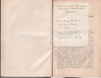
1872ref. 224630London.: Royal Geographical Society. 1872. 143-274pp notes. 21 x 13cm. Bound by a prior owner in green cloth-covered boards and quarter calf. One gathering bound in upside-down spine and boards shelf worn hinges tender but holding overall still in good condition. Alongside Palladius' Journey through Manchuria this issue also includes such articles as: the Livingstone Search and Relief Expedition; Journey Round the Island of Yezo Japan; and a Letter to Dr Kirk on an Ascent of Mount Kilima Njaro by Rev. Charles New. . Royal Geographical Society. hardcover
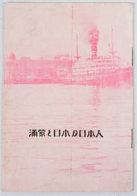
1933ref. 171122Circa1933. Map in text with outline colour graphs black and white mainly photographic illustrations 16pp original pictorial wrappers. Very good copy. 18.9 x 12.8cm. This booklet argues the importance of Manchuria and Inner Mongolia for Japan and its people as a new frontier for migration and development. It points out that the development of railway networks and in agricultural production should be of benefit for not only for Japan and its migrants but also for Manchuria through its growth prosperity and stable governance. It seems likely this booket was published a few years after the Manchurian Incident when Japan was keen to expand its influence and rights throughout the area. . unknown
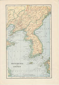
1900ref. 174813London. Circa1900. Map printed in colour showing submarine and overland telegraphs Manchuria Chosen Liao-Ting Kirin and Chili 21.5 x 13.3 cm 25.7 x 17.1 cm sheet size margins a little scuffed in very good condition. . unknown
ref. 90019306Dairen 1932 S.M.R. Red cloth tall folio 235p. index profusely illustrated with b.w. photos charts statistics many fold out maps &c. THIRD REPORT 1907-1932. FIRST & ONLY EDITION An exceptionally comprehensive reference source covering a diagram of trade of Manchuria geography administrtion hilstoricl background Manchuria in the past Russian penet- ration Japanese in Manchuria recent events communication leased territory and railway zone South Manchurian Railway trade agriculture mining forestry fisheries manufactur- ing industry currency and banking education sanitation. Copious appendices charts tables & extensive statistics. unknown
ref. 22071901Harbin 1928 M.R.S. Stiff green wrs. very good 19 x 26.5 cm. 36p. English 36p. Chinese text 3 color maps charts statistics 16 b.w. photos March 1928 issue. OBSCURE WORK The journal is a record of the activities for the Society members in North Manchuria. With reports on the structure of the M.R.S. reports of committee work organization & manag- ement statistics charts museum work publishing library scientific activity: natural history Sungaree river biolog- ical station botanical plot geology & physical geography medical veterinary and sanitary work historical science cultural development photographic work publishing &c. unknown
ref. 91065401New York 1922 S.M.R. Half cloth over boards very good 91 113p. 102 b.w. photos fold out color map 41 tables 10 charts statistics. An excellent source which addresses the geogrpahy history & government natural resources argiculture development in manufacturing commerce & finance. The South Manchuria Rail way and its work: the railway harbors ships coal mines & steel works gas electricity hotels scientific instituti- ons civic administration. The open road to Manchuria. Very good primary source loaded with statistics and facts. Scans can be sent by email. unknown
ref. 91115401Seoul 1920. Blue cloth very good 266p.index 2 appendices 46 b.w. photos statistics fold out chart valuable refer- ence source loaded with charts & statistics fold out map top gilt crisp clean copy. Covering the ten years since the establishment of the Bank of Chosen. Addressing the economic reconstruction of Chosen currency reform central bank system monetary organs. Econ- omic development of Chosen fishery forestry mining manu- facturing industry. Development of commerce & trade finan- cial banking growth of the Bank of Chosen & the part played by it in Manchuria & Chosen's economic development. SCARCE. unknown
ref. 240476011933 South Manchuria Railways. Folded pamphlet 10 x 23 cm very good 3 folds opens to a large 30 x 46 cm. sheetlarge map 12 b. w. photos 3 statistical charts English text. A lovely period ephemera and guide. Designed for the "The exhibit of the South Manchuria Railway Company.was at the Centur of Progress International Exposition at Chicago. It is an industrial and commerical exhibit of Manchuria. This folding 12p pamphlet shows good b. w. photos of Hsinking and other places: Dairen Port Arthur Harbin development of Manchoukuo Anshan ironworks statistical charts of popu- lation staple products exports &c. unknown
1925ref. 95101Ryuzan Chosen: Chosen Railways 1925. Very Good. single sheet folded several times to produce a 12 panel brochure on one side and a map of Heijo with a smaller map of Shingishu-Antung and various small 18 black and white photos around the edge on the other side. 19 x 9 cm. when folded and 38 x 44 cm. when fully unfolded. Text in English. Back cover of folded brochure heavily scuffed and lacking some of the text which briefly described hotels under the management of S.M.R. -- this damage probably occurred when this scarce item was "rescued" from an album or scrapbook. One of the photos surrounding the map shows the Railway bridge built by the Japanese 1909-1911 over the Yalu River between what is now Dandong on the Chinese side and Sinuiju in North Korea. Heij then a modest-sized city is known today as Pyongyang and is the capital of North Korea with a population of more than three million. Chosen Railways was under control of South Manchuria Railway between 1917 and 1925. Chosen Railways unknown
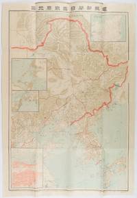
1904ref. 216818東京. Tokyo.: 電報新聞社. Denpō Tsūshinsha. Fifth Edition. Meiji 37 1904. Colour folding map with four inset maps 78.2 x 54.5cm folds into light card covers measuring 21 x 14cm. Very good copy. This the fifth edition of this map was published on 7th June 1904 reflecting the high level of public interest in receiving up-to-date information on the war particularly while the siege of Port Arthur continued without a decisive Japanese victory. The map includes four inset maps among them detailed views of Port Arthur and Vladivostok. It also records distances between key ports in Japan Korea and China. . 電報新聞社. [Denpō Tsūshinsha]. unknown
1980ref. KOS01400379Yoshifumi 1980. Soft Cover. Fine. KOS01400379 Yoshifumi paperback
1980ref. KOS01400344Yoshifumi 1980. Soft Cover. Fine. KOS01400344 Yoshifumi paperback
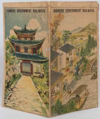
1921ref. 177452Chinese Government Railways. 1921. Doublesided broadside sheet 36 x 39cm folding to 7 x 4 inches colour lithographic covers black and white map and photographic illustrations. Wear along some folds with three small spots of paper loss along one fold which has been neatly repaired with archival material age toning to sheet still good or better condition. The opened sheet shows a map of Northern China Manchuria and Japan with the Chinese Government Railways in red and other connecting lines; the map is surrounded by photographic illustrations of various tourist spots. On the verso is further information about the different railways and day excursions. An uncommon publication. . Chinese Government Railways. unknown
1910ref. 151371910. Very good. B&w photo taken by the photographer Digby Bassett who traveled widely in Siberia and was the author of 'Mammoth and Mammoth Hunting'. Bassett studied and photographed mammoths as they thawed from glaciers. The photograph shows the governor general out of doors with a brick edifice in the background receiving visitors; on the verso is a handwritten explanatory note & signature of the photographer. 5 3/4 x 3 3/4" unknown
ref. 15156Gotha: Justus Perthes Geographical Institute. Adolf Stieler 1775-1836 was a German cartographer at the Justus Perthes Geographical Institute in Gotha. Color map includes Mongolia in the south and Japan to the east. Mounted on linen with damp stains to the linen which do not penetrate the map o/w very good. 19 x 15 1/2" Justus Perthes Geographical Institute unknown
ref. 2111902154800499Kawade Shobo Shinsha N.A. Soft Cover. Fine. The book is in fine condition. Kawade Shobo Shinsha paperback
1973ref. 2111902154606690full iron society 1973. Soft Cover. Fine. The book is in fine condition. full iron society paperback
1978ref. 2110502150905045Kaimei shoin 1978. Soft Cover. Fine. Number of books: 12 Kaimei shoin paperback