Livre Rare Book
Toa-Keizai ChosakyokuLivre Rare Book
The Manchuria Year Book 1931
1931ref. 027117Tokyo 1931 Hardcover

Antiquariaat Tanchelmus b.v · Berchem, Bélgica€ 135,00
191 resultados
1931ref. 19461931 Edition Toa-Keizai Chosakyku (East-Asiatic Economic Investigation Bureau), Tokyo, 1931.In-8, cartonnage éditeur. (xvi), 347 pages. 32 illustrations photos hors-texte, 17 diagrammes, grande carte en couleurs en frontispice, carte rempliée en noir des chemins de fer. Mention de seconde édition. Index et chronologie en fin de volume
1931ref. 027117Tokyo 1931 Hardcover
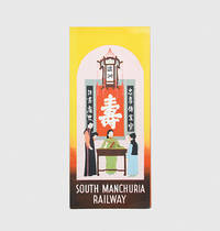
1933ref. 1964131933. An attractive piece of ephemera with photographs of cities in Manchuria a regional map incorporating the railway network and infographics recording the growth of imports exports and the population. The South Manchuria Railway occupied a prominent place in the exposition's Japanese pavilion. The leaflet's text portrays Manchuria as an independent state whose residents had seceded from China in a manner akin to the American Revolution of 1776 and positions Japan as a neutral conduit between the West and the region's rich resources. Colour lithographed sheet 460 x 300 mm folding to 230 x 103 mm printed both sides. Colours vivid and bright small closed tear at foot of one fold: a fine example. unknown
ref. 240476011933 South Manchuria Railways. Folded pamphlet 10 x 23 cm very good 3 folds opens to a large 30 x 46 cm. sheetlarge map 12 b. w. photos 3 statistical charts English text. A lovely period ephemera and guide. Designed for the "The exhibit of the South Manchuria Railway Company.was at the Centur of Progress International Exposition at Chicago. It is an industrial and commerical exhibit of Manchuria. This folding 12p pamphlet shows good b. w. photos of Hsinking and other places: Dairen Port Arthur Harbin development of Manchoukuo Anshan ironworks statistical charts of popu- lation staple products exports &c. unknown
190410 parts in 3 vols., roy. 8vo., First Edition, text in English, with very numerous chromolithographed and tinted plates (original tissue guards present where called for), many large folding maps on japon, and some hundreds of monochrome photographs (a number full-page), and maps in the text; original salmon cloth, backs lettered and tooled in gilt, red sprinkled edges, ORIGINAL WRAPPERS PRESERVED, expertly rebacked with old backstrips laid down, a remarkably bright, clean set. This magnificent record of one of the earliest major international conflicts of the twentieth century is remarkable on several counts. In essence an early partwork, it was compiled and issued whilst the war was still in progress, enabling its readers to follow the course and consequences of the fighting in a manner previously unparalleled. Certainly it is unique is the comprehensiveness and detail of its coverage, and in the variety and extent of its illustrations, the two together constituting a truly massive documentary resource. COMPLETE SETS OF THIS NOTABLE WORK ARE RARE, THE MORE SO IN ORIGINAL CLOTH IN THIS CONDITION. Wenckstern II,140.
1949244p. Inked ownership. 8vo. Original full grey cloth binding. Coldwar/Economics 9
1946Stories: The Convict Who Captured a Prison; Adventures in Manchuria; The Big Redwood; Ocean Tramps; The Personal Touch; Ripple Rock; The Man from Cork; The Reluctant Tiger; Blood Money; Breach of Contract; Nigger Goes Shark Fishing; Passage to Bahia; Gold Coast English; The Sea-Cook's Day Out; What Happened at Hossainpur; The Wide World and the P.O.W. Above-average wear. Covers present but detached from textblock. Book
ref. a57129Darien 1932. 4to. 235pp. 3 color foldout maps ind original stiff wraps bound in red cloth. VG light wear to corners. Third Report only. . hardcover
1932ref. JA9-319Dairen [Dalian], The South Manchuria Railway, 1932 / 1934. 2 B?nde original flexible Leinenb?nde, 4?, mit zahlreichen Abb. und Karten; Zustand: gut Vorsatz gestempelt
19678vo., First US Edition, with 19 plates (one double-page) on 16; pictorial cloth in red and white, backstrip lettered in black, pictorial endpapers, uncut, a near fine copy in unclipped dustwrapper. Detailed account of the Japanese C-in-C hanged as a war criminal at the end of WWII. Enser, p.133.
ref. 10512Joseph Beaume Claude Chatagnon et Roger Reynaud. In-8, broché, couverture souple coquille d'uf où est frappé le fac simile d'une médaille ( ou d'un blason) au poisson chat, 137 pages, qq clichés en noir très bel exemplaire.
ref. 2639Paris, Editions Bossard, 1922. 1 volume in-8, 155 pp., broché, illustré de nombreuses gravures sur bois in texte, bon état général.
1888ref. 28220Paris Librairie Hachette et Cie 1888 In-12 XII-451pp 84 gravures et 14 cartes , couverture détachée rousseurs, mériterait une bonne reliure
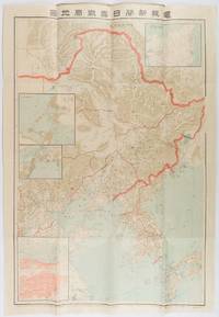
1904ref. 216818東京. Tokyo.: 電報新聞社. Denpō Tsūshinsha. Fifth Edition. Meiji 37 1904. Colour folding map with four inset maps 78.2 x 54.5cm folds into light card covers measuring 21 x 14cm. Very good copy. This the fifth edition of this map was published on 7th June 1904 reflecting the high level of public interest in receiving up-to-date information on the war particularly while the siege of Port Arthur continued without a decisive Japanese victory. The map includes four inset maps among them detailed views of Port Arthur and Vladivostok. It also records distances between key ports in Japan Korea and China. . 電報新聞社. [Denpō Tsūshinsha]. unknown
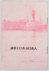
1933ref. 171122Circa1933. Map in text with outline colour graphs black and white mainly photographic illustrations 16pp original pictorial wrappers. Very good copy. 18.9 x 12.8cm. This booklet argues the importance of Manchuria and Inner Mongolia for Japan and its people as a new frontier for migration and development. It points out that the development of railway networks and in agricultural production should be of benefit for not only for Japan and its migrants but also for Manchuria through its growth prosperity and stable governance. It seems likely this booket was published a few years after the Manchurian Incident when Japan was keen to expand its influence and rights throughout the area. . unknown
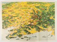
1932ref. 220844東京. Tokyo.: 大日本雄弁会講談社. Dainihon Yūbenkai Kōdansha. Showa 7 1932. Attractive colour folding bird's-eye view map with black and white photographic illustrations on the reverse. 39 x 53.5cm. Very good condition. This colourful bird’s-eye view map of Manchuria by Ito Kikuzo 1901–1985 a popular graphic artist in the early Showa period covers the entire region showing railway lines cities local produce and natural resources. Although a few small human figures appear the map largely presents Manchuria as a treasure trove of agricultural produce and natural resources. The reverse features agricultural produce and natural resources including soya beans sheep and coal with accompanying explanations. A list of products at the lower left reinforces this emphasis on Manchuria’s abundant resources while making no mention of its inhabitants. . 大日本雄弁会講談社. [Dainihon Yūbenkai Kōdansha]. unknown