JAE LORD DEXTER C FILIPINAS,Biblio.com

878 Ergebnisse
2018Best.-Nr. AME_9781773610641Delve 2018. 1st. Hardcover. New/New. Delve hardcover
1785Best.-Nr. 1979Madrid:: Printed by D. Joachín Ibara for the Spanish Crown. 1785. First Printing folio very fine in modern half calf and marbled boards; pp. ii57 uncut and unpressed; with 10 blank leaves bound-in at end. The Company was founded in 1785 to establish a monopoly on all trade between the Philippines Spain the Americans Asia and adjacent island states. The port of Manila was closed to foreign trading ships for both imports and exports. Private companies could no longer operate. The Company ceased to hold the monopoly or to operate in 1829 after the losses to Spain's colonial territories in the Americas. Printed by D. Joachín Ibara for the Spanish Crown. hardcover
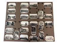
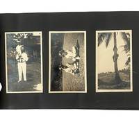
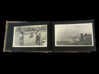
Best.-Nr. PF35Oblong Quarto album ca.18x29 cm. 38 paper album leaves 19 blank . With ca. 90 mounted original gelatin silver photographs and 2 postcards from ca. 14x85 cm 5 ½x3¼ in to ca. 109x65 cm 4 ¼ x 2½ in. Some photos with period caption in negative citing ‘Banzon photos’ likely a local studio the others without captions. Two Real Photo Color Postcards in The Collection Show the Subano Women and Nagasaki View. Both are mounted with a strong glue the previous owner tried to un-glue one to reveal the signature ‘P.J.’ possible date ‘1919’ and readdress ‘To U.S.N.Radio Station’. Other images might be captioned at the back this is subject to further research. The Tatoosh group of photos are loose one of them captioned ‘This is the most lonesome place in the world’. Binding worn several photos missing few images loose one of the postcards with tears but otherwise a very good album of strong interesting photos. Historically important collection of original photographs illustrating the life of American Navy Officer Serving at Navy Radio Station in Washington and Philippines. He likely received his training at Tatoosh before being sent to Philippines. Tatoosh station existed since late 1900s being one of the first Island Naval Radio Stations on West Coast following the first station on Mare Island that has been established in 1904. The album is divided into three group of photos the first one being from WA the second - from Philippines one of them dated in negative as of 1913 which suggests the arrival of the officer to Philippines around that time or in late 1910s. The same group of photos are taken in variety of places in the Philippines but already include a number of photos of Las Baños including the panorama of Los Baños Laguna with U.S. Ambulance & Signal Corp Camp Eldridge on it. The image of thecamp is a good verification for the dating of the photos of the first group: it has been photographed in a very early stage of its establishment while later photos from before Japanese invasion show more buildings and more developed territory. This group of photos which are larger include 17 images. The third group of photos is dedicated entirely to Las Baños its radio facilities and the life of the officer: his home his wife his friends the locals he has photographed. In this series the photographer is likely climbed one of the radio towers and took aerial shots in the process of his climb as well as from the top. As a result a series of photographed has survived showing the laguna and the operation in Los Baños in the early stage. US Naval Radio Control Station was built in 1917 including three 600' towers by 1930 it was operating at a significant capacity as the photos published by navy-radio website demonstrate. It is likely our group of photos is taken earlier as the territory shown on the photos from 1930 is developed more significantly and the pathway to operation building and the gate is not constructed yet. were built in 1917 - one destroyed in 1941 attack two demolished in 1945. 1920s was the early days for US Navy Communication Stations abroad the US: in 1924 there was a shore-based site at Shanghai as early as 1924 but its operations had been shifted to the USS General Alva in 1927; Guam in 1929 had one-person intercept site. Oahu had two stations established in 1924 and 1925. The precent station in Los Baños probably was playing a significant role in the region. Civilian radio in the Philippines started in June 1922 with the establishment of KZKZ AM in Manila Philippines by Henry Herman Sr. owner of the Electrical Supply Company in Manila. One radio tower destroyed in 1941 attack two demolished in 1945. During Japanese occupation Los Baños became known for an agricultural school campus turned Japanese internment camp. In famous ‘Raid on Los Baños’ United States Army Airborne and Filipino guerrilla task force have liberated 2147 Allied civilian and military internees from the camp. Likely the operation affected the Radio Control Station that was not re-started after 1945. Overall an important photographic evidence of the US Navy Radio operations in the Pacific. unknown
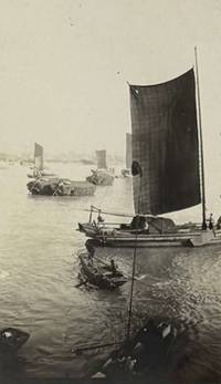
Best.-Nr. PE50Oblong Folio album ca. 275x365 cm or 11x14 in. 25 card stock leaves 11 blank. With 128 mounted original gelatin silver photographs from ca. 10x125 cm 4x5 in to ca. 65x11 cm 2 ½ x 4 ¼ in. All but two photos with period ink manuscript captions on the margins. With two mounted postcards one real photo and one printed both ca. 85x135 cm 3 ¼ x 5 ¼ in both with studio captions on the margins. The printed postcard with a period manuscript text and address on verso. Period Japanese lacquered album with a brown gilt-tooled spine. The front board with a gilt-painted scene showing a rickshaw driver carrying a geisha and a typical Japanese landscape in the background Mount Fuji sea coast with boars and a temple a Japanese pine &c.; the scene is decorated with pieces of mother-of-pearl. Binding slightly rubbed on extremities several images with creases on the margins one with a minor tear two photos possibly previously removed from the album a few photos mildly faded but overall a very good album of interesting photos. Historically significant collection of original gelatin silver snapshot photographs taken by a U.S. military medical officer who served in the Sternberg General Hospital in Manila Philippines in the late 1930s. Named after U.S. Army Surgeon General George Sternberg in 1920 the hospital was the main U.S. military medical facility in the Philippines until it was destroyed during WW2. Compiled in the years leading to WW2 apparently between 1937 and 1939 the album contains about ninety photos of the Philippines – mostly Manila and its environs. A series of images related to Sternberg General Hospital includes views of its grounds and facilities two photos of a Christmas tree inside the hospital lab where the compiler most likely worked three group portraits of the members of “basketball team Sternberg Gen. Hospital” and an individual portrait of the team member captioned “Gilchrist Sternberg Gen. Hospital.” Several photos portray the compiler’s friends and colleagues in Manila: “Harvey G. Thomas” “Yeager” and “Edward G. Ziel” “in courtyard at Sternberg” “in Lab window Sternberg” on board the Japanese steamer “M.S. Chichibu Maru” – renamed “Kamakura Maru” in 1939 &c. The photos of Manila show the “dock where or boats tied up” “old tin church” San Sebastian Basilica built in 1891 the only steel building church in the Philippines Manila Bay featuring Manila Hotel and Government Buildings naval ships and tankers in the harbour Intramuros District general views “part of old wall” San Agustin Church “street inside old Manila” five views of “old Spanish ruins” actually ruins of the Nuestra Senora de Gracia Church in modern-day Makati City Metro Manila burned during the initial skirmishes of the Philippine-American War in 1899 Manila cemetery “burial crypts Manila” “vaults in cemetery Manila” “monument in Manila” “street scenes in Philippines” “stone quarry not far from Manila P.I.” &c. Very interesting are a dozen photos of the American military installations in Manila Bay. The images show artillery guns in “Fort Drum entrance to Manila Bay” El Fraile Island and a series of views of Corregidor Island facilities Parade Grounds military barracks “buildings on Corregidor” artillery guns and personnel “14” disappearing gun”. The album also contains about twenty-five photos of the U.S. hill station of Baguio in central Luzon Island including several views taken from the train on the way to town railway station in Damortis and others images of “Army Hospital at Baguio” bungalows rooftops and famous local pines “scene from road to Antamoc mine near Baguio” Antamok gold mine near Itogon town southwest of Baguio “Filipino dwellings Antamoc gold mine near Baguio” three photos of traditional Filipino burial sites with the remains laid in between tree branches or special structures on the mountain side mountainous scenery &c. Five images portray native Filipino women and girls in traditional outfits “Ifugao girl” “native washing clothes” “Filipino girls” &c. The album closes with thirty-six photos of Chinese port cities of Shanghai and Chingwangtao Qinhuangdao Bohai Sea taken during the compiler’s voyage on board the USAT “U.S. Grant” after the beginning of the Second Sino-Japanese War 1937-45 and Japanese capture of Shanghai November 1937. A series of views of the Yangtze River taken from the deck of the “U.S. Grant” in Shanghai shows Japanese war and transport ships “Jap soldiers on river bank Shanghai” ruins of Zhabei district destroyed during the Battle of Shanghai “ruins of Chapei district Shanghai” “Chapei section of Shanghai showing shell craters & ruined blds.” &c. Chinese sail and merchant boats International Settlement seen from the river &c. At least two images feature “U.S. Grant’s” lifebuoy with the name of the ship on it. There are also views of the “Dollar Lines dock Shanghai Chinese laborers fighting for money thrown on dock” a closer view of the International Settlement with a docked naval cruiser a city street &. Very interesting are seven snapshot photos taken during the ship’s stop in Chingwangtao showing “merchants near dock” four street scenes and two scenes with U.S. soldiers during “a few minutes rest on hike near Chingwangtao China.” Overall a historically significant original visual source on the history of the U.S. military in Manila shortly before WW2 and the Japanese occupation of Shanghai in 1937-1945. hardcover
Best.-Nr. MC80Folio logbook ca. 38x245 cm or 15 x 9 ¾ in. 1 – printed title page 67 1 - blank leaves of watermarked laid paper. A copy of “The Seaman's Journal Being an Easy and Correct Method of Keeping the Daily Reckoning of a Ship During the Course of Her Voyage” New York: Burtus & Crane with the entries carefully completed in brown ink on recto and verso of the leaves with a gap of recto of leaf 41 i.e. comprising 133 pp. of text. Title page with a woodcut vignette depicting a sail ship under the American flag hand coloured and with a period ink title “Bashee Islands 1809” underneath. Period red ink stamp “C. Teubner” on the title page watercolour drawing of a maritime signal flag on the front pastedown endpaper. Period brown quarter sheep with marbled papered boards neatly repaired on hinges and extremities. Paper slightly age-toned text with occasional stains leaf 23 and others but overall a very good logbook written in a legible hand. Historically significant original content-rich logbook with a detailed record of the first trade voyage of a New York East Indiaman “America” from New York to Canton Guangzhou and back in June 1809 – June 1810. A namesake of the famous Salem merchant ship and privateer during the War of 1812 ship “America” built in 1803-1804 made five privateer cruises in 1812-1815 broken up in 1831 this “America” was built on the New York shipyard of Adam and Noah Brown for the noted local merchant company “Minturn & Champlin” and launched in May 1809 shortly before her first voyage The United States Gazette May 15 1809 p. 3. The ship’s tonnage was 493 tons Morrison J.H. History of New York Ship Yards. N.Y. 1909 p. 47. On June 21 1809 New York authorities cleared “America” for a voyage to Canton under the command of Captain Mather Evening Post Marine List// The Evening Post. New York June 21 1809 p. 3. The logbook opens with “America’s” 158-day outbound voyage starting on June 24 1809 when the ship discharged the pilot after the passing of the Sandy Hook spit at the south entrance to New York Bay. She passed the Cape of Good Hope on September 12-13 1809 without calling at port and crossed the Indian Ocean choosing the route to China via the Alas Strait between Lombok and Sumbawa Islands Lesser Sunda Islands of Indonesia. On October 21-22 “America” anchored near the “Bally Town” also marked “Laboagee” on some old maps; it is a settlement south of the modern-day town of Selong on the east coast of Lombok to get fresh water and trade for fresh supplies. A part of the crew went on shore where they were received by a local “king” who also visited the ship. “America” then crossed the “Java” Bali Sea proceeded north through the Makassar Strait between Borneo and Sulawesi crossed on October 26 – November 4 and went across the “Celebean” Celebes Sea towards the Pacific Ocean passing “Sarangaran” Sarangani and “Meangis” Miangas Islands. On November 11 1809 while in the “Celebean Sea” east of “Meangis” Island the compiler saw an island which “I did not find laid down in any chart Capt. Mather “America’s” Captain during the voyage in ship Aeolus from the Cape of Good Hope bound to China first discovered it on Sunday the 30th of November 1806…” The ship then sailed north in the Western Pacific Ocean along the east coast of the Philippines November 13-24 crossed the South China Sea passing “Bashee” Babyan “Lemma” Lamma and “Ladrones” Wanshan Islands arriving to Macao Macau on November 29. The goal of the voyage was to trade in Canton and quickly return to New York but “America” stayed there longer than expected. Captain Mather later reported that “all the English & American ships were embargoed at Canton from Jan. 27 to Feb. 22 in consequence of a new difficuly between the English and Chinese occasioned by a Chinese having been killed by a British seaman; and the English refused to deliver up any one unless the criminal could be pointed out which could not be done. It was expected the difficulty would be amicably settled” National Intelligencer. Washington City D.C. 18 June 1810 p. 3. The logbook omits the ship’s almost three-month stay in China and resumes with her departure from Macao on February 24 1810. On her 104-days return voyage “America” crossed the South China Sea sailed through the Gaspar Strait between Bangka and Belitung Islands east of Sumatra Java Sea and Sunda Strait went across the Indian Ocean and passed Cape of Good Hope April 25 and St. Helena Island May 6. The logbook ends at sea south-east of New York Bay close to the point recorded on the first day of the outbound voyage. New York “Evening Post” newspaper reported that “Arrived at this port on Saturday last the following vessels with valuable cargoes: Ship America Mather 105 days from Canton and 44 from the Cape of Good Hope with teas nankeens china silk and cassia to Minturn and Champlin owners” Evening Post Marine List// The Evening Post. New York June 11 1810 p. 3. The logbook follows the “America’s” voyage day by day thoroughly recording the ship’s geographical position and course weather winds currents operations with sails sundry works on board and ship’s repairs geographical objects passed vessels encountered termometer readings in the Strait of Alas and Western Pacific Ocean/ Philippine Sea the number of the day of the voyage and various events comets caught sharks fights on board an incident with a crew member falling overboard &c. Very interesting is a lengthy description of interactions with the inhabitants of the “Bally town” on Lombok Island where an “American ensign” was flying on shore notes about the sighting of an unknown island in the Western Pacific Ocean “two large comets” in the Indian Ocean endured storms various events on board names of encountered ships &c. Overall an important content-rich source on the history of early American trade voyages to China at the beginning of the 19th century. One of the latest mentions of the ship “America’s voyage to Canton still commanded by “Captain Mather” and owned by “Messrs. Minturn & Champlin” dates back to 1815 Alexandria Gazette. Alexandria Virginia 11 October 1915 p. 1. Excerpts from the logbook: June 24 1809. Transactions North Atlantic. These 24 hours begins with light winds and pleasant weather at 4 a.m. got under way with a light breeze from the south west at 11 a.m. … of Sandy Hook discharged the pilot. The wind hauled to the west. Set all the tending sails below and aloft. Several outward bound vessels in company. The America outsailed them all. July 15 1809. Transactions North Atlantic. <…> @ 8 a.m. saw a brig to the south and west stearing sic! to the north & east I took her to be a king’s brig. August 17 1809. Transactions North Atlantic. <…> @ 10 a.m. saw an Hermaphrodite Brig to the west steering to the N.W… September 25 1809. Transactions Indian Ocean. <…> All hands employed trimming ship got some bales of cotton out the fore hold … them in the cabin filled 8 casks with salt water between decks sailmakers mending sales carpenters repairing jolly boat. October 16 1809. Transactions Indian Ocean. <…> Ship under full sail all hands employed getting the guns out the main hold & mounting them carpenters at the boats. October 21 1809. Transactions Straits of Alas. <…> @ 5 a.m. made the land Lombock & Sambawa western extremity of Sambawa bearing north <…> @ 7 a.m. saw the Peak of Lombock bearing N. by W. dist. 3 or 4 leagues <…> got to the mouth of the Strait of Alas. At 1 p.m. came too with the small bower in 14 fathoms water sticky bottom Bally town bearing N.W. by west dist. 2 miles. Furled all sail & out all boats ready for watering. Saw an American ensign flying on shore at Bally town. At 3 p.m. out all boats mannd sic! & arm’d went on shore to the town of Bally. First & second officers. Treated well by the natives… The Land at the entrance of the Straits of Alas both on the Lombock & Sambawa sides is very remarkable - there projects from the Island of Lombock about 100 yards a Rock resembling much in form a cannon with the mouth planted downwards as you pass the mouth of the Straits this Rock sheets in & the little Town of Bally opens to the view it consists merely of a few huts belonging to the natives who received us in a friendly manner & immediately commenced trafficking sic! their productions wh. consists chiefly of ducks fowls cocoa nuts plantains & other fruit generally found in these Latitudes for money jack knives looking glasses & particularly rasors sic! - they take care however to get the full value of what they dispose of & are no novices in making a bargain. They demanded 10 dollars or 4 muskets for permission to fill our water which proved to be very brackish - they however let us have some fine turtle. The inhabitants of this Island are of a copper colour middling stature & well made they chew great quantities of Beetle sic! nut wh. renders their teeth black & their gums very red. They are all armed with axes & spears & wear nothing but a piece of calico <…> tied around the middle. The King to whom we were introduced was sitting on his throne which was composed of a block of wood surrounded by his guards who were armed in the manner already described he received us very graciously and promised to supply us with whatever we stood in need of. October 22 1809. Transactions in Bally Roads. First part fresh gales & clear weather at 4 a.m. got the long boat & pinnace out & commenced watering the ship. At 8 a.m. got all the water & stock on board. Monday October 23 1809. First part calm with pleasant weather. At 5 a.m. got the boats in. At 8 a.m. King & a great many of the natives came on board to see the Captain & the ship. Bro’t some fruit off as a present to the Captain at 10 a.m. got under way with a light breeze from the south… November 11 1809. Transactions Celebean Sea. <.> @ 4 a.m. an island in sight N.W. by W. dist. 6 or 7 leagues <…> This island I did not find laid down in any chart Capt. Mather in ship Aeolus from the Cape of Good Hope bound to China first discovered it on Sunday the 30th of November 1806 about 3 p.m. in the bearing N.O. by E ½ E. dist. 5 or 6 leagues. <…> November 25 1809. Transactions China Sea. <…> @ 4 p.m. made the Bashee Islands bearing west dist. 8 or 9 leagues… November 26 1809. Transactions China Sea. <…> @ 10 a.m. passed several fishing boats. November 27 1809. Transactions China Sea. <…> @ 4 p.m. made the Great Lemma Islands bearing W.N.W. dist. 5 or 6 leagues same tie sounded in 28 fathoms water fine grey mud… November 28 1809. Transactions China Sea. <…> @ 6 p.m. the peak of the Great Ladrone bore east ½ south distance 2 leagues… November 29 1809. Transactions China Sea. <…> @ 3 p.m. took a pilot for Macao the peak of the Great Ladrone bearing S.E. by E. 3 miles. <…> @ midnight came too with the small bower anchor in 5 fathoms water. Furled all sail. The compadore went on shore for a pilot @ 9 a.m. the compadore came off with some fresh provisions & hopes of getting a pilot the next day. <…> We were informed of several Ladrone corsairs being out. February 24 1810. Transactions China Sea. <…> @ 6 p.m. discharged the pilots Macao bearing W. ½ S. dist. 3 or 4 leagues <…> @ 4 a.m. the Middle Island bore east 2 leagues <…> @ 7 a.m. lost sight of the Frances Henrietta… March 9 1810. Transactions Straits of Gasper. <…> @ 6 p.m. saw the ship Ocean at anchor to the South of us @ 9 got under sail to the best advantage of the wind the ship Ocean in company <…> Latter part ditto. wind & weather & Meridian the Brothers bore N.E. 2 leagues the farthermost point of Sumatra in sight S.W. by W. 7 or 8 leagues. Spoke the ship Ocean & parted with her. March 11 1810. Transactions Java Sea. At anchor. @ 10 a.m. was boarded by the Gov. of Batavia boats. Latter part light airs & calm with cloudy wr. @ Meridian South pt. of Cracatau S.W. by W. ½ W. Center of Middle Islands NE. by E. ½ E. Center of Tamarin Island N.W. ½ W… March 13 1810. Transactions Straits of Sunda. <…> @ 6 p.m. Java head bore S.E. dist. 12 leagues from which I take my departure <…> lost sight of the ship Ocean Capt. McPherson… April 23 1810. Transactions Indian Ocean. <…> Caught 2 sharks & two albatrosses. Put the ship’s & Captain’s name with the Lat. & Long. of ship around the neck of one A. & let him go. April 24 1810. Transactions Indian Ocean. <…> Saw two large comets the blare of which lasted nearly 5 minutes. May 11 1810. Transactions South Atlantic. <…> @ 3 p.m. James Tylee fell overboard rounded the ship too & lowered the gig found she was sinking & lowered the jolly boat after her. June 1 1810. Transactions Western Ocean. <…> @ 3 p.m. heard a noise on the main deck went forward & found Henry Lockwood had Mr. Clark the second officer under him on deck the Captain & myself parted them. June 2 1810. Transactions Western Ocean. <…> @ 5 a.m. saw a sail to the N. & E. standing to the S. & W. @ 6 bore off N.W> by N @ 10 a.m. spoke & boarded the brig Sally & Eliza Captn. Bell 21 days from Alexandria bound to Antigua all well. hardcover
Best.-Nr. PC42Oblong Folio album ca. 275x365 cm. 75 card stock leaves with tissue guards over 30 blank. With ca. 269 mounted gelatin silver photographs including two large photos ca. 21x27 cm 8 ¼ x 10 ½ in and ca. 20x25 cm 7 ¾ x 10 in and two panoramas ca. 12x29 cm 4 ¾ x 11 ¼ in; the rest of the photos are from ca. 7x11 cm 2 ¾ x 4 ½ in to ca. 6x85 cm 2 ¼ x 3 ¼ in. Ca. 70 photos with period white ink captions on the mounts one photo is captioned in negative. With twenty-seven loosely inserted gelatin silver photos including two large ones ca. 205x25 cm 8x10 in and 17x25 cm 6 ½ x 10 in; the rest of the photos are from ca 8x105 cm 3 ¼ x 4 in to ca. 55x8 cm 2 ¼ x 3 ¼ in. Period dark brown sheep boards fastened with metal bolts; the front board with an elaborate blind-stamped ornament with two Chinese dragons and a gilt-lettered title. The first leaf with a period printed introduction titled “My Oriental Album.” Boards rubbed on extremities several leaves with minor tears on the margins not affecting the photos four images previously removed from the album but possibly laid in as loose photos but overall a very good album of strong interesting photos. Interesting album with over original gelatin silver snapshot photos of China and the Philippines taken and collected by an American sailor during his service in the U.S. Naval Battle Force in the 1930s. The album opens with two large partly-coloured photos of the U.S. naval ships where the compiler apparently served a portrait of Admiral Harris Laning 1873-1941 commander of the U.S. Naval Battle Force in 1935-1936 and images of the ships of the Battle Force “torpedo bomber” plane “night battle practice” and “ground swells.” Two large loosely inserted photos show U.S.S. “Guadalupe” launched in 1940 a fleet replenishment oiler where the compiler apparently served in the 1940s. The photos of Tsingtao Qingdao include views of the entrance to the “Enlisted Men’s Club” and the interior of a dining room apparently in the same club city racecourse beach and waterfront harbour with Chinese boats and U.S. naval ships Zhanqiao pier with the octagonal Hunian pavilion Memorial Monument to the fallen in the “Japanese War” former German Governor’s House city streets and shops a shop with flags and sign “Sze Fang Road” on the side pagodas and temples portraits of a local policeman Japanese girls Chinese kids and families people “making blankets” beggars U.S. sailors posing with young local women “Nina & I” “Shera & Spindle” “Sally” “Korean girls” &c. A series of over thirty images illustrate the “Lao Shan Valley Trip” Mount Lao southern Shandong Peninsula showing the compiler and his fellow servicemen posing on the grounds of the local temples possibly the Temple of Supreme Purity next to a “Chinese farmhouse” playing with children being carried in sedan chairs drinking beer &c. The album also contains two large panoramas of Hong Kong city waterfront and Victoria Peak taken from the sea; Victoria Harbour. Smaller photos of Hong Kong show the city waterfront with the third building of the Hong Kong and Shanghai Bank under construction completed in 1935 harbour mansions on the slopes of Victoria Peak the Peak Tram Chinese houseboats Repulse Bay Hotel a review of American marines a ferry of the “Hongkong and Yaumati Ferry Ltd.” sign “HYF” on the top &c. There are also several views of Beijing White Stupa on the Jade Flower Island interior of the Forbidden City sailors posing on the bronze astronomical instruments of the Ancient Observatory the Great Wall of China photos of “Pao Hsing Restaurant All kinds of Liquors and Grocery Regular Meals and Money Exchange Chin Hang Tao North China” a new building of the “Chinese Telegraph Administration Tangyi Road Branch” Chinese pagodas colourful street procession numerous portraits of American sailors posing in rickshaw carts at Chinese arch gates riding donkeys drinking at several bars “Morgan’s Bar” “U.S. Bar” &c. The photos of the Philippines show the facilities and vessels at the Olongapo Naval Station modern-day U.S. Naval Base Subic Bay: a floating drydock the compiler’s ship missing the entrance to the dock U.S.S. Pigeon U.S.S. John D. Ford U.S.S. Augusta H.I. J.M.S. Koma naval exercise in the Manila Bay Corregidor Island &c. Among the identified images of Manila are the views of the Central Post Office Old Legislative Building Legaspi Landing scenes of public celebrations during the day and at night in the Luneta Rizal Park with the visible Rizal Monument &c. The other images show U.S. naval ships at sea and in port a submarine lighthouses group portraits of the compiler and other enlisted sailors &c. Twenty-one photos at the rear portray the compiler and his family in the United States. hardcover
1910Best.-Nr. 235901910. Late Qing China and Philippines photo archive depicting military authority public punishment foreign presence and imperial architecture circa 1910 in the years immediately before the Xinhai Revolution ended dynastic rule in China. The Chinese photographs show Beijing monuments urban crowds soldiers execution spectators and foreign personnel at a moment when Qing authority remained visible but unstable. The group places tourist views of imperial architecture beside scenes of coercion and military order linking travel photography to the political crisis of the late Qing state. Photo archive of 32 silver gelatin photographs each 2.5 x 4.25 inches cornered in on 11 x 13.5 inch brown album leaves mainly China with several Philippines views circa 1910. The images show Beijing landmarks including the Temple of Heaven palace buildings imperial gates stone lions carved walls ceremonial terraces walled compounds and garden architecture. Several views show Chinese crowds gathered near military or judicial scenes including a public execution aftermath with a severed head displayed from a pole before laughing onlookers and children with a placard stating the events transpired. Other photographs show Chinese soldiers and civilians in open grounds foreign military or naval personnel a group of men in white naval style uniforms seated in a circle Chinese junks harbor traffic street scenes rickshaws and colonial buildings. The Philippines photographs appear to include Manila street and harbor views a woman and girl a domed theater or civic building tropical shoreline and American colonial urban scenes. China in 1910 stood between the punitive settlement that followed the Boxer Rebellion and the republican revolution that began in Wuchang in October 1911. Foreign troops remained in North China under treaty rights imperial and provincial authorities tried to preserve order through policing army reform and public punishment and revolutionary societies used anti Manchu and anti foreign resentment to attack the legitimacy of Qing rule. The execution photographs show law as spectacle with the punished body displayed before civilians and soldiers rather than hidden within prison administration. The Beijing views record the ceremonial architecture of the dynasty at the same time that its political power was nearing collapse while the Philippines views place China within a wider American and European imperial geography of ports garrisons and colonial travel. Light surface wear toning and occasional fading; mounted with photo corners on album leaves. Overall very good condition. A concentrated visual record of military order public punishment foreign presence and imperial space in East Asia immediately before the fall of the Qing dynasty. unknown
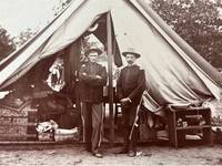
1898Best.-Nr. 236541898. Spanish American and Philippine American war US military photographs circa 1898 to 1901 documenting the Spanish American War mobilization and the subsequent American occupation of the Philippines. A caption identifying "Co. B Pa. Vol. Mt. Gretna" places one image within Pennsylvania's 1898 volunteer encampment where state militia companies entered federal service during the Spanish American War. A separate inscription "Vigan Philippine Islands Christmas 1901" establishes an American military presence in northern Luzon during the Philippine American War. The photographs record how soldiers were assembled housed transported armed and sustained across stateside and overseas settings. Photo archive of 11 photographs seven silver gelatin and two sepia toned photographs most mounted to cardstock ranging from approximately 5 x 4 to 8 x 10 inches Pennsylvania the Philippine Islands and unidentified locations circa 1898 to 1901. A large company portrait before a conical tent is captioned "Co. B Pa. Vol. Mt. Gretna" among the assembled officers and enlisted men. Other photographs show soldiers standing in opposing ranks along a wooded camp street; five armed men before numbered canvas tents; a mounted officer amid trees and tentage; a long formation carrying an American flag beside railroad tracks telegraph poles freight cars and industrial buildings; and uniformed men posed near a railroad water tower. Two soldiers stand before an open tent crowded with trunks bedding shelving cookware and personal effects while another view records enlisted men seated on the steps of a raised tent furnished with cots. An interior scene shows three soldiers eating smoking pipes and preparing food around a carved table with rifles resting across their laps and beside their chairs. One mount is inscribed "Chas. W. Grammes 925 Maple St. Allentown Pa." while another bears the dated inscription "Vigan Philippine Islands Christmas 1901." Mount Gretna served as Pennsylvania's principal volunteer encampment during the 1898 mobilization but Pennsylvania regiments received different assignments after mustering into federal service. Some units remained stateside or served in Puerto Rico while the 10th Pennsylvania Volunteer Infantry deployed to the Philippines and later fought Filipino forces after the war with Spain had formally ended. Because the Mount Gretna caption omits a regiment number the company shown cannot be securely identified with Philippine service yet the image preserves the state level mobilization from which such overseas assignments were made. By late 1901 Vigan functioned as an American controlled provincial center in Ilocos Sur where military authority and the new colonial administration operated amid continuing resistance elsewhere in the archipelago. Light surface wear and silvering to several images; tonal variation edge wear and staining to some cardstock mounts. Overall good condition. A concentrated visual record of American military organization from Pennsylvania's 1898 volunteer camps to the daily realities of occupation service in the Philippines. unknown
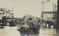
1938Best.-Nr. 235471938. Large photograph album documenting the colonial Philippines China Japan Hawaii and the United States in the inter war period 1929 and 1930. Likely compiled by an American missionary the photographs are dated and captioned showing colonial education and missionary activities expatriate tourist and native communities village visits portraits of Indigenous Filipinos and well documented Pacific travel infrastructure including photos of early railways and steam ship travel. The album includes many named individuals identified locations typed and handwritten observations and captions with ethnographic and paternalistic undertones characteristic of colonial travel photography in 1929. Photo album of approximately 140 silver gelatin and sepia toned photographs all 2.5 x 4.5 inches Philippines Shanghai and Japan 1929 and 1930. The photographs show white men and women in pith helmets cloche hats field clothing and travel dresses; a man identified as "fellow teacher Mr. Paul Russel"; a group captioned "Miss Knape Mrs. Chillson Ms. Hawkins Ms. Lynch Mrs. Cash"; group photographs of travelers likely American teachers standing in dense tropical vegetation; men crossing streams with walking sticks and hats; indigenous families and children outside thatched or leaf covered dwellings. A typed verso caption identifies "the home in Tagbilaran" comparing it to a house in Albay giving domestic detail of expatriate residence and social life outside Manila. Philippine locations including Tagbilaran and Albay village houses coastal and river landscapes and jungle terrain; In China Shanghai's "native city"; and Japanese sites including Kamakura and Tokyo. A photo from Shanghai depicts a street scene with horse drawn carts and Chinese garden or pavilion architecture. Photographs from Japan show the Great Buddha at Kamakura temple and shrine buildings a large torii steps to a temple complex and a Tokyo Imperial Palace bridge view. The provincial Philippines images include repeated portraits of local and Indigenous peoples including women and girls captioned "These are the belles of the jungle" families outside thatched dwellings children gathered near village houses and residents approached by the travelers for staged photographs. These captions and scenes document Indigenous Filipino subjects through paternalistic and exoticizing language while recording houses clothing family groups and village life in Bohol and nearby provincial districts in the 1920s. One photograph is captioned "December 29 1929" and describes the travelers as "trying to convince Filipinos to allow their photograph to be taken." In the period after the Spanish American War when the United States governed the islands as a colonial possession and made public education one of the central instruments of American administration. American teachers had entered the colonial school system in large numbers after 1901 and by the 1920s their work housing mobility and social networks formed a recognizable expatriate layer in provincial towns as well as Manila. The English captions reference to a "fellow teacher" and named residences in Tagbilaran and Albay point to a likely American teaching or expatriate circle though no creator is identified in the visible material. The Shanghai and Japan views extend the itinerary across treaty port China and Japanese tourist sites moving from the "native city" of Shanghai to Kamakura's Buddhist monuments and Tokyo imperial architecture. Some tonal variation in the photographs some pages unbound from album. Every image remains legible those detached from the album carry the album residue and many have handwritten and typed captions en verso; there are likely many more inscriptions which remain concealed as they are adhered to the album leaves. Overall in very good condition. A large dated visual record of a teacher in the American colonial Philippines and other East Asian travel routes during the interwar consolidation of American power in the Pacific. unknown
1899Best.-Nr. 237631899. American Imperialism and the Colonization of the Philippines: Admiral Dewey Spanish-American War Military Victory Celebration Parade and New Rochelle Life Photo Album 1899-1900. An important photographic record of the public celebration of American imperial expansion following the Spanish-American War highlighted by approximately 38 photographs of the September 30 1899 New York parade honoring Admiral George Dewey and the American victory at Manila Bay. The celebration occurred as the United States was imposing colonial rule over the Philippines and fighting Filipino forces seeking independence giving the photographs particular significance as a visual record of American overseas conquest presented at home through patriotic pageantry military power and mass public celebration. Photo album of approximately 153 photographs including approximately 117 silver gelatin prints and 36 albumen photographs most 3.5 x 2.5 inches New York principally 1899 and 1900. The photographs are held in gray window mounts in a string-bound album and can be removed as they are not adhered to the leaves; handwritten captions and dates occur throughout. Approximately 38 photographs document the military parade celebration showing ranks of West Point cadets mounted cavalry identified as "Troop A" and "Troop C" artillery and horse-drawn equipment military bands American flags and enormous crowds lining the parade route. The official procession included 350 West Point cadets sailors and Marines from Dewey's fleet regular Army troops New York National Guard regiments Spanish-American War veterans and Governor Theodore Roosevelt and his staff. One view is captioned "Only woman in parade" while another photograph depicts the first American flag "hoisted over Morro Castle at Santiago." Dewey's May 1 1898 destruction of the Spanish fleet at Manila Bay helped open the Philippines to American occupation and transformed him into a national symbol of the country's new overseas power. Spain subsequently ceded the Philippines to the United States while Filipinos who had fought for independence resisted American rule resulting in the Philippine-American War beginning in 1899. The New York celebration therefore documented more than Dewey's military homecoming: its flags troops artillery bands political leaders and immense crowds embodied the popular celebration of America's emergence as an imperial power at the very moment it was establishing colonial control over the Philippines. The remainder of the album documents New Rochelle and Long Island Sound life including boating hunting fishing families dogs horses carriages substantial houses residential construction and waterfront recreation. Identified subjects include the launch of "Kathleen" Horseshoe Harbor Glen Island the Columbia Library and the Atlantic City Boardwalk. Bound album with severely worn spine; photographs generally clean and in very good condition with occasional corner wear creasing and small tears. Overall in good condition. unknown
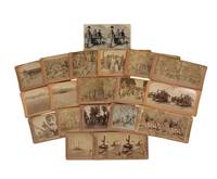
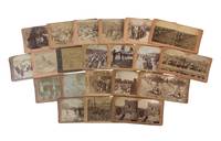
1898Best.-Nr. 231701898. Stereoview archive documenting the rapid overseas deployment of American troops at the moment the Spanish American War gave way to a longer and more revealing imperial presence in the Philippines. This archive marks the transition from the 1898 defeat of Spain to the far more sustained American military occupation that followed. After the U.S. victory over Spain the Treaty of Paris transferred the Philippines to the United States for $20 million. This resulted in a battle between American forces and Filipino nationalists under Emilio Aguinaldo in February 1899 when Filipino hopes for independence collided with the reality of a new colonial ruler. This collection of photos preserves the process of colonialism through troop deployment provisioning medical treatment and the routines of military presence. Archive of 19 stereoview cards most published by B. W. Kilburn and James M. Davis centered on American military activity in the Philippines with additional views from Puerto Rico Cuba and the United States. Each measure 3.5" x 7". The core of the images remain in Philippine occupation; "The 17th Infantry crossing the river P.I." shows movement through tropical terrain; "Our Volunteers awaiting orders under the tropical sun in the Philippines" captures the idleness and bodily strain of expeditionary service; "2nd Division Hospital established in Angeles Church P.I." reveals improvised medical infrastructure inside a colonial religious building; "Dealing out pork and beans to the Oregon Volunteers P.I." appears in multiple variants and preserves the logistics of feeding American troops in camp; and "The Insurgent House of Congress on Fire Malolos P.I." places the war directly in relation to the destruction of Filipino political institutions. The remaining cards broaden that story outward: "Troop D 5th U.S. Cavalry lining up for dinner Mayaguez P.R." points to U.S. military operations in Puerto Rico; "Modern Krupp Gun Morro Castle Havana Cuba" preserves the Spanish imperial military landscape at Havana just as U.S. power displaced it; and the exhibition drill cards including "The Little Commodore" Boston '98 and "Grand Stand Exhibition Drill Boston '98" connect the overseas war to patriotic spectacle and military display at home. Stereographs were a common late nineteenth century format for circulating military imagery and was used to render mobilization and drill into mass-viewed visual media. Minor toning edge wear and rubbing; images and printed captions remain legible; overall very good condition. This collection preserves the American campaign in the Philippines not as abstract policy but as a contemporary visual record of how troops were deployed housed fed and sustained while the United States transformed victory over Spain into colonial rule in the Pacific. unknown
1898Best.-Nr. 231301898. Spanish-American War stereoview archive circa 1898-1899 documenting how the war was pictured through mass-produced photographic views that followed U.S. mobilization battlefield action occupation and military life across both Cuba and the Philippines. These stereoviews preserves the visual system by which the war was circulated to American audiences showcasing camp organization troop movement burial hospital care naval power and overseas deployment. Particularly notable is the archive's coverage of the Rough Riders the Santiago campaign in Cuba and U.S. presence in Manila and Malate showing how stereoview photography helped normalize the war's expansion from anti-Spanish conflict into a broader American imperial presence. Archive of 21 stereoviews Various publishers. Spanish-American War stereoview archive. Cuba the Philippines and the United States circa 1898-1899. each measuring 3" x 7". The views are drawn from multiple phases and theaters of the war including camp and drill scenes in the United States embarkation and troop arrivals at Tampa battlefield and occupation imagery from Cuba and extensive and some grisly scenes from Manila and surrounding areas in the Philippines. Captions and images show soldiers in formation cavalry drill military reviews naval artillery hospital interiors encampments burial grounds and troops in active position. Cuban views include Morro Castle after bombardment dead and wounded on the battlefield of Santiago U.S. soldiers preparing to invade Cuba and troops dining near Cabañas Fortress. Philippine views include a departure for Manila American pickets routing a Filipino reconnoitering party the 18th Infantry engaged by Filipino outposts volunteers awaiting orders under the tropical sun Army Hospital Manila and "Our Boys in Camp at Malate P.I." One stereoview identifies Roosevelt's Rough Riders in the mobilization phase linking the archive to one of the war's most publicly mythologized units. As a group the stereoviews demonstrate the process by which the Spanish-American War was framed not simply as a short military victory over Spain but as a sustained structure of U.S. troop deployment and occupation extending from Cuba into the Philippines. The Manila and Malate scenes are especially important in this regard since they place American soldiers within the opening phase of the Philippine conflict where U.S. military presence quickly moved beyond liberation rhetoric into imperial control. The archive's mixture of battlefield casualties camp routine naval spectacle and celebratory review scenes shows how stereoscopic publishing converted war into a domestic viewing experience while reinforcing the legitimacy of American expansion abroad. Wear to mounts some toning; overall very good condition. A strong cross-theater visual archive of the Spanish-American War and the emergence of U.S. imperial power in Cuba and the Philippines. unknown
1944Best.-Nr. 224221944. Olson Laverne Edwin vernacular photo album circa 1944-1946 documents U.S. Navy enlisted service across the Philippines and Hawaii during the final phase of World War II and the immediate postwar occupation period providing direct visual and documentary evidence of military presence local communities and wartime social life in the Pacific Theater. The album is anchored by Olson's official U.S. Navy Certificate of Satisfactory Service confirming duty from December 18 1944 through April 23 1946 situating the material within the aftermath of the U.S. return to the Philippines following the Leyte landings and the transition into occupation and reconstruction. The photographs support research into Pacific War military infrastructure American servicemen's daily life and interactions with local populations in recently contested and strategically critical regions. Album titled "Snapshots: The Philippines and The Islands of Hawaii" compiled circa 1944-1946 contains 25 items: 23 silver gelatin photographs one wallet-sized U.S. Navy Certificate of Satisfactory Service and one Roosevelt Commemorative Birthday Ball exchange coupon dated January 30 1946. Album measures approximately 4.5 x 3.5 inches with most photographs approximately 4 x 2.5 inches. Images include candid and landscape views from the Philippines likely including Leyte depicting rural villages shoreline activity docked naval vessels and local labor such as fishing and canoe transport. One photograph shows a group of Filipino children and young men gathered along a beach while another captures men and boys navigating shallow coastal waters in a canoe. Hawaiian images include group recreation scenes and coastal landscapes reflecting off-duty life within a major U.S. naval hub. The Roosevelt Birthday Ball coupon printed with the slogan "Dance That Others May Walk" provided access to multiple Honolulu venues and connects the album to wartime charitable campaigns supporting polio treatment through organized social events. Created during the closing campaigns of the Pacific War and the first year of U.S. postwar presence in the Philippines the album situates an enlisted sailor within a broader military and geopolitical transformation that included amphibious warfare territorial reoccupation and the reestablishment of American administrative and logistical systems. The Philippines served as a critical site of both combat and reconstruction while Hawaii functioned as a central staging and support base for naval operations. The inclusion of both official documentation and leisure-related ephemera demonstrates how military service encompassed bureaucratic recordkeeping mobility across strategic locations and participation in organized morale and fundraising activities tied to the American home front. Light wear to album covers minor handling and edge wear to photographs with images remaining sharp; service certificate shows toning and wear; pages largely intact. Overall very good condition. unknown
1945Best.-Nr. 212431945. World War II Philippines photo album 1940s documenting United States Army Forces Far East activity and civilian conditions in Luzon during Japanese occupation and subsequent military operations. The album records military presence infrastructure damage and daily life among Filipino civilians providing visual evidence of the Pacific Theater at a critical stage of conflict. The material captures both organized military environments and surrounding local landscapes situating the campaign within its geographic and social context. Album comprises 48 silver gelatin photographs each measuring approximately 3" x 4.25" mounted on 8 loose black album pages within faux brown leather covers measuring approximately 10.5" x 12". The photographs depict a range of wartime and civilian scenes including damaged buildings rural and urban environments and Filipino civilians engaged in daily activity. Several images show U.S. soldiers stationed at an encampment with rows of tents including one photograph of a Filipino man possibly affiliated with the Philippine Scouts posed in front of a tent. Additional photographs depict large U.S. naval vessels alongside smaller wooden boats occupied by Filipino men and women approaching or departing from these ships. Other images capture natural landscapes including volcanic terrain and cloud formations above Luzon. The sequence of photographs reflects both military occupation and local life with visual emphasis on interaction between American forces and Filipino civilians. Created during the prolonged conflict in the Philippines where American and Filipino forces resisted Japanese occupation from 1941 to 1945 these photographs provide a record of conditions during one of the most significant campaigns in the Pacific Theater. The images reflect both the presence of U.S. military operations and the lived environment of the island during wartime. Album pages are loose within covers; photographs remain clean and well-preserved with minimal wear; overall very good condition. This album offers a concentrated visual record of wartime Luzon and the intersection of military and civilian experience. unknown
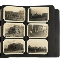
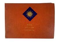
1944Best.-Nr. 220931944. 40th Infantry Division Pacific campaign photograph album documenting combat operations and daily military life of U.S. Army forces during World War II. The 40th Infantry Division served extensively in the Southwest Pacific Theater participating in campaigns across New Guinea New Britain and the Philippines as Allied forces advanced against Japanese defensive positions. The photographs record amphibious landings artillery operations destroyed towns and the collaboration between American troops and Filipino guerrilla forces during the campaign to liberate the Philippines. The album therefore documents the operational environment of Pacific warfare including jungle terrain fortified Japanese defensive networks and the logistical systems required to sustain prolonged combat across island battlefields. Photograph album containing approximately 200 original black and white photographs documenting operations of the 40th Infantry Division during the Pacific campaigns of World War II. Each photograph is sequentially numbered in white ink at the lower corner and corresponds to descriptive entries in a photographic index within the album. Early images depict American Red Cross workers disembarking from landing craft and greeted by U.S. soldiers illustrating the presence of female support personnel assigned to medical and relief operations. Additional photographs record amphibious landing scenes aerial views of destroyed towns in Luzon artillery and tank operations and soldiers operating mounted machine guns overlooking jungle valleys. Several images depict Japanese military casualties reflecting the intense close combat that characterized fighting across the Pacific islands. A printed military map within the album shows Japanese tunnel and cave fortifications in the Zambales Mountains illustrating defensive positions encountered during operations in the Philippines. The album also documents logistical and civilian dimensions of the campaign. Photographs show ships unloading cargo Filipino guerrilla units marching through urban streets and groups of local porters assisting Allied forces in moving supplies through mountainous terrain. Weapons and equipment visible in the images include field artillery pieces mortars and armored vehicles such as the M4 Sherman. One photograph depicts African American soldiers accompanied by scout dogs operating in jungle terrain illustrating the presence of Black servicemen serving within the segregated structure of the wartime U.S. Army. Other photographs show tent encampments mess areas interactions with local populations and the recovery of prisoners of war following combat operations. The photographs collectively present a visual record of combat logistics and daily military life during the Pacific campaigns. Album contains approximately 200 photographs with indexed numbering. Light handling wear visible to album and photographs consistent with wartime field compilation. Overall condition very good. unknown
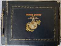
1944Best.-Nr. 159501944. United States Marine Corps photo album 1944-1945 documenting Marine service in the Pacific Theater during the final campaigns against Japanese forces including visual evidence of combat environments military infrastructure and daily life during Allied advances toward the Philippines. Compiled by an active Marine the album records conditions faced by servicemen during a decisive phase of World War II when United States forces intensified operations to dismantle Japanese control across strategic island territories. The photographs show armed Marines in field settings encampments and operational zones alongside damaged urban structures marked by bullet impacts aircraft staged on active airfields and transportation along jungle rivers providing direct visual documentation of wartime movement occupation and destruction. Photograph album containing 93 silver gelatin photographs and approximately 30 postcards assembled by a United States Marine serving in the Pacific Theater. Images depict Marines in group portraits at base camps informal scenes of soldiers at rest and aircraft on airfields including fighter planes with visible nose art. Additional photographs document jungle landscapes river travel using local barges and built environments showing structural damage consistent with recent combat. The album includes interactions between American servicemen and local civilian populations as well as images of local animals such as dogs and monkeys. Postcards depict illustrated views of Marine bases and wartime scenes several addressed to the compiler's family in Georgia. Laid into the album are photographic negatives newspaper clippings reporting wartime developments military documents and a ribbon extending the documentary scope beyond the mounted photographs. Produced during the closing phase of World War II this album aligns with major United States Marine Corps operations supporting the liberation of the Philippines in 1944 and 1945 and the broader Allied campaign across the Pacific. Marine aviation and ground units operated from forward airfields and temporary encampments such as those depicted here sustaining continuous engagement with Japanese forces while navigating tropical terrain and heavily damaged urban zones. The inclusion of civilian encounters and informal group scenes adds dimension to the study of occupation dynamics and servicemen's daily routines within active war zones. Album pages detached from original ties with some tearing and evidence of missing photographs light wear throughout; overall fair to good. A substantial primary visual record of Marine experience during the final stage of the Pacific War. unknown
Best.-Nr. A9781340579715Hardback. New. hardcover
Best.-Nr. DADAX1340728591Palala Press 2015-08-31. hardcover. New. 6.14x0.94x9.21. Buy with confidence. Excellent Customer Service & Return policy. Palala Press hardcover
Best.-Nr. DADAX1377222950Sagwan Press 2018-02-09. paperback. New. 6.14x1.66x9.21. Buy with confidence. Excellent Customer Service & Return policy. Sagwan Press paperback
Best.-Nr. DADAX1344741509Arkose Press 2015-10-17. hardcover. New. 6.14x1.50x9.21. Buy with confidence. Excellent Customer Service & Return policy. Arkose Press hardcover
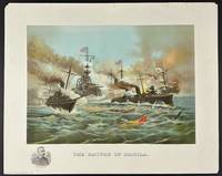
1898Best.-Nr. 13092New York: Muller Luchsinger & Co 1898. Color chromolithograph 16 x 20 inches printed on thick glossy paper. Corners a bit chipped several short closed edge tears minor surface wear. Image area still vibrant and clean. Very good overall. A striking and very rare lithograph capturing an important moment during the Spanish-American War specifically the American Navy's assault on Manila Bay in the Philippines in 1898. In the present scene three U.S. warships from the Asiatic Squadron in the left and middle including Admiral Dewey's flagship the U.S.S. Olympia fire their guns toward a few retreating ships flying the Spanish flag. A Spanish ship at middle right is almost completely sunken with just a portion of the flag peaking above the water. The scene depicts the first major engagement of the Spanish-American War a decisive victory for the American Navy that stands as one of the most lop-sided naval battles in history. During the course of the encounter the Spanish Pacific Squadron was destroyed and effectively ended Spanish colonial rule in the Philippines. The bombardment was commanded by Rear Admiral George Dewey 1837-1917 whose head-and-shoulders portrait appears in the bottom left corner. The work was accomplished by the New York firm of Muller Luchsinger & Company a prolific but still somewhat obscure producer of prints lithographs and chromolithographs in the latter-19th and early-20th centuries. OCLC records just two institutional copies at the Library of Congress and the Clements Library. A dynamic and patriotic American naval scene picturing the United States Navy's obliteration of the Spanish Navy in Manila. Muller, Luchsinger & Co unknown
Best.-Nr. DADAX1343946883Arkose Press 2015-10-04. hardcover. New. 6.14x1.75x9.21. Buy with confidence. Excellent Customer Service & Return policy. Arkose Press hardcover
Best.-Nr. DADAX1377119491Sagwan Press 2018-02-08. paperback. New. 6.14x1.71x9.21. Buy with confidence. Excellent Customer Service & Return policy. Sagwan Press paperback
Best.-Nr. DADAX1340579715Sagwan Press 2015-08-27. hardcover. New. 6.14x1.19x9.21. Buy with confidence. Excellent Customer Service & Return policy. Sagwan Press hardcover
Best.-Nr. DADAX1341385469Palala Press 2015-09-03. hardcover. New. 6.14x1.63x9.21. Buy with confidence. Excellent Customer Service & Return policy. Palala Press hardcover