225 résultats
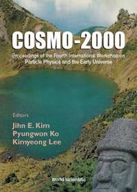
2001réf. x-9810247621World Scientific Pub Co Inc 2001. Hardcover. New. 520 pages. 8.50x6.25x1.00 inches. World Scientific Pub Co Inc hardcover
1851réf. 200120AG1851. London Edinburgh & Dublin J.& F. Tallis 1851. Original steel engraving / Vintage map. Drawn and engraved by John Rapkin. Partly hand-coloured. Illustrations by H. Warren and Enrgaved by J.H. Kernot. Plate Size: 33 cm x 25.5 cm. Sheet Size: 37.4 cm x 27.3 cm. Vintage 19th century map in very good condition. Published in the Illustrated Atlas And Modern History Of The World Geographical Political Commercial & Statistical Edited By R. Montgomery Martin. Beautifully bordered and fascinating map of Japan and Korea. The names of the major islands of Japan - Kiosiou Sitkokfi Shikoku and Niphon Honshu and the southern tip of 'Matsmai or Yersqi' Hokkaido are included on the map. Below the elbow of Honshu can be seen the tiny island of Fatsisio - the 'place of exile for the Grandees of Japan.' The map's nomenclature is interesting: Tokyo not yet the capital is named as Yedo while the then-capital Kyoto appears as 'Meaco'. Across the Korean Strait modern Seoul appears as 'Han y'. As these maps were being published both of these ancient and distinctive states Korea - the 'Hermit Kingdom' - and Japan - isolated under the centuries' long under the sakoku policy - were having to acclimate to increased Western influence in their region. The 1853-54 U.S. diplomatic and military naval expedition under Commodore Perry would force the establishment of diplomatic relations between Japan and the western "Great Powers" and eventually to the collapse of the ruling Tokugawa shogunate and the Meiji Restoration. Japan would partially embrace the West and western influences and emerge as a burgeoning regional power eventually establishing control over Korea by the early 20th century - at the beginning a calamitous half-century for the region. John Tallis 7 November 1817 3 June 1876 was an English cartographic publisher. His company John Tallis and Company published views maps and atlases in London from roughly 1838 to 1851. Tallis set up as a publisher with Frederick Tallis in Cripplegate in 1842; the business moved to Smithfield in 1846 and was dissolved in 1849. From 1851 to 1854 Tallis operated as John Tallis and Company. He started The illustrated news of the world and national portrait gallery of eminent personages in 1858 selling it for £1370 in 1861; it folded in 1863. Wikipedia The most important project John Tallis undertook was the 'Illustrated Atlas' from 1851. The original map we offer here was part of this exceptional Atlas and all the maps it contained are still today considered as the last reminder of an era of lavish map production. Tallis worked the project together with John Rapkin 1815-1876 and it was Rapkin's style and talent that we have to thank for when we marvel at these maps today. What makes these maps so special is the detail of engraved vignettes that surround the map and often show indigenous scenes people in their environment and even more so historical buildings or historical views of towns and cities architecture and landscape. The project of 'The Illustrated Atlas' was designed to be finished just in time for the anxiously awaited "Great Exhibition of the Works of Industry of All Nations" or The Great Exhibition sometimes referred to as the Crystal Palace Exhibition in reference to the temporary structure in which it was held was an international exhibition that took place in Hyde Park London from 1 May to 11 October 1851. It was the first in a series of World's Fairs exhibitions of culture and industry that became popular in the 19th century and it was a much-anticipated event. The Great Exhibition was organized by Henry Cole and Prince Albert husband of the reigning monarch Queen Victoria. It was attended by numerous notable figures of the time including Charles Darwin Samuel Colt members of the Orléanist Royal Family and the writers Charlotte Brontë Charles Dickens Lewis Carroll George Eliot and Alfred Tennyson. Music for the opening was under the direction of Sir George Thomas Smart and the continuous music from the exhibited organs for the Queen's procession was "under the superintendence of William Sterndale Bennett". Wikipedia unknown
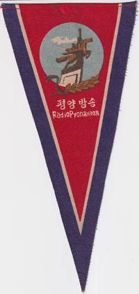
1960réf. 219665No publication details. circa1960s –70s based on design and material. Printed fabric pennant promoting Radio Pyongyang North Korea’s official broadcasting service. The image shows a stylised monument of two figures possibly symbolising industry and broadcasting with a laurel motif and radio waves under a red sky. Text in both Korean and English. Radio Pyongyang. “평양 방송” translates directly as Pyongyang Broadcasting. Text in Korean and English. 23.5 height x 11cm at top edge. A scarce example of early North Korean visual propaganda. Radio Pyongyang was founded in October 1945 and inaugurated programming with a live broadcast of Kim Il Sung's victory speech when he returned to Pyongyang at the end of WWII. The image on this pennant features a statue of two figures a worker and a peasant woman carrying a sheaf of rice riding the mythical horse Chollima symbolising speed strength and the spirit of the North Korean people. The Chollima movement which began in 1956 encouraged citizens to achieve extraordinary production and labour targets indicated by the sheaf of wheat symbolic of agricultural abundance. Radio Pyongyang helped to disseminaate the ideals of the Chollima movement and this pennant probably dates from after the Chollima Monument was unveiled in 1961. Provenance: Bought in China by a western collector in the late 20th century. . No publication details. unknown
2019réf. BN335564Die Gestalten Verlag 2019. 2019. Two Wheels South: A Motocycle Adventure from Brooklyn to Ushuaia: An Adventure Guide for Motorcycle Explorers Two Wheels South: A Motocycle Adventure from Brooklyn to Ushuaia: An Adventure Guide for Motorcycle Explorers GestaltenRobert Klanten und Matias Corea Die Gestalten Verlag unknown
1925réf. 64345Tokyo Japan: Japanese Government Railways; Chosen Government Railways; South Manchuria Railway Company et al. Toppan Printing Co. 1925. Oblong 4to. 8.6 x 8 in. 2 72 18 columns i.e. 46 pp. printed in double columns throughout although some ads are double-column size and in red & black decorative red borders. With text illustrations & diagrams in red 4 colour maps 1 4-column or double-page. photo illustrations throughout. Self-printed colour-illustrated softcovers front cover art of Mt. Fuji by Hokusai colour map back cover for the N.Y.K. & O.S.K. Steamship lines slight dustsoiling very faint tidemark at foot of spine slight edgewear still a VG bright copy. First edition of this combination land promotion and travel brochure later available at the Japanese pavilion in the ill-fated 1926 Sesquicentennial International Exposition held in Philadelphia PA. Potential Asia travelers are supplied with travel information steamship instructions details on the Railways including the J.G.R. places to visit in Taiwan Formosa; cities sites and experiences in Korea along the Chosen Government Railway line as well as travel through Japanese-controlled Manchuria China during the Roaring 20’s. Worldcat locates 1 copy U of DE. [Japanese Government Railways; Chosen Government Railways; South Manchuria Railway Company, et al. (Toppan Printing Co.)], paperback
réf. 110834Maps of the four main islands of Japan and the Korean Peninsula are surrounded by borders of cherry blossom and bamboo with scenes of Mt Fuji a pagoda and birds on the wing. Major cities are shown on the maps; Korea has Pyongyang Seoul and Pusan with '38° LINE' in a much larger font across the centre. The album 275 × 390 mm contains three series of commercially produced small photographic views loosely inserted behind photo-corners 40 hand-coloured views of Japan; 56 black and white views of Tokyo; and 40 black and white views of the Kure-Hiro district as well as 11 larger personal photographs of Bangkok. The last three items in the album are more significant: they are professionally produced photographs of two destroyers of the RAN - HMAS 'Anzac' D59 and HMAS 'Warramunga' D123 - and a large group portrait of three officers and twelve sailors of the 'Warramunga'. Both these ships served in the Korean War. The album and its contents appear to have been purchased by one of the crew members of the 'Warramunga' after she became one of the first Australian warships assigned to the Far East Strategic Reserve in 1955. unknown
réf. 011083: KOREA NATIONAL ASSEMBLY MEMBERS' FRIND SHIP ASSOCIATION. . Hardcover. Very Good. B00K: Very G00D/ . B00K: Very G00D/ $125O.OO DOCUMENTARY PICTURES of KOREAN PEOPLE KOREA NATIONAL ASSEMBLY MEMBERS' FRIND SHIP ASSOCIATION. KOREA NATIONAL ASSEMBLY MEMBERS' FRIND SHIP ASSOCIATION. Maroon Colored Spine With Title In Polished Silver Letters Tall And Wide Rectangular Hard Cover BooK: Very Good/ 124 Numbered Pages That Appear To Be Lightly Viewed And Are Clean And Tight To The Spine Shelf Edge And Corner Wear. Printed On Off White Paper. Cover Is Velour Or Velvet Showing Edge And Corner Wear Pages Are Printed On Heavy Stock Paper In Fine Or As New Condition Printed In Korean And English. Rear Of BooK Has A Tipped In Plate Printed In Korean With The Most Current Printed Date Of Date of 1981. 5. 15. Military Battle Scenes Prior To Modern Weapons. English Gift Inscription To Prior Owners Dated 12/25/85. Might Require Extra Shipping And Handling To Your Destination Due To Large Size And Weight. = Description Applies To This B00K Only Which Is A Historically Significant Treasure From The Past Hard To Find Will Be Packaged And Shipped = Carefully To Avoid Shipping Damage And Will Make It An Excellent Addition To Your Own Personal Library Collection Or As A Gift For The Discriminating Reader / Collector/. = WORLD WIDE SHIPPING AVAILABLE. KOREA NATIONAL ASSEMBLY MEMBERS' FRIND SHIP ASSOCIATION. hardcover
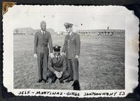
1953réf. 212881953. African American military photo album 1953-1960 documenting the service and personal life of a Black U.S. Air Force serviceman across multiple postings during and after the Korean War. The album records military duty daily routines and interpersonal relationships within an increasingly integrated armed forces providing visual evidence of African American participation in Cold War military infrastructure. The material captures both overseas deployment in Korea and domestic life across U.S. bases situating individual experience within broader patterns of military service and social change following desegregation. Album comprises 101 black-and-white silver gelatin photographs most measuring approximately 3.5" x 3.5" mounted on black pages with corner mounts. Early images place the serviceman at Kessler Air Force Base in Mississippi followed by extensive documentation of his time in Korea likely associated with the 650th Aircraft Control and Warning Squadron as indicated by a tent marked with unit insignia. Photographs show military encampments with tents and barracks vehicles including trucks and jeeps and groups of soldiers engaged in daily routines. One caption identifies "Our home in Korea" accompanying images of base infrastructure. Additional scenes include a USO performance at "K-6 Korea 54" where servicemen gather beneath a "Camp Shows" banner. The album continues with postings at Ellsworth Air Force Base in South Dakota and locations in Alaska where winter conditions specialized vehicles and outdoor activities are visible. Social and interpersonal life is extensively documented with repeated appearances of individuals identified as "Daril" "Bunky" "Peanuts" and others shown in uniform at leisure and in group settings. Domestic scenes include family gatherings such as "Roger's Birthday Party June 59" and images of women and children identified as "Mary" "Rochelle" and "Teresa" indicating sustained family connections. Travel photographs include roadside markers such as "Welcome to Illinois" and "Entering Indiana" while Alaska-based images depict community events including dog sled races and local festivals. Created during the transitional period following the desegregation of the U.S. military these photographs provide a sustained record of African American service members operating within integrated units while maintaining personal and family networks across geographic distances. The combination of overseas deployment domestic postings and family life offers a comprehensive view of military and social experience during the 1950s. Album pages show some loss and covers are detached; photographs remain sharp with strong tonal quality and are largely well-preserved; overall very good condition. This album offers an extensive documentary record of African American military life and community formation in the Korean War and early Cold War period. unknown
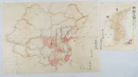
1902réf. 220266Japan. No date. Circa1902. Two very attractive colour folded manuscript maps one showing China and the other Korea. Map of China: Watercolour map 48 x 63.5cm. Closed tear now professionally repaired. Map of Korea: Finely detailed watercolour map a few tiny holes very neatly repaired on the verso with archival washi. 33 x 24.5cm Two delicate hand-painted maps one of China and one of Korea produced by a Japanese student cartographer named Koike Tokushige 小池徳重. The undated map of China appears to have been produced in the first five years of the twentieth century: a time when Japan had recently colonized Taiwan and when Japanese economic and political interest in the region was rapidly expanding. The inscription on the map suggests that it was a third year college project. But the high level of detail suggests that the artist had considerable experience of map making. The map of China shows the main provinces rivers major transport routes the Great Wall and the location of key cities although the names of the cities are not included. It also shows outlines of the Korean Peninsula Taiwan and the Japanese island of Kyushu but not the rest of Japan. The map of Korea is more detailed. It provides an accurate outline of the Korean Peninsula with careful hatching indicating changes in elevation. Rivers and major road routes are shown on the map and the locations of major towns are marked though only Busan and Incheon are named. Dotted lines show coastal sea routes and routes between Kyushu and Busan and between Incheon and China. The map shows the Gyeongin railway line between Seoul and Incheon which was completed in 1899 and route of the Gyeongbu railway line between Busan and Seoul whose construction started from both ends in 1901. But the map depicts only small sections of this line close to Seoul and Busan as being completed with the rest more lightly outlined to show the projected route implying that the map was drawn around 1901-1902 and certainly before the Gyongbu line was opened in 1904. Inserted text gives the land area and population of Korea. Rather strangely though the figure given for the Korean population is vastly underestimated. Ikeda gives this as 5.7 million when in fact at that time is was around 18 million. . unknown
1997réf. BN125803I.E.E.E.Press 1997. 1997. Hardcover. 1997 IEEE International Conference on Properties & Applications of Dielectric Materials Conference Record International Conference on Properties and Applications of Dielectrics Materials 1997 IEEE International Conference on Properties & Applications of Dielectric Materials Conference Record International Conference on Properties and Applications of Dielectrics Materials International Conference on Properties and Applications of Dielectric Materials 5th : 1997 : Seoul Korea I.E.E.E.Press hardcover
1956réf. 215131956. African American Military History Korean War Unidentified photographer African American soldiers in South Korea 1956 documents Black military service within the early post armistice U.S. occupation of Korea and provides visual evidence of desegregation in practice following Executive Order 9981. Produced three years after the Korean Armistice Agreement the images situate African American enlisted men within the operational landscape of U.S. military engineering and logistical support during the Cold War consolidation of American presence on the Korean peninsula. The archive documents the role of Black soldiers in infrastructure maintenance transport and base security while also recording their proximity to Korean civilian life in a recovering war zone. The identification of the 376 Engineer Battalion places the material within the institutional framework of the U.S. Army Corps of Engineers whose work underpinned military mobility and reconstruction during this period. South Korea 1956. Archive of 22 black and white silver gelatin photographs most measuring approximately 5 x 4 inches depicting African American soldiers stationed near a U.S. military installation likely in the Uijeongbu or Dongducheon corridor north of Seoul where engineering and support units were concentrated. Multiple images include signage identifying the "376 Engineer Battalion" while others show mixed-race groups of soldiers gathered near convoys of M35 2½ ton cargo trucks and smaller support vehicles used for personnel and supply transport. One photograph includes a Fairchild C-119 Flying Boxcar aircraft in the background confirming the logistical environment of cargo movement and aerial supply. Soldiers appear in standard issue fatigues with visible non commissioned officer insignia engaged in routine duties such as transport checkpoint supervision and base operations. Several photographs depict Korean civilians moving through nearby marketplaces and village spaces including women wearing traditional hanbok passing through areas of visible economic strain characterized by unpaved roads and temporary structures. English and Hangul signage including a storefront labeled "Kind Shop" further situates the images within a localized commercial environment shaped by U.S. military presence. The archive documents a transitional period in both U.S. military policy and Korean society as the formal desegregation of the armed forces intersected with the realities of overseas deployment in a recently devastated region. While integrated units are visible the clustering of Black soldiers within shared duties and informal groupings indicates the persistence of racialized social structures within the ranks. At the same time the photographs establish the everyday presence of American troops within civilian Korean spaces during early Cold War reconstruction linking military labor to broader geopolitical objectives in East Asia. Light surface wear including minor creasing and scattered abrasions; images remain clear with strong contrast. Overall very good condition. A cohesive visual record of African American military labor postwar occupation and cross cultural contact in Korea during a formative phase of U.S. global military expansion. unknown
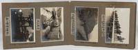
1923réf. 220274Taisho 12 1923. Over fifty black and white photographs annotated laid down in concertina style cloth covered photograph album 18 x 26.5cm most photographs measure 9.3 x 13.5cm nine measure 10 x 7cm. Some silvering of photographs but most are in very good condition. A fascinating concertina-folded album of high-quality photos dating from 1923 and showing Japanese military training exercises in northeastern Korea as well as scenes of everyday life in the surrounding region including the Ranam Cheongjin Hoeryong and Gando areas. Many of the photos appear to have been produced by a professional photographer but acquired by the soldier who has created this album who has added his own annotations based on personal experience. The first photo shows an inset portrait of a soldier named Takuuchi next to the flag of the Japanese Imperial Army's 75th Infantry Division. This is followed by a series of photos of Japanese colonial buildings in Korea including the military base of the 75th Infantry Base an overview of the city of Hoeryong on which the owner has placed a cross in ink marking the location of the recently contructed Hoeryong Shinto Shrine Heoryong's hospital and railway station and a street in the city centre an overview of Cheongjin and a panoramic overview of Ranam City also with the Ranam Shinto Shrine marked with a cross. The attention paid to these shrines which were crucial symbols of Japanese colonial rule emphasises the album creator's nationalist sentiment. There are two images of the landscape of the Tuman River and a photo of sacks of soy beans being unloaded in Gando. Other photos show scenes of everyday life including women washing clothes and grinding grain and two photos of a Korean wedding ceremony. A few of these photos including one of a village of thatched-roofed houses are in a smaller format than the images in the rest of the album and may have been taken by the album's owner himself. Twenty of the photos show 1923 training exercises conducted by the 75th Infantry Division in the Ranam area. These have also been annotated with the album owner's comments providing extra information about the content of the photos. The album concludes with two striking images of thick ice on a river probably the Tuman and of the Hoeryong Shinto Shrine in late evening. . hardcover
réf. 27011701Seoul n.d. ca 1900-1930's.Brown blind-stamp embossed album 34 x 26.5 cm. black pages most are collo-type photos some are hand-colored others are later glossy types all by and large clean all corner mounted in period album. RARE NICE! The album contains 23 pages in all each page with 3 or 4 average per page total postcard count is 76 in all. BEGINNING PAGE: The beginning page shows a "Korean District Governor at out" the a "Bird's-eye view of Seoul" which is a very RARE double photo postcard 2 attached. Then a "View of Seoul City." 1st. page: Begins with a picture of the King's ancient carriage Koka Gate of Shotoku Palace Throne Room and a Korean family of middle class. 2nd. page: Kokamon Seoul Nandimon 3 different photos two with an electric trolley. 3rd. page: The mourning dress man Full dresses two women: Keenan A student 4th. page: Choson Hotel Sin Song guide Game of checkers and three lower class women. 5th. page: The home dress of the Corean gentlemen another gentleman Keenan. 6th. 2 photos of Keenan girls. 7th. The lady going out on carriage. Buffalo vendor fishers house. 8th. The Pagoda Park Seoul 2 each Seoul Korea in Soul. The East Great Gate. 9th. Porters of water a Idol and a carrier Imperial musicians. 10th. Washing clothes in the river 2 each harvest of wheat Corean children collecting Hay. 11th. The front of Custom House Chemulpo Port of Chemulpo. 12th. Street in Seoul Nagate Dori Street of Fusan Corean cottages called Ondoru the middle below this house Chosan. 13th. Suckka Tower Grave of the Monmoo King Buddha statues. 14th. Bool Kuk Temple 2 each Grove of the domestic fowl stone pond. 15th. Chosen hotel Keijo Temple of Heaven in Choson hotel. Boy's school at Chinnampo Methodist Episcopal Mission The Old Korea news agency Korea Government building. The above are all old collotype photos probably from 1900-1915 period some hand-tinted. Next begins other photo postcards probably from the 1930's most are b.w. some color we state "color" in that case. . 16 th. Korean man smoking pipe women looking at a pond Keenan Upper class Korean gentleman. 17th. Royal Assembly Hall Ferry crossing the river Fusan Station color Capitol building. 18 th. White Buddha temple Royal Assembly Hall shows 2 girls. 19 th. City wall and gate Pyong Yang with long penned inscription Korean women weaving and spinning basket seller. 20 th. Water-wheel a firewood carrier carriers of timber. 21 st. Young porter beggar boy. Ferry below the Han River Labor of Corea. 22. nd. 4 color cards: Government of Korea two Keenan girls on the pond Sedan chair Main street Fusan a rendering not a photo card. The collection is superb with great examples of Korean-types people in native costume at daily chores and the sights of Korea its old buildings temples waterways and the like. A keen insight to the land people customs of old Korea and the Japanese administration period. CAPTIONS: Some captions are in English others in Japanese Hangul or Korean. . unknown
réf. PE29Oblong Quarto album ca. 268x364 cm. 30 card stock leaves. With ca. 215 mounted original gelatin silver photographs from ca. 87x144 cm 3 ½ x 5 ¾ in to ca. 69x67 cm 2 ¾ x 2 ½ in five real photo postcards ca. 108x139 cm 4 ¼ x 5 ½ in and six printed postcards ca. 137x87 cm 5 ½ x 3 ½ in. Most photos with period white pencil captions in French on the mounts at least seven photos including one real photo postcard with captions in negatives. Full ornamented cloth album fastened with a string. Several photos with mild silvering but otherwise a very good album with strong interesting photographs. Historically interesting album of lively vernacular photographs apparently taken by a French resident of Canada during his trans-Pacific voyage from Vancouver to the Orient in the late 1934 and early 1935. The compiler and his travel companions left Vancouver aboard the “RMS Empress of Canada” and sailed to Hong Kong with a stopover in Saigon Vietnam. From there they traveled overland to Beijing and Seoul and then continued to Japan visiting Kyoto and Nikko. On the return journey they stopped in Honolulu and New York. The album contains 215 well executed photographs from the voyage and opens with over sixty images of Saigon showing rare views of the first tea factory in the East-South Asia the Bank of Vietnam and candid street scenes of native huts boutiques and restaurants. Especially interesting is a striking image of half-naked ethnic locals sitting on the ground beside a bicycle and posing for the camera. The other photos from the region capture topographical views riverside fishing gear on the Huong River and snapshots of the compiler and his companions throughout their journey by cars in canoes along the Mekong River etc. Among twenty-five photographs of Hong Kong a standout image illustrates a bustling street scene filled with residents in traditional attire shopfronts with Chinese signs and flags of the Wang Jingwei regime flying alongside the British Union Jack. The rest of the images show the city’s port waterfront glowing night views and moments of the travel group golfing. In Beijing the focus shifts to historical landmarks documenting the Summer Palace Nine Dragon Screen Ming Tombs Temple and Altar of Heaven and the iconic Chinese guardian lions. A dozen photographs of the Great Wall offer a rare glimpse of life along its slopes with locals carrying goods in baskets and leading donkeys through the rugged terrain. The Japanese portion of the journey includes evocative views of Kyoto’s Chion-in Temple the historic Yaami Hotel and a Buddhist temple with a monk standing solemnly at the gate. The group also visited Nikko capturing sites such as the Toshogu Shrine the ornate Yomeimon Gate a stone basin and tranquil views of Lake Chuzenji. The album closes with about forty photos of Seoul Temple of Heaven Honolulu views of the waterfront photos on deck and Arizona Grand Canyon. Overall historically interesting album of lively vernacular photographs apparently taken by a French resident of Canada during his trans-Pacific voyage from Vancouver to the Orient in the late 1934 and early 1935. hardcover
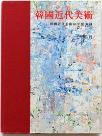
réf. MKF-BOOK-002AModern Korean Art: 60 Years Exhibition Catalogue – First Edition 1973 An illustrated first-edition publication documenting sixty years of modern Korean art published in 1973 by Kwangmyong Publishing Company and edited by the National Museum of Modern Art Korea. This historically significant volume presents an overview of the development of Korean modern art featuring artists including Ko Hui-dong and Chun Kyung-ja. It offers a valuable visual and documentary record of Korea's artistic development during the twentieth century. Published in Korea in 1973 the book is of particular interest to collectors of Korean art art historians researchers museums and institutions building collections of East Asian art and exhibition publications. Bibliographic Details Title: Modern Korean Art: 60 Years Exhibition Catalogue Publication Year: 1973 Publisher: Kwangmyong Publishing Company Korea Editor: National Museum of Modern Art Korea Edition: First Edition Language: Korean Condition: Near Mint with excellent overall preservation for its age. Please examine all photographs carefully as they form part of the condition description. The actual book shown in the photographs will be shipped from South Korea with protective packaging and tracking. Kwangmyong Publishing Company hardcover
réf. Z1-F-048-01076Springer Verlag. Used - Good. Ships from UK in 48 hours or less usually same day. Your purchase helps support Sri Lankan Children's Charity 'The Rainbow Centre'. Ex-library so some stamps and wear but in good overall condition. 100% money back guarantee. We are a world class secondhand bookstore based in Hertfordshire United Kingdom and specialize in high quality textbooks across an enormous variety of subjects. We aim to provide a vast range of textbooks rare and collectible books at a great price. Our donations to The Rainbow Centre have helped provide an education and a safe haven to hundreds of children who live in appalling conditions. We provide a 100% money back guarantee and are dedicated to providing our customers with the highest standards of service in the bookselling industry. Springer Verlag unknown
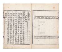
réf. 9430Four leaves of illus. 30 folding leaves. Large 8vo 305 x 208 mm. orig. yellow semi-stiff wrappers upper wrappers somewhat soiled both wrappers with some worming new stitching. Korea: 1765. First edition of this book published on royal command by King YÅngjo of ChosÅn. The book was compiled by Kim Kwi-ju 金龜柱 1740-86 the older brother of Queen Consort ChÅngsun 1745-1805. The royal Preface is furthermore written in Kim’s standard script calligraphy. Years after the compilation of this book factional intrigue under YÅngjo’s successor ChÅngjo led to Kim being exiled after which he soon died. Our book outlines sacrifices at the Confucian temple in Seoul including the KyesÅng å•“è–ç¥ and SongjÅl 崇節祠 shrines. The KyesÅng shrine built in 1669 was the site of sacrifices to the fathers of several Confucian sages including Confucius and Mencius. At the temple as a whole a number of Chinese and Korean Confucian sages and worthies were worshipped. The book contains illustrations outlining the layout of the shrines with the placement of the tablets for the various Confucian scholars marked with their names. The royal Preface is dated 1765. Ordering the compilation of a record of past exemplars apparently made the king reflect on his own character and actions. He wrote “when I with my shallow learning recite the writings of the sages and worthies but remain unable to learn the Way of the sages and worthies and when I admire the deeds of the sages and worthies but cannot act in their manner it is like knowing what something tastes like but not get to eat it or like knowing the road but being unable to follow it. Even though I might laugh at people of the past why would people of the future not laugh at me too” Minor worming mostly marginal towards end. See WorldCat 855527023 for a digital copy. unknown
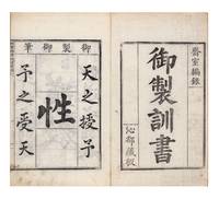
réf. 942941 folding leaves. Large 8vo 337 x 206 mm. orig. semi-stiff wrappers new stitching. Korea: Simdo æ²éƒ½ 1756. First edition and rare; WorldCat lists only one printed copy at Berkeley. This book of exhortations on good government with striking royal calligraphy was written by King YÅngjo or Yeongjo of ChosÅn 1694-1776 in 1756. At this time YÅngjo was commemorating the death of his father the previous king. According to Fang Chaoying 1908-85 YÅngjo then in his 65th year “could not foresee that he was to live twenty more years and so it appears that he was trying to justify himself in his own mind with regard to posterity as well as to the ancestors whom he expected to face any day” The Asami Library 115. YÅngjo offered three main principles for a king to follow: “to venerate Heaven to love the people and to treat the officials with respect” ibid. Large standard script characters written by the king himself are reproduced in the beginning of the book. The king’s brush records Confucian assertions such as “the following of human nature is called the Way / the cultivation of the Way is called instruction.” Accepting the Mencian dictum that human nature is inherently good the king continues: “I possess the good human nature / to realize the bright mandate of Heaven.” The main text of the book is reproduced in the handwriting of the important scholar-official SÅ MyÅng-ŭng or Seo Myeong-eung å¾å‘½è†º 1716-87. SÅ wrote in many genres and had a cosmopolitan outlook. For example he wrote a Preface to one of the major multilingual lexicographical works produced in ChosÅn in the 18th century see Söderblom Saarela “Mandarin over Manchu” 379-80. Very fine and fresh copy beautifully printed. References Fang Chaoying. The Asami Library: A Descriptive Catalog. Edited by Elizabeth Huff. Berkeley: University of California Press 1969. Söderblom Saarela Mårten. “Mandarin over Manchu: Court-Sponsored Qing Lexicography and Its Subversion in Korea and Japan.” Harvard Journal of Asiatic Studies 77.2 2017. unknown
1797réf. 111991797. Woodblock-printed. 4 1 16 39; 40 33 2 folding leaves. Three kwÅn in two volumes. Small folio 341 x 216 mm. orig. semi-stiff patterned wrappers handwritten title on upper covers old stitching. HansÅng: Chujaso Preface dated 1797. Very rare Korean collection of community rituals K. hyangnye 鄉禮 compiled by and printed for the King of Korea. We find no copy in Korea and only three copies in WorldCat Berkeley Columbia and Harvard. The reign of King ChÅngjo of Korea r. 1776-1800 witnessed a shift in the sovereign’s role in relation to Confucian teachings. “ChÅngjo sought to formulate the sage-king as an active ruler who instructed his ministers rather than received instruction from them was directly involved in the administration of the state and exercised discretion when and how he in his sagely wisdom deemed fit.”–Christopher Lovins King ChÅngjo SUNY: 2019 p. 29. As the guardian and propagator of Confucian learning he oversaw various editorial and printing projects carried out by the royal publishing house the Chujaso 鑄字所. The compilation and publication of the Collected Community Rituals reflected King ChÅngjo’s belief that a king’s ritual transformation of his people must begin at the local level. The Collected Community Rituals opens with the royal edict dated 1797 followed by a list of community ritual records compiled throughout Chinese and Korean history. The bulk of the work is devoted to the rituals of the banquet and archery competitions followed by coming-of-age K. kwanrye 冠禮 and marriage rituals. Detailed interlinear commentaries were compiled by scholars of the Kyujanggak 奎章閣 the Royal Library of the Korean court under the leadership of Yi PyÅng-mo 1742-1806. Their names are listed at the end of volume two. The original printing used the chÅngyuja ä¸é…‰å— kabinja style of movable metal type of 1777 and copies were distributed to localities throughout Korea. They were also sent to regional governmental printing houses where they were cannibalized to produce woodblocks for further printing. Nice set preserved in a jil. Our copy also has prayers for ancestral mountain and land deities as well as instructions for offering rites all handwritten in black ink on the endpapers. Red leaf-shaped seals on the first leaf of both volumes read 逸民山水 . ⧠Asami Library 4.14. King ChÅngjo Hongjae chÅnsÅ 弘齋全書 in Han’guk munjip ch’onggan 韓國文集å¢åˆŠ digital access via krpia.co.kr. unknown
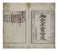
réf. 11191. 1 p.l. 4 25 34 29; 37 30 28 folding leaves. Six kwÅn in two volumes. Small folio 360 x 223 mm. orig. wrappers some wear & rubbing handwritten title on covers orig. stitching. HansÅng: Kyujanggak ca. 1799. A royal gift presented by the king of Korea. In 1794 King ChÅngjo 1752-1800 of the ChÅson dynasty compiled and had printed a collection of the letters of the great Neo-Confucian philosopher Zhu Xi 朱熹 1130-1200 to be disseminated throughout his kingdom. As King ChÅngjo wrote on this occasion “the learning of Master Zhu in its expansive and oceanic plentitude is best represented by his collected writings; the writings of Master Zhu in their utmost subtlety and precision are best represented by his personal correspondences” “ChusÅ paeksÅn yukkwÅn” 朱書百é¸å…å· in Hongjae chÅnsÅ 弘齋全書 Collected Writings of King ChÅngjo kwÅn 180. Drawing from a number of established collections he selected 100 letters and carefully arranged them “beginning with the letter to Yanping 延平 i.e. Li Tong æŽä¾— 1093-1163 Zhu Xi’s teacher to pronounce his lineage of instruction and ending with the letter to Zhiqing ç›´å¿ i.e. Huang Gan 黃干 1152-1221 Zhu Xi’s disciple to demonstrate the bestowment of teachings.” That 1794 edition with moderate marginal annotations on “personal and place names as well as philological glosses and references” was sent to be printed with the chÅngyuja ä¸é…‰å— metal type cast in the year 1777. Printed copies were sent to various official printing houses throughout the kingdom and used as models to carve woodblocks for a xylographic edition ibid. Sometime around 1799 realizing that in the capital only metal type copies of the book remained the king ordered woodblocks to be made locally as well for the work so that more copies could be printed and distributed ChÅngjo “Sinin ogyÅng…” æ–°å°äº”經… in Hongjae chÅnsÅ kwÅn 36. Most woodblock re-editions of this work retain the original title-page which contains not only the title Royal Edition of a Hundred Selected Letters of Zhu K. ŎjÅng chusÅ paeksÅn å¾¡å®šæœ±æ›¸ç™¾é¸ but also the inscription in seal script that reads ç”²å¯…å…§é–£æ´»å° — “palace edition printed with movable type in the kabin year 1794.” This title-page compounded with the absence of any additional paratextual information likely resulted in the description of these woodblock re-editions as the original metal type 1794 edition in spite of lacking the features of metal typography. We have carefully examined our copy and found that it was likely printed with the woodblocks carved around 1799 undoubtedly through the cannibalization of a typographic copy and kept within the royal library. Certain qualities of our copy make it distinctive: not only are the cursive characters rendered with impressive clarity the marginal annotations mentioned in King ChÅngjo’s edict are also preserved in faux-manuscript style — a feature absent in some other copies we have consulted erroneously described as the 1794 edition. The best evidence that our copy was printed by the royal library K. kyujanggak 奎章閣 of course is the fact that it was a royal gift K. naesabon 內賜本 presented by the king himself to notable officials or individuals in this case an examinee from SuwÅnbu 水原府. The “Record of Presentation” K. naesagi 內賜記 is handwritten on the front endpaper of the first volume as usual and is dated to the second month of Xianfeng 5 1855. However both the name of the recipient and the official responsible for the Record have been obscured. A name Im Hŭi-ji 林熙之 is written next to the name of the recipient but in a clearly different hand and ink. Records of the Royal Secretariat K. SŭngjÅngwÅn ilgi 承政院日記 states that on the 29th day of this month copies of the Hundred Selected Letters were indeed bestowed to six examinees but all their names are not given. On the first leaf of the table of contents and facing the title-page is the Seal of Presentation K. naesa’in å…§è³œå° which reads å¥Žç« ä¹‹å® Treasure of the Kyujanggak. This seal was used for presentation copies roughly between 1782 and 1894 as shown by Lee & Song in “A Study on Naesabon Preserved in Kyujanggak” in Journal of Korean Library and Information Science Society 43 no. 2. This book is rare outside of East Asia. We find three copies under WorldCat 35891835 with a misspelled title and described as the 1794 edition on account of the aforementioned title-page which our copy also possesses. None of them is described as a presentation copy. Very good set. Some occasional soiling and dampstaining. Unimportant worming mostly marginal. ⧠King ChÅngjo Hongjae chÅnsÅ 弘齋全書 in Han’guk munjip ch’onggan 韓國文集å¢åˆŠ digital access via krpia.co.kr. unknown
réf. 7461Two parts in one vol. Small folio orig. wrappers somewhat tired & a little soiled some light staining & soiling here & there manuscript title on upper cover later stitching. Hansong Seoul: Kyujanggak the Royal Library Preface dated 1793 & 1796. First edition of this handsome and large-format 323 x 217 mm. royal publication. King Chongjo 1752-1800 was one of the most intellectual and enlightened of the Korean monarchs. Perhaps Korea’s greatest bibliophile as royal patron he supported all aspects of the book: typographers printers authors librarians and lexicographers. A number of “royal” editions were published under his auspices. He founded the Kyujanggak Library in 1776 now part of the library of the Seoul National University. “The official rhyming dictionary of Chinese characters compiled under the supervision of King Chongjo and engraved in 1796. The arrangement is different from the usual Korean system in that instead of three rows of characters in the same rhyme there are four rows with the ipsÅng characters distributed in the bottom row” Fang The Asami Library 12.3. The main compiler of this work was the reformer Tong-mu Yi 1741-93 who had travelled to China and was an important member of the Northern Learning School. This group of intellectuals recognized the practical benefits of commerce and technology and urged the modernization of Korean society. Yi was appointed by King ChÅngjo as one of the famed four editors of the Royal Library overseeing the publication of books. A very nice copy. References Fang Chaoying. The Asami Library: A Descriptive Catalog. Edited by Elizabeth Huff. Berkeley: University of California Press 1969. unknown
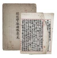
réf. 1116770 folding leaves all roughly 250 x 170 mm. Korea: mostly dated between 1910 and 1913. This fascinating collection comprises a series of handwritten administrative and case notes pertaining to police spying activities regulations and security planning in colonial Korea under Japanese rule. The documents were prepared by operatives in the Police Bureau of the Government-General of ChosÅn . Our documents are diverse in scope ranging from operational details such as surveillance and sentry procedures at the Amnok River Bridge 鴨緑江橋 the natural border between North Korea and China today accompanied by a folding colored map of the river oversight of local shrines and temples investigations into human trafficking and the abduction of women and civil police deployment plans covering major port cities. Certain entries are dated and bear the personal annotations of Akashi Motojiro who served as Chief of Police in the Government-General of ChosÅn and later became Governor-General of Taiwan. His contributions include a "Proposal to Expand the Ethnic Korean Police" marked "secret" and dated December 1911 as well as memoranda documenting statistics and tallies of Japanese and Korean police officers as of October 1912. Akashi's involvement underscores the significance of these notes for understanding the structure and priorities of the colonial police. Japan's formal annexation of Korea in 1910 inaugurated a colonial regime 1910-45 that employed its police force to maintain public order suppress dissent enforce new regulations and monitor civil society - overseeing everything from resident registration and religious activities to labor and public health. While the "military rule" of the 1910s gave way to a "cultural rule" with some reforms after 1919 police surveillance and public-security operations continued as fundamental mechanisms of control. This collection offers an extremely rare perspective on both the daily operations and the broader institutional planning of Japanese colonial policing. Fine condition. unknown
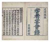
réf. 11384. 1 46 folding leaves. Small folio 346 x 227 mm. orig. yellow semi-stiff wrappers lightly rubbed title in manuscript on upper cover old stitching. HansÅng: Un'gak 1773. First and apparently only printing of the official record of "linked songs" composed at the royal banquet of elders on the occasion of King YÅngjo's r. 1724-76 80th birthday in 1773 printed the day after the banquet and presented to its guests. The title is not in WorldCat or KORCIS; we locate only two other copies both in Korea. In the intercalary third month of the 50th year of his reign King YÅngjo - the longest reigning monarch in ChosÅn history - held two birthday banquets within the KyÅnghŭigung 慶熙宮 palace complex. According to the colophon the first was a banquet of high-ranking officials held at the SungjÅng Hall 崇政殿 on the first day of the month. The second which took place a day later was a gathering of elders at the Kimsang Gate 金商門 "to reminisce about the events of the kingdom's past." The suggestion for these banquets came from the Grand Heir wangseson 王世孫 enthroned as King ChÅngjo in 1776 and was accepted by King YÅngjo only reluctantly. The high-ranking official SÅ MyÅng-ŭng å¾å‘½è†º 1716-87 who composed the colophon describes the festive banquet of elders as follows: "On this day the rain ceased and the sky cleared. A gentle breeze blew softly. Looking up at the throne one saw the King standing tall beneath the colorful canopies the table to his left and staff to his right. Looking down at the banquet hall one saw white-haired elders and toothless seniors their faces glowing amidst the delicacies. When the bells and drums were about to sound and the cups were not yet raised the elderly commoners delighting in this joyous gathering cast aside their staffs and rose to dance. Stooping and stumbling they advanced forward while shouting: 'May the King live a thousand years!'" King YÅngjo smiling at this sight composed a short verse that invoked the famous Song of Great Wind Ch. dafeng ge 大風歌 of Liu Bang 劉邦 256-195 B.C.E. the first king of the Han dynasty likewise written during an auspicious gathering of elders. He then asked the Grand Heir and other officials at the banquet to each compose a song echoing his own in three enneasyllabic lines ending with the sinographs sul 述 baek 百 and Åk 億 respectively. The sequence of "linked songs" thus composed - together with the names and positions of their authors - were collected and printed to ensure the longevity of their transmission. The colophon continues "King Gao of the Han in the prime of his life happily celebrated with the elders of his village. This was of course a common occurrence. Yet he did not know that throughout the four quarters of the realm ritual and music take precedence; instead he was preoccupied with recruiting fierce warriors.Now our sovereign achieving the seniority of Yao and Shun observes the flourishing rites of Yu and Xia. The sagely ruler honors the longevity of his subjects and his subjects likewise revere the longevity of the sage ruler. This is truly something unheard of among the rulers of the Han and Tang dynasties." SÅ MyÅng-ŭng believes that the format of linked songs which brought together King YÅngjo and his subjects through reciprocal "winds of transformation" K. p'unghwa 風化 elevated this Korean banquet above its various Chinese precedents and into closer proximity to the sagely rites of old. Writing on the transregional tradition of linked songs in East Asia Amy Y. Zhang observes the "ubiquitousness of linked verse as a potential means of constructing defining and negotiating community" and when adapted by the Korean monarchy it became "a way to cultivate harmonious relations with his subjects and to ensure continued prosperous rule"-Zhang "Writing Communities into Being: The Art of Linked Verse" PhD diss. Harvard 2025 pp. 243-44. Based on the presentation inscription on the front endpaper in our and another copy see below the woodblocks for the Record were likely carved overnight so that imprints could be distributed to guests of the banquet the next day "the third day of the intercalary third month of the 38th year of the Qianlong reign." The title-page states that the woodblocks were carved at Un'gak 芸閣 i.e. the kyosÅgwan 校書館 the royal printing house and kept within the royal archives K. sago å²åº«. Our copy was presented to Sin U-sang 申禹相 1730-99 the Assistant Director of the Ministry of War K. pyÅngjo chwarang 兵曹ä½éƒŽ whose name together with the song he had composed at the banquet appears on f. 36r of the Record. Facing the title-page and on the first leaf of the royal Preface is the Seal of Presentation K. naesa'in å…§è³œå° which reads sÅnsajigi 宣賜之記. The oldest of five seals of presentation used throughout ChosÅn history the sÅnsajigi seal appears in royal presentation copies from 1534 to 1778 as Lee & Song demonstrate in "A Study on Naesabon Preserved in Kyujanggak" in Journal of Korean Library and Information Science Society 43 no. 2. The title though recorded in traditional Korean bibliography is not in WorldCat or KORCIS. We locate only two other copies one held at the Academy of Korean Studies in SÅngnam call no. MF35-2211 and the other at the Sudang kot'aek ä¿®å ‚å¤å®… residence of the Yi clan in Yesan. The front endpaper of the Academy of Korean Studies copy is not digitized while the Sudang kot'aek copy bears a similar royal presentation inscription dated to the same day as our copy. It was presented to Yi Su-il æŽç§€é€¸ 1705-79 whose composition is recorded on f. 30r-v. Excellent copy a few leaves lightly stained on upper corner. unknown
réf. 38009901Korea late 18th-early 19th century 1780-1810. Eight color gouache pastel tinted maps ca. 57.5 x 90.1 cm.contemporary re-backing very solid clean examples complete set of all provinces hand-painted gouache manuscripts. RARE & OBSCURE . . . . A RARE & COMPLETE SET OF ANTIQUARIAN MANUSCRIPT KOREAN . . . YI PERIOD PROVINCIAL MAPS . . "P'ALTO CHIDO" OR "EIGHT PROVINCES MAPS" . . . DELUXE ELEPHANT FOLIO SIZE SHEETS . . . HAND-COLORED GOUACHE PASTELS . This is a very RARE & COMPLETE set of eight Korean provincial manuscript maps. Drawn circa 1780-1810 by an unsigned Korean cartographer. These maps are of historical importance giving place names isolating the time frame. . Painted on very thin finely hand-made mulberry-fiber tissue paper contemporary re-backed with a stiff hand-made paper. Beautifully hand-painted & colored in gouache pastels. . The record shows several reliable verities of manuscript maps showing the eight ancient Korean provinces. . Commonly these maps had no title cartographer's name date or other critical bibliographic colophon data. This is a common theme with Korean manuscript maps. . Political divisions of Korea are by and large mostly stable making name comparisons easier. . PROBABLE MAP TITLES INCLUDE: . a. The "SINJUNG-TONGGUK-YOJI-SUNGNAM:" "EIGHT SEPARATE MAPS EACH SHOWING ONE COMPLETE PROVINCE OF THE EIGHT KOREAN PROVINCES similar in intention to the "P'ALTO CHIDO." . The eight provinces were established during the Chosen dynasty 1392-1910 alternately and commonly called the Yi dynasty. . The eight provinces are from the north to south: . 1. Hamgyong 2. P'yong'an 3. P'yongyang 4. Kangwon 5. Hwanghae 6. Kanghwa 7. Kyongsang 8. Cholla'ungch'ong . During the Sejo reign 1455-68 Yang Songji made the first "P'Alt-do "P'ALTO CHIDO" type maps of the eight provinces this type and style became the "standard" for future examples. There after his style and format were copied by others for centuries. . b. A second version and style of the above eight provinces maps is called "TONGGUK CHIDO: MAP OF THE EASTERN COUNTRY i.e. KOREA" showing a compressed northern frontier along Manchuria the characteristic "CHONG CH'OK" style. . c. A third similar map: "P'ALDO-CHONGDO: A SINGLE MAP SHOWING THE EIGHT PROVINCES OF KOREA." . These maps are pictorially beautiful and artistically drawn in detail. Graphics expressing a primitive naive folk charm depicts prominent geological landscape features. Mountain ranges hills forests in green streams/rivers blues political district seats distinctively painted cartouches box-like in various differing colors for each province. Roads paddy coastal shore line & islands in blue tints with other features nicely colored. . There are a large number of name throughout each map all written in Hanzi traditional Chinese characters called "Hanja" in Korean as was the common practice at that time for Koreans. There are no Hangul characters at all. The Hanja identify navigational directions names of surrounding ocean harbors beaches geographical names city towns villages mountains rivers roads and the like. . Each of the eight maps illustrates a complete single province. Within each of the various political divisions and boundaries outlined and named. . RARITY OF KOREAN ANTIQUITIES: Antiquarian Korean examples are sparse when compared to items of the same period in China and Japan. Korean works are less than 10% of those created elsewhere. . Fewer Korean items were made survived and preserved. The attrition rate: bad weather unstable ancient mud building structures fires natural disasters earthquakes war and other factors diminished the remaining examples. . Those the numbers that come to marked are steadily reduced while the value continues to appreciate. Many never return to market when acquired by institutions or private collectors who eventually donate to museums. . DATING THESE MAPS: These were mostly undated. . There are three possible methods of dating. . a. BY PLACE NAME: there are details in the reference books about county seat names being colored or put in various kinds of 'boxes' on the map depending on that according to the resources approximate dates can be derived. . b. PAPER TECHNOLOGY & FIBERS: Koreans have been using hand-made mulberry bark and fiber paper from the Zhenguan period AD 627-649 printing Buddhist sutras by woodblocks on similar kinds of paper. . These two technologies papermaking and woodblock printing was transmitted to Japan around 700 AD. . Since that time both Koreans & Japanese have utilized mulberry paper Washi in Japanese to woodblock print and paint a large variety of items including maps books and single page works. . By comparing the paper of these maps with known dated printed Japanese books a very close approximate date can be derived. . These Korean map papers are nearly identical to dated woodblock-printed Japanese examples we have. It is therefore highly possible these maps were painted on hand-made mulberry paper from circa 1780-1810 period. . In ancient times sheet size was limited to a small size then joined to other sheets to create a large size single sheet. These maps are of that format. See McCune below where he states the kind of paper used which matches our examples. . CONDITION: Per McCune we summarize: as usual these maps were folded several times from their creation time so they could be safely stored and carried in small 'book' format in covers with a tied string. See McCune below. . Being painted on very fine & thin hand-made mulberry paper most all examples were eventually re-backed. Ours as typical have period re-backing using the same character hand-made mulberry fiber paper of a thicker quality. . They are well preserved however nevertheless as usual there remains some old original wear at the folds the expected light water stains dustiness with other typical very minor flaws for an item of this grand size being 200 years old. These do not detract from the overall excellent impression and stunning appeal. . RARITY: . The complete set is RARE! The work is nicely executed in a firm hand with artistic value illustrating artistically hills mountains and other features of the map pictorially. It is not only a map but a work of art. Tastefully colored in subtle pastels nice representation of water rives and sea. . Such early and beautifully artistic examples seldom come to market. . A RARE AND FRESH EXAMPLE NEVER BEEN ON THE MARKET IN THE LAST 120 YEARS ! . PROVENANCE: These items were acquired from a former missionary's estate who was stationed in Korea from circa 1900-1930's. They have been in this private collection since and have never been on the market. . Color scans are posted to our website. . REFERENCES: . TOOLEY Ronald V. et al.: Article: Shannon McCune: SOME KOREAN MAPS pp.70-102 with illustrations. McCUNE Shannon.: KOREAN MAPS OF THE YI DYNASTY KOREAN CULTURE Korean Consulate General L.A. Ca. Sept. 1983 pp.21-31 34 back cover color plate color & b.w. illustrated. . He discusses "P'ALTO CHIDO""EIGHT PROVINCES MAP" origins maps without scale and were copies of a Korean scholar named Won his title was: Haksaeng works based on Chong Ch'ok's 1390-1475 TONGGUK CHIDO MAP OF THE EASTERN COUNTRY then modified by Won to be the more typical "P'ALTO CHIDO" "EIGHT PROVINCES MAP" but in his new style. This new style clearly resembles our maps in layout format color of county seats and similar boxes around them and other critical details. KOREAN CONSUL GENERAL KOREAN CULTURE September 1983 pp.21-31 34 color map on back cover color and b.w. illustrated. . It was from these maps that the later versions similar to ours eventually emerged mostly by Imperial Order by the ".Yi Dynasty court specifically decreed that both magistrates and governors should prepare up-to-date maps of their territories udder their supervision." p.25. HARLEY J.B. ed. et al.: CARTOGRAPHY IN THE TRADITIONAL EAST AND SOUTHEAST ASIAN SOCIETIES. Ahead of Title: THE HISTORY OF CARTOGRAPHY Vol. 2 Book 2 an excellent article by Gari Ledyard: CARTOGRAPHY IN KOREA pp. 235-345239 figures 10.23 10.24 et al. NAKAMURA Hiroshi.: EAST ASIA IN OLD MAPS. . --. NIHON KO CHIZU TAISEI: GREAT COLLECTION OF OLD JAPANESE MAPS MONUMENTA CARTOGRAPHICA JAPONICA . --. OLD CHINESE WORLD MAPS PRESERVED BY THE KOREANS. Article in IMAGO MUNDI IV 1958. LEE Chan. CH'AN Yi.: OLD MAPS OF KOREA. Han'guk ko chido. By: Ch'an Yi Hong-gyu Che Han'guk Tosogwanhak Yon'guhoe. He discusses and illustrates a good number of similar examples. On pp.226-27 he outlines an early Yi Dynasty example of: THE MAP OF EIGHT provinces found in TONGGUK YOJI SUNGNAM Chong Sang-gi's Tongguk Chido. These manuscripts were on large paper one province per sheet. Many other fine related examples are illustrated & discussed. . --. OLD MAPS OF KOREA: HISTORICAL SKETCH. He traces the early origins of Early Yi dynasty1392-1910 Eight Provinces Map origins and progressions excellent lucid article with illustrations and references to Yi HOE's MAP OF EIGHT PROVINCES. Excellent essay on provincial maps. SHIN Michael D. ed.: KOREAN HISTORY IN MAPS: From Prehistory to the Twenty-First Century. British Museum similar examples cited: commons-wikimedia-org/wiki/Category:Room_67_British_Museum# /media/File:Map_of_the_Jeolla_Province_British_Library_c.27. f.14_fol.12_n02.jpg Library of Congress: Young Il Kim: dong-kookyu-do: A RECENTLY DISCOVERED MANUSCRIPT OF A MAP OF KOREA. Imago Mundi vol.21 1967 pp.31-49 illustrated. . . unknown