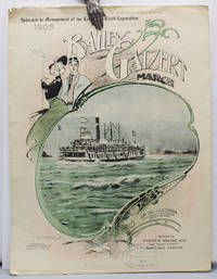
1905ref. 17219Portland Oregon: Published by Fisher Music Co. Lithographed by Anderson & Duniway Co. 1905 First edition of this sheet music as printed for the Lewis and Clark Exposition second edition overall. The sheet music was originally printed in 1902 but is here printed to promote the Lewis and Clark Exposition. The song honors the Bailey Gatzert the most famous Columbia River steamship. Benjamin A. Gifford 1859 – 1936 is considered perhaps Oregon's most famous photographer and his images include the cover photo of the steamship and Multnomah Falls. Original color-printed paper wrappers illustrated with an elaborate border around a color-tinted photo reproduction of the Bailey Gatzert steamship heading up the Columbia River by Benjamin A. Gifford. 10 x 14 in. . . With six text photo reproductions. Some chipping to edges. With the ink ownership stamp of the Portland area piano teacher Lillian R. Bickner 1884 – 1962. A very good copy. "Portland staged its first and only world's fair from June 1 through October 15 1905. During those four and a half months 1588000 paying visitors passed through the gates to the 400-acre fairgrounds on the northwest edge of town…The Lewis and Clark Exposition was conceived so Portland could demonstrate that it could mount a major civic enterprise. The city had had a solid record of economic growth since its founding in 1845 but at the turn of the twentieth century it was competing for investment and immigration with dozens of other cities throughout the American West" Carl Abbott on the Oregon Encyclopedia website. Published by Fisher Music Co., Lithographed by Anderson & Duniway Co., books
1905ref. 17219Portland Oregon: Published by Fisher Music Co. Lithographed by Anderson & Duniway Co. 1905 First edition of this sheet music as printed for the Lewis and Clark Exposition second edition overall. The sheet music was originally printed in 1902 but is here printed to promote the Lewis and Clark Exposition. The song honors the Bailey Gatzert the most famous Columbia River steamship. Benjamin A. Gifford 1859 – 1936 is considered perhaps Oregon's most famous photographer and his images include the cover photo of the steamship and Multnomah Falls. Original color-printed paper wrappers illustrated with an elaborate border around a color-tinted photo reproduction of the Bailey Gatzert steamship heading up the Columbia River by Benjamin A. Gifford. 10 x 14 in. . . With six text photo reproductions. Some chipping to edges. With the ink ownership stamp of the Portland area piano teacher Lillian R. Bickner 1884 – 1962. A very good copy. "Portland staged its first and only world's fair from June 1 through October 15 1905. During those four and a half months 1588000 paying visitors passed through the gates to the 400-acre fairgrounds on the northwest edge of town…The Lewis and Clark Exposition was conceived so Portland could demonstrate that it could mount a major civic enterprise. The city had had a solid record of economic growth since its founding in 1845 but at the turn of the twentieth century it was competing for investment and immigration with dozens of other cities throughout the American West" Carl Abbott on the Oregon Encyclopedia website. Published by Fisher Music Co., Lithographed by Anderson & Duniway Co.,
ref. 0353693677.Ghardcover. Good. Access codes and supplements are not guaranteed with used items. May be an ex-library book. hardcover
ref. 1018634444.Ghardcover. Good. Access codes and supplements are not guaranteed with used items. May be an ex-library book. hardcover
ref. B9781016137317Paperback / softback. New. paperback
ref. 45190289like new. unknown
ref. 45190289-nnew. unknown
1857ref. 375531New York: G. P. Putnam & Co 1857. One of 150 copies of the unofficial issue. Text: 4 777 1pp. Atlas: 100 engraved plates. 4pp. 2 vols. 4to text and folio atlas. Modern half russet morocco and cloth covered boards. Heavy foxing to the plates in the atlas small chip at fore-edge of atlas title minor dampstaining at lower outer corner of plates tape repair to final leaf of text. Provenance: University of Chicago ink stamp and blindstamp deaccession stamp. One of 150 copies of the unofficial issue. Text: 4 777 1pp. Atlas: 100 engraved plates. 4pp. 2 vols. 4to text and folio atlas. A very rare set of the text and plates of Asa Gray's report on the botany of the Wilkes Expedition illustrated with 100 engraved plates of plants collected by the first scientific expedition conducted by the United States Navy. The United States Exploring Expedition circumnavigated the globe under the command of Charles Wilkes between the summer of 1838 and the summer of 1842. The Wilkes Expedition "was the first American scientific expedition of any size charged to 'extend the bounds of Science and promote the acquisition of knowledge' and was one of the most ambitious Pacific expeditions ever attempted" Forbes. The Expedition represents "the first governmental sponsorship of scientific endeavor and was instrumental in the nation's westward expansion. Specimens gathered by expedition scientists became the foundation collections of the Smithsonian Institution. Significant American contributions in the fields of geology botany conchology anthropology and linguistics came from the scientific work of the expedition. Wilkes's evaluations of his landfalls influenced later U.S. positions in those areas" DAB. The Narrative of the expedition was first published in 1844 but the separately-issued scientific reports and atlases for the United States Exploring Expedition were published over a long period of time; the Expedition returned in 1842 and the final volume did not appear until 1874. Because of their limited issue and historical importance all the separately-issued scientific reports and atlases from the Expedition are highly sought after though they very rarely appear on the market. Gray's report is specifically on the "phanerogamia" seed plants or flowering plants collected during the four year voyage. The history of the publication of the many scientific reports that resulted from the Wilkes Expedition is filled with difficulties in their writing and production and Gray's botanical report is exemplary of these difficulties. "The preparation of the reports on the botanical collections brought back by the Expedition proved to be one of the worst headaches encountered during the course of the entire publication" Haskell. Asa Gray was one of the most acclaimed botanists of his era and he was the original selection as botanist for the Wilkes Expedition. In the time between his appointment and the expedition's departure in 1838 however Gray accepted the position of Professor of Botany at the University of Michigan and so he resigned from Charles Wilkes's command and was replaced by William Rich. Rich completed his botanical report in 1846 and submitted it to Wilkes who found it wholly unacceptable. Eventually Asa Gray was asked to study the specimens gathered on the expedition and to produce this report which he agreed to do and which he worked on for three years. Gray initially planned for a two-volume text report and an atlas including 300 folio plates. In the end the text was issued in one large volume and the atlas contained 100 plates drawn by the talented botanical artist Isaac Sprague. The botanical specimens described in the text and depicted in the atlas come primarily from throughout the Pacific Rim including the islands of the South Pacific Hawaii Singapore the Philippines Australia New Zealand and several countries in South America - predominantly Brazil and Chile. The total number of texts published from the voyage of the United States Exploring Expedition is massive - a total of twenty-four volumes of narrative and scientific reports. Asa Gray's botanical report is designated as Volume XV. As with Charles Wilkes's narrative account of the United States Exploring Expedition Gray's botanical report was issued in "official" and "unofficial" editions. The official edition of Gray's report was published by Sherman & Son of Philadelphia in an edition of 100 copies each of text and plates and the unofficial edition was issued by Putnam of New York in an edition of 150 copies again as quarto text and folio plates. Either edition is exceedingly rare in commerce as they were mostly intended for presentation or for placement in research libraries. Sabin writing in 1875 comments that "owing to some mistake a large number of copies of the Atlas were sold by auction unbound and without the letterpress the result is that odd volumes are comparatively common - whole sets are scarce." Actually the text or atlas individually or the two volumes together are exceedingly rare in the market. A highly desirable scientific report from the Wilkes Expedition with an atlas of 100 attractive plates with text by the noted botanist Asa Gray. Haskell 61 and 63; Rosove 354-10.A2 and 355-6.A2 both text and atlas described as "rare"; Sabin 28368; Meisel II pp.668-669; Nissen 2153; Stafleu 2129 2130; Pritzel 3529; Forbes 1993. Not in Spence G. P. Putnam & Co unknown books
1857ref. 375531New York: G. P. Putnam & Co 1857. One of 150 copies of the unofficial issue. Text: 4 777 1pp. Atlas: 100 engraved plates. 4pp. 2 vols. 4to text and folio atlas. Modern half russet morocco and cloth covered boards. Heavy foxing to the plates in the atlas small chip at fore-edge of atlas title minor dampstaining at lower outer corner of plates tape repair to final leaf of text. Provenance: University of Chicago ink stamp and blindstamp deaccession stamp. One of 150 copies of the unofficial issue. Text: 4 777 1pp. Atlas: 100 engraved plates. 4pp. 2 vols. 4to text and folio atlas. A very rare set of the text and plates of Asa Gray's report on the botany of the Wilkes Expedition illustrated with 100 engraved plates of plants collected by the first scientific expedition conducted by the United States Navy. The United States Exploring Expedition circumnavigated the globe under the command of Charles Wilkes between the summer of 1838 and the summer of 1842. The Wilkes Expedition "was the first American scientific expedition of any size charged to 'extend the bounds of Science and promote the acquisition of knowledge' and was one of the most ambitious Pacific expeditions ever attempted" Forbes. The Expedition represents "the first governmental sponsorship of scientific endeavor and was instrumental in the nation's westward expansion. Specimens gathered by expedition scientists became the foundation collections of the Smithsonian Institution. Significant American contributions in the fields of geology botany conchology anthropology and linguistics came from the scientific work of the expedition. Wilkes's evaluations of his landfalls influenced later U.S. positions in those areas" DAB. The Narrative of the expedition was first published in 1844 but the separately-issued scientific reports and atlases for the United States Exploring Expedition were published over a long period of time; the Expedition returned in 1842 and the final volume did not appear until 1874. Because of their limited issue and historical importance all the separately-issued scientific reports and atlases from the Expedition are highly sought after though they very rarely appear on the market. Gray's report is specifically on the "phanerogamia" seed plants or flowering plants collected during the four year voyage. The history of the publication of the many scientific reports that resulted from the Wilkes Expedition is filled with difficulties in their writing and production and Gray's botanical report is exemplary of these difficulties. "The preparation of the reports on the botanical collections brought back by the Expedition proved to be one of the worst headaches encountered during the course of the entire publication" Haskell. Asa Gray was one of the most acclaimed botanists of his era and he was the original selection as botanist for the Wilkes Expedition. In the time between his appointment and the expedition's departure in 1838 however Gray accepted the position of Professor of Botany at the University of Michigan and so he resigned from Charles Wilkes's command and was replaced by William Rich. Rich completed his botanical report in 1846 and submitted it to Wilkes who found it wholly unacceptable. Eventually Asa Gray was asked to study the specimens gathered on the expedition and to produce this report which he agreed to do and which he worked on for three years. Gray initially planned for a two-volume text report and an atlas including 300 folio plates. In the end the text was issued in one large volume and the atlas contained 100 plates drawn by the talented botanical artist Isaac Sprague. The botanical specimens described in the text and depicted in the atlas come primarily from throughout the Pacific Rim including the islands of the South Pacific Hawaii Singapore the Philippines Australia New Zealand and several countries in South America - predominantly Brazil and Chile. The total number of texts published from the voyage of the United States Exploring Expedition is massive - a total of twenty-four volumes of narrative and scientific reports. Asa Gray's botanical report is designated as Volume XV. As with Charles Wilkes's narrative account of the United States Exploring Expedition Gray's botanical report was issued in "official" and "unofficial" editions. The official edition of Gray's report was published by Sherman & Son of Philadelphia in an edition of 100 copies each of text and plates and the unofficial edition was issued by Putnam of New York in an edition of 150 copies again as quarto text and folio plates. Either edition is exceedingly rare in commerce as they were mostly intended for presentation or for placement in research libraries. Sabin writing in 1875 comments that "owing to some mistake a large number of copies of the Atlas were sold by auction unbound and without the letterpress the result is that odd volumes are comparatively common - whole sets are scarce." Actually the text or atlas individually or the two volumes together are exceedingly rare in the market. A highly desirable scientific report from the Wilkes Expedition with an atlas of 100 attractive plates with text by the noted botanist Asa Gray. Haskell 61 and 63; Rosove 354-10.A2 and 355-6.A2 both text and atlas described as "rare"; Sabin 28368; Meisel II pp.668-669; Nissen 2153; Stafleu 2129 2130; Pritzel 3529; Forbes 1993. Not in Spence G. P. Putnam & Co unknown
2008ref. 35139AStuttgart, Verlag Freies Geistesleben, 2008. 8°. 274 Seiten. Mit Abbildungen und einer Kartenskizze. Original-Pappband mit Original-Umschlag. (Gutes Exemplar).
1994ref. 21163ABasel, Boston, Berlin, Birkhäuser, 1994. Gr. 8°. 188 Seiten. Mit 8 Abbildungen sowie einem Titelbild. Original-Pappband mit Original-Umschlag. (Gutes Exemplar). * Lebensgeschichten aus der Wissenschaft.
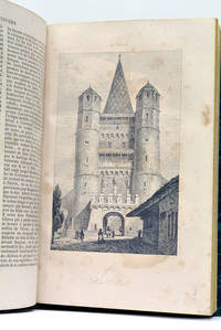
ref. 56216Paris Didot 1846. 4 feuillets. 460 pages. 1 carte dépliante. 91 planches hors-texte. 215x18 Cm. Cartonnage vert de lépoque. Dos lisse. Titre doré. Coins émoussés. Plats un peu frottés. Ouvrage illustré de nombreuses vues costumes portraits etc. Histoire de la Suisse des temps anciens jusqu'au début du 19e siècle suivie de la statistique et la description de chacun des cantons suisses. Il suit une 2e partie beaucoup plus brève sur le Tyrol. Rousseurs. Paris, Didot, 1846. unknown
1857ref. 324349New Haven 1857. Separately-issued offprint from the American Journal of Science and Arts 2nd series Vol. xxiv July 1857. 21-38 pp. plus folding map. 8vo. Period plain green wrappers stitched. Separately-issued offprint from the American Journal of Science and Arts 2nd series Vol. xxiv July 1857. 21-38 pp. plus folding map. 8vo. "Redfield's last contribution to meteorological science was a memoir upon the cyclones or typhoons of the north Pacific Ocean prepared at the request of Commodore Perry to accompany his Narrative of the United States Expedition to Japan; and was printed in the second volume of that work . He showed that the hurricanes of the Pacific followed the same general laws as those of the Atlantic and traced the paths of several remarkable storms among which was one of great force encountered by the steamer 'Mississippi' one of the vessels of Commodore Perry's squadron on route from Simoda to the Sandwich Islands in October 1854" Recollections of John Howard Redfield p. 302. Page 37 includes a description of the Kona or southerly winds of Hawaii as well as the effects of cyclones on the Hawaiian islands. Following its publication within Perry's Narrative in 1856 the work was issued in a slightly more condensed form within the July 1857 issue of the American Journal of Science and Arts. The present separately-issued offprint from the AJSA is the only separately-issued edition of the work. Scarce. Sabin 68512. Not in Forbes unknown books
1857ref. 324349New Haven 1857. Separately-issued offprint from the American Journal of Science and Arts 2nd series Vol. xxiv July 1857. 21-38 pp. plus folding map. 8vo. Period plain green wrappers stitched. Separately-issued offprint from the American Journal of Science and Arts 2nd series Vol. xxiv July 1857. 21-38 pp. plus folding map. 8vo. "Redfield's last contribution to meteorological science was a memoir upon the cyclones or typhoons of the north Pacific Ocean prepared at the request of Commodore Perry to accompany his Narrative of the United States Expedition to Japan; and was printed in the second volume of that work . He showed that the hurricanes of the Pacific followed the same general laws as those of the Atlantic and traced the paths of several remarkable storms among which was one of great force encountered by the steamer 'Mississippi' one of the vessels of Commodore Perry's squadron on route from Simoda to the Sandwich Islands in October 1854" Recollections of John Howard Redfield p. 302. Page 37 includes a description of the Kona or southerly winds of Hawaii as well as the effects of cyclones on the Hawaiian islands. Following its publication within Perry's Narrative in 1856 the work was issued in a slightly more condensed form within the July 1857 issue of the American Journal of Science and Arts. The present separately-issued offprint from the AJSA is the only separately-issued edition of the work. Scarce. Sabin 68512. Not in Forbes unknown
1807ref. 83011807. MIRANDA EXPEDITION. The Trials of William S. Smith and Samuel G. Ogden for Misdemeanours had in the Circuit Court of the United States for the New-York District in July 1806 . By Thomas Lloyd Stenographer. New York: I. Riley and Co. 1807. xxxiii 3 287 p. Contemporary mottled sheep very skillfully rebacked in period style retaining original spine label. Occasional light browning else a fine copy. The trial of Smith and Ogden for organizing and underwriting the expedition of Francisco de Miranda from New York to South America to overthrow the Spanish government there and to separate the Spanish colonies from the mother country. unknown books
1864ref. 54080Berlin, Decker, 1864-73. Lex8vo. 3 contemp. hcalf. Gilt spines and with gilt lettering. Spines slightly rubbed. XXII,(4),352VI,(4),375"XI,(4),426 pp., 24 engraved plates and 3 folded maps. Faint brownspots to margins in volume 1.
1864ref. 54080Berlin Decker 1864-73. Lex8vo. 3 contemp. hcalf. Gilt spines and with gilt lettering. Spines slightly rubbed. XXII4352;VI4375;XI4426 pp. 24 engraved plates and 3 folded maps. Faint brownspots to margins in volume 1. First edition. The offered volumes contains the general description of the expedition which relates to Japan and China. They do not comprise the scientific parts zoology botany of the expedition and not the landscape plates published as "Ansichten aus Japan China und Siam". unknown
1802ref. 72327London: A. Arrowsmith 1802. A fine and high quality facsimile of this seminal map commissioned in 2001 by renown Lewis & Clark collector Roger Wendlick. Backed on canvas and measuring 150 x 58 inches in color Wendlick commissioned the firm of Ford Graphics of Portland to make this map. Only 21 copies were made and this is the last one with a letter from Wendlick attesting to this fact. Fine. "The 1802 revision of the map of North America on display delineates the complete length of the Missouri River as well as Mackenzie's journey to the Pacific in 1793. The depiction of the Missouri headwaters which Arrowsmith studied from Peter Fidler's drawing of a map by the Blackfoot Indian Ac Ko Mo Ki shows several streams joining into two branches of the Missouri which flow almost due east. The southern branch of the Missouri appears to be the main branch of the river and connects to the Knife River; the northern branch is a good representation of the actual course of the Missouri.Although the revised map still shows a single ridge of mountains in the west a note near the southern sources of the Missouri states: "Hereabout the Mountains divide into several low Ridges." This note which was based on the reports of Fidler Mackenzie and Thompson was more encouraging to Jefferson and Lewis than the note about the Stony Mountains on the 1795 map which unfortunately turned out to be more accurate. Arrowsmith's map situates the Great Lake River on the western slopes of the mountain range and connects this river to the Columbia River with a dotted line. Since another note claims that this river can be descended to the sea in eight days the Arrowsmith map supported the erroneous belief in a convenient route to the Pacific Ocean.Both the 1795 and 1802 versions of Arrowsmith's map served as resources that Nicholas King consulted as he prepared his map for the Lewis and Clark Expedition. Lewis and Clark in fact carried the 1802 Arrowsmith map along on the expedition. Thomas Jefferson owned the 1802 map as well as an 1802 edition of Arrowsmith's map of the United States. Arrowsmith's 1802 map of North America was the most comprehensive map of the West available to Jefferson and Lewis and it was probably the most important map used in the planning of the expedition." University of VirginiaAaron Arrowsmith's 1802 map was the most current and accurate cartographic representation of the American West available to Lewis on the eve of the journey. Lewis studied this edition closely during the summer of 1803 and even carried a copy on the first leg of the expedition. Among Arrowsmith's sources were Indian maps reports and manuscript maps from the British fur trade and British Navy exploration reports and charts of the Pacific Coast. But various elements in the map reinforced Jefferson's misconceptions of western geography among these were depictions of the Rocky Mountains as a single long chain and the headwaters of the upper Missouri River at the eastern edge of the Rockies suggesting those mountains were readily portaged. A. Arrowsmith unknown
1980ref. 58338Gütersloh, Prisma (Sonderausgabe), 1980. 8 Bll., 365 SS., 1 Bl., 1 gefaltete Karte (beiliegend in Einstecklasche). 8°, Original-Leinen mit Schutzumschlag.
1884ref. 73300Washington: Government Printing Office 1884. First edition. Octavo. 75 1 pp. plus folding map of the Lena Delta in Russia and four full page heliotypes. Original blue printed wrappers. Small piece missing from outer edge of front wrapper three small and excellent paper repairs to wrappers. A very good and very clean copy in the original wrappers.The heliotypes in this publication are particularly interesting as they show Russian soldiers guarding the graves of the Jeannette crew. The final photograph shows all the coffins loaded into a Russian train."In February 1882 Secretary Thompson had despatched naval lieutenants Giles Harber and William Schuetze to the delta to search for any traces of the lost explorers particularly of Chipp's party. They were unsuccessful but in November received orders from the secretary to supervise the return of the bodies of De Long and his comrades to the United States. Weather and bureaucracy delayed them for a year; finally in November 1883 the bodies were taken from Yakutsk by train to Moscow Berlin and finally Hamburg. Here they were placed on board the U.S. steamer Frisia which arrived in New York in February 1884. The funeral cortège was escorted by naval and military detachments to the Church of the Holy Trinity on Madison Avenue for a memorial service. Afterwards the bodies of Ambler Collins and Boyd were claimed for private burial; those of De Long and six others were taken to Woodlawn Cemetery in the Bronx and buried together there. In October 1890 a large monument to the expedition's dead was unveiled at the United States Naval Academy in Annapolis. Its design is based on the original cairn and cross raised at the burial site on the Lena Delta." Wiki [Government Printing Office] unknown
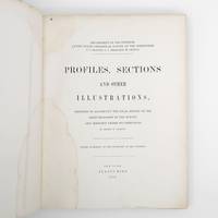
1872ref. 373132New York: Jules Bien 1872. First edition. Limited to 100 copies. 65 lithographed plates many folding preceded by 4pp. text. 4to. Original green cloth boards upper cover lettered in gilt rebacked endpapers renewed. Dampstaining. First edition. Limited to 100 copies. 65 lithographed plates many folding preceded by 4pp. text. 4to. This book was prepared to illustrate the work of the Hayden survey. It contains numerous panoramic illustrations many on folding sheets depicting sites in Wyoming Utah Colorado and Montana. This report contains the bulk of Henry Wood Elliott's art work for the Hayden Survey see preceding entry most of which was published nowhere else. These images are important because of their scientific contribution to several fields historical significance documentation of the Hayden expedition and their beauty and attention to detail. Elliott's illustrations were among the early images of many locations in the new territories of the West. From an edition of 100 copies issued in advance of the text. The Prefatory Note states p. 3: "A small edition of one hundred copies of the Profiles and Sections are issued in advance of the text for the purpose of placing them in the hands of the principal geologists in this country and in Europe. The first issue of two thousand copies in colors will be published with descriptions in about one year." We find no evidence that a subsequent edition in color was ever printed and it is stated of the present work in the Checklist of United States Public Documents 1789-1909 Washington: Government Printing Office 1909: "Originally intended to illustrate v. 4 of quarto series of reports but never thus used." The Hayden Survey was the most important of the four major government surveys of the American West undertaken after the Civil War the others being Powell King and Wheeler. Collectively these surveys filled in the map of the United States using accurate scientific methods to chart the land and investigate not only its geology but natural resources wildlife and plants as well. Schmeckebier Catalogue and Index of the Publications of the Hayden King Powell and Wheeler Surveys p. 32 #3 Jules Bien unknown books