Wissmann, Hermann vonAntiquariat.de
2079 resultados
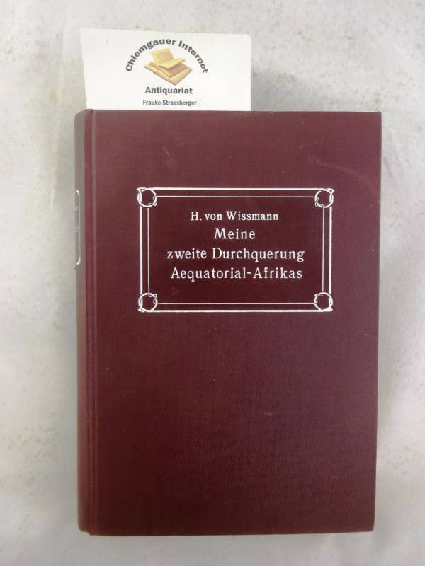
1907ref. 300413Berlin, Globus, 1907. XV, 336 Seiten. Porträt-Frontispiz. Originalleinenband. 23 cm
1960ref. 295100Seebruck Heering-Verlag, 1960. 232 Seiten. Zahlreiche, teils farbige Abbildungen, Schlagwortverzeichnis Originalhalblederband. 22 cm
1995ref. 31676Bern, Scherz Verlag, 1995. 1. Aul. 414 Seiten. Mit vielen farbigen Photographien auf Tafeln. Gr. 8°, Hardcover/Pappeinband mit Originalumschlag.
1954ref. 30253Berlin : Verl. d. Nation, [1954]. 326 S. : Ill. 8°. 5. Aufl. OHLwd. mit ill. Einbd., Kopfbuntschnitt u. SU.
1961ref. 13388Wiesbaden : Brockhaus 1961. 214 S., Mit 68 einfarb. u. mehrfarb. Bildtaf. u.e. Ktn-Skizze ; gr. 8, mit Schutzumschlag Lw., gebundene Ausgabe, Leinen, Exemplar in guten Erhaltungszustand
1992ref. 15439Flein, Frankfurt am Main: EK-Concept-GmbH, [1992]. 160 Seiten , 29 cm Pappeinband
1976ref. 50505Rudolstadt, Greifenverlag, 1976. 3. Auflage 327 Seiten , 22 cm, Leinen
ref. 64494aafBerlin, Kribe-Verlag, 1928, in-8vo, Frontispiz-Porträt mit Hs. Signatur vom Autor + 304 S. + photogr. Tafeln in Kupfertiefdruck, Original ill Leinenband.
1932ref. 26117Berlin, Privatddruck, 1932. Folio (36 x 31 cm). 32 jew. auf lose Kartontaf. unter Seidenschutzblatt montierte photograph. Abb. zusammen mit Textheft (8 Bl. auf unbeschnittenem Bütten in OUmschlag) in OHlwd.-Mappe mit mont. Deckelbild.
1954ref. 100087461Denoël 1954 in8. 1954. Broché. Maudheim : Deux Ans dans l'Antarctique. l'Expédition Scientifique Norvégienne Britannique et Suédoise dans l'Antarctique en 1949-1952
2013ref. w210630271Cambridge 2013. 341pp. Slightly over sized hardback with glossy illustrated boards no DJ VG no names or markings index chapter notes references maps drawings photographs plans of sites tables Maritime Networks in the Mycenaean World . Hard Cover. Very Good. Cambridge Hardcover
1972ref. 36313ABTübingen/Basel Erdmann 1972. 338 S., m. 31 zeitgen. Darstell. u. 1 Kart. O.-Leinen, O.-Umschl. Sehr guter Zust.
1989ref. 202106Escudo de Oro 1989 95 pages in4. 1989. Broché. 95 pages.
1986ref. 100051441Praxys / Pen Duick 1986 in8. 1986. Broché. cartes photographies noir et blanc
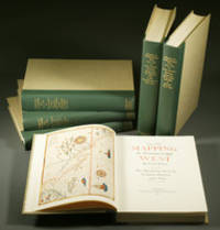
1957ref. E0551From the Spanish discovery to the opening of the Civil War 5 volumes in 6. Volume One: The Spanish Entrada to the Louisiana Purchase 1540-1804 xiv264 pages with color frontispiece map and 275 maps many folding and index; Volume Two: From Lewis and Clark to Fremont 1804-1845 xiii281 pages with colored frontispiece map 143 additional maps some folding and index. Volume Three: From the Mexican War to the Boundary Surveys 1846-1854 xiii349 pages with colored frontispiece map 322 additional maps and index; Volume Four: From the Pacific Railroad Surveys to the Onset of the Civil War 1855-1860 xiii260 pages with color frontispiece map an additional 127 maps some folding and index; Volume Five From the Civil War to the Geological Survey Part One: xviii222 pages with color frontispiece map and an additional 152 maps; Volume Five From the Civil War to the Geological Survey Part Two: 223-487 pages with 124 maps and index. Folio 14 1/2" x 10 1/2" bound in quarter green leather with gilt lettering to spines. volume I printed by the Grabhorn Press; volumes II-V printed by Taylor & Taylor and James Printing based on the designs of Edwin and Robert Grabhorn. First edition limited to 1000 copies. Carl Wheat's Mapping of the Trans-Mississippi West is a comprehensive and readable cartographic history of the American West. The first three volumes of the work are by necessity bulky and out sized to accommodate the many maps contained with their covers. These beautifully printed books present a truly graphic picture of the exploration and peopling of the vast unknown land west of the Mississippi. The author does not merely present a catalog of significant maps of each era but tells the exciting story of many facets of history that resulted in their making-of the hard journeys the hazardous exploits the motivation the mysticism the misunderstandings and the strange blend of fact imagination false geographic concept and political necessity which were consummated in the engraver's work. These volumes will provide exciting text for the casual reader and have become eminent source book for the student and scholar. Condition: A near fine set. Due to the size and/or weight of this lot extra shipping and/or handling charges may apply. Institute of Historical Cartography hardcover books
1957ref. E0551From the Spanish discovery to the opening of the Civil War 5 volumes in 6. Volume One: The Spanish Entrada to the Louisiana Purchase 1540-1804 xiv264 pages with color frontispiece map and 275 maps many folding and index; Volume Two: From Lewis and Clark to Fremont 1804-1845 xiii281 pages with colored frontispiece map 143 additional maps some folding and index. Volume Three: From the Mexican War to the Boundary Surveys 1846-1854 xiii349 pages with colored frontispiece map 322 additional maps and index; Volume Four: From the Pacific Railroad Surveys to the Onset of the Civil War 1855-1860 xiii260 pages with color frontispiece map an additional 127 maps some folding and index; Volume Five From the Civil War to the Geological Survey Part One: xviii222 pages with color frontispiece map and an additional 152 maps; Volume Five From the Civil War to the Geological Survey Part Two: 223-487 pages with 124 maps and index. Folio 14 1/2" x 10 1/2" bound in quarter green leather with gilt lettering to spines. volume I printed by the Grabhorn Press; volumes II-V printed by Taylor & Taylor and James Printing based on the designs of Edwin and Robert Grabhorn. First edition limited to 1000 copies. Carl Wheat's Mapping of the Trans-Mississippi West is a comprehensive and readable cartographic history of the American West. The first three volumes of the work are by necessity bulky and out sized to accommodate the many maps contained with their covers. These beautifully printed books present a truly graphic picture of the exploration and peopling of the vast unknown land west of the Mississippi. The author does not merely present a catalog of significant maps of each era but tells the exciting story of many facets of history that resulted in their making-of the hard journeys the hazardous exploits the motivation the mysticism the misunderstandings and the strange blend of fact imagination false geographic concept and political necessity which were consummated in the engraver's work. These volumes will provide exciting text for the casual reader and have become eminent source book for the student and scholar. Condition: A near fine set. Due to the size and/or weight of this lot extra shipping and/or handling charges may apply. Institute of Historical Cartography hardcover
1970ref. 0037011970 Original pictorial postcard of Nampa 22162' with cachet 'Manchester Nepalese Expedition Base Camp 14000 ft'. Signed by the entire expedition team John Allen Leader Bill Rowntree Arthur Clarke Yvonne Clarke Brian Cosby and Rob Beighton. A near fine copy. Signed by the Expedition Team. First Edition. unknown
1970ref. 0040731970 A complete set including Official Expedition Cover 'Manchester Nepalese Expedition to Climb Nampa 22162ft.' with post-marked Nepalese stamp and cachet 'Manchester Nepalese Expedition Base Camp 14000 ft' a bit of rubbing to extremities & a few marks to reverse; original pictorial postcard of Nampa with identical cachet signed by the entire expedition team John Allen Leader Bill Rowntree Arthur Clarke Yvonne Clarke Brian Cosby and Rob Beighton; perforated sheet with special expedition stamp and a double-side folding sheet with route map and explanatory notes. A near fine set. Signed by the Expedition Team. First Edition. unknown
1955ref. 100152171Editions L. Cuypers 1955 in8. 1955. Broché.
1935ref. 100152849Editions Alpina 1935 in8. 1935. Broché.
ref. 1330370015.Gpaperback. Good. Access codes and supplements are not guaranteed with used items. May be an ex-library book. paperback
1974ref. 9348-0290München, Renner, 1974. Quart, Org.-Ganzleinen mit illustriertem Org.-SU, XXVIII, 443 (+ 1) S., 32 unnumerierte Tafelblätter mit Abbildungen nach S/W-Photographien und 2 Faltkarte sowie einigen Textillustrationen, wohlerhaltenes Exemplar. [Ergebnisse der Frobenius-Expedition 1954/1955 nach Südost-Venezuela]. - [Ergebnisse der Frobenius-Expedition 1954/1955 nach Südost-Venezuela]. - ISBN 3876730341
1948ref. 100096925Lumière 1948 in8. 1948. Broché. iconographie en noir et blanc
1950ref. fj1380Arthaud Les amis des jeunes Cartonné avec jaquette 1950 In-12 (13.5 x 19 cm), cartonné avec jaquette illustrée en couleurs, 254 pages, illustration en couleurs en frontispice, illustrations en noir in et hors-texte ; jaquette abîmée (coiffes et bords frottés, des taches d'usage aux plats défraîchis), coiffes de l'ouvrage légèrement frottées, par ailleurs intérieur frais, assez bel état général. Livraison a domicile (La Poste) ou en Mondial Relay sur simple demande.
2003ref. 265633Blanc Silex 2003 in8. 2003. Broché.