1 517 résultats
réf. 5530ouvrage traduit de l’anglais avec l’autorisation de l’auteur par Mme H.LOREAU.Grand in 8 demi-chagrin bleu à nerfs,titre,fers dorés,plats percaline bleue chagrinée avec filets à froid en encadrement.Faux-titre,titre,une carte (itinéraire de Zanzibar à Kazeh)717 pages,tranches dorées. Illustrations, la plupart hors-texte,complet de la carte dépliante en fin de volume.L.Hachette 1862 rousseurs éparses,plus ou moins fortes,habituelles,un cahier légèrement décalé.Les deux coins inférieurs sont légèrement émoussés.Départ de Zanzibar.Zanzibar et la Mrima.Vallée du Kingani et de la Mgéta.Détails géographiques et ethnologiques.Halte dans le Zoungoméro.Composition de la caravane.Traversée de la chaîne côtière de l'Afrique Orientale.Traversée de l'Ougogo.Arrivée dans la Terre de la Lune. Fin de la traversée de l'Ounyamouézi.Arrivée au Tanganyika.Exploration.Le Lac.Retour.Départ de Kahouélé. Retour à la côte.
1862réf. 10232Paris Hachette 1862 Un volume in-8 demi chagrin vert, dos à nerfs, caissons décorés, titre doré, tranches dorées, 719 pages, illustrations in-texte, complet de ses deux cartes. Légères rousseurs, bel exemplaire.
1978160 pages. Signed and inscribed by Birrell upon title page. "Brings together for the first time the photographs and journal of Benjamin Baltzly from his trip through British Columbia in 1871." - from dust jacket. Prior owner's blind stamp upon title page. Bookplate inside front board. Item has been peeled from front free endpaper leaving some paper behind. Average overall wear. Dust jacket now preserved in glossy new archival-grade Brodart cover. A sound copy. Book
réf. 230002Paris, Librairie Dufey, 1833 4 vol. in-8, broché. Rousseurs.
1936réf. HM140181936-1960 1342 p., num. figs and pls, paperbound. Most are reprints from: Temminckia. Includes papers on: Crinoids / Gorgonarien / Chaetognatha / Aves / Hydroidea / Pisces / Pycnogonida / Octocorallia / Several on Crustacea (mainly Decapoda, Copepoda and Rhizocephala).We included also two earlier papers on this expedition: Stiasny, 1935. Die Tornarien der Snelliusexpedition (12 p.) & Stiasny, 1935. Die Scyphomedusen der Snelliusexpedition (44 p., 9 figs, 1 map, 1 folded plate). Scarce set of the earlier reports in good condition.
1858réf. 1441Alger et Paris, Imprimerie du Gouvernement, Librairie Algérienne de Dubois Frères, Challamel, 1858. In-8 - 17x24,5cm. Broché (une chemise légèrement cartonnée postérieure protège l'ouvrage). 63pp, 1 carte dépliante in fine. Edition originale.Complet de sa carte dépliante de l'itinéraire suivi par M. le Capitaine L. de Colomb, dans sa tournée d'exploration du sud, levée et dessinée par M. de La Ferronnay, officier stagiaire du Bureau Arabe de Geryville. Très rare.
réf. 201848Paris, Plon, 1898 in-8, XXVII-563 pp., frontispice, index, demi-veau tabac, dos à nerfs orné (reliure moderne). Quelques rousseurs.
réf. 201123Paris, Ch. Tanera, 1858 in-8, VII-210 pp., broché. Dos abîmé.
réf. P1-4C-5LILLE et PARIS, A.S. DE DONCOURT, 1885. In-4 (21 x 16), demi- chagrin rouge, plats en percaline rouge ornée au premier plat, dos à 5 nerfs orné, titre doré au dos, toutes tranches dorées. Dos frotté, intérieur frais, quelques rousseurs. Illustré d’une carte dépliante en frontispice et de nombreuses illustrations in et hors-texte. 318 pages – 2 ff. tables des matières et des Vignettes. À la suite : La Perse, 328pp, nombreuses illustrations. Bon exemplaire, rousseurs, Livre de Prix.
réf. 16800Librairie de L. Hachette et Cie. Paris, 1864, petit in-4 demi-chagrin vert, dos à quatre nerfs, toutes tranches dorées. Reliure de l'éditeur. 2ff.-579pp. Frontispice représentant Speke et Grant. Cartes et dessins du capitaine J. A. Grant. Trois cartes hors-texte dont deux à double page en fin d'ouvrage. Très nombreuses gravures en noir dont une quarantaine de planches à pleine page comprises dans la pagination. Première édition française de cette relation de la seconde expédition de Speke à la recherche des sources du Nil blanc. Lors d'un premier voyage en 1858 Speke avait été le premier européen à situer le Lac Tanganyika ainsi qu'un second grand lac qu'il baptise Victoria (Nyanza). Il repart en Afrique en 1860 et il faudra attendre Juillet 1862 pour qu'il atteigne les chutes du Ripon, marquant le point de jonction entre le Nil blanc et le lac Victoria. Son récit est publié en Angleterre en 1863 et traduit en français dès l'année suivante dans cette traduction. Très bel exemplaire à la reliure en parfait état et au papier exempt de rousseur.
réf. 5614Paris, Association d'imprimeurs, 1904. Fort in-8, demi-reliure à coins, photographies et cartes.
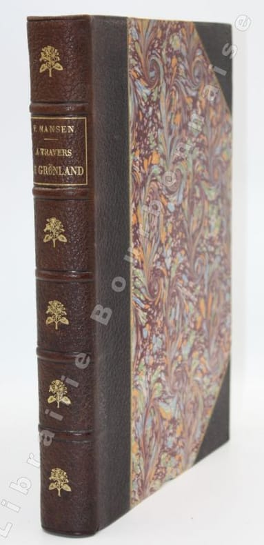
réf. 13967P., Hachette, 1893 ; in-4. 2 ff.-IV-395 pp.-(1)-1 carte dépliante en couleurs. Demi-maroquin brun à coins, dos à nerfs, titre et fleurons dorés, filets dorés sur les mors et les coins, tête dorés. Bel exemplaire.
1860réf. P1-3i-6Sans lieu ni date (1860). Atlas in-4 (27x18cm), relié demi-chagrin et coins, dos à 6 nerfs, coins usés, 24pp de texte, 39 planches et 4 cartes dépliantes. COMPLET. Quelques rousseurs.
réf. 230594s.d. à vue : 28 x 39.5 cm - cadre : 39 x 50 cm, encadrée sous verre, cadre postérieur à baguettes dorées.
19304to [27 x 20 cm]; 2 volumes, xxvi, 568; ix, 569 - 1064 pp, 476 illustrations (some color printed plates) text figures, 9 maps. orig crimson cloth, gilt lettering, dust jackets (rubbed, chipped with one having large section missing), else a fine clean set, with a presentation inscription on the author's card, signed by author to Horace Binney, paperclipped to title with rust mark. A most interesting survey of Liberia and Belgian Congo related to medical and natural conditions. Much of the travel was by foot across Africa. The first volume deals mainly with social and medical conditions, and especially of the little known inhabitants of tribal Liberia and their living conditions but also covers geology, flora, zoology. The second volume is a comprehensive survey of the natural history, with emphasis on birds, mammal, insects and reptiles. Very well illustrated. Not often found with both dust jackets and author's signature. Strong, professor of tropical medicine at Harvard, was accompanied by other physicians and zoologists on the expedition. Conover 659.
1884réf. 39550Washington: GPO 1884. "Voluminous documentation on the bungled attempt to rescue Greely and his men. The rescue expedition consisted of the Yantic and the Proteus the latter being lost in Kane Basin. The head of the expedition never followed his orders for re-supplying Greely" -. Arctic Bib 18416. A very good copy in quarter calf over boards. sep 22 2017. 310 265 pp. b/w photo plates folding maps. GPO hardcover books
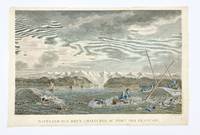
1797réf. 406875Paris: L'Imprimerie de la Republique 1797. Tape remnants from mounting along upper edge verso some foxing overall good condition and color. Hand-colored engraving by Dequevauviler after Nicolas Marie Ozanne. 9 7/8 x 15 3/4 inches image 11 x 17 inches sheet. A fine print from 'Atlas du voyage de la Perouse' depicting the capsizing of two rowboats in Alaska during La Perouse's 1786 expedition. The wreck took place off of the Port des Francais today known as Lituya Bay in Glacier Bay National Park Alaska. [L'Imprimerie de la Republique] unknown books
Second edition, 8vo, 72pp., with the half-title, disbound. ESTC locates just 2 copies, The British Library and Staatsbibliothek zu Berlin.
1908thick 8vo [24.5 x 16 cm]; xi, 425 pp, numerous plates and frontis from photos by author, some plates with two photos, itinerary, index. original cloth, gilt spine title lettering, spine edge a little rubbed, endpaper name, internal hinge repair, interior is clean and fine in very good+ cover. A picture of this book is available upon request by email. Hand S480. The anthropologist author's earlier work, Indians of Southern Mexico, produced in only a limited edition was highly regarded but consists of mostly photos (but excellent ones), although he published a number of other papers, mostly short, on the subject. This work provides a detailed travel narrative through Oaxaca, Chiapis, parts of Guatemala, Dos Rios to photograph the Otamis of Huixquilucan, to Patzcuaro to study the Tarascans, to Uruapan, Tlaxcala, Cuauhtlantzinco, Zamora, states of Puebla, Hidalgo and many others, travelling by railroad where possible, or steamer, horseback, etc. Based on several expeditions from 1896 to 1901, the author was able to greatly expand his earlier works and produce this important book that preserves much information which is not available elsewhere and of towns and regions that have greatly changed in the last 100 years. 'A first hand, reliable picture. . . an outstanding work' (Emory Bogardus).
réf. 102126Bruxelles, Imprimerie Scientifique Charles Bulens 1910, 360x280mm, en feuille sous cartable demi-percaline à coins, avec lacet. Bel exemplaire.
1970réf. 004083Munich: The Expedition 1970 Original pictorial postcard with Pakistan Stamps 50 paisa postmarked Gilgit 9 May 1970 with expedition cachet; Signed by 16 team members including leader Karl Herrligkoffer summiteers Reinhold Messner Felix Kuen and Peter Scholz as well as Michl Anderl Gerhard Baur Wolf-Dietrich Bitterling Werner Haim Gunther Kroh Hermann Kuhn Gerd Mandl Elmer Raab Hans Saler Peter Vogler Jurgen Winkler Alice Von Hobe Max von Kienlin and a sherpa thumbprint. A near fine copy. The success of the German 1970 Rupal Face expedition to Nanga Parbat was marred by the death of Gunther Messner after descending the unknown slopes of the Diamir Face. Signed by the Expedition Team. First Edition. Soft Cover. F-. The Expedition paperback
1982réf. 0035761982 Original pictorial postcard with Chinese Stamps R25 postmarked 20/4/1982. Signed by Doug Scott Nick Prescott Paul Braithwaite Roger Baxter Jones and Alex McIntyre. A near fine copy. This item can be purchased with a copy of 'The Shishapangma Expedition' by Scott and McIntyre. Signed by the Team Members. Soft Cover. F-. paperback
1869réf. 14451London & Glascow: William Collins Sons & Company. 1869. Hardcover. With two hundred illustrations after drawings by Gustave Dore Berard Lancelot Jules Noel and other eminent artists and six finely engraved maps full coloured title page reads the same for both volumes. Volume 1 first series - xii 820 pages six finely engraved maps full coloured and four others folding panorama of Jerusalem approx 200 other illustrations some full page Volume 2 second series - xii 810 pages six finely engraved maps full coloured and two others approx 200 other illustrations some full page bound in half leather as a matching 2 Volume set front hinge on Vol. 1 has small split at top new endpapers overall a very good set Heavy books may require extra postage cost. . William Collins, Sons & Company hardcover
1880réf. 1309New York: Henry Holt and Company. Very Good. Hardcover. Some fraying to top and bottom spine. Front hinge weakening. Some fraying to rear map margin not effecting printed area. Previous owner's name to front pastedown; Rare. Numerous b&w illustrations and two maps; 8vo; 448 pages . 1880. Henry Holt and Company hardcover
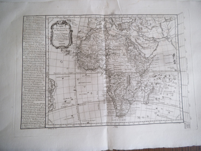
réf. 14521Carte nouvelle de l’Afrique dirigée par M. PHILIPPE dessiné par MOITHEY gravé par VALLET. Gravure sur vergé 41x290mm à la cuvette 530x350mm avec marges. (Pli central et petite déchirure réparée en marge supérieure), carte issue de l’atlas universel dirigé par PHILIPPE de PRETOT.