[CAMPAGNES DE LA RÉVOLUTION ET DU CONSULAT].Livre Rare Book

2 079 résultats
réf. 238169Paris et Milan, 1800 - 1801 7 pièces en deux vol. in-8, demi-veau fauve, dos lisses ornés de dent-de-rat et filets dorés, pièces de titre crème, coins en vélin (reliure un peu postérieure). Des mouillures claires au premier volume.
1893réf. 2712376Adelaide: C.E. Bristow 1893. Wrappers torn at edges but well repaired as are the boards of the map section. Octavo complete with maps; original wrappers and boards preserved in a brown morocco bookform box. First edition: one of 500 copies printed of the narrative of one of the last great Australian exploring expeditions written by the leader of the expedition and complete with its maps. Lindsay led this extensive expedition - it ran to eight men forty-four camels and five Afghan camel drivers - organised by the South Australian Branch of the Royal Geographical Society and equipped by Sir Thomas Elder to explore the unknown interior between South Australia and the west coast and to look for Leichhardt. Lindsay's exhaustive report includes the surveyor L.A. Wells's journal of the expedition. Also included is an extensive Aboriginal vocabulary collected by Wells from the Pidong tribe at the head of the Murchison River the Minninng tribe at Fraser Range from the Everard Ranges at Mount Illbillee and from the "Wallawe" tribe at Yarragabie Station Western Australia. He states "Appended is a list of native names which I have collected from four tribes met with during the expedition.". The separate large folding maps are original lithographs coloured to illustrate geological changes. Compiled and drawn by both Lindsay and Wells these maps show in great detail the earlier discoveries of Giles Gosse Forrest and Hunt as well as the route taken by the Elder explorers. . C.E. Bristow unknown
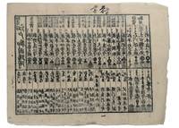
1853réf. 347481853. Three woodblock-printed sheets on mulberry paper. Mild edge wear old folds. A detailed revealing group of late Tokugawa samurai reference sheets recording the names ranks stipends heraldry standards and service obligations through which the shogunate and Edo public understood military readiness at the moment of Perry's arrival. Commodore Matthew C. Perry anchored off Uraga at the entrance to Edo Bay in July 1853. His arrival made visible the vulnerability of the Tokugawa capital and produced an immediate demand for information about coastal defence domain strength and the lords responsible for guarding the approaches to Edo. Kawaraban and related broadsides answered that demand in compressed visual form combining names crests military symbols income figures and geographical or administrative data. The first printed sheet appears to be an earlier roster of Edo office-holders or guard personnel. Its tabular format with names offices crests and standards records the recognitional system already in place within Tokugawa administration before the Perry crisis sharpened the public appetite for such information. The manuscript sheet is ruled into a large grid with headings formed from the twelve zodiac signs and the four seasons including Rat Ox Tiger Hare and the seasonal headings. The entries appear to record named houses Lords or retainers against recurring seasonal and cyclical categories probably for service attendance or ceremonial obligation. The third sheet is headed "Rekko yushinroku" here translated as "Register of Valiant Retainers of the Lords." It lists major daimyo houses and their principal retainers with domain or house headings names titles stipend figures in koku family crests standards and related insignia. Visible regional or house designations include "Kaga" "Owari" "Kii" "Satsuma" "Higo" and "Tosa." The sheet gives a graphic register of the daimyo world mobilised or imagined as mobilised around the defence of Edo Bay. Together the sheets preserve the administrative and visual language of Tokugawa defence at a moment of acute pressure. They are not formal shogunal orders and the first sheet may predate Perrys arrival but they show how late Edo Japan translated rank obligation military identity and coastal defence into portable tabular form. Their compression the names of Lords and retainers the scale of domains the crests and standards by which armed households could be recognised and the bureaucratic habits of a regime suddenly forced to account for its capacity to defend the country reveals these documents' immediacy and importance. unknown
1853réf. 347481853. Three woodblock-printed sheets on mulberry paper. Mild edge wear old folds. A detailed revealing group of late Tokugawa samurai reference sheets recording the names ranks stipends heraldry standards and service obligations through which the shogunate and Edo public understood military readiness at the moment of Perry's arrival. Commodore Matthew C. Perry anchored off Uraga at the entrance to Edo Bay in July 1853. His arrival made visible the vulnerability of the Tokugawa capital and produced an immediate demand for information about coastal defence domain strength and the lords responsible for guarding the approaches to Edo. Kawaraban and related broadsides answered that demand in compressed visual form combining names crests military symbols income figures and geographical or administrative data. The first printed sheet appears to be an earlier roster of Edo office-holders or guard personnel. Its tabular format with names offices crests and standards records the recognitional system already in place within Tokugawa administration before the Perry crisis sharpened the public appetite for such information. The manuscript sheet is ruled into a large grid with headings formed from the twelve zodiac signs and the four seasons including Rat Ox Tiger Hare and the seasonal headings. The entries appear to record named houses Lords or retainers against recurring seasonal and cyclical categories probably for service attendance or ceremonial obligation. The third sheet is headed "Rekko yushinroku" here translated as "Register of Valiant Retainers of the Lords." It lists major daimyo houses and their principal retainers with domain or house headings names titles stipend figures in koku family crests standards and related insignia. Visible regional or house designations include "Kaga" "Owari" "Kii" "Satsuma" "Higo" and "Tosa." The sheet gives a graphic register of the daimyo world mobilised or imagined as mobilised around the defence of Edo Bay. Together the sheets preserve the administrative and visual language of Tokugawa defence at a moment of acute pressure. They are not formal shogunal orders and the first sheet may predate Perrys arrival but they show how late Edo Japan translated rank obligation military identity and coastal defence into portable tabular form. Their compression the names of Lords and retainers the scale of domains the crests and standards by which armed households could be recognised and the bureaucratic habits of a regime suddenly forced to account for its capacity to defend the country reveals these documents' immediacy and importance. unknown books
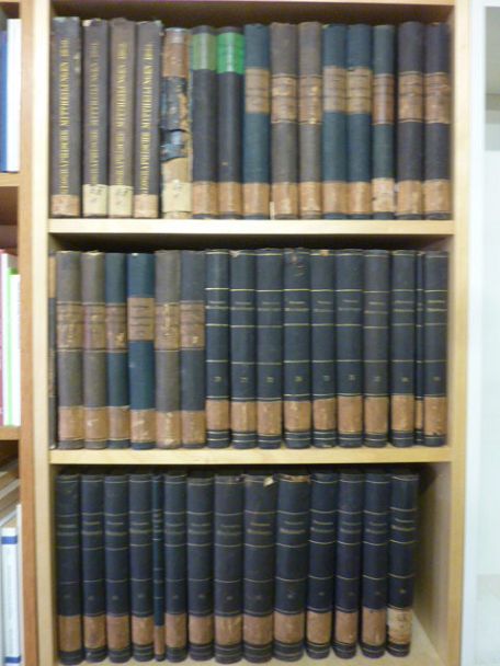
1855réf. 46629Gotha, Julius Perthes, 1855-1874. 4to. Bound in 18 contemp. hcalf, some wear to the first 10 vols., some a bit rubbed. Some scattered brownspots to the first volumes. Gilt spines. Wear to top of spines. With a huge amount of original maps, plates, profiles etc., lithographed and engraved, large and folded and mainly in colour. This set does not include the ""Ergänzungsbände"".
1855réf. 46629Gotha Julius Perthes 1855-1874. 4to. Bound in 18 contemp. hcalf some wear to the first 10 vols. some a bit rubbed. Some scattered brownspots to the first volumes. Gilt spines. Wear to top of spines. With a huge amount of original maps plates profiles etc. lithographed and engraved large and folded and mainly in colour. This set does not include the "Ergänzungsbände". The first 19 lacking vol. 14 volumes of this importent periodical from its "Golden Period". "Petermann's Mittheilungen" became the leading geographic publication of the world and remained so until World War I. All the new geographical discoveries all the reports from the latest exploratory expeditions were published and flowed into Petermann's Geographische Anstalt and he took care to see that it was translated into cartographic form as quickly as possible. The maps soon came to have a reputation for containing the latest and the most accurate information available. Not only German but international readers as well came to see the 'Mitteilungen' as an indispensable organ for the world of geographical research. unknown
réf. H4141874. Albumin Prints ca. 145 x 129 cm 15 x 106 cm und 145 x 113 cm auf Kartontafeln montiert. Mit Beschriftung in deutscher Sprache. Eine Aufnahme ist etwas gebleicht die anderen sind in gutem Zustand und von guter Qualität. Die Photos wurden während des Aufenthalts der Korvette Gazelle 1874 in Monrovia gemacht. Sie zeigen Mitglieder der Expedition. Kommandant von Schleinitz führte die Korvette Gazelle 1874 bis 1876 auf einer Weltreise mit wissenschaftlichem Auftrag. Auf den Kerguelen-Inseln verbrachte die Expedition längere Zeit um den Venustransit zu beobachten. Mitte 1875 ging es weiter nach Neu Guinea. Viele Wissenschaftler forschten in den Bereichen Zoologie Botanik Geologie Meteorologie und Meeresforschung während Schleinitz selbst ethnologisches Material sammelte. Er benannte die Halbinsel nach seinem Schiff der Gazelle. Melanesien wurde erfirscht während auf der Rückfahrt Fiji Tonga und Samoa besucht wurden. Die Ergebnisse der Expedition wurden in einem fünfbändigen Werk publiziert. unknown
1618réf. 2417Paris, Gobert (texte) & Tauernier (cartes), 1618. Petit in-8 – 11,5 x 17 cm. Reliure de l’époque en vélin, dos lisse muet. Dans une chemise-étui moderne. 7 ff., 232 pp., 4 pl. Première édition française du récit populaire de Schouten sur son voyage avec Jacob Le Maire à la recherche d’un passage alternatif au détroit de Magellan, qui a été traduit en français, allemand, latin et anglais moins d’un an après la première édition néerlandaise. Le voyage historique de Schouten n’était que le troisième tour du monde, « au cours duquel le Cap Horn fut découvert et contourné pour la première fois » (Hill). Exemplaire orné de 4 planches dépliantes (sur les 8 usuelles) : mappemonde ornée des portraits de Magellan et Schouten, carte du Cap Horn, gravure de l’Ile Horn, carte de la côte de Nouvelle Guinée. Lors d’un voyage, un ancien propriétaire a fait tamponner le dos de l’étui (XXe) au moment de son passage au Cap Horn.
17514to [25 x 20 cm]; [ii], xxxvi, 280, xv (index) pp, 7 engraved maps, plans and plates including 6 folding, one being fldg table, engraved vignette head-pieces and tail-pieces. contemporary full leather, gilt spine title & design, raised bands, light cover wear, few tiny holes on front joint,marbled endpapers, endpaper labels of Le Chev du Blaisel & B. Mendel, few leaves with light marginal browning, else clean crisp, near fine. This is the first edition of the account of the great French Scientific Expedition to South America to measure an arc of the meridian at the equator to determine the dimension and shape of the earth. After the scientific measurements done north of the city of Quito in Ecuador, La Condamine then journeyed down the Amazon, being the first to explore that region. His measurements stood the test of time until the advent of GPS showed that the actual equator was somewhat further south, although the original monument and museums north of Quito still advertise themselves as the actual equator. The work includes a detailed plan of the city of Quito and a large map of what is now Ecuador. Hill 169: 'the greatest geographical event of the eighteenth century as regards South America. . . to measure one exact degree of meridian to determine the dimensions and shape of the earth. . . the work occupied eight years'. Sabin 38479. Norman 1250.
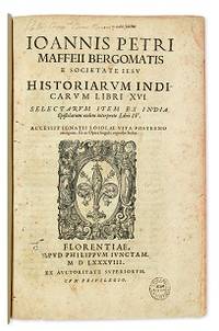
1588réf. E05544-5702 blank28 pages with woodcut device on title woodcut historiated initials and decorations. Folio 12 1/2" x 8 1/4" bound in contemporary vellum. European Americana 588/57; Palau 146976; Sabin 146976 Western Travellers in China 11 First edition of Maffei's great history of India. Ten Latin editions two in Italian and two in French appeared before 1621. Based on primary material it still remains a valuable account today. The work is divided into 16 books. Most of it deals with the Portuguese conquests and Jesuit missionary work in the East Indies and India up to about 1557 Borba de Moraes page 508 "a classic work on the subject . writes extensively about Brazil describing it very accurately"; Maffie was the firs author to use Jesuit letters extensively as well as many secular sources including Fernando Mendes Pinto. Condition: Contemporary velum with moderate wear re-backed in vellum with original spine label laid down; minor worming and foxing intermittent moderate damp staining pages 410 and 419 blank due to a printing error; early inscription and inked stamped on title page new end papers and paste-downs else a good to very good copy. Apud Philippum Juncatam hardcover
1588réf. E05544-5702 blank28 pages with woodcut device on title woodcut historiated initials and decorations. Folio 12 1/2" x 8 1/4" bound in contemporary vellum. European Americana 588/57; Palau 146976; Sabin 146976 Western Travellers in China 11 First edition of Maffei's great history of India. Ten Latin editions two in Italian and two in French appeared before 1621. Based on primary material it still remains a valuable account today. The work is divided into 16 books. Most of it deals with the Portuguese conquests and Jesuit missionary work in the East Indies and India up to about 1557 Borba de Moraes page 508 "a classic work on the subject . writes extensively about Brazil describing it very accurately"; Maffie was the firs author to use Jesuit letters extensively as well as many secular sources including Fernando Mendes Pinto. Condition: Contemporary velum with moderate wear re-backed in vellum with original spine label laid down; minor worming and foxing intermittent moderate damp staining pages 410 and 419 blank due to a printing error; early inscription and inked stamped on title page new end papers and paste-downs else a good to very good copy. Apud Philippum Juncatam hardcover books
réf. H921Wien Tempsky/ Gerold/ Hölder 1892-1931. Reihe 1-5: Östliches Mittelmeer; ab Reihe 6: Rotes Meer und weiterführend östliches Mittelmeer endet mit Reihe 11; in Reihe 9 gab es nur Berichte über das Rote Meer. Alle Reihen in den Jahresbänden der Denkschriften der k.k. Akademie der Wissenschaften. Meist in Original-Leinenbänden bzw. in Original-Broschur sehr guter Zustand. Genaue Auflistung der Forschungsergebnisse und Publikation in Kainbacher S.358-362. - Eine der großen Tiefsee-Expeditionen gegen Ende des 19. Jahrhunderts waren die Österreichischen Expeditionen des S.M. Schiffes "Pola" in das östliche Mittelmeer bis 1894 und nachfolgend in 2 Reisen in das nördliche und südliche Rote Meer 1895/98. Die Publikation der wissenschaftlichen Ergebnisse dieser Expeditionen liegen hier vollständig vor. Der Schwerpunkt lag auf der zoologischen Erforschung daneben gab es aber auch umfangreiche meteorologische geodätische geologische botanische chemische und physikalische Untersuchungen Wasserproben etc. Neben der Tiefsee wurden auch die Küsten von Südarabien Jemen Sokotra Sudan Ägypten Arabien Levante Kleinasien und Libyen besucht und erforscht. Die Publikation ist mit großem wissenschaftlichem und verlegerischem Aufwand hervorragendes Karten- und Abbildungsmaterial über einen Zeitraum von fast 40 Jahren in kleiner Auflage für wissenschaftliche Kreise und Bibliotheken herausgegeben worden. unknown
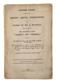
1856réf. 69186London. 1856. Parliamentary "Blue Book" on the Search for Franklin A rare Parliamentary paper relating to the lost Franklin expedition. This "blue book" a series of parliamentary reports named for their original blue paper wrappers contains a wealth of information about Franklin's expedition including detailed correspondence on the Second Grinnell Expedition with Kane's report and the Hudson's Bay Company's expedition down the Back River under Anderson and Stewart. Also includes Richard King's proposal to venture down the Back River to Montreal Island; the recovery and subsequent disposal of the Resolute; Collinson's report on Franklin relics; correspondence on the rewards for Franklin searches; and a list of American officers and men entitled to receive the Arctic Medal known today as the Polar Medal and given out by the British government to "all persons of every rank and class who have been engaged in the several Expeditions to the Arctic Regions whether of discovery or search between the years 1818 and 1855". Sir John Franklin's doomed 1845 expedition his fourth to the Arctic and third as commander set out in 1845 to search for the fabled Northwest Passage. In September 1846 the expedition's ships became trapped in the ice off of King William Island which would be their final resting place. The crew spent the next year and a half trapped there before attempting to walk south dying along the way in the arctic tundra hundreds of miles from the nearest European settlements. After three years without word the British Admiralty launched a massive search for the missing ships. Spurred by a large reward many expeditions from Britain and the United States set out on the hunt beginning in 1848 and continuing through the next decade. The British Parliament printed occasional reports of the various expeditions and related Arctic subjects during that time. These reports became known as the Arctic "blue books." One of the scarcer Franklin items rarely appearing on the market and with only a handful recorded in OCLC. Folio. Gathered signatures stitched. Soiling and edge wear to outer leaves minor scattered foxing else very good. ARCTIC BIBLIOGRAPHY 45249. TPL 3659. LANDE S910. unknown
1856réf. 69186London. 1856. Parliamentary "Blue Book" on the Search for Franklin A rare Parliamentary paper relating to the lost Franklin expedition. This "blue book" a series of parliamentary reports named for their original blue paper wrappers contains a wealth of information about Franklin's expedition including detailed correspondence on the Second Grinnell Expedition with Kane's report and the Hudson's Bay Company's expedition down the Back River under Anderson and Stewart. Also includes Richard King's proposal to venture down the Back River to Montreal Island; the recovery and subsequent disposal of the Resolute; Collinson's report on Franklin relics; correspondence on the rewards for Franklin searches; and a list of American officers and men entitled to receive the Arctic Medal known today as the Polar Medal and given out by the British government to "all persons of every rank and class who have been engaged in the several Expeditions to the Arctic Regions whether of discovery or search between the years 1818 and 1855". Sir John Franklin's doomed 1845 expedition his fourth to the Arctic and third as commander set out in 1845 to search for the fabled Northwest Passage. In September 1846 the expedition's ships became trapped in the ice off of King William Island which would be their final resting place. The crew spent the next year and a half trapped there before attempting to walk south dying along the way in the arctic tundra hundreds of miles from the nearest European settlements. After three years without word the British Admiralty launched a massive search for the missing ships. Spurred by a large reward many expeditions from Britain and the United States set out on the hunt beginning in 1848 and continuing through the next decade. The British Parliament printed occasional reports of the various expeditions and related Arctic subjects during that time. These reports became known as the Arctic "blue books." One of the scarcer Franklin items rarely appearing on the market and with only a handful recorded in OCLC. Folio. Gathered signatures stitched. Soiling and edge wear to outer leaves minor scattered foxing else very good. ARCTIC BIBLIOGRAPHY 45249. TPL 3659. LANDE S910. unknown books
1829réf. 005638London: Henry Colburn 1829. 478pp/maps. Engraved folding map frontis of Arabia. BM- notes two editions of this work in 1829; single volume quarto and a two volume octavo. This is the rare single volume edition. John Lewis Burckhardt 1784 - 1817 the son of a Swiss Colonel undertook the journey to Mekkah in 1814 disguised as an Arab; he had long since used the name Sheikh Ibrahim in his travels which he began in 1809 under the sponsorship of Sir Joseph Banks and the African Association. Burckhardt's description of the Hedjaz was the first accurate one to reach Europe. Burckhardt transmitted to the Association the most accurate and complete account of the Hedjaz including the cities of Mekka and Medina which has ever been received in Europe." The folding plans include Mekkah Medina Wady Muna and Arafat. Some light foxing to maps. Minimal library markings. Beautiful tight complete scarce book with great maps. First Edition. Library Binding. Very Good/No Jacket Issued. 4to - over 9¾" - 12" tall. Ex-Library. Henry Colburn
réf. 102116London H.M.S.O. 1877. . First edition; folio 33.5 x 21.5 cm; 16 folding maps a few small splits to folds 16 plates further illustrations in the text; contemporary blue half roan marbled boards lightly faded neat restoration to extremities a very good copy; viii 484 pp. One of the most valuable sources for the history of exploration in northern Canada. The Nares expedition so called after its commander George Nares 1831-1915 sailed in two ships HMS Alert and HMS Discovery in late May of 1875 in quest of the North Pole. The ships reached Lady Franklin Bay on North Ellesmere Island and the Alert went on to reach the extreme north of the island the highest latitude that had yet been reached by a ship. In April 1876 three separate sledge parties set out but the men showed serious signs of scurvy and several members died. Nares was forced to abandon the expedition and returned to England in September that year. Despite the difficulties faced by the expedition it did produce important scientific results including a study of Inuit dog disease and a volume of physical observations. The Nares expedition is one of the best documented Arctic expeditions with eight Parliamentary Blue Books alone devoted to it between 1875 and 1878. Arctic explorer Vilhjalmur Stefansson wrote 'The Arctic Blue Books are beyond comparison the most important tool of knowledge in this field.' London H.M.S.O., 1877. hardcover
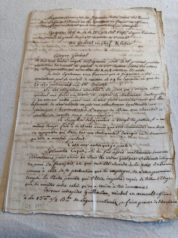
réf. 239889S.l., s.d. (janvier 1800) in-folio, [10] ff. n. ch., couverts de plusieurs écritures très lisibles, en feuilles.
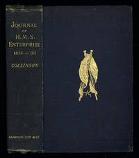
1889réf. 035576London: Sampson Low Marston Searle & Rivington. 1889. 1st Edition 1st Printing. Hardcover. Good/No Jacket. 8vo - over 7¾ - 9¾" tall. Good. Publishers cloth embossed with gilt lettering and emblem to upper cover. Front hinge cracked. Gift inscription in contemporaneous hand to free front endpaper. A touch of foxing. Two of the maps have a dog-eared fore-edge where they have not been folded quite flush with the page edges. Illustrated with tissue-guarded colour frontispiece of the ship tissue-guarded portrait of the author and 6 fold-out maps. xi i 531pp 32pp of publishers ads to rear. FIRST EDITION of the posthumously published journal by the captain who came closest to the site where Franklin's expedition ended. "In 1849 Collinson was appointed to command an expedition for the relief of Sir John Franklin by way of the Bering Strait; he himself had command of the Enterprise and with him was Commander Robert Le Mesurier McClure in the Investigator. The two ships sailed together from Plymouth on 20 January 1850 but unfortunately separated in the neighbourhood of Cape Horn and did not meet again. The Enterprise passed Point Barrow Alaska on 21 August but the ice forced Collinson to return south and winter in Hong Kong. In 1851 he was again hampered by ice and in 1852 was frozen in at Cambridge Bay for the winter. In 1853 the Enterprise was caught in the ice at Camden Bay and there passed a third winter. She reached Point Barrow on 8 August 1854 after being shut up in the Arctic entirely on her own resources for upwards of three years. Of the many who had searched for Franklin Collinson came closest to the place where the expedition had ended. Collinson's addition to geographical knowledge on this Arctic trip was very considerable and would have been tantamount to the discovery of the north-west passage had this not been already actually achieved by the men of the Investigator" DNB. Arctic Bibliography 3351; Hill 337; Ricks p 68; Tourville 986. Sampson Low, Marston, Searle, & Rivington. hardcover
réf. 50306For the lot of approximately 250 items $6000. a Correspondence with various government officials hunting guides and others involved with preparing and carrying out the trip including14 letters to Furlong typed and autograph one accompanied by four photographs of members of the expedition with trophies; five retained copies of letters from Furlong to the correspondents four telegrams seven typed and manuscript recapitulations of various aspects of the trip e.g. titles for the "Dance of the Nandi" film and a three page typed press release on the expedition dated Nairobi 27 March 1930 accompanied by a photograph of Furlong and two bearers with a leopard he has killed. b Two hunting licenses issued by the Uganda Protectorate to Furlong 22 April 1930 one "For a First Elephant" the other a "Visitor's Full Game License." c Three maps period road map of Kenya and Uganda published by Bullows and Roy for the Royal East Africa Automobile Assn.; Map Showing Cairo-Mombasa Route published by the Sudan Survey Dept Khartoum 1929; and a period National Geographic Society map of Africa. d An account book narrow 12mo 19 pp. 22 March - 8 June 1930 and approximately 125 receipts most partly printed for a wide range of services and material necessary for the trip. e 21 photographs in addition to those mentioned above many picturing Furlong in the field with his rifle and trophies some with Furlong's notations on verso and 34 unused photo postcards featuring tribesmen animals and scenery of East Africa. f 42 promotional pamphlets ca. 1925-1934 for the various parts of Africa along Furlong's route 36 of which are unrecorded on OCLC. The pamphlets were issued by African railway companies and governmental agencies outfitters e.g. Thomas Cook and "Safari Africa Limited" London ship lines and other travel agencies and taxidermy concerns. g A wooden carved string instrument from the Para Mountains in present day Tanzania with Furlong's ownership label "Col. Wellington Furlong / c/o Safariland Ltd. / Musical Instrument / Para Mountains" still attached; the instrument is shaped like a hollowed-out bread tray 27 x 7 1/2 inches three holes in the shape of crosses in the bottom six strings stretched across the opening. Furlong 1874-1967; American explorer army officer author artist and photographer embarked on this big game expedition in 1930 partly as an effort to recover relics of Sir Henry M Stanley in East and Central Africa. Gateway to the Sahara New York 1909 is among several books he published. A member of the Explorers Club he was the first American to explore the interior of Tierra del Fuego 1907-1908. Most of his personal papers are held by the Stefansson Collection at Dartmouth. unknown
réf. 50306For the lot of approximately 250 items $6000. a Correspondence with various government officials hunting guides and others involved with preparing and carrying out the trip including14 letters to Furlong typed and autograph one accompanied by four photographs of members of the expedition with trophies; five retained copies of letters from Furlong to the correspondents four telegrams seven typed and manuscript recapitulations of various aspects of the trip e.g. titles for the "Dance of the Nandi" film and a three page typed press release on the expedition dated Nairobi 27 March 1930 accompanied by a photograph of Furlong and two bearers with a leopard he has killed. b Two hunting licenses issued by the Uganda Protectorate to Furlong 22 April 1930 one "For a First Elephant" the other a "Visitor's Full Game License." c Three maps period road map of Kenya and Uganda published by Bullows and Roy for the Royal East Africa Automobile Assn.; Map Showing Cairo-Mombasa Route published by the Sudan Survey Dept Khartoum 1929; and a period National Geographic Society map of Africa. d An account book narrow 12mo 19 pp. 22 March - 8 June 1930 and approximately 125 receipts most partly printed for a wide range of services and material necessary for the trip. e 21 photographs in addition to those mentioned above many picturing Furlong in the field with his rifle and trophies some with Furlong's notations on verso and 34 unused photo postcards featuring tribesmen animals and scenery of East Africa. f 42 promotional pamphlets ca. 1925-1934 for the various parts of Africa along Furlong's route 36 of which are unrecorded on OCLC. The pamphlets were issued by African railway companies and governmental agencies outfitters e.g. Thomas Cook and "Safari Africa Limited" London ship lines and other travel agencies and taxidermy concerns. g A wooden carved string instrument from the Para Mountains in present day Tanzania with Furlong's ownership label "Col. Wellington Furlong / c/o Safariland Ltd. / Musical Instrument / Para Mountains" still attached; the instrument is shaped like a hollowed-out bread tray 27 x 7 1/2 inches three holes in the shape of crosses in the bottom six strings stretched across the opening. Furlong 1874-1967; American explorer army officer author artist and photographer embarked on this big game expedition in 1930 partly as an effort to recover relics of Sir Henry M Stanley in East and Central Africa. Gateway to the Sahara New York 1909 is among several books he published. A member of the Explorers Club he was the first American to explore the interior of Tierra del Fuego 1907-1908. Most of his personal papers are held by the Stefansson Collection at Dartmouth. unknown books
1747réf. BOOKS00585324548 pages with three folding engraved maps present southern part of South America; part of the Pacific Ocean and the track of the Centurion round the world. Octavo 8 1/4" x 5 1/2" bound in full leather with five raised spine bands with red label to spine in gilt lettering with decorative blind-stamped ruled edges. Compiled from papers and other materials of the Right Honourable George Lord Anson and published under his direction by Richard Walter M.A. Chaplain of his Majesty's Ship the Centurion in that expedition. Hill I pp 317-138. Third edition. "This is the official account of Anson's voyage. England at war with Spain in 1739 equipped eight ships under the command of George Anson to harass the Spaniards on the western coast of South America for the purpose of cutting off Spanish supplies of wealth from the Pacific area. Lord Anson who was a friend and patron of Benjamin Robins after returning from the voyage around the world in the Centurion appears to have entrusted to Robins for revision the account of the voyage which had been compiled from the journals by his chaplain Richard Walter. It is probable that Robins revised and edited the work wrote an introduction and added dissertations." Hill. Perhaps the most popular account of maritime adventure of the eighteenth century. Anson's account of harrying the Spanish of South America and the taking of the Manilla galleon with treasure with a contemporary value of $800000 and his circumnavigation has long enjoyed a distinguished place as a masterpiece in descriptive travel. Condition: Some small closed tears at the edges of the maps. Rebound in tooled leather with raised bands. Over all a very good to fine copy. John and Paul Knapton and Office of the Lord High Admiral hardcover
1747réf. BOOKS00585324548 pages with three folding engraved maps present southern part of South America; part of the Pacific Ocean and the track of the Centurion round the world. Octavo 8 1/4" x 5 1/2" bound in full leather with five raised spine bands with red label to spine in gilt lettering with decorative blind-stamped ruled edges. Compiled from papers and other materials of the Right Honourable George Lord Anson and published under his direction by Richard Walter M.A. Chaplain of his Majesty's Ship the Centurion in that expedition. Hill I pp 317-138. Third edition. "This is the official account of Anson's voyage. England at war with Spain in 1739 equipped eight ships under the command of George Anson to harass the Spaniards on the western coast of South America for the purpose of cutting off Spanish supplies of wealth from the Pacific area. Lord Anson who was a friend and patron of Benjamin Robins after returning from the voyage around the world in the Centurion appears to have entrusted to Robins for revision the account of the voyage which had been compiled from the journals by his chaplain Richard Walter. It is probable that Robins revised and edited the work wrote an introduction and added dissertations." Hill. Perhaps the most popular account of maritime adventure of the eighteenth century. Anson's account of harrying the Spanish of South America and the taking of the Manilla galleon with treasure with a contemporary value of $800000 and his circumnavigation has long enjoyed a distinguished place as a masterpiece in descriptive travel. Condition: Some small closed tears at the edges of the maps. Rebound in tooled leather with raised bands. Over all a very good to fine copy. John and Paul Knapton and Office of the Lord High Admiral hardcover books
1823réf. 55059London John Murray Albemarle Street 1823. First Edition. Hardcover. Very Good Clean Some Wear To Boards And Calf At Extremities Fade at Upper Spine Area. Sm Quarto Half Calf Spine and Corners Wrapped Marbled Boards. Twenty Six Plates There are Eleven Hand Colored Plates and a second Identical Extra-Illustraterd Uncolored Plates Identical Illustrations with Publisher and Illustrator Credits in The Same Weight Paper not Proof Before Letters B & W Engraving And A Second Hand Colored Followed By Four Plates Of Plants At The End Of The Appendix And Followed By Four Maps The Order Of Which and Titles Are Different Than the Book Index shows: Chart of the Discoveries & Route Northern Land Expedition Under The Command Of Captain Franklin An Outline To Show The Connected Discoveries Of Captains Ross Parry & Franklin in the Years 1818 19 20 21 22 & 23 Which is Hand Colored Showing the Outline Of Water and A Route In Red Line Route From York Factory To Isle A Cumberland House and The Summer & Winter Tracks From There To Isle A La Cross in 1819 & 1820And The Fourth Map is Route Of The Expedition FROM ISLE A LA CROSS TO Fort Providence in 1819 & 20. Provenance: from the SItwell Family Library At Weston Hall U. K. The Sitwell Family Seat For 300 Years. This Book Likely Arrived At Weston Hall During The time Of Harriet W. Wrightson 1788-1864 and Col. Henry HELY- Hutchinson Who Was The Nephew of General Lord Hutchinson later 2nd Earl Of Dronoughmore. It Remained Their Until The Family Sold The Library at Auction in 2021. London, John Murray, Albemarle Street hardcover
réf. H909Washington Beverley Tucker 1856. Three volumes quarto Volume 1 with 88 lithographed plates most tinted three colour facsimiles of Japanese woodblock prints two folding six maps two folding numerous wood-engraved illustrations in text the suppressed nude bathers plate is present !; Volume 2 with 27 illustration plates 18 hand-coloured 16 plates of wind & current diagrams 16 folding maps 14 linen-backed; Volume 3 with 352 wood-engraved star charts. Original cloth rubbed joints with small tears minor wear Text and plates in good condition. First edition the Senate Issue of Perry's account of his historic voyage to Japan in command of a naval expedition which was to lobby the Japanese government to establish diplomatic relations with the United States. The resulting treaty in 1853 ensured better treatment by the Japanese authorities of shipwrecked seamen and permitted American ships to dock at two Japanese ports to refuel and to seek supplies. "The most important result. was that the visit contributed to the collapse of the feudal regime and to the modernization of Japan" Hill. "As one of the chief diplomatic achievements of the 19th century the opening of Japan by the treaty negotiated by Perry will long make the name of Perry memorable. His expedition marked a departure in Occidental policy restricting Japan in American policy respecting the Orient and in Japanese policy respecting the Western world. In June 1855 Perry was ordered to Washington where his chief duty for more than a year was the preparation of a report of his expedition which was published by the government in 1856" DAB. hardcover
1858réf. 32039ABGotha, J. Perthes, 1858-1906. 4°, jeder Band zwischen ca. 300 und 500 S. mit zahlr. (oftmals farbigen) Ausklapp-Tafeln und Falt-Karten, die ersten 4 Bände (1858-1863) als schwarze original Leineneinbände mit goldener Deckel- und Rückenbeschriftung sowie reicher Deckelbildprägung, der Band 1868 als schlicher schwarzer Pappband der Zeit, dann (1870-1906) Halbleinen-Einbände der Zeit mit Rückenschildern bzw. goldener Rückenbeschriftung und Musterpapierbezügen, alle Bände in Originalausgabe alle Bände unten mit Rückensignaturschildchen, die Rückenkanten der ganz frühen Bände stellenw. angeplatzt, wenige Bände oben am Rücken etwas angerändert, beim schlichten Pappband von 1868 der Rücken beschädigt und mit Fehlstellen (innen aber bindungsstab