1 521 résultats
1787réf. E0052Two volumes: xv462 pages with two folding maps; xv430 pages with three folding plates. Octavo 8 1/4" x 5 1/4" bound in original full leather with black and red labels to spine lettered in gilt. translated from the French by an English gentleman who resided in America at that period ; with notes by the translator. Translated by G. Grieve Watt and Sabin ascribe the translation to J. Kent. Sabin 12229 First Irish edition. Chastellux was a military officer who served during the War of American Independence as a major general in the French expeditionary forces led by general Comte de Rochambeau. Being on general Rochambeau's staff for the duration of the war Chastellux acted as the principal liaison officer between the French commander in chief and George Washington. However the Chevalier de Chastellux was also widely recognized at the time of his campaigns in America as a highly talented man of letters and a member of the French Academy. After arriving in America in July 1780 Chastellux participated to the American Revolutionary War as Major General in the French expeditionary force led by general Rochambeau. During the following year he was third in command of the French forces engaged at the decisive Siege of Yorktown in 1781 where the British were ultimately defeated. Major General de Chastellux was fluent in English and with his strong ideological support of the American cause he served the alliance well. During the latter part of the campaign he was the principal liaison officer between George Washington and French general Rochambeau. Thereafter Chastellux remained a personal friend of George Washington for life. Furthermore the College of William and Mary and the University of Pennsylvania also awarded Chastellux with honorary degrees. After his return to France Chastellux also remained in contact with Thomas Jefferson now the American representative in Paris whom he had previously visited on his Virginia estate at Monticello. Condition: Title page clipped at top corner first fold out map repaired map edges repaired hinges repaired previous owner's names on front paste downs and content pages else a good set. Printed for Messrs. Colles, Moncrieffe, White, H. Whitestone, Byrne, Cash, Marchbank, Heery, and Moore hardcover
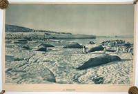
1960réf. 15833Paris: Collection de la Societe de Geographie 1960. Very good overall. An image taken by Frank Hurley on the Mawson 1911-14 Australian Antarctic Expedition. One might draw the conclusion that the original image was in the collection of the French geographical society and is reprinted here in a very large format in blue ink the photo of seals and penguins lying on the pack ice. We once thought that it might have been from one of the French expeditions to the Antarctic perhaps Charcot's 4th Antarctic expedition. However Mark Pharaoh manager of the Mawson Centre at the South Australian Museum has confirmed that it is a Hurley image taken on Mawson's 1911-14 expedition. The title "La Banquise" below the image; "Cliche de la Collection de la Societe Geographie / Collection Jean-Pierre Geographie Pittoresque" lower left; lower right "Fernand Nathan Editeur Paris - Tous Droits Reserves". and with one very small thumb tack puncture below the title. 30 1/2 x 20 1/2" Collection de la Societe de Geographie unknown
2001réf. 25817New York: Cooper Square Press. Fine in Fine dust jacket. 2001. First thus. Hardcover. 0815410794 . With many illustrations a fine set in fine dustjackets. ; 235 x 160mm; xlviii 570 xliv 508 pages . Cooper Square Press hardcover
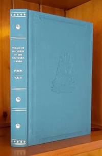
2003réf. 23857Adelaide: The Friends of the State Library of South Australia. Fine. 2003. First thus. Hardcover. 1876154381 . Limited to 400 copies with 99 copies bound in leather and the remaining 301 copies bound in cloth this is a cloth bound copy. An as new copy. Foreword by John Ling and an introduction by Anthony J. Brown. With illustrations / plates foldout chart and a map in pocket at the rear of book. The first published translation into English from the French by Christine Cornell of chapters XXII to XXXIV of Peron's journey as part of the Baudin expedition as zoologist aboard the Geographe. ; 245 x 160mm; xxxviii 278 pages . The Friends of the State Library of South Australia hardcover
2000réf. 23886Adelaide: Friends of the State Library of South Australia. Fine. 2000. First thus. Hardcover. 1876154314 . With an Introduction by Valmai Hankel portrait frontispiece folding map in a pocket to the rear pastedown endpaper an as new copy. ; Australiana Facsimile Editions No. 221; 225 x 145mm . Friends of the State Library of South Australia hardcover
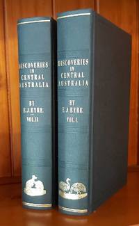
1997réf. 23887Adelaide: Friends of the State Library of South Australia. Fine. 1997. First thus. Hardcover. 1876154101 . Sent by the colonists of South Australia with the sanction and support of the government; including an account of the manners and customs of the aborigines and the state of their relations with Europeans. In two volumes. Edition limited to 600 copies of which the first 99 are numbered and bound in quarter leather this being an unnumbered set bound in cloth. An as new set. ; Australiana Facsimile Editions No. 213; 225 x 145mm . Friends of the State Library of South Australia hardcover
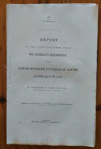
1859réf. 23335Melbourne: John Ferres Government Printer. Very Good. 1859. First Edition. Paperback. Victorian Parliamentary Paper Number 1 of 1859. Stab sewn uncut in very good condition. This book is light and postage will be reduced for shipment within Australia. ; 345 x 220mm; 21 pages . John Ferres, Government Printer paperback
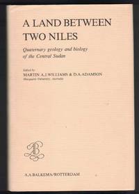
1982réf. 22210Rotterdam: A. A. Balkema. Near Fine in Near Fine dust jacket. 1982. First Edition. Hardcover. 906191096X . With maps and charts throughout a near fine copy in near fine dustjacket. ; 235 x 160mm; x 246 pages . A. A. Balkema hardcover
1931réf. 19846London: George Routledge & Sons Ltd. Very Good in Very Good dust jacket. 1931. First Edition. Hardcover. With 4 plates index chipping to top and bottom of dustjacket spine jacket now protected a very good copy in very good dustjacket. The Broadway Travellers series edited by Sir. E. Denison Ross and Eileen Power; The Broadway Travellers; 220 x 140mm; xiv 272 pages . George Routledge & Sons, Ltd. hardcover
1969réf. 16328New York: Negro Universities Press. 1969. Reprint. Hardcover. Originally published by Harper & Brothers New York 1861. With numerous illustrations xxii 531 pages 79 illustrations folding map at rear of book small stamp on verso of title page indicates this was a library book no other library marks noted original brown cloth boards a very good copy. ; 220 x 140mm . Negro Universities Press hardcover
1970réf. 1702London: Spring Books. Very Good in Very Good dust jacket. 1970. First Thus. Hard Cover. xii 337pgs colour frontis; many other illustrations dust jacket is faded on spine and front.; 285 x 220mm . Spring Books hardcover
2002réf. 4600Adelaide: The Friends of the Library of South Australia. As New. 2002. First Edition Thus. Hard Cover. Edited by Valmai Hankel & Mark Gilbert Introduction by Valmai Hankel The text has been edited from versions published in the "Journal of the Royal Geographical Society Vol 31 1861" and in "Explorations in Australia. The journals of John McDouall Stuart during the years 1858.1862" edited by William Hardman London 1864.xxviii 64pages last blank fold out map frontispiece. Olive green buckram boards with blind embossing on front & rear boards title in gilt on spine. A New Copy.; 225 x 150mm . The Friends of the Library of South Australia hardcover
réf. B9781168448644New. unknown
réf. B9781168446329New. unknown
1829réf. 005638London: Henry Colburn 1829. 478pp/maps. Engraved folding map frontis of Arabia. BM- notes two editions of this work in 1829; single volume quarto and a two volume octavo. This is the rare single volume edition. John Lewis Burckhardt 1784 - 1817 the son of a Swiss Colonel undertook the journey to Mekkah in 1814 disguised as an Arab; he had long since used the name Sheikh Ibrahim in his travels which he began in 1809 under the sponsorship of Sir Joseph Banks and the African Association. Burckhardt's description of the Hedjaz was the first accurate one to reach Europe. Burckhardt transmitted to the Association the most accurate and complete account of the Hedjaz including the cities of Mekka and Medina which has ever been received in Europe." The folding plans include Mekkah Medina Wady Muna and Arafat. Some light foxing to maps. Minimal library markings. Beautiful tight complete scarce book with great maps. First Edition. Library Binding. Very Good/No Jacket Issued. 4to - over 9¾" - 12" tall. Ex-Library. Henry Colburn
1884réf. 22023London: Royal Geographical Society 1884. First edition. Paperback. Very good condition. Proceedings of the Royal Geographical Society the complete monthly issue for November 1884. 8vo 2 pp 615-686 3 large folding maps 2 of Africa one of the Greely Arctic Expedition by Lieut J. B. Lockwood. Original blue printed wrappers slt. spine chip at tips otherwise fine. Royal Geographical Society paperback
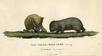
1807réf. 18812Paris: Imprimerie de Langlois 1807. Very good condition. One of the most attractive prints of wombats a pair of wombats with 4 offspring clambering about. This is plate XXVIII from the work illustrating Nicolas Baudin's expedition. At the time the French were the most progressive at sending teams of artists & scientists around the world with their explorers. Copper engraving with original hand color. Platemark measures 12 1/2 x 9 1/2'' with small margins. A large early representation of the infrequently depicted wombat. Imprimerie de Langlois unknown
1910réf. 5597London: British Museum 1910. Hardcover. Very good condition. Volume 5 of the account of the Discovery Expedition of 1901-04 led by Capt. Robert F Scott known officially as the British National Antarctic Expedition. Numerous lithographic plates including seals tunicata isopoda nemertinea coelentera and lichen. Large 4to xxii 21pp article 2 plts on seal embryos; 26 pp 7 plts on tunicata; 77pp & 10 plts on isopoda; 15pp & 1 plt on nemertinea; 62pp & 7 plts on coelentera; 12 pp & 1 plt on lichens. Original red gilt buckram ex-lib copy w/ sml. cancelled stamp on verso of plates very good condition. Vol 1. of the 6 natural history volumes is listed as Spence 837. British Museum hardcover
1824réf. 47632Vol. I has a large partial coloured map as frontis and Vol. II has 3 large folding maps in the rear The record of Franklin's first Arctic expedition fraught with hardship and tragedy constitutes one of the classics in the annals of travel literature. In all the party travelled 5500 miles overland and with the aid of canoes exploring the territory from York Factory to the mouth of the Coppermine River on Coronation Gulf east along the Arctic coast as far as Point Turnagain and back across the Barren Lands. Provisions were poor and scant and on the return journey many crew members died of cold and starvation; the young naval artist Robert Hood was murdered and another executed for the crime. The work also includes accounts by Richardson and Back of the last leg of the desperate journey across the Barren Lands. This edition omits the appendix on the natural history of the region and scientific observations on the aurora borealis and the magnetic needle. Arctic Bib. 5195. Sabin 25625. TPL 1249. Lande 1181-82. Peel 151n. John Murray hardcover
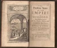
1695réf. E0561xxiv21612 pages with frontispiece folding map and eight engraved costume plates. Duodecimo 6 ¼" x 3 ½" early full calf later spine label. First Edition in English. First published in French the prior year which was published without the plates. François Pidou de Saint Olon was a French diplomat under Louis XIV. In 1682 he was nominated as the first French resident envoy to the Republic of Genoa following the Bombardment of Genoa. He was then sent as an envoy to Madrid. In 1689 François Pidou was appointed ambassador to the court of Sultan Moulay Ismail for the signing of a commercial treaty and to release prisoners now slaves of Barbary corsairs of Salé for 233 including 29 bedridden Moroccan prisoners held by the French. His mission was not successful however he continued to stay more than three weeks more in Morocco. The book gains particular interest through its author's position as ambassador giving him access not always voluntary to areas of Moroccan society previously unrecorded by travelers. There are detailed descriptions of Moroccan dress and the book is beautifully illustrated with eight engraved plates of Moroccan men and women in traditional costume. Condition: With the fine copper engraved frontispiece of the overall state of Morocco which is quite rare and is often found missing in most copies. Joints cracking spine chipped at edges; foxing else very good. R. Bently hardcover
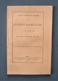
1872réf. R3304Québec: The « Gazette » 1872 "By a volunteer upon that Expedition". Transcribed and edited from the "volunteer's" manuscript notes but never before published. Light foxing on last pages. Soft cover. Fine. The « Gazette » paperback
1923réf. 79983London: Cassell and Company Ltd. 1923. Pages clean and bright with occasional light spotting foxing on endpapers cracked gutter between photo plate and page 183 but no detachment light sunning to spine and some shelf wear to boards binding firm. First Edition. Hard. Very Good. 8vo. Cassell and Company Ltd. Hardcover
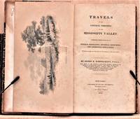
1825réf. W1883New York: Collins and Hannay 1825. 459 pages fold-out map of the "western country" and 3 engraved plates missing is the sketch of the lead mine district. First printing. Octavo. 3/ leather over marbled paper-covered boards. According to Wikipedia Henry Rowe Schoolcraft 1793-1864 was an American geographer geologist and ethnologist noted for his early studies of Native American cultures as well as for his 1832 expedition to the source of the Mississippi River. He is also noted for his major six-volume study of Native Americans published in the 1850s. The book offered here is his report on an 1821 expedition from Missouri through Illinois and Indiana into Michigan. There is heavy emphasis on lead mining in Missouri and on treatymaking with the Chippewa and Potawatomi tribes. Howes S196. Quite scarce. The book is in about very good condition: sympathetically rebacked in gilt-ruled tan leather with new brown leather title patch; clean and tight; foxing throughout; previous owners' names and date on front endpaper. First Edition. Hardcover. Collectible-Very Good. 8vo - over 7¾" - 9¾" tall. Book. Collins and Hannay Hardcover
1790réf. E00534 of 6 volumes. Volume 1: i-ix-372 pages with 23 plates including frontispiece plate of Cook and 4 folding maps; Volume II lacking; Volume III: 793-1184 pages with 11 plates including frontispiece of Possession Bay and 5 fold out maps; Volume IV: 1185-1546 pages with 26 plates including frontispiece of Woman Child and Man of Van Diemen's Land and 6 folding maps; Volume V: 1547-1938 pages with 30 plates including frontispiece of A View of Huaheine and 8 folding maps; Volume VI lacking. Octavo 8 1/2" x 5 1/2" bound in original full leather with red labels to spine with gilt lettering. Abridged by George William Anderson. An earlier Large folio edition by Anderson was published earlier. This edition originally issued in 80 weekly parts and also called the Large octavo edition. M K Beddie: 39 First edition of the bound edition. Captain James Cook RN was a British explorer navigator and cartographer ultimately rising to the rank of Captain in the Royal Navy. Cook made detailed maps of Newfoundland prior to making three voyages to the Pacific Ocean during which he achieved the first European contact with the eastern coastline of Australia and the Hawaiian Islands as well as the first recorded circumnavigation of New Zealand. Cook joined the British merchant navy as a teenager and joined the Royal Navy in 1755. He saw action in the Seven Years' War and subsequently surveyed and mapped much of the entrance to the Saint Lawrence River during the siege of Quebec. This helped bring Cook to the attention of the Admiralty and Royal Society. This notice came at a crucial moment both in his personal career and in the direction of British overseas exploration and led to his commission in 1766 as commander of HM Bark Endeavour for the first of three Pacific voyages. Cook charted many areas and recorded several islands and coastlines on European maps for the first time. His achievements can be attributed to a combination of seamanship superior surveying and cartographic skills courage in exploring dangerous locations to confirm the facts for example dipping into the Antarctic Circle repeatedly and exploring around the Great Barrier Reef an ability to lead men in adverse conditions and boldness both with regard to the extent of his explorations and his willingness to exceed the instructions given to him by the Admiralty. Cook was killed in Hawaii in a fight with Hawaiians during his third exploratory voyage in the Pacific in 1779. Condition: Lacks volume II and VI. First signature of volume one loose inner hinges cracked some interior soiling spine ends and corners of leather rubbed some scuffing to leather else a good set. Printed for A Millar, W Law, and R Cater hardcover