Mancini MariaLivre Rare Book

2 079 résultats
2002réf. sm3Editions Place des Victoires Cartonné avec jaquette 2002 grand in-4 (32.5*28), cartonné sous jaquette illustrée, 287pp., servi par de nombreuses photographies noir et blanc et sépia, préface de Franco Salvatori, président de la Société géographique italienne ; jaquette légèrement usée, très bon état Livraison a domicile (La Poste) ou en Mondial Relay sur simple demande.
réf. 188835Paris, Baudouin frères, Plancher, 1823 in-8, [4]-IV-40 pp., broché sous couverture d'attente de papier vert.
réf. 211123Paris, Plon, 1910 in-8, XI-385 pp., 2 portraits et un fac-similé, index, broché. Quelques rousseurs sur la couverture.
1995réf. w210630276Sheffield Academic Press 1995. 370pp. Over sized black hardback with DJ VG index bibliography maps and figures footnotes The Absolute Chronology of the Aegean Early Bronze Age : Archaeology Radiocarbon and History . Hard Cover. Very Good/Very Good. Sheffield Academic Press Hardcover
réf. 100121344Scheltens & Giltay in8. Sans date. Cartonné jaquette.
1994réf. 100157954SALVY 1994 in8. 1994. Broché.
réf. 173685Paris, A. Pinard, 1832 in-8, [4]-455 pp., cartonnage Bradel marine, dos lisse orné de filets dorés (reliure de l'époque). Infimes accrocs sur le plat supérieur, mais bon exemplaire.
1962réf. 100084710connaissance du monde 1962 in8. 1962. Cartonné. illustrations en noir et blanc
1950réf. 100115484Payot 1950 in8. 1950. Broché.
1839réf. 100067868Adrien le clere et cie 1839 in12. 1839. Relié.
2005réf. 100103690STEPHANE MARAIS 2005 364 pages 15x24x2cm. 2005. Broché. 364 pages.
2007réf. 100109811STEPHANE MARAIS 2007 216 pages 1x20x15cm. 2007. Broché. 216 pages.
1886réf. 100057304Librairie hachette et cie 1886 in8. 1886. Relié.
réf. 100124878Zomer & Keunings in8. Sans date. Cartonné jaquette.
1887réf. A60472Leiden, Brill 1887 vii + 186pp.with 22 plates (14 lithographs and 8 photographs) + 1 large folding map, original 1887-edition, 28cm., original softcover (spine bit repaired & small piece of paper detached from front wappers) well protected by a removable cover of cristal paper, text in german, pages still uncut, [off-print from the 1st part of K.Martins "Bericht ueber eine Reise nach Niederlandisch West-Indien und darauf gegrundete Studien"], good condition, A60472
1964réf. 074833New York: Harcourt Brace & World 1964. 1st printing. Square and unmarked. Map endpapers. 290pp. Photos. 2 fold-out maps. Unclipped jacket is lightly rubbed. In a protective mylar cover. The four worlds meeting in this book are Islam Buddhism Hinduism and Communism. Traveling through Pakistan to scale 24000-foot Mount Saraghrar for the first time. First American Edition. Hardcover. Very Good/Very Good. 8vo - 8" - 9" Tall. Harcourt, Brace & World Hardcover
1963A clean, unmarked book with a tight binding. Dust jacket is a bit tattered, worn, and foxed and some of the inside of the white dust jacket has stuck to the top edges of the cover of the book. 290 pages. Fold-out maps. The story of Club Alpino Italiano's climbing expedition on Mt. Saraghrar, in the Hindu Kush Massif, in 1958.
1856réf. 059903New York: Harper & Brothers 1856. Original blind-stamped cloth binding just rubbed through at corners and spine ends. Darkly toned endpapers. Light scattered foxing inside. ix 445pp. with four pages of publisher adverts. 12 illustrations. March Charles W. Charles Wainwright 1815-1864. First Edition. Hardcover. Very Good/No Dust Jacket. 12mo - over 6" - 8" Tall. Harper & Brothers Hardcover
1962réf. 22070123Oxford University Press UK 1962. First Edition. Hardcover. Very Good/Very Good. Signed by Author. Hardcover. 275 pages. Signed by Author. PUBLISHING DETAILS: Oxford University Press UK 1962. First Edition. CONDITION: The book itself is in very good condition and comes in very good dust jacket. More specifically: Boards have no wear rubbing or soiling. Dust jacket has light creasing. Edges of dust jacket have superficial wear. Dust jacket is unclipped. Dust jacket is protected in clear plastic sleeve. Pages are lightly tanned. Quantity Available: 1. Category: Exploration; Inventory No: 22070123. Oxford University Press hardcover
1887vii + 186pp.with 22 plates (14 lithographs and 8 photographs) + 1 large folding map, original 1887-edition, 28cm., original softcover (spine bit repaired & small piece of paper detached from front wappers) well protected by a removable cover of cristal paper, text in german, pages still uncut, [off-print from the 1st part of K.Martins "Bericht ueber eine Reise nach Niederlandisch West-Indien und darauf gegrundete Studien"], good condition, A60472
1978réf. 227851Stalling Verlag, 1978.
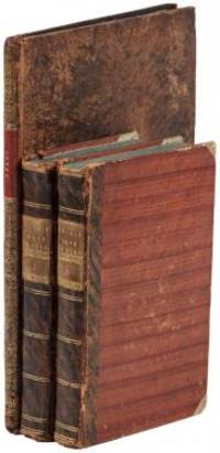
1802réf. E01512 volumes with Atlas. 4xxiv385 pages with xxii-xxiv lists books of voyages available from the publisher; 4418 pages with appendix containing vocabularies of the languages of Yukagir Yakut Tungoose Kamchatka the Aleutian Islands and Kadiak and inex. Atlas with title list of plates 14 engraved plates & large folding engraved map. Text volumes are small octavo 7¾" x 4½" 19th century quarter calf & boards spines tooled in gilt morocco lettering pieces; atlas is quarto 11" x 7½" in period tree calf spine tooled in gilt. Translated by J Castéra. Howes S-117 First French Edition. Martin Sauer was an English civil servant who knew Russian French and German. He became acquainted with Joseph Billings in St Petersburg in the 1780s. He agreed to join Billings expedition as his secretary and interpreter. It was agreed that he would write the official account but there is some controversy about his actives when he returned to St Petersburg in 1794. It has been suggested that he left hurriedly for England with much of the important archival material from the voyage including diaries and secret reports so that he could publish a record of the expedition before Russian authorities and scholars in the Academy of Sciences could review its details. Sauer's An account of the Geographical and Astronomical Expedition to the Northern Parts of Russia was published in London in 1802. It contains an abundance of detail about eastern Siberia and the Aleutian Islands and records the expeditions visits to Kodiak Island Prince William Sound and the coast south as far as Yakutat Bay. The chart was made by Aaron Arrowsmith from Sauer's notes and Billings observations and the whole complements well the other contemporary accounts of the expedition by the cartographer Gavriil Sarychev and the naturalist Carl Heinrich Merck. Aaron Arrowsmith 1750–1823 was an English cartographer engraver and publisher and founding member of the Arrowsmith family of geographers. He moved to Soho Square London from Winston County Durham when about twenty years of age and was employed by John Cary the engraver and William Faden. He became Hydrographer to the Prince of Wales ca. 1810 and subsequently to the King in 1820. In January 1790 he made himself famous by his large chart of the world on Mercator projection. Four years later he published another large map of the world on the globular projection with a companion volume of explanation. Condition: Some rubbing and wear to coves of both atlas and text volumes some chipping to spine ends small gouge at back of atlas and stamp to front end paper else in very good condition. Chez F Buisson hardcover
1802réf. E01512 volumes with Atlas. 4xxiv385 pages with xxii-xxiv lists books of voyages available from the publisher; 4418 pages with appendix containing vocabularies of the languages of Yukagir Yakut Tungoose Kamchatka the Aleutian Islands and Kadiak and inex. Atlas with title list of plates 14 engraved plates & large folding engraved map. Text volumes are small octavo 7¾" x 4½" 19th century quarter calf & boards spines tooled in gilt morocco lettering pieces; atlas is quarto 11" x 7½" in period tree calf spine tooled in gilt. Translated by J Castéra. Howes S-117 First French Edition. Martin Sauer was an English civil servant who knew Russian French and German. He became acquainted with Joseph Billings in St Petersburg in the 1780s. He agreed to join Billings expedition as his secretary and interpreter. It was agreed that he would write the official account but there is some controversy about his actives when he returned to St Petersburg in 1794. It has been suggested that he left hurriedly for England with much of the important archival material from the voyage including diaries and secret reports so that he could publish a record of the expedition before Russian authorities and scholars in the Academy of Sciences could review its details. Sauer's An account of the Geographical and Astronomical Expedition to the Northern Parts of Russia was published in London in 1802. It contains an abundance of detail about eastern Siberia and the Aleutian Islands and records the expeditions visits to Kodiak Island Prince William Sound and the coast south as far as Yakutat Bay. The chart was made by Aaron Arrowsmith from Sauer's notes and Billings observations and the whole complements well the other contemporary accounts of the expedition by the cartographer Gavriil Sarychev and the naturalist Carl Heinrich Merck. Aaron Arrowsmith 1750–1823 was an English cartographer engraver and publisher and founding member of the Arrowsmith family of geographers. He moved to Soho Square London from Winston County Durham when about twenty years of age and was employed by John Cary the engraver and William Faden. He became Hydrographer to the Prince of Wales ca. 1810 and subsequently to the King in 1820. In January 1790 he made himself famous by his large chart of the world on Mercator projection. Four years later he published another large map of the world on the globular projection with a companion volume of explanation. Condition: Some rubbing and wear to coves of both atlas and text volumes some chipping to spine ends small gouge at back of atlas and stamp to front end paper else in very good condition. Chez F Buisson hardcover books
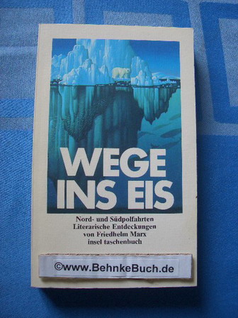
1995réf. 119425Frankfurt am Main ; Leipzig : Insel-Verl. 1995. 323 S. 18*11 cm. OBroschur.
réf. 12132In 4 reliure éditeur, pleine toile rouge éditeur, plaque polychrome, animée, d’Albert ROBIDA. Double filet doré en encadrement. Titre et filets dorés au dos. Faux-titre, frontispice (Bénarès) titre, 307 pages, 1 page de table des matières. Illustrations hors-texte et dans le texte, tranches dorées. Maison Alfred Mame et fils. Premier plat et dos, insolés. Recueil de récits d'exploration illustré de photographies le plus souvent à pleine page et de gravures; trente deux explorateurs français et de nombreux pays et villes écrits Bénarès, Tombouctou, la Grèce, l'Algérie, le Maroc; l'Indochine; le Niger, l'Egypte, Tripoli, le Tonkin, l'Ethiopie, et le contrées les plus reculées de la Russie. rare plaque polychrome d'Albert ROBIDA.