Sivadjian-ELivre Rare Book

1992rif. 100117594First 1992 270 pages 13 2x2 6x21cm. 1992. Broché. 270 pages.
1970rif. 1702London: Spring Books. Very Good in Very Good dust jacket. 1970. First Thus. Hard Cover. xii 337pgs colour frontis; many other illustrations dust jacket is faded on spine and front.; 285 x 220mm . Spring Books hardcover
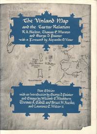
1995rif. EXNW00005New Haven & London: Yale University Press 1995 WYSIWYG pricing--no added shipping charge for standard shipping within USA. Full blue cloth gilt-on-black titles on spine black endpapers lxvi 291 pp 25 ff plates not in pagination including 4 oversized folding plates footnotes index. Light soil to fore-edge else fine. DJ has two tears with creasing to top edge of rear panel; in Brodart archvial cover. The Vinland map believed to have been drawn in about 1440 shows the Old World Iceland Greenland and the coastline of northeastern North America. It was discovered bound in a volume with a manuscript copy of the Tartar Relation "an account of Friar John of Plano Carpini's mission to the Mongols from 1245 to 1247." This volume contains facsimiles of the map and the Relation a transcription and translation of the Relation history and description of the manuscript by Marston a study of the map by Skelton and an interpretation of both by Painter. The preliminaries include essays by Wilcomb E. Washburn on the controversy surrounding the map Thomas A. Cahill & Bruce H. Cosko on forensic studies of both and antiquarian bookseller Laurence C. Witten II on his acquisition of the map in 1957. Shipping weight 6 lbs. Revised Ed. . Fine/Fine. 30 X 23½ cm. Yale University Press Hardcover
rif. 98396aafCape Town, the Van Riebeeck Society, 1939, in-8vo, 413 p. / 341 p., light foxing, small legacy stamp ‘Guggisberg’, original publisher’s grey clothbound, light wear at spine ends. Very good copy.
rif. 59749aafBern, Hallwag, 1940, in-8vo, 328 S., + ill. Tafeln, Original-Leinenband, gutes Exemplar.
1897rif. 100095386Kegan Paul Trench Trübner & C° 1897 in8. 1897. Cartonné. iconographie en noir et blanc
19718vo., Second Impression, with plates and maps; blue cloth, gilt back, a near fine copy in unclipped dustwrapper. A PRESENTATION COPY FROM THE AUTHOR WITH HIS SIGNED HOLOGRAPH INSCRIPTION ON TITLE. Published a year after the first edition.
1998rif. 100086620Editions Complexe 1998 597 pages in8. 1998. Broché. 597 pages.
2006rif. 100069774Editions france loisirs 2006 582 pages 16x25x4cm. 2006. Broché. 582 pages.
1933rif. 112031Berlin: Drei Masken Verlag, 1933. 24,5 cm ; Leinen
rif. 12766Journal d’un voyage de découvertes par le capitaine SPEKE) Nouveau journal de voyages de CHARTON. Hachette éditeur. 1863. Volume IX livraisons 226-227-228-229-230-231-232-233-234 Pages 273 à 384/ traduction de ED FORGUES Gravures, cartes. Avec la couverture de livraison n°226 papier bleu imprimé. Complet en livraisons, non sorties de reliure. Edition pré-originale. Peu courant.
rif. 94507aafEdinburgh and London, William Blackwood and Sons, 1864, lg. in-8vo, engraved frontispiece + X + 1 ll. (2 p.: half-title : Journal...Somali Land) + 372 p., + 1 double-page + 1 folding map, a very clean copy, engraved ex-libris: James Early Smith + one small legacy stamp on first fly: C.A.W. Guggisberg, contemporary h.-leather, spine richly gilt. Fine copy.
1995rif. 270312Berlin : Edition Ost, 1995. 351 Seiten.. Mit zahlreichen Schwarz-Weiß- Abbildungen. 22 cm Originalpappband.
1925rif. 53796London, Oxford University Press, 1925-29. Royal8vo. 2 orig. full cloth. Gilt lettering on spines. Containing 33 + 25 original offprints published in various periodicals in various sizes, published between 1921-29, some with plates and textillustrations, in the fields of geology, zoology, geography, hydrography, glaciology etc.
1925rif. 53796London Oxford University Press 1925-29. Royal8vo. 2 orig. full cloth. Gilt lettering on spines. Containing 33 25 original offprints published in various periodicals in various sizes published between 1921-29 some with plates and textillustrations in the fields of geology zoology geography hydrography glaciology etc. hardcover
1967rif. 33406BBStuttgart, Brockhaus Verlag, 1967. Nur Tafelband ("Atlas")! Nur Tafelband ("Atlas")! Ausgabe Brockhaus Verlag (1967). Keine Seitenangabe. Der Band enthält insgesamt 57 Karten und Tafeln. Mit Titelprägung versehener Original-Ganzleinenband mit titelbedrucktem, illustriertem Original-Umschlag. Band in sehr gutem Zus ('Quellen und Forschungen zur Geschichte der Geographie und der Reisen', Band 3,4).
2012rif. 53349Bremen, maritime press, 2012. 150 S. (21 cm) Broschierte Ausgabe
rif. DADAX146097638XNew unknown
rif. 16801Librairie de L. Hachette et Cie. Paris, 1874, petit in-4 demi-chagrin rouge, dos à quatre nerfs, dos richement orné, toutes tranches dorées. Reliure de l'éditeur. 60 gravures en noir et 6 cartes. 3ff.-600pp. Ouvrage traduit de l'anglais avec l'autorisation de l'auteur par Mme. H Loreau. Des rousseurs sinon bon exemplaire.
1890rif. 100132486Hachette et cie 1890 in4. 1890. Relié.
rif. 100133341Grands lacs in12. Sans date. Broché.
1969rif. 12040Spreitenbach, Schweiz : Gloria-Verl., 1969. 125 S. : zahlr. Ill. (meist montierte, farb. Klebebilder) Gr. 8°. Ill. OPpbd.
rif. 6480Lizenzausgabe für einen Buchclub, Gütersloh. 366 S., geprägter OLn m. OU. Mit 44 Abbildungen. Ordentliches Exemplar. Buchschnitt etwas verschmutzt. Minimale Läsuren am Umschlag. Good copy.
1890rif. 10955Leipzig, Brockhaus, 1890. 10. Aufl. 137 S. 1 mehrfach gefalt. Karte. 8°. OKart. (gebräunt, fleckig, Rücken lädiert).
1890rif. 1205961Leipzig, Brockhaus, 1890. Gr.-8vo. 10 (v. 12), 515, (1) S. u 8, 480 S., 4 Bl. m. 150 Abb. im Text u. auf 38 xylograph. Taf., 1 Profilskizze, 1 sechsseitiges Faks., 3 separate farbige Faltkarten. Hldrbde (stellenweise beschabt, Außengelenk oben bei Bd 1 hinten, bei Bd 2 vorn m. winzigem Einriß; Bd 1: Bindung etwas gelockert, Hinterdeckel feuchtspurig, Vortitel fehlt, innen vereinzelt gering fingerfleckig).