2 014 résultats
17514to [25 x 20 cm]; [ii], xxxvi, 280, xv (index) pp, 7 engraved maps, plans and plates including 6 folding, one being fldg table, engraved vignette head-pieces and tail-pieces. contemporary full leather, gilt spine title & design, raised bands, light cover wear, few tiny holes on front joint,marbled endpapers, endpaper labels of Le Chev du Blaisel & B. Mendel, few leaves with light marginal browning, else clean crisp, near fine. This is the first edition of the account of the great French Scientific Expedition to South America to measure an arc of the meridian at the equator to determine the dimension and shape of the earth. After the scientific measurements done north of the city of Quito in Ecuador, La Condamine then journeyed down the Amazon, being the first to explore that region. His measurements stood the test of time until the advent of GPS showed that the actual equator was somewhat further south, although the original monument and museums north of Quito still advertise themselves as the actual equator. The work includes a detailed plan of the city of Quito and a large map of what is now Ecuador. Hill 169: 'the greatest geographical event of the eighteenth century as regards South America. . . to measure one exact degree of meridian to determine the dimensions and shape of the earth. . . the work occupied eight years'. Sabin 38479. Norman 1250.
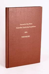
1896réf. 58059Adelaide: C.E. Bristow Government Printer 1896. First Edition. Hardcover. Fine. Adelaide C.E. Bristow Government Printer 1896. Foolscap folio 32 pages including Appendix B: Report of the Physical Geography of Central Australia by Professor R. Tate and J.A. Watt plus 24 plates on 13 leaves printed rectos only and a folding meteorological chart 2 folding maps a topographical map of Mount Watt and a Survey of Hermannsburg Mission Station and a very large folding colour map 1210 × 1210 mm. Modern cloth lettered in gilt on the front cover; blank bottom margin of the main map slightly creased with one tiny tear expertly sealed; a fine copy. South Australian Parliamentary Paper 19 of 1896: only 650 copies printed. Winnecke was the leader of the expedition and in 'the natural order of things these journals and maps should have been published in connection with the scientific and other records of the Horn Expedition as both supplementary and complementary to them'. After a financial disagreement with W.A. Horn the organiser and backer of the venture this did not occur and this first edition was published under the auspices of the South Australian branch of the Royal Geographical Society of Australasia in conjunction with the Department of the Minister for the Northern Territory and the Survey Department. McLaren 16973; an octavo edition was published the following year see McLaren 16969 - not noting the very large map. C.E. Bristow, Government Printer hardcover
1904réf. 760631904 Paris, Perrin, 1904, in 8° broché, 430 pages ; non coupé ; portrait en frontispice et carte dépliante.
réf. 50053Ernest Leroux, Paris, 1917
2007réf. 100139650Buchet chastel 2007 in8. 2007. Broché.
1763réf. P2-7B-14Paris, Guillyn, 1763. In-12 (17x10) relié plein veau époque, dos à nerfs orné, pièce de titre, XXXVI-380pp-2ff. Illustré de figures dans le texte. Carte dépliante en déficit , un cahier mal placé (p168-192 relié p.216)
réf. 44956Imprimerie Royale.1844.Gd.in-8,reliure en cartonnage épais avec pièce de titre.329 p.Carte dépliante.Nombreuses gravures en noir, H-T et I-T. Bel état avec dos insolé et qques défauts au cartonnage.
2016réf. 26480London: Folio Society. Fine. 2016. First thus. Introduced by Pater Campbell. With many illustrations A fine copy in a fine slipcase. ; 230 x 160mm; xxviii 409 pages . Folio Society unknown
1971réf. 142618Royal Marines Staff 1971. 63024 pp. Quarto. Stiff illustrated card covers staple-bound as issued. Illustrated throughout with black and white photographs within the text. Signed by the leader of the expedition M. K. Burley on the front wrapper. Two illustrated envelopes from the expedition with canceled stamps loosely inserted. Several maps including one on the inside of the front wrapper. Some rust from the staples in the latter part of the book. A very good to near fine copy. Official report of the expedition which explored the islands of the Elephant Islands Group in the Antarctic summer of 1970-71. Seems very scarce. 1971 Royal Marines Staff unknown
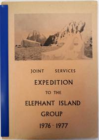
1977réf. 106929No Place: Printed by the Drawings and Publications Department of H.M.S. Collingwood nd c1977. Softcover. very good. 1st Edition. vi71pp. Quarto in original stiff illustrated card covers stapled with illustration on cover from painting by Keith Shackleton and plates from photos and maps and tables. Inscribed and signed by leader Chris Furse. Official report of the expedition which explored the islands of the Elephant Islands Group in the Antarctic summer of 1976-77. Travelling mainly by canoe between the islands the expedition divided into two main groups to perform scientific observations the Gibbs Island Party and the Clarence Island Party. 1977 Printed by the Drawings and Publications Department of H.M.S. Collingwood paperback
1968réf. 0054841968 Original pictorial postcard with two postmarked Chilean stamps 70 & 20 CTs and rsm 'Joint British Patagonian Expedition 1967-68'. Signed by the team Derek Walker Dave Nicol Gordon Hibberd Ian Clough Chris Jackson John Gregory and Niki Clough as 'Niki' one corner tip lost presumbably through removal from mounting. A scarce expedition fund raising postcard with the rare signature of Ian Clough who died on Annapurna in 1970. A very good copy. Signed by the Team Members. unknown
2003réf. 029429Edition Erdmann, K. Thienemanns Verlag, Stuttgart, Wien 2003. Unverletzter S.U Leinen Neuwertig
1937réf. GG266021937-1939 192 p., 13 figs, 5 pls, 4 (2 col.) maps, roy. 4to, paperbound. Lacks number 4 (= ''The Distribution of Organic Carbon and Nitrogen in Sediments from The Arabian Sea'' - 30 p.).
1936réf. GG266031936-1940 202 p., 81 figs, 1 col. folded map, roy. 4to, paperbound. Complete volume 2.
réf. c3589Paris, Yacht Club de France, Noel 1936 (Imprimerie Guillemot et Lamothe, janvier 1937) ; in-4°, broché, couverture beige illustrée du médaillon de Charcot au 1er plat, titre en noir et rouge; 332pp.,1f.nch. Couverture légèrement passée, dos un peu jauni, rares piqûres.Nombreuses illustrations photographiques dans le texte et à pleine page.Tirage total à 900 exemplaires numérotés, celui-ci n°446.
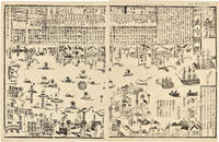
1855réf. 46844Tokyo ca. 1855. Japanese Print of Perry's Ships in Tokyo Harbor Large wood block print comprised of two sheets showing the disposition of the Japanese soldiers and ships in preparation for the arrival of Commodore Perry's American fleet seen sailing into Tokyo harbor at the right side of the image. The top third of the print is comprised of text in Japanese characters. Three large American ships dominate the right side of the print while several smaller boats dot the rest of the harbor. The whole is dotted with Japanese characters denoting various people and places around the harbor. Perry first arrived in Japan on July 8 1853 with a fleet of four ships flying his pennant on the steam frigate Susquehanna. This first visit lasted ten days and culminated on July 14 with Perry's presentation of a letter from the President of the United States to the Japanese commissioners. Perry then absented himself for seven months returning on February 11 1854 for a stay of over four months. He negotiated a treaty opening Japan to trade with the western world providing for a U.S. consul in Japan and protecting visiting ships and crews. Perry's visit to Japan remains one of the most important events in the diplomatic history between western and eastern nations. A handsome print showing the Japanese side of this important historic event. 24½ x 16 inches. Matted. Old fold lines some minor wear and soiling. Near fine. unknown books
1855réf. 46844Tokyo ca. 1855. Japanese Print of Perry's Ships in Tokyo Harbor Large wood block print comprised of two sheets showing the disposition of the Japanese soldiers and ships in preparation for the arrival of Commodore Perry's American fleet seen sailing into Tokyo harbor at the right side of the image. The top third of the print is comprised of text in Japanese characters. Three large American ships dominate the right side of the print while several smaller boats dot the rest of the harbor. The whole is dotted with Japanese characters denoting various people and places around the harbor. Perry first arrived in Japan on July 8 1853 with a fleet of four ships flying his pennant on the steam frigate Susquehanna. This first visit lasted ten days and culminated on July 14 with Perry's presentation of a letter from the President of the United States to the Japanese commissioners. Perry then absented himself for seven months returning on February 11 1854 for a stay of over four months. He negotiated a treaty opening Japan to trade with the western world providing for a U.S. consul in Japan and protecting visiting ships and crews. Perry's visit to Japan remains one of the most important events in the diplomatic history between western and eastern nations. A handsome print showing the Japanese side of this important historic event. 24½ x 16 inches. Matted. Old fold lines some minor wear and soiling. Near fine. unknown
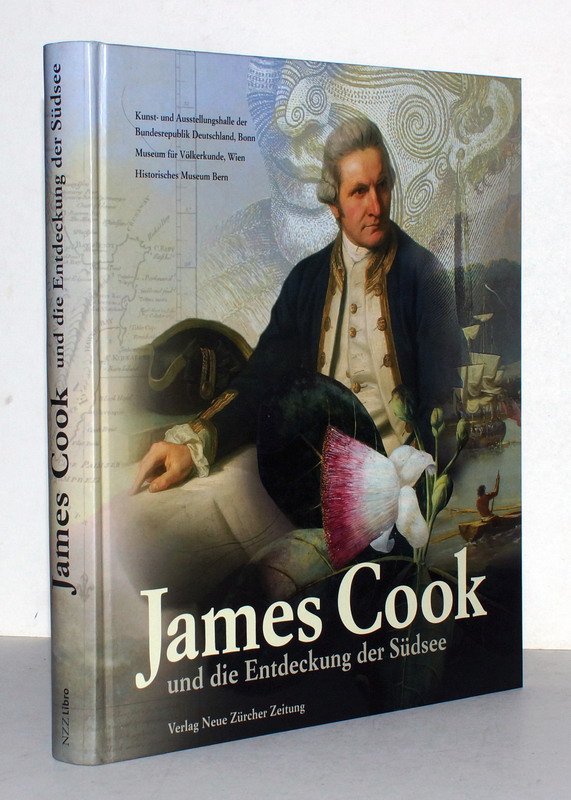
2009réf. WKP0049-0503Zürich, Verlag Neue Zürcher Zeitung, 2009. Quart, illustr. Org.-Hardcover. 276 S., mit zahlreichen meist farbigen Illustrationen, wohlerhaltenes Exemplar. ISBN 97833038235842
2009réf. REIS1107Bonn, Kunst- und Ausstellungshalle 2009. 4°, 276 S., mit über 600 teils farbige Abb., ill. OPpbd., ill. Vorsätze, ausgezeichnetes Exemplar.
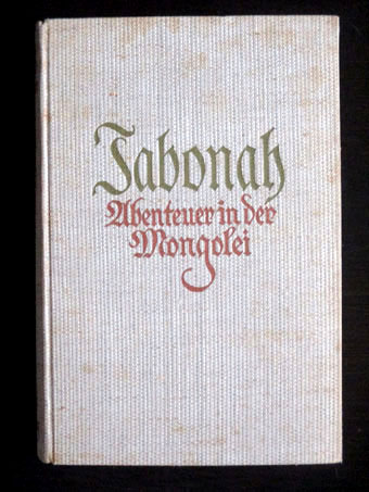
1933réf. 33950Insel-Verlag, Leipzig, (1933). EA, 306 Seiten, zahlreiche Abbildungen+ 1 Faltkarte; Gr.-8°, 23 x 15 cm, Leinen
1974réf. 100065589Cerf 1974 in12. 1974. Broché. avec sa carte détachée illustrations noir et blanc
réf. 18829Paris, Le Normant, 1811. 3 vol. in-8, CIX-277 pp. + 413 pp. + 370-8 pp. 1 pl., basane racinée havane, dos long orné de frises et fleurons dorés, pièce de titre rouge, pièce de tomaison verte, tranches jaunes (trous de vers, épidermures, quelques petites rousseurs ou taches, une pâle mouillure aux derniers ff. du 2e tome, carte manquante)
réf. P1-4D-5Paris, Firmin Didot), 1839. In-folio (34x26cm), titre, table, 32 cartes et plans dont 6 doubles pages, certains contours coloriés par Bory de St Viencent. Relié demi-basane, manque au dos, coins émoussés, plats frotté. ATLAS seul, sans le texte.
1675réf. P1-4D-6Milan, Recaldini, 1675. 2 parties reliées en un in-12 (140x70 mm), plein vélin époque, 6ff.n.c.-336 pp. Première édition Italienne. Petit trou de vers dans la reliure. First edition in Italian, 2 parts in on volume 12mo (140x70mm), contemporary vellum, binding slightly stained and rubbed.
réf. 3719Ouvrage traduit de l'anglais avec l'autorisation de l'auteur par Hippolyte Vattemare et contenant 56 gravures et 2 cartes.Paris, Librairie Hachette, 1875. in-8. broché III-préface-1 carte en couleurs-439 pp. Première édition française. Portrait en frontispice et nombreuses planches gravées hors-texte. 2 Cartes en couleurs dont une rempliée en fin d'ouvrage de L'Albert Nyanza comprenant les deux itinéraires de Sir Samuel White Baker, pacha.bon etat interieur tres frais , merite une belle reliure