NORDENSKJÖLD, Docteur Otto.Livre Rare Book

1 517 résultats
réf. 101731Paris, Ernest Flammarion sans date, vers 1905, 230x160mm, frontispice, IX - 403pages, reliure demi-chagrin à coin. Pièce de titre et d’auteur dorés au dos. Plats toilé. Illustration dorée sur le plat supérieur. Tranche supérieure dorée. Coiffes légèrement frotées, autrement belle reliure, bel exemplaire.
réf. 8920à l’usage des collèges, des pensions, des maisons religieuses & de toutes les personnes qui étudient et enseignent la géographie. Nouvelle édition augmentées de trois nouvelles cartes astronomiques & d’une introduction à la connoissance de la géographie. In 8 cartonné, muet, titre, 16 pages d’introduction, suivent 1) la division astronomique du globe terrestre en cercle, etc. 2) la démonstration de quelques effets du soleil & de la lune etc. 3)la planisphère, ou représentation du globe terrestre.4) La sphère artificielle ou armillaire oblique. 5) Mappemonde ou description du globe terrestre.6) Carte de l’Europe.7) Carte de l’Espagne. 8) carte du Royaume de France (dépliante). 9) L’Italie et ses différents états Royaumes et Républiques. 10) Pays Bas comprenant le Brabant, Gueldre, Limbourg, Luxembourg, Hainaut, Namur, Flandre, Cambresis et Artois. 11) l’Allemagne divisée par cercles avec les états de Boheime & la Suisse. 12) Carte générale de la Pologne avec tous les états qui y sont annoncés. 13) Russie d’Europe divisée par gouvernemens. 14) Suède, Norvège et Danemarck. 15) Royaume d’Angleterre divisé en ses principales provinces. 16) Royaume d’Ecosse.17) Royaume d’Irlande. 18) Le royaume de Hongrie et la Turquie d’Europe. 19) Asie divisée en ses principaux états. 20 Turquie d’Asie. 21) Carte des régions et lieux dont il est parlé dans le nouveau testament. Plan de Jérusalem. Du tems de Jésus christ, carte de la Judée sous Hérode. 22) les Indes Orientales et leur archipel. 23 l’empire de la Chine avec les Isles du Japon et la Corée. 24) l’Afrique. 25) carte de l’Egypte ancienne et moderne 26)l’Amérique méridionale divisée en ses principaux états (carte montée à l’envers) 27) L’Amérique Septentrionale divisée en ses principaux états (montées à l’envers). 28) Golfe du Mexique. Exemplaire sans les cartes de la Nouvelle York, de la Jamaïque et de la Virginies & Mariland. L’ensemble monté sur onglets. A Paris chez Laporte libraire géographe et les principaux libraires et marchands d’estampes de France et des pays étrangers. 1779. Bon exemplaire.
1860réf. P1-3i-6Sans lieu ni date (1860). Atlas in-4 (27x18cm), relié demi-chagrin et coins, dos à 6 nerfs, coins usés, 24pp de texte, 39 planches et 4 cartes dépliantes. COMPLET. Quelques rousseurs.
1675réf. P2-7B-9Paris, Estienne Michallet, 1675. In-12 (160x95mm), demi-vélin moderne, plats marbrés. 14ff.-446pp.-15ff.n.c. Edition originale de cet ouvrage de référence sur la Grèce ottomane, plusieurs fois réédité, très utile pour la connaissance des antiquités grecques. Chateaubriand le regardait comme un véritable roman. L’Edition est illustrée d'une coupe repliée d'un théâtre antique et d’un plan de la ville d’Athenes. BON EXEMPLAIRE. Manque 1 feuillet (p.217-218).
1929réf. 26494Edinburgh And London: William Blackwood and Sons. Very Good with no dust jacket. 1929. First Edition. Hardcover. Foredge and top edge of pages have minor spotting/foxing otherwise a very good copy. ; 190 x 130mm; vi 317 pages . William Blackwood and Sons hardcover
1984réf. 20236abMülheim, Okahandja, 1984. festes Kunstleder???, mit Deckelstruktur und 2 farbigen Deckel-Photo-Schildern, etwas gr. DinA 5, 207 Seiten, einige Farbphotos, Kartenskizze, Einband mit Gebrauchsspuren, gebräunt, leicht fleckig, Seiten randgebräunt, insgesamt gut erhalten / insgesamt guter Zustand
grand in-8°, 347 pages, ill. hors texte N&B, 1 carte, broche, couverture illustree à rabats. Bel exemplaire. [GE-3]
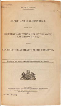
1875réf. WRCAM50678London 1875. 402pp. plus folding map. Folio. 20th-century three-quarter calf and marbled paper boards spine gilt. Stefansson Library stamp on titlepage deaccessioned. Toned minor chipping at edges of some leaves. Final leaf repaired with archival paper with no loss to text; small tears in margin of map. Very good. This scarce document describes the plans for the 1875 Nares Expedition includes specifications for the H.M.S. Discovery data on supplies needed estimations of costs and a hydrographer's report as well as a color chart of the North Polar Sea. The chart is a Polar projection map showing the seas navigated by British expeditions as well as coasts discovered by British American German Swedish and Austrian explorers through 1874. The Nares expedition which sailed from 1875 to 1876 strove to be the first to reach the North Pole and to explore its coasts and region. Though unsuccessful in this venture the expedition was the first to sail ships through the channel between Greenland and Ellesmere Island and as far north as the Lincoln Sea recording valuable information about the mysterious region. A sledging party under Captain Albert Hastings Markham also set a new record on land reaching as far north as 83° 20'. The British Parliament printed occasional reports of the various expeditions and related Arctic subjects which became known as the Arctic "blue books" named after the distinctive blue wrappers in which they were originally issued. This copy has the stamp of the Stefansson collection at the Dartmouth library but was deaccessioned as a duplicate to his widow. ARCTIC BIBLIOGRAPHY 45251. hardcover books
réf. 102116London H.M.S.O. 1877. . First edition; folio 33.5 x 21.5 cm; 16 folding maps a few small splits to folds 16 plates further illustrations in the text; contemporary blue half roan marbled boards lightly faded neat restoration to extremities a very good copy; viii 484 pp. One of the most valuable sources for the history of exploration in northern Canada. The Nares expedition so called after its commander George Nares 1831-1915 sailed in two ships HMS Alert and HMS Discovery in late May of 1875 in quest of the North Pole. The ships reached Lady Franklin Bay on North Ellesmere Island and the Alert went on to reach the extreme north of the island the highest latitude that had yet been reached by a ship. In April 1876 three separate sledge parties set out but the men showed serious signs of scurvy and several members died. Nares was forced to abandon the expedition and returned to England in September that year. Despite the difficulties faced by the expedition it did produce important scientific results including a study of Inuit dog disease and a volume of physical observations. The Nares expedition is one of the best documented Arctic expeditions with eight Parliamentary Blue Books alone devoted to it between 1875 and 1878. Arctic explorer Vilhjalmur Stefansson wrote 'The Arctic Blue Books are beyond comparison the most important tool of knowledge in this field.' London H.M.S.O., 1877. hardcover
1970VG (original blue cloth, minimal wear, no dj) Octavo 270pp Illustrated. Maps at endpapers
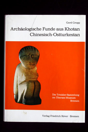
1974réf. 34780Röver, Bremen, 1974. 409 Seiten, zahlreiche Abbildungen; 4°, ca. 27 x 21 cm, Leinen mit Schutzumschlag
1857réf. 000151London: J.B. Nichols and Sons 1857. Hardcover. See Description. Tall 4to. pp. viii 2 508. Volume XXVII. 12 plates including several in color and 2 folding maps one map is folded in six sections and backed with thin gauze or mull. B&W illustrations with the text. Pages are generally clean with a couple small marginal tears. Light brown cloth; re-backed preserving part of the original spine minus 25mm at the tail and 15mm at the top. Inner hinges neatly strengthened. Some rubbing and wear; corners bumped. Contents include: An accound of the discovery of Anglo-Saxon remains at Kemble in North Wilts; On choirs and chancels particularly as to their use in the South of Europe; Remarks on some early churches in France and Switzerland partly in the time of Charlemagne; The City of Cumae and the recent excavations there; An account of the investigation of some remarkable circular trenches and the discovery of an ancient British cemetery at Stanlake Oxon.; The Burning and burial of the dead.and many other articles. J.B. Nichols and Sons hardcover
réf. 8522Copenhagen: Munksgaard 1967-69 London: Curzon Press 1988. First edition. Some light wear to the paper-covered boards of volumes I-III volume IV as new; a bright and clean set in very good condition. Pp. vol. I: pp. 129 33 black-and-white photo-plates; vol. 2: pp. 164 140 full page plates black-and-white photos and line-drawings 2 plates are double foldouts of the excavation in progress 4 maps or excavation plan views in pocket at rear; vol. III: pp. 53 24 black-and-white photo-plates of human skeletal remains; vol. IV: pp. xii 150 6 38 photo-plates of cave interior and kettle-drums numerous text-figures. vols. I-III: one-quarter green cloth lettered in white on the spine over orange and white pictorial boards lettered in white and black vol. IV: white pictorial boards lettered in black 4to all volume hardback. The contents of each volume are: Volume I: Sai-Yok Stone-Age Settlements in the Kanchanaburi province; Volume II: Ban-Kao Neolithic Settlements with Cemeteries in the Kanchanaburi province Part 1 - Archaeological Materials from the Burials; Volume III: Ban-Kao Neolithic Settlements with Cemeteries in the Kanchanaburi province Part 2 - The Prehistoric Thai skeletons and Volume IV: Surface Finds and Minor Excavations. Archaeological Excavations in Thailand is a voluminous record of the finds of the Thai-Danish Prehistoric Expedition 1960-1962. The first three volumes were published in Copenhagen in 1967-1969. The fourth volume appeared as Occasional Paper no. 1 of the Scandinavian Institute of Asian Studies in 1988. No ownership marks and few signs of use. Copenhagen: Munksgaard, 1967-69 + London: Curzon Press, 1988. First edition. hardcover
1967réf. 44603Copenhagen 1967-69. 4to. Orig. hcloth. 12918453 pp. tables and more that 200 plates. some folding. Clean and fine. hardcover
1967réf. 44603Copenhagen, 1967-69. 4to. Orig. hcloth. 129,184,53 pp., tables and more that 200 plates., some folding. Clean and fine.
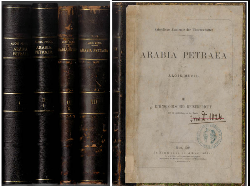
1907réf. 55717BBWien, In Kommission bei Alfred Hölder, 1907-1908. Groß-8°. 24,5 cm. XXIII, 443, XII, 343, X, 299 und XV, 550 Seiten. Schwarze und dunkelbraune Halblederbände mit goldgeprägten Rückentiteln.
1830réf. 2192Paris, Ch. Piquet, 1830. Texte + Atlas, complet. In-12, 10,5 x 17,5 cm (texte) ; In-folio oblong, 36 x 28 cm. Reliure postérieure pastiche en demi-veau fauve et coins crème en vélin, dos lisse orné de filets à froid et roulettes dorées, pièce de titre en maroquin noir, tranches du volume de texte marbrées. viii, 238 pp. ; 21 pl. (atlas). Deuxième édition, publiée la même année que l’originale. « La première édition de cet Aperçu a été envoyée à l’armée expéditionnaire d’Afrique. On trouvera, à la fin de celle-ci, quelques plans nouveaux, et, dans le texte ou en appendice, quelques additions que de nouvelles recherches nous ont mis à même de présenter au lecteur ». L’atlas contient 7 cartes ou plans gravés, dont 6 dépliants (2 établis d’après les relevés du Capitaine Boutin) et 14 planches lithographiées, dont plusieurs issues de la collection du Colonel Rottiers représentant des vues et des costumes, le tout monté sur onglets.« Ouvrage publié par le Dépôt Général de la Guerre à l'usage de l'armée expéditionnaire d'Afrique, qui quitta le port de Toulon le 25 mai 1830, en direction d'Alger. Il fut rédigé par le géographe Charles Piquet, en grande partie d'après le rapport du capitaine Boutin, envoyé en mission d'espionnage, en 1808, dans la régence d'Alger ». Gay, 852 et 873 ; Tailliart, 1455. Ex-dono JJL de Querelles sur la première carte.
2002réf. 200252S. Fischer, 2002. 252 S., mit zahlreichen zum Teil farbigen Abbildungen. Hardcover mit Schutzumschlag
réf. 37663ABBerg.-Gladbach Lübbe o.J. 207 S., reich illustr. Ok., O.-Umschl., Deckelillustr. Guter Zust.
1990réf. 6703München [u.a.] : Piper, 1990. 391 S. : zahlr. Ill., 1 Kt. Gr. 8°. OLwd mit SU.
1960réf. 5069Zürich : Artemis Verl., 1960. o.P., 173 z.T. ganzseitige Farb- u. Schwarzweiss-Aufnahmen, quer-8 (21 x 35 cm), Hldr.oder HLn., Ppbd.
1904réf. 112056Berlin: Verlag Dietrich Reimer (Ernst Vohsen), 1904. 24,5 cm ; Leinen
1909réf. H18498London: Royal Society 1909. First printing. Hardcover. Good. Quarto rose cloth over deep plum cloth boards good with some waterstaining and discoloration to covers ex-library but with very few marks contents good to very good 274 pp 42 plates. Royal Society hardcover
réf. 101763London, C. Hurst & Company 1974, 225x140mm, X - 382pages, editor's binding with jacket. Book in good condition.
1824réf. 14481Bourg, Bottier ; in-8, broché ; 168 pp. ; Thomas Riboud : Essai sur l'étude de l'histoire des Pays composant le département de l'Ain, par la recherche et l'observation des Monuments militaires, expédition, travaux et ouvrages de défense ou d'attaque, dont il reste les vestiges ou des notices, 60 pp. (Le Duc, 105) ; (4) pp., couverture rouge-brique décorée.