1 377 résultats
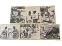
1962réf. 235391962. Lawrence of Arabia press release photo archive 1962 recording the publicity and production record of Columbia Pictures' large scale film adaptation of T. E. Lawrence's wartime role in the Arab Revolt. Released in 1962 and directed by David Lean the film became one of the defining historical epics of postwar cinema built around location shooting desert spectacle and widescreen cinematography rather than studio bound reconstruction. These press photographs document the film at the point of production on location. Archive of 6 press release silver gelatin photographs approximately 8 x 10 inches issued by Columbia Pictures Corporation 1962. The photographs show crew members operating large motion picture cameras the director or camera man seated beside camera equipment while gesturing toward a performer in Arab outfits actors and crew gathered in courtyard and desert settings men seated in water during a production or publicity scene a figure on a barren rocky rise and a street scene with riders buildings and extras arranged for a period setting. Printed press text at the margins identifies Columbia Pictures copyright in 1962 and grants newspapers magazines and periodicals permission to reproduce the photographs for nonadvertising purposes. Several images carry production or publicity codes beginning with "La" linking the group to the film's release campaign. Lawrence of Arabia was produced during the era when Hollywood studios used large format historical spectacle to compete with television and to maintain the theatrical event status of feature films. Its production depended on extended location work in desert and Mediterranean settings a visual strategy that gave the film its scale and also generated a large body of publicity photography showing the labor behind that scale. These press photographs preserve that publicity layer: not only finished scenes but cameras crew performers costumes and staged encounters prepared for circulation in the illustrated press. Light surface wear handling creases and edge toning with printed Columbia Pictures press lines retained. Overall good condition. A concise press photography record of how Columbia Pictures presented Lawrence of Arabia as both film spectacle and location made production in 1962. unknown books
1968réf. 225491968. Arabian American Oil Company. Aramco Handbook: Oil and the Middle East revised in 1968 documents the information system through which Aramco explained Saudi Arabia Middle Eastern petroleum and its own industrial operations to an English-language readership. Published while the company remained owned by four American oil corporations the handbook combines petroleum geology corporate history political geography and cultural instruction into a unified account of Saudi modernization under oil development. Its organization reveals how Aramco presented itself as both an industrial enterprise and an interpreter of Saudi society using maps photographs diagrams historical narratives and rules of social conduct to prepare foreign personnel for work in the Kingdom. The volume provides primary-source evidence for research into United States-Saudi relations corporate communication petroleum infrastructure expatriate labor and the production of cultural knowledge within a multinational oil concession. Saudi acquisition of Aramco began during the following decade and reached full government ownership in 1980 placing this edition before the company's transition to Saudi control. Arabian American Oil Company. Aramco Handbook: Oil and the Middle East. Dhahran Saudi Arabia: Arabian American Oil Company July 1 1968. Revised edition. Printed in Haarlem Netherlands by Joh. Enschedé en Zonen. 276 pages. Profusely illustrated with color maps black-and-white photographs and diagrams. Original red cloth stamped in gilt and black; no dust jacket noted. 4to. The handbook is divided into five principal sections addressing the historical background of Saudi Arabia and the Middle East the development of the regional petroleum industry the Aramco venture Saudi government and society and Arab culture and customs. A tribal map identifies numerous communities across the Arabian Peninsula including al-Mutair and al-Murrah while a diagrammatic map of the "Conquest of Najd" traces Ibn Saud's military expansion through arrows and battle annotations. Petroleum sections explain drilling refining transportation and export infrastructure including the Trans-Arabian Pipeline illustrated by parallel lengths of pipe extending across open terrain and accompanied by discussion of the decision to construct substantial portions above ground. Photographic essays show communal dining urban and industrial environments and other aspects of public life. The "Social Etiquette" section introduces such greetings as as-salÄmu ʿalaykum and kayf ḥÄlak presenting cultural instruction as part of the company's management of encounters between expatriate employees and Saudi residents. Bibliographic records confirm the 1968 Dhahran edition as an extensively illustrated corporate reference work on petroleum and the Middle East. The handbook's research value lies partly in the tension between the breadth of its documentation and the institutional perspective governing its interpretation. Its maps and photographs preserve substantial information about infrastructure geography labor social practice and the physical expansion of the Saudi petroleum industry while its text consistently casts Aramco as the principal agent joining Saudi Arabia to global markets. Cultural sections reduce complex regional and social differences to practical guidance for foreign employees and historical narratives place political consolidation and oil development within a corporate account of orderly progress. The volume should therefore be read both as a reference source and as evidence of how an American-owned concession represented its authority during a consequential phase of Saudi economic transformation. Light rubbing affects the boards with slight fraying at the spine ends and minor handling wear to the text-block edges; interior clean and binding sound. Very good. A detailed corporate record of the maps infrastructure historical narratives and cultural instruction through which Aramco explained-and justified-its place in Saudi Arabia's petroleum economy. unknown books
1980réf. 225521980. Arabian American Oil Company. Aramco and Its World: Arabia and the Middle East published in 1980 documents the corporate information system through which Aramco explained Saudi history Islamic culture regional geography petroleum engineering and industrial development to employees and a wider English-language audience. Replacing the longstanding Aramco Handbook title the volume grew from instructional booklets created during the company's postwar expansion to orient incoming American personnel unfamiliar with Arabic and Saudi social practices. Its coordinated use of historical narrative landscape photography technical diagrams and cultural guidance reveals how Aramco presented itself as both a petroleum enterprise and an intermediary between Saudi Arabia and the industrialized West providing primary-source evidence for research into corporate communications expatriate training petroleum infrastructure and United States-Saudi relations. Publication coincided with the Saudi government's acquisition of a 100 percent participation interest in Aramco's concession rights production and facilities although the Saudi Arabian Oil Company was not formally created to assume Aramco's responsibilities until 1988. Arabian American Oil Company. Aramco and Its World: Arabia and the Middle East. Washington D.C.: Arabian American Oil Company 1980. First edition in this revised and retitled form. xi 275 pages. Profusely illustrated with color photographs maps and diagrams including double-page and folding material. Publisher's blue cloth lettered in turquoise; no dust jacket. Large 4to. A large folding color map titled "The Arabian Peninsula" drawn by Don Thompson and measuring approximately 24 × 36 inches is inserted at the rear. The book traces the growth of the modern Saudi state the geography of the peninsula and the development of Aramco's petroleum system. Illustrated cultural sections show desert dwellings coffee preparation camel travel goat herding Islamic calligraphy and landscapes including Jabal al-Fil while technical chapters record seismic surveying in the Rubʿ al Khali drilling equipment instrument-filled control rooms offshore platforms tanker-loading facilities and the geometrically arranged storage and refining installations at Ras Tanura. Maps locate Middle Eastern oil fields and Aramco concession areas and charts using 1978 data compare global petroleum production reserves and consumption. The folding map extends the volume's educational purpose beyond the bound text presenting topography cities transportation routes and political boundaries on a scale suited to reference or display. A manuscript inscription on the front free endpaper reads "Dear Dick and Susie.I'm on page 117" preserving evidence of the book's circulation as a personal or professional presentation copy. The volume's detailed visual record is governed by Aramco's institutional viewpoint. Its photographs and diagrams demonstrate the process by which geological surveying extraction refining transportation and export operated as an integrated industrial network while its treatment of Bedouin life and Saudi culture translates complex communities into introductory material for predominantly foreign readers. The timing gives this edition particular interpretive value: its language continues the company's established narrative of technological leadership and cultural mediation even as ownership of the petroleum enterprise passed fully to the Saudi government. Official Aramco histories confirm that Saudi participation reached 100 percent in 1980 making the book evidence of both the mature American corporate communication apparatus and the transition toward Saudi control. Light sunning and small marks affect the blue cloth; the folding map is clean and well preserved and the contents remain sound. Very good. A substantial illustrated record of the technical and cultural knowledge Aramco used to explain its operations during a pivotal year in the transfer of Saudi petroleum ownership. unknown books
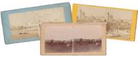
1885réf. 145761885. Collection of 4 Original 19th Century Stereoview Photographs bearing a double 6" x 3" photograph showing scenes from an Arabian Gulf town Cityscape Arab Caravan and the ruins at Petra in Jordan printed late 19th century. In the first photo we see a person resting on the riverbank across from an Arabian Gulf town with Palm trees. The second photo shows a caravan of camels and Bedouins camping. The third image is of an Arabian cityscape from the roof top including a large mosque doom with minaret. The final image captures the Palace and Corinthian Tombs Petra Jordan. In very good condition. unknown books
1928réf. 144801928. Lees G. M. The Physical Geography of South-Eastern Arabia 1928. Original geographical and geological report documenting the British geologist's expeditions through Oman and southeastern Arabia during 1925-1926 including investigations of mountainous and desert regions that had received limited systematic European surveying. George Martin Lees an assistant geologist with the Anglo-Persian Oil Company undertook fieldwork examining the geological formations tectonic structure and physical geography of Oman. His findings were presented before the Royal Geographical Society on January 16 1928 and subsequently published in The Geographical Journal. The report combines geographical surveys with observations on the water supply of Bahrain and the Qatar Peninsula archaeological discoveries of flint implements natural history collections and descriptions of the Mahri and Gara nomadic populations of southern Arabia. Lees G. M. The Physical Geography of South-Eastern Arabia. London: Royal Geographical Society 1928. Original 30-page illustrated report published in The Geographical Journal Vol. 71 No. 5 May 1928. Retained in its original blue printed wrappers with titles on the front and the original advertisements present. Illustrated with four sketch maps and photographic plates. The report examines the physical geography and geological tectonics of southeastern Arabia particularly the mountainous interior and surrounding desert regions of Oman. Lees describes his surveying expeditions geological observations and the geographical characteristics of areas previously imperfectly recorded on European maps. Supplementary material addresses water resources in Bahrain and Qatar the discovery of prehistoric flint implements and collections of birds and insects. His observations concerning the Mahri and Gara tribes include information on the inhabitants of the southern Arabian territories through which his expeditions passed. Lees's investigations preceded the extensive petroleum exploration and geological mapping undertaken across southeastern Arabia during the following decades. His employment with the Anglo-Persian Oil Company placed his geological fieldwork within the early history of commercial interest in the region's subsurface resources while his surveys contributed geographical information on Oman's mountain systems geological formations and interior routes. The archaeological and zoological observations extend the report beyond geology recording evidence of prehistoric human activity and regional wildlife. The original 1928 publication retains its blue wrappers and advertisements and is in very good condition. unknown books
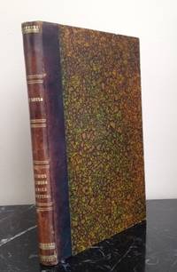
1789réf. 145041789. Sousa João de. Vestigios da lingoa arabica em Portugal ou lexicon etymologico das palavras e nomes portuguezes que tem origem Arabica 1789 a foundational linguistic study documenting the influence of Arabic language and culture on Portuguese vocabulary. João de Sousa an eighteenth century scholar of Arabic born in Damascus and later active in Portugal served as the first professor of Arabic at the University of Lisbon and was an associated member of the Academia Real das Sciencias. His work emerged from the scholarly environment of late Enlightenment Portugal when the study of language history and cultural transmission became central concerns of learned academies. The book records the long historical impact of Arabic speaking societies in the Iberian Peninsula where centuries of Islamic presence from the early Middle Ages through the late fifteenth century left lasting linguistic and cultural traces in Portuguese. Sousa João de. Vestigios da lingoa arabica em Portugal ou lexicon etymologico das palavras e nomes portuguezes que tem origem Arabica. Lisbon: Na Officina da Academia Real das Sciencias 1789. First edition. The work was produced under the authority of the Academia Real das Sciencias of Lisbon and represents the first etymological dictionary devoted specifically to Portuguese words of Arabic origin. Entries are arranged alphabetically in Portuguese and followed by the corresponding Arabic word or source a transliteration and an explanatory discussion. The lexicon also identifies Portuguese terms that entered the language through Arabic but ultimately derived from other linguistic traditions including Hebrew Greek Persian and Turkish. Among the loanwords catalogued are terms relating to plants spices agricultural products architecture and place names illustrating the wide range of everyday vocabulary shaped by centuries of cultural exchange between Islamic and Iberian societies. The book appeared during a period when European scholars increasingly examined the linguistic consequences of medieval cultural contact between Islamic and Christian societies in the Mediterranean world. The Iberian Peninsula in particular preserved a large body of Arabic derived vocabulary that entered both Portuguese and Spanish through trade agriculture science and administrative life during the centuries of Muslim rule and cultural interaction. Sousa's lexicon became an important early contribution to the study of these linguistic exchanges and preceded later nineteenth century scholarship on the subject. A second edition was published in 1830 and further studies such as the work of Francisco de S. Luiz did not appear until several decades later. Quarto volume with twenty preliminary pages and 160 pages of text woodcut device of the Academia Real das Sciencias on the title page bound in mid nineteenth century quarter sheep over marbled boards with pictorial lithograph bookplate of José Bernardo Pereira Martins. Small binder's ticket of Santos & Alves of Lisbon on the front pastedown occasional marginal annotations in ink and pencil minor repair to the upper margin of the title page and two other leaves without loss and slight wear to spine ends and corners. Overall very good condition. unknown books
1926réf. 144221926. Gröber Karl. Bird's Eye View of Mecca 1926. Original copperplate photogravure depicting Mecca Islam's holiest city and the destination of the annual Hajj pilgrimage. The elevated view records the historic urban setting of Mecca home to the Masjid al-Haram the Sacred or Grand Mosque and the Kaaba toward which Muslims worldwide direct their daily prayers. Published in 1926 the image dates from the early rule of Abdulaziz Ibn Saud over the Hejaz following his conquest of Mecca in 1924 and assumption of the title King of the Hejaz in 1926. The illustration preserves a photographic view of the holy city during a period of political transition decades before the extensive urban redevelopment and mosque expansions of the later twentieth century. Gröber Karl photographer. Bird's Eye View of Mecca. 1926. Original copperplate photogravure after a photograph by Gröber published as an illustration in the first edition of a 1926 book containing his text and photogravures. Sheet measures approximately 8.25" x 10.25" with a printed area of approximately 8.5" x 6.25". The elevated perspective presents a panoramic view of Mecca recording the city's buildings and urban topography. The copperplate photogravure process reproduces the tonal gradations and architectural detail of the original photograph. Mecca had been under Ottoman sovereignty until the Arab Revolt of 1916 after which it formed part of the Hashemite Kingdom of the Hejaz before coming under Saudi control in 1924. Gröber's 1926 publication belongs to this transitional period in the city's modern history. The original photogravure provides a contemporary visual record of Mecca before the major architectural alterations and expansions undertaken in subsequent decades. unknown books
1847réf. 146851847. Firmin Didot. Three steel engravings published in L'Univers Pittoresque in 1847 depicting the Sultan of Lahij's palace a greeting between two Arab men and a saddled camel prepared for travel. The group belongs to the illustrated French literature through which nineteenth-century European readers encountered the Arabian Peninsula combining architectural views with scenes of customary greeting and travel. The Lahij image is especially useful for documenting how the residence of the sultanate near Aden was visually presented to European audiences before the major political changes that reshaped southern Arabia later in the century. Firmin Didot. Chateau Du Saltan d'Aden a Lahadj; Salut des Arabes; Chameau scelle pour le Voyage. Paris: Firmin Didot 1847. Three original steel engravings each approximately 5 x 8.2 inches. Chateau Du Saltan d'Aden a Lahadj shows the Sultan of Lahij's castle set within a cultivated and mountainous landscape with palm trees and surrounding countryside. Salut des Arabes depicts two Arab men greeting one another with a handshake. Chameau scelle pour le Voyage shows a saddled camel in a desert setting emphasizing the animal's role in overland travel. Comparable examples of these subjects are attributed to the engraver Lemaitre in the contemporary print market. The three prints preserve a French illustrated view of southern Arabia that moves between political architecture social custom and transportation. Their publication in 1847 places them within the period when Aden had already come under British control while neighboring Lahij retained its own sultanate giving the palace view a specific political geography distinct from the port colony itself. Some age-related toning and pinholes in the upper margins; the first engraving has remnants of a sticker at the upper right corner. The third engraving shows former staple marks and an approximately 4 cm loss along the upper edge not affecting the image. Overall very good condition. unknown books
1926réf. 144751926. Cheesman Robert Ernest. In Unknown Arabia 1926. First edition of the British military officer explorer and ornithologist's account of his 1923-1924 expedition through eastern Arabia including Bahrain Hufuf the Al-Hasa oasis Jabrin and Uqair. Undertaken during the territorial consolidation of Abdulaziz Ibn Saud's rule Cheesman's expedition combined geographical surveying with zoological collecting in regions of the Arabian interior that had received limited European scientific investigation. He mapped the Arabian coast between the Gulf of Salwa and Uqair established geographical positions in the Hufuf region and investigated the location of ancient Gerrha a trading center associated with the classical history of eastern Arabia. His observations and survey results were presented to Ibn Saud at his court in Hufuf. Cheesman also collected more than 300 natural history specimens in the Al-Hasa region including mammals and birds contributing to the scientific documentation of Arabian fauna. His discoveries included the gerbil species subsequently named Gerbillus cheesmani in his honor. Cheesman Robert Ernest. In Unknown Arabia. London: Macmillan & Co. 1926. First edition. One volume 447 pp. illustrated with 67 photographic illustrations and three maps including a large folding colored map of Arabia depicting Qatar and Trucial Oman. Library binding with a small sticker on the front endpaper. With a foreword by Major-General Sir Percy Cox the narrative follows Cheesman's travels from Bahrain through Uqair and Hufuf into the desert regions surrounding Jabrin. The photographic illustrations depict settlements archaeological remains desert terrain local inhabitants and natural history subjects encountered during the expedition. The geographical observations are accompanied by scientific appendices addressing mammals birds reptiles amphibians fish insects botany geology and meteorology. The large folding map records the geographical setting of the expedition including the eastern Arabian coast and neighboring territories of the Persian Gulf. Cheesman's expedition took place during Ibn Saud's expansion of political control over the Arabian Peninsula following his conquest of Al-Hasa from the Ottoman Empire in 1913 and before the establishment of the Kingdom of Saudi Arabia in 1932. His surveys contributed to the Royal Geographical Society's mapping of eastern Arabia particularly the routes between Uqair and Jabrin while his zoological collections expanded contemporary knowledge of the peninsula's wildlife. The account also records settlements desert transportation water sources and relations with local authorities during the early years of Saudi territorial consolidation. This copy contains pencil annotations on page 71 light foxing rubbing to the binding edges and small tears along the lower edges of pages 40 and 42. The large folding map has a 2" separation along the centerfold near the edge and margins. Otherwise complete retaining all photographic illustrations and the folding colored map; overall in good condition. unknown books
1926réf. 144231926. Gröber Karl. Two Views of the Mosque at Mecca 1926. Pair of original copperplate photogravures depicting the Masjid al-Haram the Sacred or Grand Mosque in Mecca Islam's holiest city and the destination of the annual Hajj pilgrimage. The mosque surrounds the Kaaba toward which Muslims worldwide turn in daily prayer. Published in 1926 the illustrations date from the early period of Saudi rule over Mecca following the city's conquest by Abdulaziz Ibn Saud in 1924. The two views record the mosque from ground-level and elevated perspectives preserving photographic documentation of the sacred precinct before the extensive architectural expansions of the later twentieth century. Gröber Karl photographer. Two Views of the Mosque at Mecca. 1926. Two original copperplate photogravures after photographs by Gröber published in the first edition of a 1926 book containing his text and photographic illustrations. Each sheet measures approximately 8.25" x 10.25" with a printed area of approximately 6.25" x 8.25". The first photogravure presents a ground-level view of the mosque recording its architecture from within the surrounding urban setting. The second provides a bird's-eye view of the mosque showing the sacred complex from an elevated perspective. Both illustrations reproduce the tonal gradations and architectural details of the original photographs through the copperplate photogravure process. The illustrations were published during a decisive period in the modern history of Mecca. Following the collapse of Ottoman authority in the Hejaz during the First World War the city came under Hashemite rule before its capture by Ibn Saud in 1924. In 1926 Ibn Saud assumed the title King of the Hejaz incorporating Mecca into the expanding Saudi state. The paired views record the mosque's architectural setting during this transition preceding the major expansion and redevelopment campaigns undertaken from the mid-twentieth century onward. Both original photogravures are in excellent condition presenting complementary perspectives of the Grand Mosque as reproduced in 1926. unknown books
1885réf. 145461885. Vintage original albumen photograph of a Colonial French Algeria Bedouin Warrior with his camel published circa 1875. Image size: 8.25" x 11." In this image we can see a Bedouin traditionally dressed in a thoab and kufiyya. The warrior is standing in the desert holding the reins of his camel. The camel is saddled with the Bedouin's sword visible on his side flank. In the background is a single fort tower in the bare desert. Overall in very good condition. unknown books
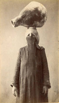
1890réf. 142871890. De Michele Luigi woman carrying a water pot circa 1890 records a common form of domestic labor in late nineteenth century Egypt through the commercial portrait photography of the period. The subject stands wearing a face veil and long garments while balancing a large water vessel on her head preserving specific details of dress posture and water carrying practice without identifying the sitter by name. Black and white carte de visite photograph measuring 2 1/2" x 4". The woman is shown full length balancing a large water pot on her head and wearing a veil covering most of the face. The reverse bears the photographer's stamp "Fotografia Egiziana / Luigi De Michele." The studio attribution places the image within the commercial photographic trade that produced portraits and occupational or ethnographic views for local and foreign circulation in nineteenth century Egypt. Images of women carrying water appeared frequently in the photographic market for Egyptian views where photographers often presented daily labor and regional dress as recognizable subjects for travelers and collectors. This example retains a named studio attribution and a clearly defined activity rather than a generic landscape or architectural subject. Excellent condition. A late nineteenth century Egyptian CDV preserving a studio view of women's water carrying labor and dress. unknown books
1780réf. 144401780. Irwin Eyles. A Series of Adventures in the Course of a Voyage up the Red Sea 1780. Early Dublin edition of Irwin's firsthand account of his 1777 journey along the Arabian and Egyptian coasts of the Red Sea and through the deserts of Upper Egypt. Born in Calcutta and employed by the British East India Company Irwin undertook the journey after his dismissal from Company service in 1776 traveling to England to seek redress. His eleven-month passage involved encounters with pirates detention difficult desert crossings and travel through territories seldom described firsthand by European visitors. Written as a series of letters addressed to an unnamed lady the narrative records maritime commerce Bedouin encounters local customs and relations between European travelers and Arab populations in the late eighteenth century. Irwin's account also documents the practical difficulties of traveling between British India and Europe through the Red Sea and Ottoman-controlled Egypt. Irwin Eyles. A Series of Adventures in the Course of a Voyage up the Red Sea on the Coast of Arabia and Egypt; and of a Route through the Deserts of Thebais Hitherto Unknown to the European Traveller in the year MDCCLXXVII in Letters to a Lady. Dublin: Sleater Whitestone Potts Colles Wilson Jenkins Flin et al. 1780. Early Dublin edition. One volume 576 pages described as quarto 4to. Bound in antique full leather with gilt decoration to the spine and original title label. Retains the original folding map of the Red Sea with two additional maps lacking. The narrative follows Irwin's passage from India toward England including his experiences along the Arabian coast and his overland journey from Cosseir Quseir through the Egyptian desert toward the Nile Luxor Cairo and Alexandria. His letters describe encounters with local inhabitants the difficulties of desert transportation and conditions in the ports and settlements through which he traveled. The text also includes Irwin's poems "Ode to the Desert" and "Ode to the Nile." The work is referenced in Blackmer Collection 865 and Atabey Collection 609. Published in 1780 Irwin's narrative belongs to the early literature of British travel through the Arabian Peninsula and Egypt when the East India Company's expanding commercial interests made the Red Sea an increasingly consequential passage between India and Europe. His descriptions of Bedouin groups including episodes characterized by the historian Kathryn Tidrick as a prolonged account of Bedouin treachery also preserve the prejudices and expectations through which British travelers interpreted Arab societies. The letters combine personal misadventure with geographical observations and descriptions of regional transportation commerce and encounters between foreign travelers and local authorities. The rear board has been reattached with dark stitching while the front hinge has a 3½" split but remains firm. Corners are bumped and worn with wear and some chipping to the head and foot of the spine. Interior pages remain in very good condition; overall good condition. An early Dublin printing retaining its folding Red Sea map and Irwin's account of travel through Arabia and Egypt in 1777. unknown books
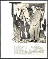
1970réf. 144461970. Baltimore Sun photographic archive. Press wirephoto of the King of Saudi Arabia at an Arab summit conference circa 1970s documenting the participation of the Saudi monarchy in high-level inter-Arab diplomacy during a decade shaped by the Arab-Israeli conflict the 1973 war oil politics and negotiations among Arab governments over regional policy. The supplied description does not identify the monarch exact summit or specific date and these details cannot be established from the available information. Original black-and-white press wirephoto measuring approximately 8.3 x 9.1 inches from the historical photographic archive of The Baltimore Sun. The image shows the Saudi king attending an Arab summit conference and was produced for rapid newspaper distribution. Wirephotos were transmitted electronically over telecommunications networks and printed at the receiving newspaper office allowing international political photographs to reach editorial desks within the short publication schedules of daily newspapers. The print therefore preserves both the summit image and the physical form in which such photographs circulated through twentieth-century press organizations. Photographs of Arab summit meetings supplied American newspapers with visual records of political leaders whose decisions affected war diplomacy petroleum policy and relations with the United States and Europe. This example remained in The Baltimore Sun's working photographic archive and retains a watermark. No additional condition defects are stated in the supplied description. unknown books
1957réf. 147851957. Palace of the Emir of Dhala March 15 1957 documents the seat of the Amiri ruler of Dhala during the final decade of the British Aden Protectorate. Dhala was a protected state under British authority from the early twentieth century until 1967 and in 1957 was ruled by Shafaul ibn Ali Shaif Al Amiri the emir who remained in power until the state was abolished in 1967. The photograph dates from a period of mounting political and military tension along the Aden Protectorate frontier; British parliamentary discussion in January 1957 specifically reported border raids and armed unrest in Dhala. Original black-and-white photograph dated March 15 1957 measuring 7 x 9 inches. The image shows the weathered Palace of the Emir built into Dhala's rocky terrain with its turret and façade constructed from stone similar in texture to the surrounding bouldered hillsides. In the foreground a small calf grazes among dry grasses while a line of royal guards stands on the opposite side of a stone wall. The juxtaposition of palace architecture armed attendants livestock and the arid landscape records both the physical setting of the emirate's ruling household and the immediate surroundings of the palace. The photograph predates Dhala's incorporation into the Federation of Arab Emirates of the South in 1959 and the subsequent political changes that culminated in the emirate's abolition in 1967. Some wrinkling to the bottom edge and right corner with age-related cracking to the upper portion; these flaws do not affect the clarity of the image. Overall good condition. A precisely dated architectural and political view of the Emir of Dhala's palace during the closing years of princely rule in the Aden Protectorate. unknown books
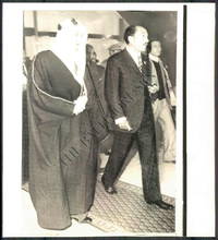
1970réf. 144441970. Baltimore Sun photographic archive. Wirephoto showing Egyptian President Anwar Sadat with the King of Saudi Arabia at an Arab summit conference documenting high-level diplomacy among Arab heads of state during Sadat's 1970-1981 presidency. Arab summit meetings during this period addressed the Arab-Israeli conflict Palestinian political claims relations among Arab states and regional responses to the 1973 Arab-Israeli War. The supplied information does not identify the Saudi monarch exact summit or date and these details cannot be established from the available description. Arab summits at Algiers in 1973 and Rabat in 1974 formed part of the diplomatic setting of Sadat's presidency. Original black-and-white wirephoto measuring approximately 8.3 x 9.1 inches from the historical photographic archive of The Baltimore Sun and identified as "Arab Summit Conference." The image depicts Sadat with the Saudi monarch among the participants in the conference. Produced for newspaper transmission the photograph was scanned and transmitted electronically over communications networks before being printed at the receiving location a process that allowed American newspapers to reproduce international news images rapidly. The print preserves both a contemporary image of Egyptian-Saudi diplomatic contact and an artifact of the twentieth-century newspaper system that carried photographs of Middle Eastern political events to American readers. Its documented retention in The Baltimore Sun archive establishes its use within a working newspaper photographic collection. Watermark present; no additional condition defects are stated in the supplied description. unknown books
1710réf. 144631710. Cluverius Philipp. Arabia Eudaemon ex Plinio Lib VI 1710. Original hand-colored copperplate map of the Arabian Peninsula drawing upon the geographical descriptions of Arabia recorded by the Roman natural historian Pliny the Elder in Book VI of his Naturalis Historia. The title referring to Arabia Felix or "Fortunate Arabia" recalls the classical geographical division of the peninsula into Arabia Felix Arabia Deserta and Arabia Petraea. The map belongs to the European tradition of historical cartography in which ancient Greek and Roman geographical accounts continued to inform printed maps well into the eighteenth century. Its depiction of the peninsula records the transmission of classical geographical knowledge through early modern European atlas production. Cluverius Philipp attributed. Arabia Eudaemon ex Plinio Lib VI. 1710. Original hand-colored copperplate engraving measuring approximately 8½" x 12". The map presents the Arabian Peninsula according to classical geographical sources incorporating historical place names and geographical divisions associated with the ancient understanding of Arabia. Its engraved delineation and hand coloring distinguish the landmass and geographical features. The map follows the cartographic work of Philipp Clüver 1580-1622 whose Introductionis in Universam Geographiam was repeatedly published in European editions throughout the seventeenth and early eighteenth centuries. Clüver's geographical writings combined classical literary sources with the cartographic scholarship of his period and his maps circulated widely through successive editions of his geographical handbook. The reference to Pliny in the title identifies the ancient textual source underlying this depiction of Arabia preserving geographical terminology inherited from Roman antiquity rather than presenting an exclusively contemporary survey of the peninsula. The map has general age-related toning with vibrant hand coloring remaining intact. Overall in very good condition. unknown books
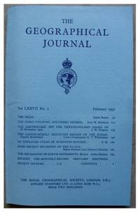
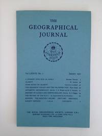
1931réf. 145811931. Arabia RUTTER Eldon. The Hejaz. The Geographical Journal. Vol. LXXVII. No. 2. London: Royal Geographical Society 1931. 13 pages including 2 sketch-maps plus photographic plates. In original blue wrappers as issued. This is a captivating account of the Rutter's expedition in Arabia namely the Hejaz at the time a forbidden country to unbelievers concerning all aspects of the Hejaz including its geographical features the territorial disputes and tribal factions as well as the population that inhabits this spectacular region. Mr. Rutter outlines his pilgrimage disguised as a Muhammadan pilgrim through the Hejaz frontier at Halli. An engaging travel account illustrated with a full-page sketch map of the Hejaz showing Mr. Rutter's route to Mecca and Medina an in-text sketch diagram depicting his route from Mecca to At Taif and several amazing photographic plates showing the Kaaba the House of Allah the Great Mosque of Mecca the Prophet's tomb at Medina and Bab es Salaam in the Mosque of Medina. This is a complete issue containing all the ads seldom found in such good and original condition. In very good condition. unknown books
1960réf. 144431960. Baltimore Sun photographic archive. Wirephoto titled "Arab Summit Conference" circa 1960s-1970s records a Saudi Arabian king with other Arab leaders during a regional summit meeting. Arab summit conferences during these decades brought heads of state together around questions including inter-Arab relations regional security and the Arab-Israeli conflict. The supplied information does not identify the individual monarch other participants exact conference or date and no more specific identification can therefore be made without the original caption or verso markings. Original black-and-white wirephoto measuring approximately 8.3 x 9.1 inches formerly in the historical photographic archive of The Baltimore Sun. The image shows the Saudi monarch among other Arab political leaders gathered for the conference and bears the title "Arab Summit Conference." Produced as a transmitted press photograph the image was electronically scanned and sent through telecommunications networks for reproduction at a receiving newspaper office. Wirephoto technology allowed news organizations to distribute photographs rapidly over long distances and became a standard component of twentieth-century newspaper reporting. The photograph preserves both a visual record of Arab diplomatic activity and physical evidence of the transmission methods used by American newspapers before digital image distribution. Its Baltimore Sun archive provenance places the print within the working files through which international political photographs were retained for editorial use. Watermark present; no other condition defects are stated in the supplied description. unknown books
1928réf. 144851928. Varthema Ludovico di. The Itinerary of Ludovico di Varthema of Bologna from 1502 to 1508 1928. Limited first Argonaut Press edition of one of the earliest European firsthand accounts of Mecca and Medina originally published in Italian in 1510. Varthema an Italian traveler from Bologna entered the Islamic holy cities in 1503 after joining a pilgrim caravan from Damascus under the assumed Muslim name Yunus serving among its Mamluk military escort. His account is among the earliest recorded descriptions of the Hajj and Mecca by a European visitor who was not originally Muslim detailing pilgrimage ceremonies religious customs urban life and encounters with merchants and local authorities. His subsequent travels extended through Yemen the Persian Gulf Persia India and parts of Southeast Asia recording commercial networks religious practices military organization and maritime trade during the opening decades of Portuguese expansion into the Indian Ocean. The 1928 edition reproduces John Winter Jones's 1863 English translation prepared for the Hakluyt Society together with Sir Richard Carnac Temple's historical examination of Varthema's travels in southern Asia. Varthema Ludovico di. The Itinerary of Ludovico di Varthema of Bologna from 1502 to 1508. As Translated from the Original Italian Edition of 1510 by John Winter Jones F.S.A. in 1863 for the Hakluyt Society with A Discourse on Varthema and His Travels in Southern Asia by Sir Richard Carnac Temple. London: The Argonaut Press 1928. First Argonaut Press edition limited to 975 numbered copies printed on Japon vellum. One volume quarto 4to pp. lxxxvi 122 last blank 2 colophon blank. Illustrated with one plate five full-page maps within the pagination a facsimile of the original 1510 title page and a title-page vignette printed in blue and black; includes an index. Edited by N. M. Penzer. Original quarter vellum over blue-grey buckram boards spine lettered and ruled in gilt with rectangular gilt devices on both covers. Retains the original ribbon marker and an ownership bookplate centered on the front pastedown. Varthema's narrative follows his passage through Egypt and Syria to Medina and Mecca then southward through Yemen and Aden onward to Hormuz and Persia and across the Indian Ocean to India and Southeast Asia. His descriptions address the religious observances of the Muslim pilgrims Bedouin encounters regional customs and laws commercial products trading practices and methods of warfare. Varthema's travels took place during a period of increasing Portuguese intervention in Indian Ocean commerce shortly after Vasco da Gama's voyage around the Cape of Good Hope established a new maritime route between Europe and India. His account records the established Muslim trading networks connecting the Arabian Peninsula Persian Gulf Indian ports and Southeast Asian markets before Portuguese naval power substantially altered regional commerce. First printed in Rome in 1510 the narrative circulated in successive European editions and translations becoming an early source for European geographical knowledge of Arabia and the Indian Ocean. Sir Richard Carnac Temple's accompanying discourse examines the historical and geographical evidence for Varthema's itinerary distinguishing his observations from earlier travel accounts and evaluating his descriptions of southern Asia. The original vellum and buckram binding retains its gilt decoration ribbon marker and ownership bookplate. Overall in very good condition. unknown books
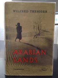
1960réf. 144741960. Thesiger Wilfred. Arabian Sands 1960. First edition second impression of the British explorer's account of his journeys through southern Arabia between 1945 and 1950 including two crossings of the Rub' al Khali or Empty Quarter in 1946-1947 and 1947-1948. Thesiger 1910-2003 known among his Arab companions as Mubarak bin London traveled with Bedouin guides across Oman the deserts of southern Arabia Abu Dhabi and the Trucial Coast recording tribal customs camel journeys desert navigation territorial disputes and the practical demands of survival in an arid environment. His account includes detailed descriptions of the Bedouin communities with whom he traveled particularly their hospitality tribal loyalties conflicts and knowledge of desert routes and water sources. Written before extensive oil development transformed much of southeastern Arabia the narrative records social and geographical conditions during the final years preceding the region's rapid economic and infrastructural changes. Thesiger Wilfred. Arabian Sands. London: Longmans 1960. First edition second impression first published 1959. One volume 326 pp. measuring approximately 9" x 6". Original cloth hardcover in illustrated dust wrapper. Illustrated with 68 photographic illustrations seven maps and a large folding map housed in the rear pocket. The narrative includes chapters devoted to Abu Dhabi the Trucial Coast and the Empty Quarter describing Thesiger's journeys through the territories of present-day Oman Saudi Arabia the United Arab Emirates and Yemen. His photographs record Bedouin companions desert encampments camel caravans regional landscapes and settlements encountered during his travels. The maps trace the principal routes and geographical features of the Arabian interior. Before undertaking his Arabian journeys Thesiger served in the Sudan Political Service and participated in military campaigns in Abyssinia and the Western Desert during the Second World War. His subsequent travels in Arabia were conducted largely on foot and by camel accompanied by Bedouin guides whose knowledge of tribal territories wells and desert conditions made the crossings possible. His descriptions of Abu Dhabi and the Trucial Coast predate the formation of the United Arab Emirates in 1971 and the extensive urban development financed by petroleum revenues. Arabian Sands preserves both Thesiger's observations and the experiences of his Arab traveling companions including Salim bin Kabina and Salim bin Ghabaisha who accompanied him on major portions of his journeys. The dust wrapper shows edge wear and a small 1 cm tear along the upper edge of the verso. Otherwise the book is in very good condition retaining its original dust wrapper photographic illustrations maps and folding map in the rear pocket. unknown books
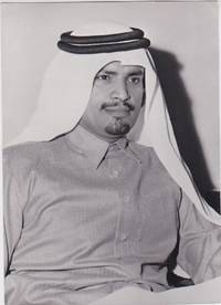
1975réf. 148221975. Press photograph 1975 depicting Sheikh Suhaim bin Hamad Al Thani Qatar's first Minister of Foreign Affairs three years after his appointment to the newly established post in 1972. Qatar had declared independence in September 1971 and joined the United Nations the same month; Suhaim's tenure therefore coincided with the country's early development of an independent diplomatic service and formal relations with foreign states. Qatar's Ministry of Foreign Affairs identifies him as the state's first foreign minister appointed on February 23 1972. Original gelatin silver print black-and-white press photograph dated 1975 on the verso and measuring 5 x 6.5 inches. Sheikh Suhaim appears in formal portrait wearing a thobe and ghutra secured with an agal. The closely framed image concentrates on the minister's head and upper body presenting the official responsible for Qatar's foreign relations during the first years following independence. The 1975 date places the image during Sheikh Khalifa bin Hamad Al Thani's reorganization and expansion of the Qatari government a period in which diplomatic relations were being established with additional countries at ambassadorial level. The photograph preserves a contemporary press image of the official charged with directing Qatar's foreign ministry during the state's early independent diplomacy. The dated verso establishes its 1975 circulation or production context without requiring attribution to a specific press agency. Very good condition. unknown books
1931réf. 145651931. Thomas Bertram. A Journey Into Rub' Al Khali. London: Royal Geographical Society 1931. 37 pages. plus photographic plates and a large fold-out colour map. Original condition with blue wrappers titles to front and containing all the ads. This is Thomas' riveting preliminary report on his explorations in Arabia pre-dating his all-important book titled 'Arabia Felix; Across the Empty Quarter of Arabia' published later in 1931. The author's narrative of a historic camel journey across the Great Southern Desert Rub al Khali is a detailed and pioneering exploration with considerable detail on the tribes their customs life geography and with appendices on anthropology zoology list of flora list of camel brands list of Arab chants. Thomas was the Financial Advisor and Wazir to His Highness the Sultan of Muscat and Oman. He performed two remarkable journeys over territory hitherto completely unknown. The first was along the Southeastern Borderlands of the Rub 'al Khali from near Ras al Had to Dhufar the second from Dhufar for a distance of some two hundred miles inland. A complete issue in very good condition. unknown books
1748réf. 143711748. Mallet Allain Manesson. "Arabes" 1748 presents two male figures identified as Arabs through the conventions of European geographical and costume illustration derived from Mallet's Description de l'Univers. Mallet's original work first published in Paris in 1683 combined maps city views portraits and images of dress with accounts of the customs religions and governments attributed to different nations; its second volume treated Asia. The engraving records the visual vocabulary through which Arab clothing and appearance were presented to European readers within this encyclopedic geographical tradition. Mallet Allain Manesson. "Arabes." 1748. Engraving. Overall page 10" x 7.25"; image 5.5" x 7.5". Beneath a decorative banner lettered "Arabes" two standing men wear contrasting garments against a mountainous landscape. One wears a buttoned tunic overcoat pointed shoes and a large turban; he holds a decorative cane while resting his other hand at his belt. The second wears a decorated collared tunic beneath an overcoat pointed shoes and a tall head covering from which a long length of fabric descends. The paired figures allow differences in headwear garment ornament and accessories to be compared within a single composition. The plate derives from an illustrated geographical work conceived by Mallet a French military engineer and mathematics teacher whose Description de l'Univers organized contemporary geographical knowledge alongside images of the "divers habillemens" of different peoples. The "Arabes" composition therefore records an eighteenth-century European printed conception of Arab dress rather than serving as direct ethnographic documentation of a specific Arab population or locality. Overall very good condition. The combination of costume detail and explicit ethnic captioning documents how Arab peoples were visually categorized for European audiences in early modern geographical publishing. unknown books
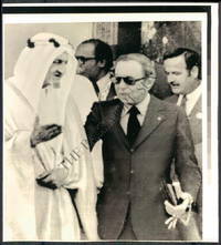
1960réf. 144471960. Baltimore Sun photographic archive. Wirephoto showing Egyptian President Gamal Abdel Nasser with Saudi royal leadership at an Arab summit conference during the 1960s a decade in which summit diplomacy became a principal forum for coordinating Arab policy on Israel Palestinian political organization regional security and disputes among Arab governments. Nasser convened the first formal Arab League summit in Cairo in January 1964; participating states included Saudi Arabia and the conference addressed the Jordan River dispute and plans for coordinated Arab military action. The supplied description identifies the second figure as the King of Saudi Arabia but does not provide a name or exact date so the individual monarch is not assigned here. Original black-and-white wirephoto measuring approximately 8.3 x 9.1 inches from the historical photographic archive of The Baltimore Sun. The image depicts Nasser with the Saudi leader during an Arab summit conference. Produced for newspaper use the photograph was electronically transmitted over telecommunications lines and reproduced at the receiving location allowing images of international political events to reach newspaper editorial offices rapidly. Such transmitted photographs formed part of the working visual record used by newspapers to illustrate foreign affairs coverage before digital distribution. The photograph preserves a contemporary press image from the period when Nasser used summit diplomacy to bring Arab heads of state into direct negotiations despite substantial political disagreements among their governments. The 1964 summit system for example brought together monarchies and republics around common regional questions even as relations among individual states remained strained. Watermark present; no additional condition defects are stated in the supplied description. unknown books