Rechinger, Karl HeinzAntiquariat.de
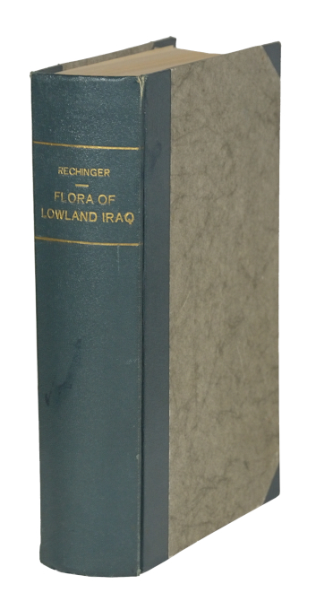
1.129 Ergebnisse
1964Best.-Nr. 57708Weinheim, Verlag von J. Cramer, 1964. Gr.-8°. 4 Bll., 746 S., HLwd. d. Zt. m. goldgepr. Rückentitel.
19578vo., First Edition, with a frontispiece, 31 plates on 16, 2 large folding maps, a full-page map and 2 full-page plans in the text, and endpaper maps in orange; original buff cloth, gilt back, a remarkably bright, fresh, clean copy in unclipped, moderately age-soiled dustwrapper. Sold from an institution with its inscription on front board, small label scar on front paste-down, bookplate on half-title verso and neat blind stamp on title. THESE ATTRIBUTES NOTWITHSTANDING, THIS IS A REMARKABLY BRIGHT, CLEAN COPY OF A PRACTICALLY UNOBTAINABLE WORK. With dustwrapper artwork by Anthony Gross. This important account covers the diplomatic and military history of the Mosul dispute between Great Britain and Turkey from 1918 to 1925, with a detailed appreciation from the author's own experiences as political officer and member of the Anglo-Iraqi delegation of the Committee of the League of Nations. In addition it contains much new information of the geography and antiquities of north-eastern Iraq , the secular frontier dispute between the Ottoman and Persian Empires, the organization and influence of the mystical dervish fraternities, modern cultural activity and other facets of Kurdish society. THIS REGION ALSO SAW THE FIRST ASSIGNMENT ANYWHERE IN THE WORLD OF THE ROYAL AIR FORCE AS THE ARM PRIMARILY RESPONSIBLE FOR EXTERNAL DEFENCE AND INTERNAL ORDER. Rare.
2015New English Original bdg. 4to. (32 x 23 cm). In English and Ottoman facsimile. 2 volumes set: (250, [218] p.), color ills. Swordsman, historian, mathematician, artist, calligrapher Matrakçi Nasuh and his Menzilname. / Account of the Stages of Sultan Süleyman Khan's Iraqi Campaign - Beyan-i menazil-i sefer-i Irakeyn-i Sultan Süleyman Han. The Facsimile Edition. 2 volumes set. Vol. 1 is the presentation of Matrakci and his work, Vol. 2 is the facsimile of Beyân-i Menâzil-i Sefer-i Irakeyn-i Sultan Süleymân Hân (Account of the Stages of Sultan Süleyman Khan's Iraqi Campaign) as preserved at the Istanbul University Rare Works Library, Manuscript ref. T5964.
2019Best.-Nr. x-0367249715Routledge 2019. Hardcover. New. 183 pages. 9.25x6.25x0.75 inches. Routledge hardcover
1967Best.-Nr. 90149Baghdad: Dar Al-Jumhuriya Press 1967. Paperback. Good. photos 16p. Softcover in original wrapper. 22cm. Heavy horizontal crease. Minor cover soil. Photos and claims concerning the use of Napalm Bombs by Israel during The Six-Day War. Dar Al-Jumhuriya Press paperback
1967Best.-Nr. 90149Baghdad: Dar Al-Jumhuriya Press 1967. Paperback. Good. photos 16p. Softcover in original wrapper. 22cm. Heavy horizontal crease. Minor cover soil. Photos and claims concerning the use of Napalm Bombs by Israel during The Six-Day War. Dar Al-Jumhuriya Press paperback books
Best.-Nr. 2h8810Railway Press Baghdad 1930. 317 pages with some glued corrections from the 30s and 40s hardcover spotted/some pencil markings. hardcover
1841In 4° (24x15,5 cm); 4 opere in un volume: 282, (2) pp. e 13 c. di tav fuori testo; 295, (1) pp. e 5 c. di tav. fuori testo; 190 pp. e 6 c. di tav. fuori testo ; 70, (2) pp. e 3 ci di tav. fuori testo. Due delle tavole sono finemente acquarellate da mano coeva. Numerose piccole testatine xilogr. L'opera contiene il Tomo XVI-XVII-XVIII della celebre raccolta di viaggi del Marmocchi, molti dei quali furono qui per la prima volta stampati in italiano. Bella legatura coeva in mezza pelle scura con dorso a 4 nervi e titolo, numero dei volumi e filettatura in oro ai tasselli. Piatti foderati con carta marmorizzata coeva. Qualche leggera strofinatura alla legatura. All'interno in buone-ottime condizioni di conservazione. Molto belle le tavole fuori testo con la riproduzione di scorci, paesaggi, personaggi e cotumi dei luoghi descritti. Good copy. First editon.
2014New English Original bdg. HC. Roy. 8vo. (24 x 17 cm). In Turkish. 6 volumes set: (1082 p., 1034 p., 954 p., 986 p., 972 p., 1058 p.). Turkish transcription of manuscripts Süleymaniye Yazma Eser Kütüphanesi, Hamidiye Kolleksiyonu No. 1377-1378-1379. Oversize and very heavy set. Kâmûsu'l-muhît. El-Okyânûsu'l-basît fî tercemeti'l-Kâmûsu'l-muhît. Prep. by Eyyüp Tanriverdi, Mustafa Koç. 6 volumes set.
1740Best.-Nr. A131-2661Amsterdam / Venezia, Tirion / Giovanni Battista Albrizzi, c. 1740. Landkarte, Kupferstich, koloriert, 27 x 33 cm / Map, copperplate engraving, coloured, 27 x 33 cm
2002186 pages. Features: Rumble between Eliot Spitzer and Harvey Pitt; AOL's new music man; New Qwest CEO; With Bill Gates at Work; How a War With Iraq with Change the World; USA Today dubs itself America's paper; Will R&D Make Merck hot again?; The Olsen Twins; Craig McCaw still dreams of an internet in the sky; America's 50 best companies for minorities. Address label clipped from front cover. Average wear. A sound copy. Magazine
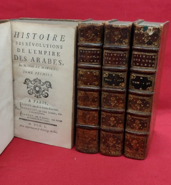
1750Best.-Nr. 118710gisset, bordelet, ganeau 1750 4 in-12 A Paris, chez Gissey, Bordelet, Ganeau, 1752, 4 volumes in-12, (2) ff., LX, 58, 498 pages, (3) ff.-(2) ff., 519 pages - (3) ff., XIV, 540 pages - (2) ff., 525 pages. Plein veau marbré, dos à cinq nerfs portant titres et tomaisons dorés sur pièces de cuir, caissons ornés, filets d'encadrements des plats à froid, filet doré sur les coupes, roulette dorée sur les chasses, tranches mouchetées de rouges, gardes de papier marbré peigné. Cinq coiffes manquantes ou endommagées, coins frottés, rares rousseurs, sinon bon état général.
1888Best.-Nr. 74526London, Kegan Paul, Trench & Co 1888 2 volumes in-8, percaline bleu-vert éditeur, XIV- 447- 32 catalogue de l'éditeur et VII- 492 pages. Index. Carte repliée imprimée en 2 tons. Légères usures.
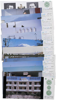
1977Best.-Nr. ABC_47947Baghdad: Ministry of Oil 1977. Original sturdy plastic case. Oblong 10 x 23 cm. With photographic illustrations all postcards are printed in colour. Remarkable complete set of 14 postcards published by the Iraqi Ministry of Oil to celebrate the flourishing petroleum industry and probably its nationalisation in 1972. The first 2 postcards show the building of the ministry and the official state portraits of then President of Iraq Ahmed Hassan al-Bakr 1914-1982 and Vice Chairman Saddam Hussein 1937-2003. The remaining 12 postcards are each printed for a different month of the year and show various aspects of the Iraqi petroleum industry including the Al-Bakr deep water terminal renamed in 2003 to Al-Basah oil terminal the Al-Khalida oil products tanker the degassing station at North Rumaila oil field the eternal fire near Kirkuk which was the first oil field found in Iraq and the Haditha-Rumaila pipeline which was newly built at the time.With a small crack in one of the sides of the sturdy plastic case. The first and last card in the set are slightly creased. Otherwise in very good condition. Ministry of Oil, unknown
1940Best.-Nr. 100183Arrault & Cie, Maitres impremeurs, Tours 1940. 418 Seiten mit 154 Figuren - 105 Tafeln mit 233 photographischen Abbildungen, (418 pages avec 154 figures - 105 planches avec 233 illustrations photographiques), 4°, privates Halbleinen mit Rückentitel, Bibliotheks-Exemplar (ordnungsgemäß entwidmet), Stempel Vorsatz und Titel, Exemplar mit leichtem Wasserschaden (Buchblock gebogen, Papier teils leicht wellig, Schnitt mit leichtem Wasserrand, nur geringfügig nach innen greifend), insgesamt ordentliches und innen sauberes Exemplar, (4 °, demi-lin privé avec titre de dos, exemplaire de bibliothèque (dûment dédié), attachement de tampon et titre, copie avec de légers dégâts d'eau (bloc de livre plié, papier partiellement légèrement ondulé, coupé avec une légère marge d'eau, atteignant légèrement à l'intérieur), dans l'ensemble soigné et à l'intérieur copie propre),
19648vo., First Edition, with frontispiece, 103 plates on 60 and 3 maps (one double-page) in the text; handsomely bound in dark red full morocco, sides with gilt frame border, back with raised bands, second and fourth compartments ruled and lettered in gilt, all other compartments tooled in gilt, gilt top, a most attractive copy ideal as a gift or for presentation. The Marsh Arabs occupy the region around the junction of the Tigris and Euphrates in southern Iraq. This classic account, recording eight years spent living among them, is a worthy sequel to his masterpiece 'Arabian Sands'.
2004Boldy signed and generically inscribed by Piper upon title page. 128 pages. Index. Footnotes. Black and white reproductions of photos. "The secret history of how America's 'Neo-Conservative' (neo-con) Trotskyites came to power and orchestrated the war against Iraq as the first step in their drive for global empire." - subtitle. "Writing about these subjects is 'radical' and 'controversial,' but it's a dirty job and someone has to do it. I make no apologies for telling the truth." - page 128. A well-studied copy with considerable pencil underlining and marginalia throughout and spine rolled. Piper (1960-2015) was a prominent talk show host and prodigious author whose works include such titles as "Confessions of an Anti-Semite". Book
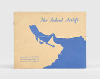
1955Best.-Nr. 195609Hull: Newcom Press for Blackburn and General Aircraft Ltd after 1955. First edition recording the transport of over 129 tons of equipment from Umm Said in Qatar to Fahud in Oman the operational centre of Petroleum Development Oman. We have traced only two other copies: one at the Solway Aviation Museum and another we sold last year. The 365-mile journey "unique in the history of aviation" p. 3 was undertaken by a Blackburn "Universal" XB260 freighter the civilian equivalent of the RAF's "Beverley" model and was a collaboration between Blackburn and General Aircraft and Hunting-Clan Air Transport. The photographs illustrate the various phases of the operation as well as the drilling machinery and aircraft. Oblong octavo pp. 20. Illustrations throughout. Original pictorial wrappers wire-stitched as issued wrappers lettered in blue. Light creasing and marking: very good. unknown
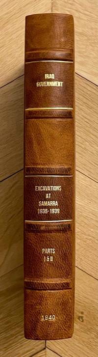
Best.-Nr. M8814Very rare complete set of two volumes bound in one. Government Press Baghdad 1940. First edition. In-8. Vol. I: 25 pages 120 plates. Vol. II: xiii & 24 pages 144 plates. Bound in an elegant modern half-leather with cloth boards a fine copy. Language: English. This book ships from Europe shipping costs will be updated accordingly BCI. Relevant subjects: Mesopotamia. unknown
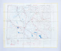
1951Best.-Nr. 182329London: Ordnance Survey 1951. Later editions marked "restricted" revised from those produced by the War Office in 1941-42 and with isogonals correct to 1953. They show the international borders between Iran and Iraq but warn that they are still under negotiation. These maps are in a variety of later editions all printed in 1951 Baghdad fifth; Basra eighth; Tehran third; Bushehr fourth. This was a critical year in Iranian politics as the country underwent the Abadan Crisis saw the assassination of Razmara and the election of Mosaddeq. In the same period Iraq saw a number of anti-government protests including the 1952 Iraqi Intifada against the Anglo-Iraqi Treaty. Over these years British and American forces kept close watch on the region's development and likely printed these maps printed on rayon as escape items to issue to forces in case fighting broke out. Escape maps were first introduced by MI9 during the Second World War designed to be easily smuggled into POW camps. They were printed on silk and for "good reasons: silk is flexible and durable in a way that paper is not and it is noiseless when hidden about one's person" Bond. They continued to be issued throughout the 20th century and into the modern day especially during the 1960s and the Vietnam War. 2 sheets of rayon 596 x 715 mm; 610 x 676 mm colour map on each side key on map of Tehran; text in English and French. Sometime folded edges fraying more so to sheet of Baghdad and Basra: a very good copy. Barbara A. Bond "Escape and evasion maps of World War II" The British Library 2016. unknown
Best.-Nr. 20819Paris, Eugène Fasquelle, sans date (1908-1911). Demi chagrin à coins, dos ornés de décors floraux peints et estampés à froid, pièces de titres maroquinées, têtes dorées, signets. 8 volumes in-4 de (8)-395, 348, 339, 315, 355, 371, 371, 347-(8) pages, texte illustré et encadré par le fac-similé des miniatures qui ornent les manuscrits originaux persans et hindous, tiré en pastel, 156 planches en couleurs (miniatures persanes du musée Guimet, BNF, musée des Arts Décoratifs et de la collection du docteur Mardrus), bandeaux, culs de lampe.
1901Royal octavo. Pp. xiv, 230. Plus 2 plates with maps of Baghdad in 17th and 18th centuries respectively. Hardcover, bound in contemporary quarter cloth and marbled boards, gilt lettering to spine, bit marked, with the original printed wrappers bound in, signature on title-page. In fine condition. Excellent copy. ~ First edition. Scarce.
1958Best.-Nr. PHO-1454Paris, , Maisonneuve ; Besson & Chantemerle, 1958 , 4 volumes in-8 , relié pleine toile rouge , supra libro aux plats, cachets ,2ff.-viii-599pp., 2ff.-ii-552pp. ,2ff.752pp.,2ff.iii-665pp.
1948Very Good Arabic Original chromo-lithograph map in brown tones. On a special paper with an ongoing blindstamped "Regestre Robur" during the borders. Folded. 70x100 cm. In Arabic. Scale: 1 /1.000.000. Chipped on margins, split on folded traces. Slight discoloration and one stain on lower margin. Otherwise a good copy. An attractive and detailed map of Syria shows the capital (as Aleppo n that map), other cities like Damascus, Raqqa, Homs, Latakia, Ayn al-Arab, Idlib, Hama, Deir Ez-Zor, Jarabulus, et alli. And it shows Turkey on the north (as Turkey containing Hatay and Alexandrette), The Mediterranean shores of the land as well as Lebanon and Palestine (and Jerusalem) on the west, Sharq al-Urdun (Jordan) and Iraq on the south and east. It's very detailed on showing the roads spread throughout the land like railways and ancient roads from the Roman period. Additionally this roads can be followed to the other Arabic countries and regions on the map. This map was calligraphed by Kamel Al-Baba, (1905-1991), who was a Lebanese contemporary / modern calligrapher. He is the son of famous calligrapher Mokhtar Al-Baba. Cannot be found in WorldCat.; Not in Library of Congress Map Collection. Very scarce.
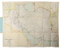
1930Best.-Nr. L6CC0NQYKB25London: George Philip & sons 1930. Colour printed map 54 x 68 cm with yellow covers 19.5 x 11 cm. Map of Iran Iraq and parts of the surrounding countries including modern Kuwait Bahrain Qatar and the UAE in the 1930s published in the series "Philips' authentic imperial maps for tourists & travellers". Published in the early years of the discovery of oil in the Middle East the map shows roads and railways but also caravan routes submarine cables and oil pipelines.Slightly soiled in very good condition. George Philip & sons, unknown