1 427 résultats
réf. DADAX1138893404New unknown
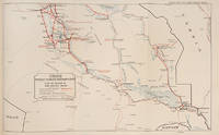
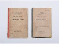
1922réf. 173026London: HMSO Press Harrow & Harrison & Sons Ltd 1922 1923 & 1923 1924. Background intelligence on Faisal's Iraq First editions of two regional sitreps issued after the 1920 Iraqi Revolt and Faisal's installation in 1921 prepared for British officials administering the new monarchy. Both are rare - print runs of 1375 likely with fewer distributed - with only five and four institutional copies traced. Each is marked Provisional and Confidential; Area 1 is additionally stamped "secret" in a contemporary hand. The projected 10-volume series was never completed and surviving instalments sometimes titled Military Report on Iraq are scarce. Compiled at short notice on the model of Naval Intelligence Division geographical handbooks the reports provide concise local intelligence: historical and geographical survey then climate resources ethnography tribal structure leading figures communications transport and routes with technical appendices. Area 1 Northern Jazirah covers northern Iraq and adjacent Turkey and Syria stressing weak British influence and the prestige lost through unchecked tribal raiding after 1919. Its core is a detailed tribal analysis supplemented by contemporary intelligence annotations on succession disputes and political loyalties. Area 7 Tigris surveys the settled agricultural belt from Kut to Qurnah and the Shatt al-Arab reflecting greater stability and asserting that firm but protective rule could secure order. Detailed appendices describe estates shaikhs armed retainers and agricultural practice. Together the volumes offer granular evidence of British intelligence gathering during the improvised creation of the Iraqi state in the early 1920s. 2 vols octavo. Area 1 pp. viii 240 with a folding table and numerous tables to the text; Area 7 pp. ii 184 3 folding many to the text. Both in original greyish yellow printed boards cloth backstrips first with reddish orange spine the second greyish green. Both volumes in field service condition and lacking the maps called for spines sunned and chipped some repairs "Mespots" added in white ink boards rubbed and lightly stained hinges occasionally cracked with some repairs and a little play but the internal binding sound; contents toned but generally clean; for such fragile productions both remain surprisingly well preserved very good. hardcover
réf. DADAX0739179942New unknown
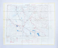
1951réf. 182329London: Ordnance Survey 1951. Later editions marked "restricted" revised from those produced by the War Office in 1941-42 and with isogonals correct to 1953. They show the international borders between Iran and Iraq but warn that they are still under negotiation. These maps are in a variety of later editions all printed in 1951 Baghdad fifth; Basra eighth; Tehran third; Bushehr fourth. This was a critical year in Iranian politics as the country underwent the Abadan Crisis saw the assassination of Razmara and the election of Mosaddeq. In the same period Iraq saw a number of anti-government protests including the 1952 Iraqi Intifada against the Anglo-Iraqi Treaty. Over these years British and American forces kept close watch on the region's development and likely printed these maps printed on rayon as escape items to issue to forces in case fighting broke out. Escape maps were first introduced by MI9 during the Second World War designed to be easily smuggled into POW camps. They were printed on silk and for "good reasons: silk is flexible and durable in a way that paper is not and it is noiseless when hidden about one's person" Bond. They continued to be issued throughout the 20th century and into the modern day especially during the 1960s and the Vietnam War. 2 sheets of rayon 596 x 715 mm; 610 x 676 mm colour map on each side key on map of Tehran; text in English and French. Sometime folded edges fraying more so to sheet of Baghdad and Basra: a very good copy. Barbara A. Bond "Escape and evasion maps of World War II" The British Library 2016. unknown
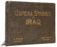
réf. 111890Baghdad A. Kerim for the Hasso Brothers circa 1925. . First edition; landscape 4to 32 x 25 cm; 73 sepia photogravure images on 50 plates; internally clean and crisp original imitation crocodile boards with bright gilded lettering some edge wear otherwise an attractive example. A fine series of sepia photographs providing a snapshot of Iraq between the establishment of its modern borders in 1920 and its full independence from Britain in 1932. Baghdad, A. Kerim for the Hasso Brothers, circa 1925. hardcover
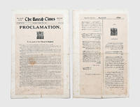
1917réf. 178262Basrah: The Basrah Times 1917. Empire and Pan-Arabism Two leaves from the first and only issue of the Basrah Times 20 March 1917 printing Sir Frederick Stanley Maude's appeal to the people of Baghdad province issued nine days after the British capture of the city. The proclamation marks a turning point in the First World War exemplifies imperial rhetoric and foreshadows the tensions between colonial authority and national aspiration that shaped the following decade in Iraq. Although Basrah fell in November 1914 Baghdad was secured only after a further two and a half years of campaigning. Maude drove the advance restoring supply lines and winning successive engagements at Hayy Dahra and Kut before the final assault. The proclamation presents the British not as conquerors but as liberators promising renewal after centuries of foreign rule and invoking the recent success of the Arab Revolt under Sharif Hussein as a model of independence and unity. Yet this balance between nationalist promise and imperial control proved unstable: the post-war Mandate endured only until the revolt of 1920 forced political transition culminating in Faisal's election as king in 1921. Two sheets each approximately 440 x 285 mm laid down on thick card framed and glazed. Text in English and Arabic. Sheets toned and with creases from old folds minor foxing a few short tears one small hole to centre of one sheet affecting one letter: a very good set. unknown
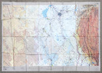
2002réf. 162482London: DGIA Ministry of Defence 2002. First edition stretching from Baghdad to Basrah and showing all of Kuwait. The sheet was likely issued to RAF pilots in the run up to the Iraq War and is printed on rayon for ease of use and durability. These charts produced by the Defence Geographic and Imagery Intelligence Agency feature many warnings about flying within controlled airspace in Iraq and Saudi Arabia. The RAF flew many missions over this region in the lead-up to the Second Gulf War and in Operation Telic. "The first documented intimations of UK involvement in the operation that became Telic can be traced to March 2002. In May the Chief of the Defence Staff CDS was advised of a potential RAF contribution to a future operation in Iraq comprising 88 fast jets and 38 support platforms - more aircraft than the RAF had deployed on a single operation since the First Gulf War and more in all probability than it will ever deploy again" Ritchie p. 5. A formal plan was drafted in August to overwhelm Hussein's government through multiple co-ordinated fronts of which the RAF's role was to eradicate the enemy air force destroy equipment support ground forces and strike important targets to shock the Iraqi people. According to the key there was another sheet issued charting northern Iraq. Single sheet of rayon 912 x 1300 mm colour map with key on recto and verso. Sometime folded and thinning along lines: a near-fine copy. Sebastian Ritchie "The Royal Air Force in Operation Telic: Offensive Air Power March-April 2003" 2021. unknown
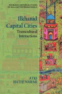
réf. ria9781399510387_inpHardback. New. New Book; Fast Shipping from UK; Not signed; Not First Edition; Studies the interaction between Perso-Islamic sedentary concepts and Mongolian nomadic traditions in the context of Ilkhanid capital cities. hardcover
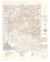
1940réf. L7VDM2ALRS81UK Government: Geographical Section General Staff War Office 1940. 2 topographic maps colour-printed. Scale 1:500000. 820 x 640 mm and 770 x 648 mm. Previously folded. Marked "Iraq Desert Sheet 1" and "Sheet 2". Generally well preserved. Compiled from 1930s surveys and produced by the British 512 Army Field Survey Company Royal Engineers for use in the Persian war theatre. These consecutive maps cover the south-western area of Iraq including Rutba and Fallujah with parts of Saudi Arabia Jordan and Syria approximately the area between 31° and 33°30 N and 39° and 44° E.Previously folded. Marked "Iraq Desert Sheet 1" and "Sheet 2". Generally well preserved. Geographical Section, General Staff, War Office, unknown
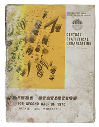
1970réf. ABC_46826Iraq: Central Statistical Organization 1970. Original printed publisher's wrappers. Folio 28.5 x 21 cm. With multiple graphs on 8 leaves most of them in the text. The main price-information is arranged in tables all tables and other introductory information are printed on 1 side of the leaves from right to left on the recto side of the leaves excluding the information in English which has from that perspective been printed on the verso side of the leaves. A statistical overview of the changes in wholesale and retail prices of among other things agricultural animal electronic and textile products in Iraq during the second half of 1970. The elaborate information gathered and presented in the present work by the index numbers & prices department of the central statistical organization of the ministry of planning of the Republic of Iraq has mostly been arranged in tables supplemented with some graphs. The information is organised by general geographical districts in the north middle and south of the country and assessing the prices of products on markets in Baghdad the capital of Iraq separately as its own densely populated district. The present work was published as a supplement to the original bulletin on prices for the first half of 1970 in an effort to bridge the gap in data supply as the Index numbers & Prices department tried to change the publishing frequency from once or twice a year to quarterly and eventually to monthly statements on the changing prices. The information is presented both in Arabic and in English for the purpose of providing a wider range of people and organisations with the information. The Arabic information of course reads from right to left and the tables with the information in both languages are oriented in the same way and the English list of contents and introductory information can be found at the back of the work to be read from left to right. Iraq experienced considerable economic development during the second half of the 20th century. By 1980 its complex central state-planned economy had become the second largest economy in the Arab world after Saudi Arabia. To achieve such development people had to keep a close eye on changing wholesale and retail prices in order to keep changes in inflation and purchasing power in check.Wrapper worn and stained with a blue stamp on the wrapper with the title in Arabic front or back wrapper some staining to the first 4-5 leaves at both English and Arabic ends of the work otherwise internally good and clean. Central Statistical Organization, unknown
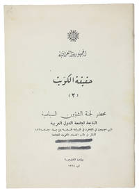
1961réf. ABC_47301Baghdad: Wizarat al-Kharijiyah = Ministry of Foreign Affairs 1961. Original printed wrappers stapled. 8vo. Arabic text. First edition of the second of two rare pamphlets published by the Iraqi government opposing the independence of Kuwait. The first pamphlet published in English and Arabic outlined Kuwait's historical connection to Iraq and analysed its "imperialist relations" with Britain. This second one in Arabic throughout prints the minutes of the Political Affairs Committee of the Arab League which met in Cairo on 20 July 1961 to consider Kuwait's request to join the League.Kuwait emerged as an independent state in June 1961 after sixty-two years as a British protectorate. With a new constitution it held its first parliamentary elections in 1963 thereby becoming the first Arab state in the Gulf to establish a parliament. Such political developments married with growing wealth and modernisations in health culture and finance helped to make Kuwait the most prosperous state in the Arabian Peninsula.The Iraqi government argued that the move toward independence was a continuation of Kuwait's relationship with Britain albeit under a new guise. Furthermore they felt that the historical links between Iraq and Kuwait entitled the former to control over the latter and one suspects a share of its growing wealth. This position partly detailed in the pamphlet led to a point of crisis with Iraq threatening invasion. To the relief of Kuwait the Iraqis were eventually deterred by the Arab League's promise of military opposition.The wrappers are a little dusty two thick black lines on the front wrapper seemingly erasing a stamp another stamp partially visible on the back wrapper most likely a bookseller's name and address "Baghdad" is legible. Internally clean and bright. Overall in very good condition.l Jisc LibraryHub 1 copy BL; WorldCat 219629380 3 copies. Wizarat al-Kharijiyah [= Ministry of Foreign Affairs], unknown
réf. 112648Government of Iraq 1929. . Revised and enlarged edition. Folio 34.5 x 21.5 cm. approx. iv 34pp. photographic frontispiece 8 folding maps coloured in outline scale 1 inch = 15.78 miles 1: 100000 original red cloth lettered in gilt on upper cover a very good copy. Maps include Baghdad and Environs The Environs of Basrah and several road maps to Southern and Northern Iraq. Government of Iraq, 1929. hardcover
réf. SONG8432138819Used: Good unknown
réf. DADAX1782663150New unknown
réf. DADAX0199361495New unknown
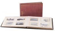
1917réf. ABC_48426Iran and Iraq 1917. Contemporary cloth one album in in red and one in grey with 'Kodak' lettered in gold on the front board and a black classical meander border tooled near the foot. The albums are kept together by a black ribbon. Oblong 8vo ca. 15.5 x 20 cm. With 191 resp. 95 and 96 gelatin silver prints all ca. 4 x 6 cm. 2 volumes. Remarkable set of Kodak photo albums with nearly 200 photographs of military life and the oil industry in Iran and Iraq in the early 20th century. The photographs were most likely taken by the compiler of the albums and show scenes from his daily life. Most of them are captioned. Included are images of Persian oil fields Abu Zenema Sinai coast Port Sudan Bushehr Basra various locations along the Tigris Euphrate and Shatt al-Arab rivers Ashwaz and Shush. The photographs also show locals involved in various activities including races shark hunting and selling wares. The compiler of the album was likely a British soldier who was stationed in Basra and other locations in Iran and Iraq after the First World War.The edges and corners of both albums are slightly scuffed with a few light stains on the back board of the red album. The paper on which the photographs are mounted is slightly browned ten of the photos have either creased corners or a damaged surface some photographs a little loose within their windows missing a photo on the final page of the red album. Otherwise in good condition. hardcover
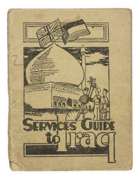
1942réf. ABC_47444Baghdad: PAI force G. H. Q. Welfare Committee 1942. Original publisher's beige printed paper wrappers. 14.5 x 11 cm. With two full-page maps of Iraq and Baghdad on page 24 and 25 and a full-page map of the "Baghdad Amenities area" on the back wrapper. Further with 6 pages of advertisements serving as endleaves. A very rare guide intended for British armed forces stationed in Iraq during the Second World War. It was probably handed to the soldiers soon after arrival. Works like these were often discarded when they were no longer needed. As such there are usually few of them left. This particular military guide is likewise extremely rare. We have only been able to find 3 other copies 2 of which are located at the Imperial War Museum in London.The Services guide to Iraq was probably published by the welfare committee of the British PAI force which is short for "Persia and Iraq Force". The British were stationed here to prevent Nazi Germany from invading the region for oil among other reasons. The guide was meant to teach the soldiers the basics of finding their way in this new country. It explains where to go for sports music religion legal aid education the costs of sending letters home and how to recognize and prevent various tropical diseases. It also aims to instill some cultural awareness in the reader: included is an excerpt of a work about the history of Iraq by Seton Lloyd 1902-1996 archaeologist and then curator at the Baghdad museum.The paper wrappers are torn at the bottom of the spine with some loss of material barely affecting the integrity of the binding a small stain and two small pen marks in red and green on the front wrapper. Somewhat browned throughout. Otherwise in good condition.l Not in WorldCat. PAI force G. H. Q. Welfare Committee, unknown
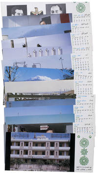
1977réf. ABC_47947Baghdad: Ministry of Oil 1977. Original sturdy plastic case. Oblong 10 x 23 cm. With photographic illustrations all postcards are printed in colour. Remarkable complete set of 14 postcards published by the Iraqi Ministry of Oil to celebrate the flourishing petroleum industry and probably its nationalisation in 1972. The first 2 postcards show the building of the ministry and the official state portraits of then President of Iraq Ahmed Hassan al-Bakr 1914-1982 and Vice Chairman Saddam Hussein 1937-2003. The remaining 12 postcards are each printed for a different month of the year and show various aspects of the Iraqi petroleum industry including the Al-Bakr deep water terminal renamed in 2003 to Al-Basah oil terminal the Al-Khalida oil products tanker the degassing station at North Rumaila oil field the eternal fire near Kirkuk which was the first oil field found in Iraq and the Haditha-Rumaila pipeline which was newly built at the time.With a small crack in one of the sides of the sturdy plastic case. The first and last card in the set are slightly creased. Otherwise in very good condition. Ministry of Oil, unknown
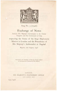
1946réf. 21150551946. London: HMSO. 1946. 8vo. Unbound bifolium as issued one punch hole in inner margin; very good.This is the very rare exchange of notes printed in Arabic and English between Hugh Stonehewer-Bird and Dr. Mohamed Fadhel Al Jamali regulating the status of diplomatic missions in both London and Baghdad after the Second World War. The Iraqi statesman Muhammad Fadhel al-Jamali tied his country closely to Britain and the US during the Cold War. After the overthrow of the monarchy he was imprisioned and wrote the influential and liberal Letters on Islam. unknown
réf. DADAX0367193698New unknown
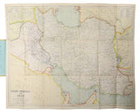
1930réf. L6CC0NQYKB25London: George Philip & sons 1930. Colour printed map 54 x 68 cm with yellow covers 19.5 x 11 cm. Map of Iran Iraq and parts of the surrounding countries including modern Kuwait Bahrain Qatar and the UAE in the 1930s published in the series "Philips' authentic imperial maps for tourists & travellers". Published in the early years of the discovery of oil in the Middle East the map shows roads and railways but also caravan routes submarine cables and oil pipelines.Slightly soiled in very good condition. George Philip & sons, unknown
réf. DADAX1409448460New unknown
réf. DADAX9400974906New unknown
réf. DADAX1788313690New unknown
réf. DADAX0190840552New unknown