140 résultats
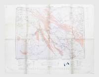
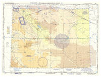
1958réf. L6DAZGHLUF3GWashington DC: USAF aeronautical chart and information service 1958. Colour printed map 56 x 73.5 cm with a legend printed on the back. Scale 1:1000000. Pilot's map of Wadi Sirhan in the border region of Iraq Saudi Arabia and Jordan. The map shows the concave and zigzagging border between Saudi Arabia and Jordan before it revision in 1965. The indefinite nature of the borders is clearly visible on the map in the changed and crossed-out borderlines and the notations "boundary approximate" and "boundary approximate". Several areas are marked as "danger area" or "prohibited area". Stamped "obsolete for use in aviation" otherwise in excellent condition. USAF aeronautical chart and information service, unknown
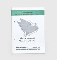
1961réf. 178445Bonn: Delegation der Liga der Arabischen Staaten November 1961. First edition first printing of this introduction to Saudi Arabia. It contains biographies and photographic illustrations of Ibn Sa'ud and other members of the royal family. We have traced no institutional copies outside of Germany Austria and Denmark. This pamphlet was produced by the Arab League's delegation in Switzerland as part of a series introducing its members their economies political systems and histories. The introduction opens by emphasizing Saudi Arabia's importance among the Arab states both for its oil resources and religious significance. The chapters then go on to cover geography infrastructure education oil and industry. Octavo. Halftone photographic illustrations throughout; text in German. Original white printed wrappers wire-stitched and hole-punched as issued front wrapper lettered and decorated in black and green Wrappers lightly toned at edges a few scuff marks minor offsetting internally contents bright: a very good copy. Philipp 796. unknown
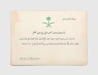
1953réf. 194501Mecca: 6-7 Dhu'l Hijja 1372 / 1953 CE. A remarkable ephemeral survival this invite was issued by the Crown Prince Saud bin Abdulaziz Al Saud 1902-1969 for dinner at the royal palace in Mecca. The construction of the palace had been initiated by Prince Saud himself in 1936. We have traced no other similar invites institutionally or on the market. The dinner was to take place after the Maghrib prayer at the Masjid al-Haram in the evening and night of 6-7 Dhu'l Hijja within the first ten - the most sacred days - of the last month of the Islamic calendar and just before the beginning of hajj on the eighth day. Single card 125 x 170 mm. Arms of Saudi Arabia printed in green at head Arabic text edges gilt. Card a little toned: a very good example. unknown
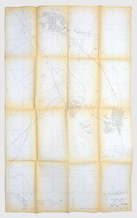
1976réf. 171424Dhahran: Arabian American Oil Co. Exploration Department 1976. A scarce map showing the locations of oil wells pipelines and refineries in the region surrounding Aramco's headquarters. We have traced only one copy US Library of Congress. The discovery of commercial quantities of oil in Dhahran at the Dammam Number 7 well in 1938 kick-started the industry in Saudi Arabia. The city is now one of the major centres of oil production in the region and has been the centre of Aramco's now Saudi Aramco's activities since the early 1950s. This map shows the Abqaiq-Dhahran Dhahran-Ras Tanura and Saudi Arabia-Bahrain pipelines. It also maps the road network airport powerlines and drainage systems. Six different types of wells are marked from observational to structural suspended and abandoned examples. It was drawn by Aramco employee Kei Inouye and first released in December 1975 with revisions published on 20 September 1976. The 1:1000000 scale key shows the connections between Dhahran and other major cities such as Dammam Safwa and al-Khobar. Large map 1366 x 845 mm key on recto. Folds toned edges a little nicked one small hole neatly repaired: a very good copy. unknown
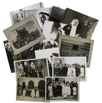
1930réf. ABC_485971930. Kept in a brown kraft paper envelope. With 13 gelatin silver prints various sizes. A collection of thirteen press photographs from the 1930s showing Saudi Arabian leaders during diplomatic visits to Europe. The beautifully sharp and clear photographs give a good impressions of what these events must have been like at the time. Most of the photographs come with the text that would have accompanied them when they were published in a newspaper and are stamped on the back by the press agency that had the rights for publication. We have not been able to find any of these photographs in online archives.Four of the images show Faisal bin Abdulaziz Al Saud 1906-1975 during a diplomatic visit to Great Britain. Faisal was the third son of King Abdulaziz the founder of modern Saudi Arabia. Faisal was very intelligent and was given numerous important duties as a result. He was sent on a five-month long diplomatic visit to Great Britain and France when he was just 13 and achieved his first military successes when he was 16. He succeeded his half brother as king of Saudi Arabia in 1964 and became a well-loved ruler. The present photographs however show his visit to Great Britain in 1939. In particular his visit to the Royal Air Force stations in Middlesex and Northolt where he viewed the Hawker Hurricane planes which he considered to buy for the Royal Saudi Air Force. After his return however he decided against it.The other photographs show Fuad Bey Hamza 1899-1951 the Saudi ambassador in France and Fakry Pacha dates unknown the Egyptian ambassador in France during an Eid al-Fitr celebration in Paris in 1939 a portrait of Sheikh Sir Abdullah al-Salim al-Sabah 1895-1965 the 11th ruler of the Sheikhdom of Kuwait and the Kaaba in Mecca during hajj.Some of the photographs are slightly discoloured or creased around the corners. Mostly in very good condition. unknown
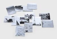
1950réf. 171429Saudi Arabia: c. 1950. A record of Aramco's formative era A collection of ground and aerial shapshots apparently taken by a Saudi Aramco manager stationed at the Mahasin camp just outside al-Hofuf showing the site's early years several scenes of local life and the drilling rig. Collectively the images provide a window onto the early years of Saudi Arabia's development. Seven images depict the camp itself including one picture taken from atop the radio tower overlooking the barracks mess halls powerhouse water trucks and wells. The structures are all surrounded by black lines which the annotations to the verso of the image inform us are "oil to keep the scorpions and snakes out - we hope". Other snapshots show the view up to the top of the radio mast the view down to ground and a panorama across to the nearest town presumably al-Mubarraz. One picture shows the drilling rig with cars in front and a crane to the right. The remaining six images were taken at leisure and show a rocky outcrop several camels locusts on the fender of a jeep local camel drivers and a view from a water tank in an oasis. Accompanying the photographs is a handwritten note from two Aramco employees to a "Mr Canady" perhaps the photographer. The employees complain of a colleague who is proposing to charge the company rent for the use of a dysfunctional bulldozer leased by the Bin Laden company. Muhammad Bin Laden was Saudi Arabia's most successful construction magnate of the mid-20th century and was famously the world's largest importer of Caterpillar bulldozers. 13 gelatin silver photographs c.120 x 92 mm 1 slightly trimmed and numbered on the print in ink manuscript captions relating to numbering on verso. Housed in developer's buff paper sleeve. Numbered image creased and slightly trimmed several others with slight striations: a very good collection. unknown
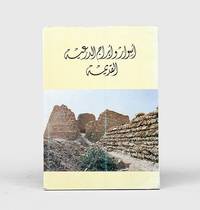
1985réf. 163227Riyadh: General Department of Antiquities and Museums 1985. The capital of the first Saudi state First edition first impression of this richly illustrated bilingual guide for visitors to the historic earthen city of Diriyah recording its history and restoration to date. This work is institutionally uncommon with WorldCat tracing only four locations Library of Congress Smithsonian Bilkent University Library and Bibliotheque Geneve. The Emirate of Diriyah often referred to as the First Saudi state had the town of Diriyah as its capital. Located on the northwestern outskirts of Riyadh its At-Turaif district served as the original home of the Saudi royal family. The town was "founded in the 15th century and bears witness to the Najdi architectural style which is specific to the centre of the Arabian Peninsula. In the 18th and the early 19th century its regional political and religious role increased and the citadel of at-Turaif became the centre of the temporal power of the House of Saud and the spread of the Islamic reform movement in Arabia Salafiyya. The property includes the remains of many palaces and an urban ensemble built on the edge of the ad-Dir'iyah oasis" UNESCO. The At-Turaif District in Diriyah was included on the list of World Heritage Sites in 2010. Quarto. With 2 folding maps numerous illustrations in the text. Original light yellow wrappers illustrations from photographs; text in Arabic and English. Some marks to covers neat repair at foot of spine. A very good copy. "At-Turaif District in ad-Dir'iyah" UNESCO available online. unknown
1945réf. 165179London: Geographical Section General Staff 1945. A detailed early map of central Arabia Second edition of this pilot's map of Riyadh and the surrounding region reissued by Britain's general staff for the use of the Royal Air Force at the end of the Second World War and annotated by a member of 53 Squadron. Revised from its first publication in 1922 the map was photolithographed in 1942 and then updated in 1945 to include new information on roads airfields landing grounds and seaplane stations. The topographical features that are referenced include all the salient information a pilot might expect such as rivers marshes areas liable to flooding mountains ruins lava flow and sandy desert. A glossary explains the English meanings of the Arabic terms included in the map such as darb road jabal mountain and qasr fort. The owner's inscriptions to the lower corners read "Riyadh" and "E. Skemp" most likely Eric Skemp who "flew Liberators on 53" Squadron Mulder p. 298. Although the squadron spent the war years stationed in Britain and the eastern United States it was assigned to carry troops home to India in 1945. Photolithographed map 630 x 790 mm. General light creasing more marked at head and foot of central fold scuff at top left corner: a very good example. Rob J. M. Mulder The Fokker Fours 2019. unknown
1810réf. PHO-1119Paris, Crapart, 1810. In-8, demi-basane bleu, dos lisse avec titre et date en pied, tranches jaunes (reliure postérieure). 4ff-viii-222pp-2ff
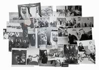
réf. 66815Saudi Arabia c.1945-1990. 31 photographs mostly of Saudi kings and members of the royal family measuring between 10.5 x 15 cm and 20 x 25.5 cm. 30 black & white and 1 colour. Some occasional small tears to edges a few photographs with loss to edges. Generally very good. A collection of photographs mostly featuring Saudi kings Abdulaziz Saud Faisal and Fahd. The collection also features a number of images with King Hussein of Jordan and one with Winston Churchill. [Saudi Arabia, c.1945-1990]. unknown
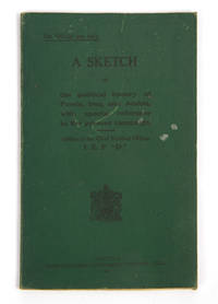
réf. 120370Calcutta Superintendent Government Printing 1917. . First edition; small 8vo 18 x 13 cms; publisher's original green printed cloth wrappers black lettering to upper cover a few marks to upper cover else a very good copy internally clean; 43 pp. This scarce intelligence pamphlet includes significant chapters on the neighbours of Iraq namely 'The Bakhtiari' the 'Pusht-i-Kuh' Pot-e Kuh and 'Central Arabia and the Shamiyah'. Scattered throughout are extensive references to the history of Arabia and Saudi Arabia with the 'Central Arabia' chapter including an account of Ibn Saud and Wahhabism as well as mentions of relations with Bahrain Oman and Kuwait. It was only five years later that the borders of Saudi Arabia with Iraq and Kuwait would be agreed under the Uqair Protocol. Sir Arnold Talbot Wilson 1884-1940 was a critical figure in the British administration of Iraq and its relations with its neighbours. He was deputy chief political officer under Sir Percy Cox and then acting commissioner when Cox transferred to Persia in 1918. The pamphlet describes itself as being 'prepared to meet the request of certain Officers of Indian Expeditionary force "D" for some account of the political status of Mesopotamia and neighbouring countries' and was likely commissioned as part of the broader reaction to the British disaster at Kut in requiring up-to-date intelligence on the region. Scarce with only 6 copies known in institutions. Calcutta, Superintendent Government Printing, 1917. hardcover
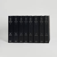
réf. 121948Cambridge Cambridge Archive Editions 2020. . 2 works in 8 vols 25.5 x 16.5 cm; publisher's original black cloth silver gilt lettering a fine set. An extensive collection of documents and letters covering the reign of King Abdulaziz also known as Ibn Saud and the first king of a unified Saudi Arabia from the reconquest of Riyadh in 1902 until his death in 1953. Many of the documents and letters here are published for the first time and many of the letters are reproduced in facsimile in King Abdulaziz's own hand. Cambridge, Cambridge Archive Editions, 2020. hardcover
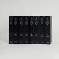
réf. 121947Cambridge Cambridge Archive Editions 2020. . 2 works in 8 vols 25.5 x 16.5 cm; publisher's original black cloth silver gilt lettering a fine set. An extensive collection of documents and letters covering the reign of King Abdulaziz also known as Ibn Saud and the first king of a unified Saudi Arabia from the reconquest of Riyadh in 1902 until his death in 1953. Many of the documents and letters here are published for the first time and many of the letters are reproduced in facsimile in King Abdulaziz's own hand. Cambridge, Cambridge Archive Editions, 2020. hardcover
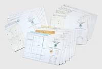
réf. 156758Saudi Arabia: Royal Saudi Armed Forces 1983. Destroy when no longer needed First editions of this extensive and institutionally rare set of large aerial charts produced for the Royal Saudi Air Force covering northeastern Saudi Arabia the Arabian Gulf region Iraq and Iran. Strictly confidential they bear the legend: "For distribution to Royal Saudi Defence Forces only. Destroy when no longer needed". The year of their publication saw the first joint military exercises of the Gulf Cooperation Council headquartered in Riyadh. Saudi Arabia relied on significant foreign assistance to augment its military during the 20th century as it sought to increase its influence in the Middle East. US involvement within the country was formalized through the establishment of a Military Training Mission in 1951. By the mid-1980s when these charts were produced a "45000-strong Saudi army received training and logistical support from some 38000 advisors of US British and French origin" Cronin. Based on extensive maps produced by the British Geographical Services General Staff GSGS the charts contain updated indices of elevations populated places roads railroads boundaries terrain elevations hydrography and vegetation and an Arabic-English glossary. The collection comprises: 1. NG38-2445 Saudi Arabia. 2. NG38-2645 Saudi Arabia. 3. NG39-2448 Saudi Arabia & Qatar. 4. NG39-2648 Saudi Arabia. 5.NG40-2454 Oman United Arab Emirates. 6.NG40-2657 Iran. 7. NH38-2845 Saudi. 8. Arabia Kuwait Iraq. 9. NH38-3045 Iran Iraq Kuwait. 10. NH39-2848 Saudi Arabia Iran Kuwait Iraq. 11. NH39-2851 Iran. 12. NH39-3048 Iran Iraq Kuwait. 13. NH39-3051 Iran. 14. NH40-2854 Iran. 15. NI38-3242 Iraq. 16. NI38-3245 Iraq Iran. 17. NI39-3248 Iran. 18. NI39-3251 Iran. 19 colour charts each 890 x 1230 mm. Some pencillings to the margins. A few small creases occasional finger soiling large section excised from centre of NH39-3048. Overall in excellent condition. Stephanie Cronin "Tribes Coups and Princes: Building a Modern Army in Saudi Arabia" Middle Eastern Studies vol. 49 no. 1 2013. unknown
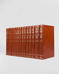
réf. 121946London Archive Editions 1994. . 14 vols 8vo 25.5 x 16.5 cm; includes maps charts & diagrams; publisher's original orange-brown cloth gilt lettering to spines top edges gilt a fine set. The complete development plans of Saudi Arabia from 1970 to 1995 with supplementary documents and reports including the master plans for Jeddah. London, Archive Editions, 1994. hardcover