315 résultats
1912réf. 36542North Yakima: Yakima Commercial Club 1912. 1912. WASHINGTON. 10 1/2" x 7" in color pictorial wrappers. 64 pp. introduction illustrations. Very brief history followed by extensive information on the Yakima Valley to include geography topography climate the Indian Reservation irrigation products produced methods of orchard development live stock dairying transportation communities industries etc. Numerous black and white photographs many full page photos of scenery residential homes buildings agriculture industries public buildings etc. Wrappers disbound from text. Light bleeding to first and last page wrappers lightly soiled and with chipping to top of front wrapper and with tiny fold to tops of page corners. Yakima Commercial Club, 1912. unknown
1905réf. 100722Montreal: Desbarats & Co. 1905. Book. Good. Original Wraps. 8vo - over 7¾" - 9¾" tall. Title continued: With many illustrations of interesting places and scenes also a short description of the Ottawa River and points of interest to the tourist who may make the trip via the Grand River and Rideau Lakes through the most charming scenery in America between Montreal Ottawa and Kingston. 56 p. Folding map - Route of the Ottawa River Navigation Co. 35 illustrations. Covers worn with chips in spine. Top corner stained. A scarce guide book. Desbarats & Co. Paperback
1873réf. 55613Washington Government Printing Office 1873. Royal8vo. Orig. full calf. Gilt boders and gilt lettering on covers. Gilt spine. Lithographed frontispiece in colour. XVI107203268 pp. 3 lithographed colourplates one large folded. unknown
réf. ria9780784415092_inpPaperback / softback. New. New Book; Fast Shipping from UK; Not signed; Not First Edition; Provides the current state of environmental preservation procedures for inland waterways. This technical report presents an overview of ecosystem sustainability procedures currently used. It examines environmental considerations for con paperback
1807réf. 55849Philadelphia: Published by B.B. Hopkins and Co. and sold by W.P. Farrand No. 170 Printed by T. & G. Palmer 1807. 8vo. xxiii 1 270; 271-275 1 40 16 15-16 17-220 4 pp. including binders instructions and publisher’s advertisement. With 7 copper-engraved plates & maps 6 engraved by Benjamin Tanner. Contemporary polished brown calf red & gilt morocco spine label chipping to head of spine minor edgewear occasional interior foxing & toning still a VG- copy from the library of John L. Gow 1797-1866 noted Pennsylvania attorney w/ ownership label and markings on front pastedown. First American edition of this classic navigation handbook which was first published in 1804 and here contained substantial corrections to the tables of the latitudes and longitudes of places on the American coast and in the West Indies as well as an improved system of finding the longitude by P. Delamar of Philadelphia. Mackay 1760-1809 was noted Scottish mathematician and astronomer taught navigation and instructed in methods of how to find longitude. Shoemaker 12965. Published by B.B. Hopkins and Co., and sold by W.P. Farrand, No. 170, Printed by T. & G. Palmer, unknown
1945réf. 39135Chatham: Shepherd Printing n. d. ca 1945. 1945. CANADA. 18" x 24" sheet one side opens to a half-sheet color map and numerous advertisements for lodging including the Joe Gawa Hotel one of Ontario's newest and finest hotels. The other side has 12 panels of promotional text regarding the various cruise packages of the beautiful Muskoka Lakes time tables and schedules and views of the inland waterways steamships R. M. S. Sagamo and the R. M. S. Cherokee. Some minor to light wear to the folds else a very good copy. Shepherd Printing, n. d. (ca 1945). unknown
1940réf. Bing89SM025United states government printing office 1940. pamphlet. good. Prompt shipment with tracking. we ship in CLEAN SECURE NEW boxes 8vo acceptable pamphlet pages 276 book in acceptabl;e condition and prompted for shipping. Cover worn along tips and edges. Pages browning along for edges. United states government printing office unknown
1888réf. 0009730New York 1888. First edition. Map. Fine. 15 x 11 inches / 36 x 26 cm 3 folds matted glazed and framed. Very Scarcce This map was removed from an Annual Report. The black-and-white map shows the boundaries of Illinois in outline presenting the Illinois River improved passage from Chicago to Grafton where it pours into the Mississippi River. It also shows the Rock River traversing to the Quad Cities. Toward the east is the Illinois & Michigan Canal the DesPlaines River the Little Calumet River and the Little Kankakee River and Calumet Harbor. The map is attributed to Thomas H. Handburg. The University of Illinois-Urbana has a photocopy of it from the photocopy in the National Archives. I have not identified to which Annual Report this belonged Nor can I find another map attribued to Thomas H. Handburg. unknown
réf. BN324090Segeln Schnelle Hilfe an Bord: Manöver · Navigation · Technik · Sicherheit Schwarzmeier Thomas Segeln Schnelle Hilfe an Bord: Manöver · Navigation · Technik · Sicherheit Schwarzmeier Thomas Segeln Schnelle Hilfe an Bord: Manöver · Navigation · Technik · Sicherheit Schwarzmeier Thomas unknown
2007réf. BN499264Mariusz Adamski 2007. 2007. siegnac nieba. / reaching for the sky. siegnac nieba. / reaching for the sky. Polska Agencja Zeglugi Powietrznej. Polish Air Navigation Services Agency Herausgeber Editor Photos Mariusz Admaski Mariusz Adamski unknown
réf. BN168889Audio Navigation und Telematik für Kraftfahrzeuge Audio Navigation und Telematik für Kraftfahrzeuge Audio Navigation und Telematik für Kraftfahrzeuge unknown
réf. BN375463General Navigation - Air Transport Pilot´s Licence JAR-FCL Unknown Binding Unknown Binding General Navigation - Air Transport Pilot´s Licence JAR-FCL Unknown Binding Unknown Binding General Navigation - Air Transport Pilot´s Licence JAR-FCL Unknown Binding Unknown Binding unknown
réf. BN604932PUB 249 Sight Reduction Tables for Air Navigation Volume 3: Latitudes 39° to 89° Declinations 0° to 29° Spiral-bound Jan 01 1878 PUB 249 Sight Reduction Tables for Air Navigation Volume 3: Latitudes 39° to 89° Declinations 0° to 29° Spiral-bound Jan 01 1878 PUB 249 Sight Reduction Tables for Air Navigation Volume 3: Latitudes 39° to 89° Declinations 0° to 29° Spiral-bound Jan 01 1878 unknown
1962réf. 161834London: P&O Orient Lines 1962. Ten long single sheets folded into four five or six panels with text on one side and coloured maps on reverse the headings printed in blue & black; small cr. 8vo folded size; all numbered by hand near the top fore-corner of the upper panel with the number whited-out on number 2 Melbourne occasional slight soiling heavier on the Miami folder edges a trifle rubbed; P&O Orient Lines London 1962-1963. The folders were 'produced to assist passengers' and contain a brief history and description of each city including places of interest hotels shopping theatres currency information etc. P&O Orient Lines unknown
1990réf. BN151395U S Naval Inst Pr 1990. 1990. Marine Navigation: Piloting and Celestial and Electronic Nagivation Marine Navigation: Piloting and Celestial and Electronic Nagivation Marine Navigation - Hobbs Richard R. U S Naval Inst Pr unknown
1898réf. 80-54BGPO 1898. 1898. 740p. Folding Maps. Photos. Spine title "Naval Operations of the War with Spain". Covers the Destruction fo the USS Maine Operations in the Atlantic Cuba and Porto Rico and Pacific Manila. Original blue pebbled cloth. Heavy. Rubber stamp inside. Near Fine Copy. Hardcover. Near Fine. Book. GPO, 1898. Hardcover
2020réf. x-9811370885Springer Nature 2020. Paperback. New. 300 pages. 9.25x6.10x0.71 inches. Springer Nature paperback
1878réf. 38742Brazil 1878. A few small holes affecting a few letters some folds reinforced on verso additions in manuscript. Broadside. 20 3/4x29 inches. The Companhia Nacional de Navegação a Vapor replaced the Companhia Brasileira de Navegação a Vapor as the government sponsored line along the southern route in 1872. Montevidio was the furthest stop of this important Brazilian shipping company from which it also provided river service to upper Brazil. The broadside contains a listing of the rates of passage from Rio de Janeiro to Montevideo as well as the limitations and restrictions for passengers which included a prohibition on weapons and flammable materials. unknown
1882réf. 17482New York: Leve & Alden's Publication Department 1882. Very good condition. Folding brochure with map of the St. Lawrence and Saguenay River and timetable with cover illustration of the river and with advertisement for Leve & Alden General Agents for the United States and list of ticket office locations. Yellow stock with black text. Descriptive text on points of interest along the route including Ha! Ha! Bay; with a Time Table commencing June 27 1882 "Until about September 10 1882" and listing departure times for the steamer "Saguenay" and "Union". With full page b&w map on the verso with the map of the Saguenay River at the top and below the map of the St. Lawrence "traversed by the Saguenay boats". The St. Lawrence route originates in Quebec and shows stops in Murray Bay Riviere du Loup and Tadousac. Lists Hon. Thomas McGreevy President Julien Chabot Manager and A. Gaboury Secretary of the Company. Folded 3 1/2 x 7 1/2". Unfolded 17 1/2 x 15". Very small area of loss at fold on lower map of St. Lawrence; short split at horizontal fold left edge o/w very good. Leve & Alden's Publication Department unknown
1898réf. 80-54GPO 1898. 1898. 740p. Folding Maps. Photos. Spine title "Naval Operations of the War with Spain". Original blue pebbled cloth. Heavy. Copy of Col. Robert D. Heinl jr USMC. Heinl wrote several of the official Marine Corps monographs on WW II battles in the Pacific. Fine Copy. Hardcover. Fine. Book. GPO, 1898. Hardcover
réf. 65033KPM / Royal Packet Steam Navigation Company. Batavia. 1912. . Deluxe edition of January 1912. Edited by W. LORCK. LII adverts 244 PP followed by LIII-CXXI adverts and b/w and colour illustrations plus 1 b/w plate : portrait of Her Majesty the Queen of the Netherlands; 1 plate "Time Table 1912; 1 folded plate "Accommodation plan of KPM Steel Screw Steamer "Tasman" and 2 colour plates: painting by C. H. Hoyt "Middle Harbour Sydney from Mosman Heights and "Samples of Javanese Art Work." . Papered boards with a colour illustration on front board by Tindall cloth spine. Front cover with small pieices missing at corners of front edge. Spine has been reinforced crudely. The first few pages up to VIII are somewhat damaged at the gutters without loss and most of Page III/IV has been torn off. The guide was published on superior glossy paper thus conserving its clarity and brightness. A very good copy of quite a rare item. 25.3 x 15.5. KPM / Royal Packet Steam Navigation Company. Batavia. 1912. hardcover
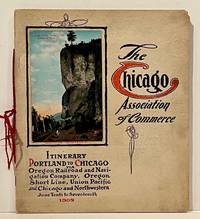
1909réf. 22859Chicago: Chicago Association of Commerce 1909. First Edition. Quarto; 8pp. Four string-tied and stapled leaves with ten 3 1/2" x 5 1/2" mounted colored illustrations each titled in red along with a map of the route. Near Fine copy in grey cardstock titled and color photograph tipped to front cover. Rare promotional piece; we fine only 1 copy at University of Michigan. This booklet was prepared by the Oregon Railroad & Navigation Company the Oregon Short Line Railroad the Union Pacific Railroad and the Chicago & Northwestern Railway as an itinerary for the approximately 40 Chicago merchants' return trip ". calling your attention to a few of the points of interest in a country of marvellous scenes wonderful accomplishments and a still more wonderful future." Lists 38 members of the Chicago Association of Commerce making the return trip. Uncommon attractive & elaborate promotional piece. Chicago Association of Commerce unknown
1939réf. 7103Np: Matson Navigation Company 1939. 1st. Paperback. First Edition. Folio. Vol. 1 No. 1 - 4 Jan. 1941-June 1941 Complete. Each issue 14pp. Numerous photo-illustrations; ads. Original photo-illustrated wrappers. Minor soiling and wear to extremities; front cover of No. 2 partially separated; otherwise near fine. Four numbers issued during the 4 day voyage on the Matson Line cruise ship from California to Hawaii California-Hawaii-Samoa-Fiji-New Zealand-Australia. Each number features a special theme-the first Hawaii's History; the second Scenic Attractions; the third Island Sports and Recreation; and fourth Native Life and Folklore. Matson Navigation Company paperback
réf. 248791882. Printed. One page 33 x 25cm small chip off one corner fold marks discreet repair to edges and fold just noticeable shadow caused by exposure to sun good condition. See Image. On otherwise blank version there is the small stamp of the Webster Collection no. '1569'. Note: In "Orient Line Guide: Chapters for Travellers by Sea and by Land" W.J. Loftie pubd 1890 i.e. a later edition the relevant plate only shows the outward journey not the homeward. I have found no other copy of the White/Hull edition 1882 on viaLibri. 1882. unknown
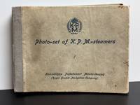
1931réf. 12296AmsterdamBatavia 1931. Accordion Binding 20 pages. Acceptable. 6" x 5" accordion bound with raised cloth binding. Tearing and fraying to bottom of outer spine. Significant bowing creasing soiling rubbing and bumping to outer and inner boards. Age wear to photographs. Stamped page numbers in silver ink. Minor creasing present to various pages. unknown