315 résultats
1896réf. 77014Washington DC: U.S. Department of the Navy Bureau of Navigation Hydrographic Office 1896. Presumed First Edition First printing thus. Map. Good. This was published at the Hydrographic Office in Washington D.C. in February 1896. No. 1530. Charles D. Sigabee Commander U.S. N. Hydrographer. Format is approximately 26 inches by 17 inches folded. This map is disbound from Volume I of the Commercial Directory of the American Republics compiled by the Bureau of American Republics International Union of American Republics Joseph P. Smith Director 1897 Title page from Directory is present. Taped to top right of map in margin is the statement "This chart is intended solely to show tracks of steam vessels on the ocean and no authority is assumed for the boundary lines as drawn between the countries." Map has some color differentiation and several inserts presenting distance information between major ports of call. Map has been folded with approximately the top third folded down. It is also folded into four sections of different lengths to fit as the frontis to the Directory. Map has some wear and soiling/staining. This is similar to the large-scale and detailed World chart on Mercator's projection produced by the British Admiralty under the "Superintendence of Captain Wharton R.N. F.R.S Hydrographer" engraved by Edward Weller and sold by J. D. Potter chart agent. The map has no internal landmass detail unless relevant to steam ship routes thus the Suez and Panama canals are marked as is the Canadian Pacific Railway. Panels along the lower edge list major ports and give distances dependent on routes taken and average knots-per-hour speeds with daily distances covered in miles. The world's major ports are linked by ship-routes each track with its relevant distance and so on. An interesting chart at the time steam took over from sail. Charles Dwight Sigsbee 1845 - 1923 was a Rear Admiral in the United States Navy. In his earlier career he was a pioneering oceanographer and hydrographer. He is best remembered as the captain of the USS Maine which exploded in Havana harbor Cuba in 1898. U.S. Department of the Navy, Bureau of Navigation, Hydrographic Office unknown
2016réf. __4431563318Springer 2016. Paperback. New. reprint edition. 260 pages. 9.25x6.10x0.62 inches. Springer paperback
réf. DADAX4431544747Springer 2014-03-27. 2014. hardcover. New. 6.14x0.88x9.21. Buy with confidence. Excellent Customer Service & Return policy. Springer hardcover

1949réf. 2082402113503178Not Available 1949. Soft Cover. Fine. Number of books: 14 Not Available paperback
réf. BN635056ATPL Radio Navigation CBT CD-ROM Sep 20 2011 ATPL Radio Navigation CBT CD-ROM Sep 20 2011 ATPL Radio Navigation CBT CD-ROM Sep 20 2011 unknown
2021réf. DADAX981334668XSpringer 2021-03-24. 1st ed. 2021. hardcover. New. 6.14x0.81x9.21. Buy with confidence. Excellent Customer Service & Return policy. Springer hardcover
2019réf. x-9811370850Springer 2019. Hardcover. New. 300 pages. 9.25x6.10x0.87 inches. Springer hardcover
2014réf. x-4431544747Springer Verlag 2014. Hardcover. New. 2014 edition. 247 pages. 9.00x6.25x0.75 inches. Springer Verlag hardcover
réf. 3975Portland Oregon:: The Company; Press of C. H. Crocker . Fifty-nine halftones on 32 pp. Oblong 8vo dark gray/green pictorial wrappers. The Columbia River and Puget Sound Navigation Company was organized in 1891 by Captain U. B. Scott and John Leary. On p. 1 the company’s real name is revealed by "Compliments of Columbia River and Puget Sound Navigation Co. Portland Oregon" which was nicknamed the White Collar Line. [Portland, Oregon:: The Company; Press of C. H. Crocker, ,. unknown
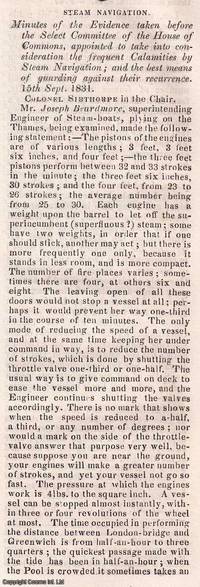
1831réf. 350541Knight and Lacey London 1831-32. Card Covers. Very Good Condition. The Mechanics' Magazine issues from November 1831 to January 1832 contained an extensive report on steam navigation accidents documenting the findings of a Select Committee of the House of Commons. This committee was formed to investigate the frequent calamities occurring in steam-powered vessels and to propose solutions to prevent future disasters. The report primarily written by Colonel Sibthorpe the committee chairman ran to approximately 70 columns and covered : Detailed accounts of steamship accidents including causes and consequences ; Technical assessments of steam engine failures and structural weaknesses in vessels ; Safety recommendations including improved boiler designs and operational protocols ; and economic and legislative considerations discussing the impact of regulations on steam navigation. These discussions were crucial in shaping early maritime safety regulations influencing the development of safer steamship designs and operational standards. The Mechanics' Magazine played a vital role in disseminating these findings to engineers shipbuilders and policymakers. The collection consists of the following seven complete issues: No. 433 Nov 26th 1831 to No. 439 Jan 7th 1832. Genuine Original and Packed with Innovation! This weekly magazine isn't just a fragment of history it's a window into the cutting-edge advancements of the Victorian era! Since 1823 The Mechanics' Magazine has tackled revolutionary topics from printing presses to vapor baths hydrostatics and hydraulics. It dives into breakthrough safety measures preventing explosive contaminated air while exploring the mechanics of oxy-hydrogen blowpipes and self-laying rail carriages. Every page crackles with Victorian-era engineering brilliance capturing the relentless drive for invention that shaped the modern world! This is an exclusive standalone issue carefully separated from its original volume; authentic original and uniquely crafted. It is not a reprint or reproduction but a distinct piece in its own right. Preserved in a modern card cover prepared for practicality - an unassuming but serviceable presentation that favours function over finery. Size: 13 x 21 cms. Category: Mechanics' Magazine; This item may require more postage than the rates shown for delivery outside the UK. If extra postage is required we will contact you before processing your order and you will be given the details and option to decline the extra cost. Knight and Lacey unknown
1969réf. 2082702114611746Shiroyama Do 1969. Soft Cover. Fine. Number of books: 1 Shiroyama Do paperback
1748réf. 45802Paris L'Imprimerie Royale 1748. 4to. Without wrappers. Extracted from "Mémoires de l'Academie des Sciences. Année 1744.". Pp. 462-774 textillustrations. First printing of this importent paper in which Maupertuis proves that the Loxodromic line or Rhumbline is the shortest way between two points on the globe after he had proved by the measuring results that the globe is a spheroid. The paper is of great importence in the history of navigation. unknown
2021réf. SONG981334668XSpringer 2021-03-24. 1st ed. 2021. hardcover. Used: Good. 6.14x0.81x9.21. Buy with confidence. Excellent Customer Service & Return policy. Springer hardcover
1906réf. 8656Portland Oregon: The Oregon Railroad & Navigation Co. Fine with no dust jacket. 1906. First Edition. Original Wraps. Map unfolds to about 1 1/2'x5'. Colored semi-topographical map of the Columbia River with towns etc. Really cool!; Map; 4 1/2x9 1/2" . The Oregon Railroad & Navigation Co. paperback
2021réf. x-981334668XSpringer Nature 2021. Hardcover. New. 362 pages. 9.25x6.10x9.21 inches. Springer Nature hardcover
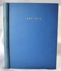
1944réf. 2005200040Houston : Gulf Publishing Co 1944. First Edition. Hardcover. Very Good. The Army Air Corps: A Rare and fine collection of the Army Air Forces in World War II. Log of Navigation. 7 issues bound as one. Bound in full blue cloth. Good binding and cover. Original pictorial wraps bound in. Clean unmarked pages. Numerous photographs maps comics. Heavily illustrated an interesting periodical. "The approved publication of the AAF Training Command." Includes: "A Camera Trip Through Army Air Forces School Hondo Texas" - a smaller photo-pamphlet; AND Log of Navigation issues: April 1944. Vol. 2 no. 4; May 1944. Vol. 2 no. 5; June 1944. Vol. 2 no. 6; July 1944. Vol. 2 no. 7; September 1944 Vol. 2 no. 9; March 1945. Vol. 3. No. 3. From the former head of the U.S. Air Forces History Division. Houston : Gulf Publishing Co hardcover
1815réf. 55781New York: Printed for Edmund M. Blunt Oct. 1815. 8vo. xvi 297 86 pp. plus 2 pp. publisher’s ads. Woodcut-engraved front of the Blunt New York Shop 9 of 15 maps & charts 1 w/ partial loss several w/ additional sailing instructions and printed notices pasted-in manuscript sailing instructions and notes on versos of some. Original calf spine & calf on rear cover perished shaken dampstaining & toning still fair reference copy from the library of Captain Thomas Hall II 1804-1829 son of Captain Thomas Hall 1778-1816 who was lost at sea while sailing from Charleston to Boston in Feb. 1829 which his brother Charles Hall 1810-1829 ownership markings on endpapers of both w/ manuscript note on verso of ffep. that this is “good for a pint of ale” facing clippings about new lighthouses ca. 1821 listing the Ten Pound Island stone tower light house first built on the site in 1821. Preserved in brick-coloured linen cloth clamshell slipcase w/ printed label on spine. Eighth edition of this early vital tool for American sea captains and navigators first published in a much shorter version of only 122 pp. in 1796 and the first edition to bear only Edmund Blunt’s name as author. The original commissioned from Captain Lawrence Furlong proved so crude and unusable that Blunt arranged for it to be edited and rewritten. Blunt’s Coast Pilots were the earliest works of their type published in North America to cover the Atlantic Coast of the U.S. with sailing directions tide tables tables of latitudes and longitudes and as this copy shows were often working evolving documents with additional manuscript annotations and printed additions including in this case the Charleston Harbour map which is not included in the binding instructions and supposedly left out of the 8th edition. Printed for Edmund M. Blunt, hardcover
1939réf. 37919London: HMSO 1939. First Thus Printing. fair. 446 & 275 2-vol. set illus. some color diagrams maps index errata slip boards weak worn soiled and some edge tears. Ink notations and pencil erasures on front endpapers some page discoloration. This is an important snapshot of naval navigation practice at the eve of the Second World War. HMSO hardcover
1839réf. 331758London: Smith Elder and Co 1839. Softcover. Good. First edition. Octavo. Disbound. 49pp. folding map. Lacking wrappers; title page and folding map detached from sewing; good. A scarce report establishes an early point for the English empire's interest in establishing a steam boat line in India and the methods by which they proposed to go about doing so. Commercial manufacturers and various merchants from Manchester Liverpool and India were enlisted to support the proposal and the report outlines navigational routes estimations of cost and the enthusiasm of changing maritime trading methods up and down the Ganges. The idea for an East India Inland Steam Navigation Company apparently began percolating in 1837 and this report fits nicely within the small pantheon of material devoted to this literature. Not in OCLC. One copy found at the British Library. Smith, Elder and Co unknown
1939réf. RiverPilotHUDSON RIVER NAVIGATION Godfrey's river and canal pilot: useful information for masters pilots mates and yachtmen navigating the Hudson River New York State Barge Canals and Long Island Sound. Compiled by Daisy M and Frank H Godfrey. Rome NY: Republican Printing Company 1939. 8vo 33pp; blue textured paper covers lettered in silver a fine copy overall. First and apparently only printing OCLC locating only two copies. Extensive listing of magnetic compass courseCayuga Ls including the Hudson River both North and South bound Oneida Lake Cayuga Lake Seneca Lake Erie Canal Oswego Canal Buffalo Harbor Long Island Sound and New Haven maint entrance to Stratford Point. Republican Printing Company paperback
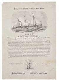
1860réf. 42341New York 1860. Broadside 11-1/4" x 16." Two vignettes of ships engraved by Waters & Son. Light dusting upper left blank corner with a small chip. Very Good. The broadside touts describes and praises this "first-class steamer of 432 tons register." The Daylight's officers are listed its construction history described and its dimensions disclosed. The Daylight "is fitted up in a style unsurpassed by any of the Sound Propellers. The Ladies' Cabin contains seven state-rooms each having three berths and Gentlemen's Cabin has twenty-four berths. She has every modern convenience and every requisite for a sea-going steamer." The Union Navy acquired it in 1862 as an armed gunboat patrolling the Atlantic Coast and Virginia waterways. Not located on OCLC or AAS online site as of August 2026. unknown
1913réf. DEMO016711INew York: Dodd Mead 1913. First American edition. Hardcover. Very Good. photos color plates maps. Octavos dark green cloth. 443 376 pages Dogged by difficulties and beaten to the pole by Amundsen by a month then their luck turned Scott's second and last expedition to the Antarctic was to explore the Ross Sea area and to reach the South Pole. bad. There were no survivors of the polar party. Vol.1 is the Journals of Captain R.F. Scott. Vol.2 is the Reports of the Journeys and the Scientific Work Undertaken by Dr. E.A. Wilson and the Surviving Members of the Expedition. Abundantly illustrated the maps and plates are quite well done and deserve to be appreciated in the freshness and colors of the original. Dodd, Mead hardcover
1840réf. 41654Paris ca. 1840. Folio. 36x25 cm. Contemp. hcalf. Spine gilt but somewhat rubbed. 264 pp. numerous illustrations in margins and in the text. 2 folded maps. The text is handwritten and reproduced with an etching technique probably zinkography. Internally clean and fine. unknown