3 426 résultats
1970réf. 866611970 Moulins, Editions des Cahiers du Bourbonnais, 1970, petit in 8° broché, 202 pages ; illustrations in et hors-texte ; couverture illustrée.
1956réf. 1179471956 Paris, Imprimerie Nationale - 1956 - Grand in-8, broché - 28 pages
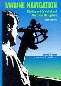
1990réf. BN151395U S Naval Inst Pr 1990. 1990. Marine Navigation: Piloting and Celestial and Electronic Nagivation Marine Navigation: Piloting and Celestial and Electronic Nagivation Marine Navigation - Hobbs Richard R. U S Naval Inst Pr unknown
réf. 111846Genève, Imagine 2016, 287x240mm, 168pages, cartonnage illustré de l’éditeur. Bel exemplaire.
1981réf. MAR4244MRelié, 72 pages, paru en 1981 chez Estran, livre en bon état général, déchirure conséquente au niveau du dos de la jaquette, quelques rousseurs sur les tranches, intérieur frais.
réf. 82911Paris, Fayard, 1964. 15 x 19, 204 pp., nombreuses illustrations et cartes en N/B, broché, bon état (couverture plastifiée).
réf. 49215Paris Rigel Editions 1998 in 4 (29,5x21) 1 volume broché, couverture illustrée en couleurs, 80 pages, avec de nombreuses illustrations en couleurs. Très bel exemplaire ( Photographies sur demande / We can send pictures of this book on simple request )
réf. 49499Paris Editions Hervas 1989 in 8 oblong (18x22) 1 volume broché, couverture à rabats illustrée en couleurs, 157 pages [1], avec de nombreuses reproductions en couleurs de peintures anciennes. Très bel exemplaire ( Photographies sur demande / We can send pictures of this book on simple request )
2006240pp. avec de nombreuses illustrations en n/bl, 30cm., reliure cart. d'éditeur, jaquette illustrée, très bon état, G94938
2006réf. G94938s.l., Chasse-Marée 2006 240pp. avec de nombreuses illustrations en n/bl, 30cm., reliure cart. d'éditeur, jaquette illustrée, très bon état, G94938
réf. 17984relié - 16x21.5 - 224pp - éditions AMIOT DUMONT - 1950
1853125pp.+ 3 large foldings plates (in fine), 27cm., bilingual: english-french, cloth binding ith some use (front hinge repaired), good condition, rare, [125 pp.+ 3 grandes planches dépliantes in fine, reliure toile avec qqs. traces d'usage, charnière intérieure restaurée, bilingue: français-anglais, bon état, rare], W87445
2000Fine English Paperback., Fine., 24 x 17 cm., [viii], 605 p., "Marmara Denizi 2000 sempozyumu bildirileri kitabi (11-12 Kasim 2000, Ataköy Marina, Istanbul).", Bayram Öztürk ve digerleri, Türk Deniz Arastirmalari Vakfi, Ist., 2000.
1982Very Good English Paperback. Pbo. 4to. (32 x 22 cm). In Turkish. [ix], 166 p., b/w ills. Old and contemporary piers of Marmara Region. Marmara iskeleleri dokümani.
1982réf. GITj380Editions Maritimes et d'Outre-Mer Jeanne Laffitte 1982. Grand in-8 275pp. Cartonnage éditeur papier glacé bradel, 1er plat illustré en couleurs. Abondante illustration dans le texte et à pleine page. Exemplaire en bon état et complet. (4870)
1955réf. qb665Bias Ma première bibliothèque Broché 1955 In-8, (19x13 cm), broché, couverture illustrée, 119 pages, illustrations en couleurs et en noir et blanc de André Jourcin ; coiffes très légèrement frottées, plats jaunis, assez bon état. Livraison a domicile (La Poste) ou en Mondial Relay sur simple demande.
1957réf. 33536Artur Geist, Bremen, 1957. Fünfte Auflage der gleichnamigen Aufgabensammlung von Prof. Steppes und Prof. Dr. Wendt. 205 Seiten, Gr.-8°, ca. 24 x 16 cm, Kunststoffeinband
1917réf. 7051Leipzig, Teubner 1917. Mit 331 Textfig. X, 455 S., 16 S. Verlagswerb. OHalbleinenbd. 23x16 cm.
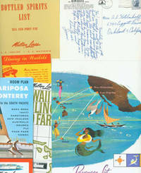
réf. 63-6134Honolulu Hawaii: Matson Lines 1964. 18 Pieces of Travel Ephemera Brochures Post Cards Booklet and Wine Lists from a May 1964 Cruise from Honolulu Hawaii to San Francisco. 11" x 8.5" and smaller. Color photos. Very Good. Honolulu, Hawaii: Matson Lines, 1964. unknown
réf. 15-9500San Francisco: S. S. Matsonia 1957. 4to. 8 pp. Two stapled folded sheets Covers with slight crease lightly browned and dust soiled else Fine. Illustrated. San Francisco: S. S. Matsonia, 1957. unknown
1904A very rare copy of this, the first appearance of A Modern War For Independence, Chapter 6 of Part 2 of Ida Tarbell's ground-breaking History of the Standard Oil Company. This 18-page chapter deals with the united opposition of producers which developed against J.D. Rockefeller's heavy-handed dominance of their industry. Illustrated with photos of A.D. Wood, Lewis Emery Jr., Thomas W. Phillips, Peter Theobald, E.H. Jennings, David Kirk, Michael Murphy, James W. Lee, Hugh King, and Clarence Walker. With this work, Tarbell invented what is known today as investigative journalism. She was motivated to expose the methods of J.D. Rockefeller's Standard Oil as she felt he had unfairly damaged her father's oil business. The New York University Department of Journalism ranked this study as the fifth best work of 20th-century American journalism. Also included is a fascinating illustrated article by P.T. McGrath entitled The Peril of the Icebergs which discusses the horrors of ships colliding with icebergs, strongly foreshadowing the Titanic disaster eight years later. Dozens of glorious illustrated ads. Binding intact. Unmarked. Average wear. Lacking covers, backstrip, and half of page 85 which contained ads. A worthy vintage copy. Book
1719réf. 59235Washington D.C.: Government Printing Office Hydrographic Office U.S. Navy 1917-1930. Nine vols. 8vo. x 4 470; 4 687 1; ix 1 586; ix 1 750 pp. plus publisher’s ads; ii 38; 5; 1 47; 1 60 3; 1 35 7 leaves. With 4 large folding colour maps. Four uniformly bound in tan publisher’s buckram black lettering front covers & spines minor soiling spotting fore-edges of covers darkening to spines very slight uniform interior toning; remaining Supplement vols. w/ self-printed softcovers toning to fore-edges minor chipping minor soiling chipping still VG set. First edition stated of vol. III and Supplements 2nd editions of other three vols. of these surprisingly scarce coast pilot guides to the Mediterranean Sea encompassing the coasts of Spain Morocco Algeria Tunisia Libya Egypt Palestine Turkey the Balearics and more draw upon British Royal Navy Ottoman Empire & Turkish coast pilots North African Russian & U.S. Navy reports. Prior to modern GPS systems and satellite navigation these regularly updated and revised navigation handbooks provided key sailing instructions. The maps outlines the available charts for the designated areas surrounding the Mediterranean Sea as well as detailing those for the Black Sea volume. Very uncommon to find complete set with all supplements to 1930. Government Printing Office, Hydrographic Office, U.S. Navy, paperback