3 434 résultats
1833réf. 49821New York: G & C & H Carvill 1833. First Edition. Octavo. Original pebble-grained boards; paper spine title; 1-78-1582pp. Backstrip partially detached ; spine label faded barely legible; text fresh and unmarked - Good or better. Ex-U.S. Naval Lyceum with ink pressure stamp to endpapers and title page with de-accession dated 1927 on verso of title page. Pencil ownership inscription of a "Thos. J. Manning U.S. Navy" at head of title page. Verso of final text leaf prints a brief list of errata. G & C & H Carvill unknown books
1833réf. 49821New York: G & C & H Carvill 1833. First Edition. Octavo. Original pebble-grained boards; paper spine title; 1-78-1582pp. Backstrip partially detached ; spine label faded barely legible; text fresh and unmarked - Good or better. Ex-U.S. Naval Lyceum with ink pressure stamp to endpapers and title page with de-accession dated 1927 on verso of title page. Pencil ownership inscription of a "Thos. J. Manning U.S. Navy" at head of title page. Verso of final text leaf prints a brief list of errata. G & C & H Carvill unknown
1972Folio 224p., illus. Facsimile edition of the 1538 manuscript Hardcover Very good condition good
First Edition, 15,[1]pp., disbound, margins a little chipped and fragile, water stain to lower outer corner. This modest proposal involves reclaiming land on the Isle of Man and establishing a college for children of the upper class, for a "religious, a moral, and a liberal education, in a salubrious climate, and removed from the more general scenes of dissipation...". But an offshoot of this private school was to be a sort of academy for Manxmen, who were born mariners, and whose contributions and expected benefits Hillary cites in detail. Cubbon, Literature of the Isle of Man, p.101, listed as "Not in Library"; Copac locates the British Library copy only.
Hardcover in-4°, 176 pages abdt ill. in-t. n./coul., cartes, index, reliure plein cuir ill. ed. Tres bel exemplaire. [P-1]
1982réf. M186871982 Lille , Musée de l' Hospice Comtesse , 1982 , in8 carré broché , 248 pp . Abondantes illustrations .Couverture légèrement défraichie sur quelques cms. Edité à l' occasion de l ' Exposition 10 /82 - 1/83
1982réf. dq1116Salmon Yves Des hommes de la mer Broché 1982 In-8, (16x23.5 cm), broché, couverture à rabats illustrée, 245 pages, quelques illustrations en noir et blanc ; pliures au dos, coiffes et bords illustrées, pliure à l'angle supérieur du 4ème plat, des marques d'usage sur la couverture, par ailleurs assez bon état. Livraison a domicile (La Poste) ou en Mondial Relay sur simple demande.
réf. 40160Paris Bernard Grasset 1929 in 8 (19x14) 1 volume reliure demi chagrin vert de l'époque, dos à nerfs, couverture conservée, 202 pages |2], avec des illustrations hors-texte en noir et blanc. Préface de J.-B. Charcot. Première partie du journal de bord du voyage d'Alain Gerbault autour du monde en solitaire à bord du Firecrest, elle relate son départ jusqu'à son arrivée à Tahiti. Bon exemplaire ( Photographies sur demande / We can send pictures of this book on simple request )
1935réf. du1100Musée de l'Orangerie Broché 1935 In-8, (18.5x14 cm), broché, 192 pages + 12 planches iconographiques en noir in fine, avant-propos de M. François Pietri, 12 planches hors-texte in fine, catalogue ; coiffes frottées, mors supérieur légèrement fendu en queue, plats défraîchis, par ailleurs intérieur frais, bel état général. Livraison a domicile (La Poste) ou en Mondial Relay sur simple demande.
réf. 12867N.R.C.;Bibliothèque d'histoire politique, militaire et navale,1936, 1 vol. in-8 br. de 350 pp. Préface de M. A. Rio. Illustré de 235 dessins de l'auteur, qui était sous-directeur de la ligue maritime et coloniale française, peintre officiel de la marine. Histoire de la conquête géographique des routes maritimes. Couverture leg.défraîchie.
1951réf. 023025Paris GRASSET 1951 un volume in-8°, 272 pp., couverture crème titrée en bleu et en noir et ornée d'une vignette. (léger tassement en pied de dos, présence de rousseurs sur la couverture, la gouttière, les tranches et débordant rarement dans l'intérieur du volume). Édition originale, tirée à 420 exemplaires, un des 350 sur alfa réservés aux bibliophiles des sélections Lardanchet numérotés (n° S.L. 341).
19548vo., First English Edition, with a frontispiece, 31 plates on 14 and numerous illustrations, diagrams and maps in the text, top and fore-edges lightly spotted; cloth, gilt back, a very good, bright, clean copy in unclipped dustwrapper, the latter lightly browned and creased at extremities. With the trade ticket of Gale & Polden, Portsmouth, on front free endpaper. Includes a bibliography.
réf. 1162082682.Ghardcover. Good. Access codes and supplements are not guaranteed with used items. May be an ex-library book. hardcover
réf. 1168848024.Ghardcover. Good. Access codes and supplements are not guaranteed with used items. May be an ex-library book. hardcover
réf. 1120119685.Gpaperback. Good. Access codes and supplements are not guaranteed with used items. May be an ex-library book. paperback
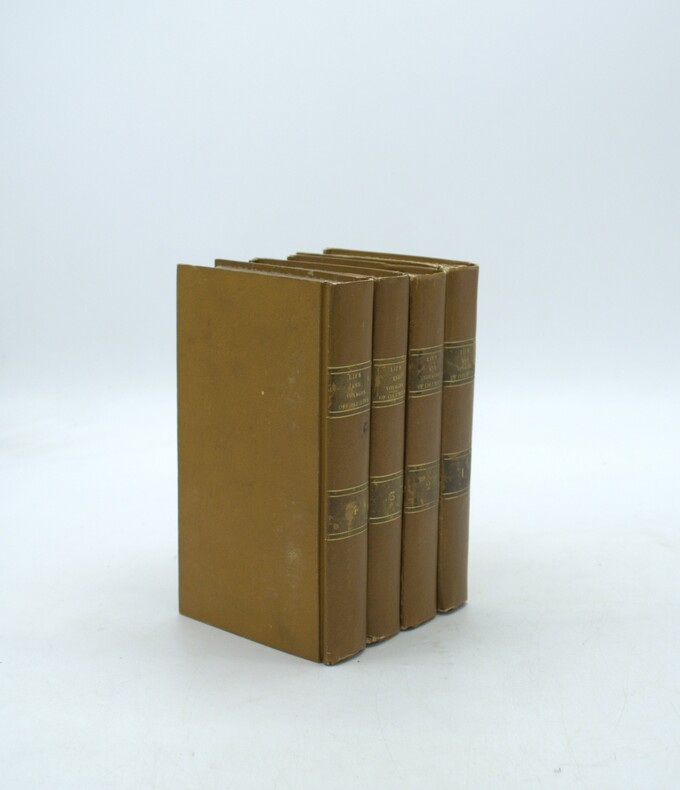
1828réf. PHO-2111Paris, Baudry, 1828. 4 volumes in-8 (18,5 x 10,5 cm), reliés plein cartonnage d’époque, dos lisse avec pièces de titre et tomaison, quelques frottements aux pièces, coins légèrement usés, très peu de rousseurs. Illustré d’une carte dépliante en frontispice du premier volume.
Engraved map with contemporary hand-colouring, (1010 x 660 mm), divided into 25 sections and laid on linen, scale approximately 12 miles to the inch, occasional minor handling and age marks but overall in good condition, in restored orig. slip-case, orig. gold printed label on upper cover. A colour coded key provides information on 26 types of rock, with two horizontal sections beneath the map showing rocks and soils from Lands End to the German Ocean along an east-west line and a line north-south from St. Georges Channel to the English Channel.
Lisboa, Portugalia Editora, 1960. 4to.; 170 pp., 1 h., y siete láminas aparte. Cubiertas originales.
Second edition, 8vo (195 x 125 mm), viii, 525, [3]pp., with a final contents leaf, lacks front fly-leaf, margins of title page browned, folding engraved plate, numerous illustrations in the text, contemporary calf, slightly rubbed. Provenance: Cont. signature of Sir John Kalkett at head of title page, the armorial bookplate of Pitfirrane Castle; University of Keele, Turner Collection label on front paste-down. Wallis, 730PAT30/39.
1889431p., illus. Hardcover Good condition in modern 3/4 leather
1875Very Good French Contemporary 1/4 leather bdg. with marbled boards. Small 4to. (27 x 19 cm). 23 p. (11 p. in Ottoman script (Old Turkish with Arabic letters; 12 p. in French), with rare 4 folded maps. A very good copy. First and only edition of this extremely rare bilingual book in French and Ottoman Turkish, including the first records on the formation and characteristics of storms to explain how storms and hurricanes occurred, which route they followed, and how they were conveyed to the regions that need to be warned by telegraph, for the vessels sailing in the seas, by French expert Coumbary who was founded the Rasathâne-i Âmîre [i.e. Ottoman Imperial Observatory]. Both the original French and Turkish translations of the work were published together in one volume. The work also included four maps which were drawn for this work only. The first map shows the movement of a storm that occurred on March 8, 1865, the second one shows the occurrence between the Tropic Cancer and Capricorn whirlwinds, storms in the Atlas and Indian oceans, the movements in the Bay of Bengal, the storms in different directions in the China Sea, the Gulfstream, Grönland, and Azores. The second observatory in the Ottoman era was established for meteorology. Before this center was established, beginning from the Reformation (1839), many meteorological observatories were built by foreigners in various cities such as Istanbul, Smyrna, Trebizond, Tekirdag, and Merzifon both as private and public establishments. The very first known temperature readings are the meteorological observations made by the Priest Dalmas at the St. Benôit monastery between 1839-1847. Later William Lane, an Englishman who came to Istanbul during the Crimean War, made observations at the British Cemetery at Haydarpasa. W. Noe, director of the Mekteb-i Fünûn-u Sahane made observations at the house in Kalyoncukulluk where he lived until the Beyoglu Fire in 1848; and finally, it is known that French engineer Ritter, who was invited by the government for waterworks in Kuruçesme (1856-1860) also conducted meteorological observations. Observations on precipitation and humidity conducted between 1875-1892 by an amateur observer on the Thomson Farm in Erenköy are invaluable on the subject of Istanbul's climate. These observations have been published in Budapest in 1928. Excellent observations on heat, pressure, and humidity, made in the summer residence of the Russian ambassador on Büyükada have also been published, in Annales St. Petersburg. In 1858, the French government established the first observatory communicating data over the telegraph, and in 1863, by compiling meteorological data in France, the French National Meteorological Network started operations. In 1868, upon the recommendation of the French government, the Rasathane-i Âmire was founded to convey meteorological forecasts to certain centers by telegraph. Instruments were purchased from leading European factories, and operations started on top of a hill 74 meters high on Pera. The first director was Mr. Aristide Coumbray, who came to Istanbul to renovate the telegraph network. (Instruments commissioned from France were set up at Mr. Coumbary's home, which stood at the garden of the Swedish Embassy. The observatory was later moved after its offices were prepared.) Coumbary represented Turkey in the first international meteorology congress, convened in Wien five years later in 1873. Rasathane-i Âmire worked by the same system as the National Meteorology Center in France. In the observation books of 1868 (August-November), names of affiliated stations are given to us Soulina, Köstence (Constantia), Varna, Burgaz, Valona, Elbasan, Durazzo, and Beirut. Later, stations in Izmir, Diyarbakir, Baghdad, and Fao were also added. The observatory founded by Aristide Coumbary in 1868 in Istanbul, operated until the end of the First World War. Özege 5735.; TBTK 7688, 10862.; Not in OCLC.
1895Very Good Turkish, Ottoman (1500-1928) Original handsome brown quarter leather binding with Ottoman lettered gilt to spine. Five raised bands to spine, separated from each other with lined gilt. Slight stains on the title page. Else a fine copy. Roy. 8vo. (23 x 16 cm). In Ottoman script (Old Turkish with Arabic letters). 99 p. Hegira: 1313 = Gregorian: 1895. Extremely rare first printed edition of this one of the earliest travel accounts, of an Ottoman admiral's early expeditions to the Indian Ocean, Arabian Sea, Red Sea, and Persian Gulf to counter Portuguese piracy and attacks on Muslim pilgrim ships, which describes the lands he has seen during his voyage from India to Constantinople by Sidi (Seydi) Ali Reis (1498-1563) sent by Sultan Suleiman the Magnificent covering the years 1553-1556. During these naval wars, after two marine battles against the Portuguese fleet and a great storm named The Elephant Typhoon (Tufan-i Fil) by the locals, Reis' remaining six galleys drifted to India. The fleet was unserviceable, resulting in his return home overland with 50 men. Reis then arrived at the royal court of the Mughal Emperor Humayun in Delhi, where he met the future Mughal emperor Akbar, who was twelve years old at the time. He returned to the Ottoman Land over Muslim states in South Asia; Afghanistan, Central Asia, and Iran. But he delayed his return because of the war between the Ottoman and the Safavid Empires in Iran. Finally, following the treaty of Amasya in 1555, he was able to return home and present his book of this narrative journey to the Sultan in 1557. This work offers an extensive insight into the Muslim situation in 16th century South and Central Asia and the Middle East, Islamic navigation, and Turkish - Portuguese relations as well as Persian, Afghan, and Indian geography, naval routes, flora, and fauna. Seydi Ali Reis, formerly also written Sidi Ali Reis and Sidi Ali Ben Hossein, was an Ottoman admiral and navigator. Known also as Katib-i Rumi, Galatali, or Sidi Ali Çelebi, he commanded the left wing of the Ottoman fleet at the naval Battle of Preveza in 1538. He was later promoted to the rank of fleet admiral of the Ottoman fleet in the Indian Ocean, and as such, encountered the Portuguese forces based in the Indian city of Goa on several occasions in 1554. Seydi was able to unite several Muslim countries on the coast of the Arabian Sea (such as the Makran Kingdom, Gujarat Sultanate, and Adal Sultanate) against the Portuguese. He is famous today for his books of travel such as the Mir'ât ül Memâlik [i.e. The Mirror of Countries], and his books of navigation and astronomy, such as the Mir'ât-i Kâinât (Mirror of the Universe) and the Kitâb ül Muhit: El Muhit fî Ilmi'l Eflâk ve'l Buhûr [i.e. Book of the Regional Seas and the Science of Astronomy and Navigation] which contain information on navigation techniques, methods of determining direction, calculating time, using the compass, information on stars, sun and moon calendars, wind and sea currents, as well as portolan information regarding the ports, harbours, coastal settlements and islands in the various regions of the Ottoman Empire. His books are translated into numerous languages including English, French, Italian, German, Greek, Arabic, Persian, Urdu, Russian, and Bengali, and are considered among the finest literary works dating from the Ottoman period. "When Sultan Suleiman had taken up his winter residence in Aleppo, I, the author of these pages, was appointed to the Admiralship of the Egyptian fleet and received instructions to fetch back to Egypt the ships (15 galleys), which some time ago had been sent to Basrah on the Persian Gulf. But, 'Man proposes, God disposes.' I was unable to carry out my mission, and as I realized the impossibility of returning by water, I resolved to go back to Turkey by the overland route, accompanied by a few tried and faithful Egyptian soldiers. I traveled through Gujarat, Hind, Sind, Balkh, Zabulistan, Bedakhshan, Khotlan, Turan, and Iran
1923Very Good English Original b/w portolan chart. Folded. A little foxing and some pencil markings and notes in Ottoman script in its period. Oblong double elephant folio. (70 x 102 cm). In English. Bosphorus to Kerempeh from the Russian survey of 1834 with additions and corrections by Commander W. J. L. Wharton., R. N. 1872-80. It's written 'London published according to Act of Parliament at the Hydrographic Office of the Admiralty Jare. 16th 1854. Also shows Killa Bay (Shile Bay) from a survey by Lieut. Comm. W. R. Pristen and the midshipmen of H. M. S. Royal Sovereign, 1920. Topography partly from a Turkish map. Up side of map, engraved a view from sea of entrance of the Bosphorus, Rumili (sic. Rumeli) Lighthouse and environment with several hills. And also shows Amastra (Ancient Amastris) from Russian surveys, 1834-41; Kosku Bay from a surbey by Capt. Spratt R. N. 1854; and Sungul Bay (Zonguldak) from the Heraclee Companys plans to 1915. A rare navigation chart.
1928Very Good Turkish, Ottoman (1500-1928) Original manuscript law document, with bilingual letterheads on the paper as "Edib Salim, Bahriye" in French and Ottoman script. 27x21 cm. 2 p., 17 lines, full. Ottoman stamps (Mortar and airplane) and seals, signed by the merchant. In Ottoman script (Old Turkish with Arabic letters). The application of the debtor of Merchant Edip Salim, named Hüseyin Hüsnü, to the 3rd Notary Public of Eminönü to issue a warning for the deed he has not paid. Dated July 22, 1928.
1877Very Good Turkish, Ottoman (1500-1928) Original wrappers. Large roy. 8vo. (25 x 17 cm). In Ottoman script (Turkish with Arabic letters). [1], 39 p. First and Only Edition of the description of an early pilot guide to the Aegean Archipelago with the Mediterranean shores of Africa, Cyprus et alli, not including Morea (Peloponnese peninsula) which was published separately as 'Tarîfât-i Sevâhil-i Mora' [i.e. Description of the shores of Morea]. Admiral / General Süleyman Faik Pasha, who graduated from the Ottoman Naval Academy, was promoted to captain in 1864 after his travel to the Cape of Good Hope, and with the information, he obtained during this trip, he published and translated three guides, especially on the seas and coasts under Turkish / Ottoman rule. This early and rare book was one of his translations from its original pilot guide in English, printed in the Bahriye Matbaasi [i.e. The Press of the Turkish Naval Forces] located in Kasimpasa district which is a quarter within the Pera area of Constantinople, a low-lying area north of the Golden Horn. is one of the oldest residential areas in Istanbul with a strong naval tradition. The ships of Sultan Mehmed II sailed into the Golden Horn from this quarter. After the fall of Constantinople, Kasimpasa flourished. By the 16th century, it contained the Imperial Arsenal and docks of the Ottoman Navy, home to 120 ships. The Turkish Naval High School was founded in 1773 within a printing house shortly after foundation, to teach geometry and navigation to naval and civilian merchant captains on board a galleon anchored at Kasimpasa. The Turkish Naval Academy was housed in Kasimpasa from 1838 to 1850. Extremely rare. Only one copy in OCLC 1030771711 (Orient-Institut of Istanbul).; Özege 19742. Not in ATYB (Askerî Tarih Yayinlari Bibliyografyasi).