[N. A.].MareMagnum
RIESENBERG Harry E. (Lieutenant) Illustrations hors texte.Livre Rare Book
600 milliards sous les mers.
1973réf. 141996Couverture rigide. Reliure de l'éditeur. 315 pages.

Librairie et Cætera · Belin-Beliet, France9,00 €
3 434 résultats
1920Very Good Turkish, Ottoman (1500-1928) Original color map. Elephant folio. (59x75 cm). In Ottoman script. [OTTOMAN MILITARY MAP of PATAGONIA and FALKLAND ISLANDS: ROUTE of DRESDEN] Alman kruvazörü Dresden'in takîbi ve tahrîbi. SMS Dresden cruiser's routes between 1913-1915 (World War 1) on the Patagonian shelf; western shores of South America, Patagonia and Falkland Islands. Dresden spent much of her career overseas. After commissioning, she visited the United States in 1909 during the Hudson-Fulton Celebration, before returning to Germany to serve in the reconnaissance force of the High Seas Fleet for three years. In 1913, she was assigned to the Mediterranean Division. She was then sent to the Caribbean to protect German nationals during the Mexican Revolution. In mid-1914, she carried the former dictator Victoriano Huerta to Jamaica, where the British had granted him asylum. She was due to return to Germany in July 1914, but was prevented by the outbreak of World War I from doing so. At the onset of hostilities, Dresden operated as a commerce raider in South American waters in the Atlantic, then moved to the Pacific Ocean in September and joined Maximilian von Spee's East Asia Squadron. Dresden saw action in the Battle of Coronel in November, where she engaged the British cruiser HMS Glasgow, and at the Battle of the Falkland Islands in December, where she was the only German warship to escape destruction. She eluded her British pursuers for several more months, until she put into Robinson Crusoe Island in March 1915. Her engines were worn out and she had almost no coal left for her boilers, so the ship's captain contacted the local Chilean authorities to have Dresden interned. She was trapped by British cruisers, including her old opponent Glasgow. The British violated Chilean neutrality and opened fire on the ship in the Battle of Más a Tierra. The Germans scuttled Dresden and the majority of the crew escaped to be interned in Chile for the duration of the war. The wreck remains in the harbor; several artifacts, including her bell and compass, have been returned to Germany.
1750Very Good French Original copper engraving b/w map. 24,5 x 19,5 cm. In French. Shows Hormuz, on the left side a part of the Island of Kishim, the lower part of the Persian coast, the Island of Hormuz with its fortress, and the entrance of ships. Decorated with ships. "This map probably comes from Raynal's History of the East Indies, and it was earlier published in Prevot's collection of voyages.". Qasimi, p. 203. Jacob van der Schuere was a Dutch Golden Age writer. He was born in Menen but moved north to Haarlem where he became a schoolmaster and wrote educational books. In 1612 he published the work Nederduytsche spellinge, which was a proposal for a comprehensive spelling of the Dutch language and in 1643 he published the math book Arithmetica oft reken-konst. He probably died in Haarlem some time after the publication of his second book, though his death is not recorded.
1926Very Good Turkish, Ottoman (1500-1928) Original hand-drawing and hand-coloured cloth bdg. with anchor drawing. 16mo .(13 x 8 cm). In Ottoman script. [218] p., 2 hand-drawing ills. (a mosque and a ship). Used pen and pencils during the notebook. Notes written between the years of 1926-1930. Full; only several pages are blank. Signatures on first pages and cover. Starting date is September, 11, 1926. Notebook mostly includes his lecture and personal notes on navigation. Some of chapters: It starts with an epigraph by Doris (?). Notes from fantastic realms (wonders of the world): Hanging Gardens of Babylon, Colossus of Rhodes, Great Pyramids of Egypt, Statue of Zeus at Olympia, the Lighthouse of Alexandria, etc. and their descriptions.; There are his course scores section in the name of 'Müzakere notlari'.; Navigation history notes.; His exam dates.; Diary for some days showing naval education in early Republican Turkey and some personal notes.; Some poems.; 'Beginning English for the Levant'.; Morse Alphabet with Ottoman script, etc. Cloth margins slightly rubbed, no missing. There is original pen pocket of note book, however its pen is missing. Some pages designed as an alphabetical index personally by writer. Otherwise it's a very good manuscript. No information on Hikmet Sakir.
1937Very Good Turkish Original albumen print mounted on cardboard. 21x48 cm. Handwritten Turkish note at the lower on empty section. Dated July 19, 1937. Slight fading on board. The photo is in very good condition. It was very significant both politically and militarily showing a Turkish war fleet visiting the British navy in Valletta, the capital of Malta, in 1937. The commander of the fleet was Admiral Sükrü Okan (1880-1957). The Turkish fleet consisted of the cruisers and destroyers named Yavuz Selim, Adatepe, Tinaztepe, Kocatepe, and Zafer, as well as four submarines and the submarine mothership Erkin. This very scarce photograph shows the Turkish fleet with the English fleet in the Valletta port on July 19, 1937.
1882Very Good Turkish, Ottoman (1500-1928) Paperback with original wrappers. Restored wrappers and spine masterfully. Roy. 8vo. (24 x 17 cm). In Ottoman script (Turkish with Arabic letters. 171, [1] p. Maps are missing. First and Only Edition of this early naval guide to the Mediterranean and Aegean Islands and shores prepared by Ottoman Admiral Süleyman Faik. Süleyman Faik, (1845-1909), was a general, after admiral and Chairman of the Turkish / Ottoman Navy General Staff, divisional. A comprehensive early printed guide to the Cezâyir-i Bahr-i Sefid [i.e. Ottoman Province of Archipelago] including the Aegean shores, the Archipelago, the Dardanelles, Rhodes, Cyprus, et alli. Only six copies in OCLC: 773143926, 67075343.; Özege 16579.; Not in ATYB: Askerî Tarih Yayinlari Bibliyografyasi [= Bibliography of Turkish History of Military Books].
1882Very Good Turkish, Ottoman (1500-1928) Contemporary handsome quarter leather binding raised four bands and gilt lettering to spine. Roy. 8vo. (24 x 17 cm). In Ottoman script (Old Turkish with Arabic letters. 171, [1] p., 15 folded maps. First and only edition of this early naval guide to the Mediterranean and Aegean Islands and shores prepared by the Ottoman Admiral Süleyman Faik. A comprehensive early printed guide to the Cezâyir-i Bahr-i Sefid [i.e. Ottoman Province of the Archipelago] including the descriptions of all islands in the Archipelago such as Patmos, Peraka, Paros, Delos, Ipsara, Acina, Sekino, Mikonos, Bozcaada (Tenedos), Istanköy (Kos), Imroz, Crete, Anti Paros, Alosis Islands with West and East of the Archipelago, and Edremit Bay, Doris Bay, Rafti Port, Aynaroz Bay; and Anatolian shores such as Izmir (Smyrna), Kusadasi, Gallipoli. This rare book has 15 folded portolan maps of Marmaris Port, Makri Port, Naghos Port, Karaagach (Ptelea, Evros in Greece) Port, Kakuve and Tertumos Ports, portolan of Iskenderun (Alexandrietta), portolan of Lazkiye (Al-Lazkiyya in Syria), portolan of Avret Island and Trablus-Sam, and portolan of Beirut and Sida. Süleyman Faik (1845-1909) was a general, and afterwards an admiral and a Chairman of the Turkish / Ottoman Navy General Staff, divisional. Only six copies in OCLC: 773143926, 67075343.; Özege 16579.; Not in ATYB: Askerî Tarih Yayinlari Bibliyografyasi [= Bibliography of Turkish History of Military Books].
1925Very Good Turkish, Ottoman (1500-1928) Original red cloth, gilt lettering on front board. Fading and stains on the extremities of boards. Roy. 8vo. (24 x 16 cm). In Ottoman Turkish (Old Turkish with Arabic letters). [3], 52, [1] p., imprint page has "Seyr-i Sefâin Idaresi" [i.e. Turkish Maritime Administration] letterhead. Uncommonly scarce first and only edition of this Turkish nautical guide to vessels and sailors, containing the logarithm tables to calculate the loxodrome line used for correct bearing while sailing, according to the Mercator projection, published by the Turkish Maritime Administration two years after the proclamation of the new Republic. Not in Özege.; Not in OCLC.
1913Very Good Turkish, Ottoman (1500-1928) Full leather new bdg. Original illustrated cover saved inside. Roy. 8vo. (24 x 17 cm). In Ottoman script (Old Turkish with Arabic letters). [12], 166, [2] p., b/w and color plates of Ottoman warships and scenes from naval wars, seven maps of the earliest examples of Ottoman cartography. Very rare second edition of this book on the history of Ottoman naval wars against Venetians began with the Crete campaign (War of Candia) in 1645 and lasted for years until 1656. The book was published first in 1729 in Müteferrika Printing House which was the first printing house in the Islamic world as the third printed book. This is the second edition including five maps of almost the same size (two paged) titled world map, The Mediterranean, The Archipelago (Aegean), The Adriatic Sea, and the compass-like in its first edition as well as two maps and twenty-six plates (some of them are color) and small illustrations of Ottoman ships as head of some carriage returns. Additional maps depict the city of Venice (from Kitab-i Bahriye [i.e. Book of Navigation) and the travels of Ottoman Admiral Sidi Ali Reis through the Sea of Oman. The Cretan War or the Fifth Ottoman-Venetian War, was a conflict between the Republic of Venice and her allies (chief among them the Knights of Malta, the Papal States, and France) against the Ottoman Empire and the Barbary States because it was largely fought over the island of Crete, Venice's largest and richest overseas possession. This account of Ottoman maritime warfare in Turkish, written in Safer 1067/November 1656. This date places the book in a moment of utmost danger for the Ottoman capital following the defeat of the Ottoman navy at the hands of the Venetians at the Dardanelles (4 Ramadan 1066/26 June 1656) and the subsequent loss of the islands of Lemnos and Tenedos. It is also written shortly after the appointment of Köprülü Mehmed Pasha as grand vizier (25 Dhulqada 1066/14 September 1656). Thus it is suggested to read it as a program of reform of the navy intended for a person whom Hadji Khalfa might have seen as the "man of the sword" who might revert the fate of the Empire. Of the four ulemâ [i.e. scholars] who wrote endorsements for the book, two are closely related to the Köprülü family. The first part is a history of Ottoman maritime campaigns from the beginning to 1067/1656, while the second is a systematic description of naval affairs, from administration and offices to shipbuilding, culminating in a list of 40 suggestions for the organization and strategy of the Ottoman navy, including the use of recent scientific and technological innovations. Thus the juxtaposition with history provides an argument for reform. Suggestions are largely centered around the traditional qanun-i qadim; there is no reference to high-board ships. The final pages include an important discussion of historical causality, explaining how divine omnipotence creates the consequence of historical causes, in reward for the righteous rule, or punishment of injustice. (Source: Ottomanhistorians). Özege 21273.
1892Very Good English, Middle (1100-1500) Original imitation vellum. An OCLC register says "decorated with small shells and seaweed pasted on". Chipped on extremities and spine, slight pouring on paper; several tapes used at the link of the pages to binding. Otherwise a good copy. Small 4to. (27 x 18 cm). In Middle English (15th century). The first leaf attached to front cover. At end, 6 blank leaves. [46] p. with [7] blank pages, many illustrations, 1 letter with its broken seal. Separately, a facsimile of a letter from Isabella (Dona Isabel por Gracia de Dios Reina de Castilla y Leon etc. etc. A Don Cristobal Colon de Genova) to Columbus, dated 'Granada a? trece de Abril de MCCCCXCII,' with a broken seal attached. Script on vellum as well. Two registers in OCLC (1029665801 and 60764823 -This one is New York Edition-). 'Düsseldorf Edition' says "A spurious work purporting to be the logbook of Christopher Columbus, which, according to legend, he threw into the sea during a storm, and which was found on the coast of Pembrokeshire 400 years later. Written in antiquated English, with paper and binding made to imitate in color and appearance a volume damaged by exposure to seawater. "S.A.S.X. MY XPO FERENS" from cover, variously interpreted, eg. Supples servus altissimi Salvatoris Xristi Mariae Josephi Xpoferens. Forgery attributed to Karl Maria Seyppel. Printed by lithographic process on imitation parchment paper. Text and illustrations printed to appear handwritten, with many decorated initials. Accompanied by: reproduction of a letter purported to be by the finder of the logbook dated "September forth 1890"; "Don~a Isabel por gracia de Dios Reina do Castilla y Leon, etc., etc. a? Don Cristo?bal Colon de Ge?nova," supposed letter on imitation parchment, authorizing his voyage, dated "Granada, a? trece de abril de mccccxcij," with an attached seal, laid in.". This is a fine hoax on Colombus' first travel into America. It includes a map containing Cuba, San Salvador, and unknown areas with a hand drawing of Columbus as well as other illustrations and decorative borders, etc. This Edition may be printed in memory of the 400th year of '1492'. "Columbus's log of the first voyage has not survived, although we do have an abstract of it, written in the 1530s by Bartolome de las Casas. However, that actually used the "Barcelona Copy" of Columbus's original log. The chart above shows the sources that exist today in green, and sources that have disappeared in red. The chart also shows where secondary souses got their original information. When he returned to Spain in 1493, Columbus gave his original log to the Sovereigns at the royal court in Barcelona. Queen Isabela ordered the log to be copied, resulting in the so-called Barcelona Copy. The original has not been seen since, however, the Barcelona Copy was returned to Columbus just before his second voyage later that year, and remained in his possession until his death in 1506. It then passed into the hands of son Fernando, who used it when he wrote a biography of Columbus in 1538. The Barcelona Copy too was lost sometime after 1554. Sometime around 1530, the Barcelona Copy was abstracted by Las Casas into the Diario. This abstract as part of his research that led to his massive work, the Historia de las Indias. So The Diario remains our best historical record of the first voyage of Columbus. On the westward passage, Columbus kept two sets of distance figures in the log. According to Las Casas, this was done to allay the fears of the crew that they had sailed too far from Spain. The abstract is mostly written in the third person, but there are a number of large direct quotes from the log written in Columbus's own first-person.". (Source: Christopher-Columbus Europe website).
1845Very Good French A fine original chromo-lithograph print from "Souvenirs de Constantinople" by Brindesi, printed in 1845. Framed, but will be sent no frame. 52x49 cm / 39x 44 cm print area. Stains on right bottom margins of the paper. The Ottoman navy, stationed in front of the Tophane Artillery barracks, is preparing to sail under the leadership of Kapudan Pasha's ship "Amiraute". Jean Brindesi was born in 1826 and worked primarily as a watercolour artist. During the Abdulmecid period (1831-1861), he worked on scenes involving soldiers in Istanbul. Two albums of lithographs after his drawings were produced by Lemercier in Paris: Elbicei Atika - Musee des Anciens Costumes Turcs de Constantinople, 1855, and Souvenirs de Constantinople, 1860; these two works are collections of picturesque views of the city of Constantinople. The originals are kept at the Istanbul Topkapi Palace Museum and at the University of Istanbul. (Source: Levantine Heritage).
1931réf. 11397Oldenburg. Stalling. (1931). 100 Seiten u. zahlr. Tafeln mit 66 fotografischen Abb. sowie 19 teils mehrf. gefaltete u. farbige Pläne, Karten u. graphische Darstellungen im Anhang. Original-Halbleinwand-Einband. (Einband am oberen, linken Rand mit geringem mit etwas Kartonverlust. Papier teils gebräunt u. vereinzelt gering fleckig). 25x18 cm
1964réf. 147072Couverture souple. Broché. 76 pages. Rousseurs. Légèrement défraîchi.
1973réf. 141996Couverture rigide. Reliure de l'éditeur. 315 pages.
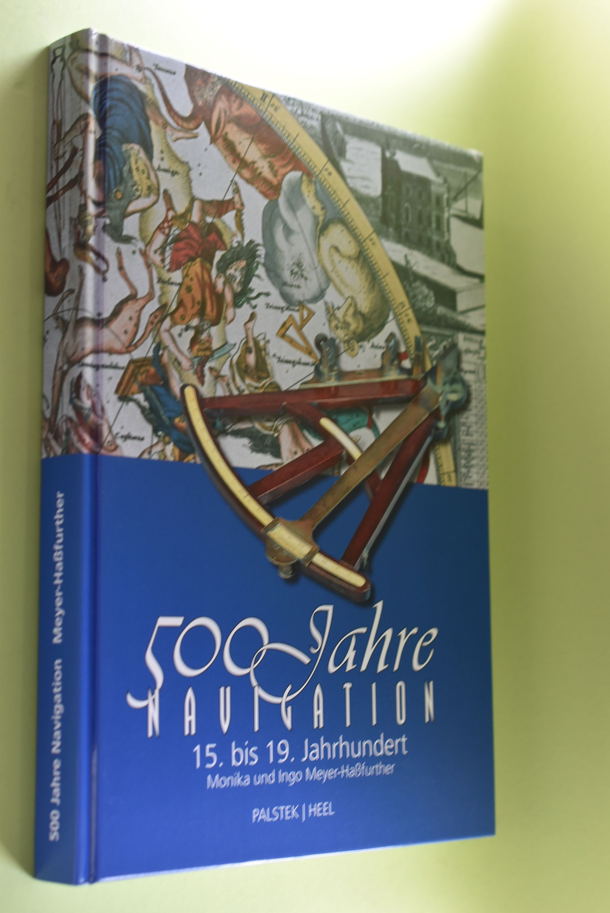
2005réf. 68787Hamburg : Palstek-Verl. - Königswinter : Heel 2005. 253 S. : zahlr. Ill., Kt. ; 30 cm Pappe 0
1931réf. WIRT0174Wien, Allgem. Tarif-Anz. 1931. 2°, 195 S., OKart., abgegriffen, kl. Eckknicke u. Eselsohren. Mit zahlr. Berichten zu den Fachgebieten Tarif- und Transportwesen, Währungen und Wirtschaft der Nachfolgestaaten, Einzelabhandlungen über besondere Gebiete der Verkehrs- u. Volkswirtschaft sowie Österreichs Industrie.
1995réf. GITj884Paris Tacussel Tanker Association 1995. Grand in-8 393pp 3 feuillets non chiffrés (remerciements, table, achevé d'imprimer). Cartonnage éditeur de papier glacé blanc bradel, illustré en couleurs sur les 2 plats. Abondante et belle illustrations dans le texte, à pleine page, en noir et en couleurs (photographies, plans, graphiques). Bel exemplaire très frais.
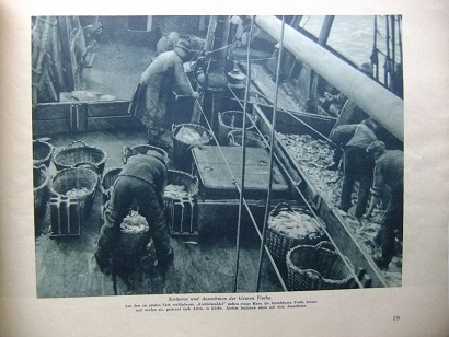
1930réf. 86275(Bremen. Ohne Jahr. Um 1930). 47, (2) Seiten. Mit 45 ganzseitigen fotografischen Abbildungen. Ill. Originalbroschur. Querformat 22x31 cm
1934réf. 69120Privately printed. 1934/1935. Collection of ephemera from P&O cruises. comprising 6 slim pamphlets: 4 x P&O Menus 2 x P&O list of Passengers with coloured covers. Occasional dirty mark to covers and contents with dates written in biro to upper margin of list of passngers o/w an attractive set. VG. unknown
1900réf. 176895Shanghai: Brewer & Co. c. 1900. From the Chefoo Bluff to Lamtong Head Sole edition untraced institutionally the copy of Vice-Admiral Seymour's chief of staff in Tianjin during the Boxer Uprising. This photographic guide is designed for "the navigator of this changeable and frequently foggy locality" preface. We have traced only one other copy which appeared in commerce in 2017. Navigators in the late Qing period could rely on only a small network of lighthouses and fixed navigational aids when sailing the Chinese coast. "In thick weather even a person familiar with the coast is at a loss to identify a well-known Islands with its summit" preface. The thirty views include the Chefoo Bluff in the Pechili Gulf the waters near the Hieshans Light House Zhejiang and Hong Kong's Lamtong Head. A concerted period of lighthouse-building in the 1910s and 1920s obviated the need for further publications of this kind. Provenance: though unmarked as such this copy was owned by Captain Edward Henry Bayly C.B. 1849-1904 Commander of the International Forces at Tianjin in June 1900. Bayly had a lifelong career in the Royal Navy. He was promoted to the rank of lieutenant in September 1873 commander in June 1887 and captain in January 1894 having served overseas in numerous ships. Bayly captained HMS Pelorus during the fleet review for Queen Victoria's diamond jubilee in 1897 and in 1899 became captain of the armoured cruiser HMS Aurora on the China station. During the Boxer Uprising he replaced the wounded John Jellicoe as chief of staff to Seymour was mentioned by Seymour in dispatches and remained at Tianjin until the withdrawal of naval forces. He retired at his own request in February 1904. Landscape octavo. With 30 mounted collotypes within red frames. Original red cloth front cover lettered in gilt white coated endpapers leaves hinged with white linen as issued. A little shaken binding sunned and stained contents well preserved a little toning at fore edges: a very good copy. hardcover
réf. 104017aafMilano, Valentino Bompiani, u.a. ca. 1966 in-8vo, cartonnage original, bon état,
réf. 8271Lausanne, Editions Mondo 1975, 250x220mm, 151pages, photos couleurs, reliure d'éditeur sous jaquette. Bel exemplaire.
1975réf. AUB-642Lausanne, éditions Mondo 1975. Bel exemplaire relié, reliure pleine toile et jaquette ornées d'éd., gd in-8 (24x22), 152 pages avec illustrations et sommaire.
1960réf. na607Société de Publications et d'Editions Broché 1960 In-8, (21x14 cm), cartonné avec jaquette illustrée, 447 pages, quelques illustrations en couleurs ; petites usures sur la jaquette jaunie, bon état général. Livraison a domicile (La Poste) ou en Mondial Relay sur simple demande.
1927réf. 24179Dortmund. (1927). 53 Seiten u. 6 teils mehrfach gefaltete Anlagen-Tafeln. Originalbroschur. (Ebd. randfleckig; Mit Rotstift handschriftlich eingetragene Seitenzahlen) 30x21 cm
1975réf. 5541Hamburg. (1975). 16 n.n. Seiten. Mit teils faks. Abb. u. einer Beilage. Farbig ill. Originalbroschur. 30x21 cm