Southern Pacific Railroad CompanyBiblio.com

1875ref. 27665New York: Evening Post Steam Presses 1875. Original printed wrappers with wrapper title as issued. Stitched. iv 3-133 pp. Wrappers moderately worn else a clean text and Very Good. A comprehensive compilation of the legal documents creating and authorizing the Railroad and its branches and affiliates. OCLC locates five copies under several accession numbers as of March 2018. A shorter version with this title appeared in 1873. Evening Post Steam Presses unknown
ref. 56-0426Oakland Calif.: Southern Pacific Company 1926 rev. 1959. Blueline print 24" x 56". Sheet two of three. Formerly "Eliot." To approx 2700' in each direction and 2200' south from Pacific Coast Aggregates spur track intersection with mainline along Pleasanton-Livermore Road. Including Pacific Coast Aggregates Co gravel pits. Scale 1" = 100'. Oakland, Calif.: Southern Pacific Company, 1926, rev. 1959. unknown
ref. 56-0423San Francisco Calif.: Southern Pacific Company 1943 rev. 1953. Blueline print 18" x 82". From Standard Avenue and Berkeley Street to Newport Avenue. With Holly Sugar Company complex including details on each building Valencia Truck Company H.M Canning Company Alexander H. Kerr & Co. Scale 1" = 100'. San Francisco, Calif.: Southern Pacific Company, 1943, rev. 1953. unknown
ref. 56-0306San Francisco Calif.: Southern Pacific Company 1929. Map. Blueline print 24" x 56" with red pencil indicating switching limits. From Pacific Ave to Second Ave. Includes inset map detailing Right of Way at Casino. With Schedule of Property listing approx 20 transfers 1877-1929. Scale 1" = 100'. San Francisco, Calif.: Southern Pacific Company, 1929. unknown
ref. 56-0425Oakland Calif.: Southern Pacific Company 1926 rev. 1959. Blueline print 24" x 56". Sheet one of three. To approx 2700' in each direction and 2200' south from East Pleasanton station point along Pleasanton-Livermore Road. Including Rio de Valle river Concrete Materials Company complex large gravel pits residence. Scale 1" = 100'. Oakland, Calif.: Southern Pacific Company, 1926, rev. 1959. unknown
ref. 56-0424San Francisco Calif.: Southern Pacific Company 1943. Blueline print 18" x 82". Two inch tear no missing material. From Standard Avenue and Berkeley Street to Newport Avenue. With Holly Sugar Company complex including details on each building Valencia Truck Company H.M Canning Company Alexander H. Kerr & Co. Scale 1" = 100'. San Francisco, Calif.: Southern Pacific Company, 1943. unknown
ref. 56-0307San Francisco Calif.: Southern Pacific Company 1947. Map. Blueline print 24" x 56" with red pencil indicating switching limits. From Bayside Ave to Bay St. With Schedule of Property listing approx 45 transfers 1905-1947. Scale 1" = 100'. San Francisco, Calif.: Southern Pacific Company, 1947. unknown
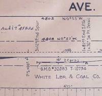
ref. 56-0421San Francisco Calif.: Southern Pacific Company 1929 rev. 1960. Blueline print 24" x 56". From beyond Belle Avenue San Luis Avenue and San Diego Street to Curtis Avenue and Garden Street. With Lake Marced Golf and Country Club Ocean View Park Tract Vista Grande Tract White Lumber and Coal Co. Scale 1" = 100'. San Francisco, Calif.: Southern Pacific Company, 1929, rev. 1960. unknown
ref. 56-0427Oakland Calif.: Southern Pacific Company 1926 rev. 1959. Blueline print 24" x 56". Sheet three of three. Formerly "Eliot." Southern Pacific tracks through land no labelled roadways. Including Coast Rock and Gravel Company Eliot gravel pit. Scale 1" = 100'. Oakland, Calif.: Southern Pacific Company, 1926, rev. 1959. unknown
ref. 56-0422San Francisco Calif.: Southern Pacific Company 1930 rev. 1959. Blueline print 12" x 61". Along Greenfield Road 3300' west and 2600' east of Comanche Drive. With Di Giorgio Farms station cold storage packing. Scale 1" = 100'. Including insert map of railroad lines approx 1/2 mile north of Greenfield Avenue scale 1" = 500'. San Francisco, Calif.: Southern Pacific Company, 1930, rev. 1959. unknown
ref. 56-0420El Paso Tex.: El Paso & Southwestern Railroad Company 1931 Rev. 1949. Blueline print 24" x 56" with red pencilling indicating switching limits. With mainline and two spur tracks. No buildings indicated. Scale 1" = 100'. El Paso, Tex.: El Paso & Southwestern Railroad Company, 1931, Rev. 1949. unknown
ref. 58-0472San Francisco Calif.: Southern Pacific Company 1924 rev. 1937. Blueprint 24 inches x 56 inches. From Winslow Avenue to Charter Street. Includes station points Redwood City and Redwood Junction Eastern Addition Hancock Addition Diller's Addition Horstman Chemical Company. Scale 1 inch = 100 feet. San Francisco, Calif.: Southern Pacific Company, 1924, rev. 1937. unknown
ref. 56-0311San Francisco Calif.: Southern Pacific Company 1924 revised 1947. Map. Blueline print 24" x 55" with 8" tear no missing material. From Grand Ave and Industrial Way to north line of Tanforan Ave. Includes Reichhold Chemicals Inc Bayshore Highway Standard Oil Co South San Francisco Land and Improvement plots. Scale 1" = 100'. San Francisco, Calif.: Southern Pacific Company, 1924, revised 1947. unknown
ref. 56-0276San Francisco Calif.: Southern Pacific Company 1950. Map. Blueline print 24" x 56" notes indicate "Sheet 1 of 3." Includes Southern Pacific and Western Union Lines Hathaway Ave Meekland Ave Atlas Imperial Diesel Engine Co. Map primarily consists of signs and measurements along railroad track. Scale 1" = 100'. San Francisco, Calif.: Southern Pacific Company, 1950. unknown
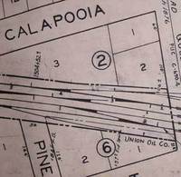
ref. 58-0470San Francisco Calif.: Southern Pacific Company 1928 rev. 1929. Blueprint 24 inches x 56 inches. From Pacific Avenue to Twelfth Avenue Middlefield Road to Fair Oaks Avenue. Includes Union Oil Company Golden State Mushroom Compan North Fair Oaks. Scale 1" = 100'. San Francisco, Calif.: Southern Pacific Company, 1928, rev. 1929. unknown
ref. 58-0477San Francisco Calif.: Southern Pacific Company 1925 rev. 1958. Blueline print 24 inches x 56 inches. From St. Francis Way to Broadway and Winslow Street. Includes Mezesville Wellesley Park Dingee Park Pacific Gas and Electric Standard Oil Co. Proposed lease limits to Redwood City for fence and cultivation purposes. Scale 1" = 100'. San Francisco, Calif.: Southern Pacific Company, 1925, rev. 1958. unknown
ref. 56-0241Oakland Calif.: Southern Pacific Company 1930. Map. Blueprints each 24" x 55". Station plan of Oakdale railroad property with approx. four blocks on each side along tracks from north of Stanislaus River to south of South St. Scale 1" = 100'. Oakland, Calif.: Southern Pacific Company, 1930. unknown
ref. 56-0390San Francisco Calif.: Southern Pacific Company 1947 rev. 1961. Blackline print 24" x 56". Sheet 1B. From Modoc Street to Twelfth Street. Includes Alturas Box and Moulding Consolidated Wholesale Standard Oil Wilson's Motel Alturas Building Material Superior Lumber Pit River. Scale 1" = 100'. San Francisco, Calif.: Southern Pacific Company, 1947, rev. 1961. unknown
ref. 56-0300San Francisco Calif.: Southern Pacific Company 1925 revised 1942. Map. Blueline print 24" x 55". Includes Woods Lagoon land approx. 2500" each direction perpendicular from San Lorenzo River to beyond Twin Lakes/Seventh Ave. Scale 1" = 100'. San Francisco, Calif.: Southern Pacific Company, 1925, revised 1942. unknown
ref. 56-0413San Francisco Calif.: Southern Pacific Company 1931 rev. 1960. Blueline print 24" x 71". No buildings. Plan details measurements along railway line. From 3100' southwest to 3900' northeast of Cartago station point. Scale 1" = 100'. San Francisco, Calif.: Southern Pacific Company, 1931, rev. 1960. unknown
ref. 58-0475San Francisco Calif.: Southern Pacific Company 1925 rev. 1944. Blueline print 24 inches x 56 inches. From Stauffer one mile north into Salt Marshes. With Salt Ponds Salt Marshes Plant Rubber & Asbestos Coom P.G. & E. Steinberger Slough station point Stauffer. Scale 1 inch = 100 feet. San Francisco, Calif.: Southern Pacific Company, 1925, rev. 1944. unknown
ref. 56-0409San Francisco Calif.: Southern Pacific Company 1923 rev. 1931. Blueprint 24" x 56". From Summer Avenue to Oak Grove Avenue along California Drive. Includes Ansel Eason plot Bayshore Highway Broadway station point Kaiser Paving Wisnom Lumber Burlingame Terrace Shell Oil. Scale 1" = 100'. San Francisco, Calif.: Southern Pacific Company, 1923, rev. 1931. unknown
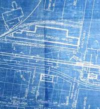
ref. 56-0410San Francisco Calif.: Southern Pacific Company 1923 rev. 1931. Blueprint 24" x 56". From beyond Chadbourne Avenue and State Highway approx 1 mile to the southeast. With Schedule of Property listing 18 transfers 1862-1899. Includes West Coast Porcelain Mfg Buri Buri Rancho few buildings along railroad tracks. Scale 1" = 100'. San Francisco, Calif.: Southern Pacific Company, 1923, rev. 1931. unknown
ref. 56-0264Southern Pacific Company 1959. Revised 1960. Map. Blueline print 24" x 56". Includes Western Union Line Signal Line Texum Station Meander Line of 1872 Lake Ewauna. Scale 1" = 100'. Southern Pacific Company, 1959. Revised 1960. unknown
ref. 56-0386Portland Ore.: Southern Pacific Company 1946 rev. 1948. Blueline print 24" x 56". Title is printed "Page" with "Albany" lightly printed over same position. From County Road 21/55 to 15th Street and Ferry Street to US 99E/Pacific Highway. Includes John Millard's Land Plat station point Page Albany Ice & Cold Storage Forest Furniture Hudson-Duncan & Co. Scale 1" = 100'. Portland, Ore.: Southern Pacific Company, 1946, rev. 1948. unknown