6911 resultados
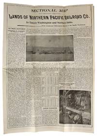
1895ref. 46744St. Paul MN: s.i. 1895. Very Good. St. Paul MN: s.i. 1895. Land map folded into a bi-fold informational pamphlet 90x95 cm; 23x11 cm; 9 unpaginated panels. All panels generally toned and creased as expected with minor rubbing to extremities and one closed tear to top edge of map along middle fold. Overall a Very Good or better example. An information-packed pamphlet for farming colonists looking for "healthful and pleasant living" in the Pacific Northwest; folds out to a map of the region and available land advertised at $3 to $10 an acre which could be bought from the Northern Pacific Railroad Company. Rail tickets could be purchased following the "Yellowstone Park and Dining Car Route" which also offered "Free Colonist Sleeping Cars" and 150 pounds of baggage carried for free on each full fare. s.i. unknown books
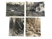
1920ref. 233311920. Logging Pacific Northwest logging industry photo archive documenting systems of timber extraction in Oregon Washington and Northern California during the early twentieth century illustrating how camps moved logs through cutover ground snowbound slopes skid roads and mechanized loading sites. The prints show the sequence of logging work: clearing hauling lifting sorting and burning slash as part of industrial forest production across the western lumber belt. Photo archive of 4 large silver gelatin photographs each approximately 8 x 9.5 inches Northern California Oregon and Washington circa 1920s-1940s. One photograph shows a jammer raising a massive log while a worker stands in the foreground with peavey in hand and freshly cut rounds stacked beside the machine; the verso reads "Jammer bringing in W.P. log / Park River Lbr. Co." Another records winter logging on a steep snow-covered hillside where a horse team and two workers move timber down a built log road; the verso notes "I-20 / winter logging at camp 23 PFI / 1019-CL." A third shows a bulldozer amid a broad cutover tract strewn with felled trunks and stumps emphasizing road building and ground clearing after cutting. The fourth captures active burning in the forest with smoke rising around a dozer and a handwritten verso caption reading "Burning out skid road with dozer." Captions include "PHOTO FROM / WESTERN PINE ASSOCIATION / Yeon Building Portland 4 Oregon / PLEASE RETURN" stamps a Rognon Studio Westwood California stamp and a Haas Brown Seattle studio mark preserving the circulation history of the prints within western forestry and commercial photography networks. These photographs come from the period when Pacific Northwest logging shifted across overlapping systems of machinery camp roads and organized slash disposal concrete evidence of how western timber companies converted forest land into transportable lumber under changing technological conditions. Creasing to corners and minor loss at corner margin on one image. Overall clear and sharp very good condition. The photographs preserve the working sequence of regional resource extraction and the transformation of forest landscapes in the Pacific Northwest. unknown
1920ref. 233311920. Logging Pacific Northwest logging industry photo archive documenting systems of timber extraction in Oregon Washington and Northern California during the early twentieth century illustrating how camps moved logs through cutover ground snowbound slopes skid roads and mechanized loading sites. The prints show the sequence of logging work: clearing hauling lifting sorting and burning slash as part of industrial forest production across the western lumber belt. Photo archive of 4 large silver gelatin photographs each approximately 8 x 9.5 inches Northern California Oregon and Washington circa 1920s-1940s. One photograph shows a jammer raising a massive log while a worker stands in the foreground with peavey in hand and freshly cut rounds stacked beside the machine; the verso reads "Jammer bringing in W.P. log / Park River Lbr. Co." Another records winter logging on a steep snow-covered hillside where a horse team and two workers move timber down a built log road; the verso notes "I-20 / winter logging at camp 23 PFI / 1019-CL." A third shows a bulldozer amid a broad cutover tract strewn with felled trunks and stumps emphasizing road building and ground clearing after cutting. The fourth captures active burning in the forest with smoke rising around a dozer and a handwritten verso caption reading "Burning out skid road with dozer." Captions include "PHOTO FROM / WESTERN PINE ASSOCIATION / Yeon Building Portland 4 Oregon / PLEASE RETURN" stamps a Rognon Studio Westwood California stamp and a Haas Brown Seattle studio mark preserving the circulation history of the prints within western forestry and commercial photography networks. These photographs come from the period when Pacific Northwest logging shifted across overlapping systems of machinery camp roads and organized slash disposal concrete evidence of how western timber companies converted forest land into transportable lumber under changing technological conditions. Creasing to corners and minor loss at corner margin on one image. Overall clear and sharp very good condition. The photographs preserve the working sequence of regional resource extraction and the transformation of forest landscapes in the Pacific Northwest. unknown books
ref. 4014San Francisco:: The Company. 4to brown pebbled cloth black leather spine and tips; company’s name on front cover in gilt as well as “Earl V. Burke”. Six-month run of an in-house organ of a company that provided large advertising cards used in electric street cars on the West Coast. It was published every Saturday and did not have a set number of pages per issue. Paging is erratic and at a certain point there are two numbering systems: one typed at the head of the page at one point dropping some 20 pages and the other rubberstamp numbering at the point of error to the end.The masthead to each issue has the following text: “The coaster is issued every Saturday for the exchange of ideas and news between our offices. It must not be circulated outside of our Organization. Contributions desired for publication should each San Francisco Office not later than Thursday of each week. If you benefit by reading the articles of others in the coaster you should reciprocate by letting us have some of your own ideas.The text is a mixture of social news: happenings in the various branches; retirements; encouraging rhetoric and express business instructions on the placement of cards some are returned to the client after the agree and instructions for ordering supplies.The first issue of this volume contains two pages outlining the United States eminence in many fields. With only 6% of the world’s population and 7% of the land the United States produced in 1920: 25% of the agricultural supplies; 40%of the mineral products; 34% of the manufactured goods.Earl Vincent Burke 1885–1963 was a graduate of UC Berkeley and is listed in the 1930 census as “Business Manager Advertising”. He was a member of the Book Club of California; John Henry Nash printed an invitation for Burke’s lecture at the San Francisco Public Library on Master Printers. By the 1949 census he and his wife both listed themselves as “Free Lance Writers”. San Francisco:: [The Company],. hardcover
ref. 4014San Francisco:: The Company. 4to brown pebbled cloth black leather spine and tips; company’s name on front cover in gilt as well as “Earl V. Burke”. Six-month run of an in-house organ of a company that provided large advertising cards used in electric street cars on the West Coast. It was published every Saturday and did not have a set number of pages per issue. Paging is erratic and at a certain point there are two numbering systems: one typed at the head of the page at one point dropping some 20 pages and the other rubberstamp numbering at the point of error to the end.The masthead to each issue has the following text: “The coaster is issued every Saturday for the exchange of ideas and news between our offices. It must not be circulated outside of our Organization. Contributions desired for publication should each San Francisco Office not later than Thursday of each week. If you benefit by reading the articles of others in the coaster you should reciprocate by letting us have some of your own ideas.The text is a mixture of social news: happenings in the various branches; retirements; encouraging rhetoric and express business instructions on the placement of cards some are returned to the client after the agree and instructions for ordering supplies.The first issue of this volume contains two pages outlining the United States eminence in many fields. With only 6% of the world’s population and 7% of the land the United States produced in 1920: 25% of the agricultural supplies; 40%of the mineral products; 34% of the manufactured goods.Earl Vincent Burke 1885–1963 was a graduate of UC Berkeley and is listed in the 1930 census as “Business Manager Advertising”. He was a member of the Book Club of California; John Henry Nash printed an invitation for Burke’s lecture at the San Francisco Public Library on Master Printers. By the 1949 census he and his wife both listed themselves as “Free Lance Writers”. San Francisco:: [The Company],. hardcover books
ref. 56-0322San Francisco Calif.: Southern Pacific Company 1949. Map. Blueline print 20" x 50" with red pencil indicating interchange points. From San Bruno to Fort Mason and Yerba Buena Island to Colma. Includes Index to Industries with approx. 700 listings locations indicated on map by both number and grid indices. Scale 1" = 1600'. San Francisco, Calif.: Southern Pacific Company, 1949. unknown
ref. 58-0509San Francisco Calif.: Southern Pacific Company 1948 rev. 1960. Blueline print 34 inches x 67 inches. From Port of Sacramento at Lake Washington to Watt Avenue Sutterville Road to Arcade Boulevard. Includes station points Mikon Washington Elvas Brighton Ramona Perkins Swanston Haggin Ben Ali. Includes Index of Industries with approx 500 industries listed. Scale 1 inch = 1000 feet. San Francisco, Calif.: Southern Pacific Company, 1948, rev. 1960. unknown
ref. 56-0328San Francisco Calif.: Southern Pacific Company 1950. Map. Blueline print 42" x 73". From French Camp to Calaveras River and San Joaquin River to US 99/Manteca Road. Includes Index to Industries wiith approx 250 listings. Scale 1" = 800'. with insert showing Rough and Ready Island scale 1" = 2000'. San Francisco, Calif.: Southern Pacific Company, 1950. unknown
ref. 58-0510San Francisco Calif.: Southern Pacific Company 1948 rev. 1960 switching zones and limits approved 1962. Blueline print 34 inches x 67 inches. Colored pencil indicates switching zones and limits. From Port of Sacramento at Lake Washington to Watt Avenue Sutterville Road to Arcade Boulevard. Includes station points Mikon Washington Elvas Brighton Ramona Perkins Swanston Haggin Ben Ali. Includes Index of Industries with approx 500 industries listed. Scale 1 inch = 1000 feet. San Francisco, Calif.: Southern Pacific Company, 1948, rev. 1960, switching zones and limits approved 1962. unknown
ref. 56-0243Denver Colo.: The Weiland Engineering Co. 1930. Insets and notes 1937 1940. Map. Blueprint 41.5" x 51". Some tape on face some tearing no missing material. Map of Nogales within city limits. With additional engineering and survey notes and official approval notation by mayor and city hall. Zones labelled. Scale 1" = 200'. Denver, Colo.: The Weiland Engineering Co., 1930. Insets and notes, 1937, 1940. unknown
ref. 58-0511San Francisco Calif.: Southern Pacific Company 1950. Blueline print 34 inches x 67 inches. From Sacramento City Park beyond Marconi Avenue and Auburn Boulevard along railroad tracks. With Rancho Del Paso station points Swanston Haggin Benali. Includes Schedule of Property listing 18 transfers 1865-1950. Scale 1 inch = 400 feet. San Francisco, Calif.: Southern Pacific Company, 1950 unknown
ref. 56-0375Los Angeles Calif.: Southern Pacific Company 1942 revised 1962. Map. Blueline print. 24 x 91 inches. Light scuffmarks. Along San Fernando Road from Kellogg Avenue to Goodwin Avenue. Includes Los Angeles Channel Ralph's Grocery Co Cinch Products Stires Drill California Zonolight Co. With Schedule of Property listing approx 15 transfers 1925-1942. Scale: 1 inch = 100 feet. Los Angeles, Calif.: Southern Pacific Company, 1942, revised 1962. unknown
ref. 56-0469Stockton Calif.: Southern Pacific Company 1928 rev. 1941. Blueline print 24 inches x 13 feet. Three maps joined securely. From 3400' west of First Street Los Banos to 3000' east of Abatto along railroad tracks. With 6" tear no missing material. Details of all industries along railroad tracks. Including Los Banos Lumber & Supply Co Standard Oil Co Central California Creameries. Scale 1" = 100'. Stockton, Calif.: Southern Pacific Company, 1928, rev. 1941. unknown
ref. 58-0496San Francisco Calif.: Southern Pacific Company 1918 rev. 1945. Blueline print 24 inches x 47 inches. From Aqua station beyond South San Francisco to 3rd & Townsend Station Visitacion to Daly City. Includes track plans for South San Francisco Visitacion San Francisco Cemetaries. Scale not indicated. San Francisco, Calif.: Southern Pacific Company, 1918, rev. 1945. unknown
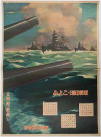
1619ref. 176888東京. Tokyo.: 東京日日新聞社. Tōkyō Nichinichi Shinbunsha. Showa 16 1941. Colour poster from a 1941 calendar. 53.5 x 38.5cm small holes at corners central horizontal fold. Some light even browning but overall a striking WWII image from a Japanese calendar. This colour illustrated calendar shows the months of March April and May 1941. The illustration features four Japanese war ships at sea with two naval guns in the foreground. The calendar is titled "Rough Sea on the Pacific Ocean". The implication being military threats are coming from across the Pacific. . 東京日日新聞社. [Tōkyō Nichinichi Shinbunsha]. unknown
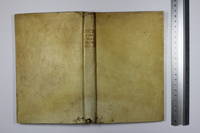
1721ref. 011121Lucca: Per Vicenzo Giuntini A spese di Gio: Riccomini 1721 Book. Good. Full vellum. 227 1 pages. In old full vellum the boards having worming but this only goes into the text block as far as page 4. Spine damaged by worming. Some pages browned. Armorial bookplate to the front pastedown of Sylvester Lord Glenbervie and armorial bookplate to the front free end paper of H.F. Davies Elmley Castle. Ink letter R to the upper outer corner of the front free end paper. Per Vicenzo Giuntini A spese di Gio: Riccomini hardcover
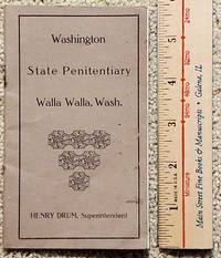
1916ref. 2306011Walla Walla: Washington State Penitentiary 1916. First Edition. Soft cover. Very Good. Original printing. Circa 1916. This rare little circa 1916 booklet 24pp features the mug shots front-facing and profile of twelve 12 escapees from various units of the prison system in Washington State. Each entry faces a blank page except the center two pages which features two entries. Most escapes occurred in 1915 and the reward was good until 1917. All rewards were for $100 except that R. H. Cook who only justified a $50 reward. He escaped from the Meskill Rock Quarry Lewis County Aug. 8 1915. He was a machinest who burgled. He is described as a "Nativity sic American." Bound with two staples the staples are rusted and the middle two sets of leave are just folded in. Rust showing showing of course on paper next to the staples. Henry Drum was the Superintendent serving as such 1913-1921. He was also a member of the first Washington State Senate as noted in his obit published in the Bellingham Herald. . We have located no other copies. Other than the rust staples vg condition. The "Pen" at Walla Walla was known not so affectionately as the "Concrete Mama." RARE. Washington State Penitentiary unknown
2002ref. DBS-9781402071430kluwer 2002. 1st. Hardcover. New. kluwer hardcover
2002ref. DBS-9781402071430kluwer 2002. 1st. Hardcover. New. kluwer hardcover
1851Decorativa carta geografica pubblicata in The Illustrated Atlas, And Modern History Of The World Geographical, Political, Commercial & Statistical… edito da John Tallis. Le mappe del The Illustrated Atlas non solo fornivano conoscenze geografiche aggiornate, ma utilizzavano anche viste a vignetta all'interno del disegno per mostrare i popoli nativi e le loro occupazioni, le città e i punti di interesse. Le mappe si rifanno alla tradizione cartografica dei cartografi olandesi del XVII secolo, con bordi decorativi finemente incisi. Le tavole sono state disegnate e incise da John Rapkin con vedute realizzate da una serie di artisti di spicco. Le mappe furono pubblicate in volume completo dal 1851 fino al 1865 circa. Alcune delle mappe furono pubblicate anche in altri libri di storia pubblicati da Tallis, tra cui quello sulle British Colonies e, senza le vignette, in dizionari geografici ed enciclopedie fino al 1880 circa. John Tallis (1817-1876) era un editore di mappe britannico. Nato nelle Midlands, Tallis arrivò a Londra negli anni '40 del XIX secolo. Tallis iniziò la sua carriera londinese con una serie di notevoli vedute stradali di Londra. Iniziò una collaborazione con un certo Frederick Tallis, forse suo fratello, ma la loro collaborazione terminò nel 1849. In occasione della Grande Esposizione del 1851, Tallis pubblicò il The Illustrated Atlas. Le mappe furono successivamente ristampate dalla London Printing & Publishing Company, che lasciò intatta l'imprint di Tallis, assicurandogli così una fama duratura. Incisione su acciaio, coloritura dei confini all'acquarello, in ottime condizioni. Islands outlined with gold and surrounded by illustrations of Auckland, Mount Egmont, a New Zealander, and the port of Wellington. Border in a New Zealand motif. Decorative map taken from The Illustrated Atlas, And Modern History Of The World Geographical, Political, Commercial & Statistical by John Tallis The maps from The Illustrated Atlas were first published in serial form to a target audience that led insular lives due to the expense and hardship of travel. All that changed as the progress of the nineteenth century brought swift and dramatic changes in public awareness of far away places. Tallis' maps no doubt played an important role in this dramatic awakening. These maps not only provided up-to-date geographical knowledge, but also used vignette views within the map's design to show the native people and their occupations, cities and points of interest. The maps hark back to a cartographic tradition from the Dutch mapmakers of the seventeenth century with finely engraved decorative borders. The maps were drawn and engraved by John Rapkin with views drawn and engraved by a number of prominent artists. The maps were issued as a complete volume from 1851 until about 1865. Some of the maps were also published in other history books published by Tallis including British Colonies and, without the vignettes, in geographical dictionaries and encyclopedias until about 1880. John Tallis (1817-1876) was a British map publisher. Born in the Midlands, Tallis came to London in the 1840s. Tallis began his London career with a series of remarkable London street views. He began a partnership with a Frederick Tallis, possibly his brother, but their collaboration ended in 1849. For the Great Exhibition of 1851, Tallis published the Illustrated World Atlas, one of the last series of decorative world maps ever produced. The maps were later reissued by the London Printing & Publishing Company, who left the Tallis imprint intact, thus ensuring his enduring fame. In 1858, he began publication of the popular Illustrated News of the World and National Portrait Gallery of Eminent Personages, selling it in 1861 (it ceased publication in 1863). Engraving, hand-coloured outlines, in very good condition.
1908ref. 1812050Portland: Privately printed 1908. First Edition. Soft cover. Fair. 1st printing. Decorated wraps. 142pp. Illustrated with half-tone portraits & a drawing. Back cover detached & moderately edge chipped; last 25 pages coffee stained across bottom & top; slight page curling. The paper is good paper & very flexible. Graded fair with the various issues and price accordingly 6-guns 1218 references Harry Tracy & Dave Merrill material. A rare outlaw item. Privately printed unknown
ref. DADAX1741043042New unknown
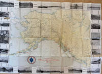
1917ref. List1730Chicago: Poole Brothers 1917. Folding map measuring 38 ½ x 26 ¾ inches. Tape repairs to verso some tears at folds and edges still bring and attractive good to very good overall with excellent restoration potential. A map of the canneries in Alaska British Columbia and Washington operated by the Deming and Gould Company who were influential in the growth of the Alaskan salmon trade. The map's date of printing 1917 suggests that perhaps it was related to the war effort as salmon demand increased during this period. The Demings based in Chicago were influential in the growth of the salmon trade in Alaska and the Pacific Northwest founding Pacific American Fisheries Inc. in 1899 and continuing in various iterations until their sale of the firm in 1934 due to president E.B. Deming's ailing health. The map shows seventeen different canneries several on the Alaska peninsula and the one in Bellingham. We find no record of this imprint only a later and small version held at the University of Washington. Poole Brothers unknown
1917ref. List1730Chicago: Poole Brothers 1917. Folding map measuring 38 ½ x 26 ¾ inches. Tape repairs to verso some tears at folds and edges still bring and attractive good to very good overall with excellent restoration potential. A map of the canneries in Alaska British Columbia and Washington operated by the Deming and Gould Company who were influential in the growth of the Alaskan salmon trade. The map's date of printing 1917 suggests that perhaps it was related to the war effort as salmon demand increased during this period. The Demings based in Chicago were influential in the growth of the salmon trade in Alaska and the Pacific Northwest founding Pacific American Fisheries Inc. in 1899 and continuing in various iterations until their sale of the firm in 1934 due to president E.B. Deming's ailing health. The map shows seventeen different canneries several on the Alaska peninsula and the one in Bellingham. We find no record of this imprint only a later and small version held at the University of Washington. Poole Brothers unknown books
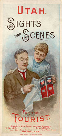
1888ref. 52275Chicago: Rand McNally & Co. Printers 1888. 1888. UTAH RAILROAD. First Edition. 8vo. 21.5 x 10 cm. 8 1/2" x 4" color pictorial wrappers. 48 pp. illustrated from photographs fold-out map 'Tourist Map of Union Pacific and Connecting Lines' 20.5 x 59 cm. 8 1/4" x 23 1/2" present at the rear. The map is in nice condition and provides an excellent panorama of the Union Pacific Railway. Lines in red and run from Kansas City Atchison and Omaha to Denver and south to Gunnison or west through Cheyenne Granger and onto Portland with a spur up to Helena or west through Ogden and onto San Francisco with a spur down to Los Angeles. Blue shaded illustrations surround the lines which include a plowing scene Union Depot Salt Lake City Garfield Beach a mining scene Falls of the Yellowstone a ranching scene etc. Union Pacific produced guide for the would-be tourist of Salt Lake City including a description of the Mormons and their customs. Illustrated with nine full-page engravings from photographs by C.R. Savage. Also provided are List of Agents. Pullman Palace Car rates. Information on Salt Lake City tours Salt Lake City and the area surrounding "The Temple City" Beck's Hot Springs the Great Salt Lake Giant's Cave at Garfield Beach Echo Canon Weber Canon the Devil's Gate Ogden Ogden Canon etc. Detailed information on 9 different tours touting what the tourist might see and do. Covers lightly used light wear to fore-edges else a very good copy. Rand, McNally & Co., Printers, [1888]. unknown