CASSINI Giovanni Maria (1745 - 1824)MareMagnum

6901 resultados
1798- EDIZIONE ORIGINALE, COLORITURA COEVA -Decorativa mappa dell'arcipelago Tonga tratta dal "Nuovo Atlante Geografico Universale delineato sulle ultime osservazioni", edito a Roma dal 1792 fino al 1801, opera che la Calcografia Camerale commissionò al Cassini al fine di sostituire l’ormai obsoleto "Mercurio Geografico".L'arcipelago è costituito da due distinti gruppi di isolette vulcaniche: quello delle Isole Sopravento (o del Vento), a Sud, che include Tahiti, Moorea, Maiao, Mehetia, Tetiaroa; quello delle Sottovento, a Nord, che comprende Raiatea, Huahine, Bora-Bora, Maupiti, Tahaa, e gli atolli Scilly e Bellingshausen. Già scoperte nel 1607 da P. Fernandes Queirós, furono riscoperte da S. Wallis nel 1767 e chiamate Isole della Società da J. Cook nel 1769, in onore della Royal Society.L'Isola di Natale deve il suo nome al capitano inglese William Mynors, che avvistò l'isola nel Natale del 1643 a bordo della nave Royal Mary.Giovanni Maria Cassini, Chierico Regolare Somasco fu geografo e cartografo, ma anche intagliatore di architetture e prospettive - uno dei migliori discepoli di Giovanni Battista Piranesi - Cassini fu uno degli ultimi sferografi italiani del Settecento ed i suoi globi ebbero una notevole diffusione, come pure questo "Nuovo Atlante Geografico".Incisione in rame, coloritura coeva dei contorni, leggere bruniture, per il resto in ottimo stato di conservazione. FIRST EDITION, CONTEMPORARY OUTLINE COLOUR -The Italian painter and engraver, Giovanni Maria Cassini, produced this attractive map of the Tonga Islands and Christmas Island.The Society Islands are a group of islands located in the Pacific Ocean and part of French Polynesia. It includes Bora Bora, Tahiti, Moorea, Taha'a and Huahine. The archipelago is suspected to have been named by Captain James Cook supposedly in honour of the Royal Society, the sponsor of the first British scientific survey of the islands; however, Cook himself stated in his journal that he called the islands Society "as they lay contiguous to one another."Christmas Island was first discovered on in 1615 by Captain John Milward of the East India Company ship, and it was named Christmas Island on 25 December 1643.Cassini was geographer and cartographer but he was also good at engraving architectural items and perspectives – he was one of the best disciples Giovanni Battista Piranesi had. Moreover, Cassini was one of the last artists to engrave spheres in the XVIII century and his globes were quite famous and widespread, and realized the most important Italian Atlas of the XVIII century; his maps always bear a cartouche, extremely rich in colours and details. Copperplate with fine original hand colour, some foxing, otherwise in very good condition.
19131st separate edition, 16mo (small) 39 pages. Includes portrait ; 15 cm. 1 of 100 copies printed. "Reprinted in 100 copies from the anniversary number of the Jewish tribune, Portland, Oregon, December 19, 1913" [from the Title page verso]. Henry Ward Beecher ( 1813 1887) was an American Congregationalist clergyman, social reformer, and speaker, known for his support of the abolition of slavery, his emphasis on God's love, and his 1875 adultery trial . Several of his brothers and sisters became well-known educators and activists, most notably Harriet Beecher Stowe, who achieved worldwide fame with her abolitionist novel Uncle Tom's Cabin ..Over the course of his ministry, he...grew interested in social reform, particularly the abolitionist movement. In the years leading up to the Civil War, he raised money to purchase slaves from captivity and to send riflesnicknamed Beecher's Biblesto abolitionists fighting in Kansas and Nebraska . After the war, Beecher supported social reform causes such as women's suffrage and temperance. He also championed Charles Darwin's theory of evolution, stating that it was not incompatible with Christian beliefs . Beecher's long career in the public spotlight led biographer Debby Applegate to call her biography of him The Most Famous Man in America (Wikipedia, 2019) . OCLC: 17882630. OCLC lists 14 copies worldwide. Light wear, about Very Good- Condition. (KH-8-54)
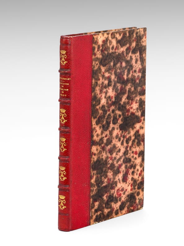
1806ref. 665231 vol. in-12 reliure demi-maroquin rouge, dos à 5 nerfs ornés (chiffres LL entrelacés surmontés d'une couronne), toutes tranches peignées, Chez P. F. Bottier, A Bourg, s.d. [ 1806 ], 1 f. blanc, 143 pp.
1806ref. 3025Edinburgh, A. Constable, 1806. In-8 de VII-232-LXI pp., cartonnage de l'époque.
ref. awd-1023Paris, Mercure de France, 1999. In-8 br., couverture imprimée à rabats, 350 pp.
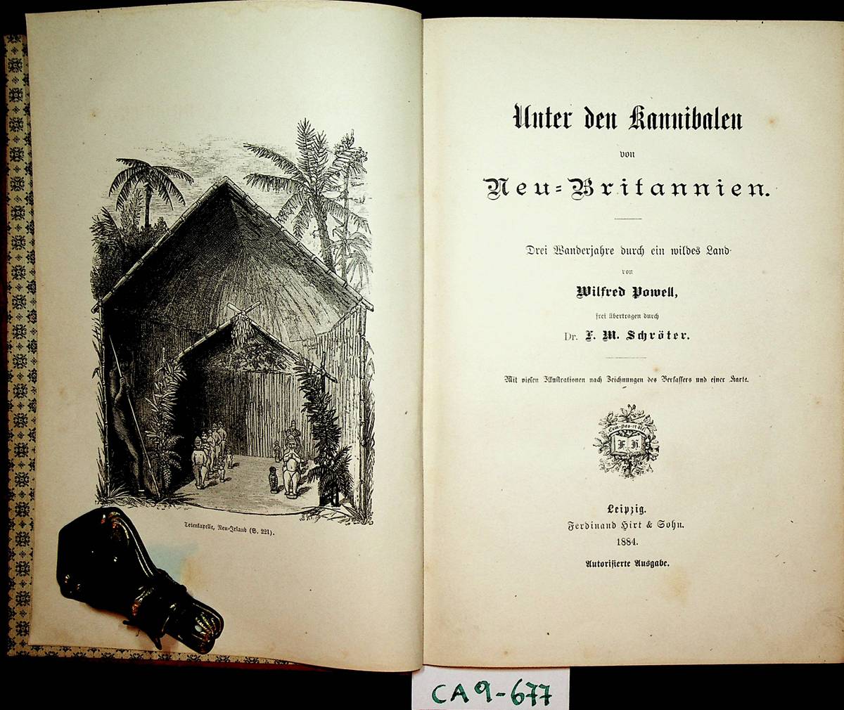
1884ref. GC10-643Leipzig, Verlag Fedrinand Hirt, 1884. original Leinenband, gr.-8?, 262 SeitenMit vielen Illustrationen nach Zeichnungen des Verfassers und einer Karte. und X (10) Seiten, Zustand: Einband etwas fleckig, innen sehr guter Zustand
ref. DADAX0295987359New unknown
ref. PA8815 loose original gelatin silver photographs each ca. 181x124 cm 7x5 in. Nine photos with captions either on negatives or on the verso. Glue residues on the verso of most photos two photographs with minor tears at the edges but otherwise a very good collection with strong interesting photos. Historically important collection of well-executed photos of the Pacific Northwest including rare early views of the Puget Sound Naval Station in Bremerton Washington. The Puget Sound Naval Shipyard was established as a repair facility in 1891. Early construction included dry docks shipways and support facilities making it the first repair yard in the Northwest capable of handling the largest ships. In 1902 the station was redesignated Navy Yard Puget Sound and expanded during WWI to accommodate major shipbuilding and repair programs. By WWII it had become the West Coast’s premier yard for ship repair and modernization and the only facility capable of servicing capital ships. In 1965 it also became the first West Coast yard to maintain nuclear-powered submarines and today continues to operate as a nuclear-capable maintenance facility. The collection comprises fifteen excellent original gelatin silver photographs apparently taken by an American traveler and his companion captured from the back in several photos in the late 1890s. Especially interesting is a well-executed photo of the U.S.S. Nipsic gunboat docked at the Puget Sound Naval Shipyard. The Nipsic arrived at the yard in 1892 and at the time the photograph was taken was serving as both a receiving ship and a prison hulk. The image shows the gunboat with a large roof built over the amidships section used to accommodate personnel and prisoners. Another important photo from the Naval Shipyard shows officer’s quarters constructed to provide adequate housing for the officers responsible for the shipyard and industrial area. The images depict early grounds of the quarters with several similar buildings erected side by side. The other photographs from the collection feature excellent views of the Columbia River Gorge and its environs showing Latourelle Falls Rooster Rock Beacon Rock Oneonta Gorge and Mount Hood. Overall historically important collection of well-executed photos of the Pacific Northwest including rare early views of the Puget Sound Naval Station in Bremerton Washington. unknown
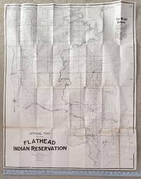
1909ref. 2507062Coeur D'Alene: n.p. 1909. First Edition. Soft cover. Very Good. Original issue. Size 31 ½" x 39." folds to 4" x 10". Mapped according to townships and sections and showing Flathead Guide Meridian and Fourth Standard Parallel. Portions of Sanders and Flathead counties. Shows large portions of Flathead Lake Flathead and Little Bitterroot Rivers and maps tiny lakes. Roads ferry crossings U. S. Power Reserve Northern Pacific Railroad Buffalo Reserve Indian Agency and Settlement St. Ignatius Mission towns of Ronan and Polson. Just a few small splits at corners and one longer split which we decided not to repair in case buyer wants professional restoration. Old tape on some folds. Overall in very good condition. Very very scarce. Of note is that it was in 1909 that a buffalo roundup took place on the reserve and the great Montana painters Charlie Russell was present. Rare. n.p. unknown
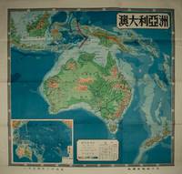
1954ref. 224585上海 Shanghai.: 地圖出版社 Ditu chubanshe. 1954. Coloured topographical map of the Australian continent inluding Papua New Guinea and New Zealand 106 x 112cm text in traditional Chinese characters. Legend includes desert coral reef seasonal rivers and lakes continental boundaries and so on. Inset map of Australia and the Pacific Islands also with key indicating altitude and sea depth. Folds into lightly worn original paper envelope measuring 38 x 25.5cm. Pinholes upper right and left corners small hole at fold point and tear in upper margin now repaired with archival washi paper 澳大利亞handwritten on reverse. Both envelope and the reverse of the map have small production labels attached. Map very bright with clear strong colours. Striking map in very good condition. . 地圖出版社 [Ditu chubanshe]. unknown
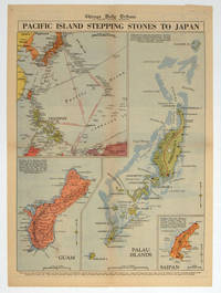
1944ref. 208880Chicago.: Chicago Daily Tribune. 28 September1944. Colour pictorial map on a single newspaper leaf archivally laid down on linen 50 x 39.2 cms; 59.3 x 43.3 cms sheet including captions faint toning to fold lines very good condition. Vivid colour maps of the Palau Islands Guam and Saipan in the Marianas and an inset location map published in the "Chicago Daily Tribune" in September 1944 months after the landing of US and Allied Forces in the offensive against the Japanese during the Pacific War. . Chicago Daily Tribune. unknown
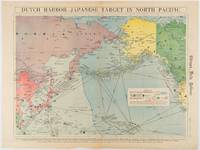
1942ref. 180751Chicago.: Chicago Daily Tribune. Friday June 51942. Printed colour map on a single newspaper leaf 37.5 x 53.2 cm; 44.7 x 59.8 cm sheet inset legend marginal browning and at the folds some undulation of paper and tide mark along lower section but in remarkably bright very good condition. Strategic map published in the Chicago Daily Tribune "The World's Greatest Newspaper" on June 5th 1942 two days after the Japanese attack on Dutch Harbor the site of the US army and navy bases in the Aleutians and as it transpired at the outset of the Battle of MIdway. The owner and proprietor of the Tribune Robert McCormick was staunchly against the United States entering the war and had firm views once it had occurred that American resources should not be used defending the British Empire. Famously the Tribune published the "Victory Program" Roosevelt’s military plan to prepare the United States for possible entry into World War II and was subject to prosecution for an alleged violation of the Espionage Act relating to the newspaper’s front-page account of the Battle of Midway 4-7 June 1942. It became an important test case for the limits of free speech and censorship during war-time. The Legend shows territorial Control of Ocean Areas marking Japanese Naval and Air bases as of 1941 and "according to latest reports" those established in the first six months of 1942. Also shown are pre-war sovereignties as at the bombing of Pearl Harbour on December 7th 1941. The Anson Archipelago is shown but a question mark "indicates islands etc. whose existence or give position is doubtful…". . Chicago Daily Tribune. unknown
1995ref. 2009038Eugene & Salem: Privately printed & Your Town Press 1995. Limited/Numbered. Hardcover. Fine/Very Good. Limited edition to 20 special copies bound in gilt-stamped dark cowhide of which this is #10. Quarto. 204pp. Illustrated with vintage photos maps & facsimiles. Bibliography. Laid into this limited edition is a printed limitation card 4 3/4" x 8 1/2" signed by Gray and three card stock full page prints of cowboy/cattle drawings limited to 20 copies to go with this edition. French was a famous Oregon rancher and lived 1849-1897. Fine as new. The dj has a small corner tear/chop to the lower front corner of the back panel. This edition rare. Privately printed & Your Town Press hardcover
1993ref. 2009037Eugene & Salem: Private Published & Your Town 1993. Limited Edition. Hardcover. Fine. Limited to 31 copies bound in tan sheepskin with titles gilt-stamped & livestock brands black-stamped with Brown's "Horseshoe Bar" being the centrail motif. 222pp. Illus. Maps. Facsimiles of documents. Appendix. Bibliography. This copy with a full page presentation on the ffep by Gray to your bookseller and dated in 1993 at the time of your bookseller's visit with Mr. Gray. Laid in to this limited edition is a color print portrait "Bill Brown 1900" signed the artist Boyd Brown. Thoroughly researched & loaded with information. Background includes the early days of the fur trade various trails through Oregon cowboys rustlers ranchers etc. From Wiki: "William Walter Brown July 19 1855 - January 11 1941 was an American pioneer rancher in central Oregon. He owned two large ranches between Burns and Prineville Oregon. Together his properties comprised one of the largest privately owned sheep and horse operations in the United States. He was known as the Horse King of the West and the Millionaire Horse King because over 10000 horses carried his Horseshoe Bar brand. Brown was also a well-known philanthropist who gave hundreds of thousands of dollars to a wide range of religious and educational institutions." This special copy is rare. Fine like new. Private Published, & Your Town hardcover
1981ref. 1912022Portland: Sandy's Camera Shops 1981. Hardcover. Very Good. Original photograph collection. Oblong textured simulated leather decorated hard binder 10 1/2" x 13/34" with 20 metal ring snaps. 1 page double column printed introduction. Laid in: a small plastic container of volcanic ash from Mt. St. Helen's. This is a remarkable collection of 60 color snapshot photographs each approx. 5 1/2" x 3 1/2" purportedly taken by Mr. Covert. They are fitted into10 card leaves each side with an opening for three photos. Some photos are snug & in place; others are loose and sliding around a little in their spaces. The photos are not in chronological order although a buyer might be able to arrange them approximately so with not too much effort. These photos were shot many from an airplane flying near the mountain in the days before the May 20 1980 eruption the day of including a handful apparently taken in the first moments! the eruptoin and some after the eruption. Included are also three photographs of the 1979 solar total eclipse seen from Portland. Abundant photographs may be found on-line and in books of the Mt. St. Helen's eruptions but some of these are special in your bookseller's opinion because of the fact that the photographer was in the air near the mountain taking them! Many I have never seen before although surely some were published in various print products. I am not certain if the July eruption may be represented or not in a couple of photos but the vast majority are of the May eruption before during and after. As I your bookseller look at even these snapshot photos I am once again in awe over the power and magnitude of this cataclysmic event. Sandy's shops were well known to regional photographers and customers for many years but it apparently no longer exists. An internet search brings us several references to Mr. Covert. The album is a bright black with three gold-stamped decorative motifs on the front cover & on the spine. The corners have some splitting to the vinyl material & there is a nick on one joint. The photographs are in fine condition and are sharp. Sandy's Camera Shops hardcover
1993ref. 1302109Portland: Privately Published 1993. 2nd Edition. Soft cover. Fine. 4to wraps with original flex plastic overlay. 712pp 22pp Index to Photographers by Cities. Other Indices: Daguerreotypists Panoramic Photographers Stereo Photographers Tintype Imprints Pinhole Photographers Women Photographers. Preface to this 2nd edition says only 50 copies were printed of the 1st edition & that in the new edition "many corrections have been made and this edition incorporates a number of additional photographers." This is a truly monumental work & labor of love with so much information beyond dates/places of photographers who are presented alphabetically. It is all text; no illustrations except for the cover. A typical lengthy entry has Name/company birth/death years Chronology Directory Listings Artifacts Photographer's Imprints Official Records New Items and Advertisements Bibliography. Where less is known about a particular photographer not as much can be given. A modern rarity. Fine. Privately Published unknown
1785Carta della Nuova Zelanda del Capitano Cook, tratta dal "Compendio della storia generale dei viaggi" tradotta dal lavoro di Prevost "Historie generale des voyages". L'opera in sette volumi è dedicata ai viaggi di Cook e altri viaggiatori nell'emisfero australe ed è stampata a Venezia da Vincenzo Formaleoni.Acquaforte, solite pieghe di carta, in ottimo stato di conservazione. Map of New Zealand by Captain Cook, taken from the "Compendio della storia generale dei viaggi" Italian translation of the Prevost's work "Historie generale des voyages". The seven-volume work is dedicated to Cook and other travelers in the southern hemisphere and is printed in Venice by Vincenzo Formaleoni.Very good condition with usual traces of original binding folds.
18298vo; 2 volumes, xvi, 536; viii, 576pp, illus, 2 engraved frontispieces, 6 fine engraved plates (of idols, tombs, etc) with tissue guards, 2 maps (one folding), facsimile. contemporary 1/2 calf with marbled boards, joints cracking, but firm (one re-enforced), clean, very good set. A picture of this book is available upon request by email. Cox ii, P502 (referring to the later 1830 issue): "One of the earliest instances of ethnological research by a missionary, and valuable for its information on the mythology, traditions, customs, etc of the south sea islanders while still little sophisticated by Europeans. . . . The publication of this work went far to redeem the character of missionaries in the eyes of some who had thought of them all as ignorant and narrow-minded". An important contribution. Judd 60. Day (Pacific Island Literature, 100 basic books) 40: 'A more intesting book we have never perused. The work was used as source material by Herman Melville'.
1940ref. 129895Quebec 1940. Photograph. very good. Artist Unknown. 29.25" X 35". Original B/W photograph. In large wooden frame which reads 'CP' at bottom. In very good condition with only slight yellowing due to age. Grey matting. A nice image of the Chateau. very good B/W historic photo of Chɴeau Frontenac an imposing hotel with five brick and stone wings and a central tower erected in seven stages between 1892 and 1993. It is prominently located on a cliff overlooking the St. Lawrence River within the Quec historic district. The Chɴeau Frontenac was designed by American architect Bruce Price as one of a series of "chɴeau" style hotels built for the Canadian Pacific Railway company aka CPR during the late 19th and early 20th centuries. CPR'S policy was to promote luxury tourism by appealing to wealthy travelers. The Chɴeau Frontenac opened in 1893 five years after the Banff Springs Hotel which was owned by the same company and similar in style. 1940 unknown
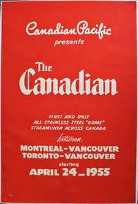
1954ref. 143315Canada: Canadian Pacific C. 1954. Good. Original colour lithograph travel poster promoting "The Canadian". There is minimal creasing along the sides and a multiple small pin holes in each of the corners. There is also a rip on the bottom edge that has been professionally restored. The size is 915mm x 610mm or 36" x 24". This poster is in good condition. The poster says Canadian Pacific Presents: The Canadian- First and only all stainless steel "dome" streamliner across Canada between Montreal-Vancouver Toronto- Vancouver starting April 24_1955. This poster was issued by the Canadian Pacific to promote The Canadian a streamliner that would go across Canada. It is a bright red background with bold white lettering in varying fonts across the whole poster. This is the first poster made advertising the first trip on "The Canadian" the soon to be famous all stainless steel "dome" streamliner across Canada. An iconic poster for the very first trip. 1954 Canadian Pacific unknown
ref. DADAX0415024560New unknown
19468vo., First Edition; handsomely bound in full dark red crushed morocco, sides with gilt frame border, back with raised bands, second and fourth compartments lettered and ruled in gilt, all other compartments tooled in gilt, gilt top, uncut, red silk marker, a most attractive copy ideal as a gift or for presentation. The author served as Deputy Chief of Naval Intelligence during WWII. His emphasis on psychological warfare made a considerable impact upon Japanese morale well before the first atom bomb. Enser, p.233.
ref. 28030401San Francisco 1937 G.P.O. A large poster on stiff board 33 x 48 cm. white with black ink b.w. photo and aircraft English & mostly Chinese text time tables for departing air craft and schedule. OBSCURE ITEM LIMITED EDITION OF 500 This lovely period poster was printed September 30 1937 in a LIMITED EDITION OF 500 only copies per the colophon at the bottom of the poster. CONDITION: The poster is very clean and obscure. There are 2 very tiny mended closed tears in the right and lower margin else this is a very clean nice copy of a rare item. There is almost no surface soil and a small bump to lower right corner again none of this invades the text at all and can be matted out in a frame. The "CHINA CLIPPER" an early Pan-Am aircraft is shown flying over the city of San Francisco just above Fisherman's Wharf and other piers and North Beach Russian Hill the tower and downtown in the background. The text informs the Chinese community about the new air mail service drop off locations times of pickup and the like. Nicely executed. QUITE SCARCE . unknown
ref. 01-0066San Francisco Calif.: Southern Pacific Railroad 1962. Map. Blueprint. 31.5 x 133 inches. Scale 1 inch = 1000 feet. April 1955 revised to Feb. 1962. With index to industries showing names and location. San Francisco, Calif.: Southern Pacific Railroad, 1962. unknown
ref. FRE8151 p. 295x23 cm. 11 ½x 9 in. With a folded map ca. 136 x 60 cm. 53 ½x 23 ½ in. By the late 1910s the Union Pacific Railroad UP was one of the largest and most strategically important rail systems in the United States: Operated a core network of roughly 9000–10000 miles of track including subsidiaries and controlled lines the broader system was significantly larger it formed a central component of the transcontinental rail system linking: Omaha / Council Bluffs Midwest hub across Nebraska Wyoming Utah to connections reaching the Pacific Coast via Southern Pacific and other lines controlled or was closely associated with major lines such as: Oregon Short Line Oregon–Washington Railroad & Navigation Company as outlined on the map included in the report. In practical terms UP was a backbone carrier of western U.S. transportation moving both freight and passengers across vast distances. 1918 was important year in UP history as for the first time it became component of a single national logistics machine not a fully autonomous company - after half a century of operation as a for-profit private corporation it became a part of a nationalized system run by the USRA begun Dec. 1917 fully implemented in 1918. These changes are reflected in the report in the ‘Federal Control of Railroads’ section as well as ‘Physical Changes’ and ‘Water Companies - Federal Control’. Other sections of the report included the equipment asset accounts status as well as the all kinds of passenger and car statistics for the board of directors to review. The map shows UP lines in its pre-WWI glory: once the U.S. entered World War I the federal government through the United States Railroad Administration imposed strict limits on new construction prioritization of maintenance and war traffic/ As a result large-scale new line construction was effectively frozen capital projects were deferred unless militarily necessary. Present report is not found on Worldcat copies in trade seen often lack the map. unknown